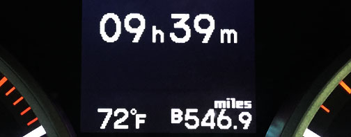
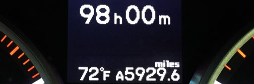
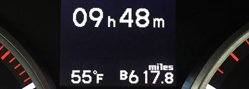
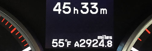
Archive for May, 2016

One More Canadian Night: Cache Creek, British Columbia

Posted in Alaska, ILX, Road Trip on May 30, 2016 by tysonhugie

Odometer:  169,628

169628

Day Distance & Time:  546 Miles; 9 hours 39 minutes

546

Overall Trip Distance & Time:  5,929 Miles; 98 hours

5929

We’re getting close to the States!  I hope that my friends and family members there have had a nice Memorial Day.  The weather eased up on us today and we enjoyed partly cloudy skies for our drive through British Columbia.  We got to see a lot of neat little towns tucked away in the mountains.  From where I sit at the Motel 6 in Cache Creek, I can hear the creek itself churning outside.  That sound is so therapeutic.  I might have to just lounge next to it for awhile this evening.  Here’s the view.

cache_creek

Today we traversed the Yellowhead Highway, route #16 in British Columbia.  If we’d stayed headed east on that road instead of cutting south on 97 at Prince George, it would have planted us back in Edmonton where we made a visit many days ago.  I can’t recall exactly, as the days at this point are all running into one another.  The remarkable thing is that either due to a primarily downhill grade, better fuel quality than we’d been getting, or simply a lighter right foot, my car got over 36 miles per gallon today over our 546-mile day.  Move over, hybrids!

36mpg

This morning in Houston (B.C., not Texas), we made a stop at the world’s largest fly fishing rod.  It’s six times larger than the average fishing rod and would require a river 15 boxcars wide to cast it on.  It took 270 hours for local volunteers to assemble.  That’s some community spirit!

tyson_houston_fishing_rod

Jason and I grabbed lunch at a restaurant called J&S in Vanderhoof and I tried a dish called poutine for the first time.  It’s basically French fries with some cheese and gravy on them.  It was delicious!

poutine

js_vanderhoof

Road conditions were great today, and it was nice to be finished dodging potholes and frost heaves.  Shortly after Williams Lake on route 97 headed southbound, the highway opened up to two lanes in each direction with glass-smooth pavement.  I’d forgotten what that felt like!  Short and sweet entry today, but tomorrow we cross into Washington and I have several visits to make.  From here on out, I may collect my thoughts for a couple of days at a time before blogging.  Just wanted to relay this last entry from Canada and thank you for following!

Beautiful morning leaving New Hazelton, B.C.

morning

Passing a variety of small lake towns, including this one – Burns Lake

burns_lake

Our lunch spot in Vanderhoof

vanderhoof_lawn

Junction of highways 16 and 97 near Prince George

97_sign

Must be in logging country!

log_Truck

I agree!

billboard

I liked this old cabin along Hwy 97

house

Another red Honda dealership sighting!  This one in Williams Lake.

red_honda_2

Getting closer to Cache Creek

cache_junction

Bathroom break in the woods!

bathroom_break

Arriving our destination for the night

cache_creek_2

Jason and I were ready to try some local grub so we hit up Herbie’s Drive-In up the street.

herbies

It’s cozy and the chicken sandwich wasn’t half bad.

jason_at_diner

I wandered around to explore the town a little (needed to get the legs moving anyway).  Check out this interesting castle-themed motel.  It’s currently for sale, but still appears to be in operation.

castle2

castle1

This place, the Wander-Inn Restaurant, is closed and has weeds growing in the parking lot.

wander_inn

I’d love to explore inside a place like that.

Cassiar Highway 37: Nightly Stop in New Hazelton, British Columbia

Posted in Alaska, ILX, Road Trip on May 29, 2016 by tysonhugie

Odometer:  169,081

169081

Day Distance & Time:  621 Miles; 9 hours 49 minutes

621

Overall Trip Distance & Time:  5,382 Miles;

5382

Kitwanga, British Columbia in 2006

kitwanga_2006

Same spot today

kitwanga_2016

I saw this poem in a frame in a gas station bathroom today and it struck me as something worth sharing.

Come drive the great Alcan Highway from one end to the other

Miles of splendor and adventure, become a vein of northern gold.

One time in the summer, let the Arctic sun steal your slumber.

Again in winter, challenged, by the frost and bitter cold.

What a great highway, with its very few by-ways.

Just think, you’re heading northwest to the Pole.

Don’t wait too long to drive it, prove you can survive it.

You should go now, before your dream grows too old.

Come drive the great Alcan, from one end to the other.

Give a thrill, bless your bones, far from home.

The people you meet, and the places you eat and sleep,

Make it worth all the miles, upon miles, you roam.

So come drive the great highway, give thanks for those By days,

Don’t complain, till it’s explained, how the whole thing was done.

Take the trip of your lifetime, celebrate the grand northern lifeline.

The great deed done under the spell of the midnight sun.

– J Hamilton Clarke, 1989

Okay, it took 88 hours in the car, but I’m finally getting fatigued.  And FYI, my trip timer in the car maxes out at 99 hours, 59 minutes, so sadly it won’t even be able to log my entire Alaskan trip.  Don’t these engineers at Acura know there are people out there (okay, just one person) who like to take 131-hour road trips?  Today dragged on for a lot of reasons.  But I’m happy to report that we’re safely at our nightly destination after having seen more of the great, beautiful north.

Jason and I have now “clinched” Highway 37 – the Cassiar Highway – in British Columbia.  That’s a term my friend Kevin uses when he successfully drives a highway from end to end.  And Jason and I did all 450 or so miles of the Cassiar, from the junction with the Alaska Highway in the Yukon, to the end point where it tees into Highway 16 at Kitwanga, BC.

cassiar2

By the time we got to the southern terminus, we were both pooped, so we only came another 20 or so miles east to a small town of New Hazelton to call it a night.  Luckily, despite being old, the place is well kept and the lady at the front desk couldn’t have been any friendlier.

bulkley_new_hazelton

From the point that we departed Teslin, Yukon this morning, the rain has been persistent throughout the day.  Those of you who were disgusted by my muddy car should rejoice because at this point, most of it has washed off.  We made our way south from “Nugget City” just west of Watson Lake and the Cassiar Highway weaved through green forests for seemingly endless miles.  Road conditions were very good considering how infrequently traveled that stretch of road must be, but the shoulders are narrow or nonexistent, the road itself is quite narrow, and there are no pavement markings whatsoever for many many miles.

hwy_37

We had zero cell service for the entire day which made us feel all the more removed from civilization.  And the settlements along Highway 37 are barely blips on the map.  Our first stop was in Dease Lake which had just one all-in-one gas station, grocery store, and small deli.  I had to wait for the cashier to ring up someone’s broccoli and whipped cream before she could activate Pump #2 for me outside to get some fuel.  I indulged in some potato wedges, buffalo chicken nuggets, and a corn dog to scarf down in the car on my way out.  Gas station diet.

dease_flyer

Roads got progressively better the further south we got, and I suspect by now we’ve seen the worst of them.  We are still about 14 hours / 800 miles from Seattle so it’ll be two more days before we drop back into the US of A.  But today’s scenery along the lakes, rivers, and mountains was beautiful despite the wet weather.  Jason and I both got antsy in our cars today.  I caught him taking a run around a rest area this afternoon to get some blood flowing in his legs again.  Tomorrow, we press on to southern British Columbia.  Stay tuned!

Rain (and a bit of snow) as we made our way east from Teslin this morning.

snow2

Fueling up at Nugget City.

nugget_gas

Legal drinking age is 19!

19_drink

Cassiar Mountain Range

mtns

Love the excessive use of quotes on this cork board posting at the Dease Lake gas station.

quotes

Are we there yet?

tyson2

The deli in Dease Lake

dease_deli

More of the Cassiar Range

cassiar_ilx

Taking time to stop and enjoy the flowers.

flowers

Lots of rain means lots of puddles on the roadside.

ilx_cassiar

Stop for fuel and hot cocoa in “Bell II”

bell2

Update:  Jason and I went to find dinner.  Turns out everything in town (all 3-4 restaurants we drove past) were closed, either because they were out of business, closed on Sundays, or closed because it was 9:30 p.m.

But, in the process we stumbled across this awesome one-lane historic bridge!

crossing_hagwilget

It crosses Hagwilget Canyon with the Buckley River.  Beautiful (and rainy!).

hagwilget_2

Nice little side tour to end the evening.

hagwilget

(We ended up getting microwaveable meals from the Chevron to cook at the hotel room, blah!)

Starting the Return Trek: Back in the Yukon

Posted in Alaska, ILX, Road Trip on May 28, 2016 by tysonhugie

Odometer:  168,459

168459

Day Distance & Time:  695 Miles;

695

Overall Trip Distance & Time:  4,761 Miles;  78 hours 31 minutes

4761

No big deal – just a little grizzly bear crossing the road in Haines Junction, Yukon Territory!

ilx_bear

bear

The southbound trek has begun!  And we’re hoping that some of that Alaska mud caked to our cars still remains when we make it back to the Lower 48.  Call it a souvenir.  Today was a back-track day – the only one we’ll be having, since tomorrow morning we head south from Watson Lake on the Cassiar Highway – Highway 37 – through British Columbia.

mountains

After fueling up at Chevron in Fairbanks, Jason and I made our way to the Canadian border under bright blue northern skies this morning.  The Customs representative was a little puzzled when he learned that we were traveling together, yet in separate cars.  It’s something difficult to justify – even to ourselves – but eventually we were sent on our way in Beaver Creek and on down the Alaska Highway in the Yukon, retracing our steps from a few days prior.

destruction_bay_2

Destruction Bay is aptly named – the roads in that stretch of the highway are among the worst we’ve experienced.  We had to wait twice – for 15 minutes each time – for a pilot car to guide us through some very long (and dusty) stretches.  Now that the 3-day holiday weekend is in full force, the RV traffic is starting to ramp up and most of the vehicles we saw coming northbound were touristy looking.

pilot_wait

I made a point to stop in Kluane National Park and Reserve to take a picture at an old log cabin that my dad & I visited in 2006.  Sometime in the last decade, the original highway through that area has been bypassed by a newer version.  The log cabin was visible from the new highway but I found an access road to the old stretch of road and went to the cabin once more.  The padlock on the front door had already been busted free so I let myself inside and wandered around the two rooms.  It was still fully furnished, though in pretty sorry shape.

The cabin in 2006:

cabin

With dad at the cabin:

cabin3

The cabin today:

cabin

Inside:

cabin_inside_2

We dined at the Kluane Park Inn in Haines Junction.  We were the only patrons.  The sight outside the windows was breathtaking.  Freshly-snowed-upon peaks surrounded us.  The menu was surprisingly large and also had a surprisingly Asian flair.  I didn’t want to risk anything too crazy so I went with a cold cut turkey sandwich and a Diet Coke.  It ended up being delicious!

kluane_park_inn

By this time we’d decided we wanted to press on to Teslin again and stay in the log cabins we stayed in on the northbound leg, so I called ahead.  I actually recognized the woman’s voice who answered.  “Is this Jessica?” I asked.  Sure enough, it was her, and she remembered me!  The people in this region are so dang friendly.  Jason and I hauled some butt to get on through Whitehorse and to our final destination for the day, which took us about 3 hours.  It’s of course still very light outside at 11:00 p.m.

Jason has been dutifully blogging about his trip, too.  Check out his version of the story at any time!  Here’s his blog link.

Fueling up at Chevron in Fairbanks

fairbanks_chevron

The Three Bears Outpost in Tok, Alaska. One stop shop for ammo & sporting goods!

3_bears_inside

Three Bears Outpost from outside

3_bears

View from a rest area

lake

More amazing views

peaks2

Fitting song for the roller coaster frost heaves after entering the Yukon.

bumpy_ride

kluane_4

Stove inside that cabin I visited

stove

Bedroom in the cabin

cabin_inside

Even an oven mitt still hanging up!

mitten

View of the old road that goes past the cabin, which has since been bypassed

old_road

Peaks in Kluane National Park.  Just can’t get enough of these.

kluane_peaks

Here’s how my car’s back-up camera looks when it’s covered in mud.

ilx_camera

Peaks in Haines Junction, to show Carlos they were just under clouds in my previous picture.

haines_peaks

Passing through Whitehorse

whitehorse_signs

Arrival tonight in Teslin for the night, fueling up.

yukon_motel

Catch ya later!  Hope everyone is having a great weekend!

I Drove to the Arctic Circle!

Posted in Alaska, ILX, Road Trip on May 27, 2016 by tysonhugie

Odometer:  167,763

167763

Day Distance:  391 Miles

arctic_map

tyson_arctic

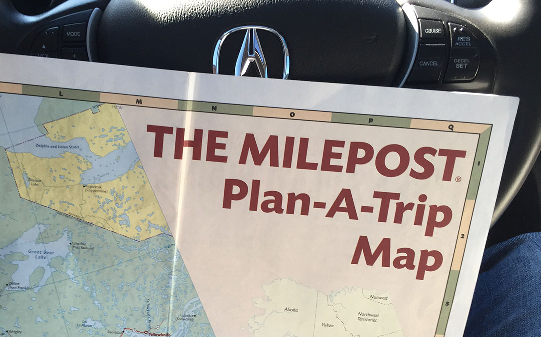
It’s uncommon for me to get nervous about a road trip.  I’m a pro at this, or at least I think I am.  I’ve dealt with my share of road, weather, and traffic conditions and I’ve put several hundred thousand miles under my belt.  I’ve driven coast to coast multiple times, and now to Alaska twice.  But for some reason, the thought of today’s drive gave me a pit in my stomach and a feeling of uneasiness that I just couldn’t shake.  Maybe it was the fact that many of The Milepost guidebook’s instructions were in red font as a form of warning.

dalton_book_page

This is a direct quote from the book:

Despite recent improvements, the Dalton remains about 75 percent gravel, with tire-puncturing rocks, bumpy washboard, dust in dry weather, slippery mud in wet weather, and dangerous curves.  Services are few and far between.

This is not a road for the unprepared or for the faint of heart.  It’s straight out of an episode of Ice Road Truckers – literally.  The show was filmed there.

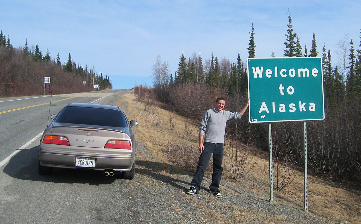
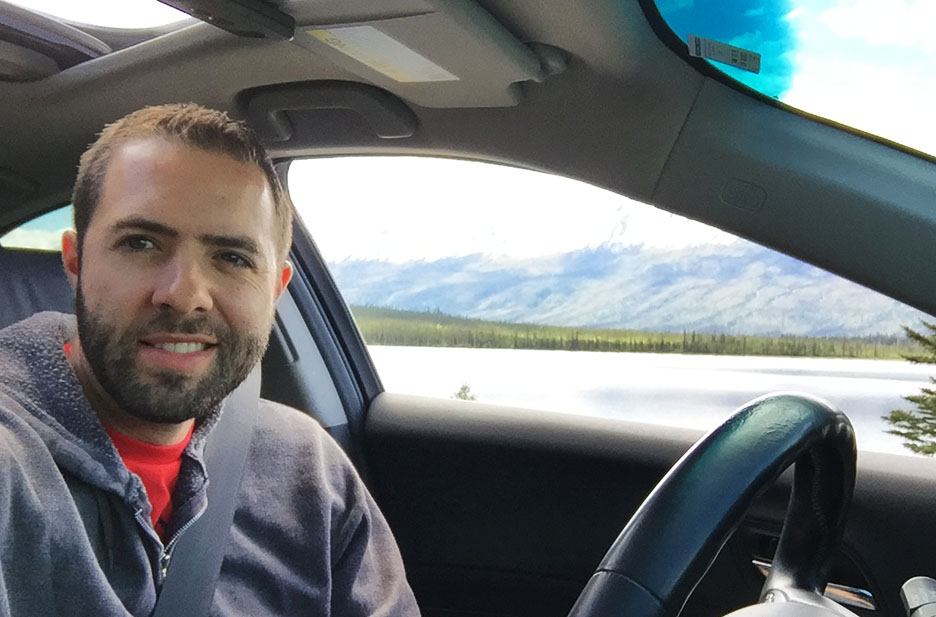
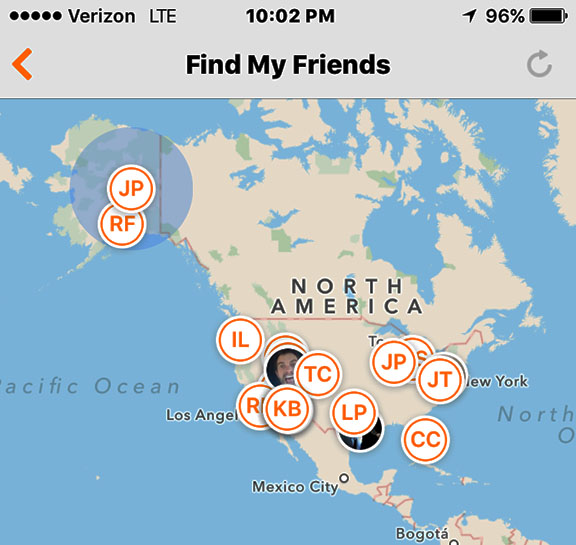
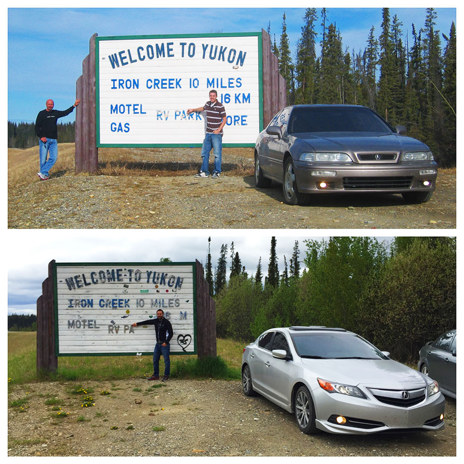
I told Jason last night.  “I’m 60% leaning toward starting our long drive home, and 40% leaning toward driving to the Arctic.”  He told me he was 85% for the Arctic.  So, I was swayed.  And we did it.  About a week ago, I was in Tucson, Arizona about 70 miles from the Mexican border.  And today, in the same car, I was so far north of the equator that on one day each year, the sun never goes below the horizon.  And one day each year, the sun never comes above the horizon.

The Arctic Circle is the southernmost latitude in the Northern Hemisphere at which the sun can remain continuously above or below the horizon for twenty-four hours; as a result, at least once each year at any location within the Arctic Circle the sun is visible at local midnight, and at least once it is not visible at local noon.

hilltop_gas

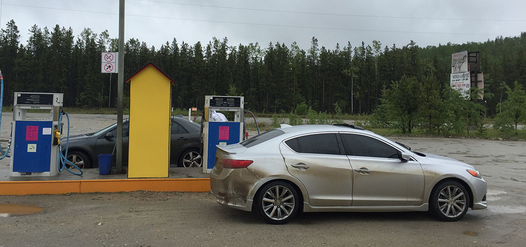
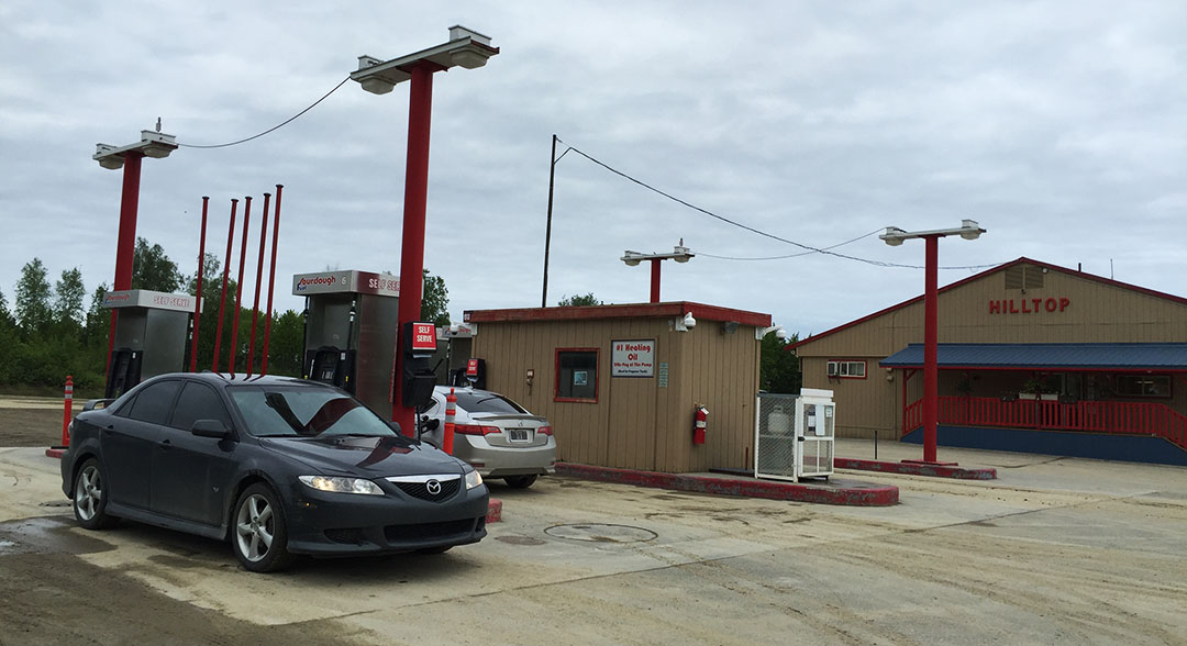
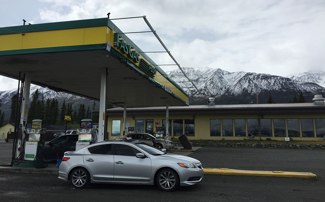
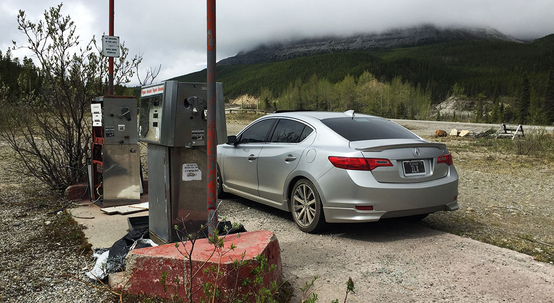
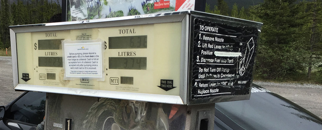
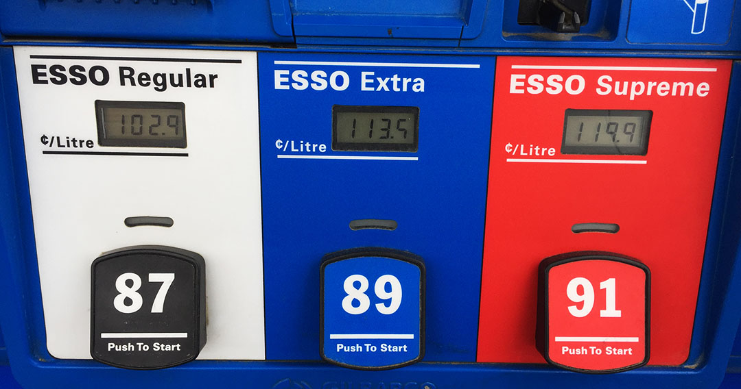
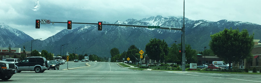
Locals had recommended that we fuel up at a service station called Hilltop in Fox, Alaska about 15 miles north of Fairbanks, so we did that first thing this morning.  Once again it was a “diesel or unleaded” gas decision with no variety of unleadeds to choose from.

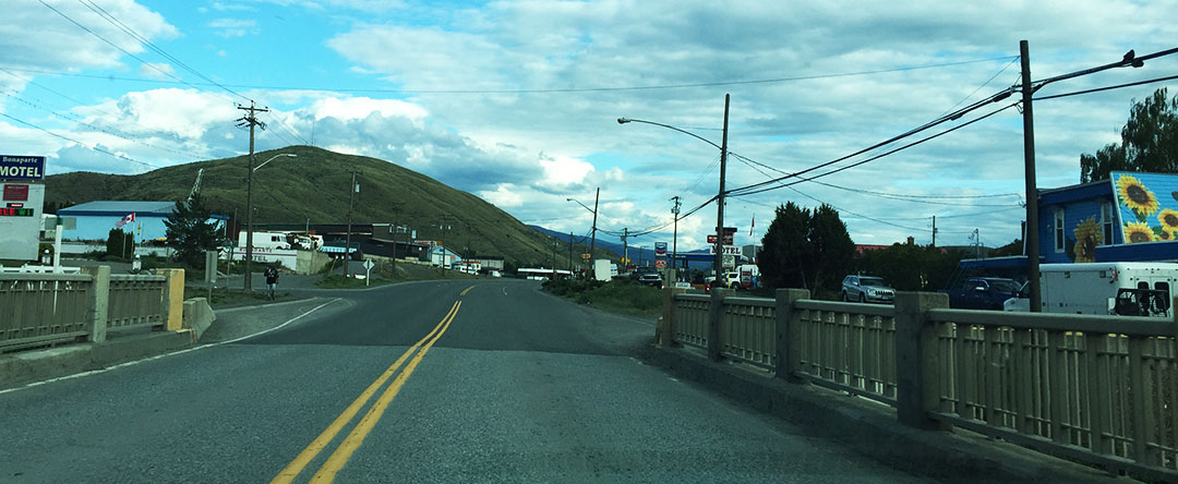
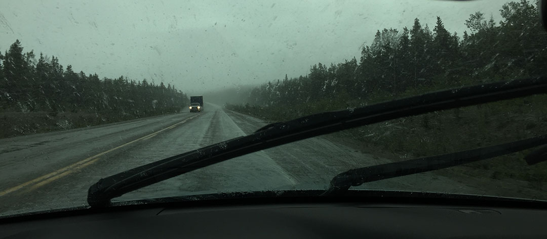
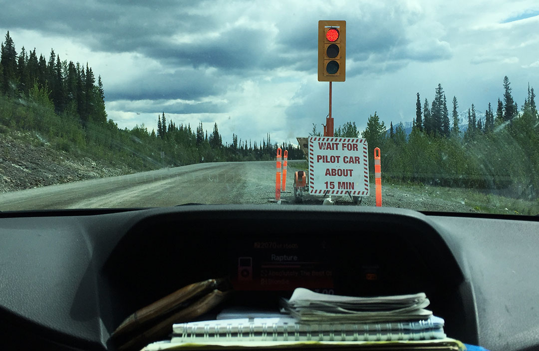
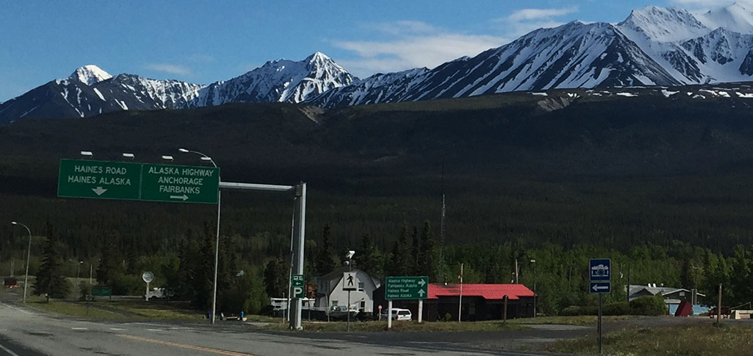
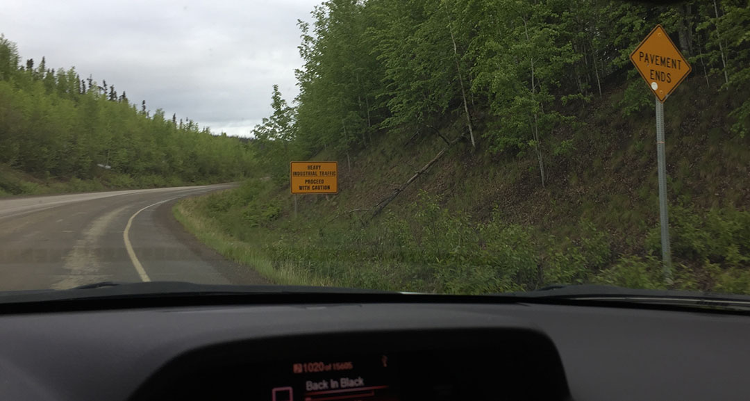
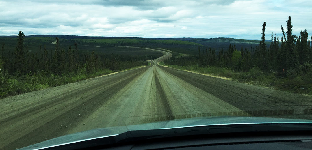
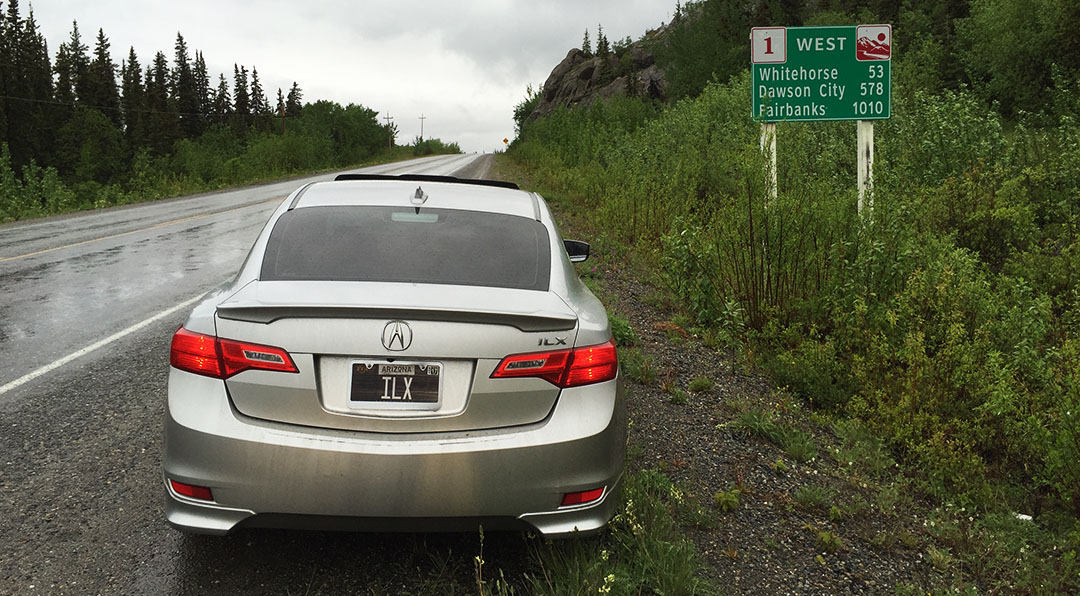
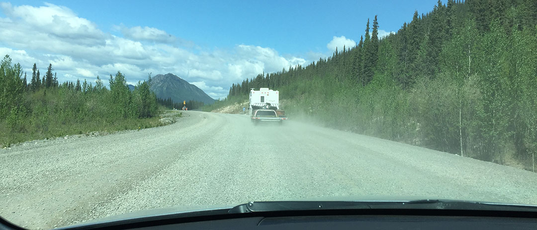
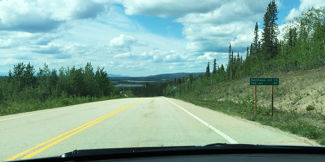
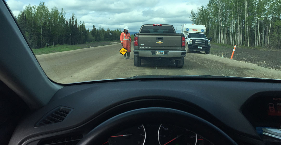
We drove another 60 or so miles on the two-lane Elliott Highway toward its junction with the Dalton Highway.  Conditions seemed to get progressively worse.  In some spots, the road had completely caved in.  Road workers have done their best to mark the especially bad areas with orange cones for driver awareness until they can be repaired.  I was apprehensive about our weather, knowing that the cloudy skies meant that we may hit rain and thus be mud-bogging in our sedans.

dalton_sign

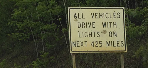
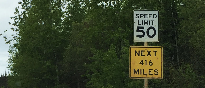
Pavement ended at the Dalton / Elliott junction.  The next sign we saw was “All Vehicles Drive with Lights On Next 425 Miles.”  And with that, we were off.  Headed northbound on the road that’s taken lives and obliterated vehicles.  We saw the carcass of a Mitsubishi Galant just a few miles down – crumpled and left by the roadside for some reason.

lights

The road surface was indeed wet and muddy but my meaty Michelin Primacy tires seemed to have a good grip.  More so than Jason’s, who reported from his walkie talkie that his Continentals were feeling a bit squirrely.  In some areas I was able to get up to 55 or even 60 miles per hour on the unpaved portions.  In other areas I had to quickly hit the brakes and pull evasive maneuvers to get around obstacles.  If ever there were a time to have both hands on the wheel while driving, it was on this road.

const2

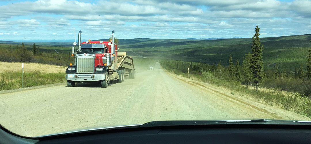
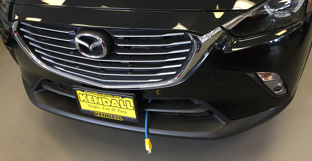
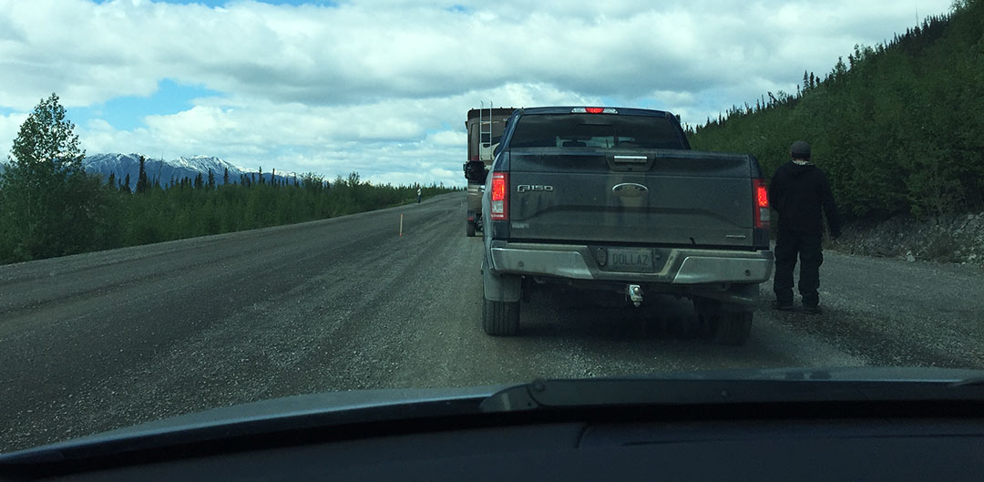
In the 8 hour round trip, we saw minimal traffic.  Only two other “cars,” in fact – a Chrysler 200 and a Ford Taurus that were surely both rentals.  Everything else was a semi truck or construction related pickup.  At one point I was following a tractor that was doing some grading of the road on a gravel portion. It had left a huge berm in the center of the road.  I had to cross over it and scraped the underneath of my car pretty good.  Luckily it was pretty loose dirt and not gravel or larger rocks.

ilx_grade

In short sections, pavement did resume.  But Jason and I both found that the condition of the pavement was even worse than the condition of the gravel.  Huge frost heaves sent our cars lurching when hit just right.  I managed to forewarn Jason via the radio of a few particularly tricky areas but neither one of us avoided the potholes entirely.  Sometimes all I could do was grip the wheel strongly and grit my teeth.  I kept a close eye on my gauge cluster watching for any losses of tire pressure, just in case.

ft_hamlin_bridge

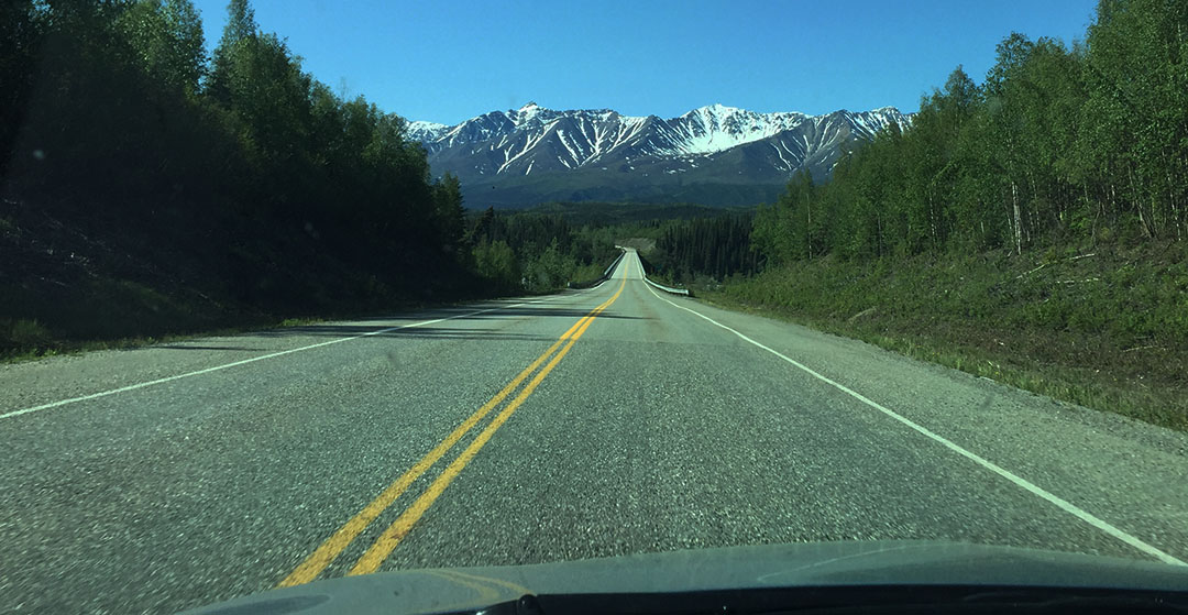
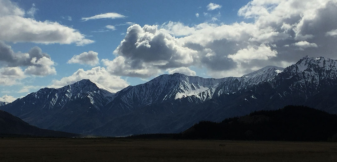
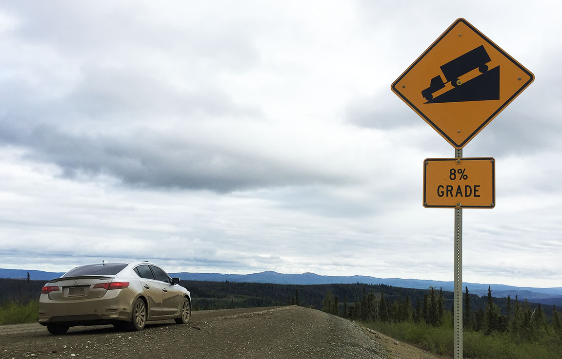
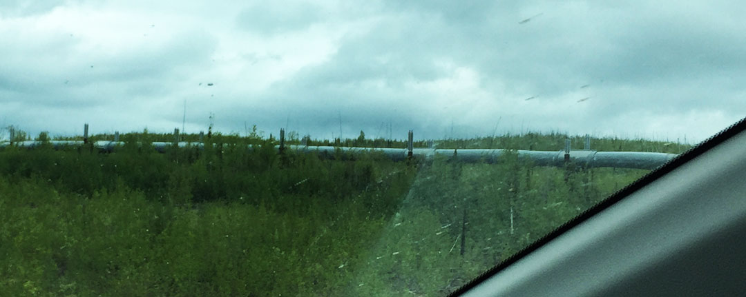
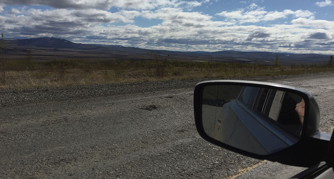
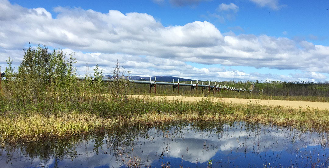
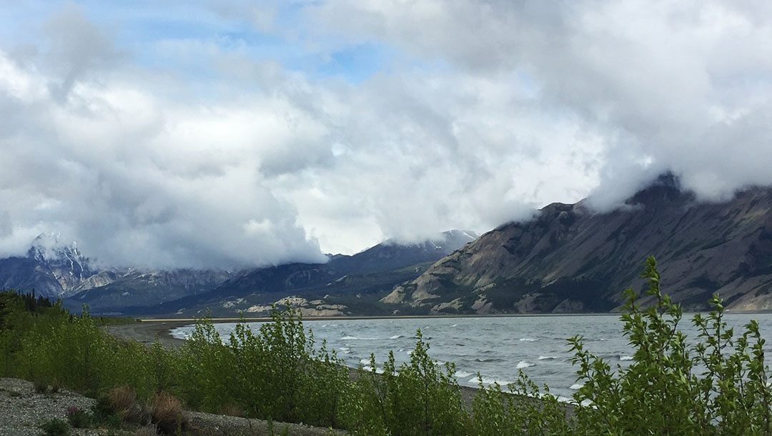
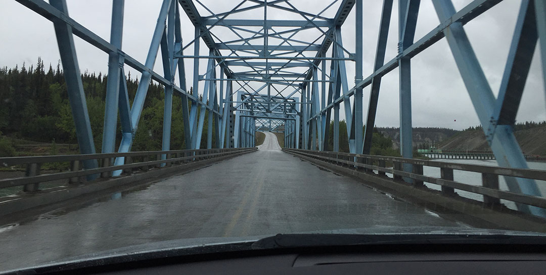
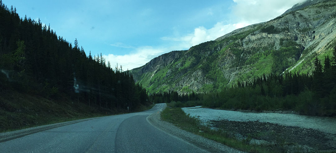
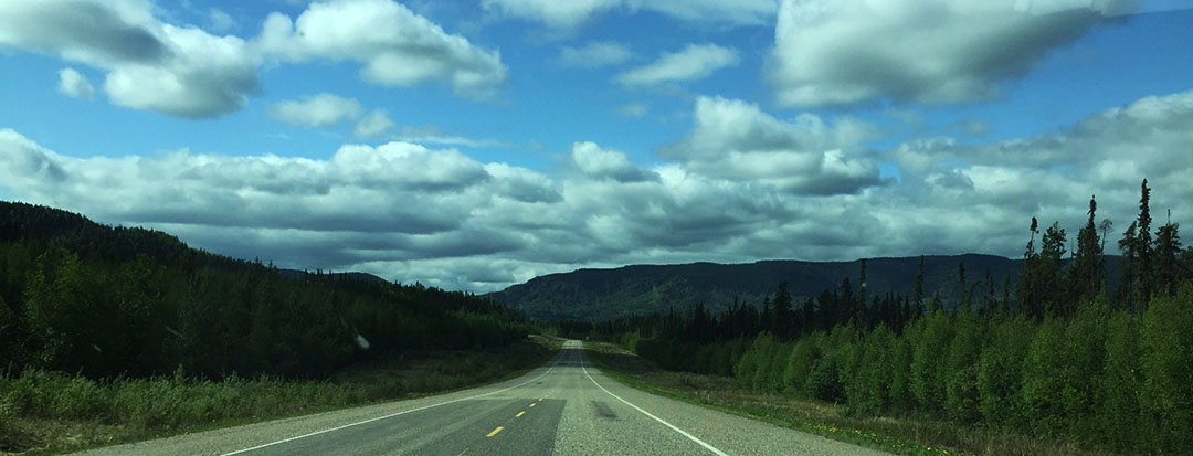
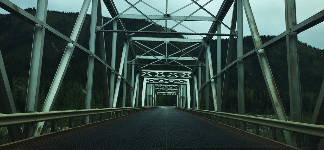
The countryside was beautiful as we made our way up and down steep 7-8% grades, across narrow bridges, and through various types of terrain.  For most of the drive, the Trans Alaska Oil Pipeline was visible from the road.  The pipeline is why the road exists, after all.  Eventually the clouds parted a bit and we saw a hint of blue sky which was a relief.  Our road sharply descended into a small valley with the Yukon River at the base.

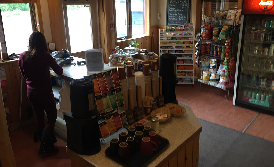
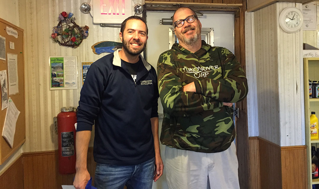
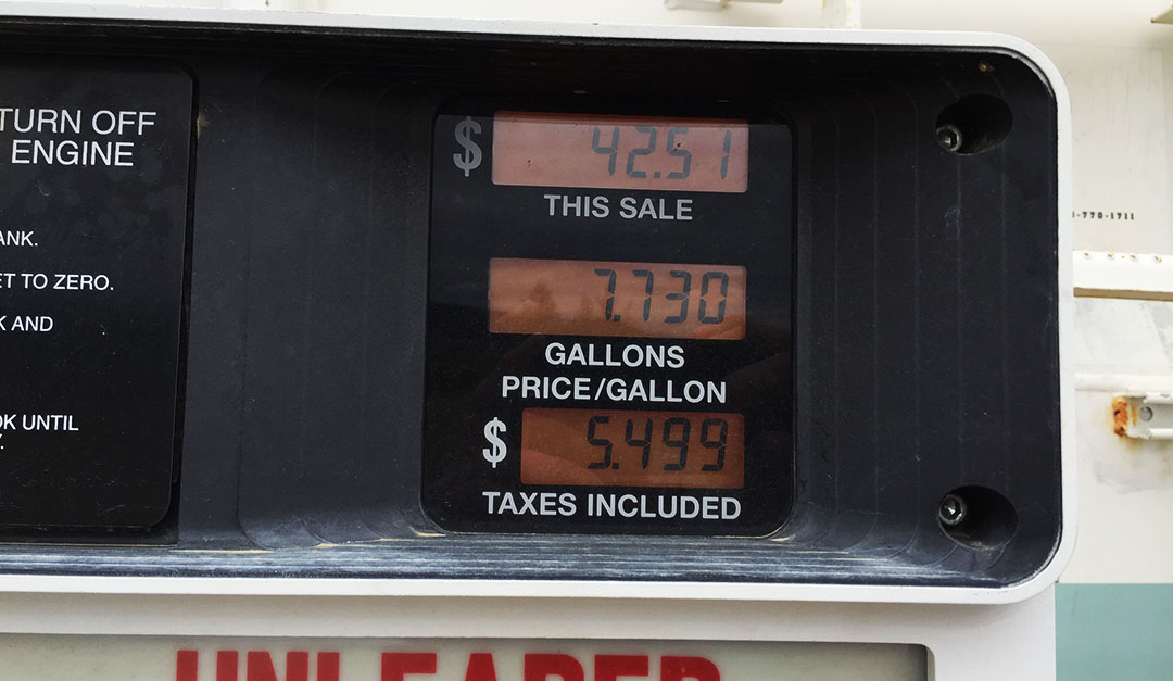
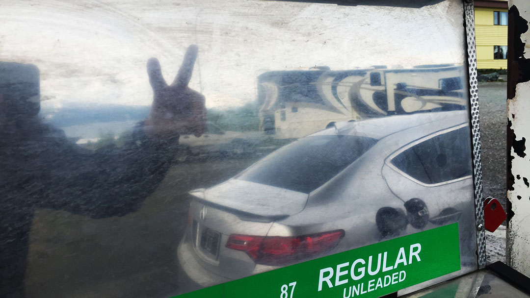
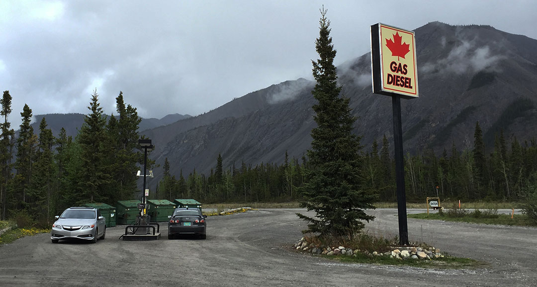
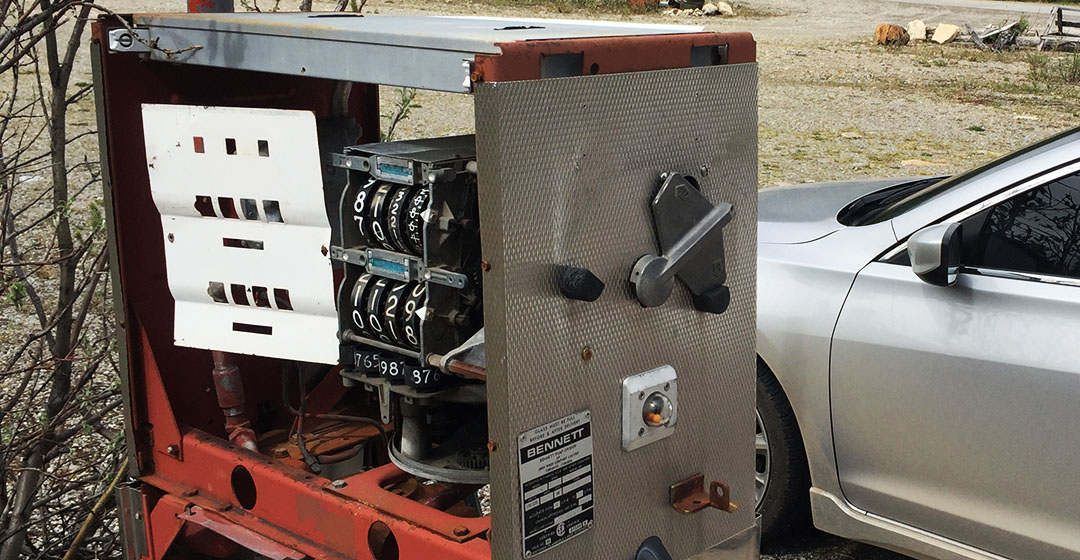
We crossed over the wooden bridge and arrived at Yukon River Camp, a rustic lodge with a restaurant and a single gas pump.  To be on the safe side, Jason and I decided to top off there.  A man named Stephen who was running the store was kind enough to give us some tips and an update on road conditions up ahead.

yukon_camp_outside

Here’s Stephen.  Our gas was $5.49 per gallon.

stephen_yukon_camp

The next 60 miles were more of the same, and by the same I mean amazing scenery, rough roads, and a surreal sense of “Am I really doing this?” as we crept further and further northbound.  Pine trees cleared out and soon the terrain was more barren.  There was still snow on the roadside in various places.  The tundra up there is a rough place for any living thing to survive.  Temperatures can reach 80 below zero during the wintertime.  Somewhere along the way I managed to run over a rabbit that decided to cross the road at a very inopportune time.  Otherwise our wildlife sightings were nil.

arctic_sign

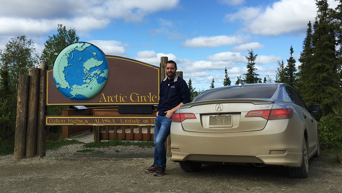
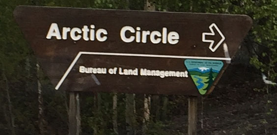
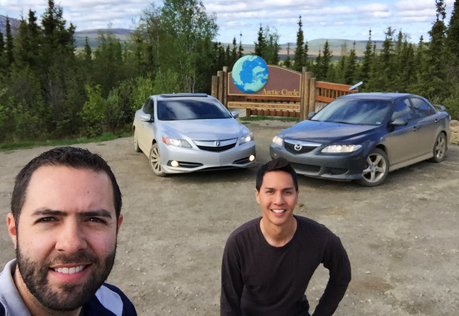
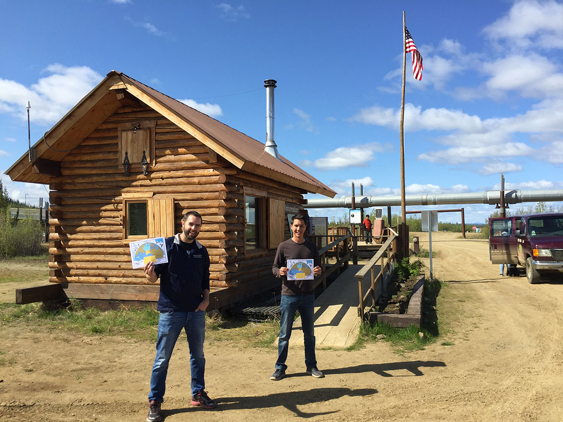
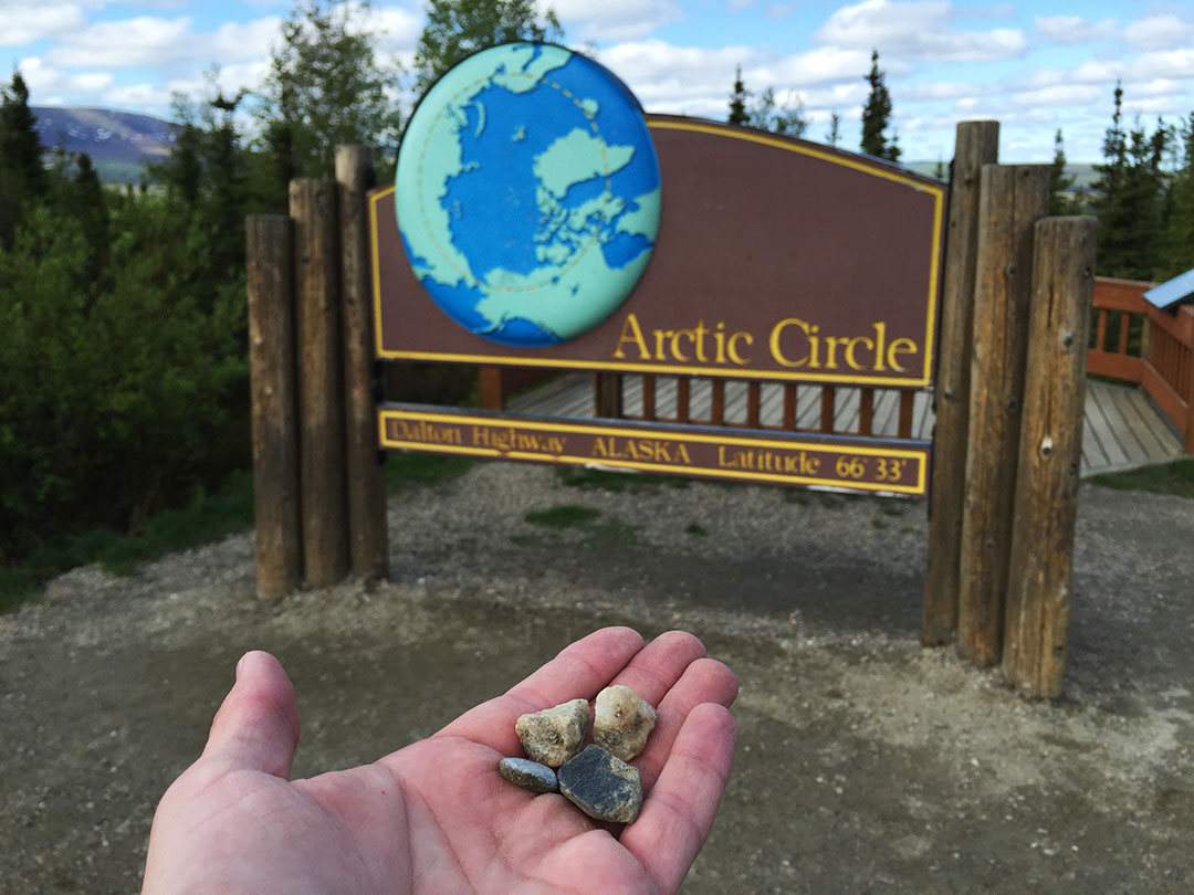
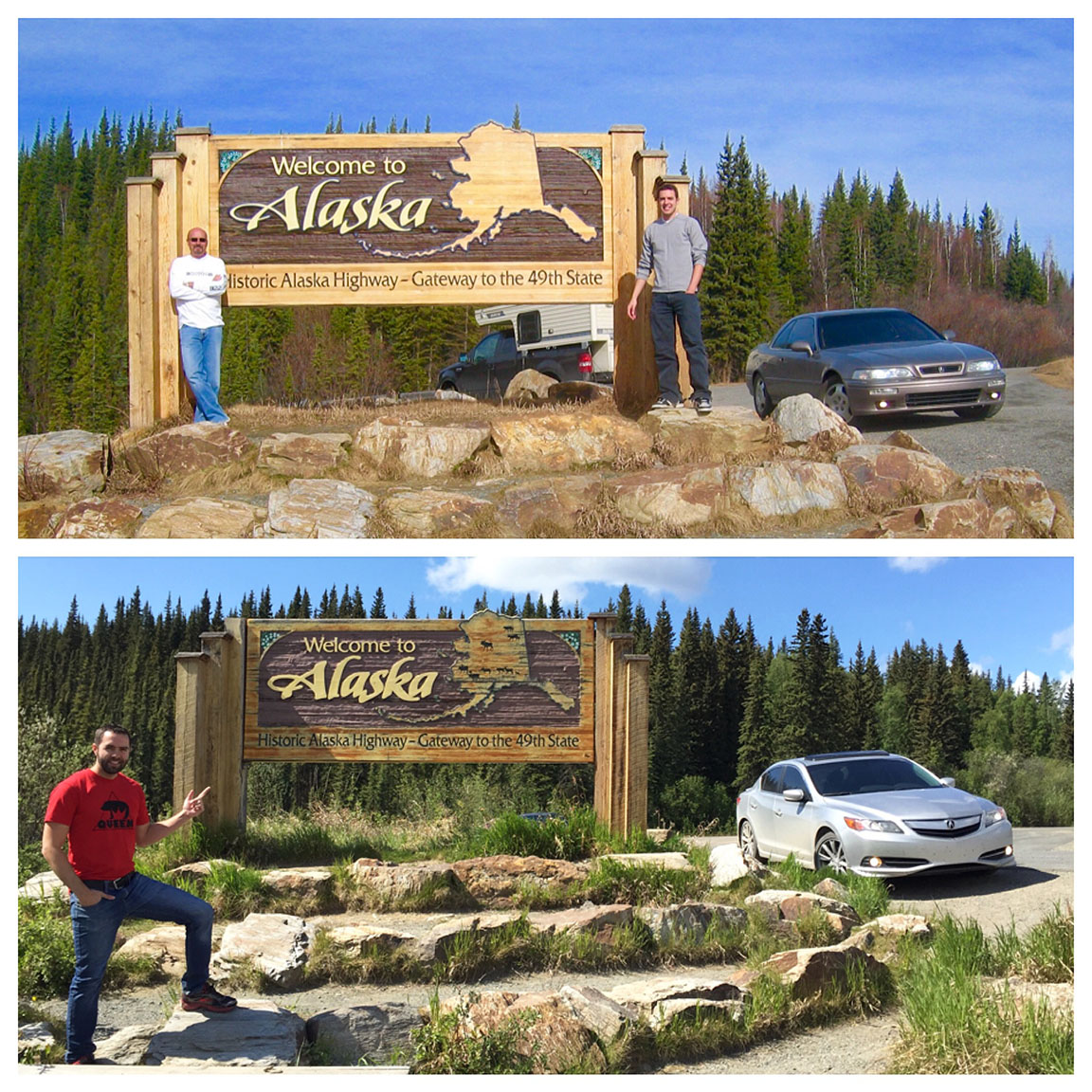
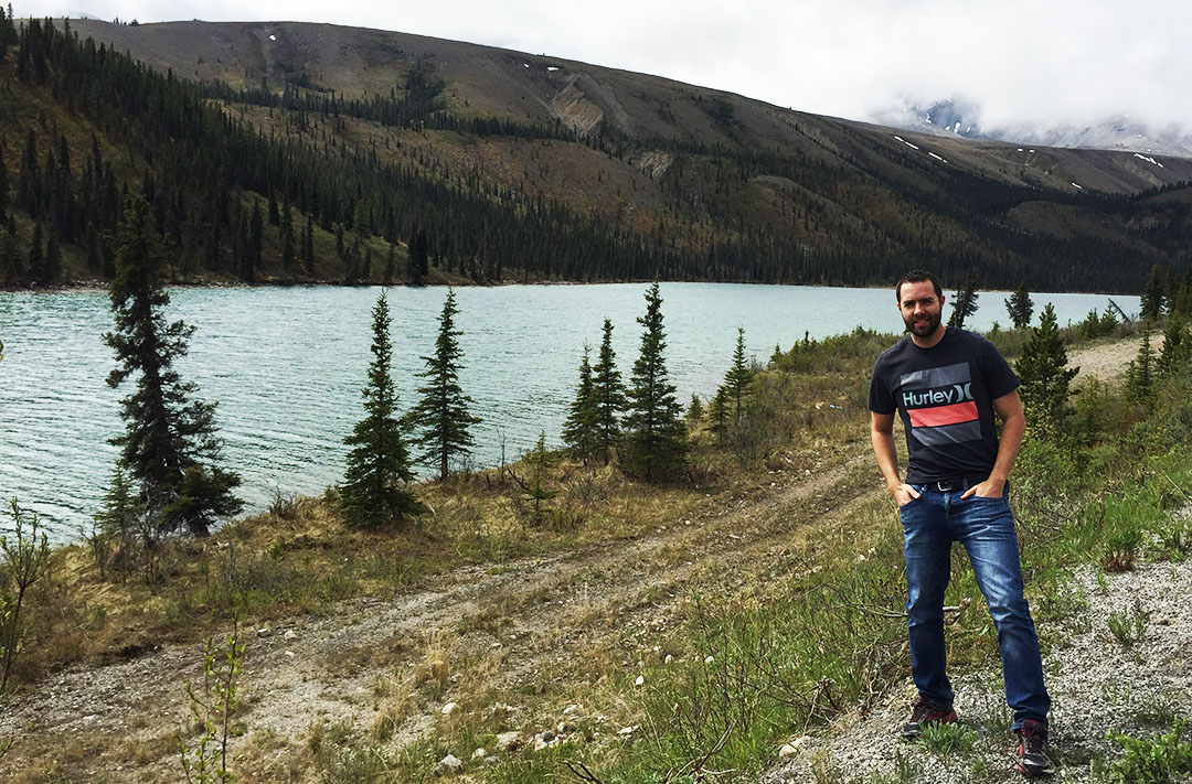
When we finally pulled up to the sign/marker at the official start of the Arctic Circle, I couldn’t believe we’d made it.  We were both a little giddy.  There was of course nobody else for miles around.  We took some celebratory photos and then enjoyed the scenery while having some snacks.  (Thanks Jason for sharing your Lunchables).

tyson_jason

A Ford 15-passenger van pulled up a little while later with 4 visitors from Pittsburgh.  They thought we were insane for having taken our personal vehicles on the Dalton Highway.  Their tour guide was unloading supplies to fix a bite to eat for his clients so I told Jason, “Perfect, we’re just in time for lunch!”  The guide laughed and said, “Yeah, did you bring some?”

tyson_jason_certificates

certificate

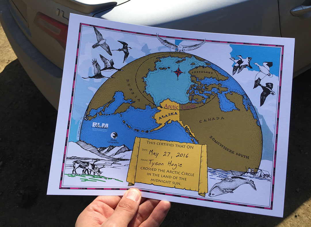
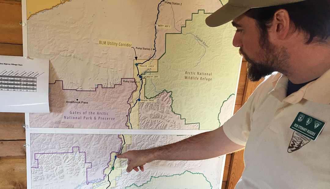
On the way back into Fairbanks, we stopped again at Yukon River Camp, but this time to stop in at the one-room log cabin that serves as a visitor center.  It barely opened for the season yesterday.  The worker there, Rob, filled out a certificate for each of us that acknowledged that we had in fact that we had “Crossed into the Land of the Midnight Sun.”  Awesome!  I might just have to hang that in my cube at work!

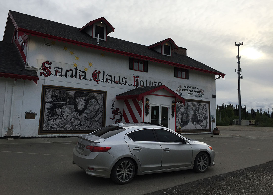
So it’s back to our cozy motel here in Fairbanks now for one more night before heading back to the Lower 48.

Thanks for coming along!

Pavement ending at the beginning of Dalton Highway

pavement_end

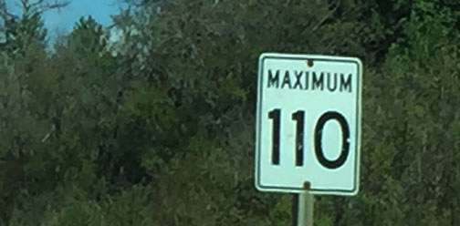
Speed Limit 50, Next 416 Miles

50mph

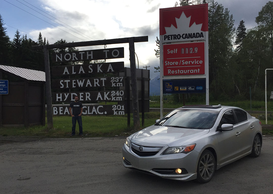
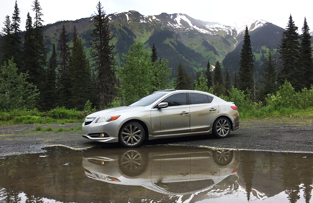
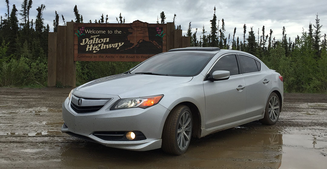
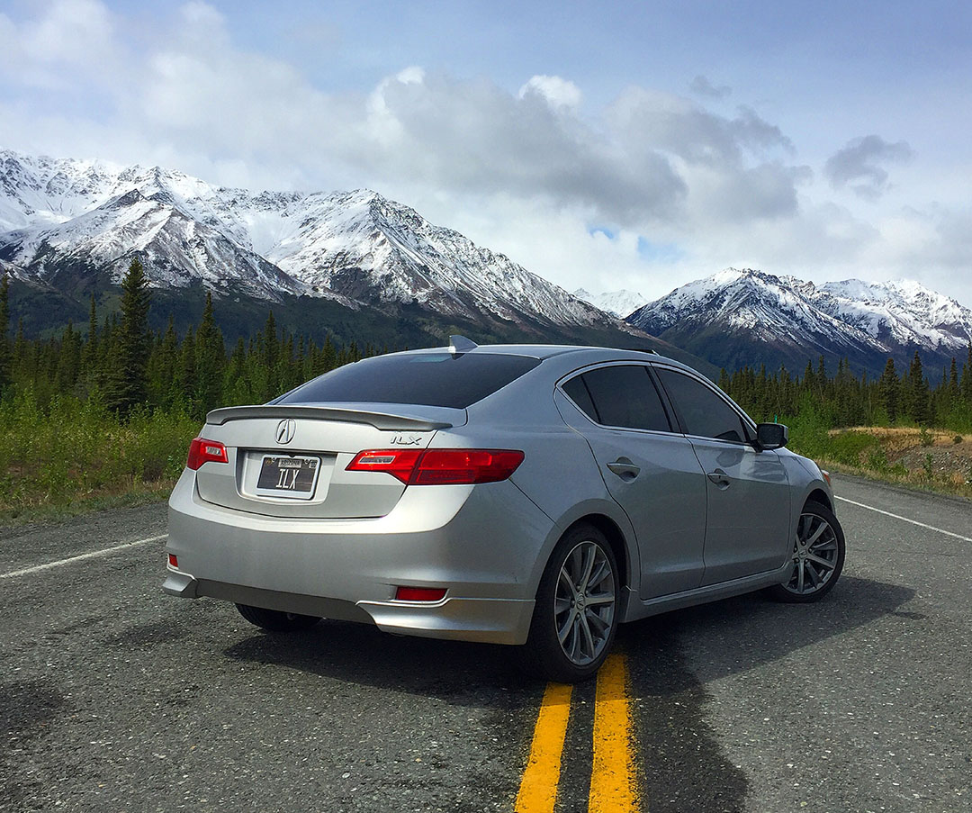
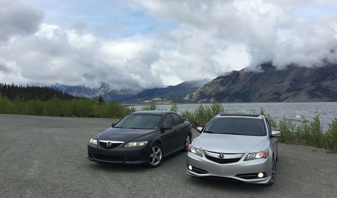
ILX at the entrance to the highway

ilx_at_dalton

tyson_dalton

Road conditions for part of the drive

road2

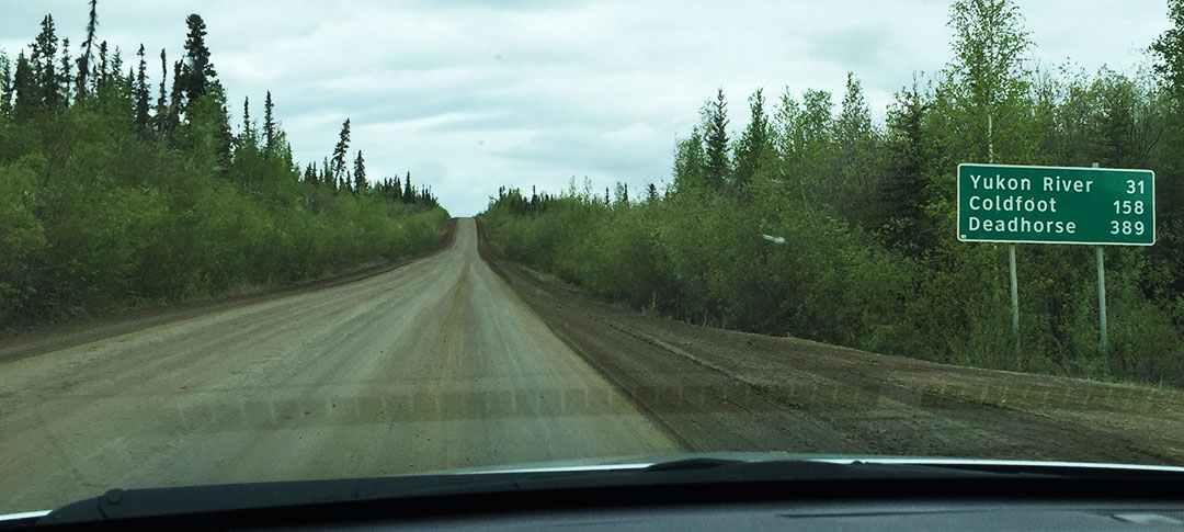
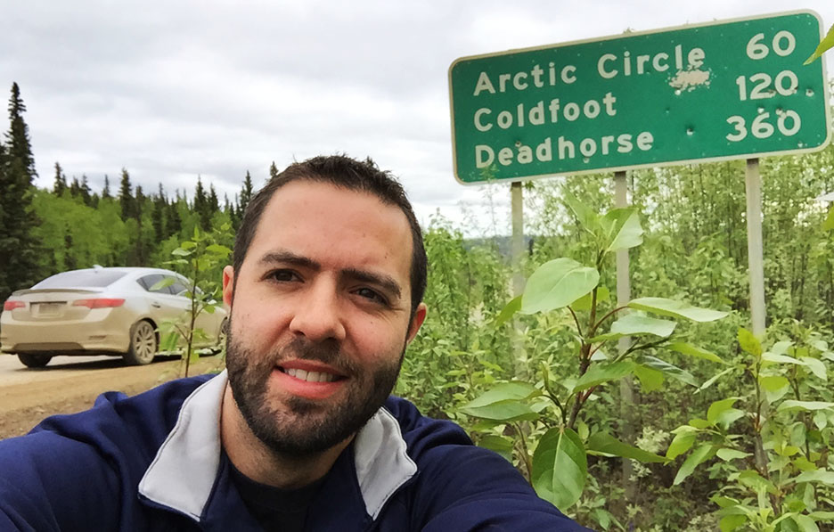
Distance marker.  Deadhorse is the end of the highway at the far northern end of Alaska, Prudhoe Bay.

road

Trans-Alaska Oil Pipeline as seen on the roadside parallel to us.

pipeline

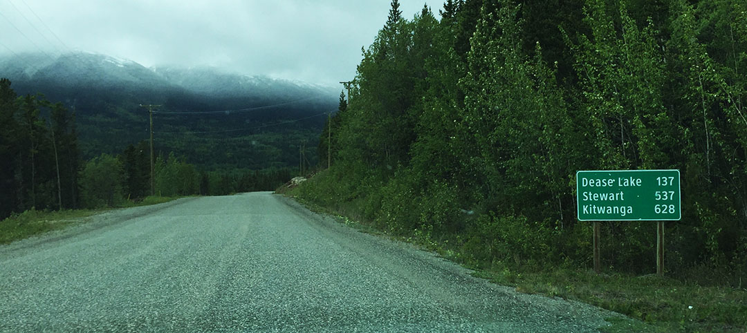
Distances!  Getting closer to the Arctic!

arctic_60_miles

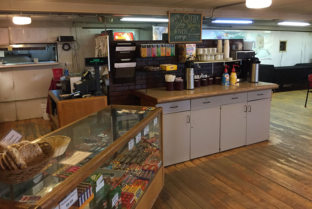
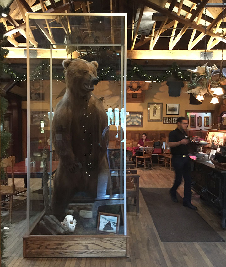
Inside of the Yukon Camp.

yukon_camp_interior

Check out this rig!

ford_van

Jason fueling up at Yukon Camp.

jason_gassing

Ouch!

549_gas

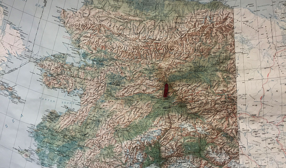
Never before has a “You Are Here” arrow sticker had so much meaning!

map2

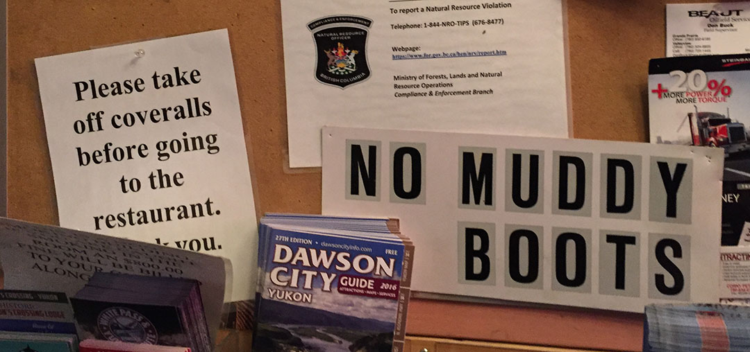
Sign on the door to the restrooms at Yukon Camp

bathroom_sign

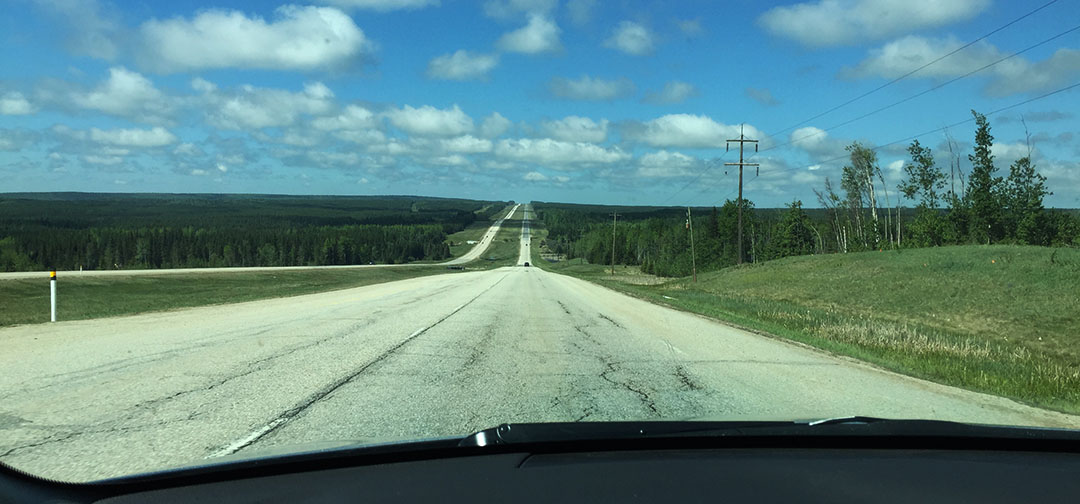
Long (bumpy) road ahead

road_with_ilx

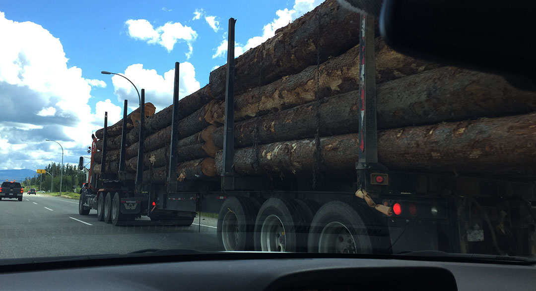
When one of these comes barreling at you, you close your eyes and pray for minimal damage when it peppers you with rocks.

semi

Speaking of rocks, I took a few from the area around the sign because a friend asked me to get him a souvenir.

rocks_for_tj

Tour van arrived just as we were about to leave.  Otherwise we’d had the place to ourselves!

tour

The arctic.

scenery

What do you think of my two-tone ILX?

ilx_arctic

Rob at the Yukon Camp visitor center.

rob_jason

Showing us our way around.

rob

The scenery is very beautiful and the pipeline is very prominent.

yukon_pipeline

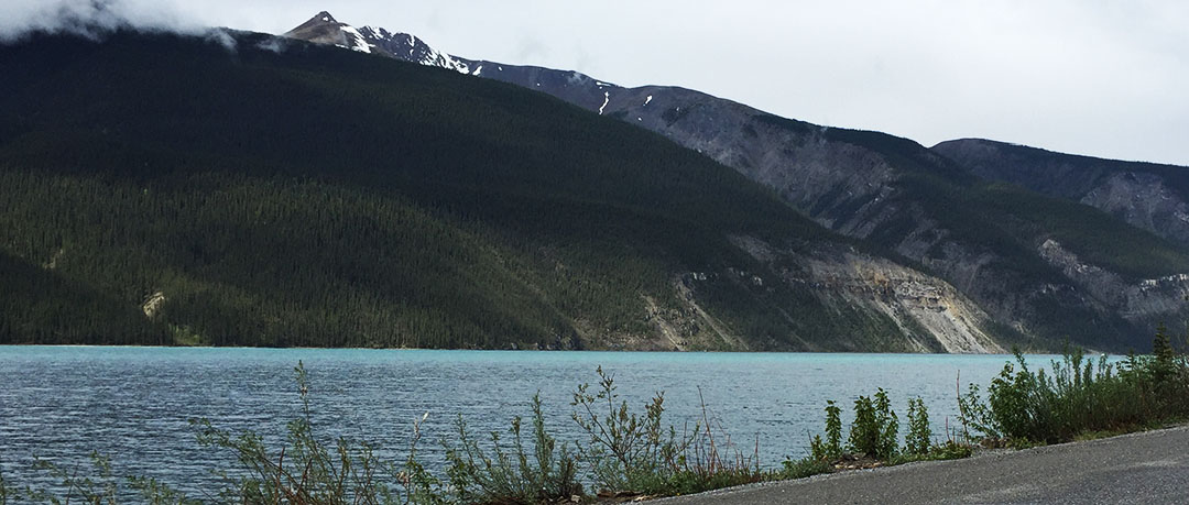
Crossing the Yukon River.

crossing_yukon_river

Snow on the roadside.

snow

Hope you enjoyed!  Who wants to detail my car when I get home?

Freestyle Day in Fairbanks, Alaska

Posted in Alaska, ILX on May 26, 2016 by tysonhugie

Day Distance:  Only 40 ish Miles 🙂

What a feeling it was to be able to kick back in a hotel bed this morning and not be hurriedly rushing to get ready and get out on the road for a long day of travel.  Today was our intermission in between hectic to-and-fro drives from the Lower 48 to Alaska.  Here’s a newspaper headline I’m not used to seeing back home.

fairbanks_paper

Once I finally dragged myself outdoors, I was pleased to learn that right next to our hotel was a Denny’s.  But this wasn’t just any Denny’s.  This, my friends, is the “Northernmost Denny’s In the World.”  The sign says so!

northernmost_dennys

The ultimate omelet hit the spot.  Finally some comfort food I’m used to after these crazy days on the road.

ultimate_omelete

While the town of Fairbanks doesn’t have a ton to offer in terms of riveting attractions – it’s largely just a community of friendly hard workers who are here and who make the most of living in a place that’s so rugged and remote – we still enjoyed getting out for a little informal self-guided tour of the community.  Our first stop was not very “Alaska” in nature, but I had to find a Starbucks so I could purchase a souvenir mug for my friend Jon back home in Phoenix.  We found one located inside a supermarket and I did my duty as a tourist by picking one up.

starbucks_2

Just so I could show Jon exactly where I bought him that mug, I took a screen shot of my location:

starbucks

Eight miles north up the Steese Highway from downtown Fairbanks, we visited a section of the Trans-Alaska Oil Pipeline (formely, Alyeska Pipeline).  This massive system of oil-pumping infrastructure stretches 800 miles from Prudhoe Bay to Valdez.  Do any of my readers remember the historic Exxon Valdez oil spill of 1989?  That’s when an oil tanker bound for Long Beach struck a reef and spilled 38 million gallons of crude oil over the next couple of days.  I was very young at the time, but I remember hearing about it.  Oil is very big business up here.

tyson_pipeline

The Mazda and Acura with the oil line in the background.

pipeliune

The next stop was to drop off Jason’s 2004 Mazda for an oil change at Kendall Mazda of Fairbanks.  The service people marveled a bit that Jason’s 6 had traveled all the way from New Mexico over the last 6 days.  I took a minute to wander through the showroom and noticed that every single new car in there had a $495 – $595 add-on to the sticker price which was for “Winterization Package.”  They also all have (as do most vehicles in Fairbanks) plugs dangling out of the front where an extension cord can give power to an engine block heater.

winterization

Can’t they at least make the cord a little less unsightly?

plug

Aside from the block heater, the Winterization Package also includes special coolant that’s good to 60-below zero.  When Jason got the call later in the day that his car was ready, the advisor recommended the package.  Jason respectfully declined since the car is soon going back to the desert with us.  I suppose living in a harsh climate is something not too difficult for me to comprehend.  How would these Alaskans feel if I put them in a sun-baked car in Phoenix in the summertime?  The average high temperature in Fairbanks is a whopping 73 degrees in July.  Brrr.

I felt like taking a peek at the local Honda dealership just for kicks, so we moseyed over there (on the other side of town – which amounted to about 5 miles) while Jason’s car was in the shop.  My ILX, though having driven almost 4,000 miles since its last 0W20 oil change, still tells me its oil life is at 70% so there’s no need for me to have any maintenance done at this time.  The Honda / Toyota / Subaru dealership happened to be right next to a restaurant called The Cookie Jar which came highly recommended by my friend Matt, so I stopped in there for a half-dozen chocolate chip cookies to take home.  They are most delicious!

cookie_jar

One interesting discovery I’ve made is how much time can change a community.  When my dad and I visited here in 2006, we stayed at a rugged yet very cozy place here on Airport Road called the Captain Bartlett Inn.  Formerly known as the King 8 Motel and dating back to who-knows-when, it was renamed Bartlett in 1977.  When we stayed there, it was already a bit run-down.  Here’s a photo of our arrival in the Legend coupe.

BARTLETT_2006

But I didn’t expect it to be completely gone now.  And it is.  Vanished!

bartlett

Yet for some reason my Apple maps on my iPhone still show it there, which was why I’d been confused during the drive-by this morning.

bartlett_on_map

As it turns out, the place was bulldozed in 2009 just 3 years after we stayed there.  The bar area inside the building had $1 bills stapled to the walls.  Before the building was torn down, the bills were collected ($2,100 worth) and donated to a local charity.  Here’s a video I found of the demolition.  The property is currently for sale and has a chain link fence around it.

bartlett_location_2

bartlett_location

We caught a movie at Regal Cinema down the street this afternoon, then dined at The Pump House.  It’s a restaurant on the banks of the Chena River that’s the most “Alaska” of any restaurant in town.

pump_house

A 9-foot-tall bear greets visitors after entering the front door.

grizzly

I went with the Alaskan Salmon (of course!) and it was splendid.

alaskan_salmon

salmon

We are livin’ good!

livengood

This is an example of a “pig” that goes within the oil pipeline to move the oil through.

pigs

For my loyal TSX-owning readers (ahem, Carlos, Conor, Josh):  Here’s an Alaska TSX for you.

tsx_in_alaska

“Rent a Beater” advertisement on a flyer at our hotel.  I want one!

rent_a_beater

Alaska Trip Day 6: Fairbanks, Alaska

Posted in Alaska, ILX, Road Trip on May 26, 2016 by tysonhugie

Odometer:  167,325

167325

Day Distance & Time:  701 Miles;  12 hours, 11 minutes

701

Overall Trip Distance & Time:  3,626 Miles;  57 hours, 46 minutes

3626

tyson_at_border

The Land of the Midnight Sun, they call it.  Around June 21, the sun will be visible here in Fairbanks for all 24 hours of the day.  As of right now, a few weeks away from that, I can tell you that it’s midnight and I’m looking out the 2nd floor window of Super 8 and it’s nowhere near getting dark yet.  I guess the daylight trickery was part of the reason why Jason and I felt motivated enough to chug through a few extra miles this evening and get us to our final destination.  We logged in a total of 701 today, which beat our last couple days’ worth by quite a bit.  The crazy part is that today we also experienced more construction and weather-related delays than any other leg of the trip.

It all started at our quaint cabin in Teslin, Yukon where we headed out northbound on British Columbia Highway 97.  We passed a distance marker that gave us the remaining distance to Fairbanks – a staggering 1010 kilometers.  I didn’t think in a million years we’d actually end up going that far today, but we did.

fairbanks_1010

It only took us about 90 minutes to get to the capitol of the Yukon Territory:  Whitehorse.  It’s a surprisingly large and modern city (pop. 23,000) for being in such an extreme region of the world.  They even have (and thanks Jason for noticing from a mile away) a full-blown Honda dealership there. With a red (instead of blue) sign!

red_honda

We fueled up at Petro Canada down the street and switched the wipers into high gear to fight rain showers all the way to Haines Junction where they finally let up a bit.  Neither one of us had a huge appetite but we did need to use the restroom.  We opted to pull a roadside bathroom break in the trees when we saw that the Alcan Motor Inn had no public washroom.

Photo re-create!

2006:
tyson_haines

2016:

haines_junction

The external temp readout on the ILX showed a chilly 40 degrees outside as we made our way north-westward toward Kluane National Park and Reserve, home to the Yukon’s largest lake.  The clouds began parting just enough to allow us to see a hint of blue sky as we parked the cars along the shoreline for a quick photo in the near-freezing wind.  I was surprised at how large the waves in the lake were.

kluane3

From our vantage point on the southern shore, it sounded a lot like the ocean.  As we closed in on ½ tank fuel remaining, I decided it was best that we again top off, so we visited Fas Gas in “Destruction Bay” for some 87 octane fuel.  The attendant inside had to activate the ancient pumps for us.  He had a cork board hanging behind his counter where he’d clip the credit card according to pump number to keep them in order.  He wasn’t very chatty but I didn’t care for small talk anyway; we had places to go yet.

destruction_bay

A couple of things happened around that time:  The road got really bad, and the scenery got really good.  Clouds parted and we now had a perfect view of the huge snow-capped peaks surrounding us.  Traffic was so light I was able to park the ILX in the middle of the road and take a picture of it.

ilx2

The roller-coaster ride for the remaining 115 or so miles to the U.S. border gave my car’s suspension a serious workout.  I think I caught air on at least one occasion.  And then there was the construction.  At one point, we had to wait several minutes for a pilot car to come get us and lead us through a muddy stretch of road.  Meanwhile all I had to do was look at the scenery around me to realize that I didn’t care about the delay at all.

construction_2

Beaver Creek, Yukon was the last stop before entering the U.S. of A.  The eastbound Canadian Customs checkpoint was a full 30 kilometers separate from the westbound U.S. Customs checkpoint.  And the actual “Welcome to Alaska” sign is actually a bit before the Customs station.  Odd layout, but I guess it works!  As Jason and I communicated via walkie talkie, there was a definite sense of glee as we both saw the wooden sign coming up.  We’d driven a very long way for that occasion.  In my case, a total of 3,333 miles since I’d left my driveway last Friday morning.  We staged a few photos and pressed on.

ak_compare

This sign, by the way, has been removed sometime in the last 10 years!  I was so bummed!

ak_welcome

Now we “gained” another hour, putting us an hour behind Pacific.

ak_time_zone

I was ready to stretch legs and get out of the car (permanently?!) by the time we got to Tok – just starting to feel a little overwhelmed when I thought about how far we’d come, and also how far we had yet to go (a couple hundred miles).  But after a burger at Fast Eddy’s, I was feeling a little more motivated.  The U.S. road conditions were only marginally better than Canada’s.  The presence of road markings was at least consistent.

delta_junction_recreate

We got to the “official” end of the Alaska Highway in Delta Junction (1,422 miles since Dawson Creek, British Columbia) and there was surprisingly little fanfare.  I nearly blew right past the Visitor Center, in fact.  We staged a couple of re-creation pictures once again (above).  Did you notice I’m even wearing the same sweater in both?

I also learned some history about the road itself.  A wooden sign reads:

This highway was constructed during World War II as a military supply route for interior Alaska Military and Airfields in 1942.  7 Army regiments and 42 contractors and public roads administrators working from Delta Junction South and Dawson Creek North completed it when they met at Soldiers’ Summit at Kluane Lake, Yukon Territory in November 1942.  At the peak of construction, 77 contractors employed 15,000 men and 11,000 pieces of road-building equipment.  The total construction cost for 1,422 miles was $115,000,000.

By this time I was in a “GIT ‘R DUN” mindset so Jason and I both decided, in looking at the lack of quality motels in Delta Junction, that we might as well press on and head to our finish line in Fairbanks – only 95 more miles down the road.  And that we did!  Stopping just briefly in North Pole for (of course) a picture at the Santa Claus house.

north_pole

When my dad and I stopped here in 2006, I bought the deed to 1 square inch of North Pole land for $5.  I should see what my property’s worth in today’s real estate market up here.

tyson_at_santa_house

And now it’s time for us (and our trusty vehicles) to get some much-needed rest.  Let’s see where the trip takes us from here.  Jason has just notified me that the Arctic Circle entrance sign is just 5 hours north of us on the Dalton Highway toward Prudhoe Bay.  Ten hours round trip for a sign?  It’s tempting :).

Thanks for coming along!

Bridge in the Yukon this morning

bridge2

Fueling up at Petro Canada in Whitehorse, YT

petro_canada

Yukon Honda!

yukon_honda

I pulled up the satellite view of our location at one point

location

Kluane Lake, YT, in the background

kluane2

Driving through Kluane

kluane

Peace sign as reflected in this ancient gas pump, filling my car with some 87 octane.

87_oct

Views for days

peaks

view3

Construction zone (one of several)

dust

View as I waited for a pilot car at a construction zone.  Not bad.

view2

My home away from home!

tyson_driving

Beaver Creek:  “Most Westerly Community in Canada” – just prior to the Alaska state line

beaver_creek

Quick stop at Beaver Creek

beaver_creek_2

Approaching U.S. Customs

customs_sign

customs_2

Yay!  Back to miles instead of kilometers

distance_ak

U.S. roads ahead

ak_road

90 octane was considered “V Power” in Tok, Alaska

90_octane

Fueling up in Tok

gas_tok

Leaving our lunch spot in Tok:  Fast Eddy’s

fast_eddys_tok

ILX at Santa’s house.  Have you all been good this year?

santa

I should pick up a load of goodies for some friends back home.

santa_house_ilx

Fairbanks upon our arrival.

fairbanks

Fun to see my friend map and know that I’m way up here!

fmf

G’nite and thanks for reading!

Alaska Trip Day 5: Teslin, Yukon Territory

Posted in Alaska, ILX, Road Trip on May 24, 2016 by tysonhugie

Odometer:  166,623

166623

Day Distance & Time:  617 Miles; 9 hours 48 Minutes

617

Overall Trip Distance & Time:  2,924 Miles; 45 hours 33 Minutes

2924

teslin_tyson

“It’s like driving through a Bob Ross painting,” I told Jason via walkie-talkie as we crested the Yukon Highway 1 near the Liard River today, with “happy” pine trees in the foreground and the looming, snowy peaks in the distance.  Today’s scenery has been endless and awe-inspiring.  We put in a long day, at 9 hours 48 minutes, but it went by quickly because we were too busy enjoying the surroundings.  Best of all?  ZERO CELL SERVICE most of the day.  Staying unplugged today (until now) was one of the most enjoyable things I’ve ever done.

I definitely think we timed this trip perfectly.  Springtime is sprouting all over, the roads are free of snow, and yet the peak tourist season isn’t yet underway so we rarely have to deal with a slow-moving RV in our way.  For miles upon miles, we had the roads to ourselves today.  Every once in awhile a tractor-trailer would come barreling toward us I’d wave just to see if I could get its driver to do the same back.  I was in my element.

tyson

Jason and I survived our showers in non-clear water at the Buffalo Inn in Pink Mountain, British Columbia this morning. The gal in the restaurant this morning told me I could have a banana for the road, and I wasn’t super hungry so that’s all I cared to have for breakfast.  Just 35 miles into our drive, we had a black bear sighting on the left shoulder of the road.  I didn’t have time to brake & snap a photo in time, but it was an eye opener and definitely not something I’m accustomed to seeing out in the wild in Arizona!

There was very strong evidence of forest fires in some areas as we made our way up Highway 97.  But soon the landscape changed from pine tree forests to a very rocky canyon called Stone Mountain Provincial Park.  There were signs warning us to watch for sheep in the road but we didn’t have any sightings (probably because I wasn’t paying close enough attention).  We got photos at an abandoned service station in Summit and then continued on toward Muncho Lake about 40 minutes down the road.  Even though the clouds had started drizzling on us, it didn’t dampen my spirits because I soon saw the lake itself in all its turquoise glory.  The road winds along its edge for about 6 miles before arriving at the log cabin-styled Northern Rockies Lodge which was our next pit stop.

munch_dist

hwy

Once again I’ve thrown a kink into my fuel tracking because (for the first time in ownership of my ILX) I don’t know what octane I pumped there.  There were only two options:  Unleaded and Diesel.  I had to go inside the lodge and leave a credit card on file before the attendant would activate the pump.  The car took 22 or so liters of fuel and I’m sure I paid a crazy premium price for it, but I didn’t want to risk pressing on to the next stop given I was already down to about ½ tank and I like to travel on the top half whenever possible.

munch_gas

There were only 3 lunch menu selections inside the restaurant at the Northern Rockies Lodge, and each one cost $18.  I went with the ham & cheese sandwich and it came with a side salad.  The price gave me sticker shock until I read something on the menu that surprised me:  Groceries are delivered to Muncho Lake twice a week, by truck, from Edmonton, Alberta (800 miles away).  Now I didn’t feel too bad about the $18 sandwich.  Dorothy, our server, commented as the rains started coming down more heavily, “It’s liquid sunshine out there.”  I liked that.

Buffalo sighting!

buffalo

We passed a few “AVALANCHE AREA” signs – once again something very foreign to a desert dweller like me.  I have to imagine this area and its roads area extremely rugged for most of the year.  We did get stuck in a few construction-related stops where we had to wait for a pilot vehicle to guide us through, and two of those construction zones were on muddy / gravel roads of about 10 miles in length.  Road conditions elsewhere were surprisingly good, aside from the occasional frost heaves (most of which are clearly marked with yellow signs).  I love a good roller-coaster highway anyway.  Yukon Territory entry sign:  2006 & 2016.

yukon1

Watson Lake, Yukon Territory’s most famous attraction is its signpost forest.  People from all over the world have taken signs of any sort – mostly license plates or the like – to nail to the boards.  There are thousands of them.  Jason contributed a New Mexico license plate to the cause, and I pinned up a dealership plate from Acura of Tempe, Arizona – just because I thought to grab one when I got my last oil change.

tyson_sign

Now came the moment of figuring out how far we wanted to go that night.  We weren’t quite spent so I looked at the map and figured we could make it to Teslin (166 miles) in about 2.5 or 3 hours, so I called ahead to the Yukon Lodge and made a reservation for the night.  It must have been the Red Bull I picked up in Watson Lake but I somehow got my “second wind” and I was listening to music at max volume, moonroof open, and chair dancing by the time we did get to Teslin.  I re-created a 2006 photo near the bridge leading into town (first pic in this post) before we checked in for the night to cabin #16.

teslin_cabin

One interesting thing I’ve learned about Canada is its special credit card policy.  Your card will never leave your sight.  If you’re dining out, the wait staff will bring a handheld swiper to your table and print a receipt on the spot.  In the States, we give away our card and send it to who-knows-where with the server until they return with a receipt.  Here, there’s no chance for funny business so I think it’s a good concept.

With that, here are the rest of today’s pics!

Check that bath water!

bath_water

I found this drink in BC.  “Five Alive,” so it felt fitting to drink it while wearing my “Alive with Five” T-shirt!

five_drink

Best thing I saw on my phone all day!

no_service

Forest fire remains along Hwy 97

burned

The sign at left means “hold on – it’s a rollercoaster of a road coming up.”  Frost heaves do a number on these highways.

frost_heave_sign

Nice long, straight stretch.

highway

Waiting for the green light in one of the dirt road / construction stretches.

construction

Bridge crossing.  The road surface is metal on these, and it has a tendency to grab your steering wheel and steer it for you.

bridge

Entering Stone Mountain

stone_mountain

Quick pic at (abandoned) Summit Cafe there.

summit_cafe

Pumps are long since out of order, too.

summit

Old “rolly” numbers like an odometer!

broken_pump

Getting out of the cars to enjoy the air and the scenery.

stone_mtn_2

Loved the peaks in the distance.

stone_mtn

Same angle in 2006:

06a

Muncho Lake

muncho_lake

Gas pump at Muncho

pump

Northern Rockies Lodge

northern_rockies_lodge

The $18 ham & cheese

lunch

Rain coming down as we departed

mazda_ilx

Yukon entry comparison:  2006 & 2016

yukon2

Watson Lake Sign Post Forest

signs

With Jason at the entrance

signpost_entrance

Is that a butch enough expression?

butch1

Now heading out on Yukon Hwy 1 toward Whitehorse

whitehorse_sign

Market in Watson Lake.  One-stop shop!

watson_store

I found an Acura RSX in the Yukon!  Wearing snow tires.

yukon_rsx

Alrighty, time to call it a night!  Tomorrow, Alaska at last.

Alaska Trip Day 4: Pink Mountain, British Columbia

Posted in Alaska, ILX, Road Trip on May 23, 2016 by tysonhugie

Odometer:  166,005

166005

Day Distance:  499 Miles

Trip Distance:  2,306 Miles

hwy_start

It feels weird to be checking in for the night when I still need sunglasses to walk outside.  It’s so bright outside, yet it’s 7:23 in the evening.  As we get farther north, the days are very long – which is nice, but also a little dangerous because it encourages you to drive past your limits when fatigued.  Jason and I decided to pit stop here – at the “town” of Pink Mountain, which amounts to nothing more than a motel, restaurant, and gas station.  The address is “Mile 143 Alaska Highway.”  So see if your smartphone’s map app can find such a place.

buffalo_inn

What a great day on the road it’s been!  Our “official” Alaska Highway travels are now underway.  Up until this morning, we’d only traveled what’s referred to as the East Access Route.  This afternoon, upon arrival into Dawson Creek, BC, we’d finally reached Mile Zero of the 1,422-mile stretch of road formerly known as the Alcan Highway.  Hoorah!

This morning it was blustery and 40 degrees Fahrenheit in Edmonton, Alberta when we bid farewell to my friend Cole and met up with another friend, Chris, for a meet-up at a Starbucks on the west end of town.  Chris runs the AcuraConnected.com site and has been a long-time friend since he and I first met at the Detroit Auto Show in January 2012 as invited guests / bloggers of Acura.  He drives a super-duper clean 2005 Acura TSX which be brought out for today’s occasion.  (It even still has protective plastic on the door sills, ooooh!).  It was great to catch up with Chris and thanks to Victoria Day, a Canadian holiday, that he had the day off work and was able to do so.

chris_tobias

Westward we went, to connect with Highway 43 which took us to Whitecourt.  I made small talk with a couple from Alabama at an Esso gas station who are on a 5-week-long RV trip to Alaska.  When the guy told me he and his wife would be putting the RV on a ferry to ride back to Seattle, I told him, “That’s cheating.  You have to drive it both ways!”  He got a kick out of that.  Skies cleared up and by the time we made it to Valley View, we had nearly completely blue skies and vivid green forests on either side of us.  Doesn’t this road just make you want to haul butt?

43

Too bad it’s only a 110 km/hour limit.  Which ends up being around 65 mph.  Yawn!

110

I’d been feasting on a bag of Jack Links jerky for awhile (I somehow managed to eat nearly the entire large bag, actually).  But it was time to get something more substantial for lunch.  We dined in Grande Prairie at a restaurant chain called Tim Horton’s, and it was there that we first started seeing signs pointing us in the direction of the Alaska Highway.  That was exciting for us.   After Grande Prairie the split highway ended and we merged into a two-laner which will remain for the rest of our trip.  We grabbed a snapshot at the British Columbia provincial line and cruised on our way into Dawson Creek.

bc_border

Look how much better today’s weather was than what my dad & I had in 2006.

06

I remembered how limited the services & amenities are up here so I pulled out my Milepost map and tried to figure out how far we should drive today.  I called one motel a couple of hours up the road called the Sasquatch Crossing Lodge which advertises “daily sasquatch sightings.”  Unfortunately, the number rang and rang with no answer.  So I tried Plan B, which ended up being the Buffalo Inn.  The woman who answered the phone told me there was vacancy tonight.  Then she said, “Great, see ya tonight.”  “Do you need my information?” I asked.  “Nah,” she said.  “You’ll be fine.”

check_in

This motel is a story in itself.    Sure enough, when we went to check in, there was a piece of notepaper with a Sharpie-written note with ROOMS AVAILABLE: scrawled across the top, and the front desk attendant – who was at the time doubling as the restaurant hostess – got us checked in to room #112 for $110 Canadian for the night.  “Casual” doesn’t begin to describe this place.  The wood floor is unfinished and the furniture in the lounge area has camo print fabric.  My dad would eat this up.  He’d wear camo head to toe every day if my step-mom allowed it.

beds

Oh, and the water’s brown.  “It’s safe to drink, though” she assured us.  I’m serious.  The toilet looks like it needs to be flushed, but it already has.  At least they’ve made bottled waters available to us for free.

So here we are – I’m over 1/4 of the way through my overall trip, mileage wise.  I’m also about 1,600 songs into a 15,000 song iPod so plenty more listening to do before that selection is exhausted.  Rock on, everyone!

First milestones (kilometer-stones?) this morning:

distances

“Moose Row” – watch out for those bad boys!

moose_row

Cool Northwest Territories bear-shaped license plate I saw on a minivan in Valley View.

windstar_plate

First signs for Alaska!  In Grande Prairie, Alberta.

grande_Prairie

Lunch at Tim Horton’s was some sort of Italian toasted bagel with potato wedges on the side.

tim_hortons_2

Apparently Jason and I are the only ones who didn’t get the memo to back in at the restaurant.  Is that a rule?

tim_hortons

Check out these side-by-sides in Beaver Lodge.  2006 on top, 2016 on bottom.  Also a slightly different angle, but we did the best we could at the re-creation!

beaver_lodge

Next distances:

dist

Finally in Dawson Creek at the start of the Alaska Highway.  Since 1942 this place’s claim has been that it’s “Mile Zero.”

dawson_2

Mile marker in the middle of an intersection in town.

dawson

Doing some route planning on the go with my fold-out Milepost map.

map

We dealt with some steep grades today.  We also observed that painted road lines are largely nonexistent on a lot of stretches of road.  You want to pass?  Dare to?  Go for it.

steep_grades

View overlook at Gundy Road pullout.

view

Here’s where I’d hoped to stay:  Sasquatch Crossing.

sasquatch_ad

Darn, I had to leave my muddy boots and my coveralls outside at the motel!  Haha.

no_muddy_boots

Here’s the exterior of the Buffalo Inn.  When was the last time you saw a Pontiac 6000?

buffalo_inn_2

Dining room

dining_room

Speaking of, I’m heading to that dining room now.

To all who are following along, THANKS, and I hope you’re having as much fun with this as I am!

Alaska Trip Day 3: Edmonton, Alberta

Posted in Alaska, ILX, Road Trip on May 22, 2016 by tysonhugie

Odometer (ILX):  165,505

165505

Day Distance:  658 Miles

Trip Distance:  1,806 Miles

Ahoy from Canada!  I just learned more about Canada in the last hour at dinner with my friend Cole than I did in all of middle school & high school combined.  He grew up in British Columbia but has lived in Alberta for the last few years.  And he’s acting as a gracious host for us in opening up his home for our nightly stay here before Jason and I truck on through on our journey to Alaska.  Beats Motel 6 by a long shot!  Plus we got to take his 1976 Ford F-250 to dinner.

cole_with_truck

The day started out with about an 8:00 a.m. departure from Butte, Montana.  It was a cool morning with partly cloudy skies and the scent of freshly-fallen rain.  Loved it.  A big chunk of our journey was spent on Interstate 15 northbound in Montana – the first few hours, anyway.

The highway curves through the Beaverhead Lodge National Forest toward the state capitol, Helena, then continues north to Great Falls where the landscape levels out a bit and becomes more manageable for a kick-back driving style.  We fueled up in a small town called Conrad – our last chance to get fuel before it was sold by the liter.  Jason commented “It’s the perfect buffet for a road tripper!” in regard to the selection of items available at the gas station for food.  I grabbed some string cheese and deviled eggs.

gas_station_goods

The border checkpoint at Sweetgrass, Montana was quiet.  In the 4 lanes that were open, there were no waiting cars.  Jason and I were the only ones arriving.  And, as it turns out, he breezed right through long before I did.  For some reason the agent had about 20 questions for me, including the origin & destination my trip, my career, the amount of cash I was carrying, and a variety of other things.  I just answered politely and tried to make the experience drama free – which it was.

From there, I got us a little bit lost in Lethbridge when I missed paying attention to a critical turnoff.  As a result, we ended up on a road called “Scenic” Road, which was appropriate because that’s exactly the route it ended up being.  Jason followed me on over to Highway 2 northbound.  In the process, the rains started coming down, and we watched a bit of a crisis take place when somehow a ski boat on a trailer became detached from the truck that was towing it, and went cruising down the shoulder unattended.  Brake lights illuminated in front of me as people hurriedly went to try and stop it somehow but it eventually came to rest in a grassy area.  What the heck?

We fueled up as the Esso in Claresholm where 91 octane was selling for 119 cents per liter.  My fuel spreadsheet just got a whole lot more complicated.  As did my phone situation:  I had to spend about 15 minutes on the phone with Verizon trying to get my data plan activated for international use.  I guess Verizon has a $2.00 / day plan so that’s what I went with.  Thankfully that drama got ironed out and I was able to use my phone again in short order.

With Jason still in my rearview, we went on through Calgary – the province’s largest city.  Industry there thrives around oil and gas.  We found traffic on Highway 2 to be pretty smooth flowing on the 4-lane-wide freeway except for a piece of construction where they were doing some bridge work.  We found a great Italian restaurant callled Pacini right near the Calgary (YYC) airport.  My favorite part about the restaurant was the “bread bar” where they had slices of various types of bread available with oil, vinegar, pesto butter, and even a grill to toast it on.  And I got a kick out of the fact that every TV in the bar area had a hockey game on it.  Oh, Canada!

The last few hours of today’s drive were drenched in drizzling non-stop rain as we closed in on Edmonton.  Speed limits were 110 km/h on the highway and I got used to knowing that was about 65 miles per hour.  I pulled into Cole’s housing complex and parked next to a 2006 Acura CSX.  Now I fit right in here!

Woke up to this temp in Montana!

butte_weather

Beautiful day, though.  Here, Jason was getting his stuff packed into the Mazda.

butte_depart

Fist-bump to start the day!

fist_bump

Beautiful sky on I-15 northbound. They call Montana “Big Sky Country” for a reason.

sky

More technical part of the interstate.

i15

Many gas stations in Montana are attached to casinos like this Lucky Lil’s.

casino

Jason and I decided to do a “sound test” and check the decibels of each of our cars at 80 miles per hour.  Somehow, my high-revving ILX was still quieter than his Mazda by about 10 dB.

sound

Approaching Canadian customs!

customs

Then this automated text message came through.  $2.05 per megabyte for int’l data?!

verizon_tex

Welcome to Alberta!

alberta

Same pic, but with the coupe 10 years ago.

ab

Headed toward Calgary.

calgary_sign

Gas at Esso in Claresholm, AB

esso2

Those prices look amazing until you realize they’re in liters… and Canadian dollars!

esso

Gas log just got a lot more complicated with that last entry.

fuel

Welcome to Calgary

yyc

“Bread Bar” at Pacini restaurant in Calgary

bread

More rain heading north

rain

Fueling up behind an Acura TSX in Edmonton

tsx_at_esso

What a polite gas station!  Free air freshener if you aren’t satisfied with the washroom cleanliness!

washroom

Acura Civ… er, CSX!   This was a Canadian-only model.

csx

Tomorrow we enter the ACTUAL Alaska Highway!  Come back for more!

Alaska Trip Day 2: Butte, Montana

Posted in Alaska, ILX on May 21, 2016 by tysonhugie

Odometer:  164,846

164846

Day Distance:  714 Miles

Trip Distance:  1,149 Miles

Hiiiii!

This was NOT the optimal time for my laptop to automatically decide to upgrade itself to Windows 10.  Ugh.  I’m in a new town with sights to see and explore and no patience for new technology, so pardon the brevity.  The front desk attendant, Sharon, here at the Motel 6 in historic Butte, Montana says that “Sparky’s Garage” is the best grub in town and it’s walkable from here, so you know where I’m heading as soon as I click that blue Publish button in the right hand pane.

Welcome to day 2!  Jason and I pulled off a flawless 714-miler today and enjoyed every minute of it.  Utah, Idaho, and Montana were BEAUTIFUL.  Multiple times on the walkie talkies we agreed – if time allowed, why would anyone fly anywhere?  You stare at airports and airplanes and you fight crowds and have to strip down for the TSA.  Today, we cruised the open road, listened to whatever the heck we wanted, stopped where we wanted, and kept our shoes on.  Plus we saw scenery like this.

scene

This morning we started out in Washington, Utah at my mom’s place.  Over the course of the day, we crossed two state lines, visited with 3 of our friends, and enjoyed some tasty grub.  Our route couldn’t have been easier.  We spent the whole time on Interstate 15 northbound, which will continue to take us all the way to the Canadian border tomorrow.  I’ll let the pictures tell the story for now.

Mom’s place this morning

moms

Stopping briefly in central Utah in a town called Holden to take a birthday photo for a friend back home who’s from there.

holden

Fueling up at Flying J in Nephi, Utah at exit 222.

nephi_gas

Here, I picked up a dual-outlet power socket thingie.  Check out this mess of wires:  I can be charging a walkie talkie, charging my phone, and still playing my iPod all at the same time thanks to this setup.

cords

The thought crossed my mind.  Should I change my car’s clock?  I’ve never done that in the 4 years I’ve owned it (Us Arizonans don’t observe Daylight Saving Time).  Then I thought… what time zone is Alaska ON, anyway?  Turns out, the state has its own time!  And it’s an hour “behind” Pacific.

anc_time

The Wasatch mountain range as seen from Salt Lake City

slc_mtns

My friend Jeremy made us delicious mac & cheese (plus taquitos) for lunch at his home.

jer_mac

Back to the 15 we go.

15

Cruising northbound near central Salt Lake.

slc_sign

After 400 miles in Utah, we reached the Idaho state line.  Potato country!

jason_state_line

Jason’s Mazda rolled 193,000 miles today.

idaho_line

Sign at the gas station in Malad, Idaho.  By the way, I’m tracking all my gas consumption and pricing!  Full spreadsheet to come when the trip concludes!  Nerds get ready.

brake_notice

Check out this pulled BBQ pork!

bbq

I got that from this place right here:  Spero’s House of BBQ in Malad.  It came highly recommended by Ryan who drove over from Logan, Utah to have a late lunch with us.

bbq_with_ryan

We also met up with my friend and long-time blog follower Nate who lives in Pocatello, Idaho.  That’s him in the blue behind me, and his maroon Toyota Tacoma in the background.  Thanks for meeting up, Nate!

nate

This song felt very fitting.

rocky_mtn_high

Idaho has “Variable Speed Limits” in some areas.  The signs are electronic.  Luckily we saw 80’s most of the way.

variable_speed_limit_idaho

Finally, the Montana State Line!  (And Continental Divide) at Modina Pass 6,870 feet.

montana

Great little restaurant in Dell, Montana called the “Calf-A.”  Dad and I stopped there last July.

calf_a

Downtown Butte is rather charming!

butte

Tomorrow:  We hit the border crossing into Canada within about 3 hours.  Wish us luck.