ILX Trip to Southern Utah Part 2: Burr Trail
Odometer (Legend): 522,698

Odometer (ILX): 48,688

Leg Distance: 73 Miles

Fresh off the Hall’s Crossing ferry boat on the north side of Lake Powell at Bullfrog Marina last Saturday, Ryan and I already had a pretty good idea where we’d be heading next in our vehicles. We wanted to scope out a route called the Burr Trail, one of the most remote yet scenic roads in Utah. This route is primitive in sections as it winds through the backcountry. Here is a little info on Burr Trail, courtesy of the National Park Service:
John Atlantic Burr was born in 1846 aboard the SS Brooklyn somewhere in the Atlantic Ocean. He and his family lived in Salt Lake City, then later moved south and established the town of Burrville, Utah, in 1876. John Burr soon developed a trail to move cattle back and forth between winter and summer ranges and to market. This cattle trail through the rough, nearly impassible country around the Waterpocket Fold, Burr Canyon, and Muley Twist Canyon came to be known as the Burr Trail.
I lived in Utah for over 20 years and had never even heard of Burrville, but I looked it up on Google Maps and realized why: It’s teeny. Here’s the whole town today.

After heading north from the marina on State Route 276 for about 4-5 miles, we turned west on Burr Trail. There were no signs or markings aside from this lonely one.

The National Park Service has posted written instructions online on what to expect for each mile of the drive. These were most helpful as Ryan and I made our way through what was new, unfamiliar territory for both of us.

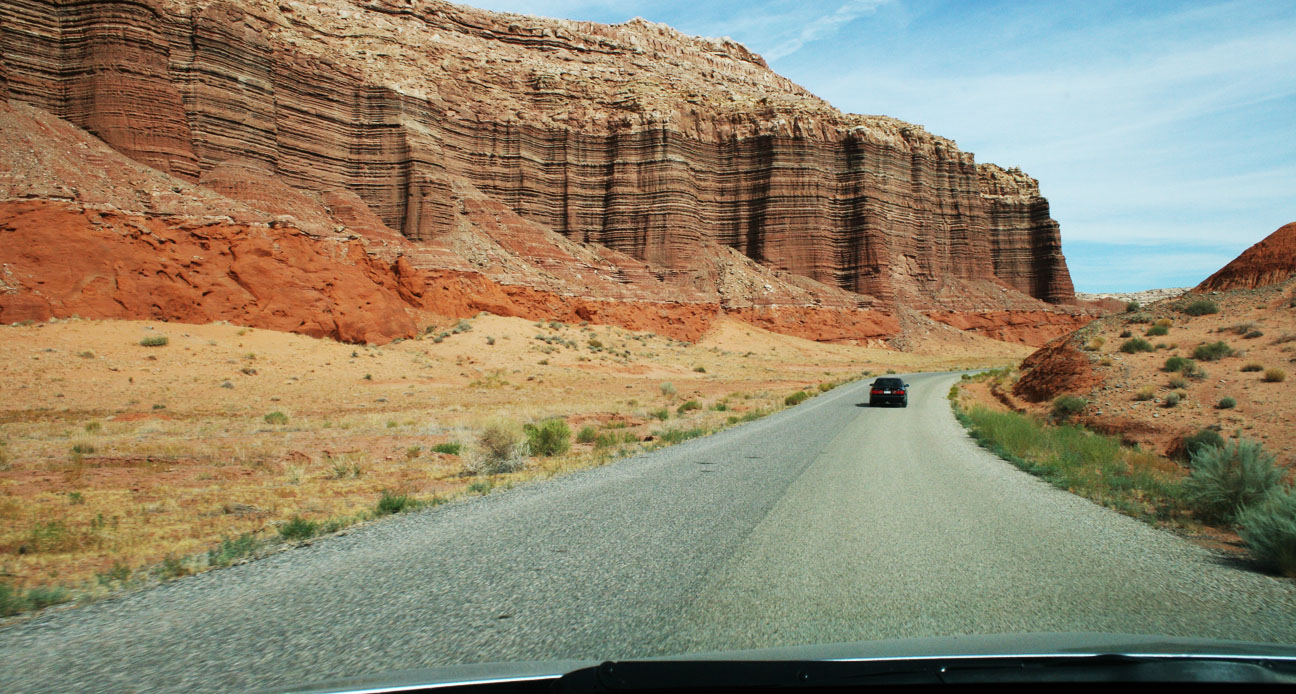
Our eyes were wide open to appreciate the chiseled mountains that surrounded us in various shades of red.
Just a little ways into the drive, our plans were nearly foiled. There’s a part of the Burr trail that floods when the lake level exceeds a certain measurement (3,695 feet, to be exact). See the note here in red on a map:
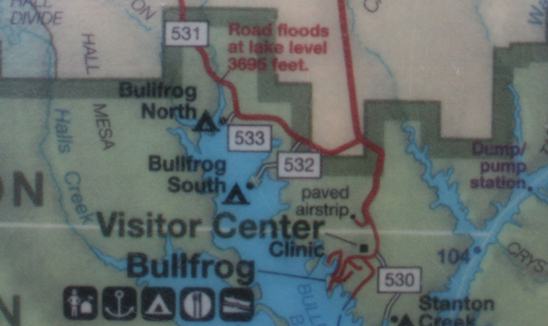
The lake’s level appears to currently be at or near that level, because Ryan and I saw a wash ahead of us with muddy ruts that I was almost positive my car wouldn’t be able to get through. I had Ryan go first in his Audi, and then I had him video record me crossing – just in case anything funny happened, of course.
Thank goodness for those 6 inches of ground clearance! I used them all.
With that out of the way, we continued onward on Burr Trail. For a time, the road straddled a ridge with canyons on both sides. Then we left the pavement for what ended up being 15 miles of off-roading.

The printouts that I’d taken with me had a lot of warnings regarding the dangers of driving this road in inclement weather.

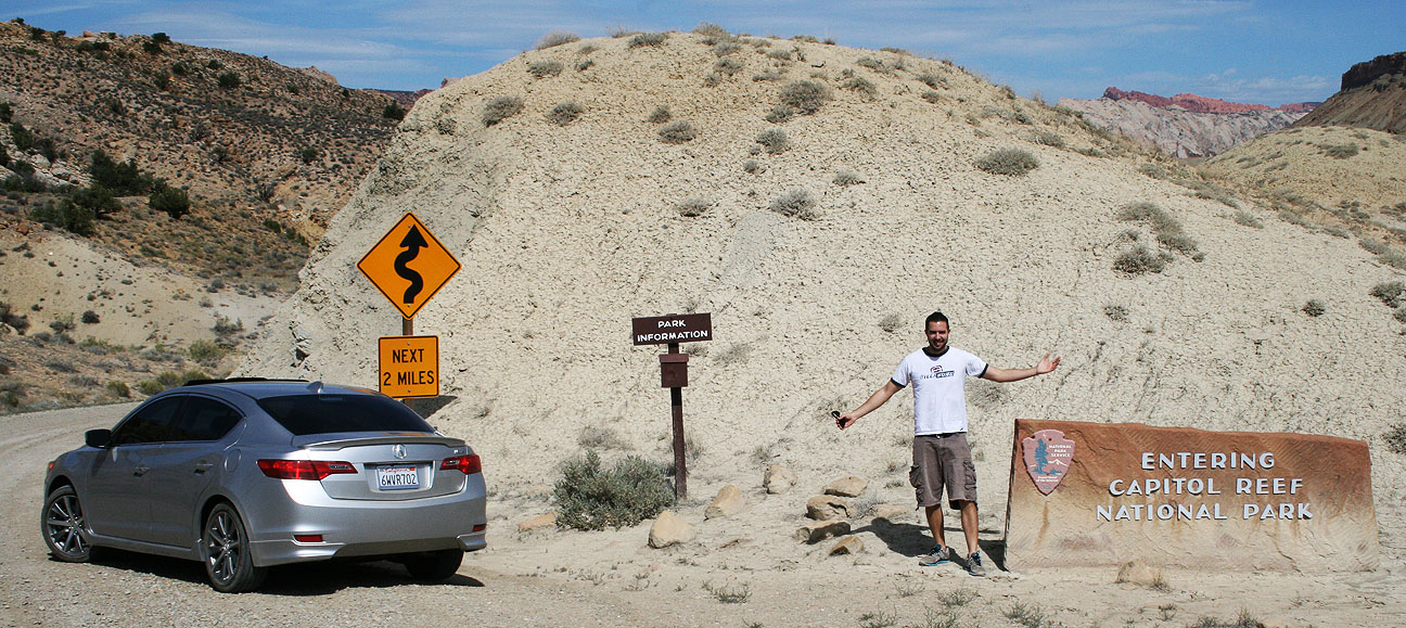
A bit further up the road, Ryan and I entered the park boundary for Capitol Reef National Park. Unlike most other national park entrances, though, this one has no entry fee. It’s so remote that it isn’t even staffed. There’s a small signpost which reads “PARK INFORMATION” and holds a wooden box containing brochures.
Even though summer travels are in full swing, Ryan and I only saw a couple of vehicles in the 2 hours that we were on the Burr Trail. This road is truly under-appreciated, and I’m okay with that. It’s something amazing to be able to stop your vehicle, shut off the motor, and hear absolute silence. That’s what we experienced.

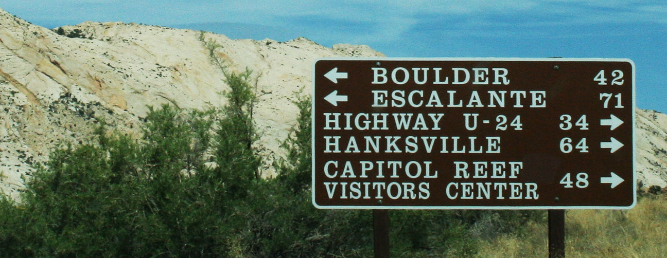
A sign at the fork in the road ahead ensured us that we were on the right track, but still 42 miles from our next destination in Boulder, Utah.
I had Ryan take the lead in his Audi and gave him plenty of space so that I didn’t have to eat his dust the whole time. Not long after he got out of my line of sight, he came on our 2-way radio and said, “Dude, this just got real.” I knew the sights ahead were going to be awesome. And they were.

Massive stone canyon walls loomed above us on 3 sides as we started up a series of very tight switchbacks. Road conditions were poor in some spots. There were washboard ruts that gave my car’s Traction Control System a workout as my Michelin tires tried to get a grip in the loose gravel.

We made it up the steep grades and pulled over to take a look at what we’d just driven up.
The winding dirt road in this picture was the road behind us. To truly appreciate the picture, click it to enlarge, and follow the line all the way from the background to the twisty foreground. This is my kind of road!

It’s worth noting here that for a long chunk of our day, including this stretch, Ryan and I had zero cell phone service. If we’d had any issues we would have been a long hike away from any civilization.

At the top of the switchbacks, we saw Peek-A-Boo arch to the right. This is said to resemble an unblinking eye in the horned head of a giant lizard.

Finally we were back on pavement as we entered the Grand Staircase-Escalante National Monument. It was established in 1996 and protects over 1.8 million acres of land.

Still the road was narrow in many places and had no markings whatsoever.

Ryan and I commented to one another via our walkie-talkies how surprised we were at how quickly the landscape can change in just a matter of miles. We went from red rocks to white rocks as we got closer to Boulder, Utah.

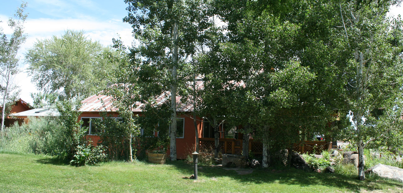
Parched and ready for a break, the Hell’s Backbone Grill beckoned us.
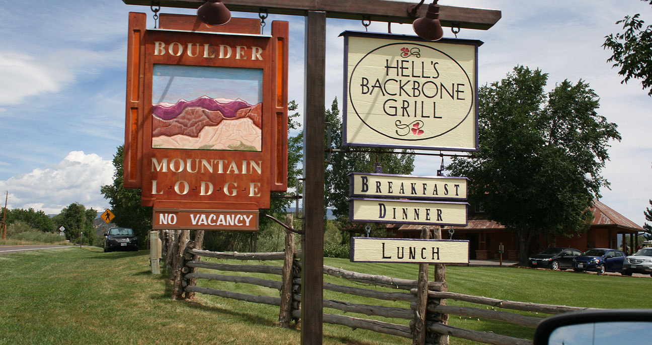
The restaurant, which had a rustic lodge feel to it, was hidden in these trees.
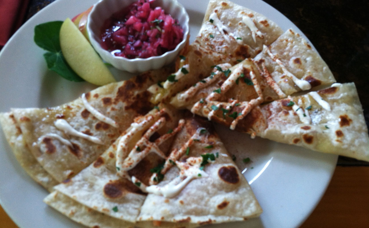
Ryan and I were the only ones there for lunch! Well, except for a cat named Jezabel who sat on a chair in the patio. I tried something new to me: Smoked Trout Quesadilla.

“Where the food is heavenly” is a fitting slogan; this really did hit the spot.
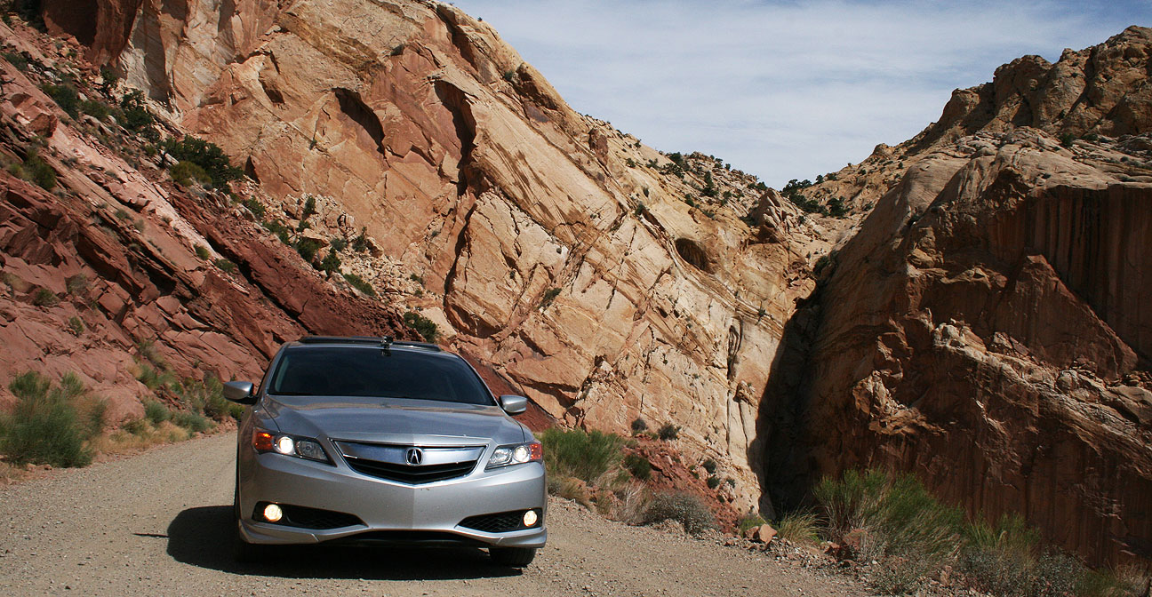
The ILX took a few deep breaths outside after climbing Burr Trail.

Ryan and I topped off our stomachs with dessert. My hot fudge sundae even had an orange flower stuck in it.

The “Country Corner” service station pictured below is long-since closed, but we grabbed some beverages and headed out for the next chapter of our trip: Hell’s Backbone Scenic Byway. Would the road live up to its ominous sounding name? Find out next time.


August 5, 2013 at 6:54 pm
Burr trail looks like tons of fun! Sometimes you just got to leave the asphalt to see some really great stuff. This is something I’m drooling over and need to drive soon. I’m guessing if your 6 inches of clearance worked in the ILX, my 12 inches in the Accord should be fine. Haha.
August 5, 2013 at 7:26 pm
Jason, you’re absolutely right. Some of the most amazing sights & sounds of the countryside cannot be viewed from the comfort of a paved highway. I’ll take a back-road ANY day over a boring interstate highway. Both of our cars are set up for 4×4 action 🙂
August 6, 2013 at 4:48 am
That road is just sick and twisted. Okay, it’s just twisted. Gpa Mc was excited to tell us all about his phone conversation with you regarding the Burr Trail. Very interesting stuff.
August 6, 2013 at 7:50 am
Yeah, had a great conversation with Gpa! He’s driven Burr Trail, too, except he went in the opposite direction that Ryan and I did! He also gave me some great tips on other places to see in that same area, including a neat old ghost town called Widtsoe. Sounds like I need another trip to Utah soon.
August 7, 2013 at 6:50 am
That looks like a great trip. Who knew there was a ferry on Lake Powell? You keep finding great places.
If you are interested in another offbeat ferry, try the Los Ebanos ferry near McAllen, Texas. It’s a hand operated ferry across the US/Mexico border. I lived in that town for a while and have great memories.
http://www.texasescapes.com/TOWNS/Los_Ebanos/Los_Ebanos_Texas.htm
August 7, 2013 at 10:12 am
Wow, awesome Kevin. Reading up on Los Ebanos now, says it costs $2.75 online. A steal! The Rio Grande sure doesn’t look as “grande” as I thought it’d be. McAllen is just about as far south in Texas as you can get! The ferry ride would be an adventure in itself. Guess it’s time to reactivate my passport.
Researching other stuff in the area — apparently Hidalgo, Texas is the killer bee capital of the world. Who knew?!