ILX 40,000 Milestone: Group Drive to Roosevelt Lake, Arizona
Odometer (Legend): 522,260
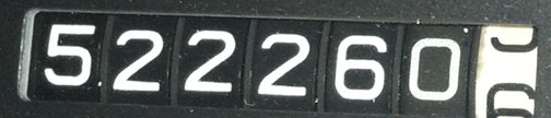
Odometer (ILX): 40,126

Trip Distance: 206 Miles
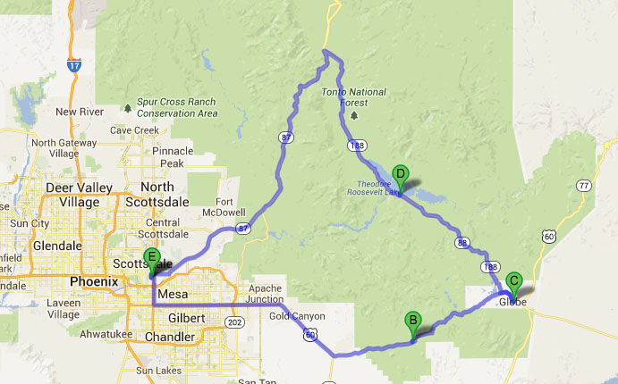
Would you believe I made it all the way to Miami and back for a day trip? Sure did! Miami, Arizona that is. The small copper boomtown about 80 miles east of Phoenix was just one of the many destinations that I visited in my 2013 Acura ILX with a few friends today. Here’s a 4-minute recap in country music form.
Eastward ho on US-60 we went, in search of tunnels, lakes, and bridges.

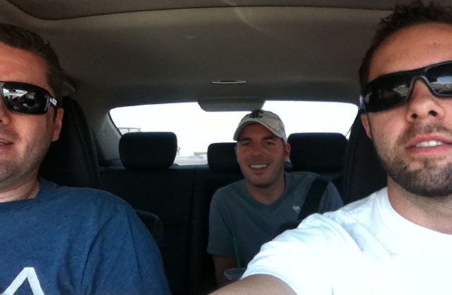
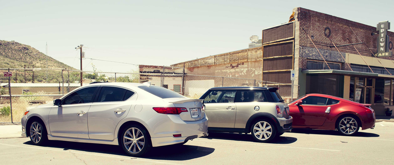
These two lucky chaps shared the ILX with me while a few of our other friends drove separately. Kevin got shotgun and Brian had the back seat to himself. There was plenty of room for all.
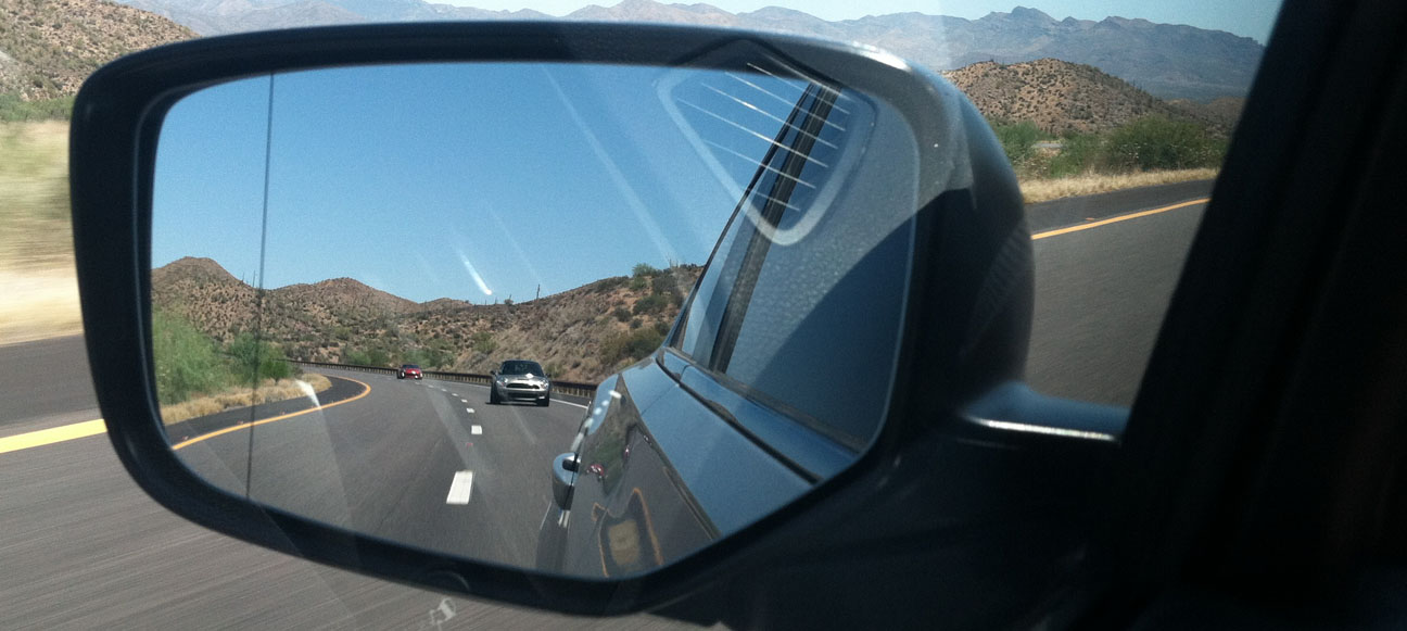
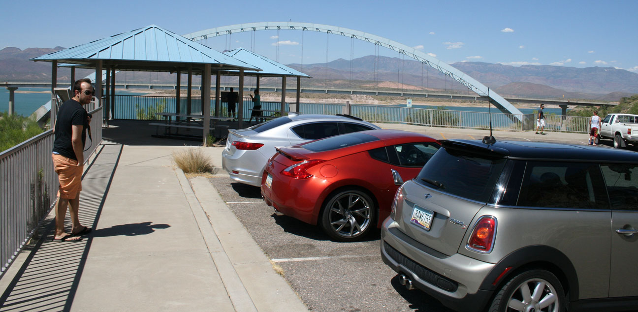
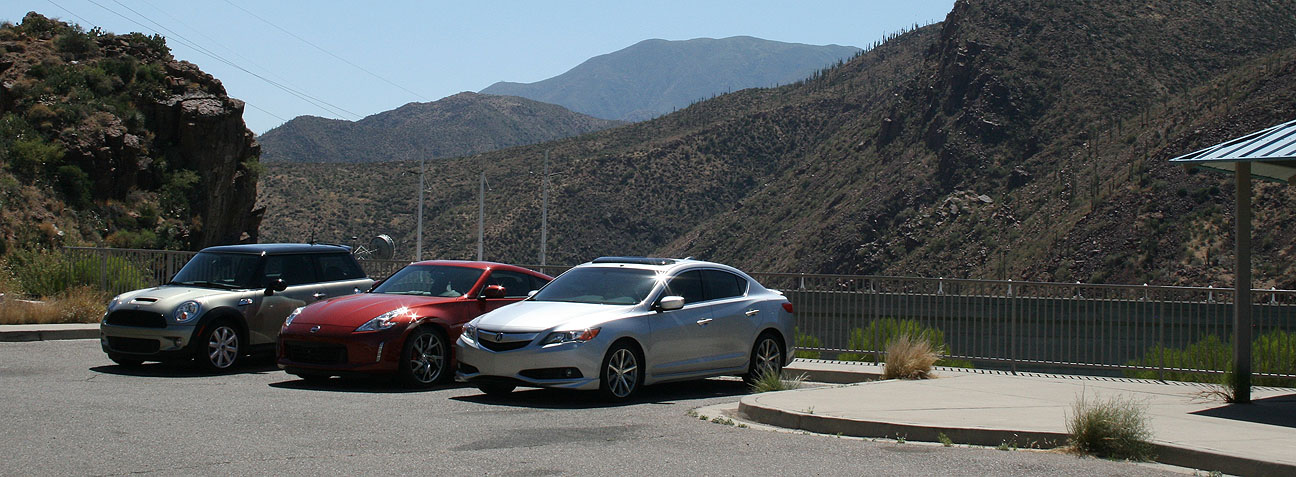
In the rearview you’ll see the participants in today’s road rally. Brock brought his 2007 Mini Cooper S 6-speed and Matt brought his 2013 Nissan 370Z Sport 6-speed. I took the lead and we headed for the hills.
First stop was Superior, Arizona, which from the looks of things is far from “superior” in any way. Buildings here on Main Street have been vacant for decades. Superior’s history starts in 1875 when the Queen Creek Mine started producing copper that brought thousands of prospectors to the area. Mine operations have largely been shut down, but a few hearty residents (3,000, to be exact) continue to call this place home.

Our stop here was merely for a photo-op with of the ghost-towned buildings that lined this once-busy thoroughfare through town. The cars in today’s drive were all 6-speed manuals, but that’s about all they had in common.

Thanks to Brock for this great shot!
Not a single business was open for customers along this stretch. We peeked inside a few of these. One was a diner that looked 100% complete inside. It was almost as if the owners and patrons had simply vanished from existence and left everything in place.
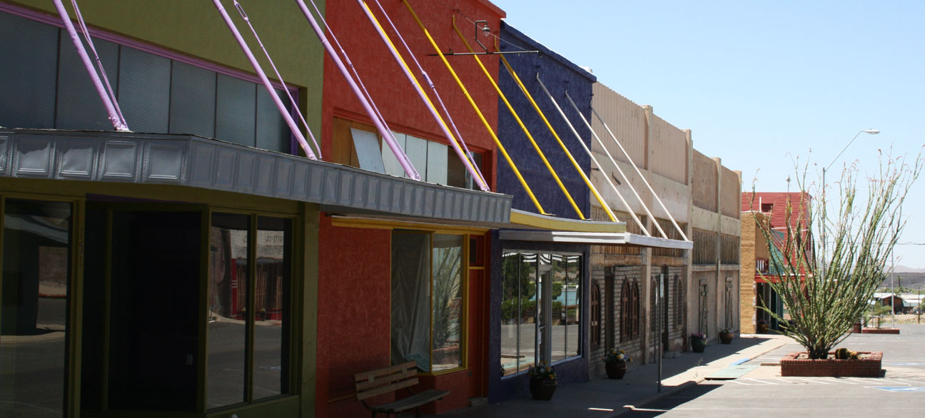
It’s an eery feeling to walk around in a community that showed so few forms of “life.” We saw only a few other people out and about early on Sunday afternoon.

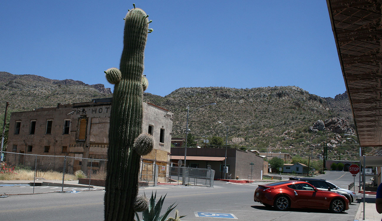
We saw it fitting to take a picture of Matt’s 370Z in front of the historic Hotel Magma, constructed in 1923. Matt’s Z’s official color is “Magma Red.”

A lonely cactus watches us as we bring more excitement to town than it’s probably seen for a few days.
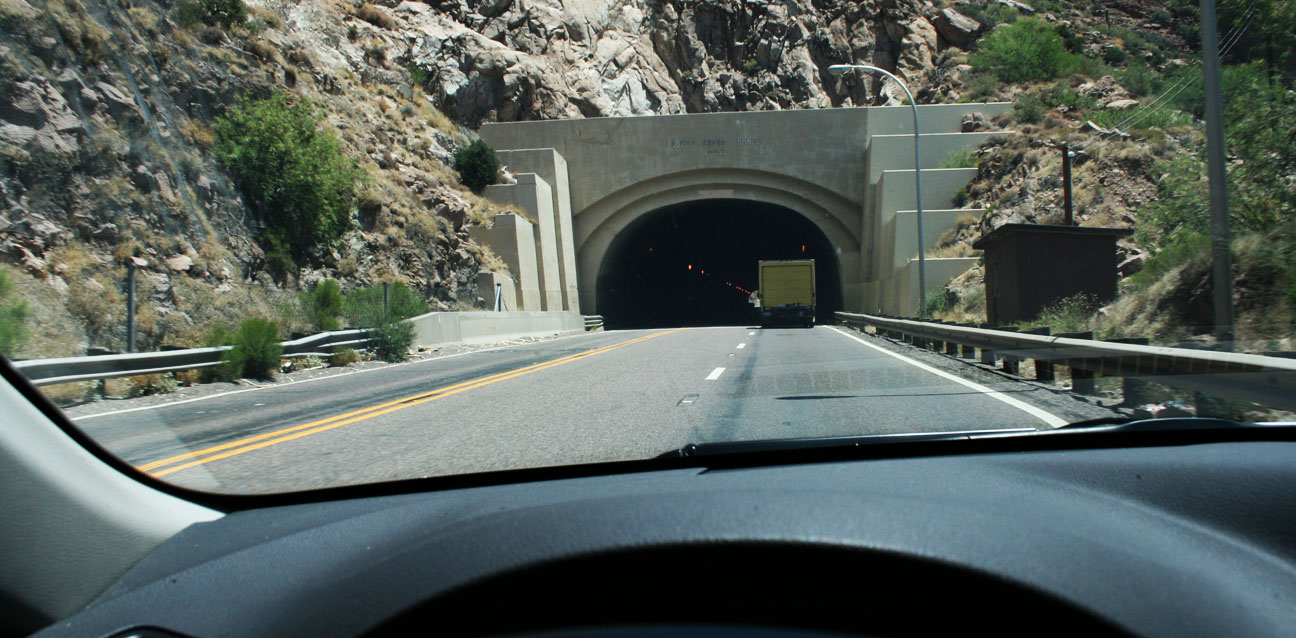
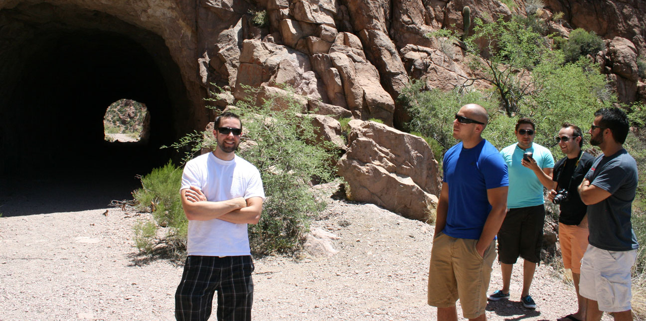
Just a ways up the road, the drive took us through the 1952 Queen Creek Tunnel. Originally striped as two lanes in each direction, it now has just two lanes uphill and one downhill due to wider lanes than the standard when it was constructed. It’s roughly 1/4 mile long. Matt got on the gas of his 370Z inside so we could all listen to his exhaust note.
Just at the north end of the tunnel, we pulled out into a gravel area and admired the scenery.

This picture shows the current (yellow line) highway where the Queen Creek Tunnel cuts directly through the mountain. The curvy road toward the bottom of the frame is the pre-1952 highway alignment. It also included a short tunnel, called the Claypool tunnel. This was a critical piece of infrastructure for travelers going from Superior to the next town.

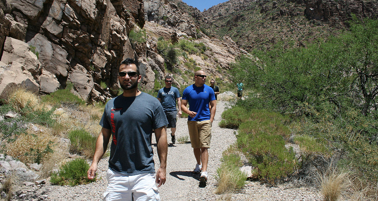
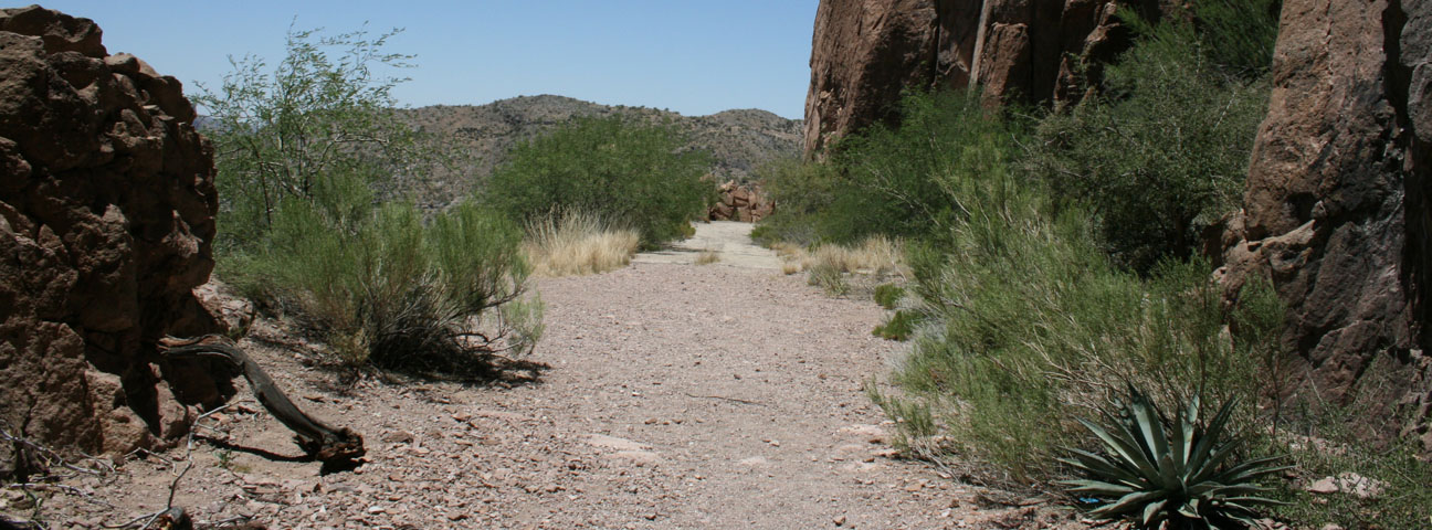
Claypool tunnel is now completely closed to automobile traffic but it can be reached in a short 15 minute hike from the current road. We crossed through this gate and went to check it out.
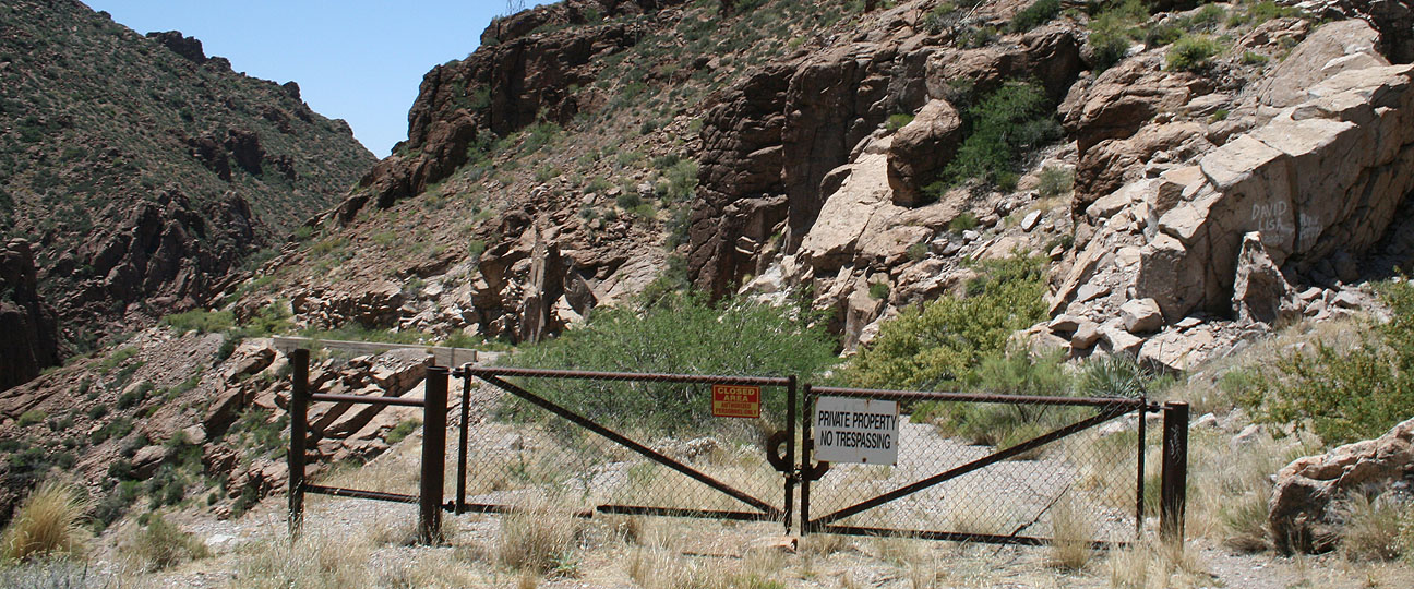
Temperatures over 100 degrees Fahrenheit didn’t melt our appetite for adventure.
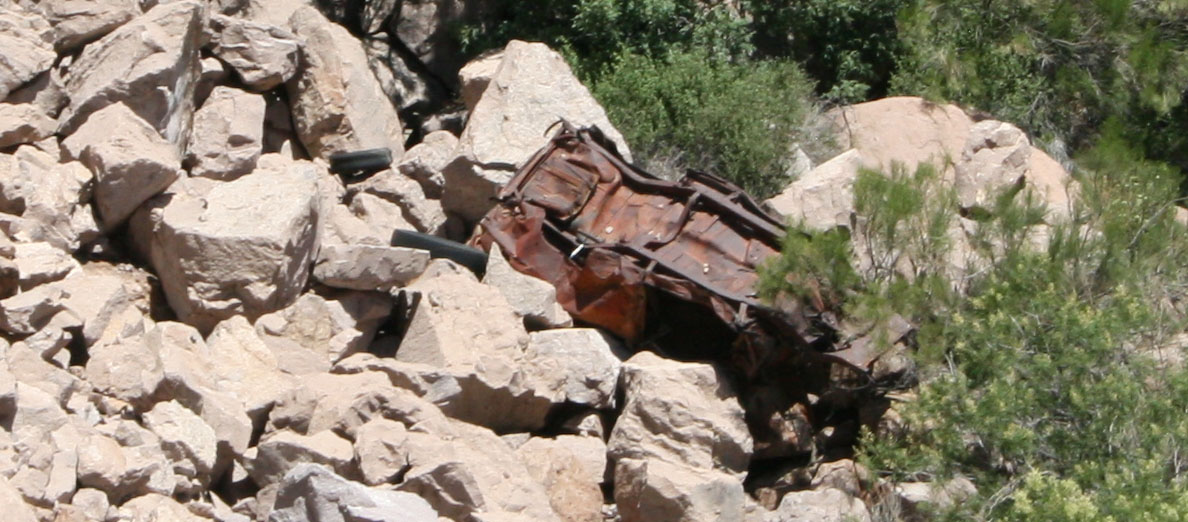
Peering over the edge of the road, we saw the remains of some auto wreckage in the ravine below.
Jack admires the scenery. Though it’s been over 60 years since this stretch of road was in service, we could still see plenty of areas where the blacktop and even painted road lines are still clearly visible.

Soon, we could see the Claypool tunnel.

Aside from the sound of our shoes crunching along in the dirt, we heard unmistakable squeaking sounds coming from the ceiling. Connor pulled out his cell phone to see if this tunnel would allow him to “check in” on his FourSquare app, and indeed our suspicions were confirmed when he saw what it was called there: “Bat Cave.”
Jack captured this picture of me walking along. It looks like something from a sci-fi film!
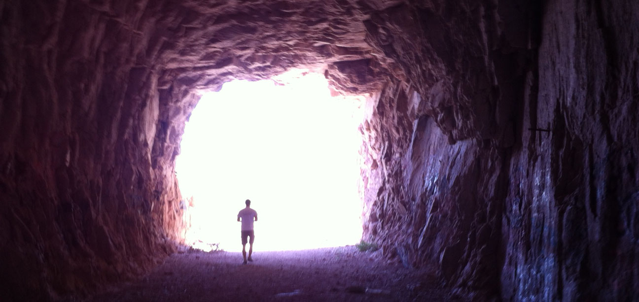
It’s amazing how crudely built this tunnel was. There is graffiti on the walls but it’s litter-free and relatively undisturbed.
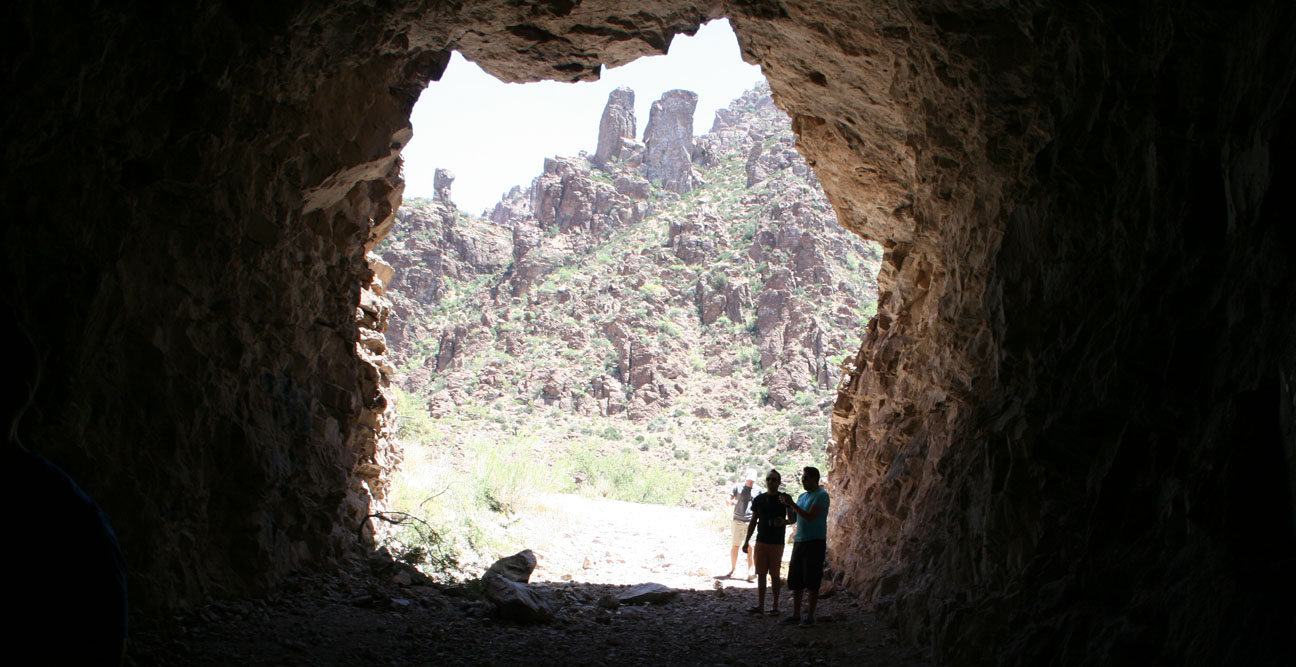
Coming out the other end, it’s difficult to tell that this was even at one time a road.
Here I am playing tour guide and telling the others about the history of the tunnel that I’d learned online. They just roll their eyes at me when I start spouting off random facts and trivia. I love geeking out on stuff like this!
Time to make our way back to the cars and continue the journey.

These guys definitely have the right level of enthusiasm.

Here we are, entering Miami. Not to be confused with the Miami, Florida that’s 2,361 miles away from my house — this one is a lot closer.

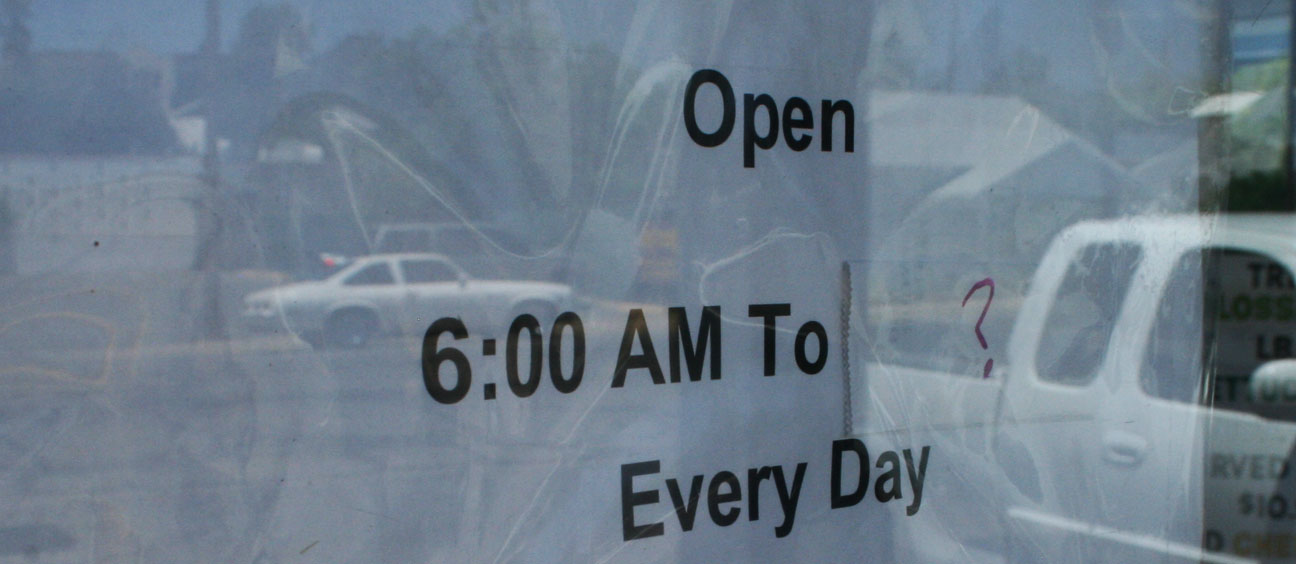
A few miles down the road, we’d seen all that Miami had to offer (which wasn’t much), and we entered the next town of Globe. Lunch was at Jerry’s Restaurant – one of the “safest” looking places in town. As much as I love hole-in-the-wall type food joints, I respect the health of my travel companions so I wanted something that seemed clean and had decent reviews.

Just don’t try and come here too late in the day. Looks like they leave their closing time up in the air (Noted by “?”).
Inside, our party of 7 overtook the place. It was a quiet Sunday afternoon in Globe.

Fueled up and ready to journey onward.

My ILX crossed the 40,000 mile mark less than a mile after leaving Jerry’s.

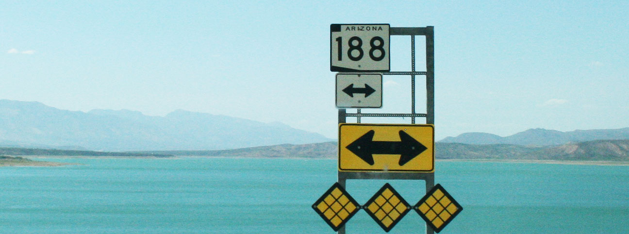
Thirty miles, later up Highway 188, we saw this bridge looming ahead of us. This was the famous Roosevelt Lake Bridge.

This junction is where Highway 88 leads back to the Phoenix area via a 20+ mile dirt road and. We opted not to do any off-roading this trip, but I’ve driven that stretch before in the Legend.

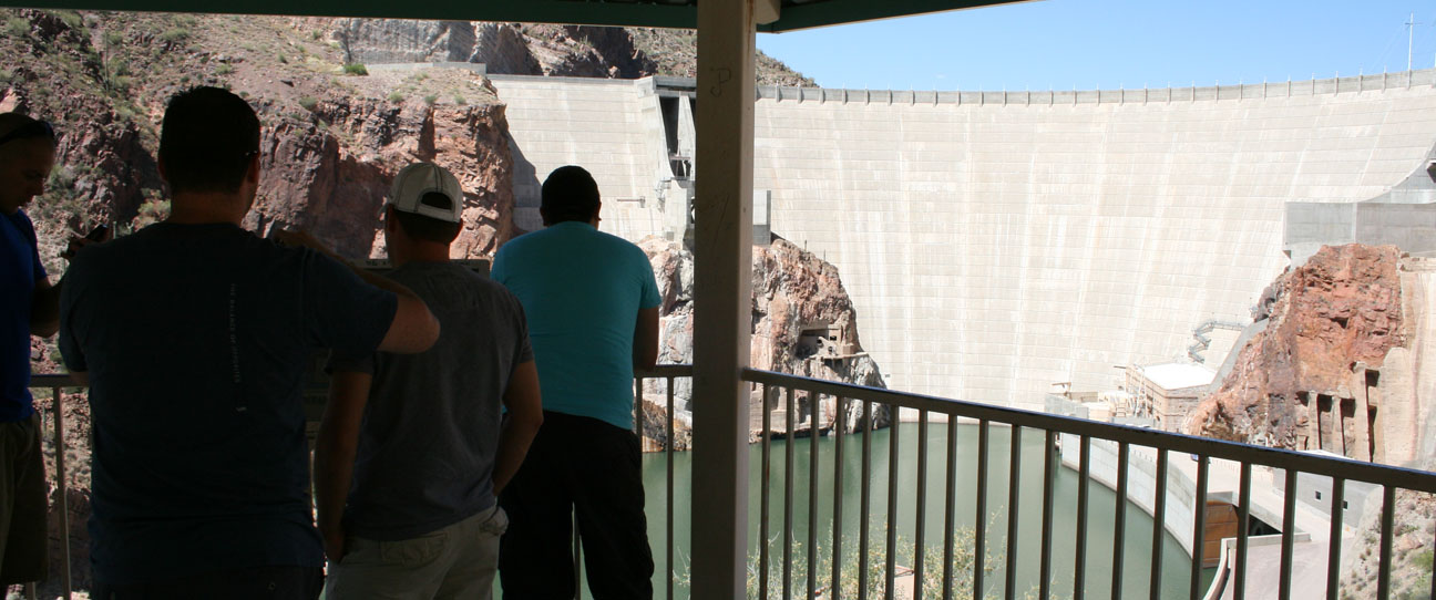
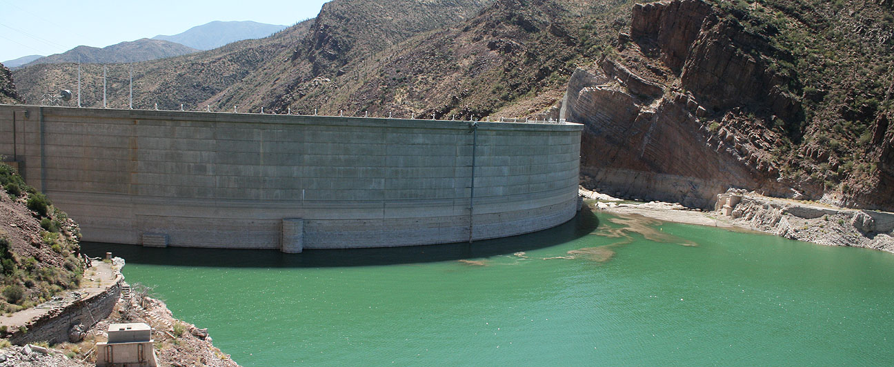
We drove as far as where the pavement ended before looping back to get a glimpse of the Roosevelt Dam.

A picture truly does not give a sense of the massive size of this dam. Built between 1905 and 1911 and named for then-president Theodore Roosevelt, the dam currently stands 357 feet high. I say currently because the dam when originally built was 280 feet high, but in the 1990’s it underwent some reconstruction that made it much larger. There were 41 workers who died during construction of the original engineering masterpiece.

Still, in 1911 the Roosevelt Lake that the original dam created was the world’s largest artificial reservoir. The lake today contains over 1 million acre-feet of water. It also put the original town of Roosevelt under water!
Here’s some information I learned from the Bureau of Reclamation about the dam and its newer bypass bridge.
Prior to completion of the bridge in October 1990, traffic drove over the top of the dam. The bridge itself earned rare distinction when the bridge was named one of the top 12 bridges in the nation in November 1995. The American Consulting Engineers Council cited the bridge for overall design, size, eye-appeal and design challenge. Other bridges cited were the Golden Gate Bridge and Brooklyn Bridge.
The $21.3 million bridge was built to take traffic off the top of Roosevelt Dam. Roosevelt Lake Bridge is the longest two-lane, single-span, steel-arch bridge in North America. The bridge, spans 1,080 feet across Roosevelt Lake providing two-way traffic. The original dam-top roadway was designed to allow two Model-T Fords to pass abreast, but today’s recreational vehicles and full-size automobiles are too wide to permit two-way traffic.

Here, we parked our vehicles in the overlook and viewed the bridge from a distance.
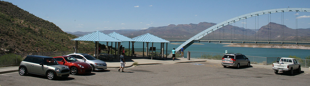
The bridge was painted blue so that it would blend in with the sky. I’d say they matched the color quite perfectly.
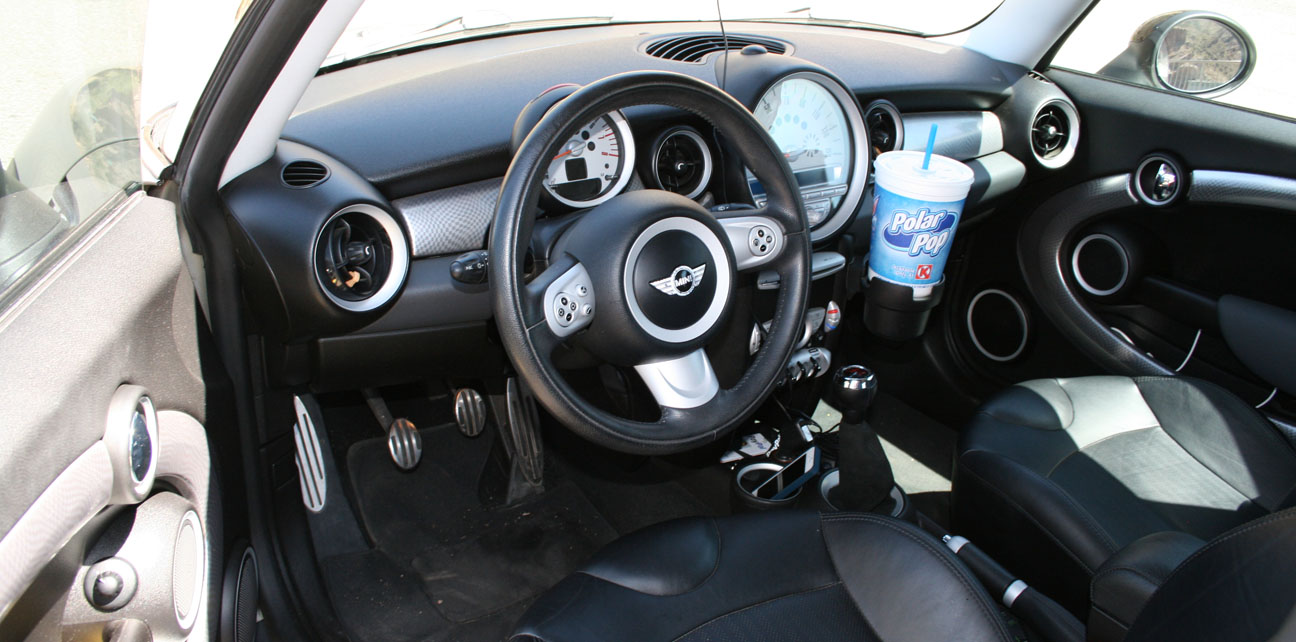
Check out the interior of Brock’s Mini Cooper with just 50,000 miles on it.
This is the view from the other side of the dam.
Notice that the road on the bridge has a slight upward curvature. This is because if the bridge was level, drivers would have the perception that the roadway was sagging — not a good sensation when you’re driving 150 feet above the water!

One more shot of the rides, anxious for the last leg of our journey.
Group shot: Brian, Tyson, Jack, Matt, Kevin, Connor, Brock

We cruised back to Highway 188 and headed northbound.
Here’s what it looked like to cross that 1,080-foot bridge.

Our last stop was for some refreshing drinks (remember, it was a 100-degree Arizona day!) at the Butcher Hook restaurant, store, and saloon in Tonto Basin.

Highway 87 took us home.

Thanks to my friends for coming along – whether in person, or vicariously through the blog post.


June 3, 2013 at 5:39 pm
100 degrees but its a DRY heat! Pretty scary that it looks like a whole town can up and leave. Great place to shoot a mini movie if you ask me.
I could swear that bridge is a LOT newer than finshed in 1990. HHmmm.
June 3, 2013 at 6:28 pm
It does look newer than 1990! I still can’t believe that up until that point, traffic was actually routed over the top of the dam. (Traffic patterns were similarly routed away from Hoover Dam a few years ago – alleviating a HUGE bottleneck on my PHX to LAS trips. And yeah, there are a lot of towns out here that just look like they were abandoned randomly. Those are the kinds of places where I’d love to take a metal detector and have a heyday.
June 4, 2013 at 10:29 pm
Tyson, looked like tons of fun! Claypool tunnel was my favorite part. Looked like quite an area to explore. The landscape looks a lot like what I have here. Also, congrats on the 40k milestone. Looking forward to seeing the big 50k!
June 5, 2013 at 6:45 am
Thanks Jason! Claypool was a lot of fun – few people today even know that it’s hidden there and hikeable. I’m surprised at how quickly 40k crept up. 50 will be a big one. Thanks for reading and I look forward to seeing you next month for our biggest and ‘bestest’ group drive ever.