Archive for August, 2013

ILX Trip to Washington Part 4: Return to Phoenix; Wrap-Up Video

Posted in ILX, Road Trip on August 17, 2013 by tysonhugie

Odometer (ILX):  52,375

52375

Odometer (Legend):  522,729

522729

Leg Distance:  790 Miles

return_trip

As much as I absolutely LOVE driving, the thought of getting in the ILX for another 22 hours of drive time to get home to Phoenix, Arizona was pretty daunting.  For the first leg, at least, I had some co-drivers.

tia_driving_ilx_2

Jodi took a turn, too.  She said it’d been 2 years since she’d driven a stick shift, but she got the hang of it quickly!

jodi_driving_ilx

In Logan, Utah we dropped off two passengers and lightened the load a bit.

cache_valley_arrival

I was able to spend the evening with my dad and give the car one last rest before the final stretch.

ilx_in_logan_utah

Grandma and I were up before sunrise and out the door with plenty of road snacks to keep us fed.  My favorite things to munch on are Rice Krispy treats and string cheese.  We had both!  We made a restroom stop in Fillmore, Utah off Interstate 15.  Fillmore was the state’s capitol until 1856 when the legislature decided to move the capitol to the larger area of Salt Lake City.  The original statehouse is still standing today (below).

acura_ilx_fillmore_utah_capitol

I had last visited this site in my Legend in November 2006.  It sure hasn’t changed much in 7 years.  Or in 158 years, for that matter.

legend_fillmore_statehouse_november_2006

At a stoplight later on, I looked to my right and saw this.  How many 81-year-old people do you know who multi-task with laptop computers and text messaging while on a road trip?  Grandma never slows down!

doce_texting

Viva Las Vegas!  Just 4.5 hours from home at this point.

vegas

And finally, at long last, I pulled into my driveway and breathed a sigh of relief.

arrival_home

To wrap it all up, here’s a 7 minute video capturing just a few of our weekend’s highlights.  You’ll get to see us visit homes my grandma had lived in 70 years ago, see some pictures of Grand Coulee Dam, and retrace the steps of that 1950 automobile accident that my grandma walked away from.

Thanks for coming along for the ride!

ILX Trip to Washington Part 3: Grand Coulee Dam & Dry Falls

Posted in ILX, Road Trip on August 16, 2013 by tysonhugie

Odometer (Legend):  522,729

522729

Odometer (ILX):  52,236

52236

Leg Distance:  293 Miles

grand_coulee_map

All aboard!  The third and final leg of the Washington trip starts with our quest to head north even more.

sky_day_2

We lucked out and the weathermen were dead wrong about their forecasts for rain on Sunday.  Partly cloudy skies and comfortable temperatures gave us the perfect environment to enjoy a cruise around Washington.  We made our way in the ILX from our hotel in Moses Lake to Highway 155 which parallels Banks Lake.

ilx_at_coulee_dam

Banks is 27 miles long and covers 27,000 acres of surface area.  We’re talking about a lot of water here!  Pictured here are my mom, my grandma, and myself.  Oh, and the ILX trying to steal all the attention.

group_shot_coulee_dam

Not much farther up the road, we entered the cities of Electric City and Grand Coulee.  These towns line the waters that back-up from the massive Grand Coulee Dam.  It’s impossible to convey in photos just how massive this structure is.  The width, in fact, is a mile long!

grand_coulee_dam

coulee_dam_sign

Here are some Grand Coulee Dam fast facts that I found interesting.

  • The dam generates more power than a million locomotives
  • It contains almost 12 million cubic yards of concrete
  • At 550 feet above bedrock, it’s as high as the Washington Monument
  • It is also 500 feet wide at the base
  • There is enough concrete in the dam to build 2 standard 6-foot-wide sidewalks around the world at the equator
  • It took 9 years (1933-1942) to build the dam

Needless to say we were awestruck at the size & scope of this engineering marvel.  Today, the dam has 3 important functions:  irrigation, power production, and flood control.

jodi_tia_joyce_coulee_dam

We didn’t take the time to participate in a 50-minute dam tour, but we did spend quite awhile wandering through the exhibits in the Visitor Center.  One such exhibit was this scale model.

dam_visitor_center_3

What was mom pointing at here?  Who knows.

dam_visitor_center_2

This was one of the most interactive visitor centers I’ve ever been to.  They even have a jackhammer there that you can hold onto and activate.  It simulates 1/10th of what an actual jackhammer would feel like.

tia_jackhammer

Grand Coulee Dam has a special place in my grandma’s memory because she lived in the area in the early 1950’s.  In fact, her workplace (“Green Hut Cafe”) once sat where the visitor center is now located.

green_hut_2

One of the coolest features (I thought) from the exhibits were these 48 glass jugs.  Each one was labeled with a different state name.  When the Grand Coulee Dam was dedicated in 1942, water from each of the (then 48) states was poured from atop the dam’s spillway — symbolic of the fact that all states had contributed to its construction.

dam_visitor_center

I found it fascinating that the flooded area behind the dam ended up wiping out multiple small towns, 2 railroads, 4 sawmills, and even cemeteries.  3,000 people were relocated to make way for the water that started backing up in the mid-1930’s.

acura_ilx_grand_coulee_dam

After we’d had our fill of the dam, we continued our northbound trek on Highway 155, crossing over the 2-lane Grand Coulee Bridge.

coulee_bridge

Our next destination was perhaps a bit odd in purpose, but still very worthwhile and meaningful.  In the early morning hours of August 24, 1950, my grandma was involved as a passenger in an auto accident just south of the town of Okanogan, Washington.  The car in which she rode soared up a hill at 85+ miles per hour and plunged off an embankment.  Miraculously, even after the car rolled an estimated 12 times, she was able to climb to the main road and seek medical attention.  Below is a newspaper article and a few pictures of the vehicle.

Loup Loup Accident

We knew very little about the exact location of the accident but we were determined to find it, so we made our way to Okanogan.

okanogan_welcome_sign

The newspaper article had described the site as:  “A curve one mile south of Okanogan on the new Twisp-Okanogan cutoff.”  Based on some Google satellite mapping research we had done previously we knew that the cutoff was probably Highway 20.

twisp_cutoff

Sure enough, just past Okanogan city limits, we saw ahead of us a road which branched off to the right and climbed a steep hill.  It was an eery feeling to drive up it, knowing that the road had nearly claimed my grandma’s life 63 years ago.  The below picture is thanks to Google since I didn’t take a photo from the base. The road at right is the one that climbs away from Highway 20 and has a sharp right-hand turn at the top.

okanogan_road

We parked the ILX and roamed around this place.

hiking_okanogan

The guard rail in place today prevents similar accidents from occurring.  My grandma hadn’t been back here since the night of the accident, so technically she had never even seen it in daylight!

ilx_okanogan_wa

Here she is standing at the very corner where that driver lost control.

doce_at_okanogan_corner

We were hungry from our voyage so we dined in Omak, just north of Okanogan.  We happened to arrive just the town’s annual “Stampede” parade had closed Main Street.

omak_welcome_sign

Soon, though, the road opened back up and we found a parking space and a great Mexican restaurant.

acura_ilx_in_omak_wa

“Downtown Omak:  It’s All Right Here!”  I guess the word “all” is used pretty loosely here.  Omak doesn’t amount to much, but it has a fun vibe to it, and it’s only about 40 miles from the Canadian border.

downtown_omak_mural

Our last stop for the day, on our way back to Moses Lake, was at Dry Falls.  “How can a waterfall be dry?” you ask.  The answer would take thousands of years to explain, because that’s how long it took for this place to form.  Dry Falls is thought to be the greatest known waterfall that ever existed.  It was 10 times bigger than Niagara Falls.

dry_falls_visitor_center_sign

Today, though, only the cliffs remain.  The cause for the eventual diversion of the water has to do with the melting of a glacier during the Ice Age and its impact on the shifting water flows.

dry_falls_washington

It was totally un-planned that I happened to capture Jodi and grandma making the exact same (well, mirror) pose whilst soaking in the splendor of Dry Falls. Even their wardrobe matched.

jodi_doce_at_dry_falls

I’d parked next to one of my favorite Hondas of all time:  the Prelude.  This one looked like a 1992-96 (4th Generation) Si model in pretty nice shape for its age.

prelude_ilx

From a sign near the Visitor Center parking lot:

These cliffs are skeletal remnants of what was once the world’s largest waterfall.  They bear stark witness to the tremendous power of catastrophic floods that swept over eastern Washington at the end of the last ice age.  The falls began 20 miles to the south, but receded upstream through powerful erosive action.  The retreat of the falls gave birth to the canyon below, the Lower Grand Coulee, with the enormous force of the floodwaters spewing several cubic miles of rock over vast areas downstream.  Today, Dry Falls remains as one of the most spectacular geologic wonders of the age of ice.

At the end of the day, we feasted on the best corn on the cob I’ve ever tasted.  Home-grown Washington sweet corn.

carn

My cousins are as big into cars as I am, but in a vastly different way.  They build demolition derby vehicles and have brought home multiple awards.  This big old Chrysler looked pretty unstoppable to me!

demolition_derby_car

The family reunion brought out the fun in everyone.

family_pic

Billy Bob Tyson, at your service.

tia_tyson_jodi

Tomorrow:  The return stretch to Phoenix.  Would I survive two more 12-hour driving days in a row?

ILX Trip to Washington Part 2: Boise to Moses Lake

Posted in ILX, Road Trip on August 15, 2013 by tysonhugie

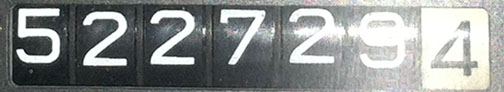
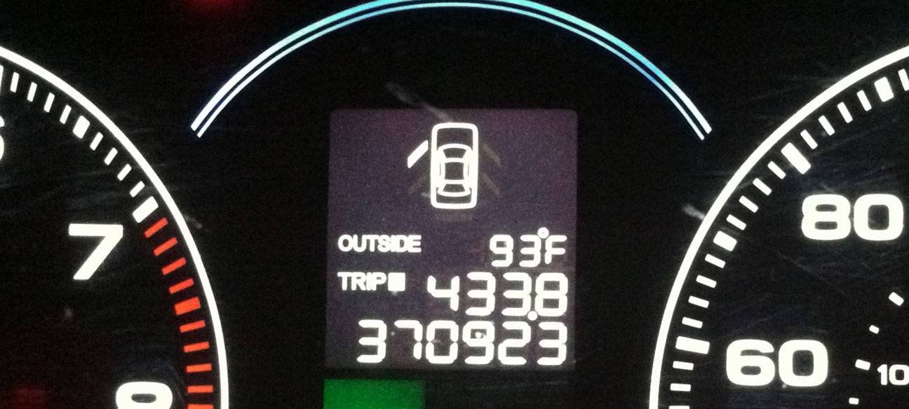
Odometer (Legend):  522,728

522728

Odometer (ILX):  52,211

52211

Leg Distance:  430 Miles

boi_to_moses

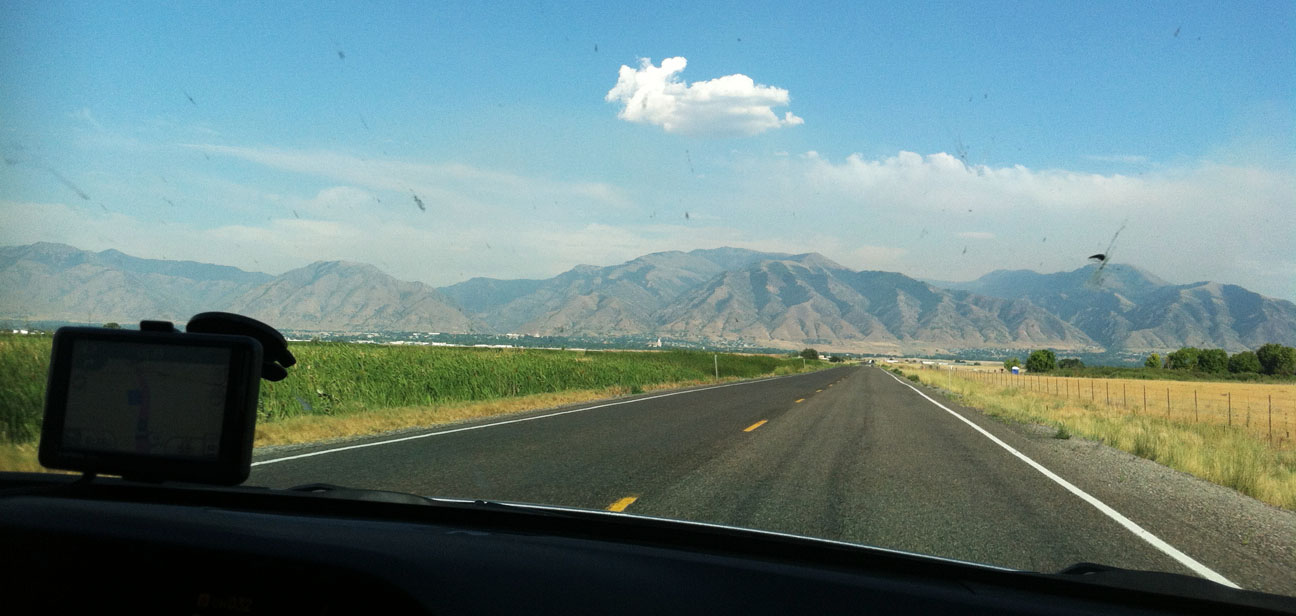
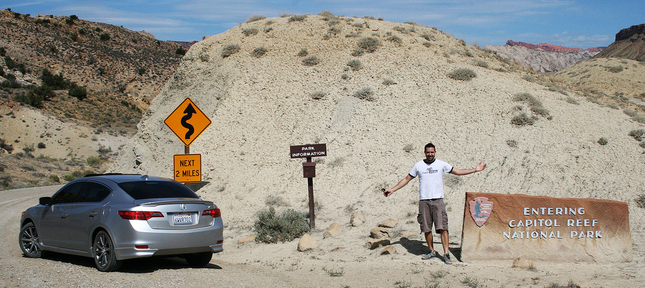
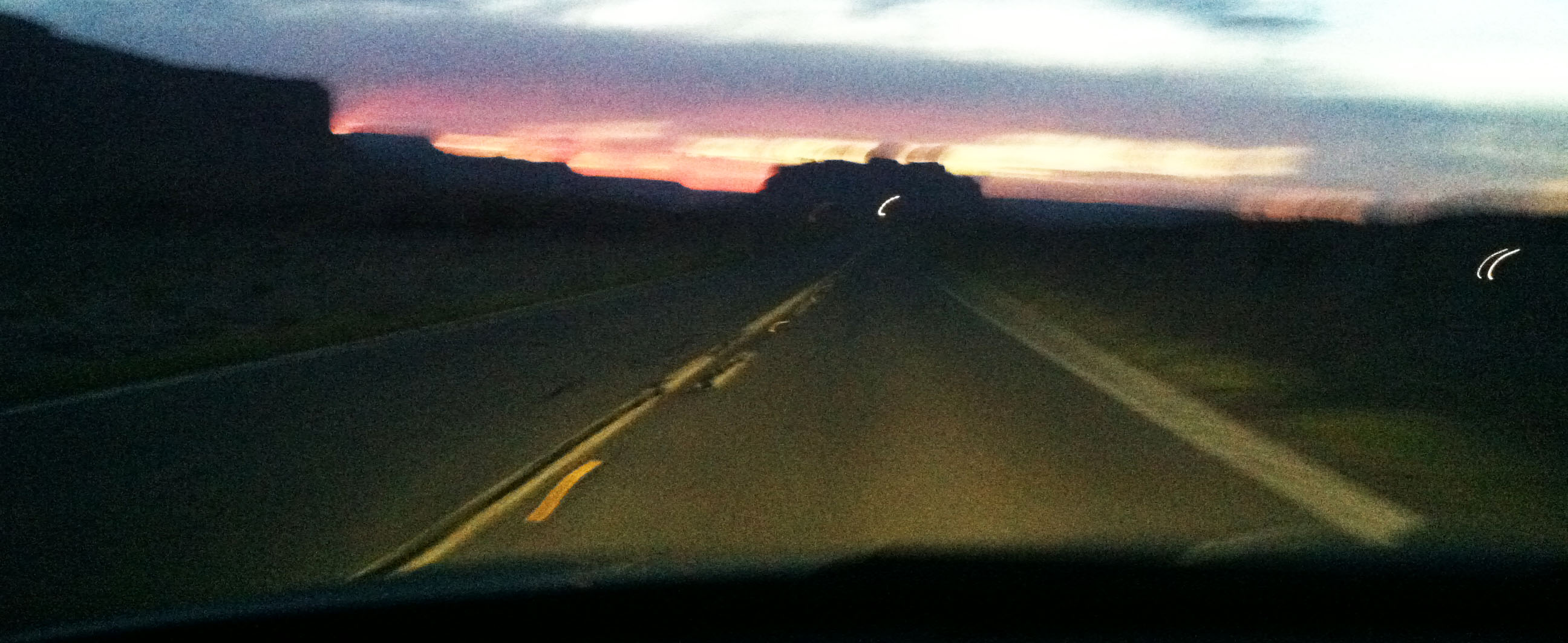
Welcome to ‘part deux’ of the 3,300 mile road trip with the fam damily in the Acura ILX.  We didn’t linger for very long last Friday night in the state famous for its potatoes.  Back in the car we went, bright & early the following morning!  Wildfires east of Boise left the sky looking ominous as the sun peeked out.

boise_morning_sunrise

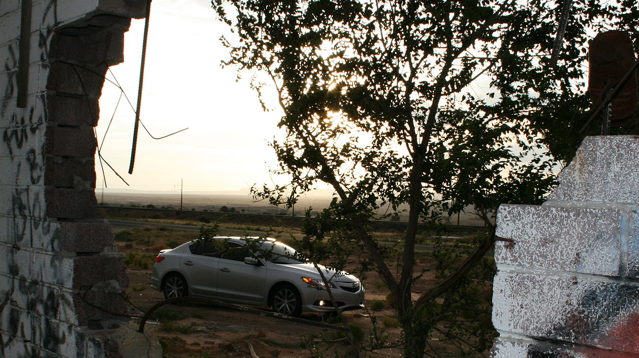
Fitting four adults and their luggage into a compact car is a lot like playing Tetris.  It’s a good thing we were so skilled.

loading_up_ilx

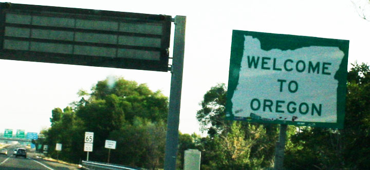
It only took about 50 miles until we entered Oregon via Interstate 84.  This marked the first time my Acura ILX has been in Oregon (its 15th state visited since I took delivery of the car in June 2012).

oregon_entrance

I couldn’t help but become reminded of one of my favorite computer games from elementary school:  Oregon Trail.

oregon_trail

Thankfully, our mode of transportation was quite a bit more advanced than a covered wagon.   And nobody suffered from dysentery or anything of the sort, as far as I know.  In all, we would be spending about 200 miles on Interstate 84 westbound in Oregon.

portland_distance

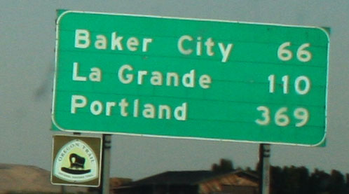
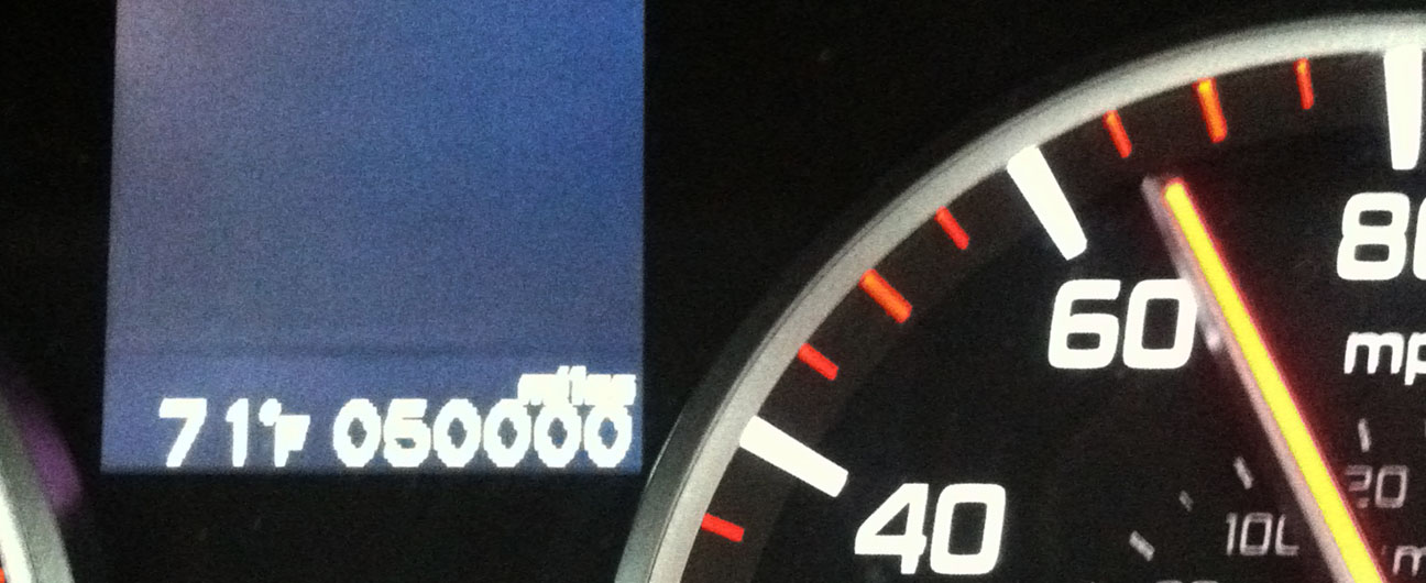
An important milestone took place as we were nearing Baker City.  I captured the 50,000 mile rollover on video which you’ll soon see.  It’s hard to believe I’ve already been enjoying the ILX for 1/10th of 500,000 miles!

50000_miles

Did you know that it’s illegal in Oregon to pump your own gas?  Fueling up in Oregon feels like taking a step back in time to when stations were full-service.  We rolled up to the Shell station in La Grande and I lowered my window.  The attendant approached me and took my credit card.  “Fill it up?” he asked.  “Yes, 91 octane please,” I replied.

The attendant left my gas cap hanging against the paint which was a pet peeve of mine.  There’s a reason why Acura put a cap holder built into the inside of the fuel door.

oregon_gas_ilx

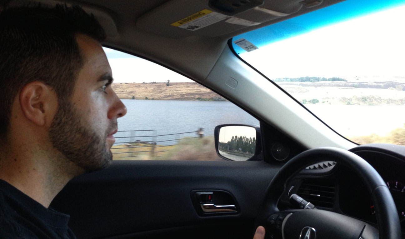
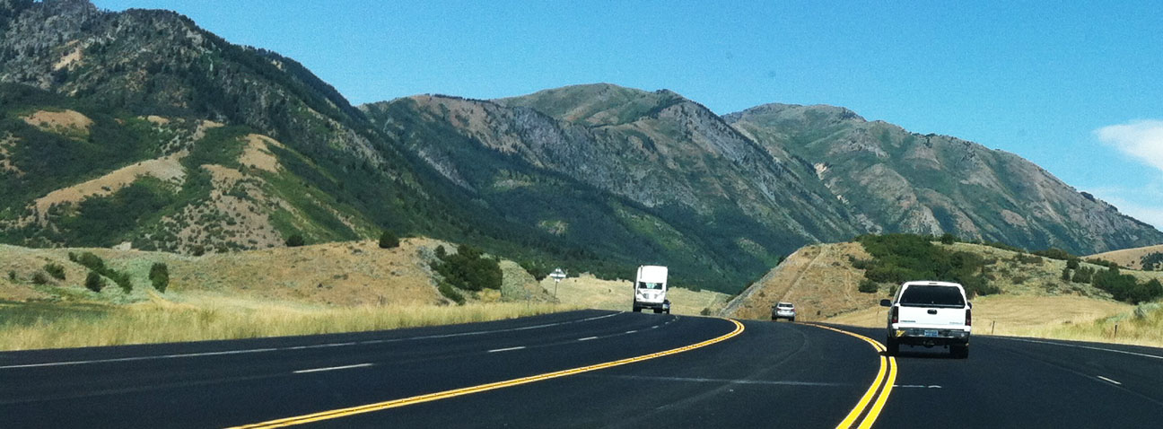
Soon we were climbing the Blue Mountains of northeastern Oregon and the grades became steep.  Truckers are warned multiple times to check their brakes before the downgrade heading into Pendleton.  I used my 6-speed transmission to its full capacity as we reached the 9,000 foot summit.  For being loaded with passengers and gear, I was surprised to have plenty of power from the 201-horsepower motor.

i84_downgrade_warning

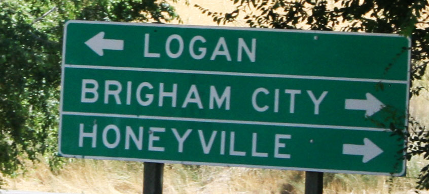
State #16 came shortly on Hwy 395 northbound.  The Washington state line follows the Columbia River, so the welcome sign was on a bridge.  Unfortunately, this kept me from being able to pull over for a picture.

washington_welcome_sign

Focus & dedication!

tyson_driving_ilx

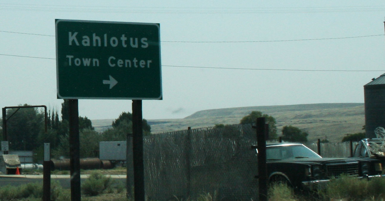
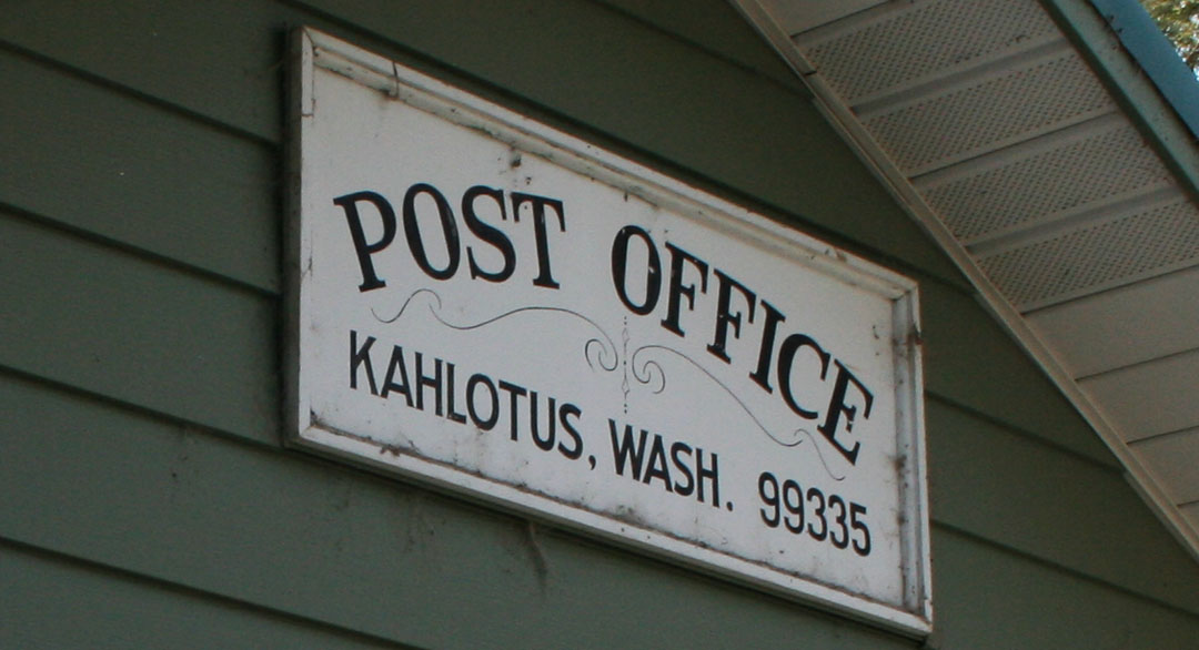
We had one more destination on our trip back in time to rediscover some places of my grandma’s youth.  We headed east on Highway 260 near Connell, Washington toward to the tiny town of Kahlotus.

connell_kahlotus_sign

The last time my grandma lived here was in the mid-1950’s.  It brought back a flood of memories for her to be back in the area.

gma_kahlotus_welcome_sign

Though established in 1906, Kahlotus had been settled as early as the 1880’s.

kahlotus_mural

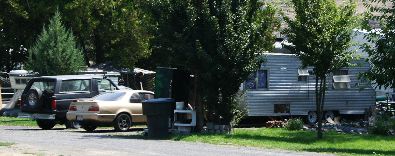
The Town Center is really not much at all to look at.  The buildings are old and run-down and there are abandoned vehicles sitting here and there.  Today, the town is home to fewer than 200 people.

kahlotus_town_center_sign

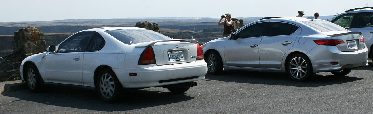
Oddly enough, though, it’s also home to two Acura Legend coupes!   I spotted this 1987-89 coupe right away, and it was the first Legend I’d seen the entire trip until this point.

kahlotus_wa_g1_legend

Not even 5 minutes later, I spotted a second Legend.  This one appears to be a 1991 in Golden Glow Pearl.

g2_legend_in_kahlotus

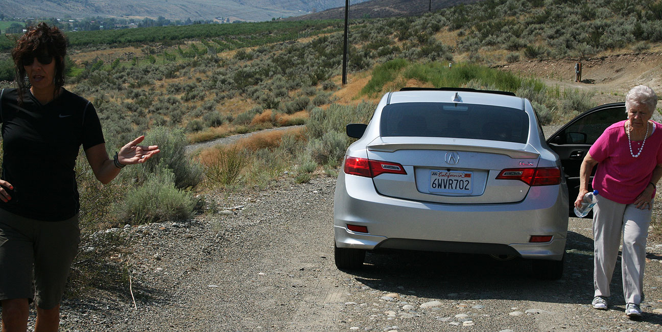
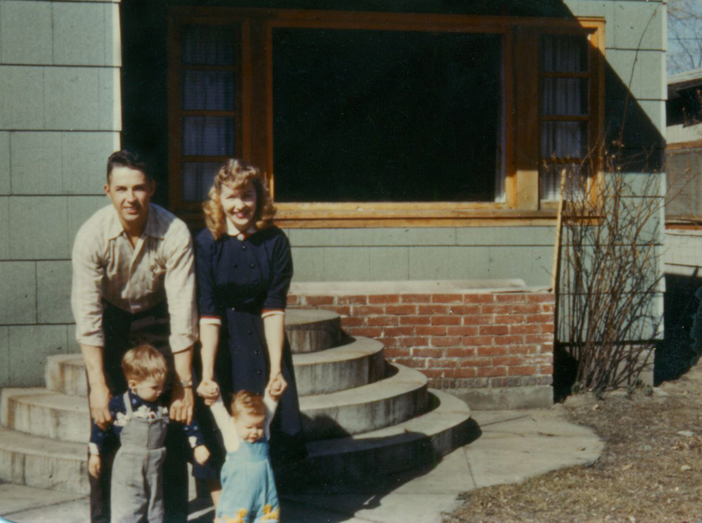
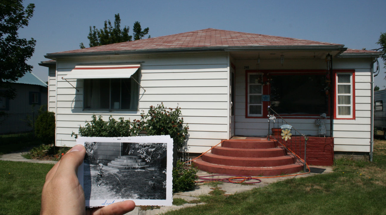
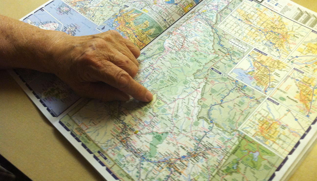
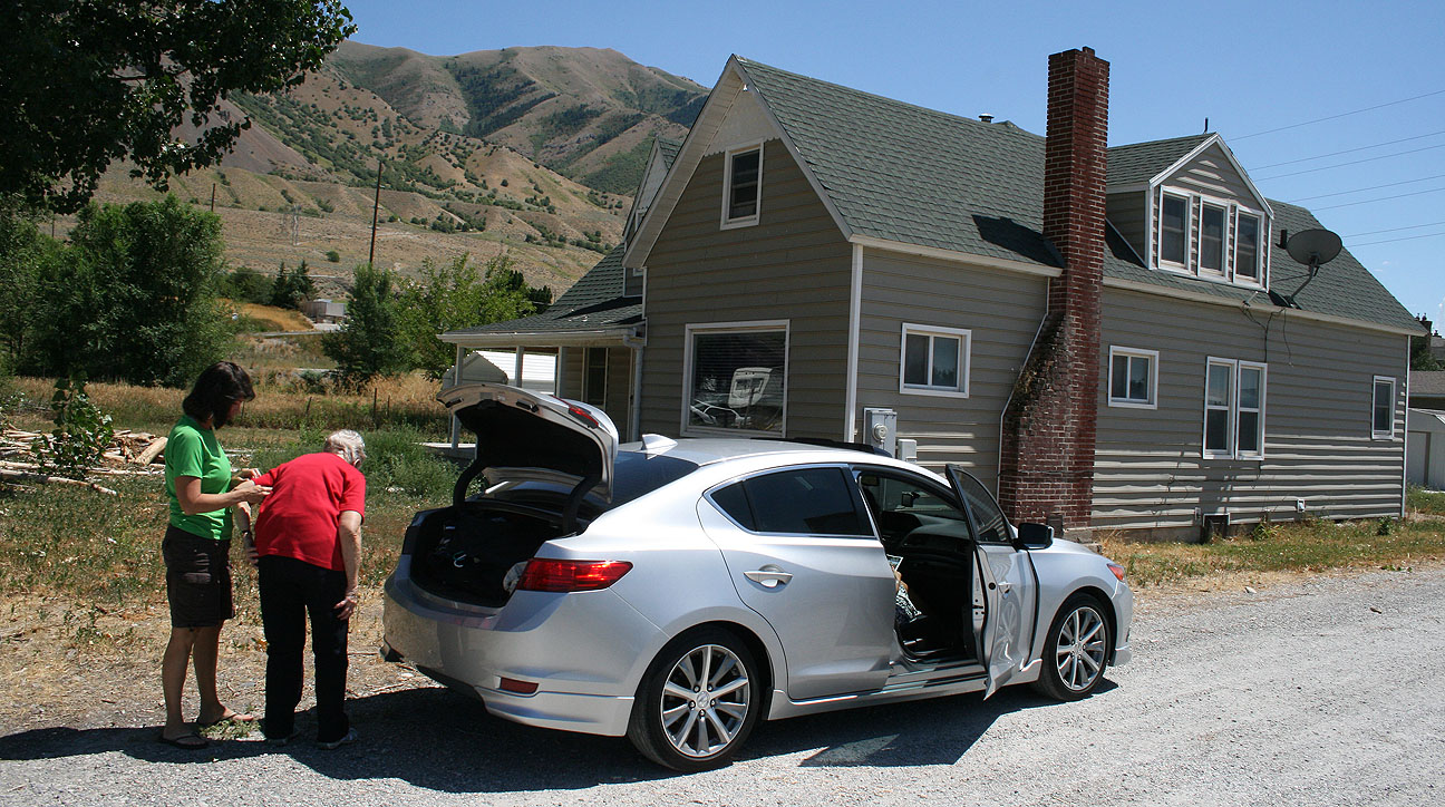
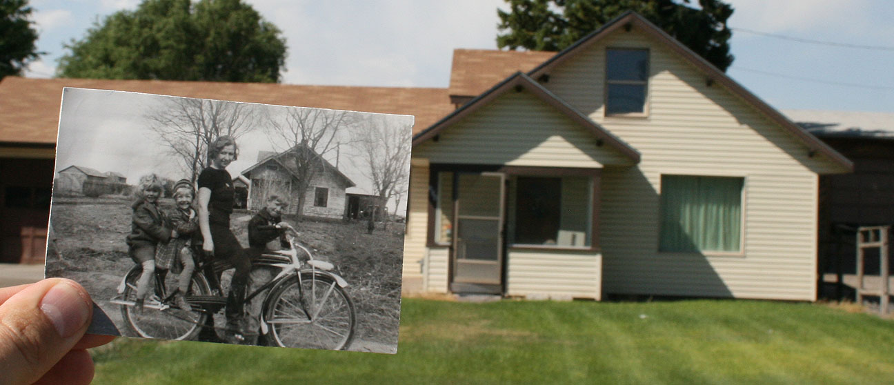
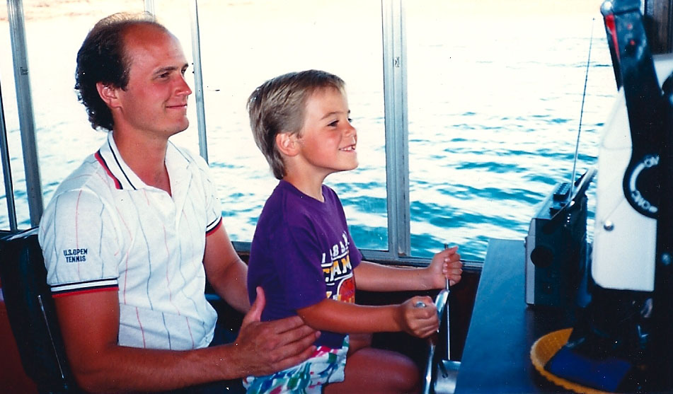
We had a mission, though, and it wasn’t to seek out Acuras.  We were looking for a house that my grandma rented in 1955.  Below is a picture of her, my grandpa, and my uncles.  We didn’t have an address to the house (in fact, house numbers weren’t added until many years later when they became required for emergencies), so the only way we knew we’d be able to identify it was by its 4 rounded front steps in the picture.

DonJoyceKahlotus

We’d almost given up.  There were only a few streets in town and we carefully scrutinized the entry steps on every home that we drove past.  There was only one road left to check out:  Martin Street.  Seconds later:  “There it is!  There are the steps!  Stop!”  I hit the brakes and backed up.

arrival_kahlotus_home

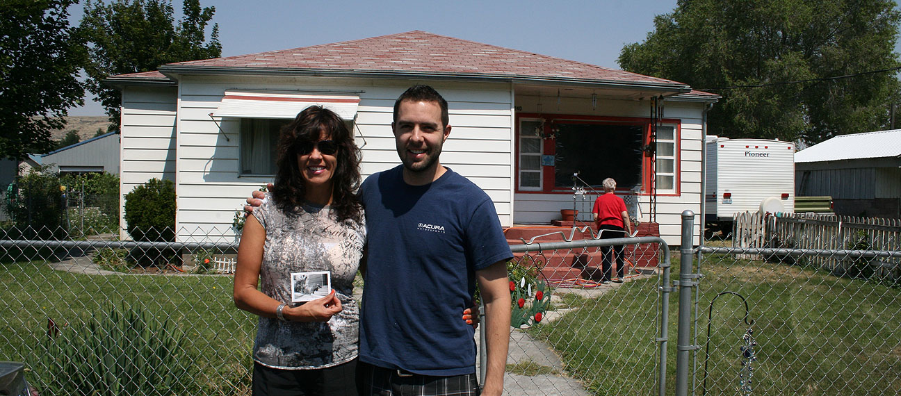
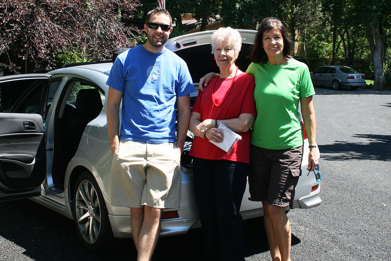
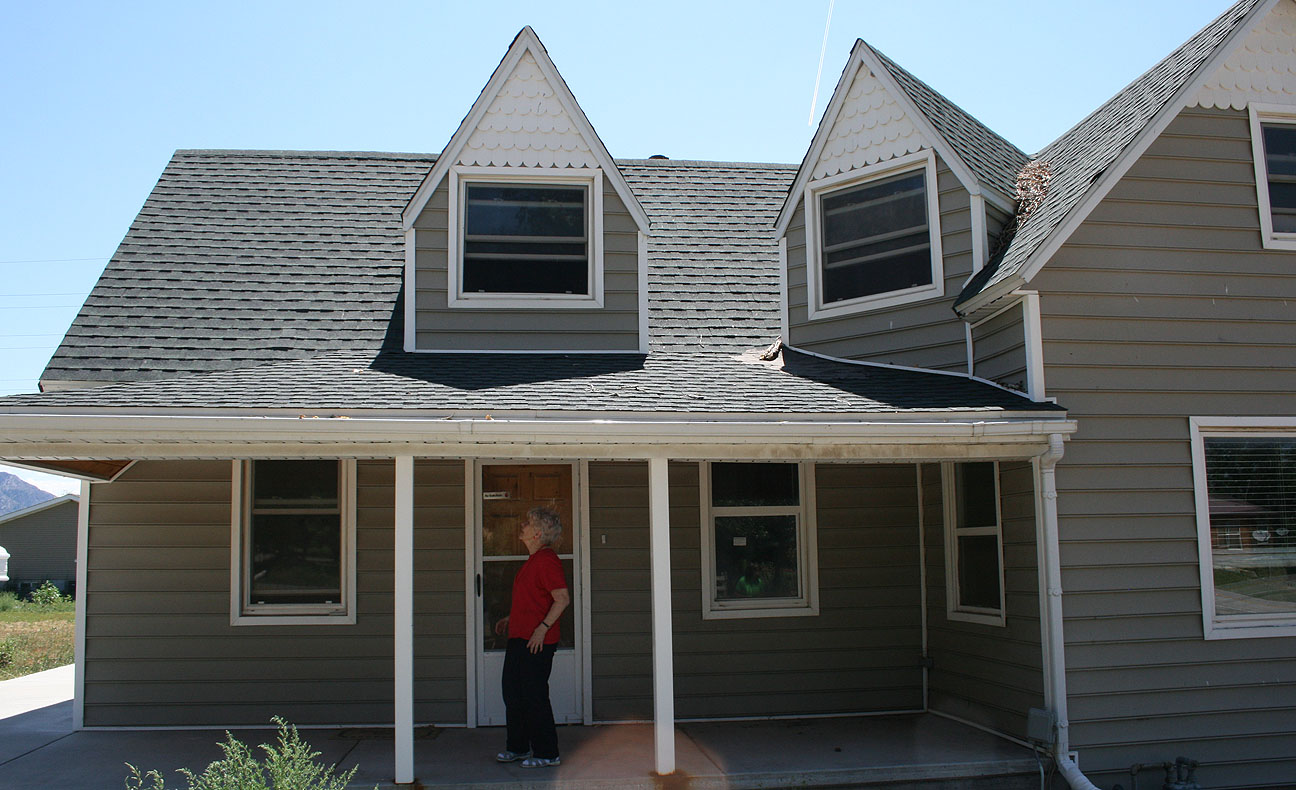
I’ll be darned.  There was that house.  Excited, grandma went to the front door to see if anyone was home.  I stood with my mom for a quick picture to celebrate our investigative success.

tia_tyson_kahlotus

A family photo was in order, taken by the home’s current occupant.

group_on_steps

The most exciting part of the story was the conversation that ensued with the home’s owner.  We started talking about who might still be in Kahlotus from the time when my grandma lived there.  As it turned out, the man knew my great-grandma and her husband.  “Oh, Frank and Reta were good friends of ours!” he said.

ilx_in_kahlotus_visiting

The world is just too small.  The black & white photo I was holding in the below picture was dated September 1955.

steps_comparison

With that mission accomplished, we roamed around town a bit.

kahlotus_post_office

I couldn’t tell if the jailhouse pictured here was for real or some type of movie prop!

kahlotus_jail

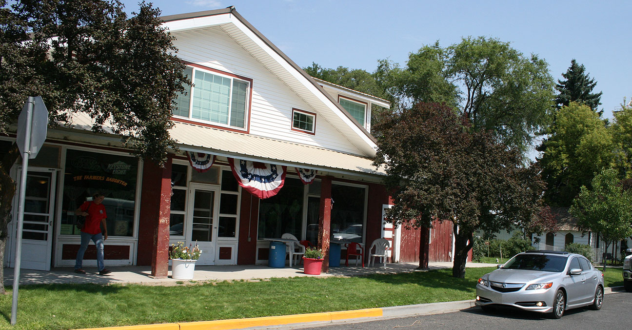
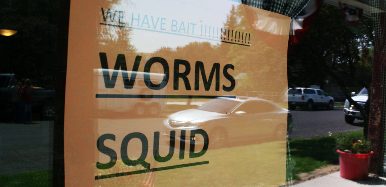
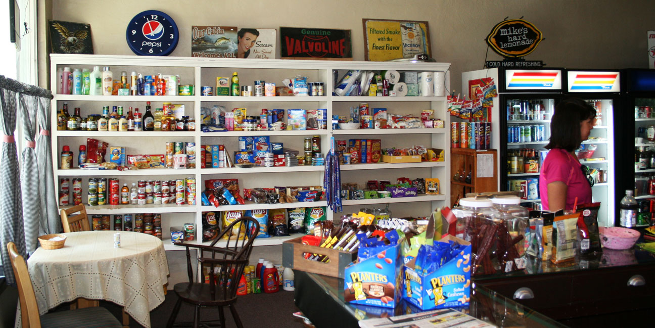
The only store in town is called Farmer’s Daughter.  We stepped inside to find some refreshments and it felt like we’d traveled back in time 50 years.

acura_ilx_in_washington

Hey, one-stop shopping!

worms_squid_kahlotus_wa

Jodi picked me up a root beer float that was most refreshing.

jodi_inside_kahlotus_market

Most of southeast Washington looks like this.  Rolling wheat fields as far as the eye can see.  It’s quite a contrast to what I’d perceived “The Evergreen State” to look like.

washington_wheat_fields

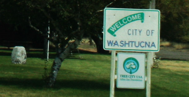
Another fun spot of civilization lies just a few miles to the east.  We looked around Washtucna but things were eerily quiet.  It’s approaching ghost-town status.

washtucna_entrance_sign

jodi_washtucna

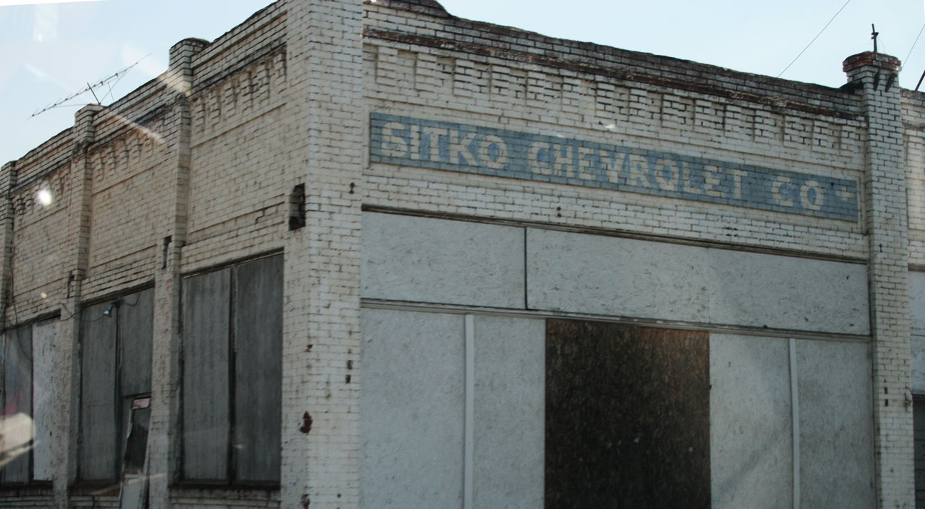
Sitko Chevrolet Co.  I wonder how long it’s been since this dealership was functional?

sitko_chevrolet_washtucna_wa

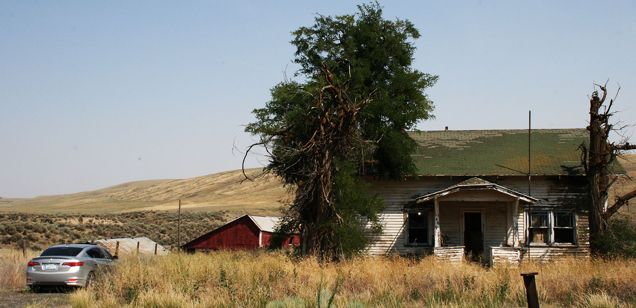
Ted’s Garage looks to have closed its doors long ago, too.

teds_garage_washtucna_wa

Even some of the homes have been left abandoned and are wide open for entry.  Washtucna is an urban explorer’s playground.

abandoned_house

I took a peek inside this home but I got spooked by a swarm of bats that came flying out of the ceiling.

abandoned_house_acura_ilx

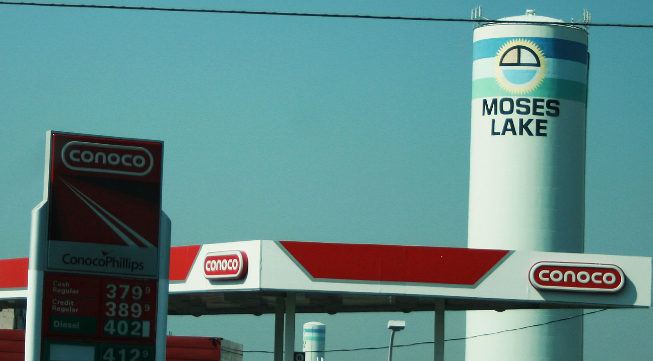
By this time, we needed to make our way toward Moses Lake where we’d be attending our family reunion.

doce_jodi_tyson_in_ilx

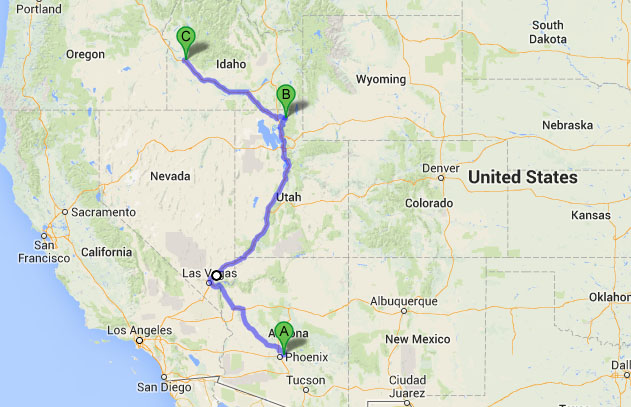
And, we made it!  Moses Lake is located along I-90 in central Washington.

moses_lake_silo

See the red “A” marker on this map.

moses_lake_map

The town was named for an Indian chief who had originally owned the land.

The city was originally named Neppel, after a town in Germany where one of the original settlers had lived.The first settlers established fisheries and farms — some of the first exported items were carp, jackrabbits and fruit — but irrigation attempts failed and settlers left at about the same rate as they came. When the town was incorporated and renamed Moses Lake in 1938, the population was estimated at 301 people.

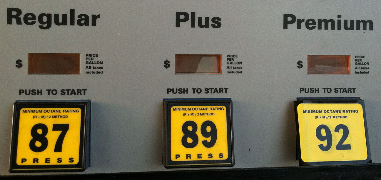
I’d seen 91 and 93 octanes, but I don’t know that I’d ever pumped 92 octane premium gas before.  It was time to refuel the ILX as well as our bellies after a long day in the car.  I got 34 mpg average that day..

92_octane

Our catered dinner at Porterhouse Steakhouse was accompanied by a number of family members who I’d never met before but who I instantly felt comfortable with.

moses_lake_porterhouse_steakhouse

Most importantly, Grandma was reunited with her older brother who she hadn’t seen in a couple of years.  Finally we were able to take a breath and relax after couple of long days on the road!

doce_reo

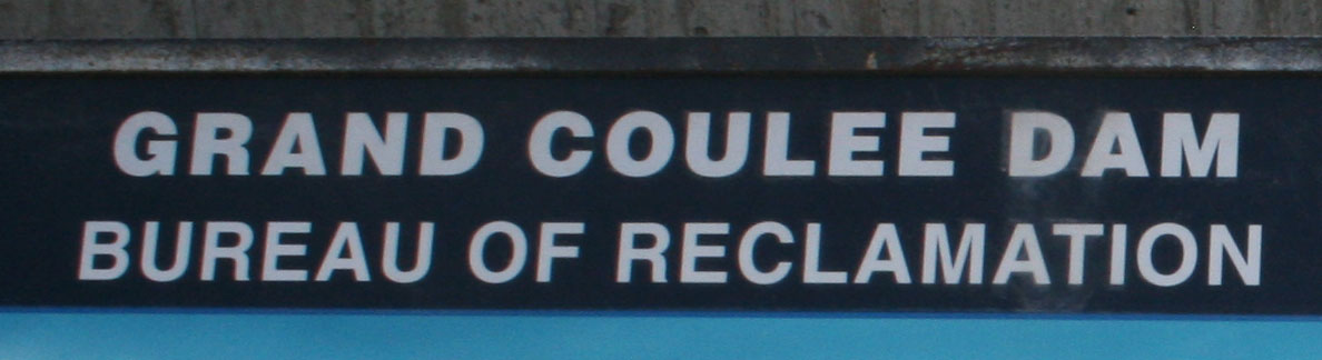
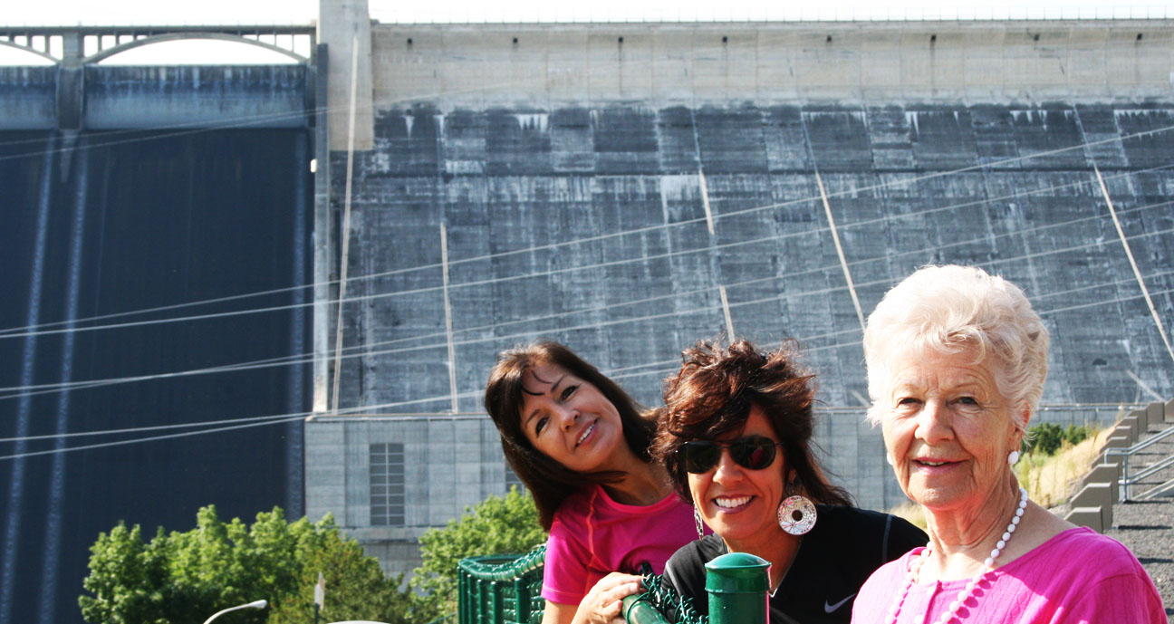
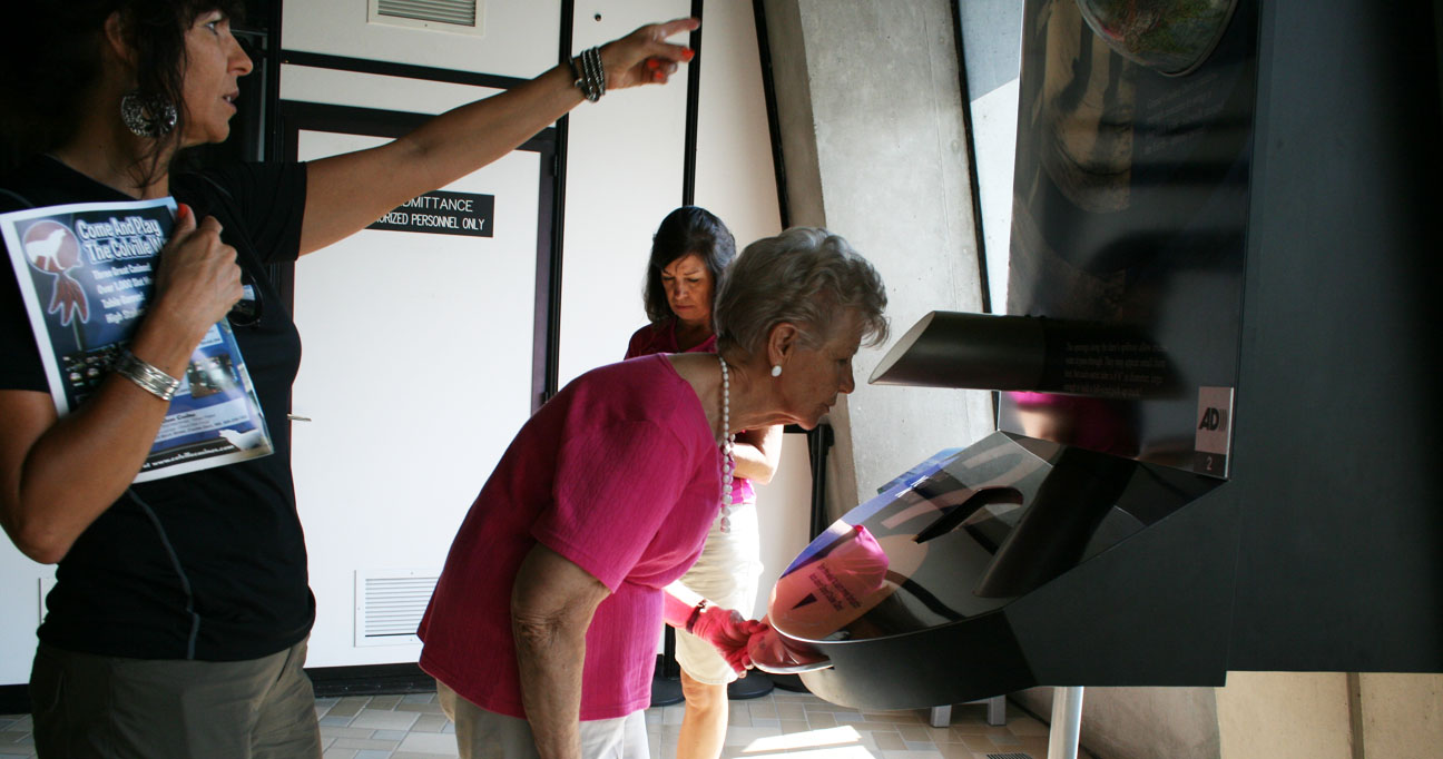
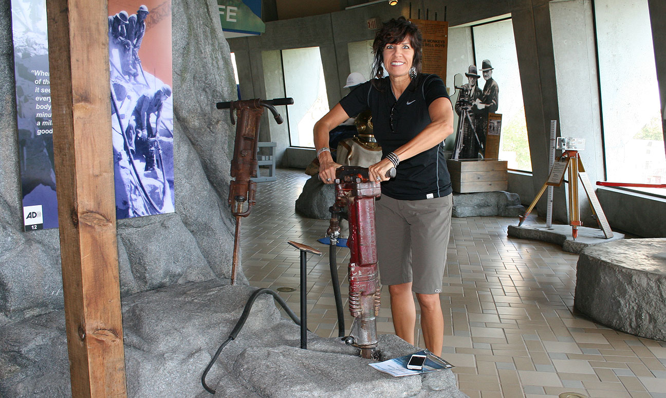
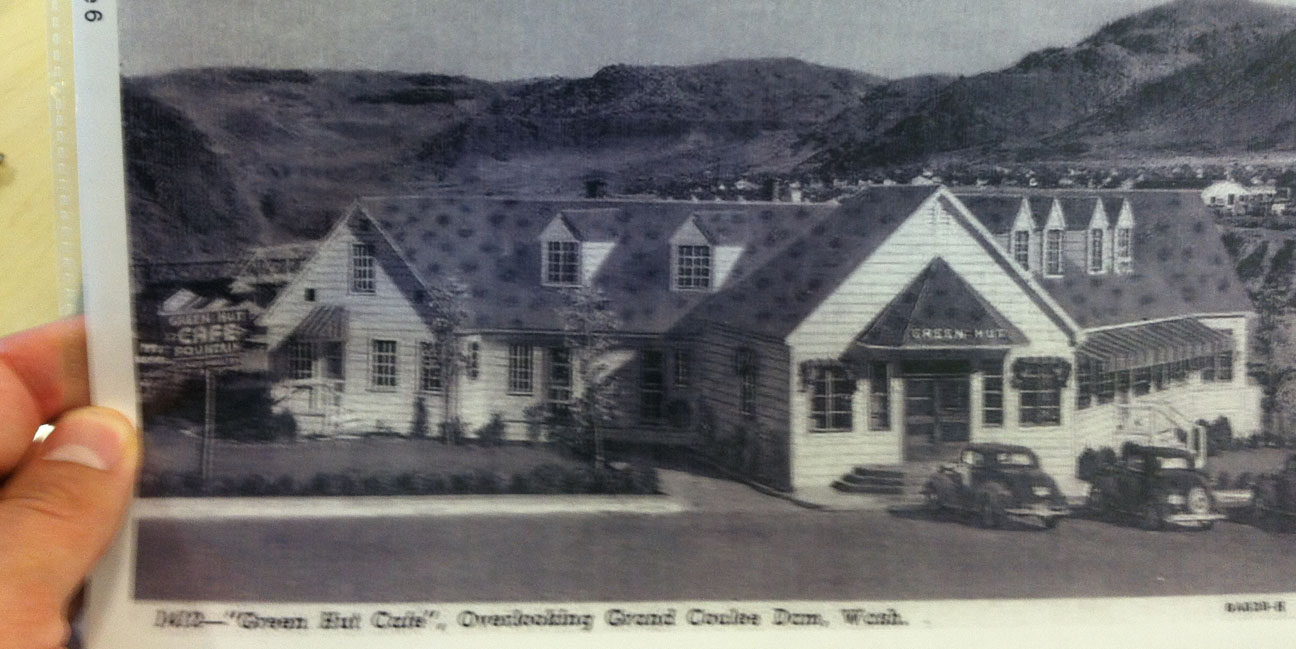
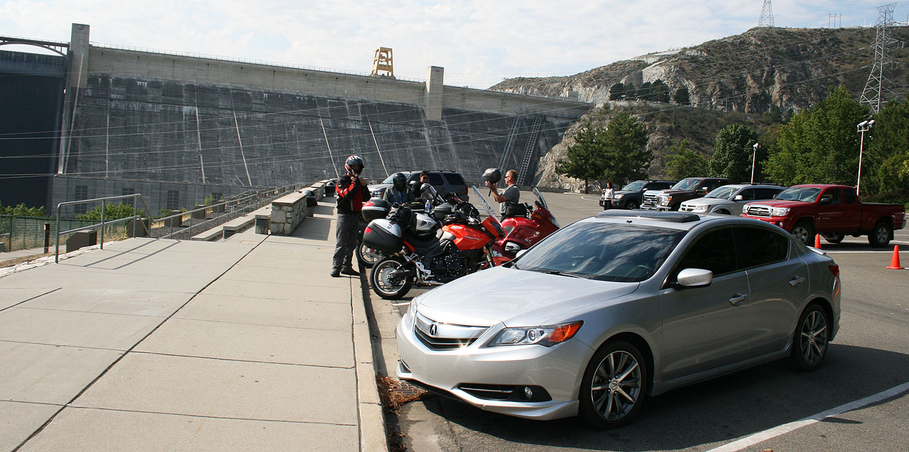
Coming up:  A trip to the country’s largest hydroelectric project:  Grand Coulee Dam.  Trust me, it was a “dam” good time.  I think you’ll agree after reading tomorrow’s blog post.  See you soon.

ILX Trip to Washington Part 1: Phoenix to Boise

Posted in ILX, Road Trip on August 14, 2013 by tysonhugie

Odometer (ILX):  52,155

52155

Leg Distance:  1,200 Miles

phx_to_boi

If my passport hadn’t expired, I would’ve visited Canada in the ILX this past weekend.  At the northernmost destination on my road trip, I was only about 40 miles from the border!  This time, unlike on most of my trips, I had multiple passengers along for the ride.  Our destination:  Moses Lake, Washington for a family reunion.

I departed on the 3,300-mile journey last Thursday afternoon and headed out of Phoenix.  Smoke from nearby wildfires created an amber hue in the Las Vegas sunset.  I wouldn’t be stopping on the Strip, though.

vegas_sunset

When I arrived in St. George, Utah to pick up my grandma, we pulled out the 2014 Rand McNally atlas and grandpa pointed out some trip highlights that we would experience on the drive to the Pacific Northwest.

gpa_showing_map_idaho

From gma’s house, my iPhone’s map application said it was 1,000 miles exactly to where the reunion would be held.

map_tyson_doce

But, we had to pick up two other important passengers in Logan, Utah along the way.  My mom and my aunt Jodi were waiting anxiously for the ILX taxi to pick them up.  This picture was taken in Sardine Canyon, approaching Cache Valley where Logan is located.

sardine_canyon

“Let’s get this show on the road!” says grandma.

todd_doce_ilx

Here is our pre-departure picture, featuring me, my grandma, and Jodi.  Grandma and Jodi ended up staking out their domains in the back seat while my mom rode shotgun.  It was a tight squeeze to fit all of our luggage into the trunk, but we did it!

tyson_joyce_jodi_departure

It should come as no mystery that there was no shortage of conversation with all these passengers in the car.  For once, I gave my audio system a break and enjoyed chatting with my family members.  Our first pit stop was in Deweyville, Utah.

deweyville_house_acura_ilx

The home pictured above is where my grandma lived during her high school years during the 1940s.  Deweyville today is probably about the same as it was back then.  As of the 2010 census, there were only about 330 people living there.

logan_sign

Grandma’s old home is up for sale with a price tag of $134,900.  She shared with us some memories of what it was like inside those upstairs bedrooms.  Interesting note:  This home was featured in the 1998 Vince Vaughn / Joaquin Phoenix film called “Clay Pigeons.”  Here’s a video clip from the movie that clearly shows the Wellsville Mountains in the background.

clay_pigeons_movie

doce_deweyville_house

Our next stop was about 2.5 hours later in Burley, Idaho off Interstate 84.  My grandma lived in this home when she was about 8 years old.  We had an old black & white picture from 1940 featuring my great-grandma and her 3 kids on a bicycle in front of the house.  Sure enough, the home today looks almost the same as it did back then.

burley_house_comparison_pics

Below is our re-creation of the original picture.

jodi_tia_joyce_burley_idaho

The current owner of the home happened to get home just as we were looking it over.  She was caught a little offguard that there were strangers in her yard taking pictures of her home, but when we showed her the 73 year old black & white picture, it all made sense.

burley_idaho_home_acura_ilx

I gave up the reins to my mom for the next segment of the drive from Burley to Boise.

tia_driving

And thus I had a little bit of time to snag some pictures and actually goof off for awhile instead of watching the road.

tyson_gma

Are we there yet?

tyson_doce_jodi_tia_in_ilx

Look at that driving technique!  10:00 and 2:00 demonstrated to the fullest extent.  I hope she got an “A” in Driver’s Ed.

tia_driving_ilx

We spent the night in Boise, Idaho.  At 210,000 residents, it’s Idaho’s largest city but it still had a small-town feel as far as I was concerned.  It was that evening when I met up with Josh who drives the 370,000 mile 2005 Acura TSX.

The following day, we’d cross an important milestone in the ILX and take it into 2 states that it hadn’t yet seen before.  More on that tomorrow!  A 4-part roadtrip write-up awaits you.

Coming Attractions: ILX Trip to the Evergreen State

Posted in ILX, Road Trip on August 13, 2013 by tysonhugie

Odometer (ILX):  52,135

52135

I drove the ILX 3,356 miles over the last 6 days through 6 states.  Stay tuned this coming week for the trip write-up as I take you along for a ride the beautiful Pacific Northwest.  It’s time for me to catch up on some much-needed sleep.  Until then, will somebody please come get these bugs off my car?

ilx_buggy_front

Reader’s Ride: Josh’s 2005 Acura TSX

Posted in Reader's Ride on August 10, 2013 by tysonhugie

I found a car that’s well on its way to million mile status.  Check out the odometer on this 2005 Acura TSX that’s driven an average of over 46,000 miles per year.  That’s right:  370,923 miles!

josh_tsx_odometer

Several months ago, I’d seen a fellow Acura fan post on Facebook about his high-mileage TSX.  We ended up sharing stories about our experiences in “life beyond 100,000 miles” in an Acura.

acura_ilx_tsx_fronts

These two Acuras share the same 2.4 liter 4 cylinder motor.

ilx_tsx_josh

Josh and I finally had a chance to meet last night when he brought his White Diamond Pearl beauty over to a hotel where I was staying on the west side of Boise, Idaho.

josh_2005_tsx

Josh bought this TSX brand new.  He is in the insurance business and currently drives around 5,000 miles per month.  Josh says that his car is 100% dealer maintained and the service team at Lyle Pearson Acura knows him personally.  In fact, when they call him for an after-service follow-up, “Smooth and silky, as always, Josh?”  is their greeting.

tsx_ilx_tl

This car is equipped with all the bells & whistles that were available in 2005, including the navigation.

josh_tsx_interior

Check out that bug collection!

tsx_bumper_bugs

Josh and I took the TSX for a spin around the block and I must say – even with the original suspension, the car rides great!

tyson_in_josh_tsx

My favorite part:  He’s even still left the blue plastic covering over the aluminum door sills since the car was new 8 years ago.

josh_tsx_door_sill

Thanks, Josh, for meeting up!  Drive to Five!  I’ll be keeping tabs on your progress.

ILX Trip to Southern Utah Part 3: Hell’s Backbone & Bryce Canyon

Posted in ILX, Road Trip, Utah on August 6, 2013 by tysonhugie

Odometer (Legend):  522,703

522703

Odometer (ILX):  48,732

48732

Leg Distance:  519 Miles

leg3

Welcome to the third and final chapter of last weekend’s wild ride in Utah with 2013 Acura ILX.  Fueled up by my tasty Trout Quesadilla after lunch in Boulder Utah on Saturday, I had a renewed vigor for travel.  My friend Ryan and I were determined to conquer one last road before we called it a day:  Hell’s Backbone.

Hell-Backbone_big-650x388

Seen along the ridge in the above picture, Hell’s Backbone (Forest Road 153) was built in the mid-1930s as an alternate route between the towns of Escalante and Boulder, Utah.   It was constructed by the Civilian Conservation Corps and created a means for the first automobiles to reach Boulder.

Print

Highway 12 is notoriously one of the most beautiful in Utah.  Someday I plan on driving it in its entirety.

12_scenic_byway

Just a few miles south of Boulder on Highway 12, we veered right and entered Hell’s Backbone Road.  Again, Ryan led the way in his 230,000 mile Audi A6 while I followed in the 48,000 mile Acura ILX.

entering_hells_backbone_road

We were lucky to not encounter adverse weather conditions during our drive, as muddy roads would have made this route impassible for passenger cars.  Notice I had my GoPro video camera mounted on the car’s rear quarter panel for part of the drive.

acura_ilx_driving_hells_backbone

The dirt road reaches an elevation of 9,000 feet and skirts the edge of Box-Death Hollow Wilderness.  Midway through the 38-mile stretch of gravel road lies the the one-lane Hell’s Backbone Bridge (originally constructed in 1933).

tyson_hells_backbone_sign

From an informative sign on-site:

The original bridge was in use until the early 1960’s, when its decaying timbers started to groan and squeak ominously as vehicles crossed over it.  The faithful old wooden bridge was replaced by a steel and concrete reinforced structure.  That bridge was replaced in 2005 by the present bridge which is wider and stronger than the two previous bridges.

This thing still looks pretty skinny to me!  I wonder what it would’ve looked like in 1933.

acura_ilx_bridge

Ryan and I took a breather from driving and spent awhile hiking around the area.  It was perfect weather.

acura_ilx_in_utah

Here, Ryan (carefully!) climbed on top of one of the sandstone spires.  A fall would have been fatal at that height.

ryan_climbing_hells_backbone

Pictures do not do justice to the depth of the canyon and the many layers of it.

view_hells_backbone_tyson

All aboard!  Here is the ILX crossing the bridge.

acura_ilx_hells_backbone

I was met by a truck coming the opposite direction and had to back up to let it pass.

acura_ilx_on_hells_backbone_bridge_utah

Hell’s Backbone Road went on to join with Pine Creek Road, which is what we followed to the town of Escalante, Utah.  In all, we traveled around 38 miles on the dirt backroads.

fueling_escalante_utah

Here, I took the chance to go ahead and top off my fuel tank with some $4.09 premium fuel at the only gas station in town.

escalante_utah_fuel_choices

And from there, since Ryan and I had completed our mission, I started contemplating the drive home.  Unfortunately, as the GPS screen capture illustrates below, there was no direct way to get where I was going.

garmin_route

Through the towns of Henrieville, Cannonville, and Tropic, we headed westward on Highway 12.  I love old homes like this one, and I’d especially like to take a peek inside if the opportunity presented itself.  Looks like this one’s even for sale!

old_house_escalante_ut

Bryce Canyon, just up the road, is one of 5 national parks in Utah.  I started seeing some impressive rock formations and knew that we were getting close.

acura_ilx_bryce_canyon

Sure enough, we rolled up to the entrance. Given the long day that Ryan and I had already experienced, we opted out of entering the park.

tyson_at_bryce_canyon_sign

However, we still enjoyed plenty of the surrounding area’s scenery, including this tunnel on the highway.

tunnel_utah_hwy_12

And these scenic pull-outs where I couldn’t resist stopping for a picture.

ilx_red_canyon_2

This place specifically is called “Red Canyon.”

ilx_red_canyon

Finally, we’d reached our separation point.  From the junction at Highway 89, Ryan would be heading north and I’d be heading south.

departing_hwy89_12

That Phoenix destination marker must’ve been identified with me in mind.  I can’t imagine many travelers in that part of Utah are driving to Phoenix.

hatch_kanab_phoenix

It felt really good to finally be honing in on my target destinations as I got close to Flagstaff, which is only 2 hours from Phoenix.

return_trip

My ILX performed like a hybrid from an MPG perspective!  From the time I reset my trip meter when entering Hell’s Backbone until the time I arrived at home, 515 miles later, I averaged 38 miles per gallon.

38_mpg

That concluded Saturday’s travels!  Here’s a video wrap-up of the entire weekend:

hybrid1

Anybody notice a new feature here?

Thanks for coming along for the ride, as always!

ILX Trip to Southern Utah Part 2: Burr Trail

Posted in ILX, Road Trip, Utah on August 5, 2013 by tysonhugie

Odometer (Legend):  522,698

522698

Odometer (ILX):  48,688

48688

Leg Distance:  73 Miles

burr_trail

Fresh off the Hall’s Crossing ferry boat on the north side of Lake Powell at Bullfrog Marina last Saturday, Ryan and I already had a pretty good idea where we’d be heading next in our vehicles.  We wanted to scope out a route called the Burr Trail, one of the most remote yet scenic roads in Utah.  This route is primitive in sections as it winds through the backcountry.  Here is a little info on Burr Trail, courtesy of the National Park Service:

John Atlantic Burr was born in 1846 aboard the SS Brooklyn somewhere in the Atlantic Ocean.  He and his family lived in Salt Lake City, then later moved south and established the town of Burrville, Utah, in 1876.  John Burr soon developed a trail to move cattle back and forth between winter and summer ranges and to market.  This cattle trail through the rough, nearly impassible country around the Waterpocket Fold, Burr Canyon, and Muley Twist Canyon came to be known as the Burr Trail.

I lived in Utah for over 20 years and had never even heard of Burrville, but I looked it up on Google Maps and realized why:  It’s teeny.  Here’s the whole town today.

burrville_utah_satellite_view

After heading north from the marina on State Route 276 for about 4-5 miles, we turned west on Burr Trail.  There were no signs or markings aside from this lonely one.

burr_trail_entrance_utah

The National Park Service has posted written instructions online on what to expect for each mile of the drive.  These were most helpful as Ryan and I made our way through what was new, unfamiliar territory for both of us.

burr_trail_notes

Our eyes were wide open to appreciate the chiseled mountains that surrounded us in various shades of red.

following_ryan_on_burr_trail_utah

Just a little ways into the drive, our plans were nearly foiled.  There’s a part of the Burr trail that floods when the lake level exceeds a certain measurement (3,695 feet, to be exact).  See the note here in red on a map:

powell_map_burr_trail

The lake’s level appears to currently be at or near that level, because Ryan and I saw a wash ahead of us with muddy ruts that I was almost positive my car wouldn’t be able to get through.  I had Ryan go first in his Audi, and then I had him video record me crossing – just in case anything funny happened, of course.

Thank goodness for those 6 inches of ground clearance!  I used them all.

With that out of the way, we continued onward on Burr Trail.  For a time, the road straddled a ridge with canyons on both sides.  Then we left the pavement for what ended up being 15 miles of off-roading.

acura_ilx_burr_trail_3

The printouts that I’d taken with me had a lot of warnings regarding the dangers of driving this road in inclement weather.

acura_ilx_burr_trail_2

A bit further up the road, Ryan and I entered the park boundary for Capitol Reef National Park.  Unlike most other national park entrances, though, this one has no entry fee.  It’s so remote that it isn’t even staffed.  There’s a small signpost which reads “PARK INFORMATION” and holds a wooden box containing brochures.

acura_ilx_capitol_reef_np_burr_trail

Even though summer travels are in full swing, Ryan and I only saw a couple of vehicles in the 2 hours that we were on the Burr Trail.  This road is truly under-appreciated, and I’m okay with that.  It’s something amazing to be able to stop your vehicle, shut off the motor, and hear absolute silence.  That’s what we experienced.

burr_trail_scenery

A sign at the fork in the road ahead ensured us that we were on the right track, but still 42 miles from our next destination in Boulder, Utah.

burr_trail_distance_sign

I had Ryan take the lead in his Audi and gave him plenty of space so that I didn’t have to eat his dust the whole time.  Not long after he got out of my line of sight, he came on our 2-way radio and said, “Dude, this just got real.”  I knew the sights ahead were going to be awesome.  And they were.

burr_trail_following_ryan

Massive stone canyon walls loomed above us on 3 sides as we started up a series of very tight switchbacks.  Road conditions were poor in some spots.  There were washboard ruts that gave my car’s Traction Control System a workout as my Michelin tires tried to get a grip in the loose gravel.

burr_trail_rocks

We made it up the steep grades and pulled over to take a look at what we’d just driven up.

acura_ilx_front_burr_trail_utah

The winding dirt road in this picture was the road behind us.  To truly appreciate the picture, click it to enlarge, and follow the line all the way from the background to the twisty foreground.  This is my kind of road!

switchbacks_on_burr_trail_utah

It’s worth noting here that for a long chunk of our day, including this stretch, Ryan and I had zero cell phone service.  If we’d had any issues we would have been a long hike away from any civilization.

no_service

At the top of the switchbacks, we saw Peek-A-Boo arch to the right.  This is said to resemble an unblinking eye in the horned head of a giant lizard.

peekaboo_arch

Finally we were back on pavement as we entered the Grand Staircase-Escalante National Monument.  It was established in 1996 and protects over 1.8 million acres of land.

acura_ilx_grand_staircase_sign

Still the road was narrow in many places and had no markings whatsoever.

red_rocks_burr_trail_utah

Ryan and I commented to one another via our walkie-talkies how surprised we were at how quickly the landscape can change in just a matter of miles.  We went from red rocks to white rocks as we got closer to Boulder, Utah.

approaching_boulder

Parched and ready for a break, the Hell’s Backbone Grill beckoned us.

hells_backbone_sign

The restaurant, which had a rustic lodge feel to it, was hidden in these trees.

hells_backbone_grille

Ryan and I were the only ones there for lunch!  Well, except for a cat named Jezabel who sat on a chair in the patio.  I tried something new to me:  Smoked Trout Quesadilla.

hells_backbone_menu

“Where the food is heavenly” is a fitting slogan; this really did hit the spot.

trout_quesadilla

The ILX took a few deep breaths outside after climbing Burr Trail.

acura_ilx_parked_outside_boulder_utah

Ryan and I topped off our stomachs with dessert.  My hot fudge sundae even had an orange flower stuck in it.

tyson_ryan_at_hells_backbone_grill_boulder_utah

The “Country Corner” service station pictured below is long-since closed, but we grabbed some beverages and headed out for the next chapter of our trip:  Hell’s Backbone Scenic Byway.  Would the road live up to its ominous sounding name?  Find out next time.

country_corner_boulder_utah

ILX Trip to Southern Utah Part 1: Lake Powell

Posted in ILX, Road Trip, Utah on August 4, 2013 by tysonhugie

Odometer (ILX):  48,648

49648

Leg Distance:  491 Miles

leg1

Coming to a blog near you:  A 3-part series about this weekend’s trip to Southern Utah’s red rock backcountry.  The Acura ILX 6-speed hit the highway again for a 1,083-mile on- and off-road adventure that I’m looking forward to sharing with you.

The intent of this trip was to meet up with my friend Ryan who had joined me on the Arches National Park trip back in February.  We were determined to check out some of the most scenic roads that Utah has to offer.

Friday afternoon’s departure from the Phoenix, Arizona area left me soggy as I hit monsoon rainstorms about two hours into my trip, in Flagstaff.
rain_flagstaff_arizona

About 50 miles north of Flagstaff on the Navajo Indian Reservation, there’s a bridge crossing the Little Colorado River near the town of Cameron.  An old suspension bridge seen in the background here was built in 1911 and spans 680 feet.  It was damaged by an overload of sheep in 1937!  However, it was repaired and continued to carry automobile traffic until 1959 when it was replaced by a newer bridge just to the east.

highway_89_overweight_truck_route_arizona

Because of the weight restrictions imposed on the bridge, there was a secondary route that truckers were required to follow, called the Overweight Truck Route.  Signs for that bridge are still in place but the route is now closed.

acura_ilx_overweight_truck_route_cameron_arizona

I still took the ILX to explore a little about what’s left of that old alternate route.

highway_89_oversize_truck_route_cameron_arizona_acura_ilx

There’s a lot of neat road history in this area.  An old stretch of Highway 89 parallels the current highway.  I saw this section where it had buckled in various places over a wash crossing, forming a zig-zag of concrete.

highway_89_crumbling_arizona

I branched off to the northeast on Highway 160 and headed in the direction of Four Corners, stopping along the way to get a picture at the remains of a service station.  Standard Oil, dating back to 1870, was once the largest oil refiner in the world.

standard_oil_products_acura_ilx_2

This particular station looked like it hadn’t seen any customers for at least half a century, though.

standard_oil_co_acura_ilx

As dusk fell, I was rolling northward on Highway 163 through Monument Valley.  Traffic was light and this was a great chance to enjoy the open road and the amazing scenery that surrounded me.

sunset_hwy_163

The employee at the front desk of the Super 8 Motel in Blanding, Utah, told me after I’d checked in for the night, “You’ve got a really nice car.”  I glanced outside to where it was parked.  It did look rather photogenic in that light.

acura_ilx_checking_in_at_super_8

Ryan arrived at about this same time in his black 1996 Audi A6 Quattro.  We called it a night fairly early, because we wanted to be rested up for the next day, when we’d be seeing this. (Photo Credit for this pic)

lake_powell

Lake Powell is a body of water on the Colorado River that covers over 250 square miles.  That makes it the second largest man-made reservoir in the United States.  Creation of this lake was made possible by construction of the Glen Canyon Dam which was completed in 1963.

glencyndam23_jdg

It took 11 years for the water to fill up to the high water mark!

lake_powell_july_1987

The above picture of me with my dad was taken in July 1987.  Lake Powell was a favorite boating destination for my family when I was growing up.  Here’s another classic from a few years later (I’m on the right).

hugies_at_rainbow_bridge_lake_powell

The arch seen in the background there has a story of its own.  Lake Powell is home to Rainbow Bridge National Monument, a 290-foot-tall sandstone natural bridge that had been seen only by the Native Americans until 1909.

scenery_highway_276

Ryan and I decided to transport our vehicles across Lake Powell via a ferry that’s been in operation since 1985 called Hall’s Crossing.  The drive from Blanding to Hall’s Crossing was 88 miles via scenic byways 95 and 276 .  As seen here, the rate for vehicles is $25 so we were prepared with cash to pay our fares.

ferry_costs_acura_ilx_utah

This curvy two-laner was prime environment for the 6-speed ILX.  I found I rarely needed to downshift to get up the grades.  Interestingly enough, we only saw one other vehicle on this road, and it ended up being a ferry employee who blew past us. She must’ve been late for work!

hwy_276_to_halls_crossing

Soon we could see a sliver of blue water in the distance.  We’d arrived at Hall’s Crossing.  The road to this crossing was completed in 1969.

tyson_at_halls_crossing_lake_powell

The park ranger let us in the marina without paying the $15 per vehicle fee, since we were just going to catch the ferry rather than spend time boating.  Her instructions were, “Don’t recreate.”  As in, recreation, not re-creation.  Still sounded funny to use that word in such a context.

arriving_halls_crossing_lake_powell

As we got closer to the ferry dock, it became apparent that the water level looked pretty low.

arriving_halls_crossing

I’ve since learned that Lake Powell’s water level fluctuates greatly depending on rainfall and other factors; it is now at its lowest point in 5 years.

driving_down_ferry_ramp_lake_powell

After a 30-minute wait for our 9:00 a.m. departure, the ferry attendant waved us onward and the ILX climbed the ramp to get on the boat.

driving_onto_ferry

The ferry is 3 lanes wide.  I would estimate it could accommodate 15 or so vehicles.  Ryan and I were in our element!  A ferry operator came on an intercom and instructed everyone that we could exit our cars and wander around.

tyson_ryan_with_acura_ilx_on_ferry

Here was the ILX’s parking space for the 30-minute ride from Hall’s Crossing to Bullfrog Marina.

acura_ilx_on_ferry_lake_powell_utah

And we’re off!

ferry_moving_lake_powell

Notice the water line evident behind us as we made our way across the lake.

tyson_ryan_on_ferry

Because of the way Lake Powell is laid out and how it extends into so many different canyons, there are nearly 2,000 miles of shoreline – more than the west coast of the United States!

powell_map

I was able to stand at the back of the ferry and watch the waves which we were creating.

ferry_wake_lake_powell

Views surrounded us on all sides as we motored past houseboats, ski boats, and jet skis.  When people see the ferry coming, they get out of the way!

lake_powell_ferry_view

Captain Tyson at your service.

tyson_on_halls_crossing_ferry_lake_powell

The ferry itself was only built about 13 years ago but to me it looked much older.

ferry_utah_dept_transportation

All too soon, our joyride was over but another one was yet to begin.  After we exited the lake, Ryan and I plotted out our game plan for where we’d take our cars next.  I think you’ll enjoy the next piece of the story.  Stay tuned.

exiting_ferry_acura_ilx