Grand Canyon 26-Mile Hike: South Rim to North Rim in One Day
Odometer (Legend): 533,657

Odometer (ILX): 127,082

Trip Distance (Car): 476 Miles

Trip Distance (Hike): 26 Miles

Last week, I was reviewing a GMC Canyon. This week, I’m reviewing another Canyon. The Grand Canyon.
While most of the canyon’s 5 million visitors per year are content to stand at the edge and admire its grandeur from afar, others are not happy until they get down and dirty while trudging across 20+ miles of it. My mom is one of those people, and I let her talk me (and a few friends) into joining her for this crazy adventure inside one of the “7 natural wonders of the world” last Friday. And 4 days later, my legs still scream at me for putting them through it.
I last blogged about the Grand Canyon in April 2014 when my friend Brad and I road-tripped to the Skywalk, a glass platform suspended from the canyon walls at the West Rim on the Hualapai Indian Reservation. But the 1,900-squre-mile national park is vastly different to look at from any of the many different angles, and there are several different hiking paths that lead down into it for those who dare.
Painfully Awesome
My friend Dave was telling me the other day about a bike ride he’d taken that had been especially difficult. He called it “painfully awesome.” That sums up in two words exactly how I’d describe Friday’s 14-hour hike. It was the most physically challenging thing I have ever done. Joined by 5 ambitious friends as well as my mom & stepdad, we set our sights on a “rim-to-rim” excursion. In other words, we would start on the south side of the canyon, hike down into into its depths at the Colorado River, then eventually make our way up the north side. For many months we prepared ourselves physically and mentally for the task, but the actual experience was exponentially more than I was ready for.

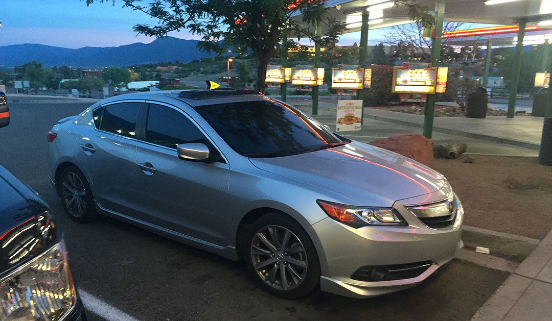
On Thursday afternoon, I picked up Kyle, Bryce, and Justin in the ILX for our departure from the Phoenix area. It took us about four hours to arrive at the Maswick Lodge along the South Rim. Highway 64 is a very quiet place at night. It’s a two-laner that climbs through the pine forests west of Flagstaff with little traffic, and no significant services or amenities aside from an occasional lonely gas station. By about 10:00 p.m. we met up with my mom, stepdad, and two other friends and settled in for a somewhat sleepless night.
It’s Go Time
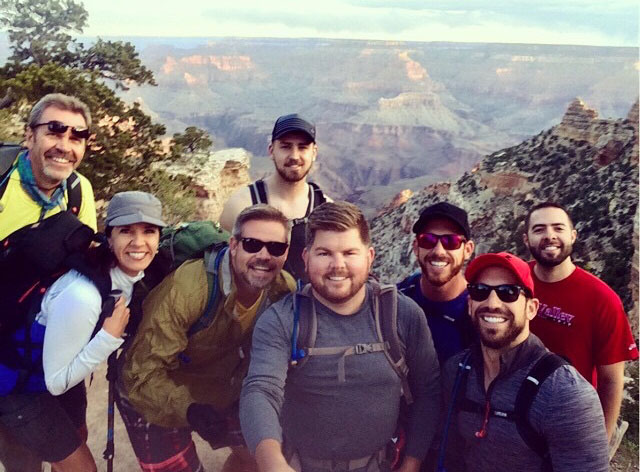
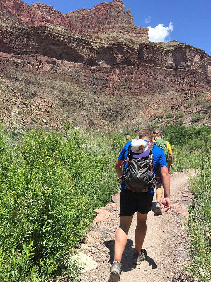
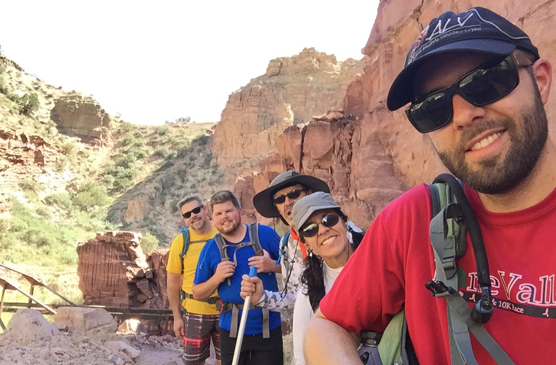
In the blink of an eye it was time for a 4:00 a.m. wake-up call. Right off the bat, anxiety ran high because we were rushed to get to the train station for a 5:00 a.m. shuttle bus. We had to make last-minute decisions on what to throw into our packs, how much water to take, and what to wear. (Some of our gear would be staying in my car rather than making the trip across the canyon on our backs.) The bus took us to the South Kaibab trailhead (elevation 7,260 feet) about 15 minutes away and we hopped out. The sight of the canyon at daybreak is something unreal. Temperatures were cool but not uncomfortable. And then began our short-lived tradition of taking a group “selfie” at one-mile intervals throughout the course of the hike. I say short-lived, because by about halfway through the day we cared very little about group pics; we were focused instead on sheer survival.

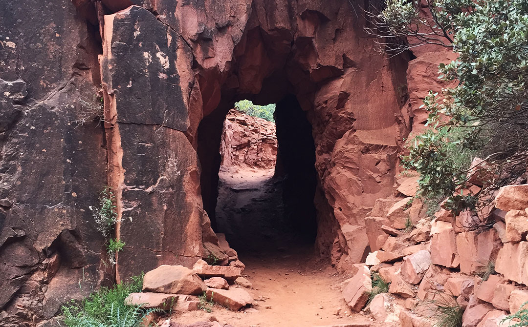
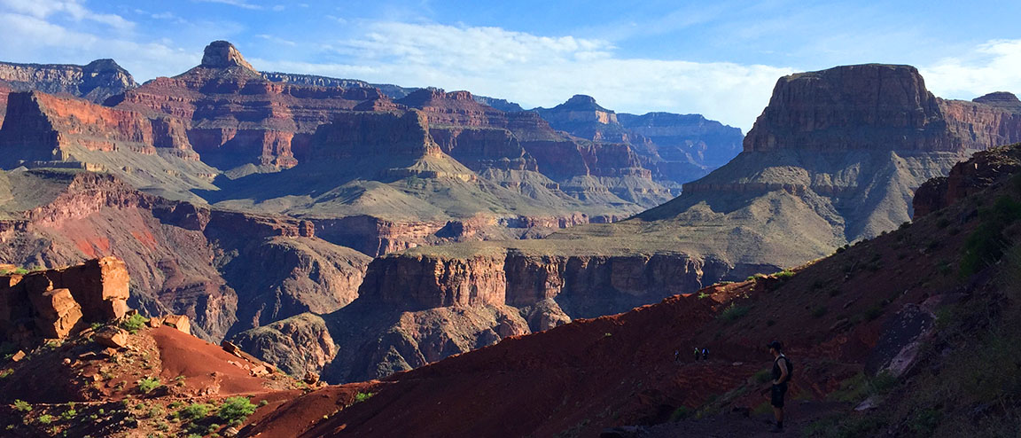
With energy in abundance we made our way down the rocky but well-marked trail toward the base of the canyon. “We’re going down there?” I thought to myself as I looked in the distance at the vast expanse of rugged terrain. The trail required a good deal of focus for proper footing, but every once in awhile we had to look up from the ground below and admire the scenery around us. “OOOH AHH POINT,” one of the first signed viewpoints we came across, was aptly named. We zig-zagged our way down thousands of feet in elevation. Right away I discovered an issue with my Camelbak backpack when it started soaking my back and shorts. Somehow I hadn’t sealed it tightly enough and it was leaking like crazy. Eventually I dumped the water out of it and resorted to just using 3 refillable bottles.

Besides having plenty of water, we were adequately prepared with other forms of nutrition. Rustin and Wade had packed what appeared to be an entire deli counter. Sliced lunch meats, prosciutto cheese, fresh strawberries and other delicacies were offered up when we made our first rest stop. Thanks to the downhill grade, our pace was quick at a little over 2 miles per hour. A short tunnel and pedestrian bridge across the Colorado River (which had a milky green look to it at the time) awaited us when we finally got to the bottom of the canyon.
Phantom Pit Stop
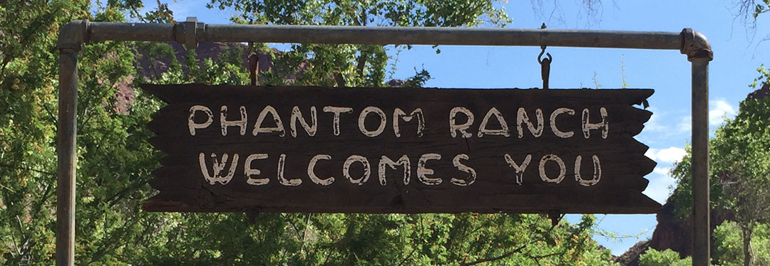
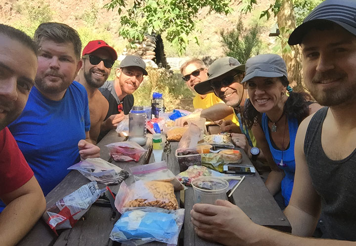
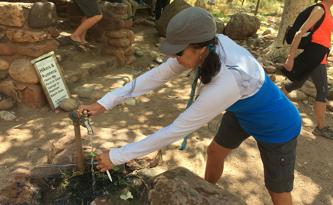
By now we were starting to wonder when we’d make it to Phantom Ranch at 2,460 feet. Notably the most “developed” of any place we’d be seeing throughout the course of the day, the lodge there has been a waypoint for Grand Canyon travelers since it was constructed in 1922. It was about 7.4 miles into our hike, and as we got closer, I could only think about one thing: LEMONADE. Inside the lodge, they sell cups of ice cold lemonade for $3.00 each. I chugged one so quickly it gave me a headache. Outside, there was a fresh water spigot for refilling water packs. The 8 of us sat around a picnic table under a shade tree and laid out some food items to refill our stomachs. Rustin pulled out a travel size bottle of Hidden Valley Ranch dressing and we all gave him a look of: “You packed that down here?”
The sound of Bright Angel Creek running nearby was therapeutic in itself. Todd took the opportunity to soak his legs in the chilly water. The rest of us just enjoyed the chance to rest at the picnic area. After so much downhill, for some reason when standing still, my legs felt wobbly. I knew already that for every one step downhill we’d taken, we’d be taking closer to two uphill. And that I dreaded.
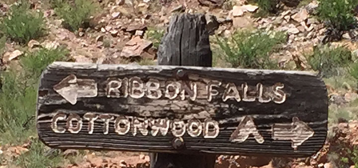
Ribbon Falls
The trail ran parallel to the river for many more miles. It was about this time – probably 10:30 or 11 in the morning – when the heat started cranking up. Even though I’d lathered up in SPF50 and I was wearing a baseball cap and sunglasses, I could feel the sun cooking the back of my neck. At times we had to walk single file and at other times we stood two abreast and held conversations. Several times there were bridge crossings where the trail changed sides in relation to the river. The steady uphill grade started getting the best of me and I now started drinking more water than ever before. I could now see why on average 250 people per year are rescued from the canyon. Dehydration is a very real concern.
My mom had learned of a detour that was an absolute must-see called Ribbon Falls. I don’t think any of us were too keen on adding distance to our already-long hike, but multiple sources had recommended we make time for it. So, when we saw a crudely-carved wooden sign pointing us in its direction, we rallied our energy as best we could and headed toward Ribbon to check it out. We had to cross a stream and hike up some boulders to get there, but in about 20 minutes we came upon the most beautiful oasis I’ve ever seen. Misty water came down upon us from dozens of feet above where it spilled through an opening in the red sandstone. Justin quickly scampered up as high as he could go on the waterfall itself, but all I could think about was ripping my shoes and socks off to dip my feet in the water.
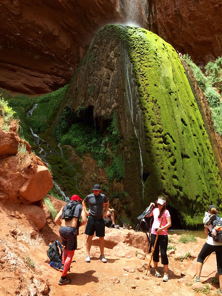

I could have sat at Ribbon Falls for the rest of the day, but sadly we knew we had another 12 or 13 (all uphill) miles to hike before dusk.
Cottonwood Campground
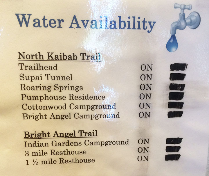
Todd had a great idea for a way to beat the heat when we got a couple of miles into our hike again. We took our shirts off and soaked them in the creek. The feeling of putting on a soaking wet T-shirt or tank top is unbelievably refreshing when you’re sweaty and gross – especially if there’s a slight wind to exaggerate the temporary chill factor. There are, occasionally, water spigots available every few miles on the trail from Phantom Ranch to the North Rim. Hikers have to be careful and plan ahead, though, because it’s possible sometimes for the water to be out of service. We lucked out and everything was in operation during our hike.
The next stop had probably a dozen or so campsites in it. We again took refuge in a spot of shade and refueled our bodies with food & drink. I took the opportunity to dump a grape flavored 5 Hour Energy shot into my water bottle in hopes that the caffeine would give me a kick for the next little while. My legs, feet, and back were screaming at me. By now, our tradition of taking a group photo at every mile marker had long been thrown out the window. Sometimes there was a lot of space between each of us, as each hiker settled into his or her own pace.

The Ascent
It was upon leaving Cottonwood that I really started questioning my ability to go the rest of the way. I knew from reviewing my mom’s pre-printed trail notes that our location at Cottonwood was still 6.8 miles from the finish line on the North Kaibab Trail. But it wasn’t that distance that scared me. It was this:
- Cottonwood Campground: 4,080 feet
- North Kaibab Trailhead: 8,241 feet
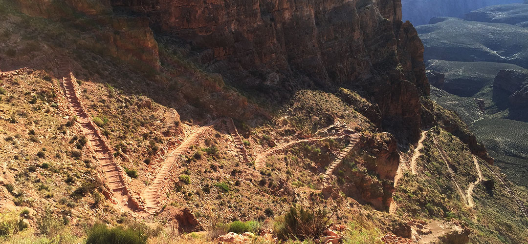
Okay. So, I’m no rocket scientist but that’s 4,161 feet. Vertically. In other words, after having already hiked about 18 miles, we still had almost 7 to go and we would essentially be climbing 78% of a vertical mile. Straight up in the air. My life flashed before my eyes. Would I send everyone onward without me and potentially stay the night in the canyon? Was I going to be one of “those people” who had to get helicopter air lifted out of the canyon on the news? I couldn’t let myself think about failure. I just had to keep taking it one step at a time.
And that’s where I found myself setting my own pace. Kyle, Bryce, and Justin had gone on ahead. I was kind of in the middle of the pack. I set my iPhone (in airplane mode all day to conserve battery since cell service is non-existent of course) on shuffle and let it play music from inside my pocket. That helped steer my mind clear from the task at hand. I passed a couple who was walking the opposite direction. They could tell that I was “spent” physically by the way that I braced myself with a tree while standing to catch my breath. “There’s a water stop about a mile and a half up, right after a tunnel,” the man told me. I thanked him. But I’m pretty sure he lied to me.
That was probably the longest mile and a half of my life. I kept looking for a tunnel that never came. Endless log stairs, rocks to climb over, and switchbacks. I’d round a corner and they just kept coming. “Really?!” was the thought that kept crossing my mind. I’d walk for a couple minutes, then have to catch my breath and keep my heart from coming out of my chest. When I finally saw that tunnel after an eternity of hiking, it almost seemed like a mirage. I went through, plopped down on a rock, and just sat there without moving a muscle for at least a few minutes. The sun had started its descent into the horizon already so I knew daylight was on the way out.

The fat chipmunks at that small rest area kept me company (and ate some of the peanuts in my trail mix) for about 15 minutes until my mom and Todd arrived, and then Rustin and Wade were just a few minutes behind them. We talked for a bit and then decided it was best to press on as daylight would soon be closing out.
Final Stretch
The last 1.7 miles of the hike happened at a snail’s pace. Every so often I would look behind/below me at the huge canyon and get a little dizzy thinking I had just come up from there. At one point I got insanely hungry and dug into a Nature’s Valley granola bar. I didn’t care that it had become nothing more than a packet full of crumbs at that point. I inhaled it, and I downed two more bottles of water that I’d filled up at the rest stop. Keep in mind, I hadn’t used the bathroom since Cottonwood. All that water was flowing right through me as sweat.

I knew I was getting close when I started hearing the sound of automobile traffic overhead. The trail conditions got notably better, and I passed a man sitting along the side of the trail who was waiting for some family members. “You’ve only got 100 yards to go,” he told me. Music to my ears. I made it. And it was the biggest rush of relief that I had ever felt.

Aftermath
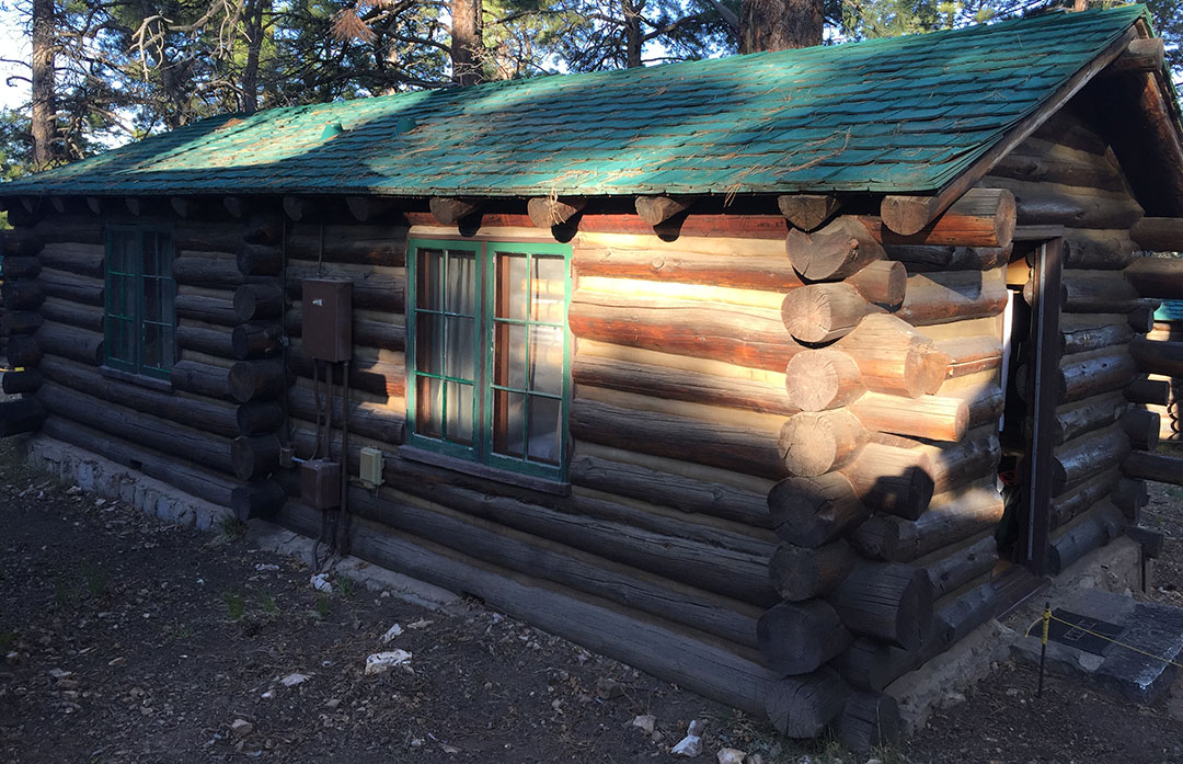
It’s miraculous that the 8 of us everyday people made it through such a physically taxing event. We took one last group photo from the bed of Todd’s pickup truck which was parked there at the North Rim. After showering up, we made it to our 9:00 p.m. dinner reservation at the historic North Rim Lodge. I glanced around the table and the look of exhaustion was pretty common. We slept like rocks at our rented log cabin.
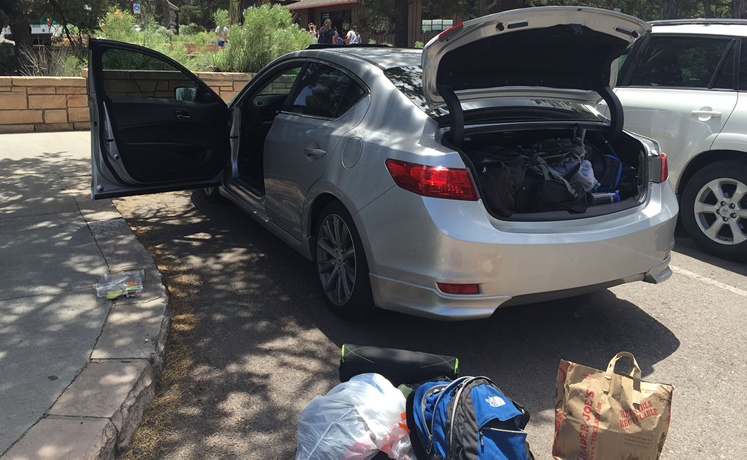
On Saturday morning, Justin, Bryce, Kyle, and I got on a 7:00 shuttle van that drove us 4.5 hours back to where my ILX was parked at the South Rim. Each time we stumbled out of the packed van at a rest area, my legs reminded me that they weren’t happy with what I’d put them through the day prior. It was great to get back to the car and settle in for the rest of the trip home. Here’s a picture from when we exited the park on Saturday morning.

We dined at a neat little Italian restaurant in historic Williams off Interstate 40 before heading back to the Phoenix area.
Thanks for being a part of this memorable adventure! The rest of the pictures and a short video follow:
Rest stop near Camp Verde, Arizona on I-17 headed north toward the Grand Canyon
Setting out on our hike

Still wearing a smile, just a few miles into the hike.

One of the group pictures we took for the first 1/2 of the hike

Switchbacks leading down to the floor of the canyon
Another group pic

Rustin and Wade taking a snack break

A few of the scenic views that surrounded us

Wade and Rustin had a lot of energy still at about 6 miles into the hike.
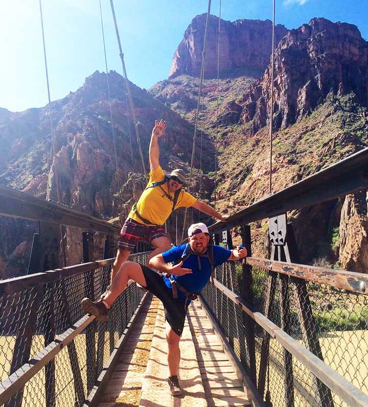
Group shot whilst crossing the bridge

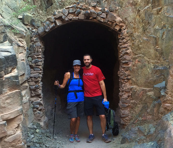
Tunnel crossing – Todd pictured here

View of the bridge

Back on the trail we went

Refreshing lemonade at Phantom Ranch

Speaking of Ranch, here’s the man who packed a bottle of it!

Luckily for us, the pipes were working.
Mama Tia filling up on water before heading out again
Taking a break in the shade along the trail (Bryce, Tia, Kyle)

One of many river crossings

Arrival at Ribbon Falls

Rustin savoring every drop of his Diet Dr. Pepper which he’d lugged into the canyon

On the trail again, just can’t wait to get on the trail again.
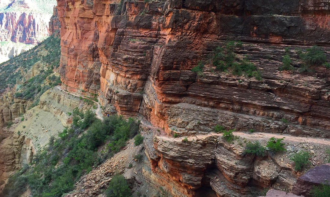
A few pictures from the upward climb. You can see the trail about halfway up the hillside.

And another shot of the trail looking back down.
North Rim Lodge as seen on Saturday morning, the day after our hike

Our shuttle van for the 4.5-hour trip from North Rim to South Rim

Arrival back at the ILX which had been parked at Maswick Lodge
Lunch spot in historic Williams, Arizona

Finally, a shout-out to one of my most loyal readers, Conor, who sent me a Hot Wheels NSX to match the real deal!

Thanks buddy!

June 2, 2015 at 8:06 am
Tyson,
Truly an amazing journey… well done!
I recall wanting to do this hike about 10 years ago with my oldest friend, naturally he chickened out. Maybe he knew something I didn’t?
The trip of a lifetime, one you’ ll always remember.
Thanks for sharing…
June 2, 2015 at 9:25 am
Hy, it’s the adventure of a lifetime. We are so lucky to have such an awesome landmark just a few hours away here in Arizona. Knowing what I know now about the level of intensity, I might recommend doing the hike in cooler weather but otherwise I couldn’t have asked for a better outcome. Thanks for reading!
June 2, 2015 at 11:27 am
Seriously? Who would subject fellow friends and loved ones to this hike? 🙂 I know it’s tough, and when I finished it the first time, I pronounced it as the most difficult thing I had done physically in my life. It makes a marathon seem like a walk in the park. But honestly, it will be a time and place that you will return to again and again in your mind; ye shan’t forget Rim2Rim2015.
Thanks for saddling up and bringing your buddies. I say we plan an annual hike for the same group. Let’s explore our beautiful world! Maybe another one of the 7 Wonders of the World has our name on it?
June 2, 2015 at 11:28 am
Sounds good. Here are the options:
Mount Everest in Nepal.
Victoria Falls in Zambia/Zimbabwe.
Grand Canyon in Arizona, USA.
Great Barrier Reef in Australia.
Northern Lights.
Paricutin volcano in Mexico.
Harbor of Rio de Janeiro, Brazil.
June 2, 2015 at 2:56 pm
Let’s start with Everest, then. 🙂
June 2, 2015 at 2:35 pm
What an amazing view! I’ve always wanted to hike the Grand Canyon but it’ll happen eventually.
June 2, 2015 at 2:38 pm
It’s definitely a “once in a lifetime” type thing. I have done plenty of hiking but never anything that was quite at this level. I would highly recommend it! Thanks again for reading.
June 2, 2015 at 3:39 pm
Woohoo! So proud of you for joining the ranks of those who have done R2R… the HARDER way!
June 2, 2015 at 3:40 pm
Thanks Jod for being our inspiration for the route 🙂
June 2, 2015 at 3:48 pm
I can do a 26 mile hike with you Tyson. Anytime you come down to Miami, you let me know ok 🙂 🙂 I think a Miami hike will be just a little easier than your Grand Canyon hike. 😉
June 2, 2015 at 3:55 pm
Haha, game on! Find me a good hill to climb please. And make sure there’s a pool or hot tub at the end. Thanks 😉
June 2, 2015 at 4:19 pm
Miami has no hills. It will be a 0.0 elevation rise. I think you can manage it. 😉 But it is all relative. Many many people who have heart problems cannot even walk around the block without becoming exhausted. I can walk 5 kilometers in less than an hour without feeling tired. Every time I finish such a walk, I feel very fortunate. You are in great shape in order to do what you did in the Grand Canyon. You and your mom should consider the Hawaii Ironman competition. 2.4 mile swim, 112 mile bike ride, and 26 mile marathon all in one day, back to back. You start at 7:00am and have 17 hours until midnight to complete it.
June 2, 2015 at 4:40 pm
Ironman in Hawaii? THAT, Carlos, is the epitome of endurance! I am considering a half Ironman, however….. (wink).
June 3, 2015 at 6:17 pm
There is a hill in Miami- the bridge to Key Biscayne 🙂
A cycling friend of mine has done the Ironman Hawaii
June 2, 2015 at 7:32 pm
First of all – absolutely stunningly amazing! Second – just when you’re feeling all alone, at least you had some “fat chipmunks” to keep you company. Lastly – on a scale of 0 to Natures Valley Granola Bar, how much of your life was falling apart? 😉
Epic adventure! There were some parts that had me on the edge of my chair.
June 2, 2015 at 7:57 pm
Haha seriously. I found out the chipmunks wouldn’t eat raisins but they’d go crazy for peanuts. Oh man, that Nature’s Valley bar was obliterated inside my pack, but every crumb was delicious. My life is about a 3, not falling apart too badly. Lol
June 3, 2015 at 12:25 pm
You and your group are brave! When I saw that big gash in the ground last August, I stayed up top for the obligatory views and photos. Didn’t even break a sweat! 😉
June 3, 2015 at 12:37 pm
Ha! Hope you packed enough water for your strenuous Grand Canyon viewing from the edge! Next time you get out here I’m dragging you out for some sort of extreme backcountry shiz.
June 3, 2015 at 3:59 pm
That video really drove home the immensity of this undertaking. Kudos to you all!!
June 3, 2015 at 4:57 pm
Thanks, Mark! My friend Kyle (who was also on the hike) commented on the video: “You sure made use of your alone time, didn’t you?” Haha, I guess I did. Had to find a way to keep my mind off the task at hand. On to the next adventure I guess. Heading out tomorrow on that 5-day road trip with my dad. The open road awaits.
June 3, 2015 at 6:19 pm
Would love to do that Grand Canyon hike. Maybe some day. Awesome write up Tyson.
June 3, 2015 at 6:24 pm
Thanks Marc! Gotta take advantage of this great rugged terrain in my backyard out here. It’s just a good thing we did the hike in May as opposed to July / August. Heat stroke would for sure happen, haha.
June 4, 2015 at 9:08 pm
This was the most descriptive account of this grueling hike I have ever read. I felt the heat on my back, the sweat on my brow, the pain in my legs, and the threat of failure. Well done, Tyson!
June 4, 2015 at 9:34 pm
I’m glad we could take you along for the ride (hike) virtually, Doce! Thanks for being a part of it! Love ya!
June 9, 2015 at 6:23 pm
I’d pack you through that canyon on my back if I could, mom!
June 8, 2015 at 10:22 am
This certainly looks like it qualifies as painfully awesome! Fantastic scenery and quality time with family and friends are bonuses on top of an amazing accomplishment. Thanks for taking us along!
June 8, 2015 at 6:16 pm
Thanks Dave! Glad you enjoyed coming along for the hike. One of these days I will get ambitious and hop on a bike for an adventure like the ones that you’ve been having. Pedal on!
June 9, 2015 at 9:25 am
Mountain biking is a lot like hiking, except more adrenaline and a little less rose smelling.