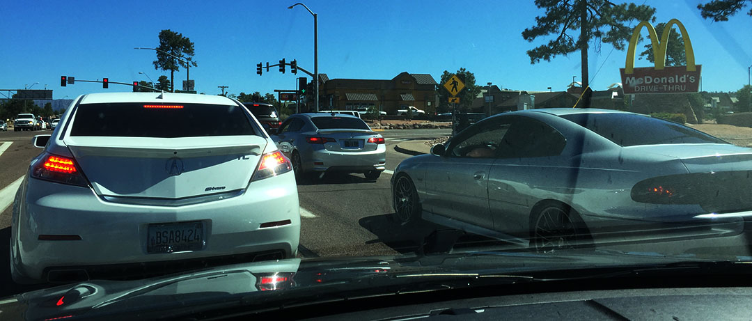
I fell in love with Alberta, Canada this past weekend. The scenery, the food, and more than anything else, the overwhelming hospitality of the people there really swept me off my feet. I was able to spend 4 days and 3 nights exploring the area – an idea hatched back in April that would give me the chance to reconnect with a long-time friend who lived in the area as well as see some of Canada’s most breathtaking features of the Rocky Mountains.
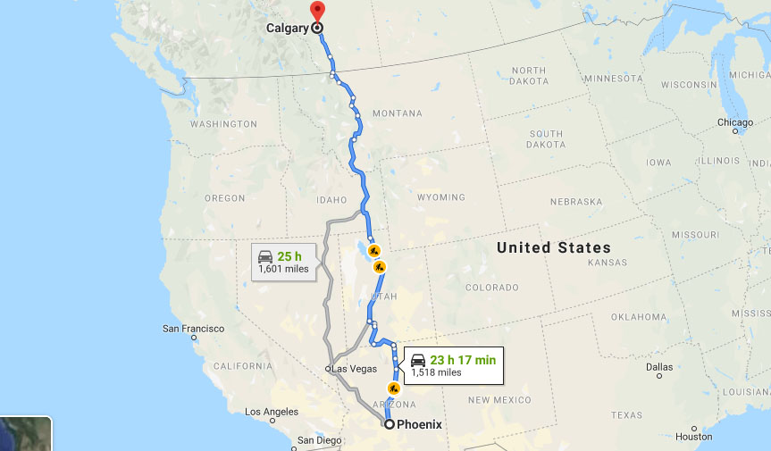
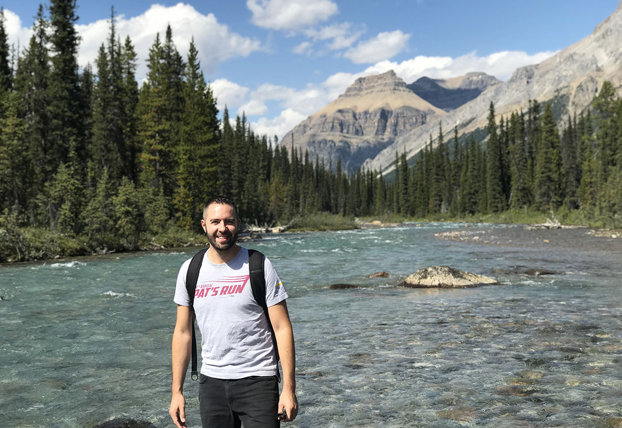
From the moment I landed in Calgary after my flight from Phoenix on Thursday afternoon, I was whisked away by Jeff and Lucas to Banff National Park about 90 minutes to the west. While I snacked on snacks in the backseat of Jeff’s Mazda 3, I got a chance to learn a little about the area and enjoy the scenery along the way. After entering the park, we made our way to a trailhead at Hector Lake.
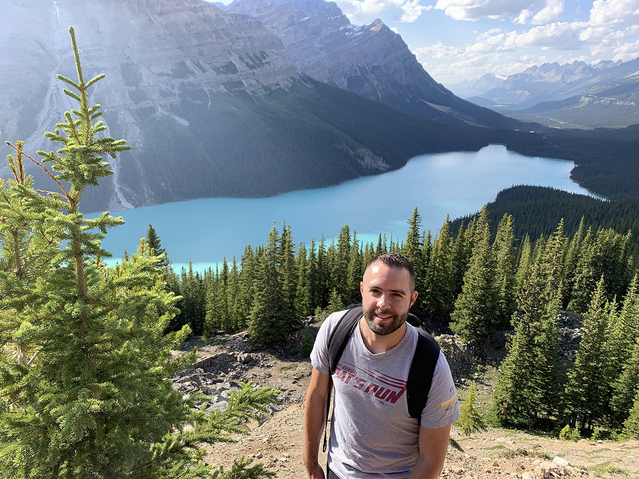
The 40-minute hike required us to cross the a river multiple times, but I didn’t mind getting my sneakers wet because I felt like I was living in a postcard-perfect landscape. We also made a stop at Peyto Lake, with its characteristic turquoise blue water and an upstream glacier.
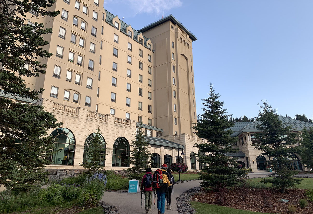
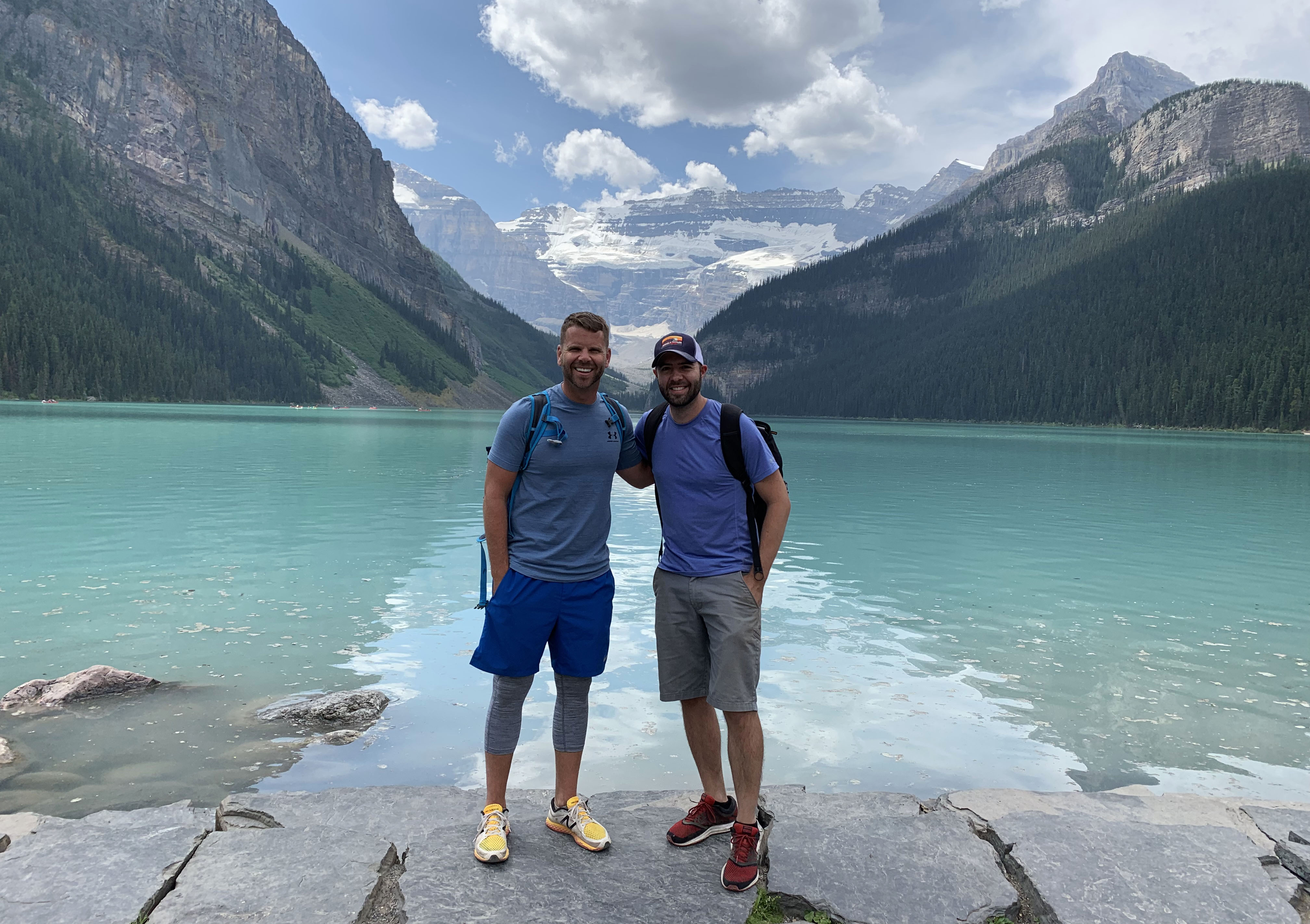
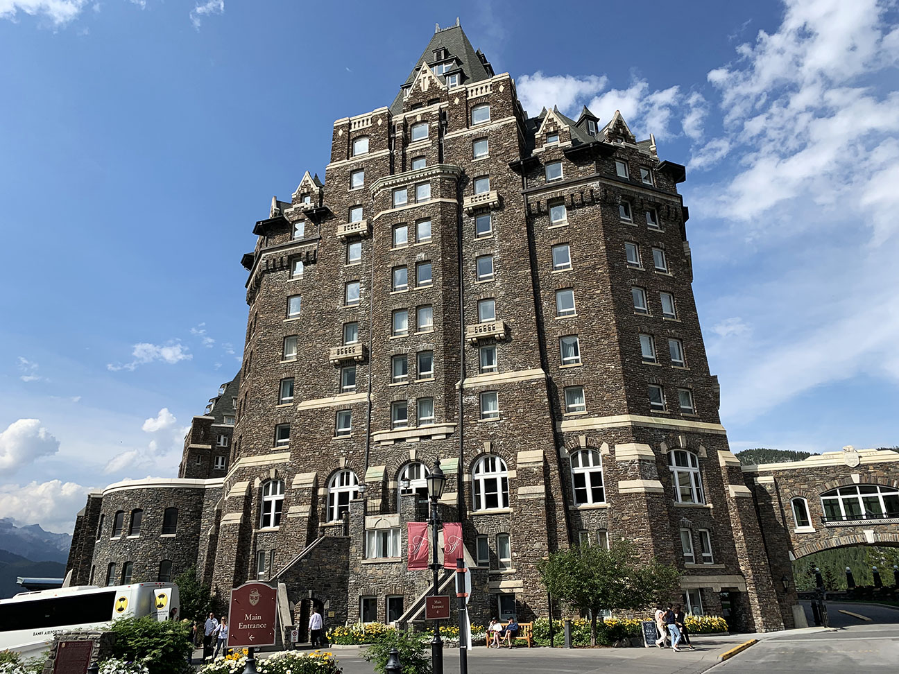
My wake-up call in Calgary at Jeff’s place on Friday came as the clock struck 4:30 a.m., which was 3:30 a.m. my time. I was a bit of a zombie as we made our way back to Banff, but when we parked at Lake Louise, my eyes lit up with the scenery: The 127-year old “Chateau” hotel overlooks what has to be one of the most gorgeous natural wonders in the world. We were surrounded by 360-degrees of pure perfection.
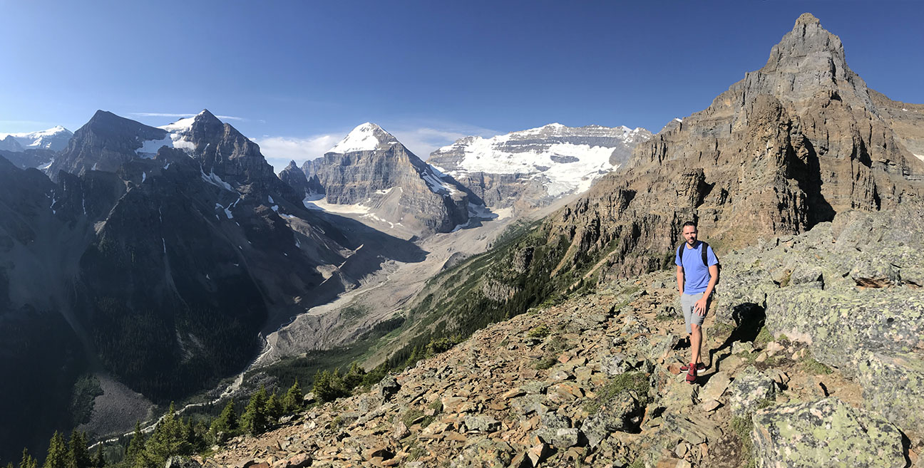
Luckily, my shoes had dried out overnight because they were about to get some pretty hardcore miles put on them. We took the trailhead alongside the lake that started an immediate ascent – initially a moderate grade with pavement, then gravel, then becoming eventually a narrower pathway that zig-zagged its way up the mountainside.
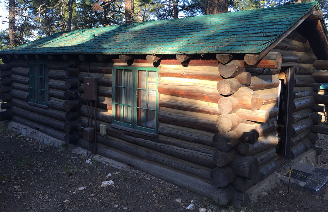
Our destination was the Devil’s Thumb – a scenic lookout point about 3,000 vertical feet above the lake itself. One waypoint along the path was the Lake Agnes “tea house” – a log cabin structure where they serve food and drink provisions. From the tea house, the level of technicality grew and at some points of the hike, I scrambled on all fours to get traction and work my way up the mountainside. The panoramic view from the top of Devil’s Thumb was 100% worth it!
We hadn’t yet burned all our energy or daylight by the time we returned back to ground level, but we recharged our batteries a bit by enjoying the view from lounge chairs before hitting up another short hike, to Silverton Falls. Jeff introduced me to the town of Banff itself – crawling with tourists like me. Of all the dining options, Mexican food sounded best to me so we stopped in at a saloon-themed place called Magpie and split a delicious pulled pork enchilada with some chips, salsa, and guacamole on the side.
The rest of the weekend was spent right in Calgary, where the sun didn’t peek out from behind the clouds on either Saturday or Sunday, but that was perfectly fine with me – I enjoyed the temperatures and the light drizzle. In perfect fate, there was a “Taste of Calgary” culinary event taking place in the Eau Claire part of town so we took advantage of the chance to indulge. The buffalo chicken poutine was to die for.
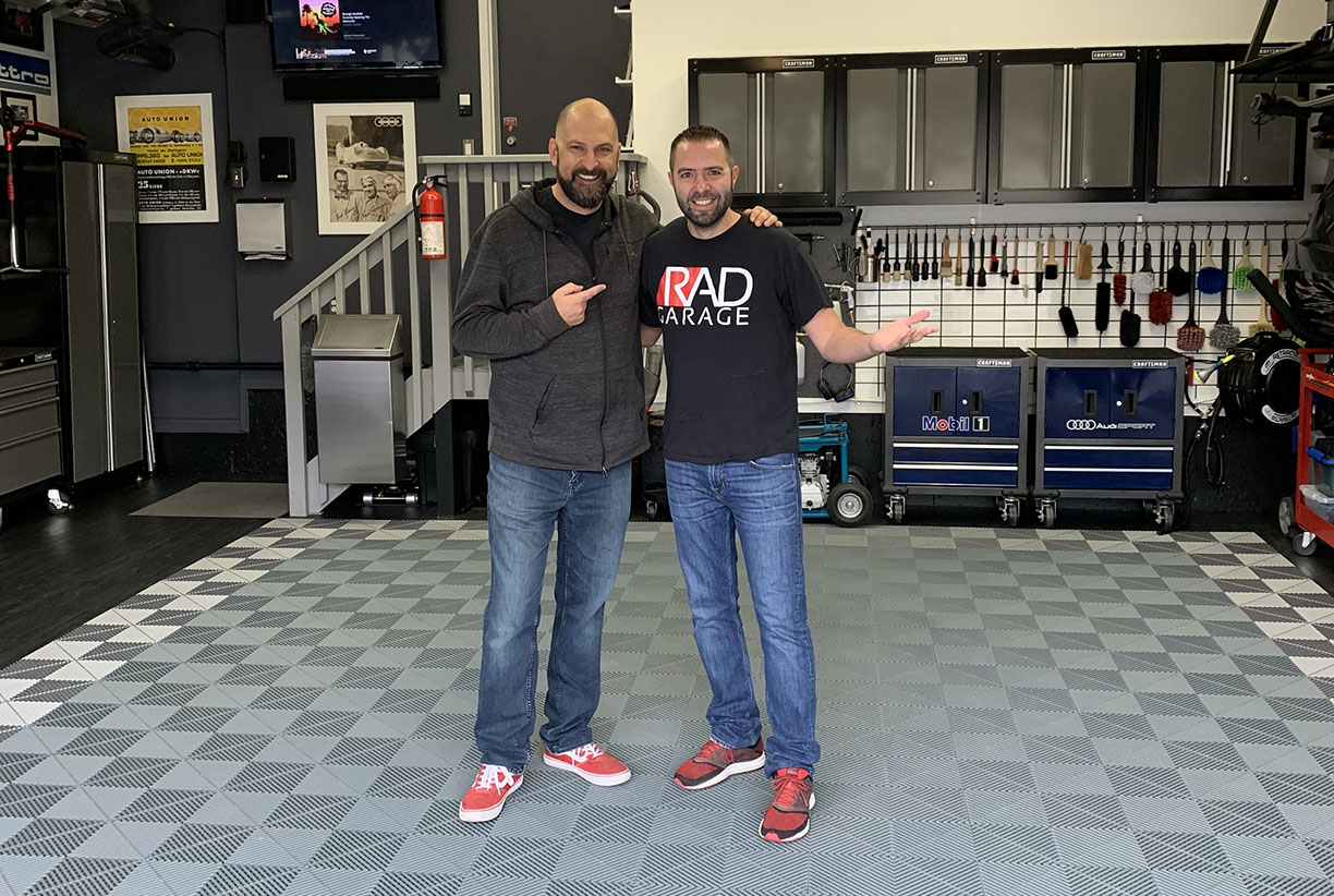
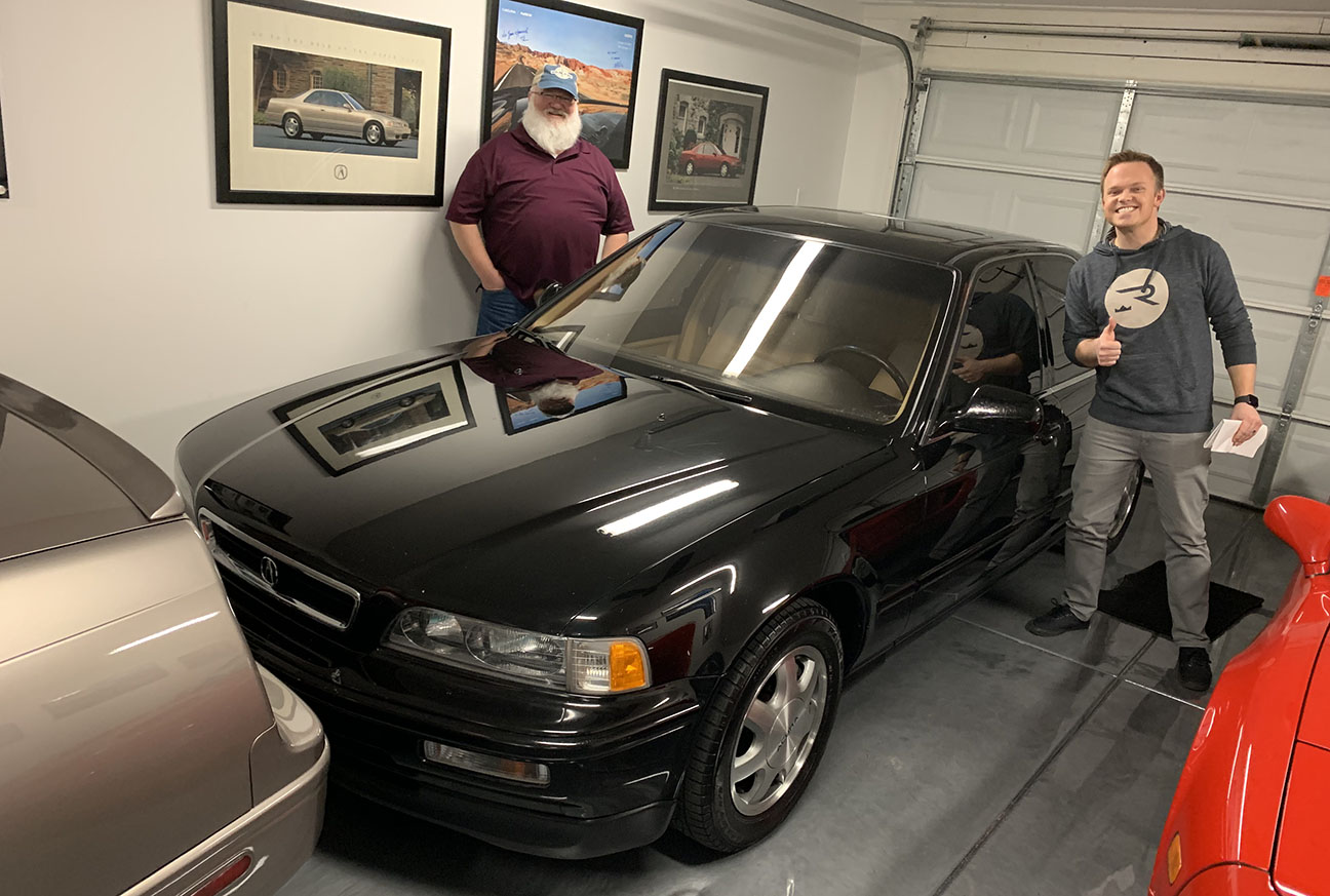
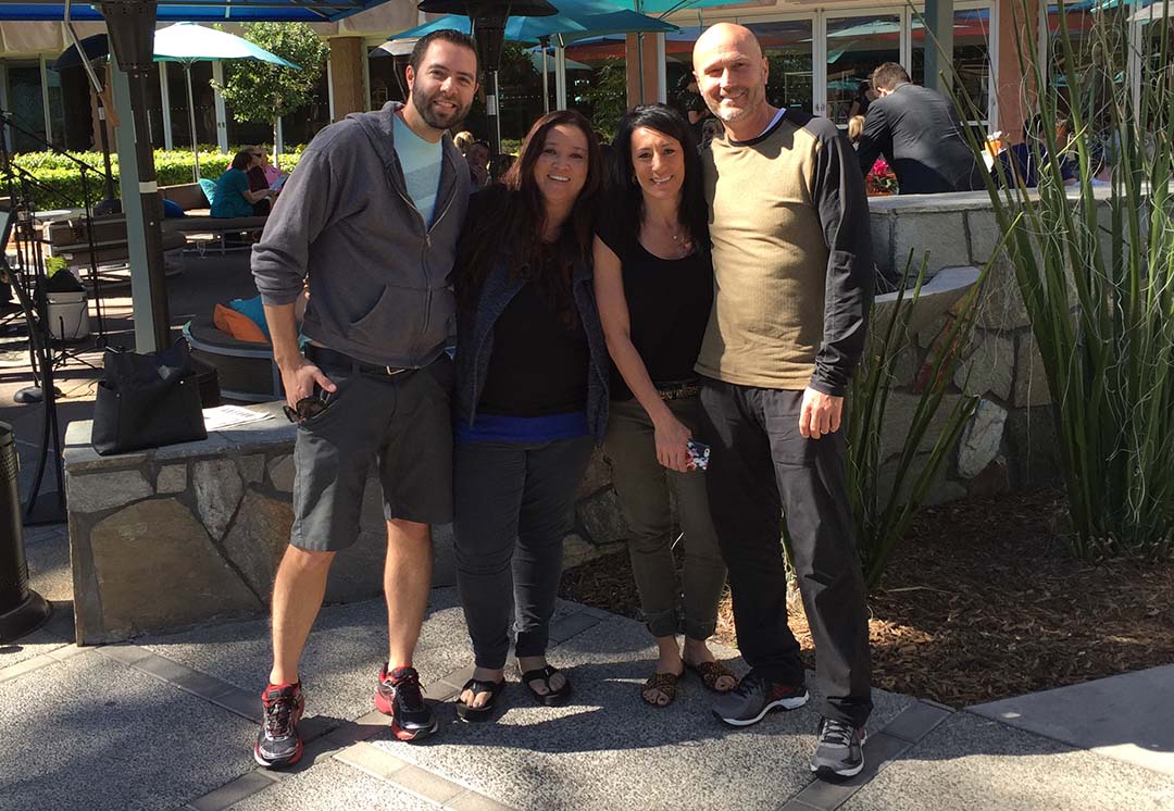
Capping off an already-incredible weekend was the chance to shake hands with someone who I’ve idolized from the automotive community for a few years now: Rick from RAD Garage. Rick’s detailing “theatre” made from his 2-car garage in suburban Calgary is a place of dreams for anyone who takes pride in maintaining the condition of his or her vehicle. What started 9 years ago with the installation of a tool chest and the hanging of a few photos has transformed the space into a comprehensive mecca of detailing paradise. Every product, every brush, every solution for every type of detailing challenge resides there.
An Adams product for every need – and then some. My favorites were the Cars & Coffee, and the Pumpkin Spice spray.
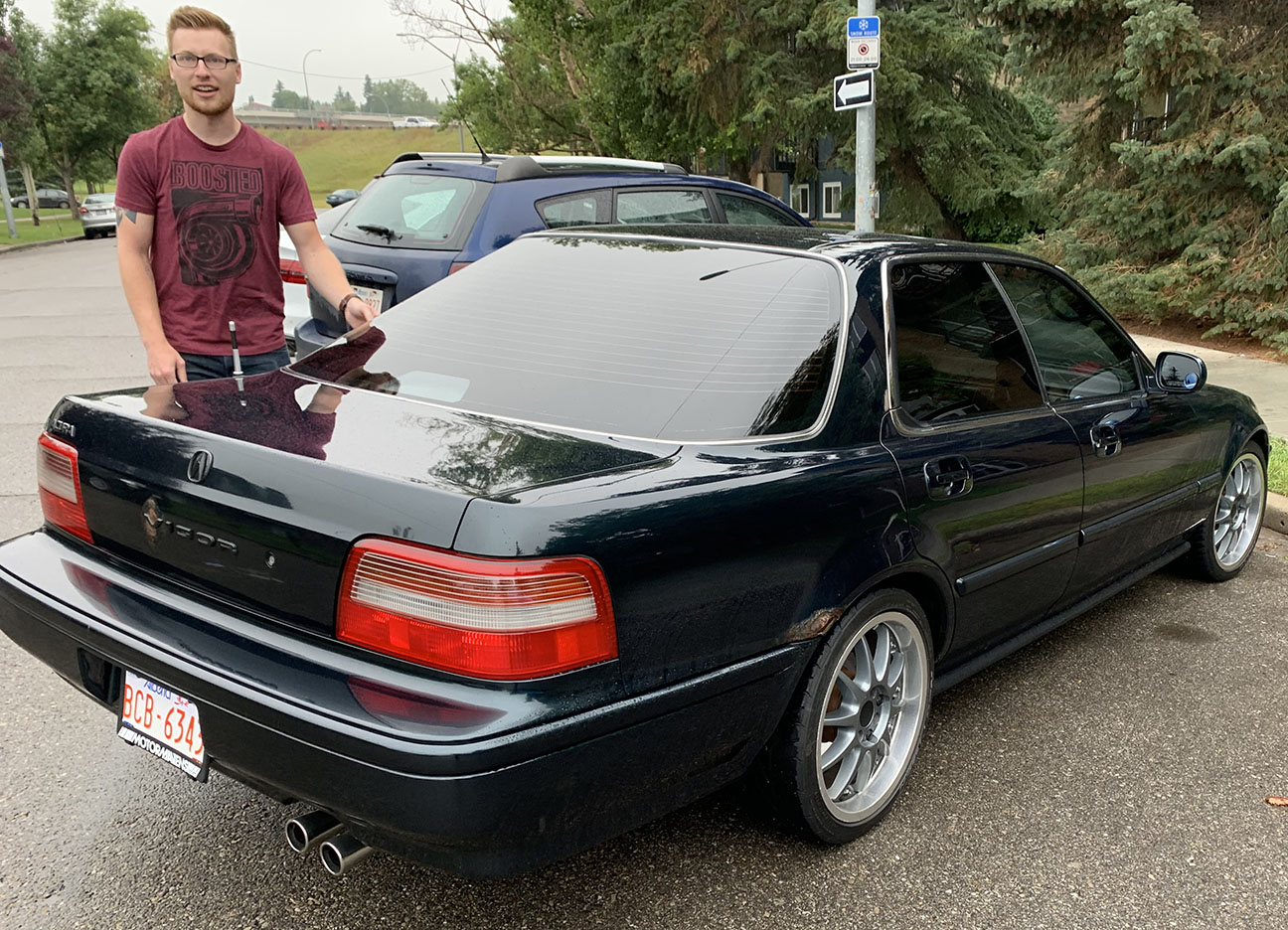
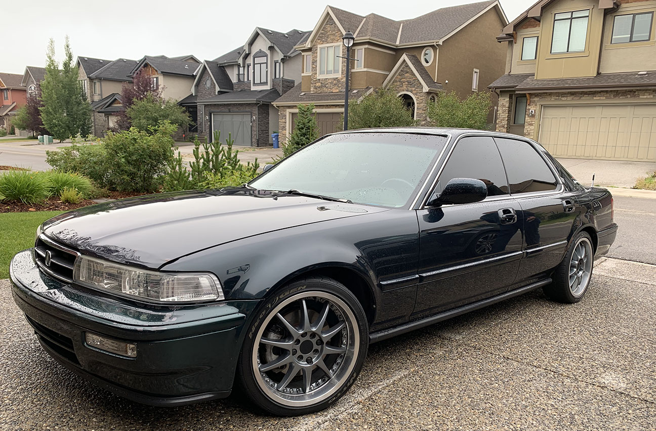
My friend Zach was kind enough to shuttle me to Rick’s place in his 272,000-kilometer 1994 Acura Vigor GS – I felt right at home from the passenger seat.
Canadian-spec cars got heated seats, heated mirrors, and a trunk ski pass-through as standard equipment!
Rick and I had the chance to share a bit of Q&A for our respective channels and I enjoyed picking his brain a little about how his garage had evolved over the years. Here is the video that he put together:
And here’s my version:
I enjoyed a phenomenal couple of days with the people and places of Canada. It was enough to make me not want to come home – or at least to start thinking about making another epic road trip to our northern neighbors from behind the wheel. Maybe I’ll be able to set something up soon.
Arriving Hector Lake
Peyto Lake
View looking upward to the canyon above Peyto Lake
Agnes Lake
Jeff showing the way as we ascended toward Devil’s Thumb
A friend pulled up my location on “Find My Friends,” and sent me a screen shot.
Making the descent
Lake Louise in the background
Fairmont Banff Springs hotel in Banff
Walking tour of Calgary with Jeff
Know what that is? The elusive Acura 1.7 EL! We didn’t get those in the States.
Riding to Rick’s in Zach’s Vigor
I loved the foam drawer liners in the toolboxes at Rick’s – custom fit for each tool present.
Overview of Rick’s garage
Zach’s Vigor
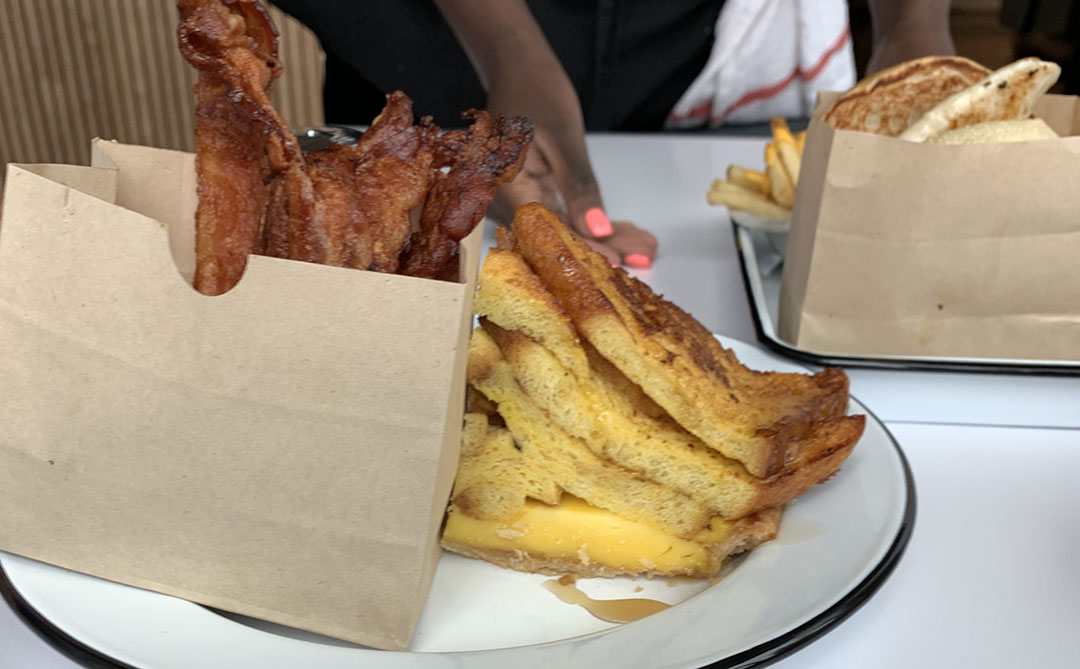
“French Toast Pie” (and a bag of bacon) for breakfast at Chix in the East Village of Calgary
Calgary Public Library internal architecture. Amazing innovation!
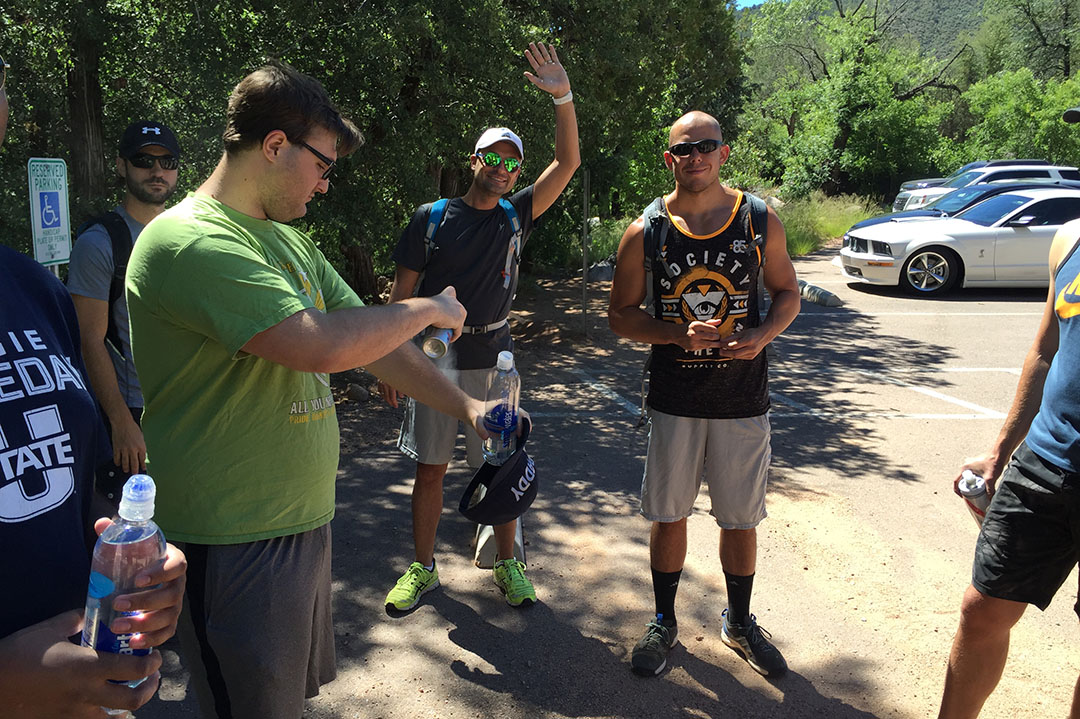
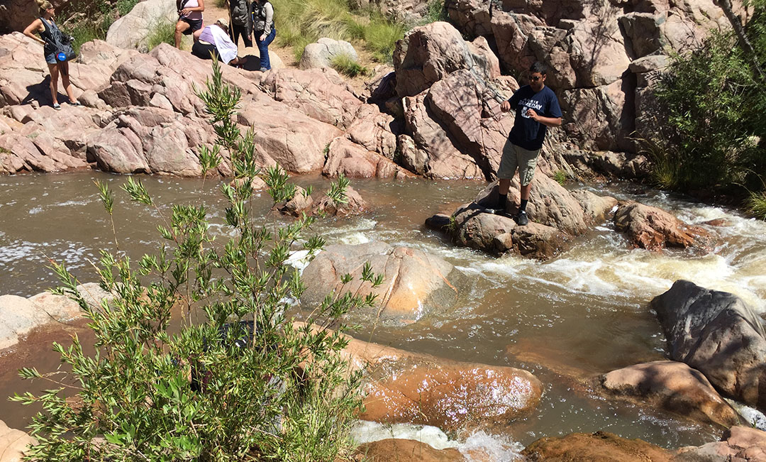
Mom was a victim of her first cactus attack this weekend. The cholla, or “jumping,” cactus is famous for its ability to seemingly jump out and cling to passersby. Worse, it’s tough to pull out and only wants to latch on to anything (or anyone) that attempts to remove it. The solution? Just ask Chris, the seasoned hiker who joined us for this excursion. He whipped out a hair comb which was able to extract the needles safely without putting anyone at risk. Clever survival tips for the desert southwest.
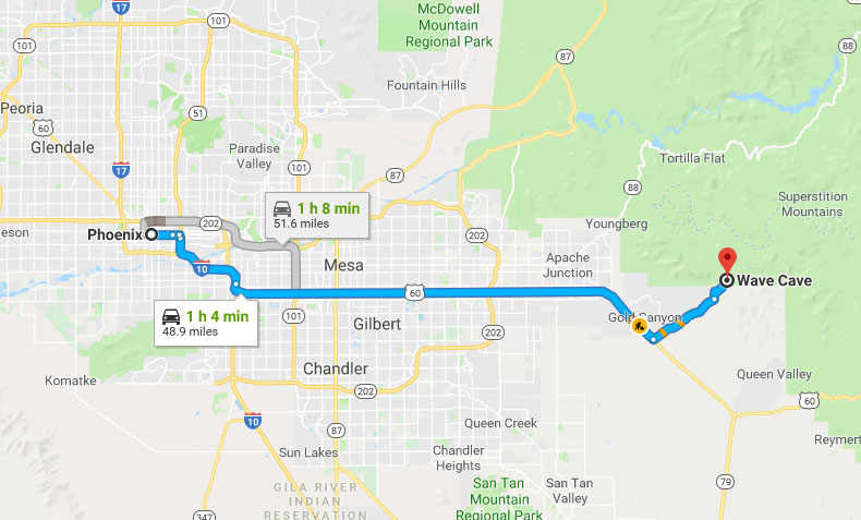
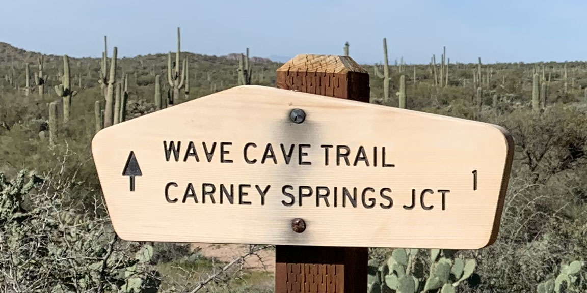
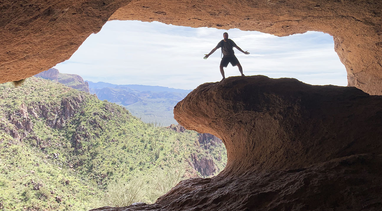
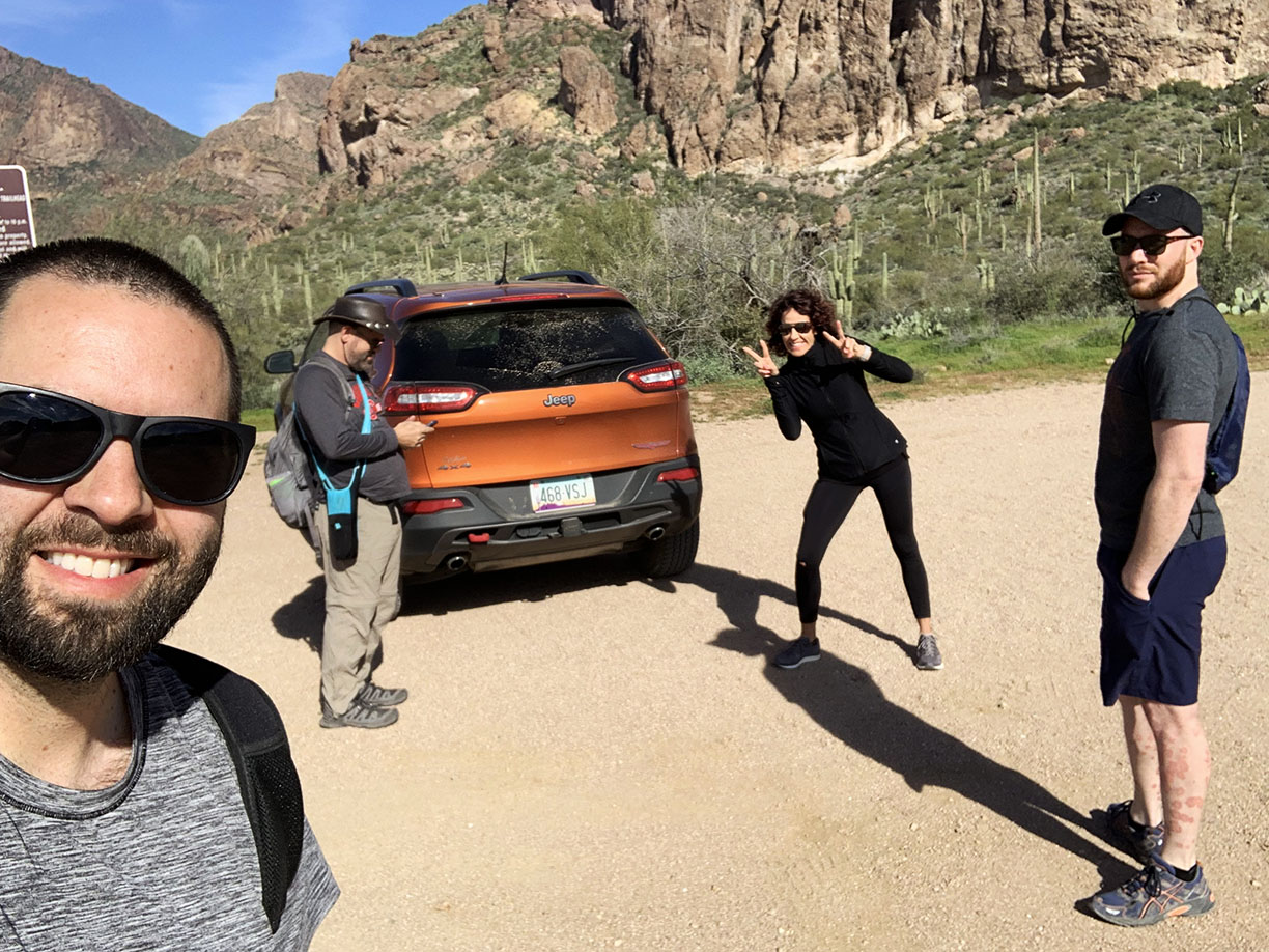
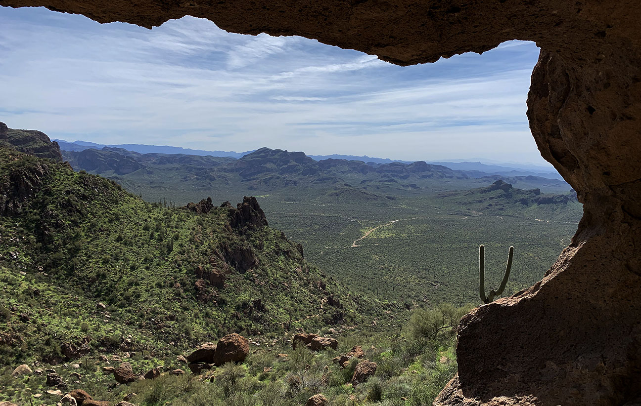
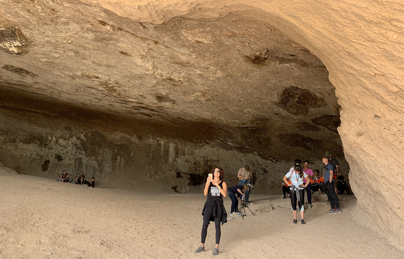
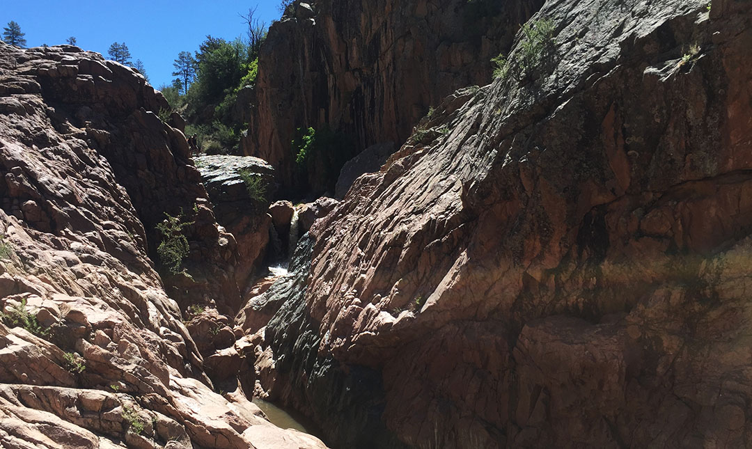
All of this came about from our decision to hike to one of the Superstition mountain range’s most unique geologic features: A sandstone rock in the shape of a large wave. See me surfing up there? The cave’s remoteness and difficulty have kept some hikers away, but we tackled the 4-miler with confidence and enjoyed basking in some of Arizona’s prime spring weather for a few hours on Saturday morning.
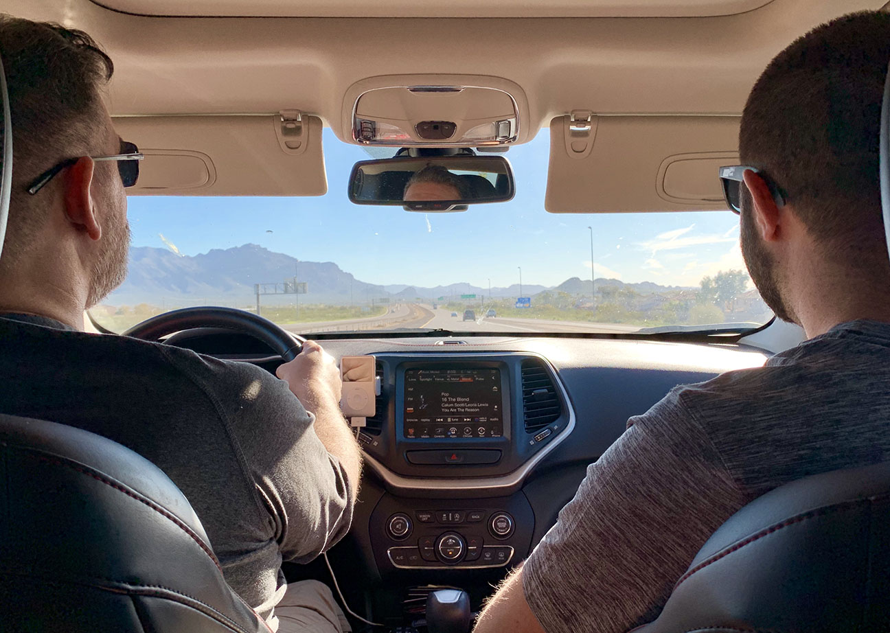
Reaching the Peralta Trailhead took us about an hour from Central Phoenix and while I would have been perfectly fine subjecting my ILX, or the SLX, to a few miles dirt, we decided to takes Chris’ Jeep Cherokee. Our first stop was the drive-thru at Starbucks. You can’t go out into the wilderness unprepared, after all. Frappaccinos in hand, we were ready to conquer nature.
The trail itself seemed to intensify in difficulty as we worked our way up the 800 or so feet in elevation. Though the cave itself was visible from the trailhead, it required scrambling up a few stretches of jagged rocks flanked by prickly cacti – definitely the type of environment where adequate and stable footing is a necessity. I took a spill just once and scraped up my right hand thanks to loose gravel.
The view was worth it. From the interior of the cave itself, we were able to gaze across the landscape for many miles in the distance. With temperatures in the high 60s and a light breeze, conditions were optimal to hang out and enjoy the scenery before beginning our descent. Round-trip travel time was about 3 hours, and we rewarded ourselves for a job well done by having lunch at Costa Vida.
Here are a few more pics before I get into this week’s round of automotive news & updates here in Acura Land.
We pulled my low-miler out of the garage for commute duty during mom’s visit.
I also received a drop-in from my friend Mike from San Diego, who was riding in style in his friend’s Challenger.
My buddy Mirel scored a new car: Check out his white 1994 LS 6-speed coupe.
On Saturday, we were ‘seeing red’ with all these reds (called Milano, Formula, and Torino) while my friend Sunny was in town from Salt Lake City in his TSX Special Edition.
Another fun Acura-sition took place over the weekend, and I was able to help make it happen. My friend Jason “re” purchased a 1991 LS sedan that he owned a couple of years ago. It only has 48,000 miles on the odometer thanks to spending its first 10 years tucked away in hiding. You see, this car was stolen when it was brand new on the dealership floor and recovered much, much later.
I helped out by having a couple of maintenance items done before Jason & his dad flew down to pick it up.
My friend Jimmy stopped by the dealership while I was there.
Jason & his dad were happy campers when they arrived to take delivery.
Jason sent these pics while passing through my mom’s city where she met up with the new RLX.
It’s interesting to see how these vehicles, 25 model years apart, are different in some ways and similar in others.
Speaking of throwbacks, mom lined up the RLX in the same place as her old 2000 3.5 RL which she owned 14 years prior.
Picturesque Snow Canyon, Utah
The last bit of news here relates to a fun project I was able to collaborate on with Acura. A small film crew flew out last week to spend a day with me doing a sort of documentary on my car collection and some favorite road trip stories. After shuttling all 8 cars to a nearby parking lot, we took 3 of them out on an 80-mile scenic loop through the Bush Highway past Saguaro Lake.
I’ll post a blog entry once the film debuts in the coming months, but it will be a short 5-8 minute YouTube feature on Honda’s YouTube channel. Brand Culture Champion Charles Schnieber posted a few photos of our day on Instagram under his handle @kokoro_honda.
Getting interviewed in the hot seat… in my garage.
The production was facilitated by 3 gracious volunteers who assisted with driving – thanks to Chris, A.D., and Woody!
Closing out the night with a fantastic sunset in the Superstition Mountains.
Imagine living in a place so remote that the cold Dr. Pepper you’re about to swig had to come in on a pack mule or be air lifted there by a helicopter. Given the logistic challenges of sustaining a town so remote, I was surprised such a luxury was even available – let alone refrigerated. I even got this one at a discount because the can had been damaged during mule transport.
I’m about to introduce you to a community that has thrived in the heart of northern Arizona for hundreds of years. If you’re lucky, you’ll pick up a hint of 3G cell signal there. But otherwise, the inhabitants of the village of Supai are about as “low-tech” as you can get in the year 2018. (See location in the middle of this Google Maps screen shot).
I’ve lived within a few hours of the Grand Canyon my entire life and only been into the (mile-deep) middle of it one time, three years ago when some friends and I did a crazy, 26-mile, “South Rim to North Rim,” hike. It was time to put the hiking boots back on (or, just my running shoes, in this case) and trek back into one of Arizona’s wonders of the world.
The Havasupai Indian Reservation is surrounded on all sides by the national park, and it’s one of the most difficult to obtain a hiking permit to access. In fact, twice in the past (2008, and then again earlier this year), I’ve had a permit that has been cancelled or re-scheduled due to flooding in the canyon. This time, we crossed fingers that our trip would proceed as planned, and it did – for the most part.
Havasupai is a word that means ‘havasu’ (blue-green waters) and ‘pai’ (people). So the 639 people who live within the 300-square-mile reservation are the people of the blue-green waters. They are governed by a constitution that was signed in 1939 and led by a seven-member tribal council.
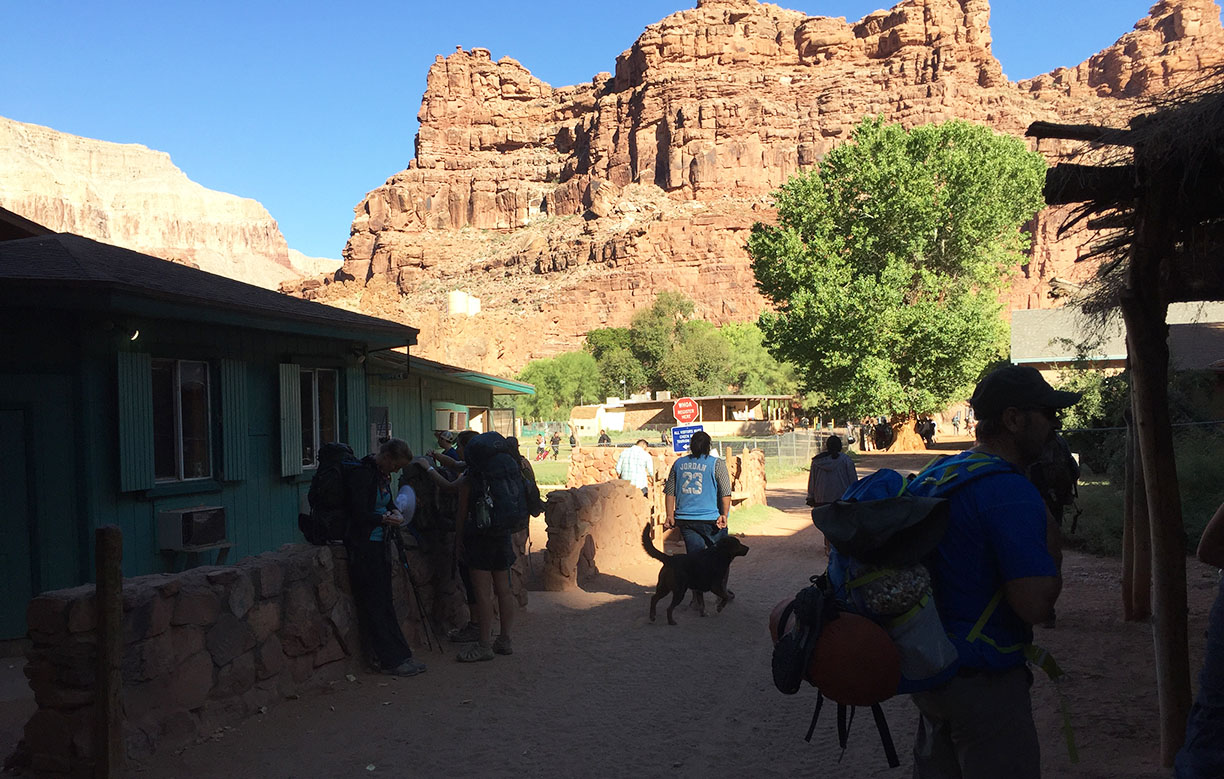
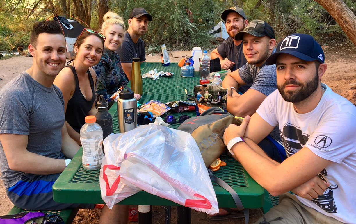
Our party of nine met up at the crack of dawn – actually, a little before it – on Friday morning, September 21. Getting there was a straightforward trek up Highway 89 from Phoenix, through the Route 66 towns of Seligman and Peach Springs, and then about 68 miles on a paved two-laner to the trailhead parking lot.
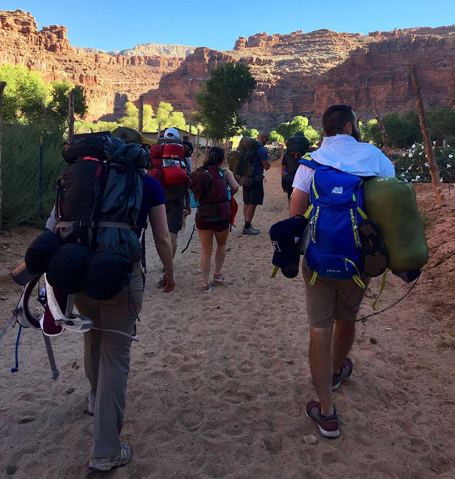
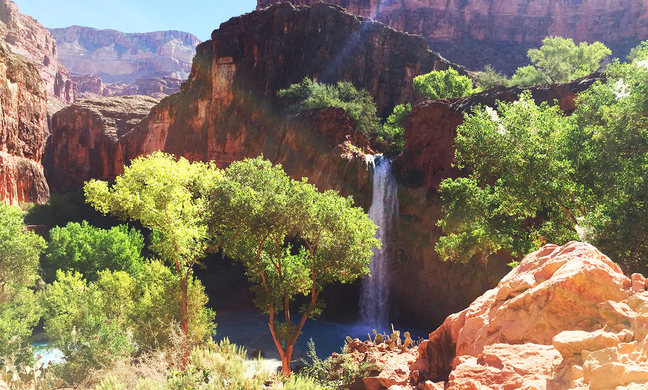
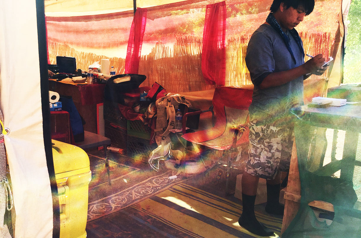
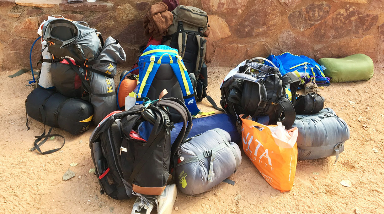
Getting all my gear into a backpack was no small challenge, and I had to carefully prioritize which items were critical for the trek. The 8-mile initial drop into the town of Supai was easy thanks to cool morning temperatures, well-traveled pathways, and primarily downhill grade. Amenities there were impressive: A cafe, general store, schoolhouse, and churches were all all present – staffed by natives and welcoming to the estimated 200 tourists who are camping in the area on any given day.
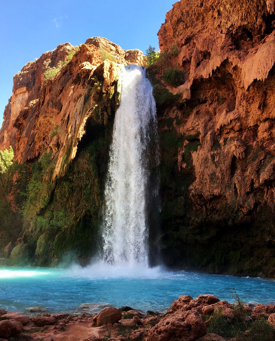
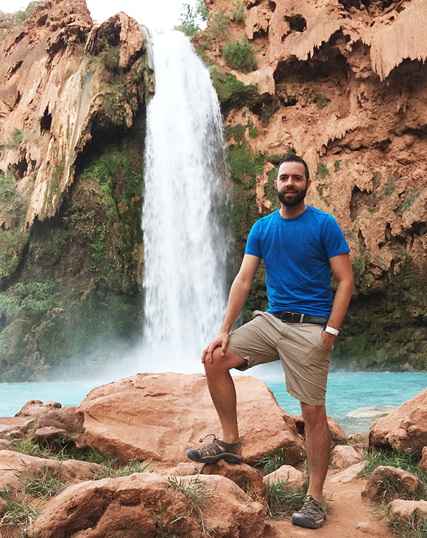
We found the perfect campsite for our party. It was two more miles down the dirt pathway and located right on the verge of Mooney Falls, which sent crystal blue waters cascading about 200 feet to the canyon below. Kyle set up a hammock along the river and that ended up being my favorite place to (literally) hang out. Best of all, we were disconnected entirely at that point from contact with the outside world.
On Saturday, we scaled the cliffside with assistance of chains & ladders to the pools below Mooney Falls. It was an unforgettable experience in conquering a fear of heights. The most unnerving thing about making the descent was the fact that over time, the rocks & ladders had worn smooth so grip was limited. Besides that, the waterfall’s mist kept all footholds nice and slippery with water. Yikes.
We enjoyed the sights & sounds of Mooney Falls for a couple of hours before making our ascent to camp again. That afternoon’s highlight was getting a taste of some of the natives’ frybread. A $12 taco with beans, cheese, and tomatoes was the ultimate afternoon snack and worth every penny to someone who was sick of eating dehydrated meals from tinfoil bags. Jack opted for the ‘dessert’ version, drizzled in Nutella and caramel. In fact, he had two, and made me promise not to tell anyone. Sorry Jack!
Campfires are explicitly outlawed in the Havasupai region, so we told nighttime stores while huddled around the picnic table before calling it a night.
Already a little sore from two days of trudging around in the sand & water, I wasn’t feeling too keen on a roughly 10-mile (uphill) return hike to the parking lot on Sunday morning, so 3 from our party elected to take a helicopter from Supai instead. It was my first time riding in a helicopter, and I was glad that I did. The one-way fare for a 7-minute flight was $85 and because of limited seating (only room for 6) and a high volume of people leaving the canyon that day, it took about 4 hours until we actually got onboard. The views were spectacular.
By the time we got back to our vehicles, the members of our group who’d opted to hike out had already beat us there and left the area. I played catch-up in my ILX and reunited with Kyle, Jack, and Justin at Roadkill Cafe in Seligman before continuing the rest of the way into Phoenix.
The next time I crack open a Dr. Pepper, I’ll remember this trip with fond thoughts of sand in my shoes and a babbling brook underneath me in a hammock. Here is a video and a few more photos from our adventure!
Hiking in
Group photo courtesy of mom’s selfie stick
Checking in at the Tourist Office, where we were issued wristbands with our group name & trip dates
Imagine how simple life must have been 700 years ago. Yesterday, I walked in the literal footsteps of the Mogollon (pronounced moga-yon) people – a band of indigenous tribes who lived off the land through subsistence farming during that era, and who left behind a glimpse of what their lives consisted of. Being without cell signal for 5 hours gave me but a very small taste of what it would have been like to be more in tune with nature. And I liked it.
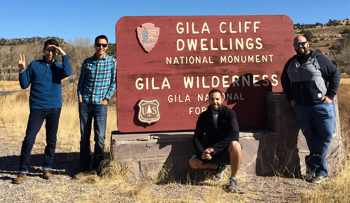
The southwestern United States is home to some of the best-preserved historic ruins thanks to predictable weather patterns and remote geography. Almost exactly 110 years ago, President Theodore Roosevelt set aside about 530 acres in southwestern New Mexico as part of a national monument that today resides about 40 miles north of the town of Silver City. For us Arizonans, that makes it a pretty accessible overnight road trip destination. And this weekend, per suggestion of (and in partnership with) Driven for Drives‘ Jason Pawela, I checked it off my list.
I broke free from the Phoenix urban grid a little after 3:00 p.m. on Friday to make my eastward trip toward the New Mexico state line. As was to be expected, I had to fight my way out on I-10 in commuter traffic but eventually was able to set the cruise on my Integra at 75 miles per hour. I made just one stop, at Love’s in Benson, for fuel and a stretch of the legs. The final 50 or so miles from I-10 at Lordsburg into Silver City were lonely and even a little creepy. My ‘Christmas tree’ of dash lights (ABS, check engine, high beams, and cruise) were the only lights I saw aside from vivid constellations under the night sky – highly visible thanks to the area’s lack of light pollution.
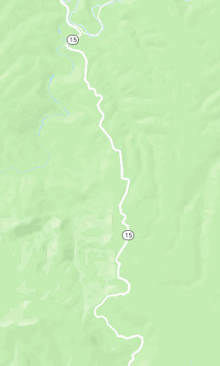
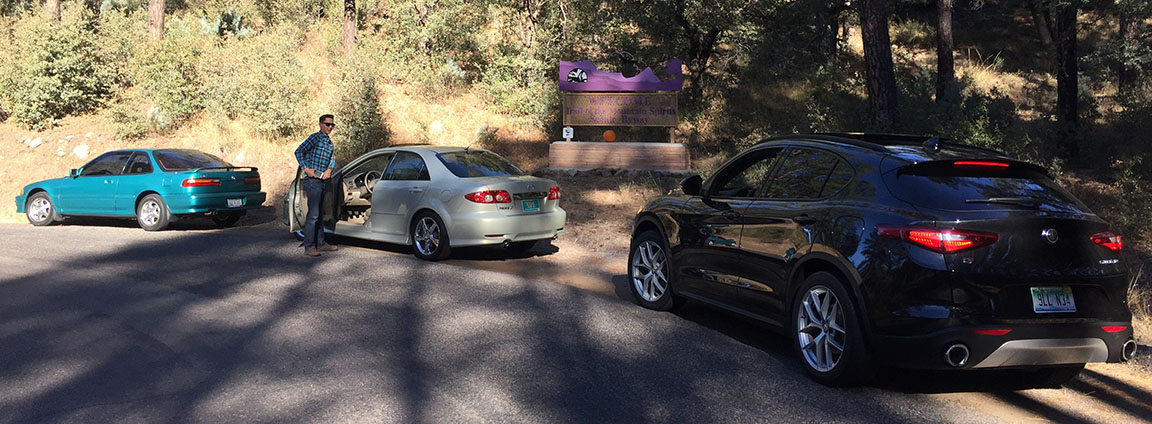
Saturday morning brought us crisp 45 degree temperatures and blue skies. I met up with Jason, James L, and James Z for a hearty Comfort Inn breakfast (complete with green chili on the side – total New Mexico thing!) and then we rallied our participants for this weekend’s drive: 2018 Alfa Romeo Stelvio, 2004 Mazda 6, and 1992 Acura Integra. It took only a few minutes to lose cell service as we headed north on twisty Highway 15. For only a 2-liter motor, the Alfa’s 280-horsepower 4-cylinder motor develops oodles of power and James was right on my tail. I swapped keys with Jason for a few miles and was impressed at how smoothly his (‘new‘) Mazda 6 handles given its 180k+ miles.
It’s a good thing I was a driver, because I wouldn’t have lasted 5 minutes as a passenger with these curves. For about half that stretch, the road was narrow, with blind corners and no painted center line. NM DOT basically says “Good luck!” and to allow for plenty of travel time (they said 2 hours) between Silver City and the ruins.
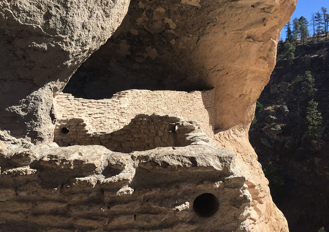
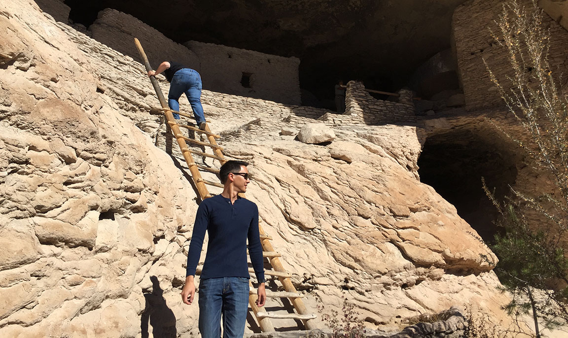
After a brief intro at the Visitor Center which probably looks today about the same as it did in the 1960s, we headed to a parking lot & trailhead 2 miles up the road. The dwellings in the area were believed to have been occupied around the year 1275 and are still remarkably well preserved. The Gila River running nearby was the Mogollon peoples’ source of life. By 1874 when explorer Henry Weatherbee Henshaw discovered and wrote about the ruins, some parts of them had been damaged. But ever since President Roosevelt’s decision to make it a national monument, the preservation has been vigilant – we weren’t even allowed to take liquids other than water on the hike, and we were asked not to touch any of the walls with our hands.
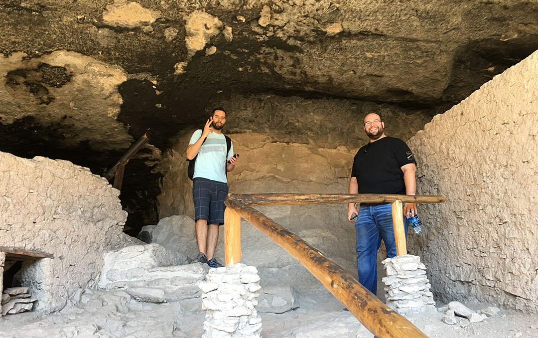
To access them, we had to hike a one mile loop which crosses several footbridges. There was a small brook running underneath them and the sound of waterfalls made it a therapeutic experience. A steep incline further down the trail took us up the cliffside and then we walked through a series of 5 different “rooms,” each one laid out with a unique floor plan. What struck me was the savvy use of space and the distinct feeling of temperature and brightness in each room. The south-facing openings were optimal because they would allow some summer sunshine to enter and heat up the rooms in the winter time, but kept them shaded during the summer when the sun was higher in the sky.
Much of the Mogollon peoples’ lives remains a mystery, and part of our tour consisted of a Q&A session with ranger Connie. Connie took the time to point out a few key features and asked us what we thought they were. They included a grinding stone, pictograph images painted on the walls, and architectural features of the caves. Today, there are wooden step ladders leaning to the various rooms but some of the original infrastructure – including rooftops over some of the rooms – are now gone. It took us about an hour to hike the circle.
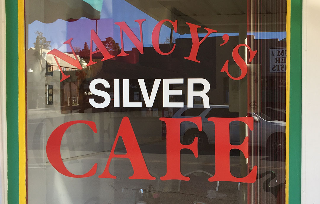
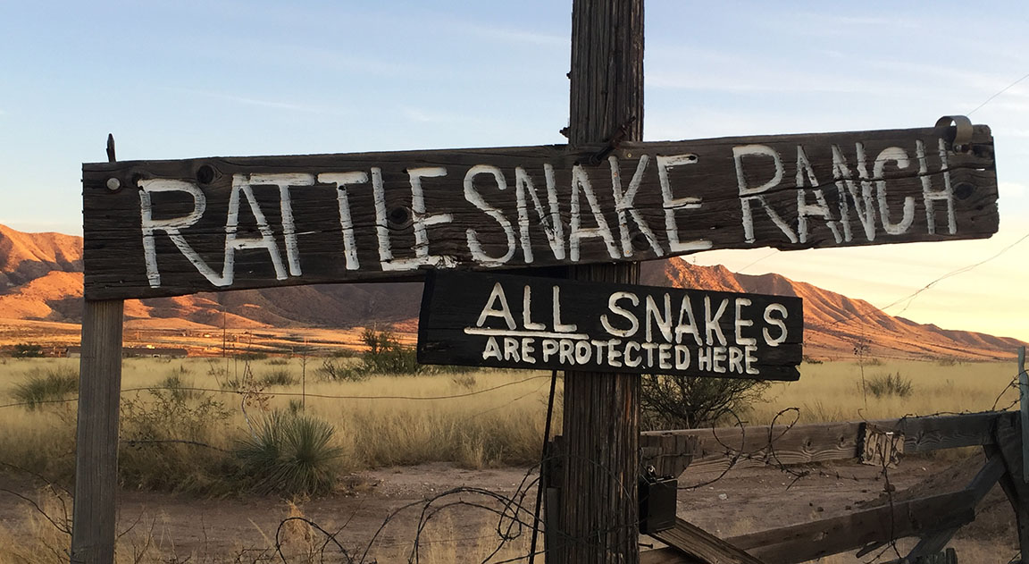
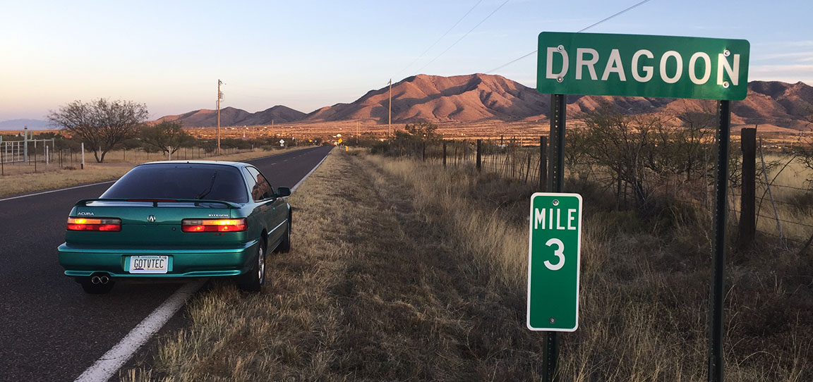
The return trip to Silver City was once again ‘spirited’ in nature, and we made good time thanks to being a little familiar with the terrain by now. Lunch was at Nancy’s Silver Cafe right in historic downtown, where the 3-taco plate was just what the doctor ordered to satisfy those hunger cravings. We parted ways by mid afternoon and I sailed off into the sunset – literally, squinting at it the whole way – returning to Phoenix. I did make just one stop along the way, in a town called Dragoon, perhaps in hopes I’d see a fire-breathing dragon. But I did not. I just saw a sign about some rattlesnakes and some run-down buildings.
Here are the rest of my pics from this trip, as well as a short video. Thanks for coming along!
Getting ready to roll on out.
Welcome to the Trail of the Mountain Scenic Byway
Whoever picked purple for the lettering on this sign probably made the wrong choice.
We missed fall colors by just a few weeks…
… but in a few areas they are still very vivid. New Mexico does get 3-4 inches of snow per winter at this elevation, according to Ranger Connie.
Visitor Center. Entry fee is $5 per person for the hike to the ruins.
Making our way toward the dwellings.
The round hole here is where a wooden pole (supporting a roof) once would have been.
Climbing down the ladder from the largest room.
Some of the blackened ceilings in the caves are due to fires / smoke.
Posted in Hikes, TL, Utah on September 18, 2017 by tysonhugie
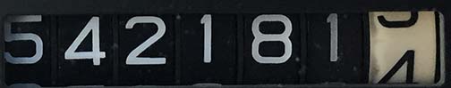
Odometer (Legend): 554,721
Odometer (TL): 101,487
Trip Distance: 900 Miles
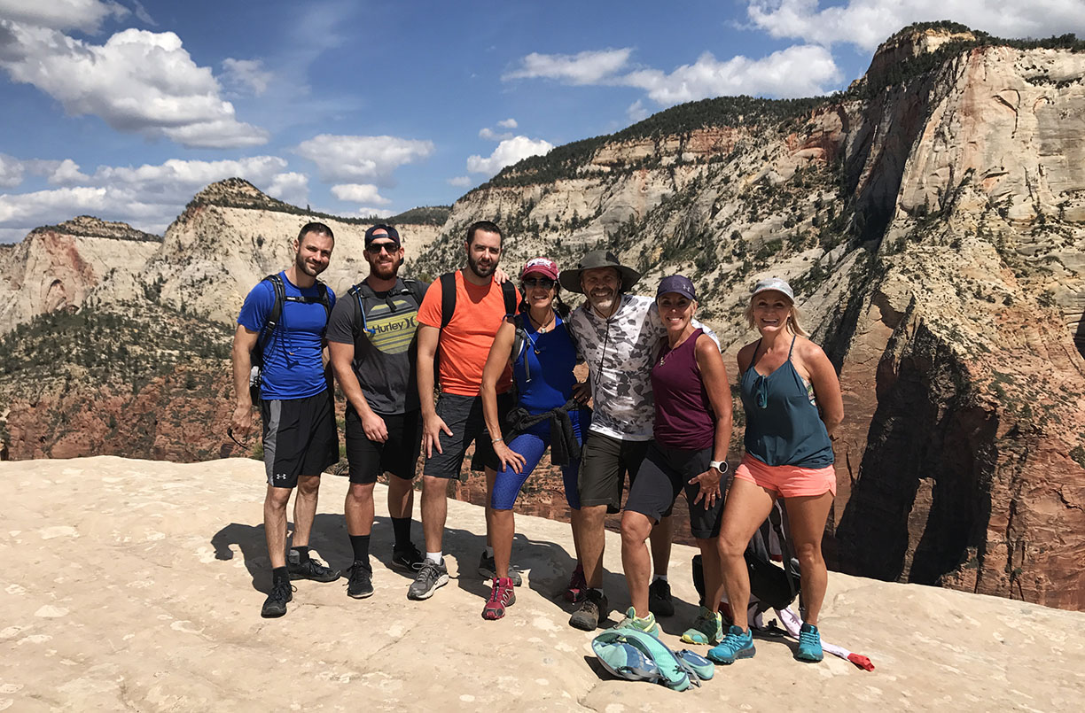
For some reason it’s always two days after a hike when the worst cramping and soreness start. My friend Kyle described the contortions he had to make when getting out of the car last night: “I twisted out of the car like a geriatric.” And he’s only 32! A 17-mile, 8-hour-long hike can really give your leg muscles a run for their money. I paid for it on my end, too. But it was worth it.
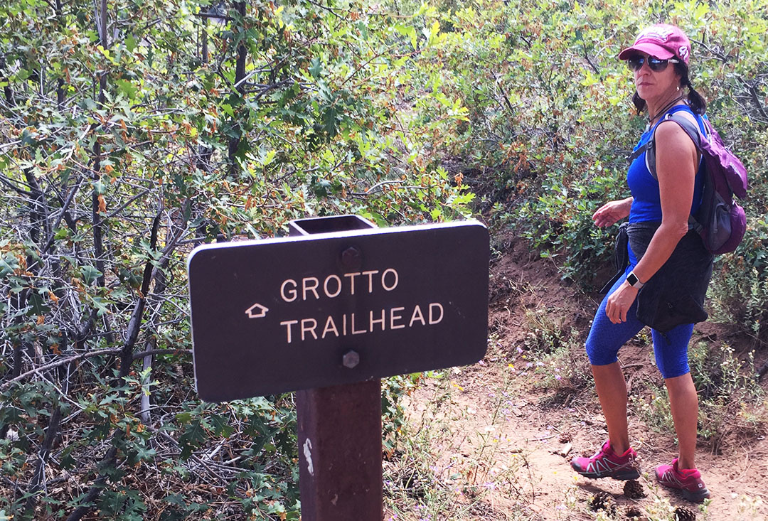
Having grown up about 45 minutes from Zion, in St. George, Utah, I’ve spent plenty of time in the park but it never seems to get old. This specific trail – the “West Rim” – was new to me and gave a never-before-seen perspective on some of the park’s 229 square miles of beauty. Some 4.2 million people visit the park each year, but I’d dare say that most of them don’t attempt a one-day hike as ambitious as the one that we did.
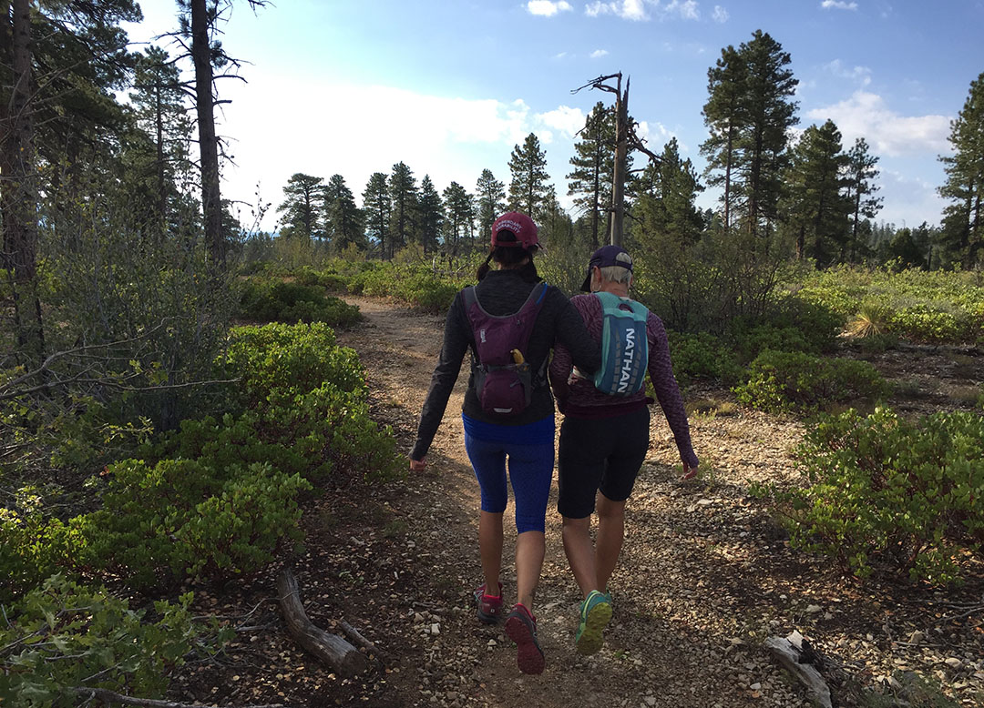
Once again my mountainman (mountainwoman?) of a mother, Tia, reigned athletically supreme as she led our pack of 7 adventurous hikers on a quest through the southern Utah backcountry. Though technically a downhill hike for its majority, the West Rim trail had its fair share of grades — enough that I guzzled down about 6 bottled waters over the course of the day. I liked how with each water I finished, my backpack got a little bit lighter to carry.
The terrain on the West Rim took us through many different types of trails: Wooded forest, singletrack pathway through a field, shale rock, cliffside on sandstone, and a lot in between. All the while, we were afforded some of the best views that money can’t buy. Luckily for us, even the weather was prime – with our start temperatures at the Lava Point Campground around 50 degrees and the finish in the low 70s.
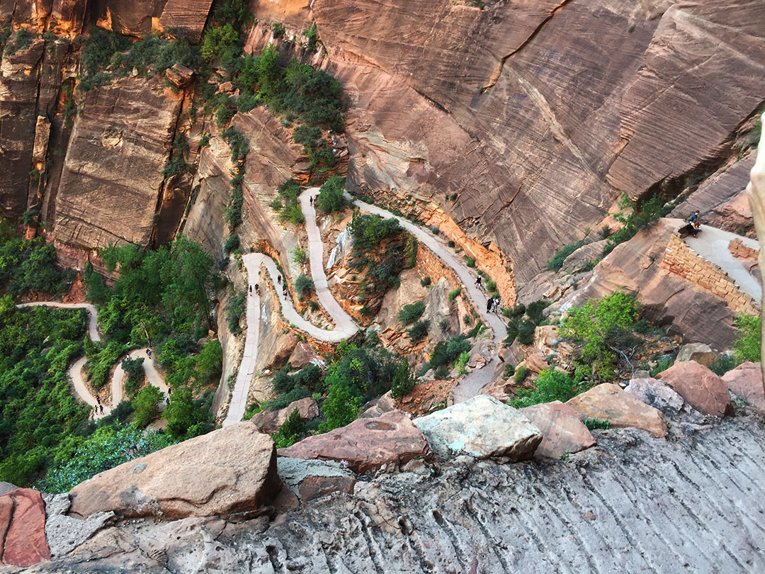
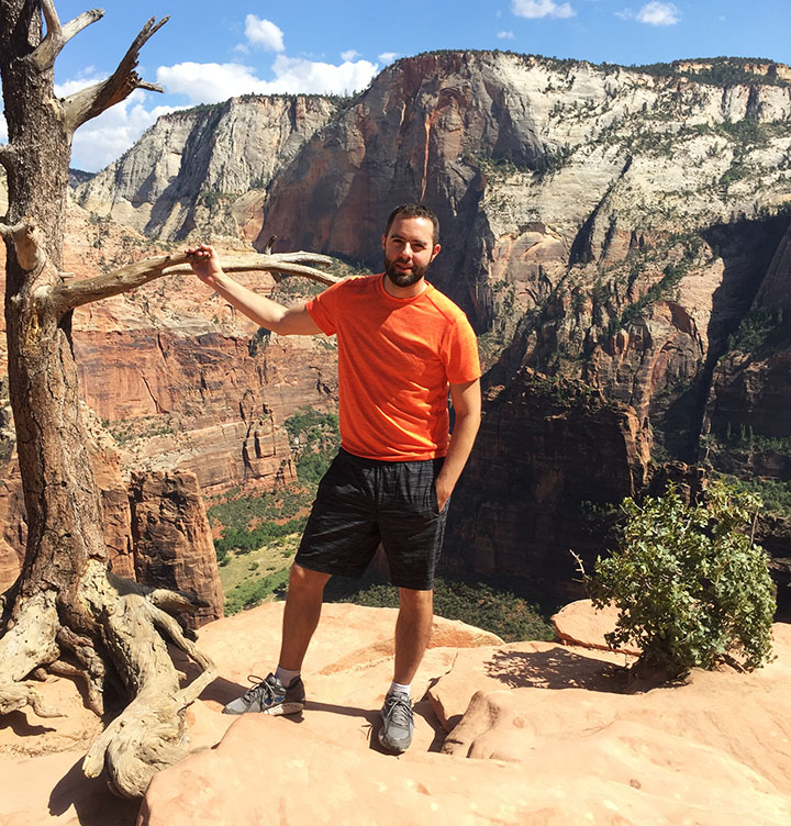
We found a consistent pace and alternated who got to lead the pack. I usually preferred to stay toward the back of the lineup, and wherever space allowed, we usually walked two abreast so we could carry on conversations with one another. At one point, Kyle and Sandy broke away for an ‘optional’ one-mile out & back side trip to “Angel’s Landing” – a spectacular viewpoint atop a 1,500-foot-tall sandstone cliff to the canyon below. I’d already seen it, and by the time we got to that decision point, we were already 14 miles into our 17-miler, so I opted to rest my legs.
By the time we finally were within eyesight of “The Grotto,” where a shuttle bus would pick us up and take us to the visitor center to get my stepdad Todd’s truck, we broke into a jog because we were so excited, and because it felt easier on the quads and knees than taking a slower walk. No pain, no gain! We finished strong. And we celebrated:
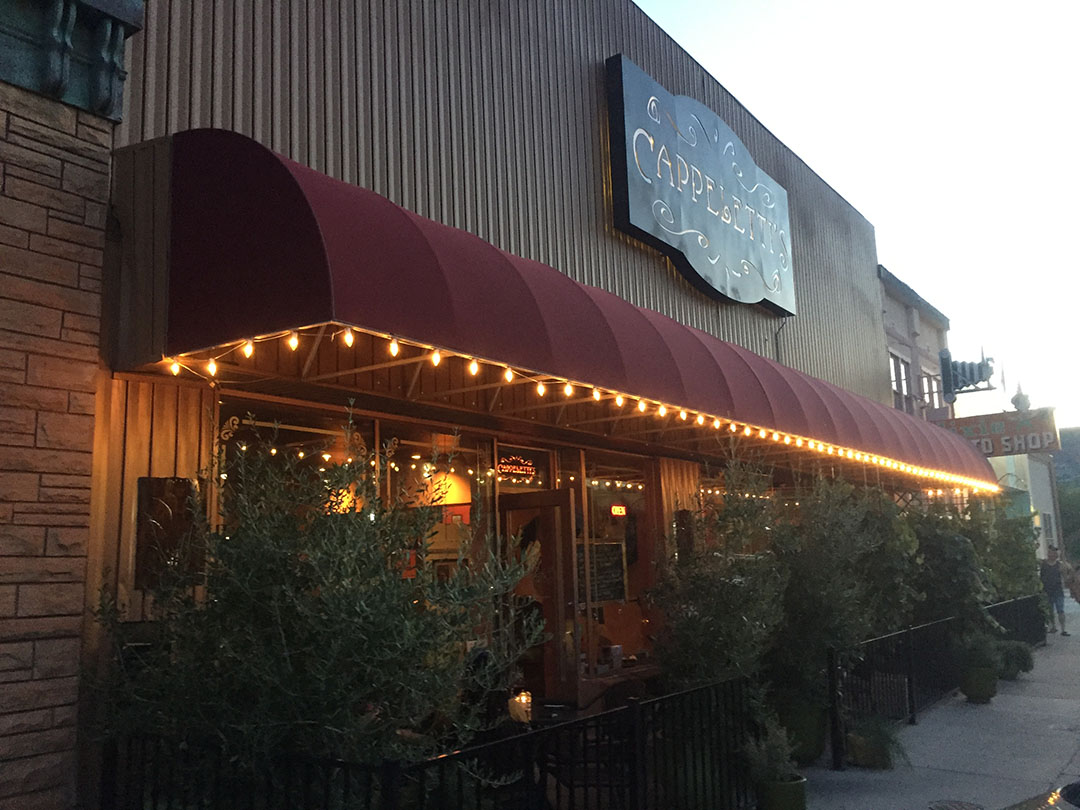
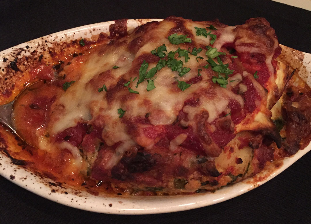
We were grateful for the chance to refuel our bodies later that evening. Kyle and Rob and I decided to consume as many carbs as we could, so we paid a visit to an Italian place on Tabernacle Street in St. George called Cappeletti’s. The lasagna was top-notch. True to tradition, mom fixed us a breakfast of hotcakes the following morning pre-departure. There’s nothing like a drizzle of maple syrup to undo all the calorie-burning we’d done the day prior!
Here is a 3-minute video, along with some photos of our weekend!
TL at Sunset in Kingman, Arizona on the way to St. George Thursday night
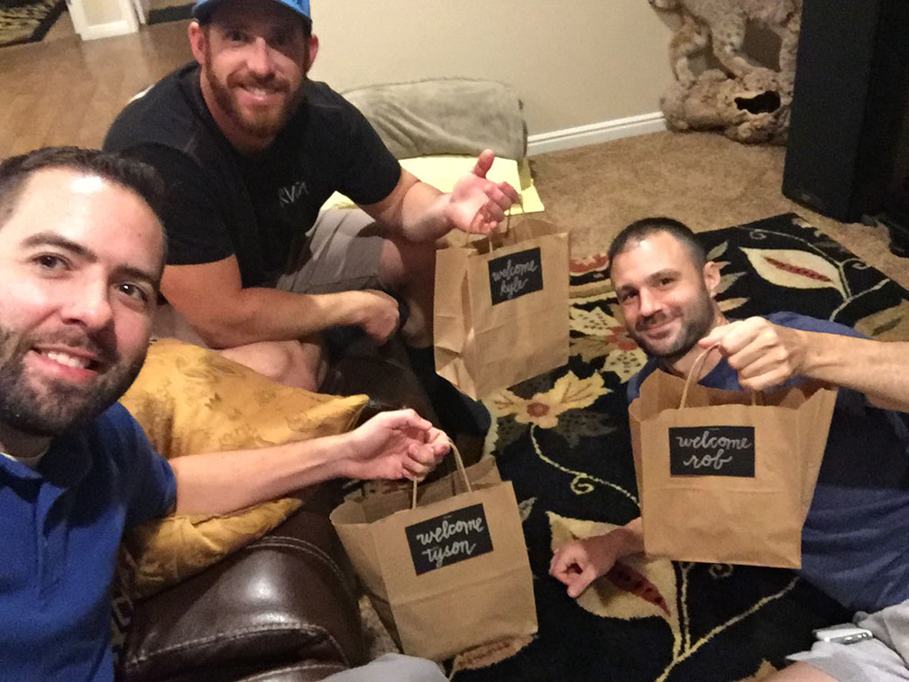
Mom had left us goody bags
Taking my brother’s 1968 Chevy II Nova SS to lunch. It has a 525-horsepower “LS3” V8 and 6-speed manual transmission.
Outdoor dining at 25 Main.
Now taking a ride in my other brother’s 700+ horsepower Lexus IS300. What a beast.
I dictated a shopping list to my 6-year-old niece. Can you decipher this?
It says: hamburger, pita bread, trail mix, and water.
Morning of the hike! Aunt Jodi dropped us off at the trailhead.
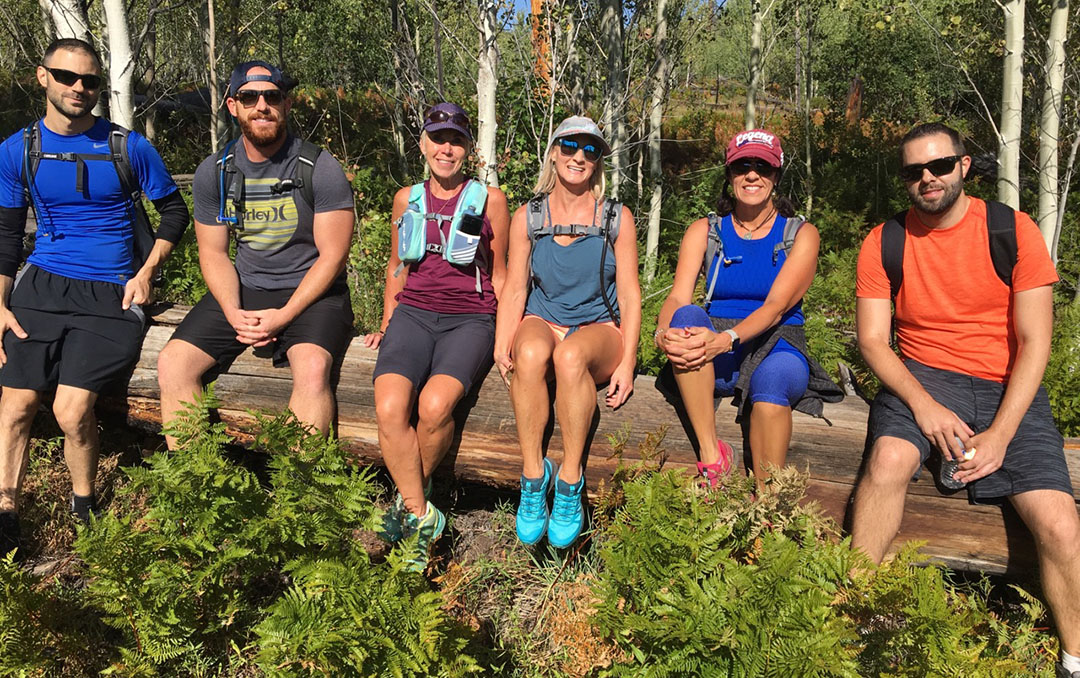
Six bumps on a log
Starting out at a brisk pace
Taking a breather and eating some snacks
Following a few signs toward the destination – with mom in the lead
Approaching “Scout Overlook” near Angel’s Landing
Panoramic views. See the road at the bottom of the canyon?
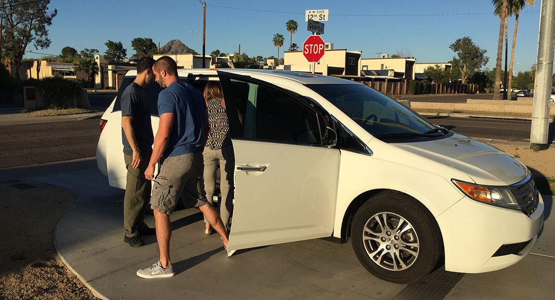
Over the weekend, I gained a greater appreciation for two things: moms and minivans. When you’re entertaining 3 kids under the age of 6 years old, you start to realize just how much of a challenge it can become to make sure everyone’s fed, happy, and playing fair. You also look for any way possible to ease the burden of travel logistics. My brother Payton and his family visited for 4 days from southern Utah, and their 2013 Honda Odyssey EX-L was just the right ride for their family on such a 14-hour round-trip journey to Phoenix.
And we drove that Odyssey to OdySea. This Scottsdale aquarium opened last July and is home to 500 species of sea life, living in over 2 million gallons of water. I guess if our desert ever runs out of irrigation water, we can always drain the fish tanks!
Our favorite feature of the aquarium campus, though, was housed next door in a place called “Butterfly World.” A 3-D movie educated us on the butterfly life cycle, and then we were permitted to enter a greenhouse-like atrium which is home to over 3,000 butterflies of various colors and sizes.
My niece Vivienne was thrilled that two butterflies perched on her colorful clothing. Her younger brother Rex didn’t have any such luck and was peeved that they weren’t attracted to him. And the youngest, Locke, must not have received the memo about “don’t step on the butterflies.” He’s only 1 year old, and his primal instinct is to step on any insect within leg’s reach. And, he did. When we left Butterfly World, it was home to 2,999 butterflies instead of 3,000.
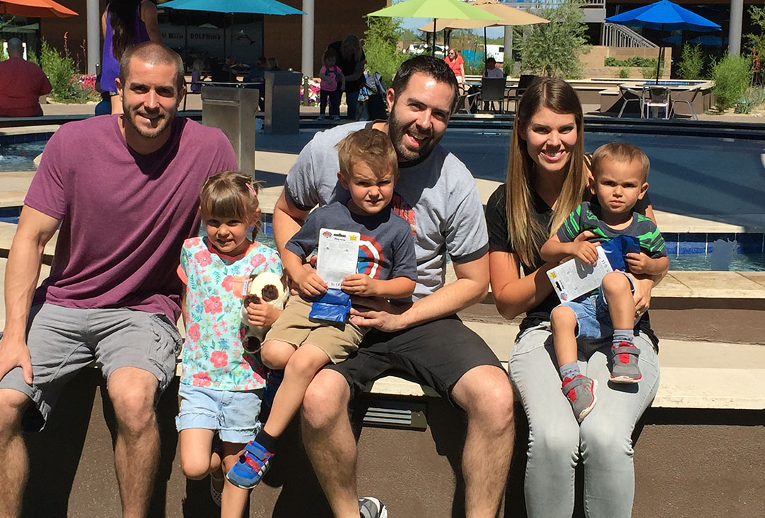
On Saturday, we spent our energy on a short hike at Papago Park near the Phoenix-Scottsdale border. The place was bustling with hundreds of other families taking advantage of the perfect weather, but we made our way to the summit at “Hole in the Rock” and enjoyed the view. The afternoon was spent at the Clarendon Hotel, a boutique hotel in central Phoenix that has a great pool facility. We called dibs on a cabana and soaked ourselves in the long hot tub while listening to relaxing music. My brother had a celebrity encounter too: He recognized Geoff Rowley, famous skateboarder, enjoying the hot tub with us and struck up a conversation. Geoff was in town for the PHXAM event.
I had to make sure everyone was well-fed, so our dining destinations were carefully selected. I introduced my brother and his family to Los Dos Molinos on Camelback Road for Mexican food on Friday night, we ordered Spinato’s Pizza on Saturday, and I took them to Zookz for breakfast sandwiches on Sunday morning before the Odyssey started its return trip to Utah.
Thanks to Payton and Kali for bringing the kids down to spend a few days with me! I’ll be finding miniature toy frogs in the couch cushions and closets for a few months yet.
Here is a 10-minute video introduction to my garage that my brother put together for his YouTube audience.
(Forgive my error on stating the GS 6-speed sedan was offered in 1993-94. You all know it’s 1994-95!)
And 4 minutes’ worth of random scenes from throughout the weekend on my own channel.
Locke ‘riding’ a little motorcycle
Viv enjoying the backyard swing
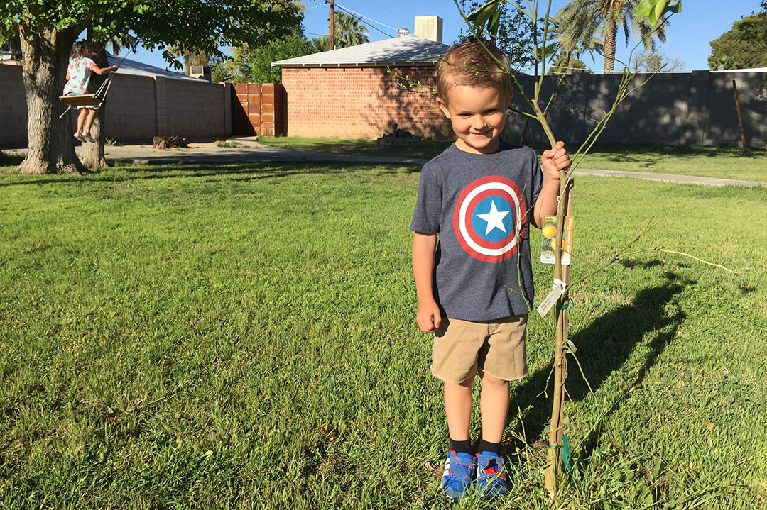
Rex standing next to an orange tree in the backyard
Ready for our 3-D movie at Butterfly World
In the courtyard at OdySea just before grabbing lunch
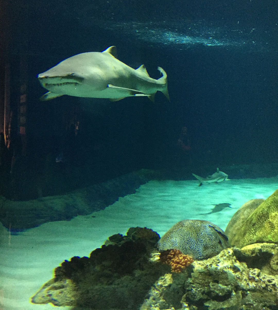
Shark exhibit
Dinner at Los Dos Molinos Uptown
Breakfast at Zookz
Hiking at Papago Park
Locke, Vivienne, and Rex playing in the backyard
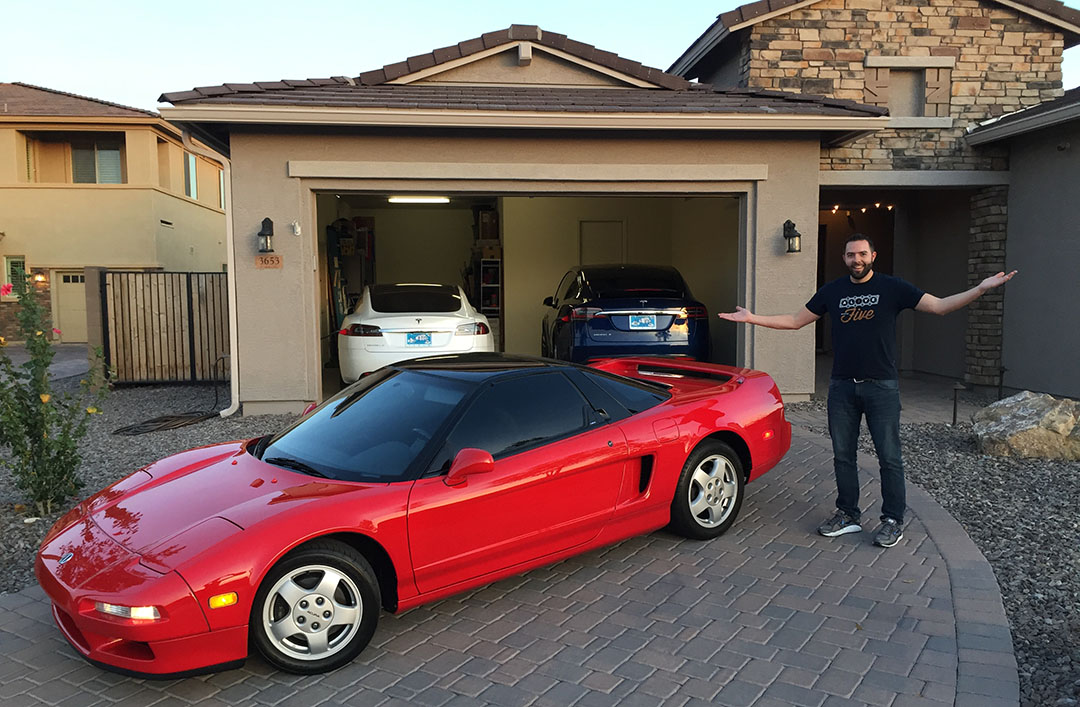
Couple other random pics from recent weeks. My friends Todd and Josh have two Teslas!
My friend Kevin picked me up a “Chiriaco Summit” bumper sticker. More on that soon!
What if I told you Arizonans there’s a place within an hour of Phoenix where you can slice 20 degrees off the temperature and dip your toes in the refreshing East Verde River? Maybe it would be best if I kept this place a secret, but since I’m feeling generous I’ll clue you in to this secluded little watering hole.
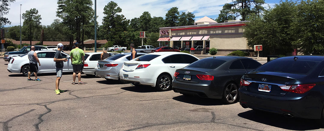
It’s the season of “beat the heat” so many of the destinations you’re likely to see me hit up this summer will be to higher elevations where I can get a reprieve from the Phoenix oven. This one in particular has been on my Destination Spreadsheet for some time now. On Saturday morning, my house in Scottsdale became the meeting point for a variety of cars and people ready for adventure. Here were our attendees:
Tyson, Clayton, and Miles: 2013 Acura ILX
Peter and Jack: 2002 BMW 325iT
James and Rob: 2016 Chrysler 300
Paul: 2013 Acura TL SH-AWD
Kyle: 2005 Pontiac GTO
Sunny: 2013 Hyundai Sonata 2.0T
Brad and Kenny: 2013 Audi RS5
Brad described it as “quite a menagerie.” A menagerie is defined as: A collection of wild animals kept in captivity for exhibition. Sounds about right when referring to this bunch of cars & gents. Though, in this case, all were unleashed from captivity allowed to roam freely in the hills of the Tonto National Forest surrounding Payson, Arizona. The one-way trek to our destination was only about 80 miles but ascended 3,800 feet in elevation.
For the most part it’s a 65-mph split highway but the curves can be fun and they require constant attention. The ILX with 3 occupants and 100-degree temperatures bogged down on the steeper grades and I found myself downshifting to 5th gear and even 4th occasionally to keep up with the pack. From Payson, we continued north past a couple of roundabouts and hung a right on Houston Mesa Road. The road narrowed to two lanes and had some nice curves for the next 8 miles until we arrived at Water Wheel Campground. Luckily, we found ample parking to stash our 7 vehicles but things were filling up quickly with a lot of Saturday adventure-seekers like ourselves. Parking was $8 via cash / self-service, with envelopes to be deposited in an opening in a post near the trailhead.
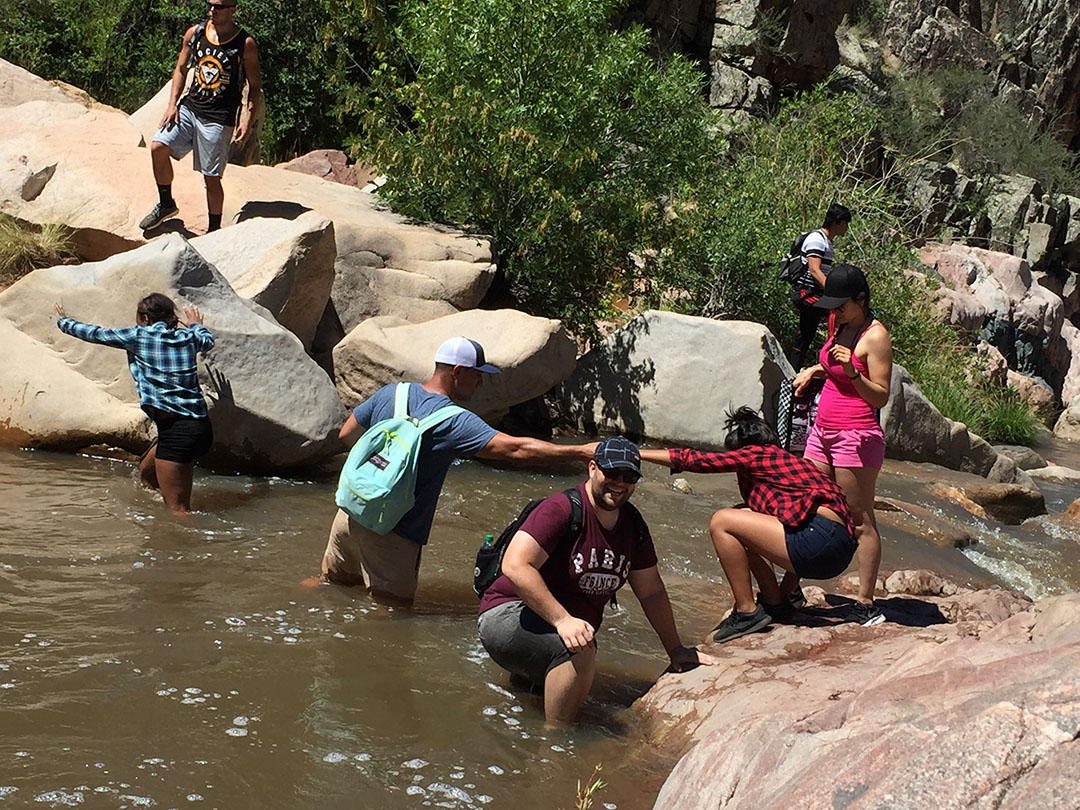
The hike itself does not stick to any specific route but rather follows the East Verde River upstream however a hiker decides to follow it. We did find a path along the west side of the river that had some welcomed shade from overhead trees – even at 88 degrees I managed to break a pretty aggressive sweat. The sound of the gushing river next to us helped give a sense of refreshment even without taking a dip. There came a time when we needed to crawl up and over some large boulders and we paved our own way, or followed people who were ahead of us.
At one point it looked like we needed to cross the river itself so we carefully collected our balance and hopped across. The rocks were slippery at times. For the return, I opted to just remove my shoes & socks and put them in my backpack so that I could walk barefoot across the water and not worry about a slip & fall incident. The water was chilly but it felt great. We wandered a bit further upstream and saw a series of waterfalls coming down. Jack whipped out the selfie stick for a group photograph and Kyle got brave enough to jump in the water.
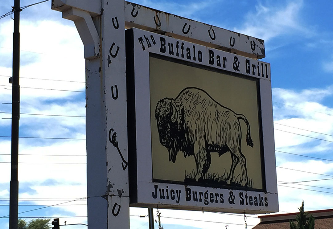
By the time we made it back to our vehicles, we’d only been hiking about an hour and a half round trip. The overall hike distance is about 2 miles each way, and I think we probably only went about half that. So there is much more to see and we all want to get back up there, but we were ready for lunch and a few people needed to be back by late afternoon so we headed back to Payson. For grub, we dined on the patio at Buffalo Bar & Grill. The wait staff had already lined up several small tables for us in anticipation of our arrival and the service was top-notch.
It was great to break away from the Valley’s heat and get up to the mountains for some clean air and a little time with Mother Nature. Water Wheel Falls was just what the doctor ordered for a quick day-trip. Thanks to my friends for joining! Here’s a short video with some highlights of our excursion.
Pre-departure in Scottsdale
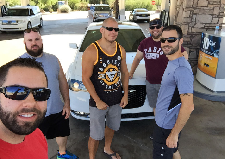
Fuel stop at the Chevron in Fort McDowell: Tyson, Peter, Jack, James, Rob
Backwards baseball caps for the bros.
Kyle caught this pic of my ILX, Sunny’s Sonata, and Peter’s 3-series in his sideview mirror.
Getting through Payson and to the campground.
Kyle’s mean GTO in the rearview.
Parking at Water Wheel Falls
Paul’s TL was blindingly clean in the Arizona sunlight.
Clayton gave us a wave before we started the hike.
Information at the trailhead.
Coming up on the first of a series of falls.
Here’s where we had to crawl up and over some rocks on the river’s edge.
Sunny preparing to cross the East Verde.
James got a little wet.
Group shot thanks to Jack’s selfie stick.
Solo shot.
Back in Payson with our diverse lineup of vehicles.
Peter’s wagon rolled 205,000 yesterday and still looks great.
Buffalo Burger at Buffalo Bar & Grill.
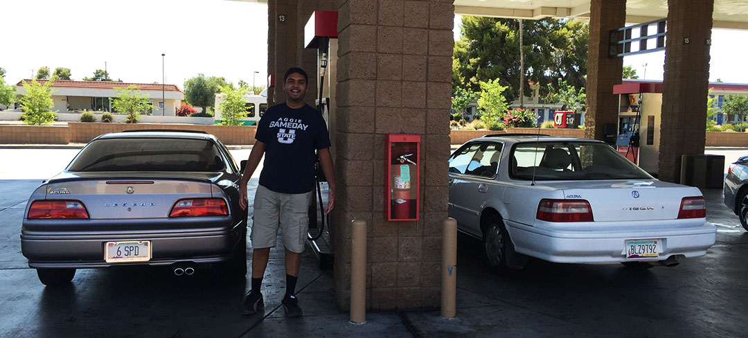
Sunny and I took the Legend out and ended up next to a nice lady in a Vigor 5-speed!
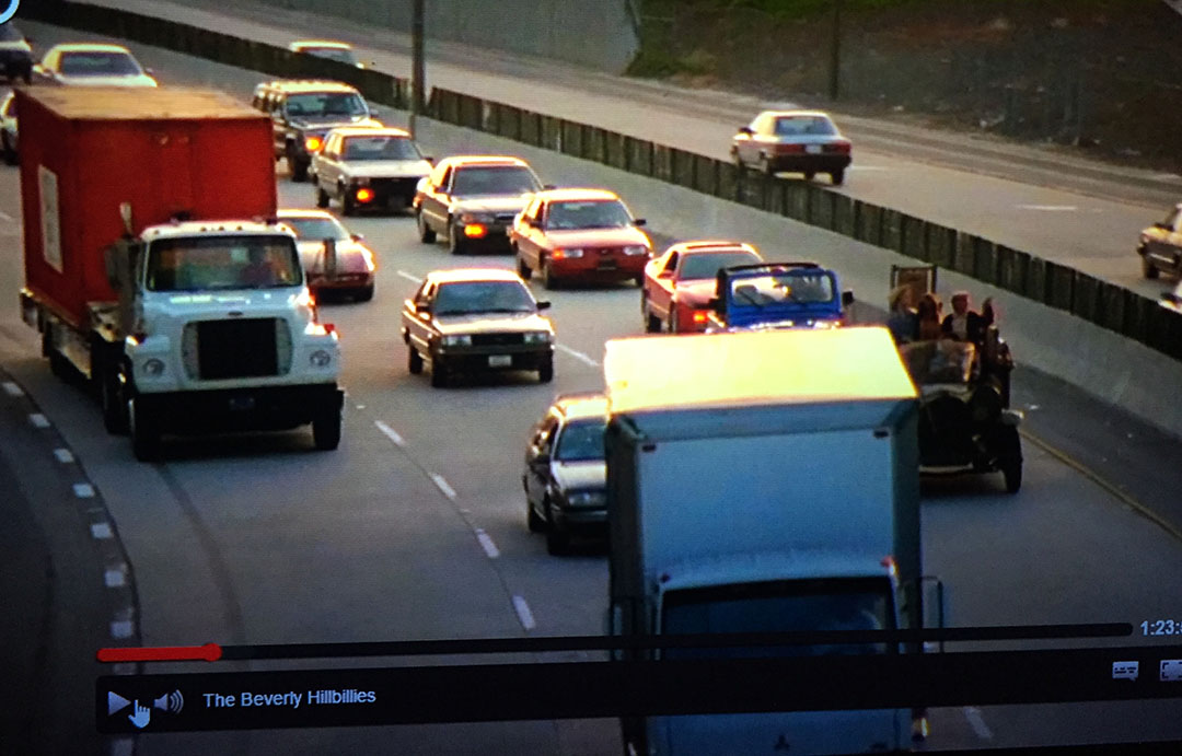
I spotted a G2 Legend sedan in Beverly Hillbillies (1993 movie) about 10 minutes in!
And a very thoughtful friend brought me back a souvenir from his Hawaii trip.
Get over to TSX Travels! Josh is about to have some big news SOON.
My mailbox was overflowing with Acura maintenance coupon postcards yesterday afternoon. Every time they have some sort of promotion I seem to get multiple notices – but hey, I’m not complaining. Especially when the main featured car is Ludacris‘ 1993 Legend sedan.
Clever stuff, people!
And I might be taking them up on this $28.95 oil change at Acura of Tempe the next time I get over there.
The one thing that does put the enthusiasts in a tizzy is the fact that the tagline for the promotion is “Keep the Acura you Love Maintained for Life.” And just exactly how are we supposed to do that when so many critical parts have been discontinued? Thus, us true ” Legend lifers” are left to dumpster dive and go junkyarding every so often to find the parts we’re looking for.
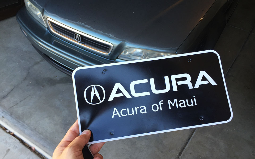
CHECK OUT THESE NEW PLATES! This’ll go on my Legend sedan to replace the existing set. I couldn’t believe the plate combo was available when I went to search for it a couple of months ago. Don’t mind if I do!
Perfect use for this emoji.
It would be selfish of me to keep all 300 days of Phoenix sunshine per year completely to myself, so once a year my dad & stepmom travel down from Utah to partake. I was happy to share some rays. Having lived in Arizona now for 10 years, I definitely have my favorite hot-spots that we try to visit each time I have friends or family in town, but every once in awhile I throw a new destination in the mix to spice things up a bit.
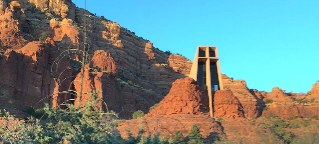
Over the weekend, I introduced them to Sedona on a short overnighter (2.5 hour drive each way in the ILX) to explore the red rocks landscape of that area. Aside from hiking Devil’s Bridge which I’ve blogged about a few times in the past, we also made a visit to the Chapel of the Holy Cross – a church built in 1956 directly into a rock formation.
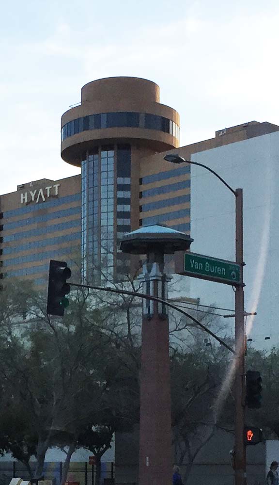
A definite highlight of their visit was our dining experience on Saturday night. I’d made reservations at Compass Arizona Grill, a revolving restaurant on the 24th floor of the Hyatt Hotel in downtown Phoenix.
My dad’s not big on heights (and for that matter, neither am I) so the ride up to the top in an exterior-facing elevator was just the start of a pretty exciting evening. The restaurant has fixed exterior windows in a circular form with a floor inside them that spins around, making one complete revolution every hour. I was slightly concerned about the implications of being prone to motion sickness and having to sit through a dinner while in motion, but it didn’t end up bothering me at all. Best of all, our 6:30 start time meant we hit the sunset lighting perfectly.
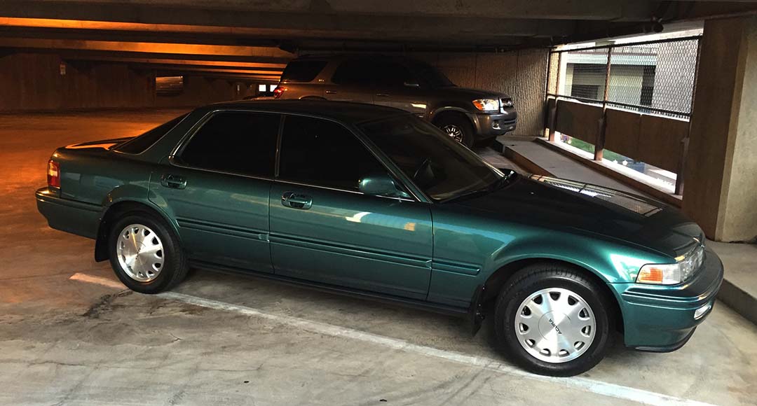
Our high-class ride of choice that evening was my green 1994 Vigor, shined up for the occasion. We also put a few miles on the ILX (Sedona trip) and the Legend coupe (airport run) over the course of dad & Tanya’s 4-day visit. Many thanks to them for taking the time to come see me. I’m extending an open invitation to anyone who reads this – if you’re a fan of road tripping and want to explore the southwest with me and my friends, come on down to visit!
Here are the rest of the photos from the weekend adventures.
Opening night dinner at Oregano’s – our favorite place for a Pizza Cookie.
Meeting up with Chandler and Jack for “Canal Convergence” festival at the Scottsdale Waterfront.
While rummaging through a few old photos, I dug up one taken in 2001 – when I was 20 years old – of me in my Mormon missionary garb standing next to my then-dream car, an Acura Vigor. I figured it would be fitting to take a picture of that picture, in front of my Vigor!
Putting dad to work on home improvements, including replacement of some trim in the garage.
Quick stop in New River at the abandoned gas station called Jack Ass Acres
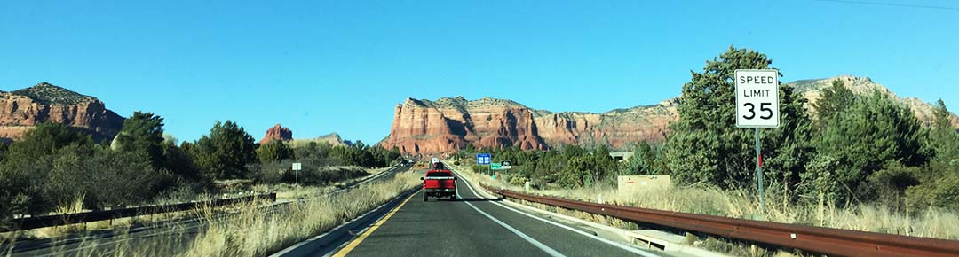
Just about to enter Sedona, Arizona on Highway 179 – the Red Rock Scenic Byway
Checked in at the Sky Ranch Lodge in Sedona, near the airport
Doing some shopping in the Uptown district
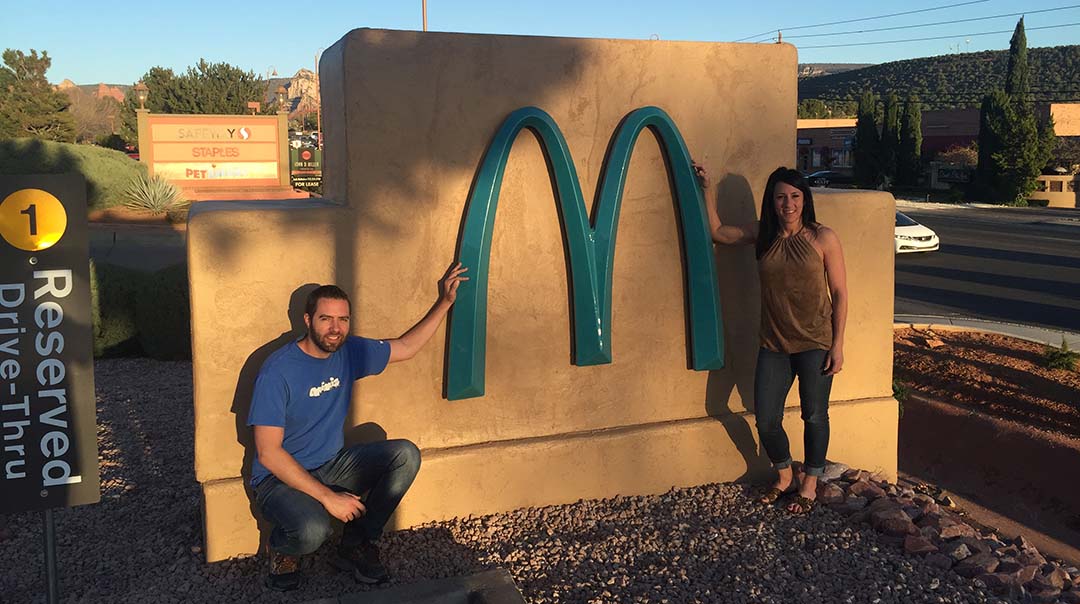
The only McDonald’s in the world with turquoise arches
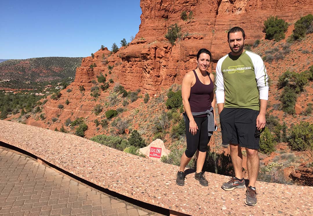
Midway through our Devil’s Bridge hike
Tanya and me on the bridge. Dad was a little nervous for us here.
With Tanya at the chapel
View from inside the chapel
ILX in Sedona
Dinner group at the restaurant
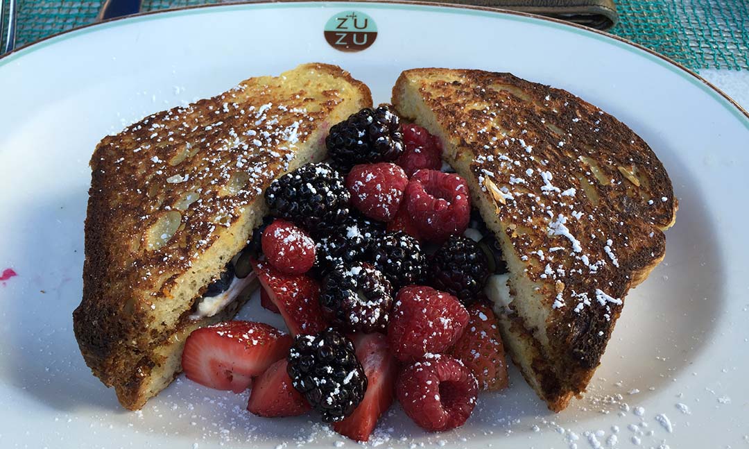
Great way to start a Sunday morning: Brunch at Cafe ZuZu inside the Hotel Valley Ho in Scottsdale
Tyson, Linh, Tanya, Craig
Airport run in the Legend later in the afternoon
A few other bits of news to share with you:
Just days after I posted my recent “Magic Fives” blog entry highlighting my 155,555 milestone on the ILX, my mom upstaged me. Her 2010 Volkswagen EOS turned over 55,555 miles at 51 degrees at 55 miles per hour at 8:55 in the morning. Congrats, and nicely done!
Who has $1/4 million I can borrow? Now’s your chance to get online and configure your dream 2017 Acura NSX. Mine would be Nouvelle Blue Pearl and loaded to the max with just about every available accessory. Orders are now being taken! I’m told there are over 1 million possible combinations of specific configurations of Acura NSX. There’s a good chance yours will be one-of-a-kind.
See my friend Ira perched there atop this natural sandstone arch? I had sweaty palms when taking this picture of him: Visions of a slab of rock fracturing from the arch and sending him down on a 100-foot drop to the earth below. Kids, don’t try this at home.
Ira paid me a visit from Portland, Oregon this weekend. While the PDX area in which he resides offers virtually any sort of outdoor creation within about an hour radius, what he doesn’t have – and what he came to Arizona to see – was some of the natural beauty of the southwest. We hit the road on Friday afternoon in the ILX and headed out on a 2-hour drive to quaint Sedona, Arizona. It’s home to about 10,000 residents and nestled in a landscape of vivid red rock formations. Sedona is popular destination for people who want to “get away from it all” – the whole vibe is one of relaxation, self-discovery, and detachment from the hustle and bustle of daily life.
By the time we checked into the Sky Ranch Lodge on Airport Road (located at a vantage point high above the town), nighttime had fallen. The keys to suite #280 were “real” keys: heavy, brass-colored, old-school things. I can’t remember the last time I stayed at a hotel or lodge that hadn’t gone the route of the credit card-style swiper. Though the city lights were nice, the real view that we wanted to see would welcome us the following morning. A light cloud cover kept the sun from highlighting the colors of the surrounding mountain range, but it was still a breathtaking sight to behold.
We picked up a few provisions from the local AM/PM – namely, in my case, 2 donuts and some chocolate milk. Ira made the better decision by getting a banana and bottled water. Just a 6 mile drive up Dry Creek Road, we found the turnoff for the hiking trail to Devil’s Bridge. By now it was only about 8:00 in the morning and we were only the second car in the parking lot. The first mile or so of the hike was on a rugged road – passable by most trucks, SUVs, and even a Subaru Outback we witnessed with a daring driver at the wheel.
Then, the trail split and headed east toward the hills. We were in shorts – ill-prepared for the 38-degree start temperature – but quickly forgot about the cold as we got our cardio workout in for the day. In all, our hike would take us up the equivalent of about 40 flights of stairs. The sandstone rocks at times were perfectly placed for hiker access. Along with the higher elevation came more snow and mud – leftovers from last week’s winter storms.
“Where the heck is it?” I caught my breath, and asked Ira as we kept trudging along. Then I glanced to my left. We had already arrived. The ice made for a slippery surface upon which to navigate, so I played it extra cautious while feeling my way out – sometimes crouched down and walking on hands and knees – to the arch itself. I took note of how quiet the surroundings were when we stood completely still. Coupled with the fact that no other hikers were in the immediate area, and that we had absolutely zero cell phone signal, it made for a great feeling of peace and quiet. Soon it was time to make the return trek which went by quickly.
Ira and I enjoyed a hearty breakfast at Creekside Restaurant along Highway 179 on the way out of town. It was just what the doctor ordered to satisfy those cravings we’d built up from burning a few calories along the trail. Enjoy the rest of the pictures from our quick overnight trip, and for anyone visiting Arizona who wants a great taste of nature without hiking the entire Grand Canyon, I highly recommend hitting up the Sedona area for a trip to Devil’s Bridge. Here are the rest of my photos from the trip!
ILX at the trailhead
My “Look ma, no hands!” pose atop Devil’s Bridge
Ira back in Scottsdale, driving the NSX on Portland Street – fitting because he’s from Portland
Congrats also to my friend Mirel who picked up a(nother) Legend LS coupe 6-speed!
And one last little blurb here: I was on the news on Friday morning with my car! Tomorrow, there’ll be a car show in the evening called “Future Classics.” It’s open to any vehicle from 1970 through 2005 model year. I am entering my 1994 Legend coupe.
A few of us were asked to report to the 3TV Studio on 7th Avenue for a 3-minute intro to the car show on Good Morning Arizona.
Here’s the video. My (quick!) moment in the spotlight comes around 2 minutes in. And watch for my wave at the very end!
Coming up this week: A visit from a special friend, and a trip to the Barrett-Jackson collector car auction, where the first 2017 Acura NSX will be auctioned to a lucky new owner this coming Friday night. I have my checkbook ready.
Last week, I was reviewing a GMC Canyon. This week, I’m reviewing another Canyon. The Grand Canyon.
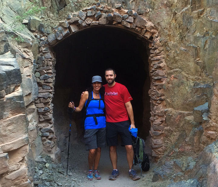
While most of the canyon’s 5 million visitors per year are content to stand at the edge and admire its grandeur from afar, others are not happy until they get down and dirty while trudging across 20+ miles of it. My mom is one of those people, and I let her talk me (and a few friends) into joining her for this crazy adventure inside one of the “7 natural wonders of the world” last Friday. And 4 days later, my legs still scream at me for putting them through it.
I last blogged about the Grand Canyon in April 2014 when my friend Brad and I road-tripped to the Skywalk, a glass platform suspended from the canyon walls at the West Rim on the Hualapai Indian Reservation. But the 1,900-squre-mile national park is vastly different to look at from any of the many different angles, and there are several different hiking paths that lead down into it for those who dare.
Painfully Awesome
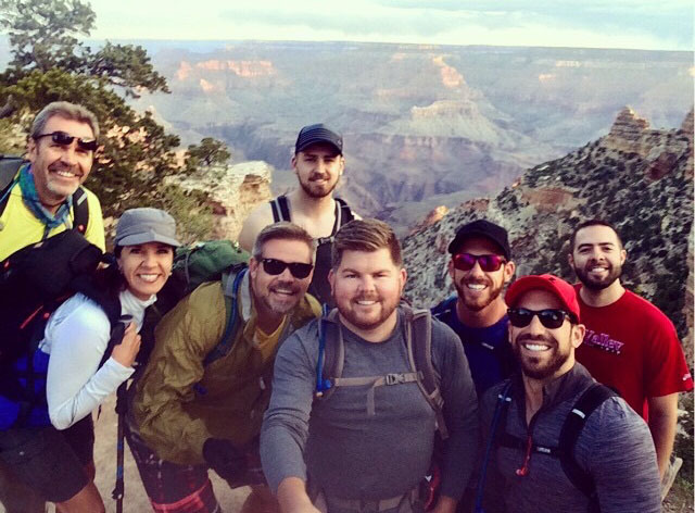
My friend Dave was telling me the other day about a bike ride he’d taken that had been especially difficult. He called it “painfully awesome.” That sums up in two words exactly how I’d describe Friday’s 14-hour hike. It was the most physically challenging thing I have ever done. Joined by 5 ambitious friends as well as my mom & stepdad, we set our sights on a “rim-to-rim” excursion. In other words, we would start on the south side of the canyon, hike down into into its depths at the Colorado River, then eventually make our way up the north side. For many months we prepared ourselves physically and mentally for the task, but the actual experience was exponentially more than I was ready for.
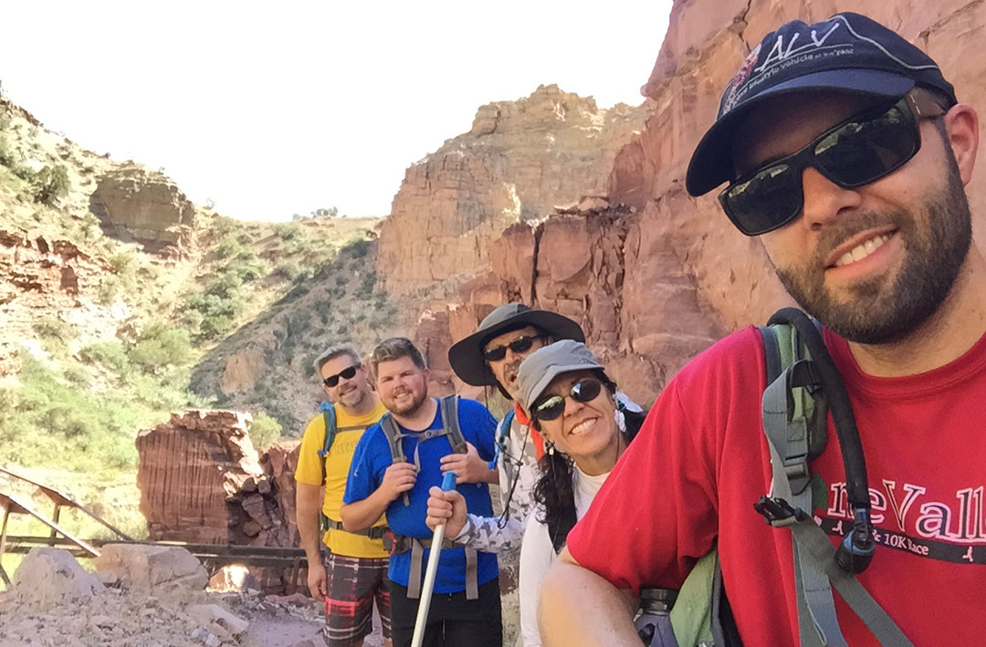
On Thursday afternoon, I picked up Kyle, Bryce, and Justin in the ILX for our departure from the Phoenix area. It took us about four hours to arrive at the Maswick Lodge along the South Rim. Highway 64 is a very quiet place at night. It’s a two-laner that climbs through the pine forests west of Flagstaff with little traffic, and no significant services or amenities aside from an occasional lonely gas station. By about 10:00 p.m. we met up with my mom, stepdad, and two other friends and settled in for a somewhat sleepless night.
It’s Go Time
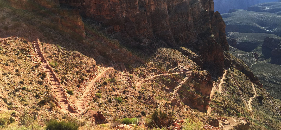
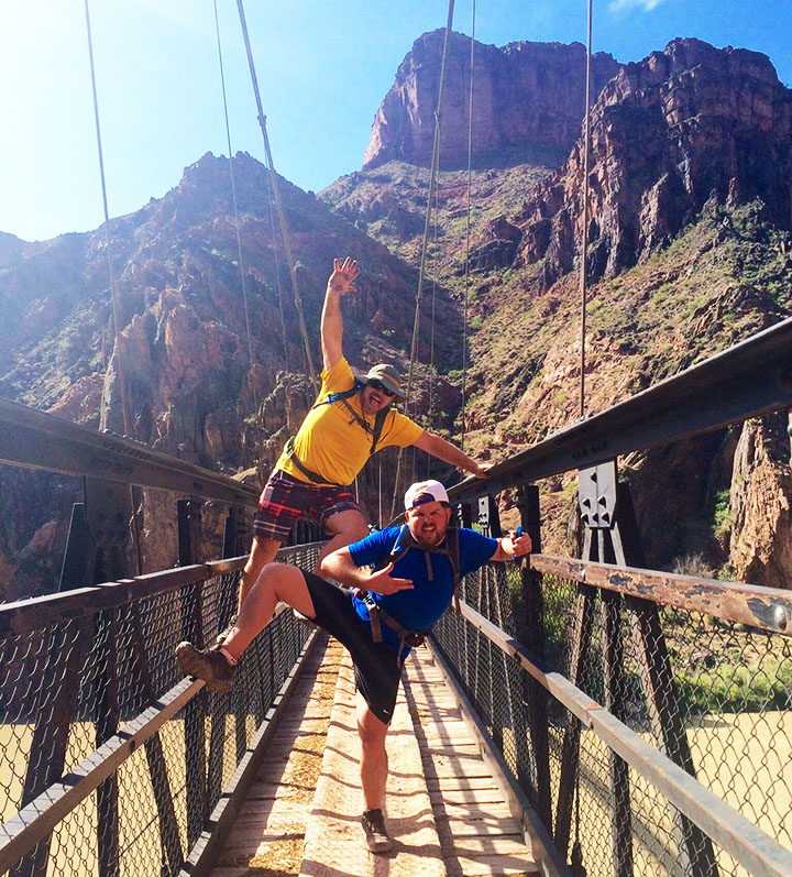
In the blink of an eye it was time for a 4:00 a.m. wake-up call. Right off the bat, anxiety ran high because we were rushed to get to the train station for a 5:00 a.m. shuttle bus. We had to make last-minute decisions on what to throw into our packs, how much water to take, and what to wear. (Some of our gear would be staying in my car rather than making the trip across the canyon on our backs.) The bus took us to the South Kaibab trailhead (elevation 7,260 feet) about 15 minutes away and we hopped out. The sight of the canyon at daybreak is something unreal. Temperatures were cool but not uncomfortable. And then began our short-lived tradition of taking a group “selfie” at one-mile intervals throughout the course of the hike. I say short-lived, because by about halfway through the day we cared very little about group pics; we were focused instead on sheer survival.
With energy in abundance we made our way down the rocky but well-marked trail toward the base of the canyon. “We’re going down there?” I thought to myself as I looked in the distance at the vast expanse of rugged terrain. The trail required a good deal of focus for proper footing, but every once in awhile we had to look up from the ground below and admire the scenery around us. “OOOH AHH POINT,” one of the first signed viewpoints we came across, was aptly named. We zig-zagged our way down thousands of feet in elevation. Right away I discovered an issue with my Camelbak backpack when it started soaking my back and shorts. Somehow I hadn’t sealed it tightly enough and it was leaking like crazy. Eventually I dumped the water out of it and resorted to just using 3 refillable bottles.
Besides having plenty of water, we were adequately prepared with other forms of nutrition. Rustin and Wade had packed what appeared to be an entire deli counter. Sliced lunch meats, prosciutto cheese, fresh strawberries and other delicacies were offered up when we made our first rest stop. Thanks to the downhill grade, our pace was quick at a little over 2 miles per hour. A short tunnel and pedestrian bridge across the Colorado River (which had a milky green look to it at the time) awaited us when we finally got to the bottom of the canyon.
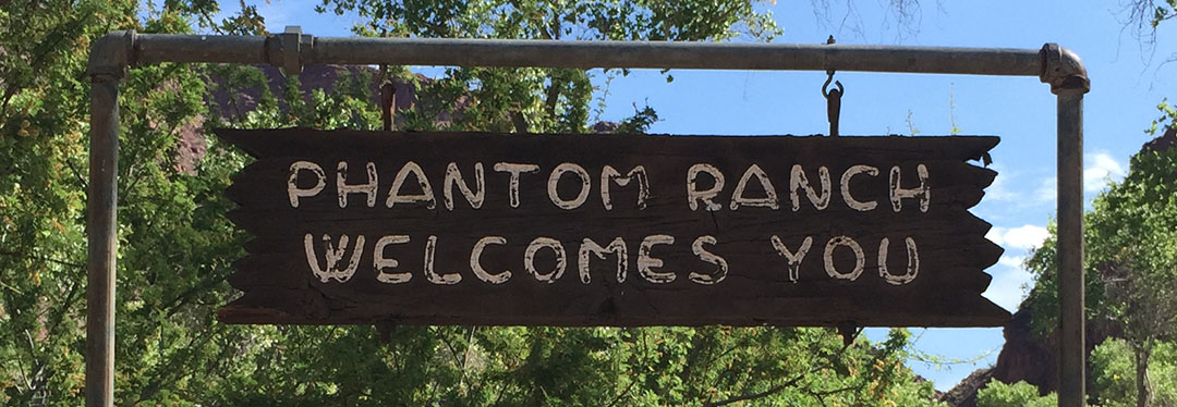
Phantom Pit Stop
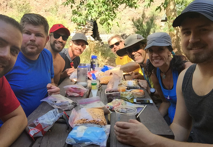
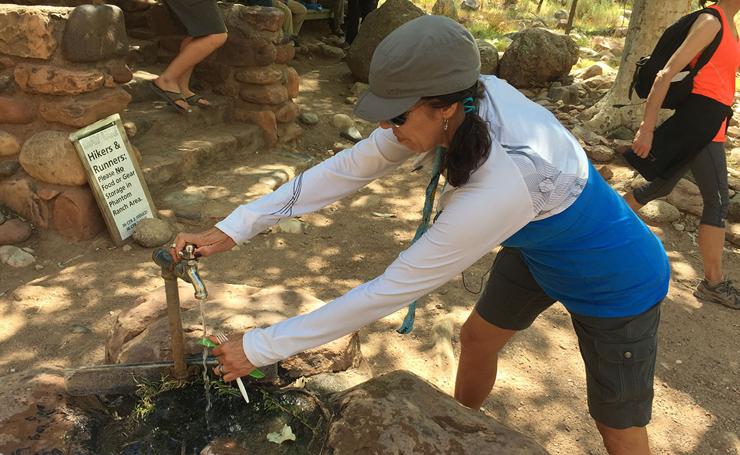
By now we were starting to wonder when we’d make it to Phantom Ranch at 2,460 feet. Notably the most “developed” of any place we’d be seeing throughout the course of the day, the lodge there has been a waypoint for Grand Canyon travelers since it was constructed in 1922. It was about 7.4 miles into our hike, and as we got closer, I could only think about one thing: LEMONADE. Inside the lodge, they sell cups of ice cold lemonade for $3.00 each. I chugged one so quickly it gave me a headache. Outside, there was a fresh water spigot for refilling water packs. The 8 of us sat around a picnic table under a shade tree and laid out some food items to refill our stomachs. Rustin pulled out a travel size bottle of Hidden Valley Ranch dressing and we all gave him a look of: “You packed that down here?”
The sound of Bright Angel Creek running nearby was therapeutic in itself. Todd took the opportunity to soak his legs in the chilly water. The rest of us just enjoyed the chance to rest at the picnic area. After so much downhill, for some reason when standing still, my legs felt wobbly. I knew already that for every one step downhill we’d taken, we’d be taking closer to two uphill. And that I dreaded.
Ribbon Falls
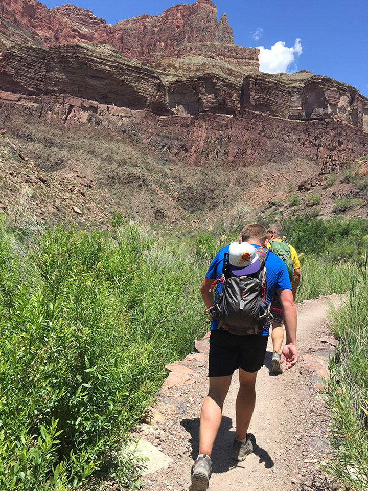
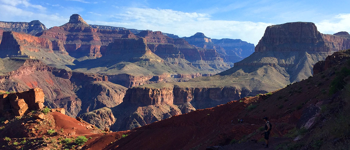
The trail ran parallel to the river for many more miles. It was about this time – probably 10:30 or 11 in the morning – when the heat started cranking up. Even though I’d lathered up in SPF50 and I was wearing a baseball cap and sunglasses, I could feel the sun cooking the back of my neck. At times we had to walk single file and at other times we stood two abreast and held conversations. Several times there were bridge crossings where the trail changed sides in relation to the river. The steady uphill grade started getting the best of me and I now started drinking more water than ever before. I could now see why on average 250 people per year are rescued from the canyon. Dehydration is a very real concern.
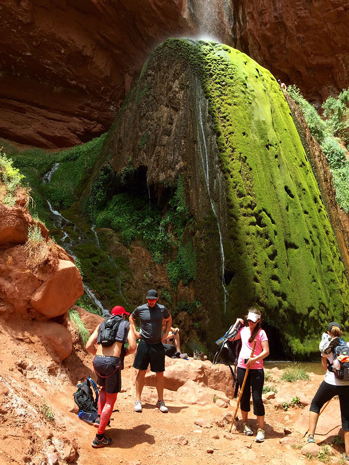
My mom had learned of a detour that was an absolute must-see called Ribbon Falls. I don’t think any of us were too keen on adding distance to our already-long hike, but multiple sources had recommended we make time for it. So, when we saw a crudely-carved wooden sign pointing us in its direction, we rallied our energy as best we could and headed toward Ribbon to check it out. We had to cross a stream and hike up some boulders to get there, but in about 20 minutes we came upon the most beautiful oasis I’ve ever seen. Misty water came down upon us from dozens of feet above where it spilled through an opening in the red sandstone. Justin quickly scampered up as high as he could go on the waterfall itself, but all I could think about was ripping my shoes and socks off to dip my feet in the water.
I could have sat at Ribbon Falls for the rest of the day, but sadly we knew we had another 12 or 13 (all uphill) miles to hike before dusk.
Cottonwood Campground
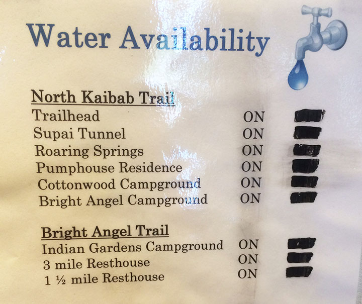
Todd had a great idea for a way to beat the heat when we got a couple of miles into our hike again. We took our shirts off and soaked them in the creek. The feeling of putting on a soaking wet T-shirt or tank top is unbelievably refreshing when you’re sweaty and gross – especially if there’s a slight wind to exaggerate the temporary chill factor. There are, occasionally, water spigots available every few miles on the trail from Phantom Ranch to the North Rim. Hikers have to be careful and plan ahead, though, because it’s possible sometimes for the water to be out of service. We lucked out and everything was in operation during our hike.
The next stop had probably a dozen or so campsites in it. We again took refuge in a spot of shade and refueled our bodies with food & drink. I took the opportunity to dump a grape flavored 5 Hour Energy shot into my water bottle in hopes that the caffeine would give me a kick for the next little while. My legs, feet, and back were screaming at me. By now, our tradition of taking a group photo at every mile marker had long been thrown out the window. Sometimes there was a lot of space between each of us, as each hiker settled into his or her own pace.
The Ascent
It was upon leaving Cottonwood that I really started questioning my ability to go the rest of the way. I knew from reviewing my mom’s pre-printed trail notes that our location at Cottonwood was still 6.8 miles from the finish line on the North Kaibab Trail. But it wasn’t that distance that scared me. It was this:
Cottonwood Campground: 4,080 feet
North Kaibab Trailhead: 8,241 feet
Okay. So, I’m no rocket scientist but that’s 4,161 feet. Vertically. In other words, after having already hiked about 18 miles, we still had almost 7 to go and we would essentially be climbing 78% of a vertical mile. Straight up in the air. My life flashed before my eyes. Would I send everyone onward without me and potentially stay the night in the canyon? Was I going to be one of “those people” who had to get helicopter air lifted out of the canyon on the news? I couldn’t let myself think about failure. I just had to keep taking it one step at a time.
And that’s where I found myself setting my own pace. Kyle, Bryce, and Justin had gone on ahead. I was kind of in the middle of the pack. I set my iPhone (in airplane mode all day to conserve battery since cell service is non-existent of course) on shuffle and let it play music from inside my pocket. That helped steer my mind clear from the task at hand. I passed a couple who was walking the opposite direction. They could tell that I was “spent” physically by the way that I braced myself with a tree while standing to catch my breath. “There’s a water stop about a mile and a half up, right after a tunnel,” the man told me. I thanked him. But I’m pretty sure he lied to me.
That was probably the longest mile and a half of my life. I kept looking for a tunnel that never came. Endless log stairs, rocks to climb over, and switchbacks. I’d round a corner and they just kept coming. “Really?!” was the thought that kept crossing my mind. I’d walk for a couple minutes, then have to catch my breath and keep my heart from coming out of my chest. When I finally saw that tunnel after an eternity of hiking, it almost seemed like a mirage. I went through, plopped down on a rock, and just sat there without moving a muscle for at least a few minutes. The sun had started its descent into the horizon already so I knew daylight was on the way out.
The fat chipmunks at that small rest area kept me company (and ate some of the peanuts in my trail mix) for about 15 minutes until my mom and Todd arrived, and then Rustin and Wade were just a few minutes behind them. We talked for a bit and then decided it was best to press on as daylight would soon be closing out.
Final Stretch
The last 1.7 miles of the hike happened at a snail’s pace. Every so often I would look behind/below me at the huge canyon and get a little dizzy thinking I had just come up from there. At one point I got insanely hungry and dug into a Nature’s Valley granola bar. I didn’t care that it had become nothing more than a packet full of crumbs at that point. I inhaled it, and I downed two more bottles of water that I’d filled up at the rest stop. Keep in mind, I hadn’t used the bathroom since Cottonwood. All that water was flowing right through me as sweat.
I knew I was getting close when I started hearing the sound of automobile traffic overhead. The trail conditions got notably better, and I passed a man sitting along the side of the trail who was waiting for some family members. “You’ve only got 100 yards to go,” he told me. Music to my ears. I made it. And it was the biggest rush of relief that I had ever felt.
Aftermath
It’s miraculous that the 8 of us everyday people made it through such a physically taxing event. We took one last group photo from the bed of Todd’s pickup truck which was parked there at the North Rim. After showering up, we made it to our 9:00 p.m. dinner reservation at the historic North Rim Lodge. I glanced around the table and the look of exhaustion was pretty common. We slept like rocks at our rented log cabin.
On Saturday morning, Justin, Bryce, Kyle, and I got on a 7:00 shuttle van that drove us 4.5 hours back to where my ILX was parked at the South Rim. Each time we stumbled out of the packed van at a rest area, my legs reminded me that they weren’t happy with what I’d put them through the day prior. It was great to get back to the car and settle in for the rest of the trip home. Here’s a picture from when we exited the park on Saturday morning.
We dined at a neat little Italian restaurant in historic Williams off Interstate 40 before heading back to the Phoenix area.
Thanks for being a part of this memorable adventure! The rest of the pictures and a short video follow:
Rest stop near Camp Verde, Arizona on I-17 headed north toward the Grand Canyon
Setting out on our hike
Still wearing a smile, just a few miles into the hike.
One of the group pictures we took for the first 1/2 of the hike
Switchbacks leading down to the floor of the canyon
Another group pic
Rustin and Wade taking a snack break
A few of the scenic views that surrounded us
Wade and Rustin had a lot of energy still at about 6 miles into the hike.
Group shot whilst crossing the bridge
Tunnel crossing – Todd pictured here
View of the bridge
Back on the trail we went
Refreshing lemonade at Phantom Ranch
Speaking of Ranch, here’s the man who packed a bottle of it!
Luckily for us, the pipes were working.
Mama Tia filling up on water before heading out again
Taking a break in the shade along the trail (Bryce, Tia, Kyle)
One of many river crossings
Arrival at Ribbon Falls
Rustin savoring every drop of his Diet Dr. Pepper which he’d lugged into the canyon
On the trail again, just can’t wait to get on the trail again.
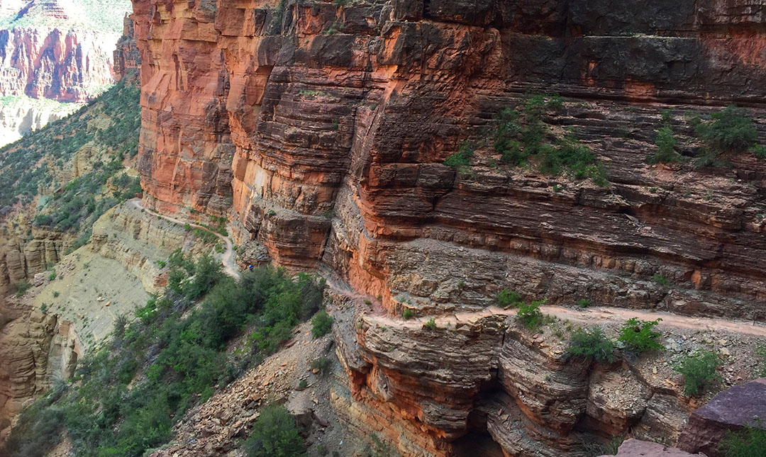
A few pictures from the upward climb. You can see the trail about halfway up the hillside.
And another shot of the trail looking back down.
North Rim Lodge as seen on Saturday morning, the day after our hike
Our shuttle van for the 4.5-hour trip from North Rim to South Rim
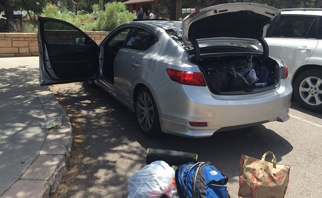
Arrival back at the ILX which had been parked at Maswick Lodge
Lunch spot in historic Williams, Arizona
Finally, a shout-out to one of my most loyal readers, Conor, who sent me a Hot Wheels NSX to match the real deal!