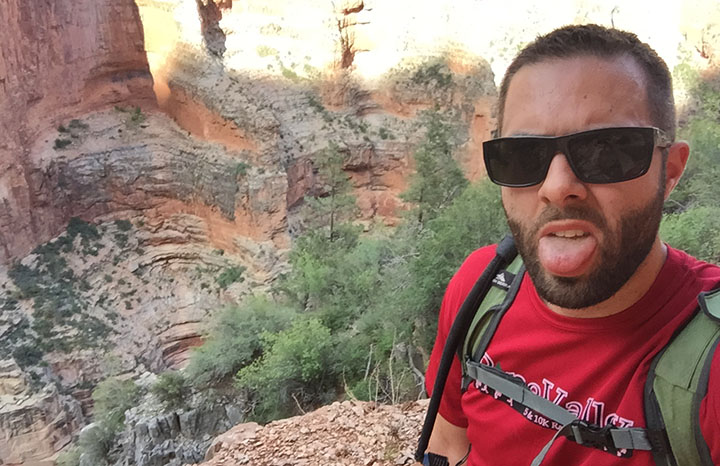
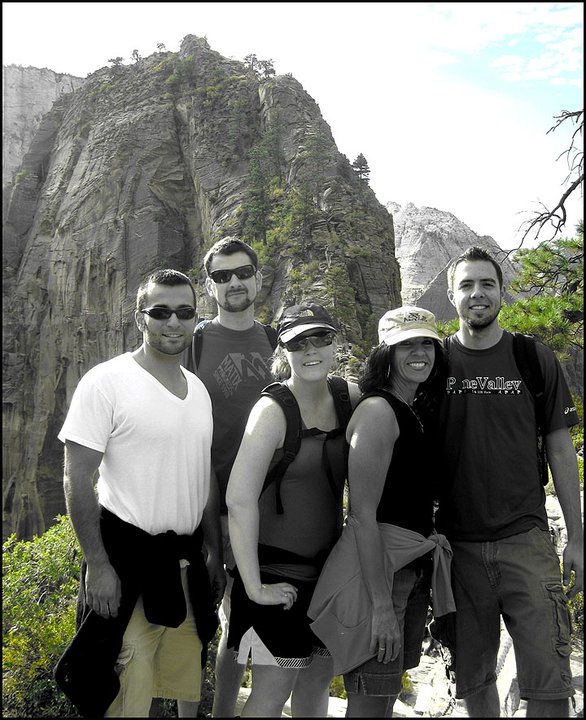
I have a few fun features to share today. Mom planned a trip down from southern Utah in her new (to her) 2016 Acura RLX. We met up in one of Arizona’s red-rock gems, the town of Sedona. It was about a 2 hour drive for me on Saturday morning. We enjoyed the seclusion and solitude of an Airbnb room about 5 miles up Oak Creek Canyon from the hustle and bustle of the town’s shopping plazas. Saturday evening, we dined at Javelina Cantina and then enjoyed the sunset from atop the Airport Mesa.
On Saturday, after breakfast at Indian Garden (I highly recommend the “ranchero bowl”), we went to Slide Rock State Park, a recreation area just a few miles up Highway 89A from where we were staying. The place gets its name from the slippery nature of the Oak Creek’s bed – after years and years of erosion making the surfaces smooth, coupled with mossy deposits, there is some great slipperiness to be enjoyed. We saw a few people tumble to a very wet riverbed in what looked to be painful experiences!
The rocks were nice and warm, but the water was chilly!
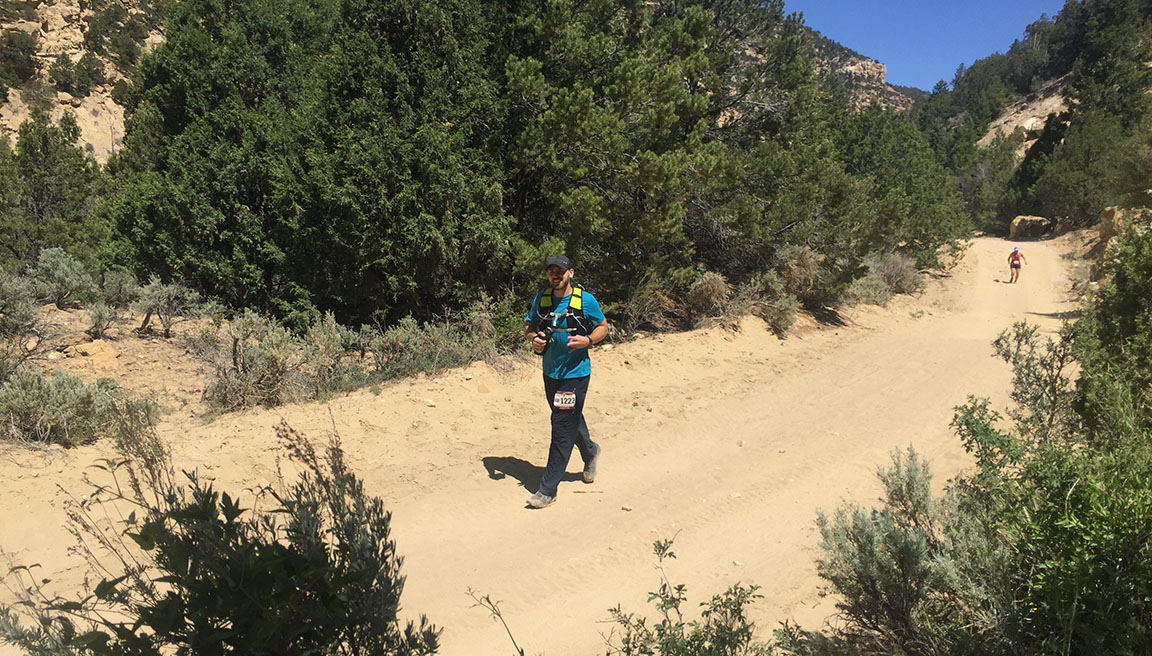
The last stop on our weekend tour of the region was a quick jaunt out Highway 260 toward the small town of Pine, where we were anticipating the arrival of a friend who was running a 100-mile (!) race. Unfortunately, as the day went on our timelines were crunched and mom had to head back to Utah, and I had to return to Phoenix. I’m happy to report that our crazy friend did complete his event though.
ILX + RLX at the Airbnb
Shopping at “Tlaquepaque.” We love saying that one.
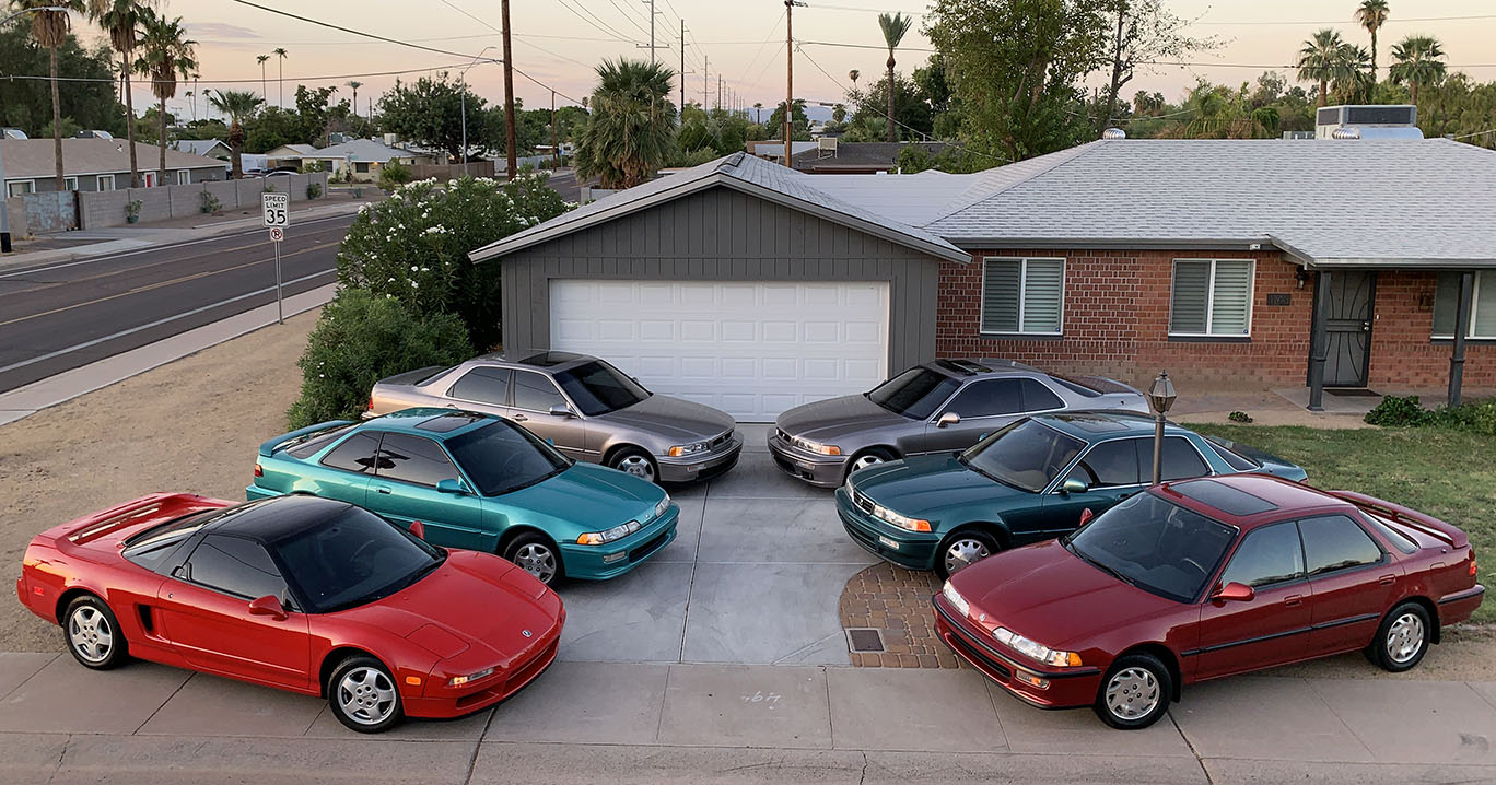
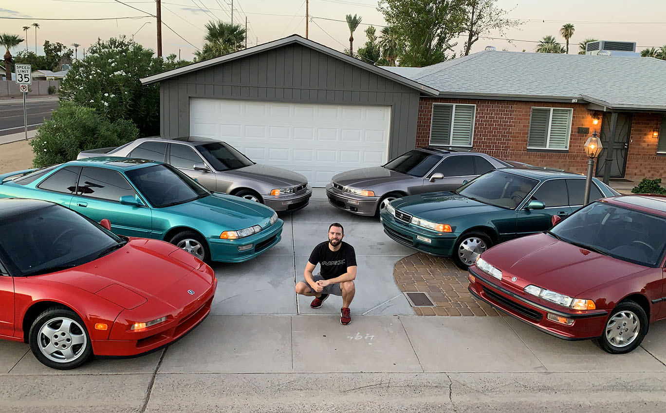
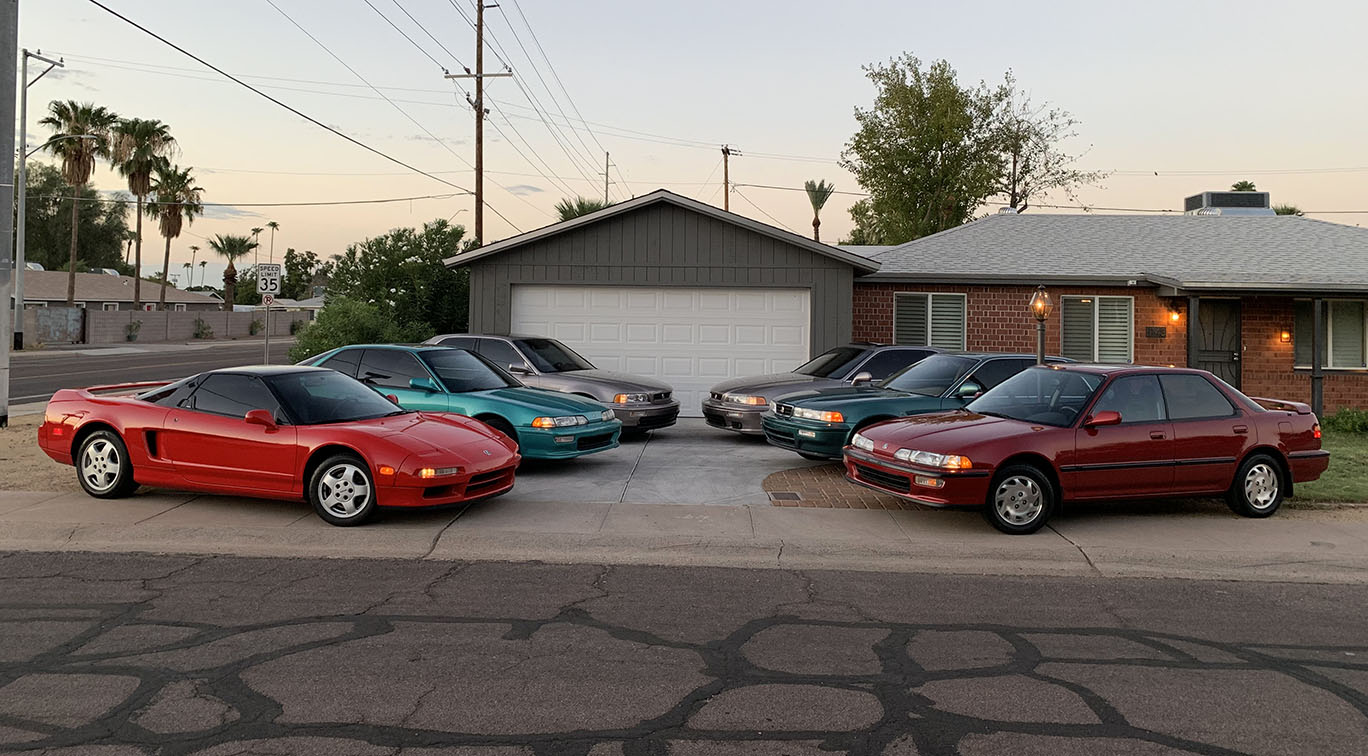
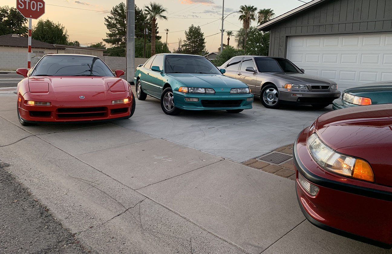
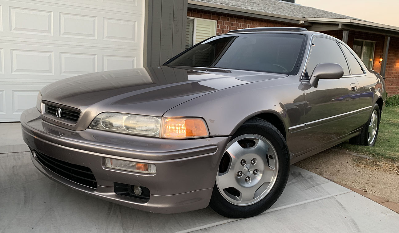
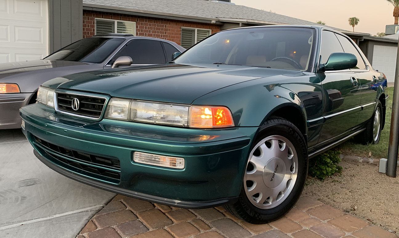
I decided to have a little fun bright and early on a Sunday morning and stage my cars in “brochure” fashion like a photo that might have appeared in a 1991 through 1993 full-line pamphlet from Acura, since the 6 cars included there are the full 6 body styles that were available during those years. Luckily I only had one neighbor drive by at 6:00 a.m. while I was on top of my step ladder looking like a goofball.
1992 Integra GS-R 251,000 Miles
1992 Integra GS Sedan 73,000 Miles
1994 Legend LS Coupe 566,000 Miles
1994 Legend GS Sedan 161,000 Miles
1994 Vigor GS 114,000 Miles
1992 NSX 115,000 Miles
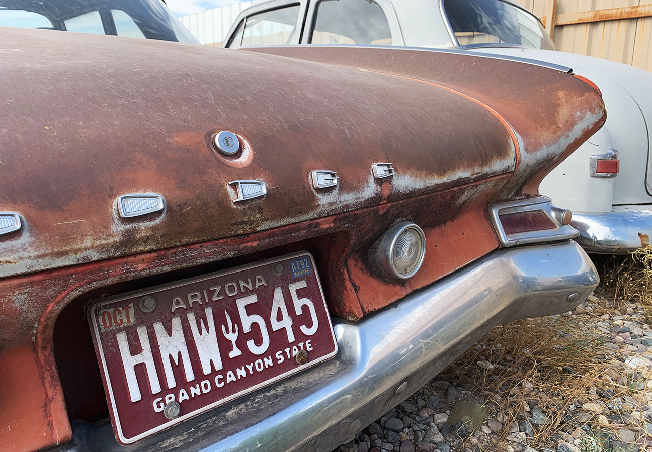
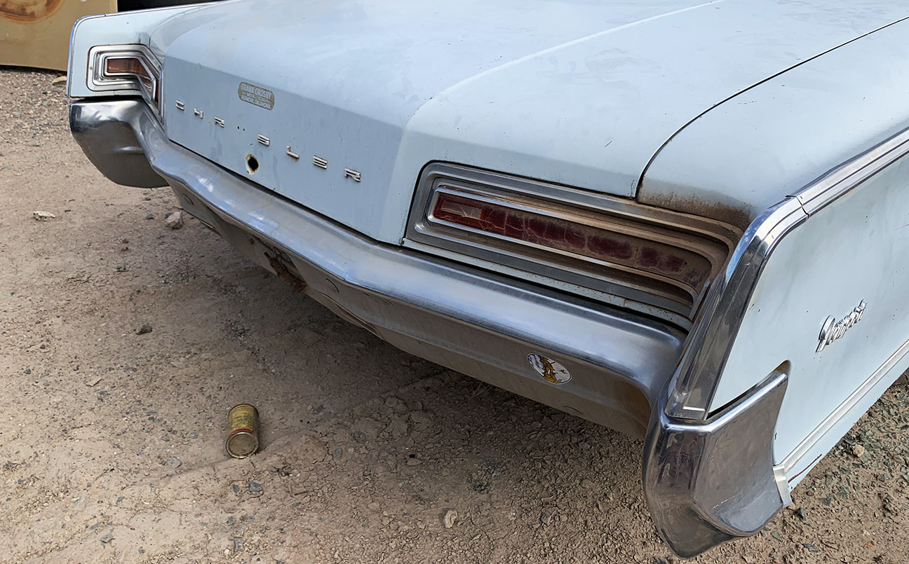
Lastly, I took the chance to pay a visit to “DVAP” – better known as Desert Valley Auto Parts. It’s a junkyard that was featured as part of a TV series called Desert Car Kings back in 2011. I visited in 2018 with my friend Dane, and the video that I captured became quite popular, so I decided to go back and give it another whirl. I filmed 20 minutes’ worth of banter and it received over 10,000 views in its first 10 days online. A box office hit!
Have you ever heard of a Dodge Seneca?
Nice looking old pickup truck!
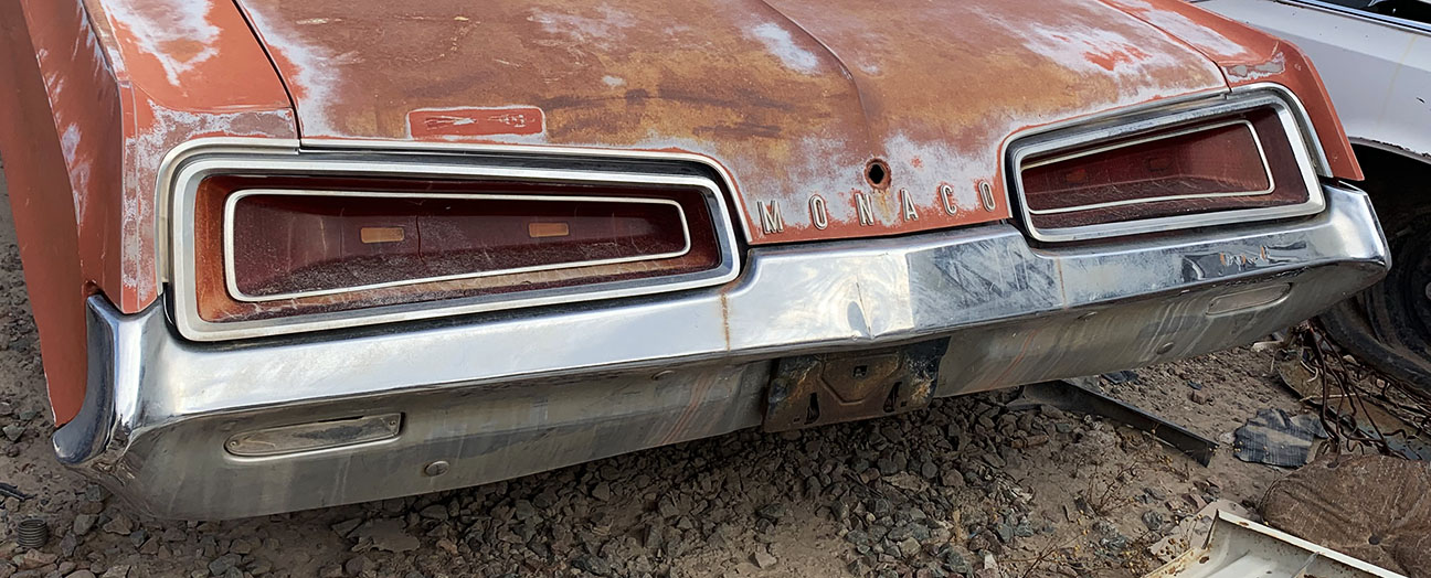
Some cool back ends on these next two Chrysler products.
This one looks pretty mean.
And some Chevy Bel Airs for good measure.
Guess what? The SLX got new leather. Here’s a pic and video as the saga continues.
Thanks for reading, watching, and following, as always! Have a great week!
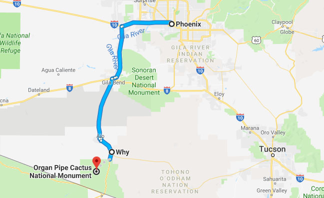
“Just so I can do a little mapping on times and distances.”
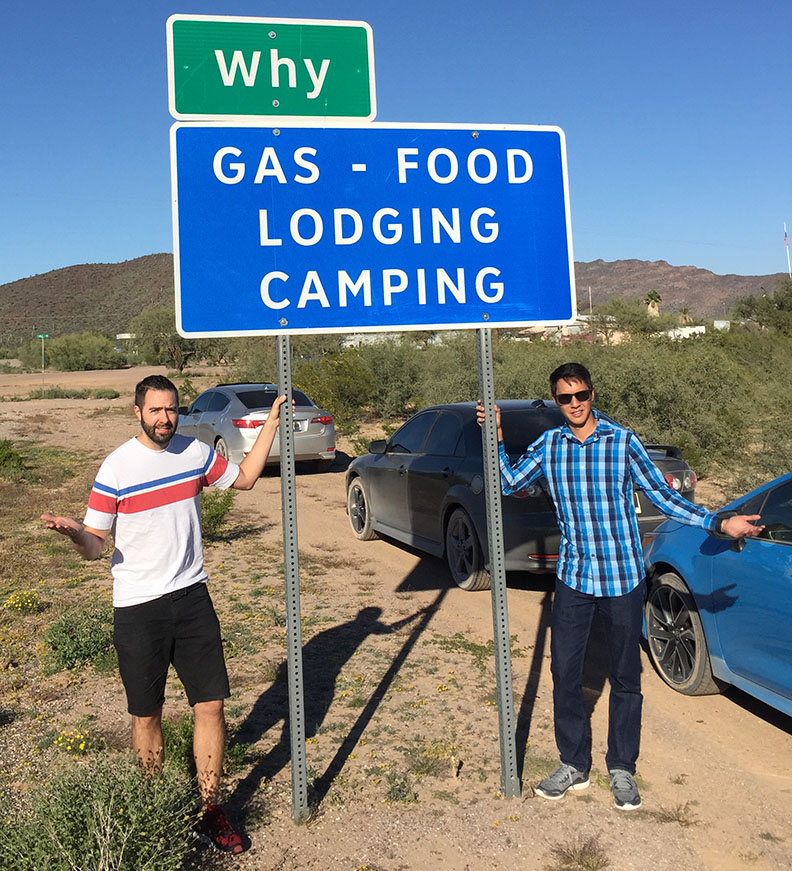
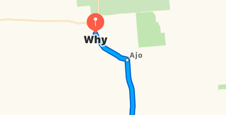
“So Why?”
That’s how a planning conversation about this trip could have gone. Because, of all the places our group could have picked to rendezvous before venturing into the Organ Pipe Cactus National Monument, we picked the town of Why, Arizona. And the term “town” is used very loosely, since it’s home to only about 100 people. And, as we discovered, its only restaurant (Granny Mac’s Kitchen) is closed on Saturday – the one day of the week that we’d be visiting. Guess we’ll have to sample Granny’s culinary creations on a future trip.
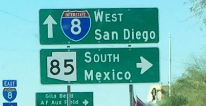
I’ve visited Why before – about 5 years ago, actually, and discussed a little about how its name came to be. The intersection of State Routes 85 and 86 originally created a Y shape, but for safety reasons were later transformed to meet at a T. It was here in Why, at the Why Not Travel Store where James Lee of Six Speed Blog and I awaited arrival of Jason from Driven for Drives. In addition to snacks and drinks (though I was disappointed the nacho cheese machine was out of cheese), the Why Not store also sells Mexican automobile insurance policies for travelers who are on their way south of the border. A liability-only policy runs $35 per day and “full coverage” rates vary.
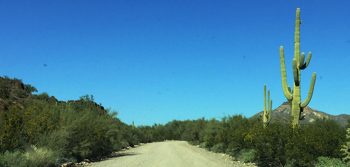
We didn’t stick around long, because we had turf to cover a little south of Why. Tucked into the far southern reaches of Arizona – literally, touching the international border with Mexico, is a special place that is remote in geography and picturesque in landscape. Even now, when Arizona’s weather is at its prime and tourism should be at its peak, we had the park largely to ourselves. Organ Pipe Cactus National Monument was established 81 years ago in 1937 and sees just over 1/4 million visitors per year. By comparison, another of Arizona’s parks, the Grand Canyon, sees about 7 million visitors per year. I much prefer visiting the lesser-traveled park units.
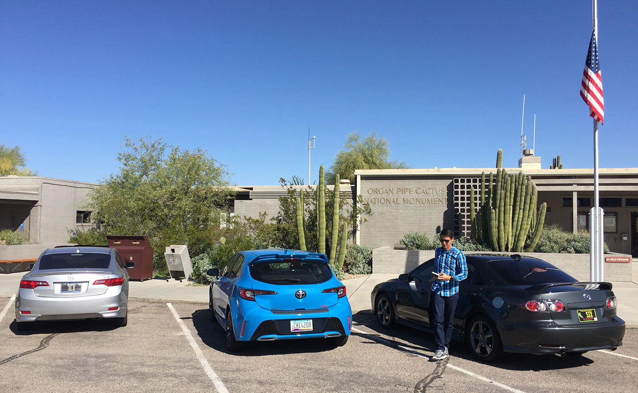
Now with 3 cars in tandem – my ILX, James’ tester Corolla hatchback, and Jason’s Mazda 6, we visited the Kris Eggle Visitor Center. It was named for a 29-year-old border patrol agent who was killed in the line of duty in 2002 by a Mexican drug smuggler. The dangers of being so close to the border are very real, and even today, visitors are encouraged to travel in groups and only visit during the day.
A 15-minute overview film taught a little about the terrain and its history. I noticed that a pair of hikers inquired with the park ranger about getting a token for completing one of the hikes, and later learned that any visitor who hikes 5 or more miles in the monument is eligible. We also saw a 7 or 8-year-old take a “ranger oath” with his right arm extended. Traditions like that make visits to the parks memorable.
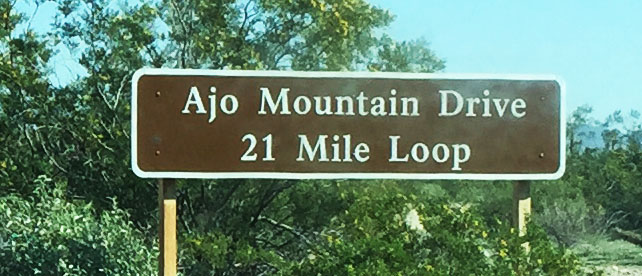
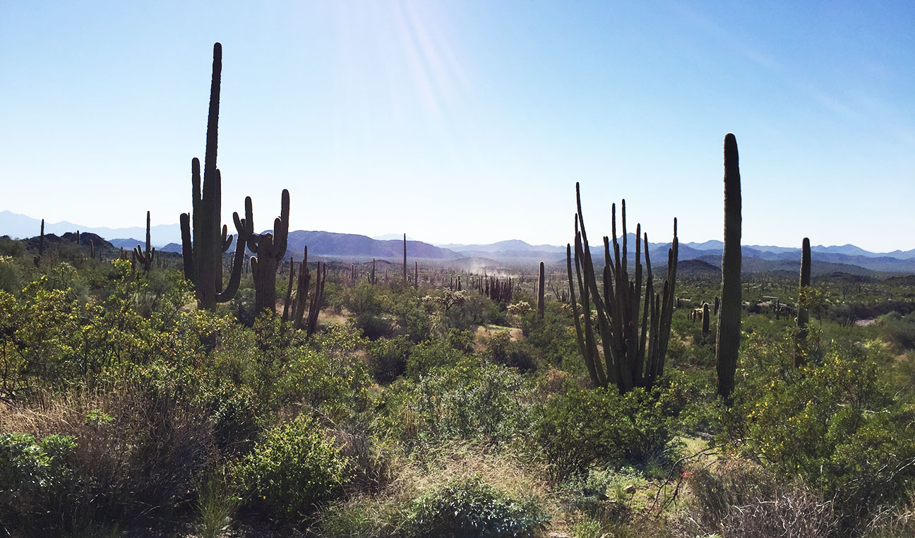
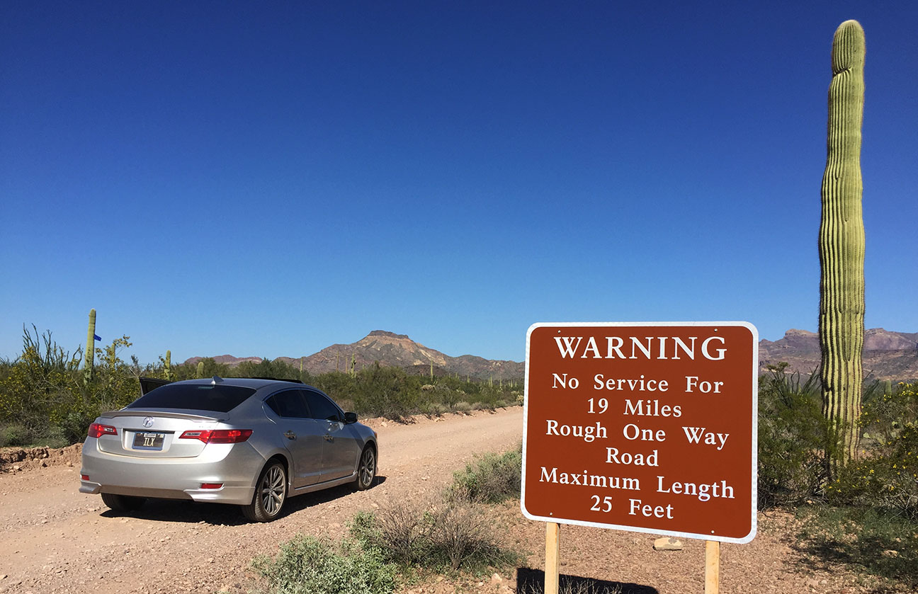
The Ajo Mountain Trail was the main attraction for us, and despite the fact that it was rugged and unpaved for most of the 21-mile loop, we knew we had to check it out. Per-car admission was $20 but to me it was worth it to be able to say I’ve “been there, done that.” I led the way and kicked up a pretty good cloud of dust for my followers while we stayed in touch by walkie-talkies. The trail extends eastward to the foothills and curves up to a panoramic lookout over the terrain. The Sonoran Desert, we had learned earlier in the film at the visitor center, is notoriously one of the most “green” types of deserts, and even in summer displays a wide variety of plant life. One of those plants, the Organ Pipe Cactus for which the monument was named, is native to the area and highly prevalent.
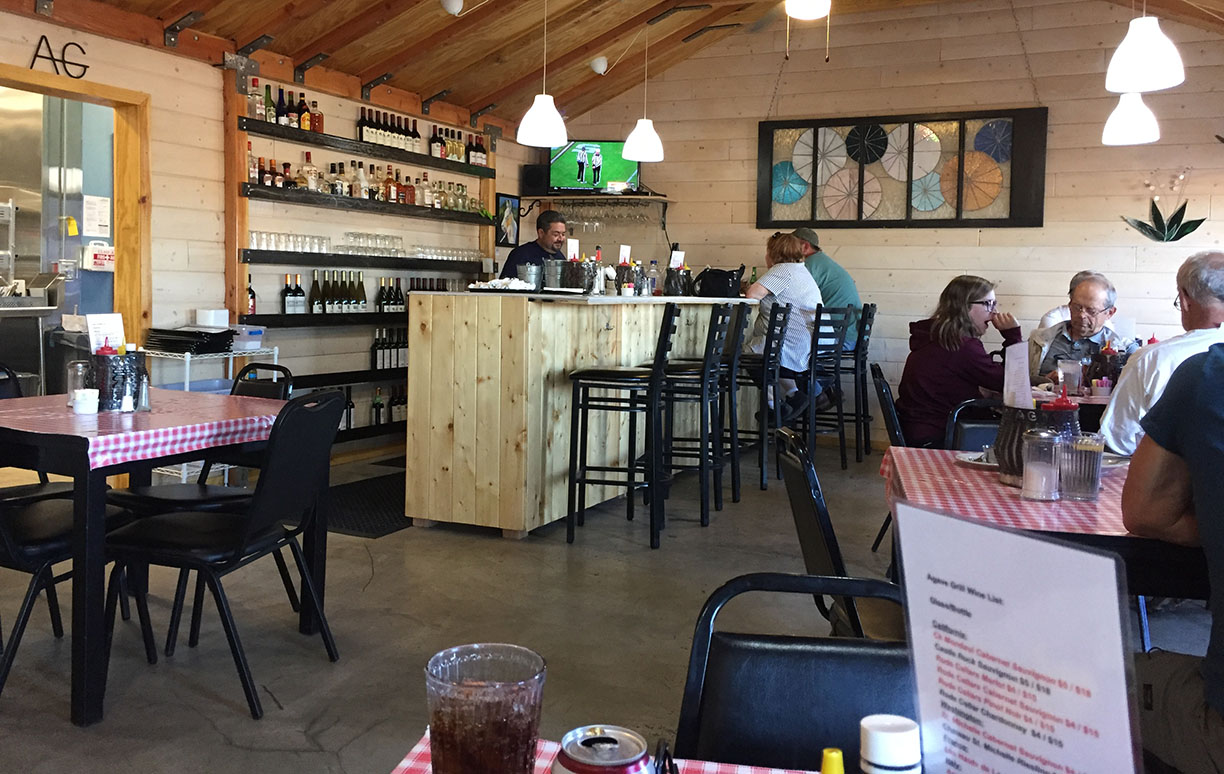
Since amenities immediately near the visitor center were few, we decided to back-track to the town of Ajo for a bite to eat at Agave Grill before splitting ways for the evening. James gave his hamburger a little more pizzazz by adding avocado, bacon, and a fried egg. Jason and I couldn’t help but play copy-cat and order the same thing. The owner of the restaurant later came out to let us know how much the kitchen staff had enjoyed putting together our custom-ordered burger creations.
But the next time I visit, it’ll be on a non-Saturday so I can see if Granny Mac’s food compares.
Signage indicating proximity to Mexico. Here’s where we headed south from Gila Bend on Highway 85.
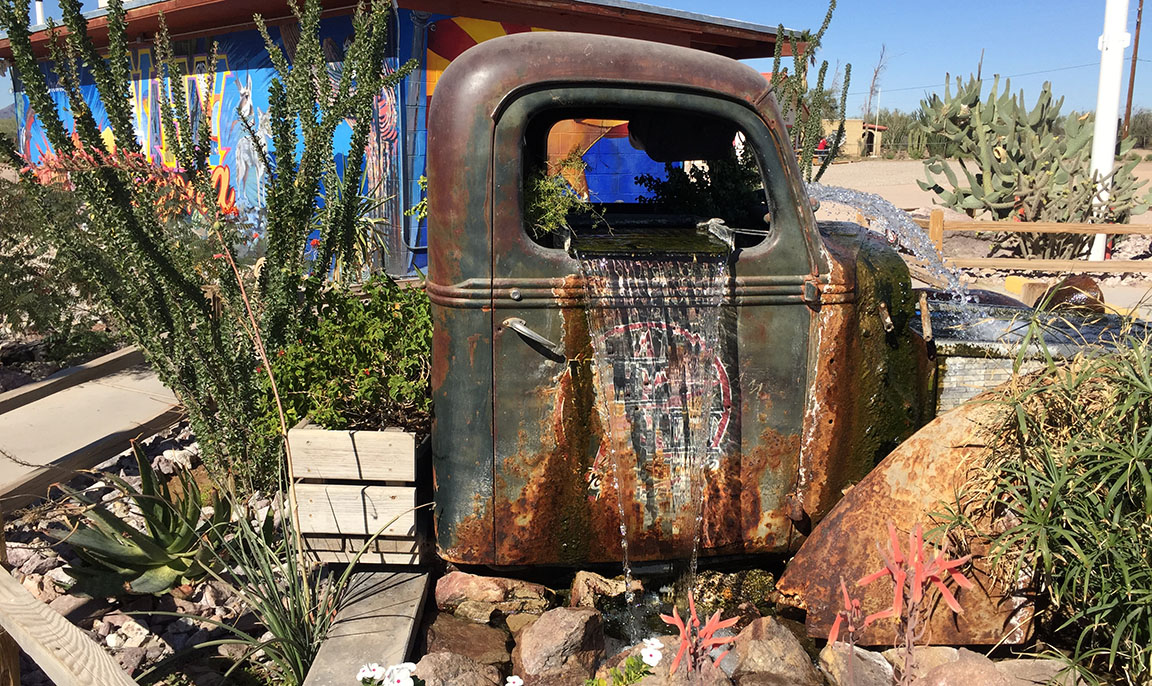
Cab of an old pickup truck made into a fountain – with music playing from inside it!
Coyotes on the loose!
Your one-stop shop:
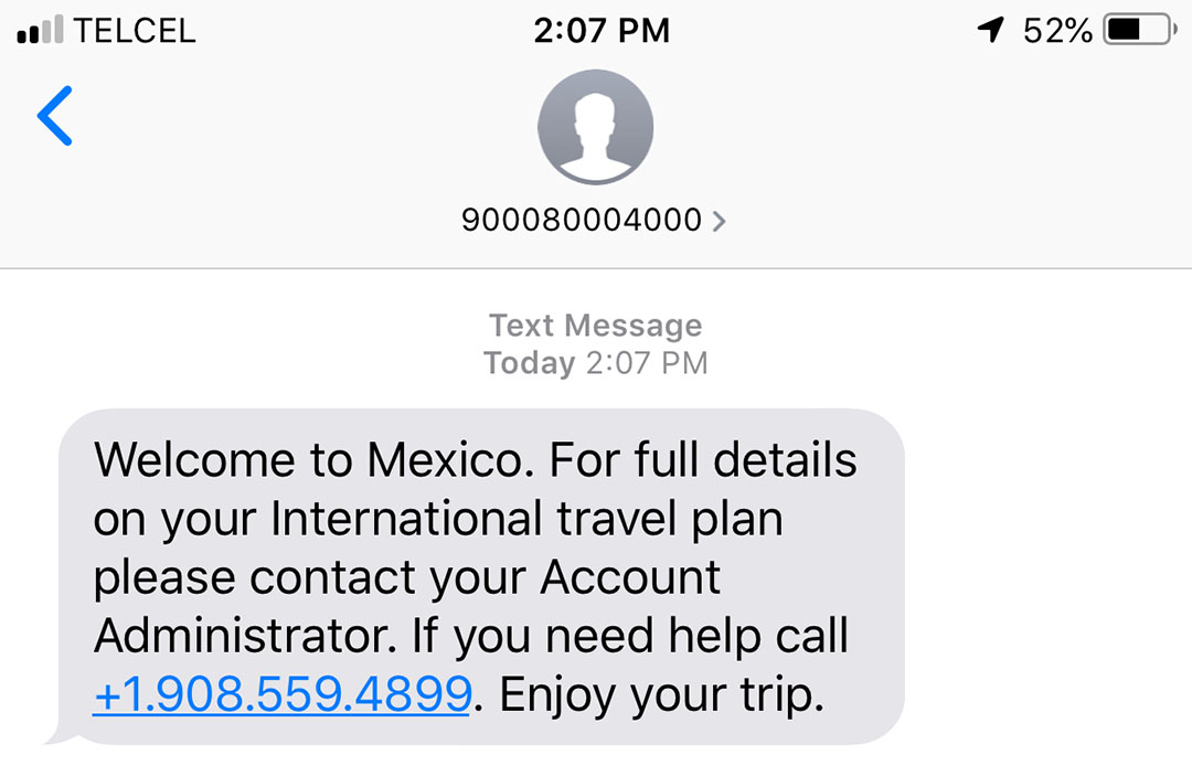
Jason received this text on his phone as we neared the border (though we didn’t cross it!)
Need a place to store your car? Or your gun? While in Mexico…
From the Why Not Travel Store: “If you need a penny, take one. If you need two, get a job!”
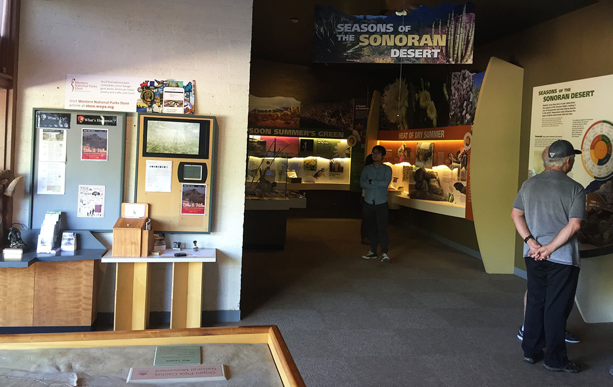
Interior of the OPCNM Visitor Center
Jason making some purchases
Headed out on the Ajo Mountain Road
Not a great place to have low clearance and low-pro tires!
Quick break near a summit on the trail.
Check the size of that saguaro cactus.
“Double arch”
Dinner spot at Agave Grill in Ajo, Arizona
The burger that wasn’t even on the menu. We’ll call it, “James’ Juicy Creation.”
Imagine living in a place so remote that the cold Dr. Pepper you’re about to swig had to come in on a pack mule or be air lifted there by a helicopter. Given the logistic challenges of sustaining a town so remote, I was surprised such a luxury was even available – let alone refrigerated. I even got this one at a discount because the can had been damaged during mule transport.
I’m about to introduce you to a community that has thrived in the heart of northern Arizona for hundreds of years. If you’re lucky, you’ll pick up a hint of 3G cell signal there. But otherwise, the inhabitants of the village of Supai are about as “low-tech” as you can get in the year 2018. (See location in the middle of this Google Maps screen shot).
I’ve lived within a few hours of the Grand Canyon my entire life and only been into the (mile-deep) middle of it one time, three years ago when some friends and I did a crazy, 26-mile, “South Rim to North Rim,” hike. It was time to put the hiking boots back on (or, just my running shoes, in this case) and trek back into one of Arizona’s wonders of the world.
The Havasupai Indian Reservation is surrounded on all sides by the national park, and it’s one of the most difficult to obtain a hiking permit to access. In fact, twice in the past (2008, and then again earlier this year), I’ve had a permit that has been cancelled or re-scheduled due to flooding in the canyon. This time, we crossed fingers that our trip would proceed as planned, and it did – for the most part.
Havasupai is a word that means ‘havasu’ (blue-green waters) and ‘pai’ (people). So the 639 people who live within the 300-square-mile reservation are the people of the blue-green waters. They are governed by a constitution that was signed in 1939 and led by a seven-member tribal council.
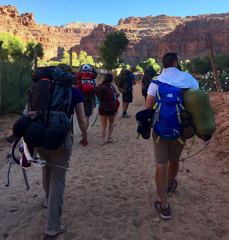
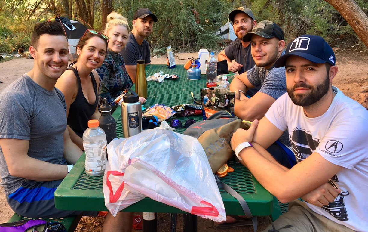
Our party of nine met up at the crack of dawn – actually, a little before it – on Friday morning, September 21. Getting there was a straightforward trek up Highway 89 from Phoenix, through the Route 66 towns of Seligman and Peach Springs, and then about 68 miles on a paved two-laner to the trailhead parking lot.
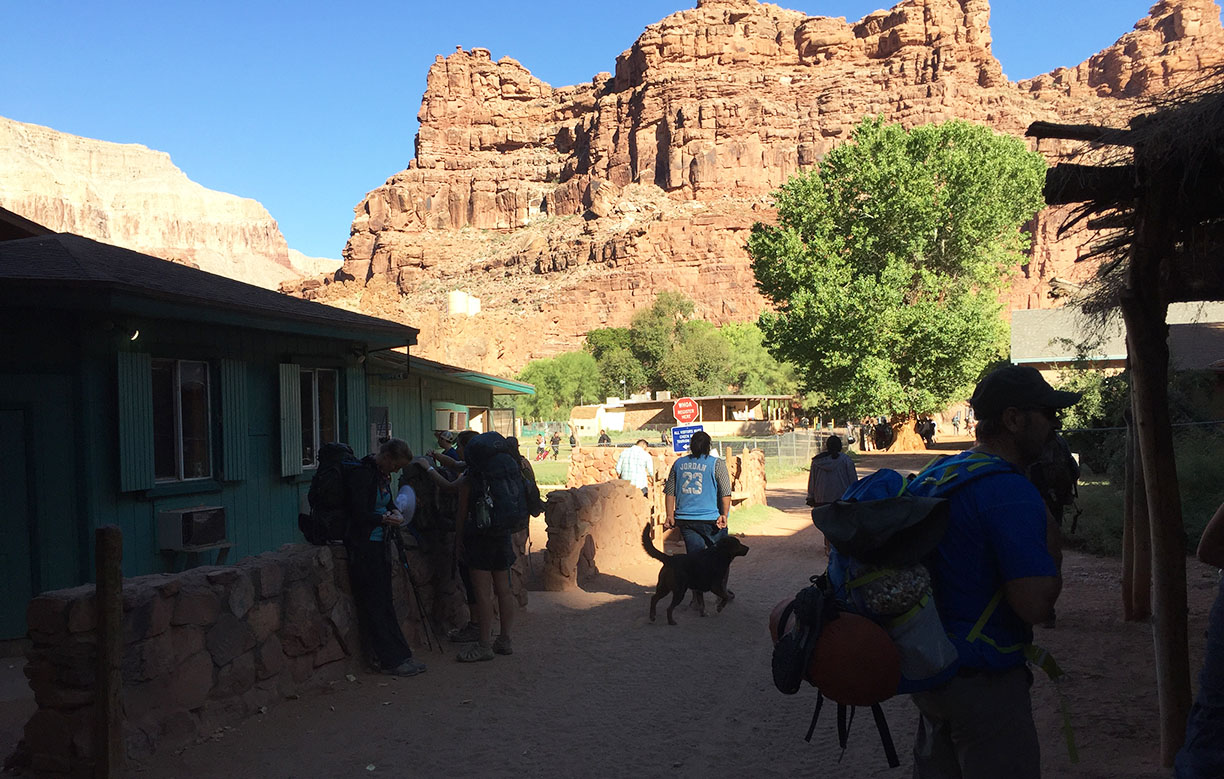
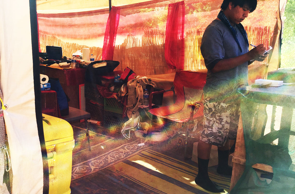
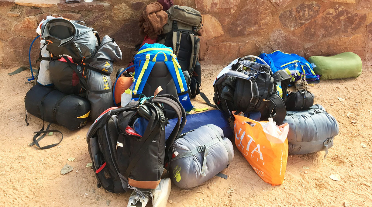
Getting all my gear into a backpack was no small challenge, and I had to carefully prioritize which items were critical for the trek. The 8-mile initial drop into the town of Supai was easy thanks to cool morning temperatures, well-traveled pathways, and primarily downhill grade. Amenities there were impressive: A cafe, general store, schoolhouse, and churches were all all present – staffed by natives and welcoming to the estimated 200 tourists who are camping in the area on any given day.
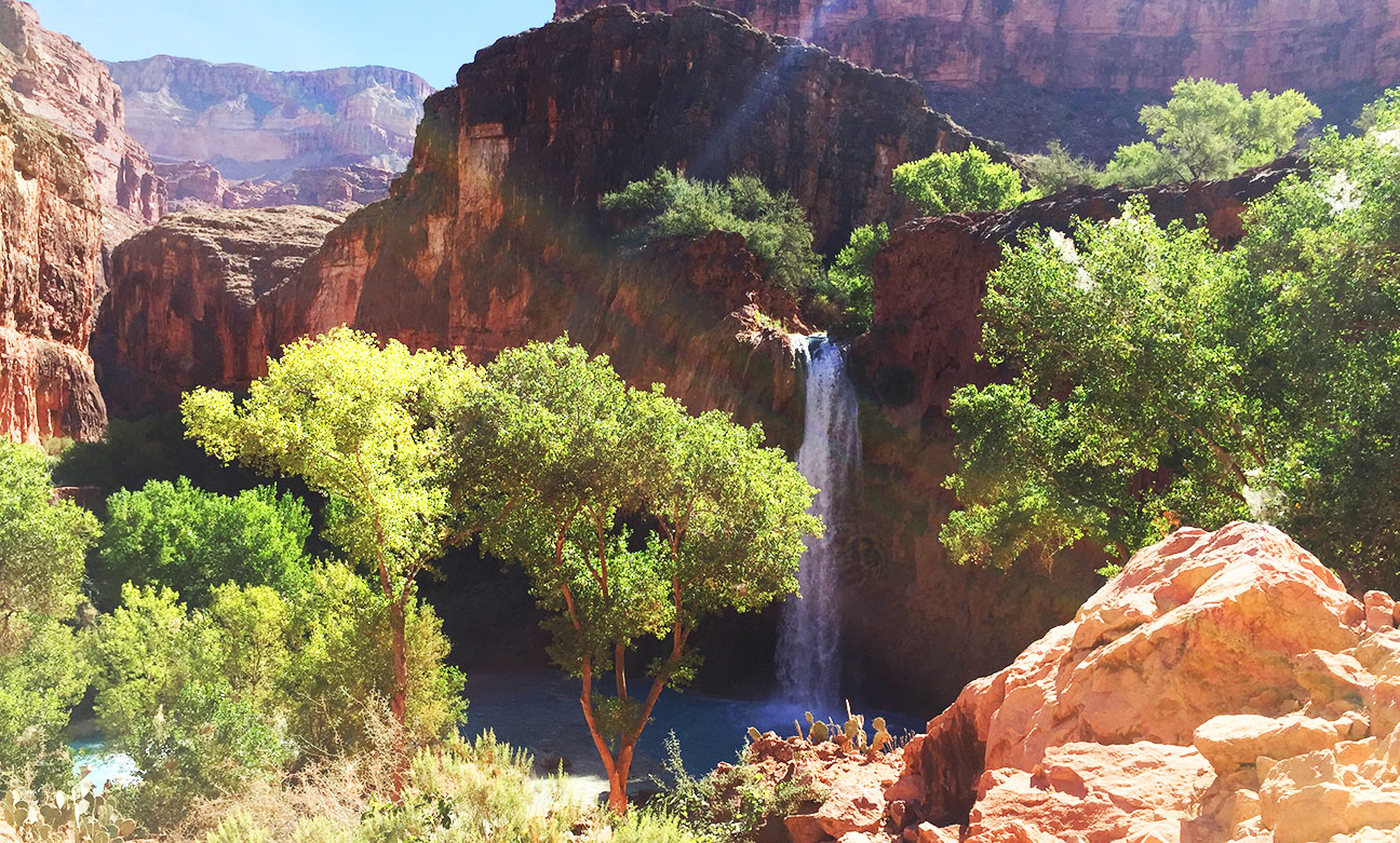
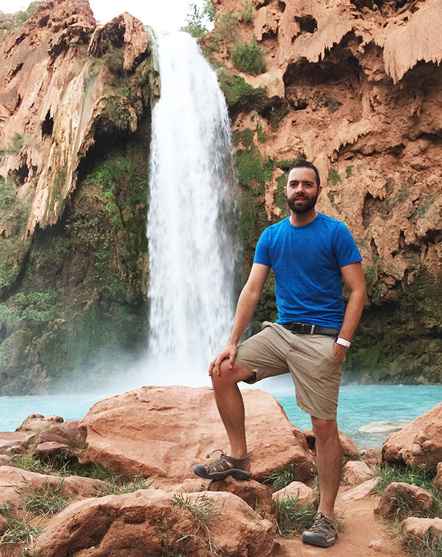
We found the perfect campsite for our party. It was two more miles down the dirt pathway and located right on the verge of Mooney Falls, which sent crystal blue waters cascading about 200 feet to the canyon below. Kyle set up a hammock along the river and that ended up being my favorite place to (literally) hang out. Best of all, we were disconnected entirely at that point from contact with the outside world.
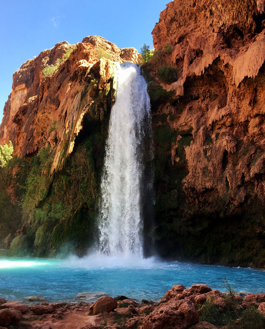
On Saturday, we scaled the cliffside with assistance of chains & ladders to the pools below Mooney Falls. It was an unforgettable experience in conquering a fear of heights. The most unnerving thing about making the descent was the fact that over time, the rocks & ladders had worn smooth so grip was limited. Besides that, the waterfall’s mist kept all footholds nice and slippery with water. Yikes.
We enjoyed the sights & sounds of Mooney Falls for a couple of hours before making our ascent to camp again. That afternoon’s highlight was getting a taste of some of the natives’ frybread. A $12 taco with beans, cheese, and tomatoes was the ultimate afternoon snack and worth every penny to someone who was sick of eating dehydrated meals from tinfoil bags. Jack opted for the ‘dessert’ version, drizzled in Nutella and caramel. In fact, he had two, and made me promise not to tell anyone. Sorry Jack!
Campfires are explicitly outlawed in the Havasupai region, so we told nighttime stores while huddled around the picnic table before calling it a night.
Already a little sore from two days of trudging around in the sand & water, I wasn’t feeling too keen on a roughly 10-mile (uphill) return hike to the parking lot on Sunday morning, so 3 from our party elected to take a helicopter from Supai instead. It was my first time riding in a helicopter, and I was glad that I did. The one-way fare for a 7-minute flight was $85 and because of limited seating (only room for 6) and a high volume of people leaving the canyon that day, it took about 4 hours until we actually got onboard. The views were spectacular.
By the time we got back to our vehicles, the members of our group who’d opted to hike out had already beat us there and left the area. I played catch-up in my ILX and reunited with Kyle, Jack, and Justin at Roadkill Cafe in Seligman before continuing the rest of the way into Phoenix.
The next time I crack open a Dr. Pepper, I’ll remember this trip with fond thoughts of sand in my shoes and a babbling brook underneath me in a hammock. Here is a video and a few more photos from our adventure!
Hiking in
Group photo courtesy of mom’s selfie stick
Checking in at the Tourist Office, where we were issued wristbands with our group name & trip dates
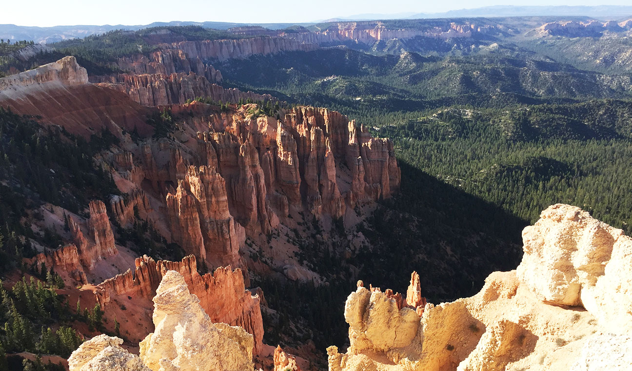
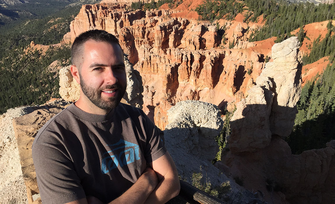
Do you know what a hoodoo is? The name to me sounds a lot like “voodoo,” and according to the Internet, can be used interchangeably with it. But there’s an alternate definition you may not have heard of. A hoodoo can also mean a column of weathered rock. Check out this view of a vast number of hoodoos that I saw on Friday at Bryce Canyon National Park in Utah. Now you know!
This past weekend’s 4-day, 1,000-mile road trip took me through Bryce as well as some of Utah’s other scenic wonders. It was the perfect escape from the day-to-day grind. I’ve visited Bryce a few times in the past, including when my friend Peter’s TSX rolled 200,000 miles three years ago and a trip to “Hell’s Backbone” in the ILX five years ago. Still, I can never get tired of seeing that amazing landscape. I took for granted that I grew up with so many beautiful national parks virtually in my own backyard in southern Utah.
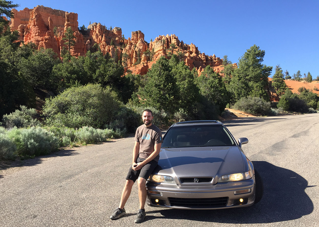
My tried and trusty Legend coupe was the chariot of choice for this backroads adventure, and it delivered perfect reliability as I knew it would. The idea for this trip came about because two friends were competing in the Bryce Canyon Ultra Marathon – a “50K” (32-mile) trail run that would subject them to some of the region’s most challenging terrain but also some of the most rewarding views. I think they’re nuts, but then again my own sanity is a little questionable too.
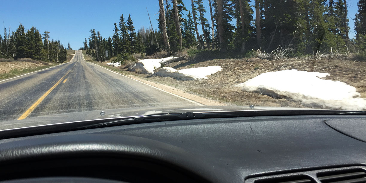
Bryce is one of five national parks in Utah and perhaps one of the least traveled – just the way I like them. The way we got there was pretty straightforward, with a night in my hometown of St. George on Thursday, and then northbound to Cedar City. From Cedar, that’s where things got interesting. We climbed nearly 5,000 feet in elevation on Highway 14 eastbound over the course of 18 miles – windows down, sunroof open, and soaking in the glorious temperatures.
From there, we hooked north on Highway 148 past Cedar Breaks National Monument. By that time, we were at 10,000 feet in elevation – high enough that even on June 1, we saw snow on the roadside. Cedar Breaks was awe-inspiring. We were also delighted that there was next to no traffic. The road is closed from November through May so it had just recently opened back up for the season – literally, the visitor center opened the very day we were rolling through.
Our destination for the next two nights was Panguitch, Utah – a tiny (2,000-resident) town on Highway 89 and home to the Blue Pine Motel, which has been there since 1901. While the accommodations weren’t first class, they were definitely warm and inviting. It’s a family owned atmosphere and a step back in time. We loved our stay. My friend and I visited Bryce Canyon later that first afternoon, some 20 minutes away, and soaked in some of the views from Rainbow Point and Sunset Point. Cars are $35 but we picked up an $80 annual parks pass for admission into any of the National Park units for an entire year. Seems like a decent value!
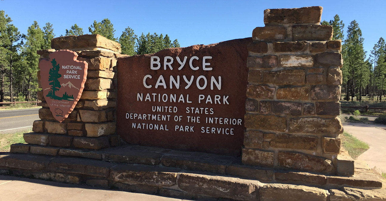
Bryce Canyon National Park was established 90 years ago and covers about 55 square miles. Navigating it is easy since there’s just one main 18-mile-long, north-south road with a loop at the end. We hiked 1.3 miles round trip on the Navajo Trail loop at Sunset Point before hitting up the restaurant inside the lodge for a delicious bite to eat.
The runners rocked their event, which started and ended in the foothills east of the small town of Hatch on Saturday. The level of difficulty was pretty extreme, with a 7,000-foot elevation change over the course of the 32 miles, along with high temperatures, rocky or sandy footing, and windblown dust. Our friends came in at 9 and 10 hours – exhausted but feeling accomplished. We treated them to Diet Cokes on ice, just as they’d requested.
The small town vibe continued when we made friends with the owner of Cowboy Smokehouse back in Panguitch, who gave us a free order of bacon-wrapped sweet potatoes for our appetizer. It tasted better than it sounds.
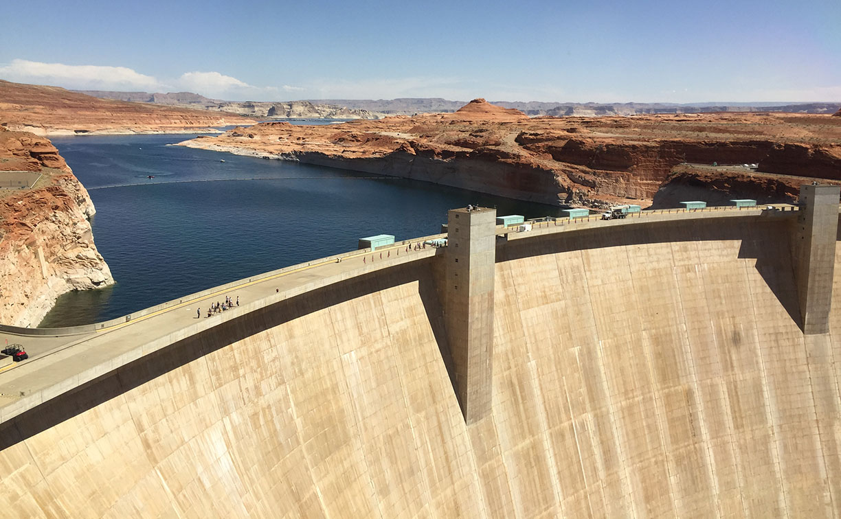
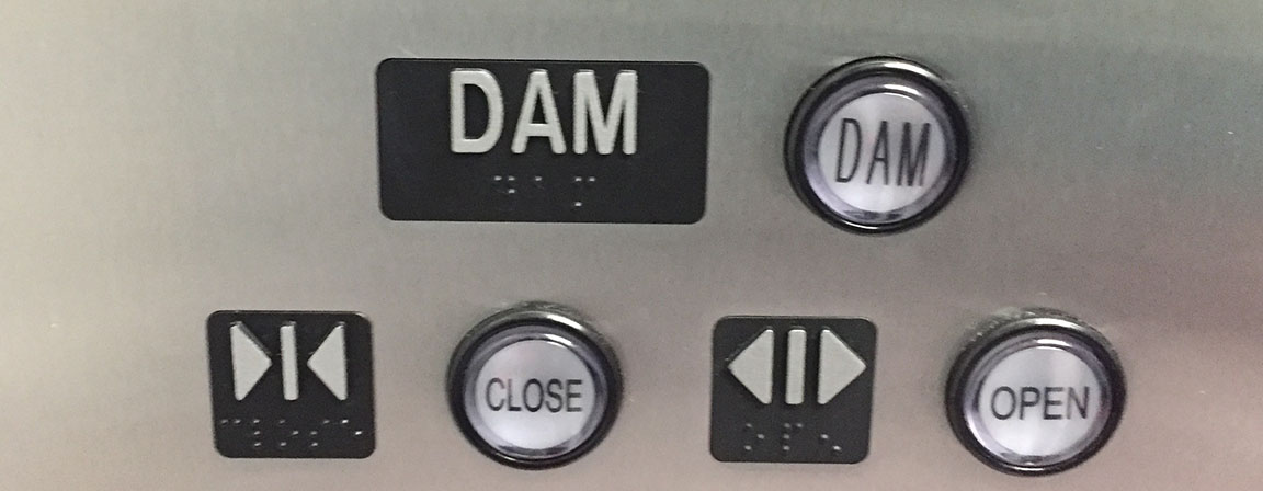
By Sunday morning, it was time to make the trek back home, so my friend and I headed out southbound on Highway 89 under a bright blue sky. We stopped just once in Utah – for fuel in Kanab – but decided to lollygag a little at the Arizona/Utah state line in Page. We happened to arrive at the Glen Canyon Dam at Lake Powell just in time for a 10:30 a.m. tour (and it would only cost us $5 each). Score! I’ve always wanted to take a dam tour. It was a dam good time.
For 45 minutes, we were part of a group of 15 people listening to a tour guide teach us about the dam and its history. We got to ride in two elevators, down a total of over 700 feet to the base of the canyon where the Colorado River runs below. The dam was completed in 1966 but the lake behind it, Lake Powell, took 16 years to fill up! Today there are 8 turbines capable of generating 1.32 gigawatts of power. When I read that on one of the signs, it made me think of Doc Brown’s quote in Back to the Future about needing “1.21 gigawatts.” Great Scott!
My favorite part of the tour was learning that for 1 year only, traffic did flow over the dam itself. I asked our tour guide about it because I could see the the faded remnants of a double-yellow line on top of the concrete. She told us that for just 1 year (1978) traffic was directed across the dam, because construction was taking place on the adjacent bypass bridge.
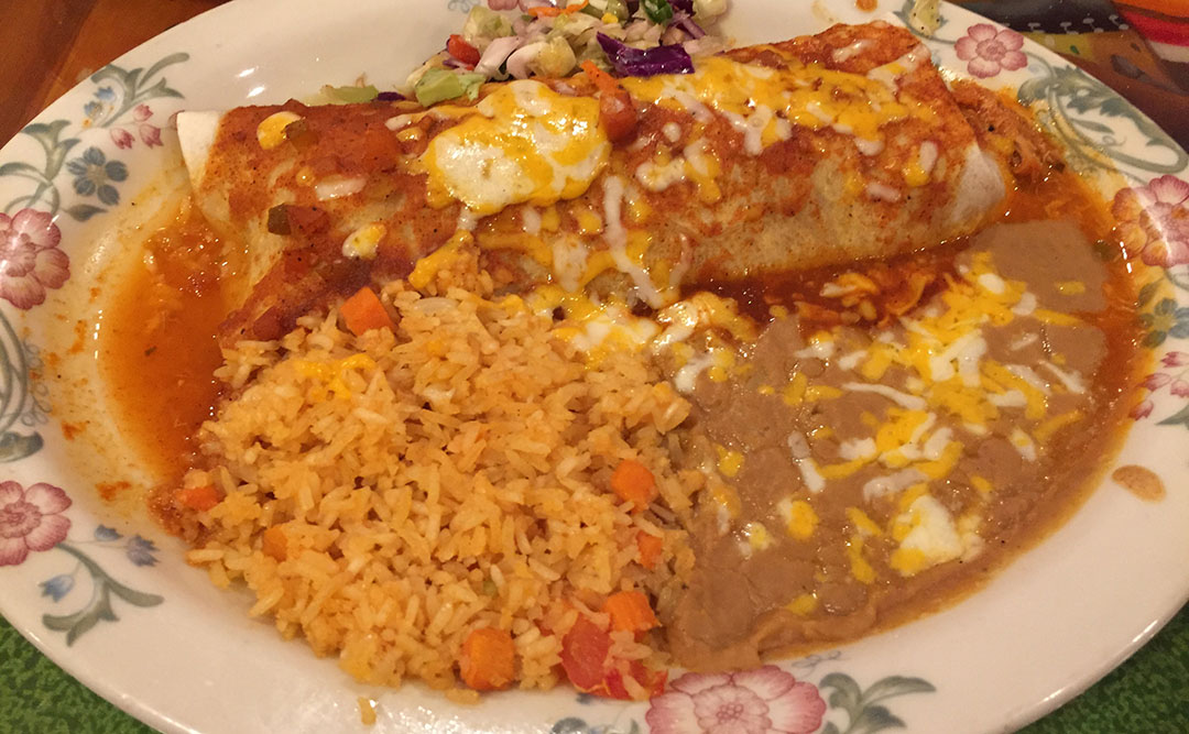
For lunch, we hit up Fiesta Mexicana in Page, then worked our way to Flagstaff on Highway 89 and connected with Interstate 17 for the final 2 hours of downhill slide into the Phoenix Valley. If only we could have brought some of the cooler temperatures back home with us! The oven has been preheated and we are ready to bake here until October or so. Gotta love it!
Thanks for coming along!
Glen Canyon Dam Tour
Here’s something new for the blog. I have 3 readers who are selling cars and who contacted me about listing them here. Does anyone have interest in these? Let me know and I’ll put you in touch with the sellers.
Brandon’s 1990 Legend L coupe for sale
Automatic
155,000 Miles
San Diego, CA
$ Make Offer
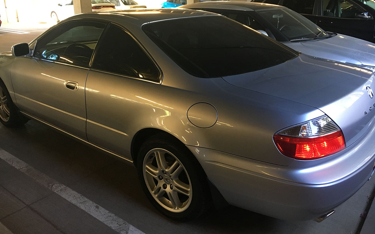
Matt’s 2003 CL-S for sale
6-Speed Manual
255,000 Miles
Phoenix, AZ
$4,300
Srikanth’s 1991 Legend L sedan for sale
Automatic
151,000 Miles
Providence, RI
$ Make Offer
More trip pics – snow along Highway 148, in June
Cedar Breaks National Monument
Pond near the starting (and finish) line of the 50K race
Hanging with mom at the finish line
Sandy’s Audi Q5 got dirty while my Legend stayed clean back at the motel
Small town talk: I had to ask someone what “chicken lights” are.
Blue Pine Motel parking
Hanging at Glen Canyon Dam. Watch your step!
View looking toward the bridge over the Colorado River
Imagine how simple life must have been 700 years ago. Yesterday, I walked in the literal footsteps of the Mogollon (pronounced moga-yon) people – a band of indigenous tribes who lived off the land through subsistence farming during that era, and who left behind a glimpse of what their lives consisted of. Being without cell signal for 5 hours gave me but a very small taste of what it would have been like to be more in tune with nature. And I liked it.
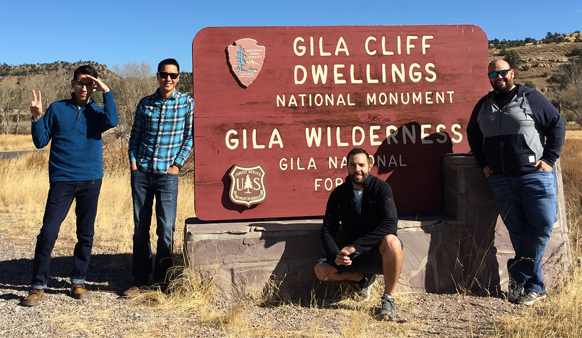
The southwestern United States is home to some of the best-preserved historic ruins thanks to predictable weather patterns and remote geography. Almost exactly 110 years ago, President Theodore Roosevelt set aside about 530 acres in southwestern New Mexico as part of a national monument that today resides about 40 miles north of the town of Silver City. For us Arizonans, that makes it a pretty accessible overnight road trip destination. And this weekend, per suggestion of (and in partnership with) Driven for Drives‘ Jason Pawela, I checked it off my list.
I broke free from the Phoenix urban grid a little after 3:00 p.m. on Friday to make my eastward trip toward the New Mexico state line. As was to be expected, I had to fight my way out on I-10 in commuter traffic but eventually was able to set the cruise on my Integra at 75 miles per hour. I made just one stop, at Love’s in Benson, for fuel and a stretch of the legs. The final 50 or so miles from I-10 at Lordsburg into Silver City were lonely and even a little creepy. My ‘Christmas tree’ of dash lights (ABS, check engine, high beams, and cruise) were the only lights I saw aside from vivid constellations under the night sky – highly visible thanks to the area’s lack of light pollution.
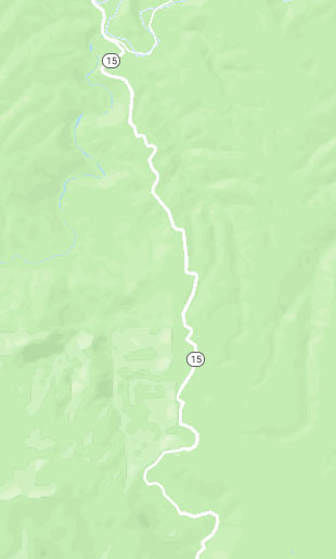
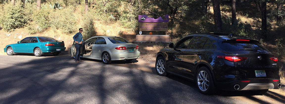
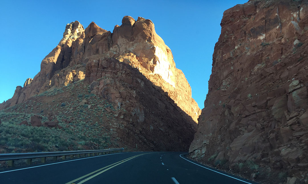
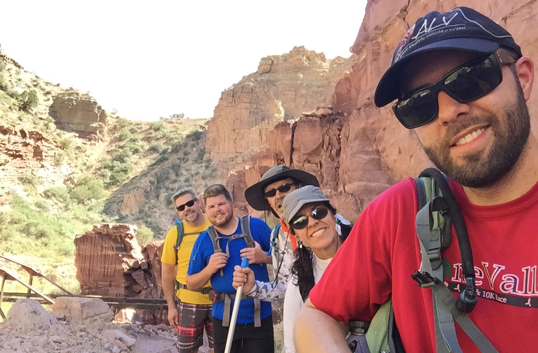
Saturday morning brought us crisp 45 degree temperatures and blue skies. I met up with Jason, James L, and James Z for a hearty Comfort Inn breakfast (complete with green chili on the side – total New Mexico thing!) and then we rallied our participants for this weekend’s drive: 2018 Alfa Romeo Stelvio, 2004 Mazda 6, and 1992 Acura Integra. It took only a few minutes to lose cell service as we headed north on twisty Highway 15. For only a 2-liter motor, the Alfa’s 280-horsepower 4-cylinder motor develops oodles of power and James was right on my tail. I swapped keys with Jason for a few miles and was impressed at how smoothly his (‘new‘) Mazda 6 handles given its 180k+ miles.
It’s a good thing I was a driver, because I wouldn’t have lasted 5 minutes as a passenger with these curves. For about half that stretch, the road was narrow, with blind corners and no painted center line. NM DOT basically says “Good luck!” and to allow for plenty of travel time (they said 2 hours) between Silver City and the ruins.
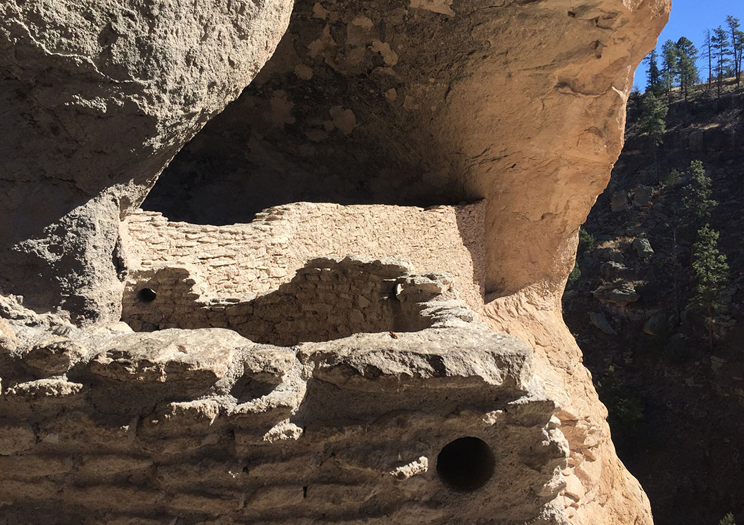
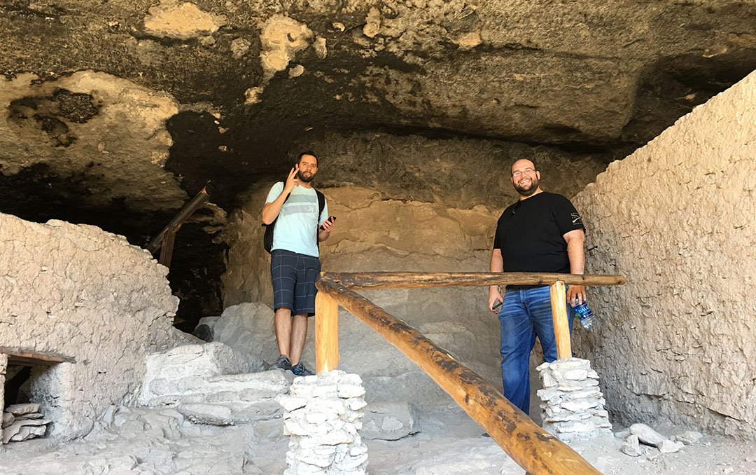
After a brief intro at the Visitor Center which probably looks today about the same as it did in the 1960s, we headed to a parking lot & trailhead 2 miles up the road. The dwellings in the area were believed to have been occupied around the year 1275 and are still remarkably well preserved. The Gila River running nearby was the Mogollon peoples’ source of life. By 1874 when explorer Henry Weatherbee Henshaw discovered and wrote about the ruins, some parts of them had been damaged. But ever since President Roosevelt’s decision to make it a national monument, the preservation has been vigilant – we weren’t even allowed to take liquids other than water on the hike, and we were asked not to touch any of the walls with our hands.
To access them, we had to hike a one mile loop which crosses several footbridges. There was a small brook running underneath them and the sound of waterfalls made it a therapeutic experience. A steep incline further down the trail took us up the cliffside and then we walked through a series of 5 different “rooms,” each one laid out with a unique floor plan. What struck me was the savvy use of space and the distinct feeling of temperature and brightness in each room. The south-facing openings were optimal because they would allow some summer sunshine to enter and heat up the rooms in the winter time, but kept them shaded during the summer when the sun was higher in the sky.
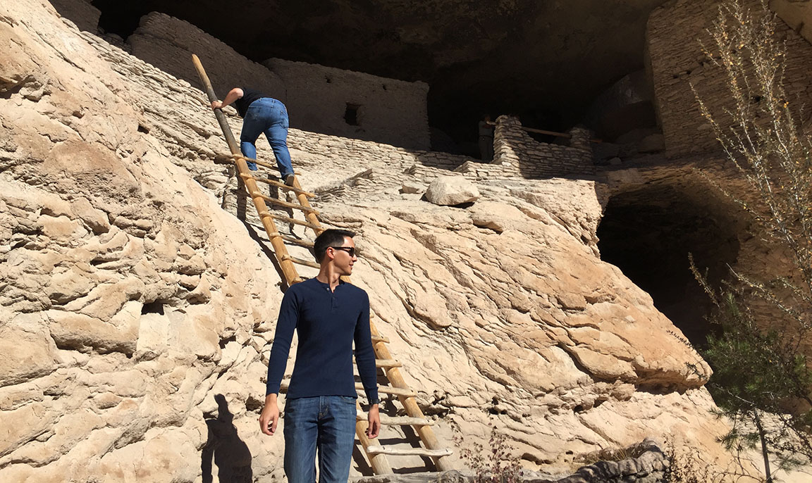
Much of the Mogollon peoples’ lives remains a mystery, and part of our tour consisted of a Q&A session with ranger Connie. Connie took the time to point out a few key features and asked us what we thought they were. They included a grinding stone, pictograph images painted on the walls, and architectural features of the caves. Today, there are wooden step ladders leaning to the various rooms but some of the original infrastructure – including rooftops over some of the rooms – are now gone. It took us about an hour to hike the circle.
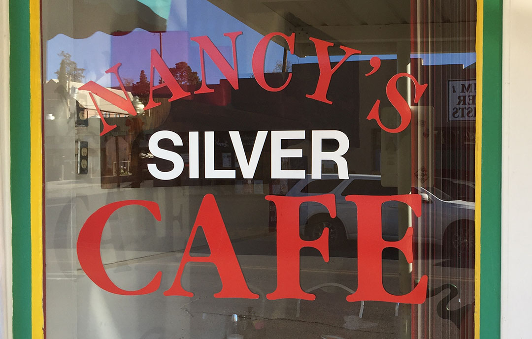
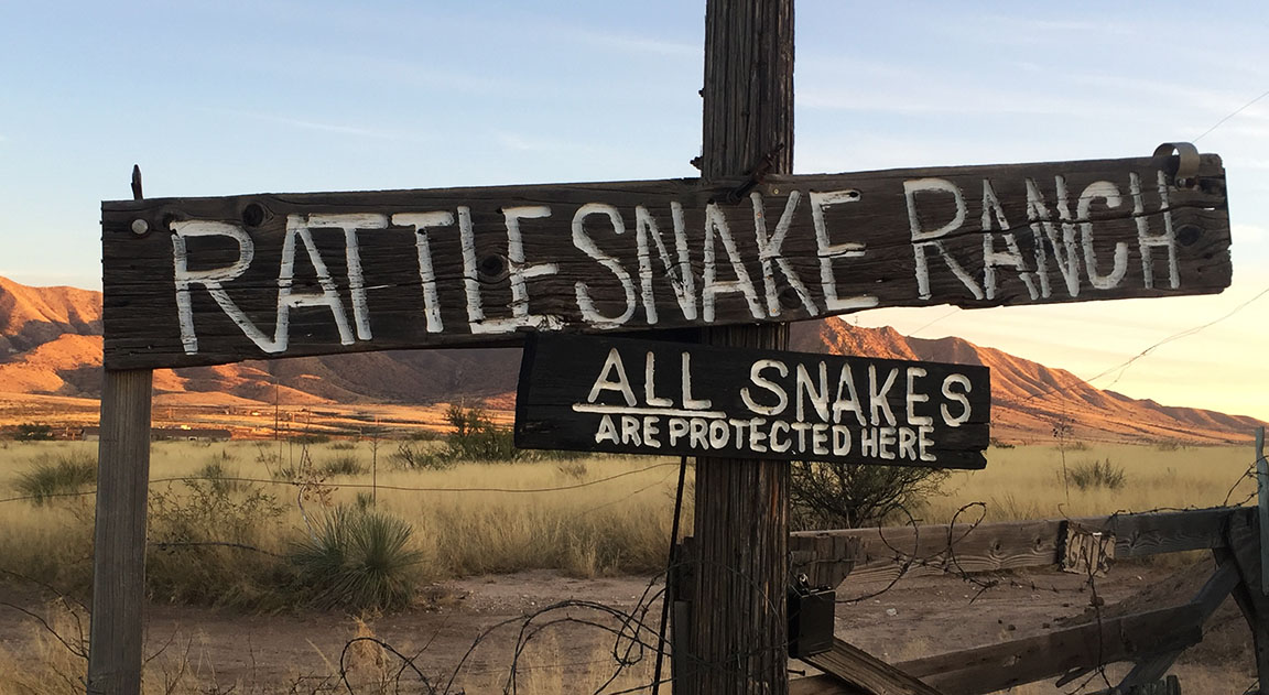
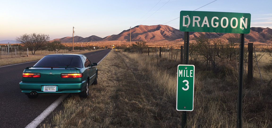
The return trip to Silver City was once again ‘spirited’ in nature, and we made good time thanks to being a little familiar with the terrain by now. Lunch was at Nancy’s Silver Cafe right in historic downtown, where the 3-taco plate was just what the doctor ordered to satisfy those hunger cravings. We parted ways by mid afternoon and I sailed off into the sunset – literally, squinting at it the whole way – returning to Phoenix. I did make just one stop along the way, in a town called Dragoon, perhaps in hopes I’d see a fire-breathing dragon. But I did not. I just saw a sign about some rattlesnakes and some run-down buildings.
Here are the rest of my pics from this trip, as well as a short video. Thanks for coming along!
Getting ready to roll on out.
Welcome to the Trail of the Mountain Scenic Byway
Whoever picked purple for the lettering on this sign probably made the wrong choice.
We missed fall colors by just a few weeks…
… but in a few areas they are still very vivid. New Mexico does get 3-4 inches of snow per winter at this elevation, according to Ranger Connie.
Visitor Center. Entry fee is $5 per person for the hike to the ruins.
Making our way toward the dwellings.
The round hole here is where a wooden pole (supporting a roof) once would have been.
Climbing down the ladder from the largest room.
Some of the blackened ceilings in the caves are due to fires / smoke.
What are some of the most expensive toll roads you’ve driven?
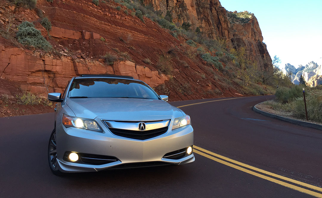
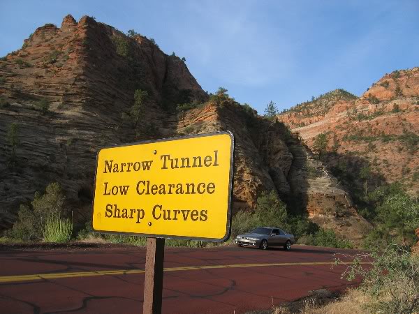
On Thursday morning, I paid $30 to drive 14 miles on State Route 9 in southern Utah. $2 per mile! But that’s a small price to pay for this kind of scenery-per-mile, right?
Truth is, that fee was actually the cover charge for Zion National Park, and it just so happened that I needed to pass through Zion in order to get to a Thanksgiving feast that was awaiting me at Aunt Jodi’s house on the other side in Rockville.
Knowing, though, that I wouldn’t need to re-enter the park since I’d be taking a different route home, I decided to “pay it forward.” It was Thanksgiving Day, after all. As soon as I got through the park and exited its west end, I hit the brakes, threw the hazards on in the ILX, and rushed out the driver door to hand my park pass to an unsuspecting motorist going the opposite way who was waiting in line at the ranger station to enter. “Do you want a free park pass? It’s good for 7 days,” I told the driver of a white SUV. “Umm, sure!” he said as he took the brochure and receipt. “Happy Thanksgiving!” I yelled as I ran back to the ILX and drove away.
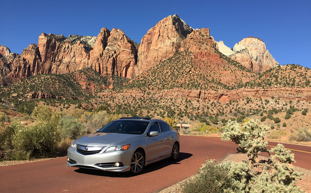
Growing up in southern Utah, my family’s home was only 45 minutes from the gates of Zion National Park. Zion is one of Utah’s 5 colorful national parks, established 97 years ago and covering over 200 square miles in the southwest corner of the state. There are some key features including waterfalls, gardens, and picturesque sandstone cliffs carved away by the Virgin River at the base. Holiday tourist traffic was heavy on Thanksgiving but that didn’t stop me from enjoying the scenery and stopping for a few photos on my quick drive through.
My favorite feature of the park is 1.1-mile-long tunnel called the Zion – Mount Carmel Tunnel. It was carved away in 1930 and shortened the distance from Zion to nearby Bryce Canyon by 70 miles. The tunnel is narrow and requires a special escort for oversize vehicles. The interior of the tunnel is completely black except for 3 or 4 spots where there are ‘windows’ opening up to the outside canyon. Unfortunately cars are not allowed to stop at those windows.
We dined heartily on turkey and trimmings at Jodi’s. It was good to see my brothers and a couple of my cousins. Here are a few photos and a short video from my Thanksgiving weekend. Check out my cousin Dillon’s dance moves at 1:46 in. I hope you and your families had an enjoyable one.
Highway 89 northbound just south of Page, Arizona
Utah state line near Lake Powell in Page
I liked this Parry Lodge in Kanab, Utah
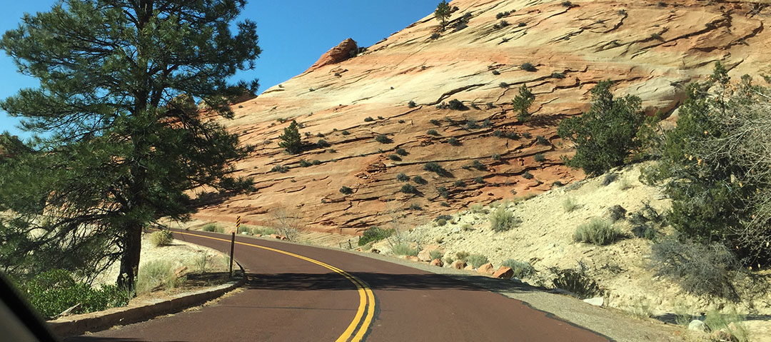
Highway 9 westbound
Curvy road after exiting the tunnel
These backdrops never get old
Quick jaunt to Salt Lake to visit a family member in the hospital
Sunset off mom’s back patio on Saturday night
Visiting a couple of my favorite little people, nephew Rex and niece Vivienne
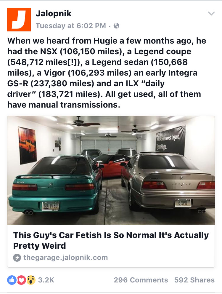
I was shocked on Thursday evening when my friend Chris messaged me about an article that had just been posted on Jalopnik about my garage and Acura collection. Jalopnik is one of the largest automotive media pages around – with over 300,000 followers on Facebook, 150,000 YouTube subscribers, and a huge presence overall. A couple of months ago, I had shot a quick email over to editor Andrew Collins who I also knew to be an Acura driver (with a > 200,000-mile TL). He took enough interest in the story to put together an article about it.
The level of response was pretty nuts. My blog had its best view day in its 5-year history, with 2,558 views and over 1,200 visitors the following day. Both the Facebook post and the article itself got about 300 comments each. I was terrified of reading them but eventually got the nerve. To my surprise, most were overwhelmingly positive. I’m glad a few people out there can relate to a my madness or at least consider it a little bit entertaining.
The blog, by the way, is sitting at around 496,000 views overall since I started it in March 2011. That means we are shortly coming up on a Drive to Five milestone of a completely different nature. Thanks for being part of it!
Last week, I was reviewing a GMC Canyon. This week, I’m reviewing another Canyon. The Grand Canyon.
While most of the canyon’s 5 million visitors per year are content to stand at the edge and admire its grandeur from afar, others are not happy until they get down and dirty while trudging across 20+ miles of it. My mom is one of those people, and I let her talk me (and a few friends) into joining her for this crazy adventure inside one of the “7 natural wonders of the world” last Friday. And 4 days later, my legs still scream at me for putting them through it.
I last blogged about the Grand Canyon in April 2014 when my friend Brad and I road-tripped to the Skywalk, a glass platform suspended from the canyon walls at the West Rim on the Hualapai Indian Reservation. But the 1,900-squre-mile national park is vastly different to look at from any of the many different angles, and there are several different hiking paths that lead down into it for those who dare.
Painfully Awesome
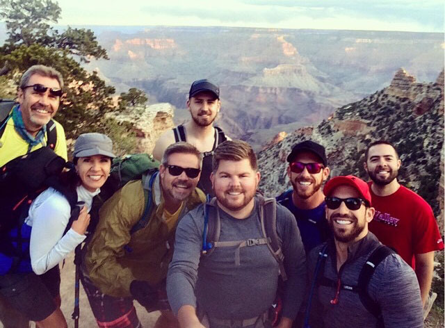
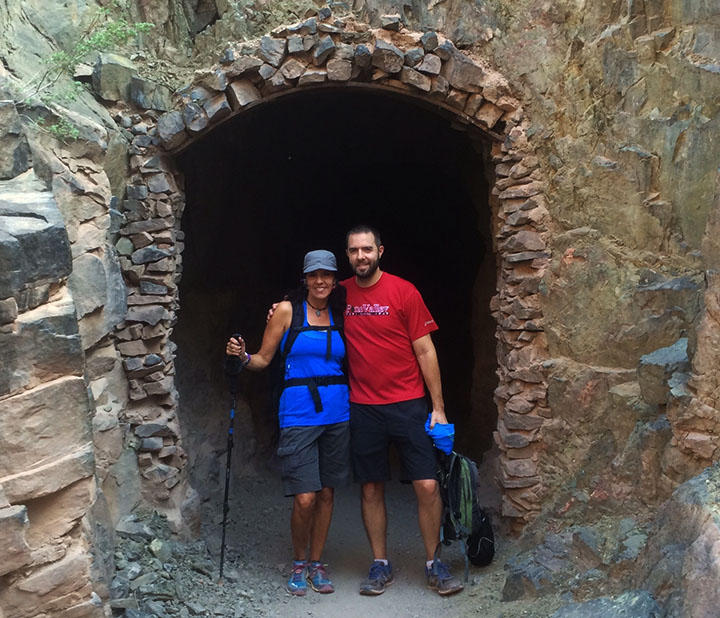
My friend Dave was telling me the other day about a bike ride he’d taken that had been especially difficult. He called it “painfully awesome.” That sums up in two words exactly how I’d describe Friday’s 14-hour hike. It was the most physically challenging thing I have ever done. Joined by 5 ambitious friends as well as my mom & stepdad, we set our sights on a “rim-to-rim” excursion. In other words, we would start on the south side of the canyon, hike down into into its depths at the Colorado River, then eventually make our way up the north side. For many months we prepared ourselves physically and mentally for the task, but the actual experience was exponentially more than I was ready for.
On Thursday afternoon, I picked up Kyle, Bryce, and Justin in the ILX for our departure from the Phoenix area. It took us about four hours to arrive at the Maswick Lodge along the South Rim. Highway 64 is a very quiet place at night. It’s a two-laner that climbs through the pine forests west of Flagstaff with little traffic, and no significant services or amenities aside from an occasional lonely gas station. By about 10:00 p.m. we met up with my mom, stepdad, and two other friends and settled in for a somewhat sleepless night.
It’s Go Time
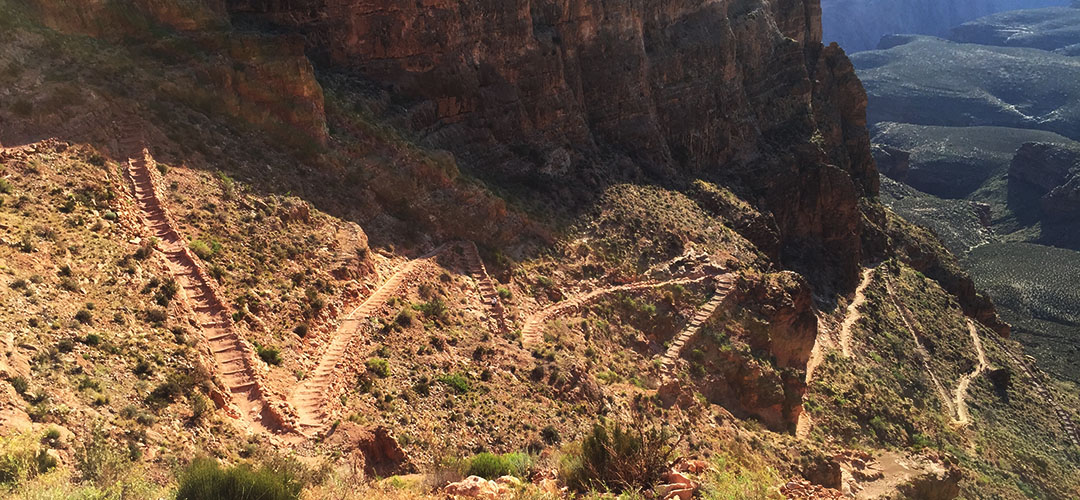
In the blink of an eye it was time for a 4:00 a.m. wake-up call. Right off the bat, anxiety ran high because we were rushed to get to the train station for a 5:00 a.m. shuttle bus. We had to make last-minute decisions on what to throw into our packs, how much water to take, and what to wear. (Some of our gear would be staying in my car rather than making the trip across the canyon on our backs.) The bus took us to the South Kaibab trailhead (elevation 7,260 feet) about 15 minutes away and we hopped out. The sight of the canyon at daybreak is something unreal. Temperatures were cool but not uncomfortable. And then began our short-lived tradition of taking a group “selfie” at one-mile intervals throughout the course of the hike. I say short-lived, because by about halfway through the day we cared very little about group pics; we were focused instead on sheer survival.
With energy in abundance we made our way down the rocky but well-marked trail toward the base of the canyon. “We’re going down there?” I thought to myself as I looked in the distance at the vast expanse of rugged terrain. The trail required a good deal of focus for proper footing, but every once in awhile we had to look up from the ground below and admire the scenery around us. “OOOH AHH POINT,” one of the first signed viewpoints we came across, was aptly named. We zig-zagged our way down thousands of feet in elevation. Right away I discovered an issue with my Camelbak backpack when it started soaking my back and shorts. Somehow I hadn’t sealed it tightly enough and it was leaking like crazy. Eventually I dumped the water out of it and resorted to just using 3 refillable bottles.
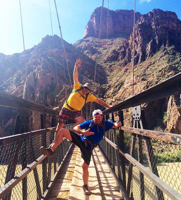
Besides having plenty of water, we were adequately prepared with other forms of nutrition. Rustin and Wade had packed what appeared to be an entire deli counter. Sliced lunch meats, prosciutto cheese, fresh strawberries and other delicacies were offered up when we made our first rest stop. Thanks to the downhill grade, our pace was quick at a little over 2 miles per hour. A short tunnel and pedestrian bridge across the Colorado River (which had a milky green look to it at the time) awaited us when we finally got to the bottom of the canyon.
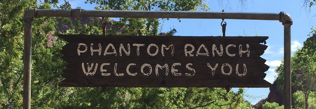
Phantom Pit Stop
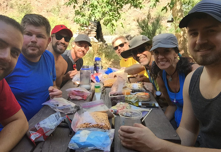
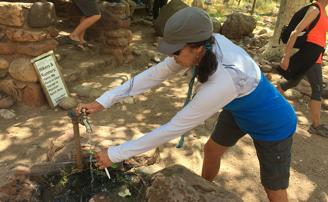
By now we were starting to wonder when we’d make it to Phantom Ranch at 2,460 feet. Notably the most “developed” of any place we’d be seeing throughout the course of the day, the lodge there has been a waypoint for Grand Canyon travelers since it was constructed in 1922. It was about 7.4 miles into our hike, and as we got closer, I could only think about one thing: LEMONADE. Inside the lodge, they sell cups of ice cold lemonade for $3.00 each. I chugged one so quickly it gave me a headache. Outside, there was a fresh water spigot for refilling water packs. The 8 of us sat around a picnic table under a shade tree and laid out some food items to refill our stomachs. Rustin pulled out a travel size bottle of Hidden Valley Ranch dressing and we all gave him a look of: “You packed that down here?”
The sound of Bright Angel Creek running nearby was therapeutic in itself. Todd took the opportunity to soak his legs in the chilly water. The rest of us just enjoyed the chance to rest at the picnic area. After so much downhill, for some reason when standing still, my legs felt wobbly. I knew already that for every one step downhill we’d taken, we’d be taking closer to two uphill. And that I dreaded.
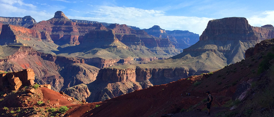
Ribbon Falls
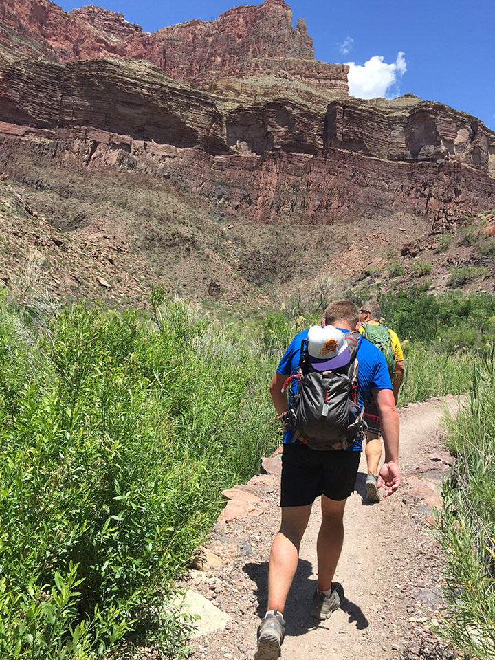
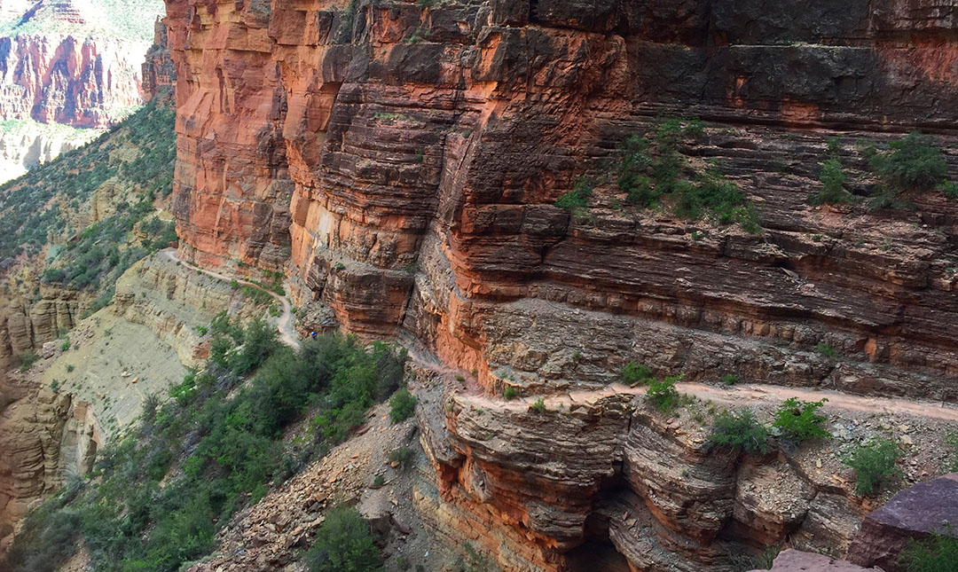
The trail ran parallel to the river for many more miles. It was about this time – probably 10:30 or 11 in the morning – when the heat started cranking up. Even though I’d lathered up in SPF50 and I was wearing a baseball cap and sunglasses, I could feel the sun cooking the back of my neck. At times we had to walk single file and at other times we stood two abreast and held conversations. Several times there were bridge crossings where the trail changed sides in relation to the river. The steady uphill grade started getting the best of me and I now started drinking more water than ever before. I could now see why on average 250 people per year are rescued from the canyon. Dehydration is a very real concern.
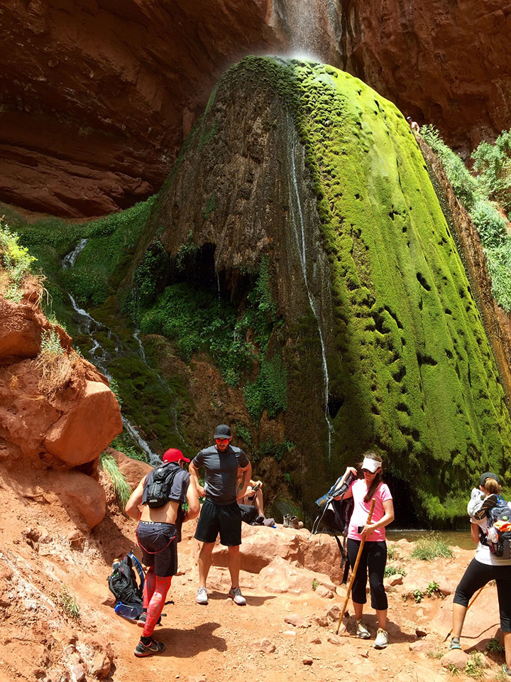
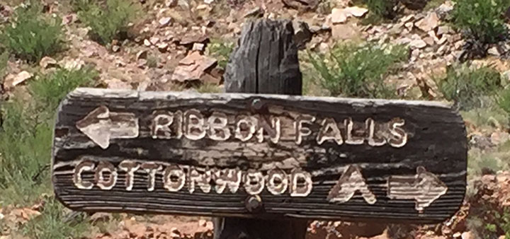
My mom had learned of a detour that was an absolute must-see called Ribbon Falls. I don’t think any of us were too keen on adding distance to our already-long hike, but multiple sources had recommended we make time for it. So, when we saw a crudely-carved wooden sign pointing us in its direction, we rallied our energy as best we could and headed toward Ribbon to check it out. We had to cross a stream and hike up some boulders to get there, but in about 20 minutes we came upon the most beautiful oasis I’ve ever seen. Misty water came down upon us from dozens of feet above where it spilled through an opening in the red sandstone. Justin quickly scampered up as high as he could go on the waterfall itself, but all I could think about was ripping my shoes and socks off to dip my feet in the water.
I could have sat at Ribbon Falls for the rest of the day, but sadly we knew we had another 12 or 13 (all uphill) miles to hike before dusk.
Cottonwood Campground
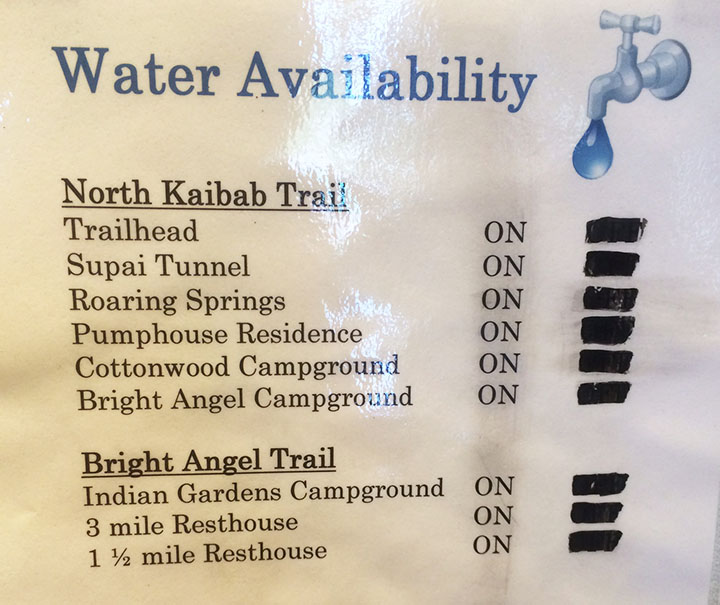
Todd had a great idea for a way to beat the heat when we got a couple of miles into our hike again. We took our shirts off and soaked them in the creek. The feeling of putting on a soaking wet T-shirt or tank top is unbelievably refreshing when you’re sweaty and gross – especially if there’s a slight wind to exaggerate the temporary chill factor. There are, occasionally, water spigots available every few miles on the trail from Phantom Ranch to the North Rim. Hikers have to be careful and plan ahead, though, because it’s possible sometimes for the water to be out of service. We lucked out and everything was in operation during our hike.
The next stop had probably a dozen or so campsites in it. We again took refuge in a spot of shade and refueled our bodies with food & drink. I took the opportunity to dump a grape flavored 5 Hour Energy shot into my water bottle in hopes that the caffeine would give me a kick for the next little while. My legs, feet, and back were screaming at me. By now, our tradition of taking a group photo at every mile marker had long been thrown out the window. Sometimes there was a lot of space between each of us, as each hiker settled into his or her own pace.
The Ascent
It was upon leaving Cottonwood that I really started questioning my ability to go the rest of the way. I knew from reviewing my mom’s pre-printed trail notes that our location at Cottonwood was still 6.8 miles from the finish line on the North Kaibab Trail. But it wasn’t that distance that scared me. It was this:
Cottonwood Campground: 4,080 feet
North Kaibab Trailhead: 8,241 feet
Okay. So, I’m no rocket scientist but that’s 4,161 feet. Vertically. In other words, after having already hiked about 18 miles, we still had almost 7 to go and we would essentially be climbing 78% of a vertical mile. Straight up in the air. My life flashed before my eyes. Would I send everyone onward without me and potentially stay the night in the canyon? Was I going to be one of “those people” who had to get helicopter air lifted out of the canyon on the news? I couldn’t let myself think about failure. I just had to keep taking it one step at a time.
And that’s where I found myself setting my own pace. Kyle, Bryce, and Justin had gone on ahead. I was kind of in the middle of the pack. I set my iPhone (in airplane mode all day to conserve battery since cell service is non-existent of course) on shuffle and let it play music from inside my pocket. That helped steer my mind clear from the task at hand. I passed a couple who was walking the opposite direction. They could tell that I was “spent” physically by the way that I braced myself with a tree while standing to catch my breath. “There’s a water stop about a mile and a half up, right after a tunnel,” the man told me. I thanked him. But I’m pretty sure he lied to me.
That was probably the longest mile and a half of my life. I kept looking for a tunnel that never came. Endless log stairs, rocks to climb over, and switchbacks. I’d round a corner and they just kept coming. “Really?!” was the thought that kept crossing my mind. I’d walk for a couple minutes, then have to catch my breath and keep my heart from coming out of my chest. When I finally saw that tunnel after an eternity of hiking, it almost seemed like a mirage. I went through, plopped down on a rock, and just sat there without moving a muscle for at least a few minutes. The sun had started its descent into the horizon already so I knew daylight was on the way out.
The fat chipmunks at that small rest area kept me company (and ate some of the peanuts in my trail mix) for about 15 minutes until my mom and Todd arrived, and then Rustin and Wade were just a few minutes behind them. We talked for a bit and then decided it was best to press on as daylight would soon be closing out.
Final Stretch
The last 1.7 miles of the hike happened at a snail’s pace. Every so often I would look behind/below me at the huge canyon and get a little dizzy thinking I had just come up from there. At one point I got insanely hungry and dug into a Nature’s Valley granola bar. I didn’t care that it had become nothing more than a packet full of crumbs at that point. I inhaled it, and I downed two more bottles of water that I’d filled up at the rest stop. Keep in mind, I hadn’t used the bathroom since Cottonwood. All that water was flowing right through me as sweat.
I knew I was getting close when I started hearing the sound of automobile traffic overhead. The trail conditions got notably better, and I passed a man sitting along the side of the trail who was waiting for some family members. “You’ve only got 100 yards to go,” he told me. Music to my ears. I made it. And it was the biggest rush of relief that I had ever felt.
Aftermath
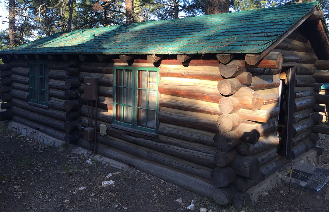
It’s miraculous that the 8 of us everyday people made it through such a physically taxing event. We took one last group photo from the bed of Todd’s pickup truck which was parked there at the North Rim. After showering up, we made it to our 9:00 p.m. dinner reservation at the historic North Rim Lodge. I glanced around the table and the look of exhaustion was pretty common. We slept like rocks at our rented log cabin.
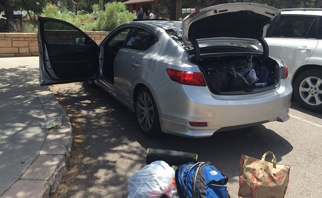
On Saturday morning, Justin, Bryce, Kyle, and I got on a 7:00 shuttle van that drove us 4.5 hours back to where my ILX was parked at the South Rim. Each time we stumbled out of the packed van at a rest area, my legs reminded me that they weren’t happy with what I’d put them through the day prior. It was great to get back to the car and settle in for the rest of the trip home. Here’s a picture from when we exited the park on Saturday morning.
We dined at a neat little Italian restaurant in historic Williams off Interstate 40 before heading back to the Phoenix area.
Thanks for being a part of this memorable adventure! The rest of the pictures and a short video follow:
Rest stop near Camp Verde, Arizona on I-17 headed north toward the Grand Canyon
Setting out on our hike
Still wearing a smile, just a few miles into the hike.
One of the group pictures we took for the first 1/2 of the hike
Switchbacks leading down to the floor of the canyon
Another group pic
Rustin and Wade taking a snack break
A few of the scenic views that surrounded us
Wade and Rustin had a lot of energy still at about 6 miles into the hike.
Group shot whilst crossing the bridge
Tunnel crossing – Todd pictured here
View of the bridge
Back on the trail we went
Refreshing lemonade at Phantom Ranch
Speaking of Ranch, here’s the man who packed a bottle of it!
Luckily for us, the pipes were working.
Mama Tia filling up on water before heading out again
Taking a break in the shade along the trail (Bryce, Tia, Kyle)
One of many river crossings
Arrival at Ribbon Falls
Rustin savoring every drop of his Diet Dr. Pepper which he’d lugged into the canyon
On the trail again, just can’t wait to get on the trail again.
A few pictures from the upward climb. You can see the trail about halfway up the hillside.
And another shot of the trail looking back down.
North Rim Lodge as seen on Saturday morning, the day after our hike
Our shuttle van for the 4.5-hour trip from North Rim to South Rim
Arrival back at the ILX which had been parked at Maswick Lodge
Lunch spot in historic Williams, Arizona
Finally, a shout-out to one of my most loyal readers, Conor, who sent me a Hot Wheels NSX to match the real deal!
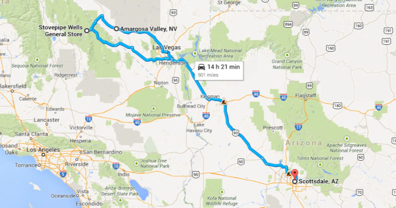
“This could be scary,” Sofyan mumbled as we rolled our suitcases up the front walkway to Longstreet Inn & Casino in Amargosa Valley, Nevada. The hotel, visible for miles on Highway 373 in the barren desert, had loomed like an oasis on the horizon while we approached it (photo below). The sound of country music and horribly off-key karaoke filled the air while I and my 3 traveling colleagues checked into our rooms for the night’s stay. We were weary from a full day of adventure in Death Valley National Park, one of the country’s most oft-overlooked and yet most scenic landscapes. And the evening’s agenda was just what we needed to unwind: A dip in the pool, a home-cooked meal topped off by apple pie, and the clearest nighttime sky I’ve seen in a long time – with stars so visible it was as if we’d pulled them closer to earth.
“Death Valley” sounds like such an enticing place to visit in the middle of the summer, doesn’t it?
On July 10, 1913, a record 134 °F (56.7 °C) was measured at the Weather Bureau’s observation station at Greenland Ranch (now the site for the Furnace Creek Inn), the highest temperature ever recorded in the world.Daily summer temperatures of 120 °F (49 °C) or greater are common, as well as below freezing nightly temperatures in the winter. July is the hottest month, with an average high of 115 °F (46 °C) and an average low of 88 °F (31C (reference).
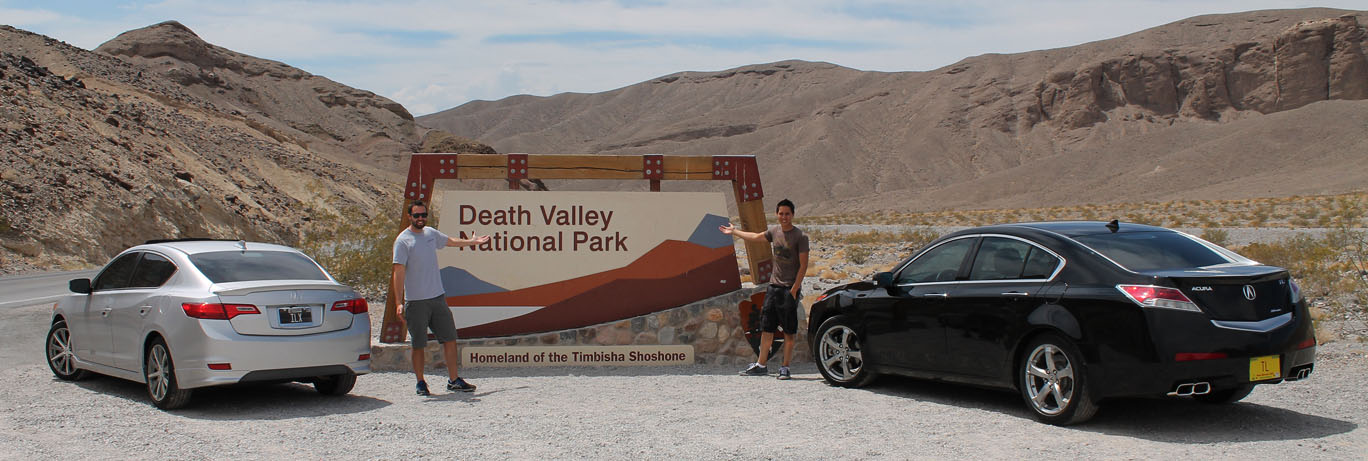
The area was named a national monument in 1933 and became a national park in 1994. It receives nearly a million visitors annually. Death Valley got its name from prospectors who passed through the area in 1849 when the California gold rush took place, though reportedly only one death took place. My first and only experience with the area was in August 2011 in the Legend coupe when I paid a visit to a close friend and automotive spy photographer Brenda Priddy who spends her summers there.
Joining me for this trip were a few friends. Sofyan, host of the 2theRedline YouTube auto review channel, had flown in from Washington, D.C. for the occasion, and my local friend Peter also came along.
Our day started out in Las Vegas, a city that never sleeps. Glassy-eyed and a bit tired from a night out on the town, we made our way to Johnny Rockets for delicious Belgian waffles with strawberries & whipped cream. That sugar rush was enough to bring me to my senses. Jason Pawela from Driven for Drives arrived and we set out with his 2010 Acura TL and my 2013 Acura ILX in search of some adventures. Highway 160 – “Blue Diamond” took us westward toward Pahrump, Nevada. A slow-moving 65 mph limit felt like it should have been 85 mph: The arrow-straight highway made its way through the desert and Sofyan, who’s visiting from Washington, D.C., commented on the landscape. “So what IS a tumbleweed?” he asked. Oh, you city folks!
A little beyond Pahrump, we took a left on Highway 190 toward Death Valley National Park. A few brave travelers – most from other countries, it seemed – joined us at the entrance sign for pictures. Our first stop was at Furnace Creek. It’s a place with $5.56 premium Chevron gas and a breeze that feels like a blow dryer in your face. We were able to find a saloon/restaurant – “49er” — serving up lunch so we were grateful for the opportunity to refill our bellies. All four of us ordered the exact same meal: Turkey club w/o red onion. It hit the spot. A stop at the national park visitor center was in order, so we could pay our $20/car entry fee and legalize our visit. A sign inside the gift shop announced: Heat-Related Deaths Since April 2014: 2. That’s a sobering thought.
Peter, Sofyan, Tyson, Jason
Jason and I swapped car keys and headed out toward Badwater Basin, some 17 miles away. Badwater is the lowest elevation point in North America, at 282 feet below sea level. I enjoyed seat-time in the 305-horsepower TL with its 3.7 liter V6. Torque for days! The sound system and level of refinement were clearly superior to the ILX, but I did briefly miss the more nimble feel of my smaller sedan. Regading Badwater: Legend has it that a traveler once got to this point and was severely dehydrated. He could not even get his horse to drink from the shallow pool because the water was so salty. Thus the place was named “bad water” and it stuck. Receiving fewer than 2 inches of rain per year, Badwater is one of the driest places in the world. We hiked out a little and Jason filled a Ziploc bag with sand, then we gratefully sought refuge from the oven inside our nicely air conditioned Acura sedans.
Just 85 miles from Badwater stands the tallest mountain in the contiguous 48 U.S. states, called Mount Whitney (14,505 feet). You may recall a trip from last summer when Jason and I drove the highest elevation paved road in North America: Mount Evans in Colorado, at 14,265 feet. I would have loved to visit Mount Whitney if time permitted.
We wanted to make sure and take home some Death Valley dust on our cars, and I knew just the place to find it. “20 Mule Team Road,” just a few miles from Furnace Creek, is an amazing one-lane, one-way dirt track that winds for 2.7 miles along some terrain that looks like another planet. Jason and I weren’t afraid of doing a little off-roading. In fact, after our first lap of Mule Team, we switched drivers. Sofyan drove the ILX and Peter drove the TL – and we did it all over again. Kicking up dust in style.
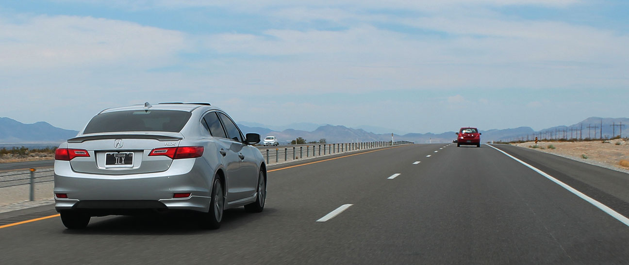
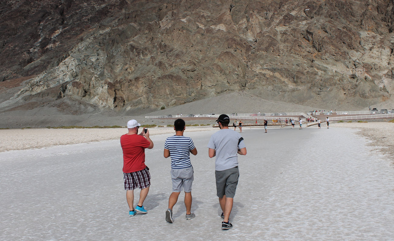
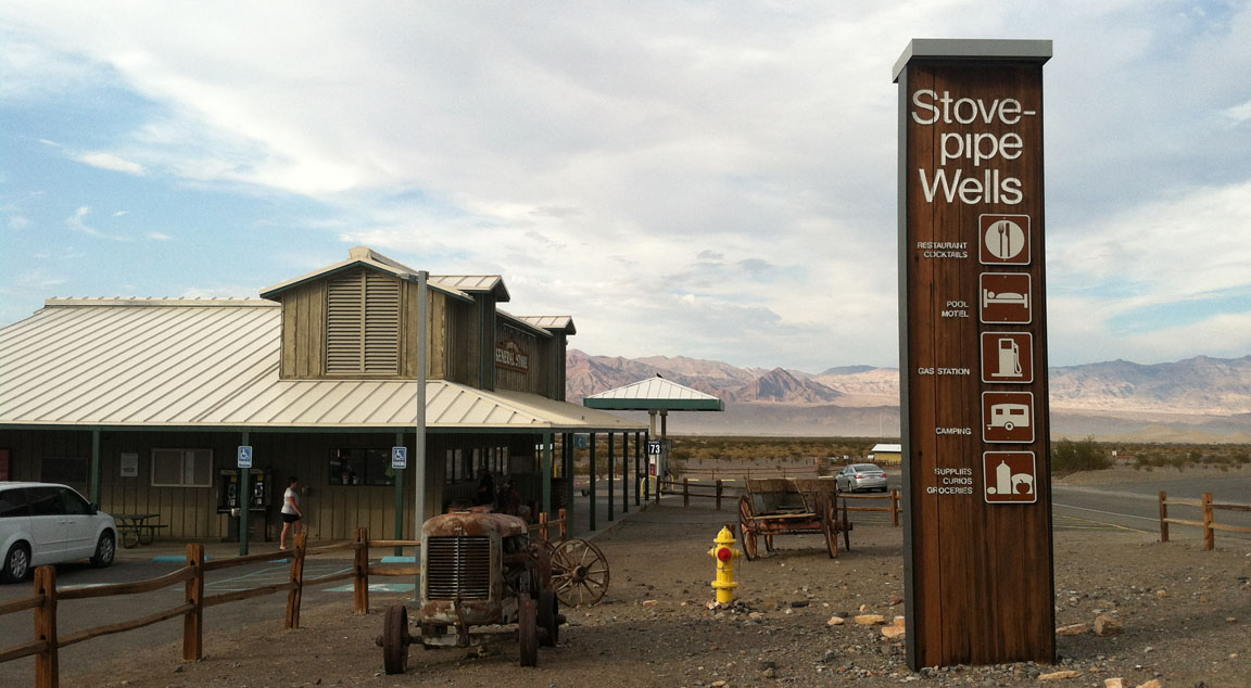
The last place I wanted to check out was Stovepipe Wells, a small settlement about 23 miles north of Furnace Creek. It’s nestled in between expansive sand dunes. As we approached, it was evident that the wind activity was high because of the wisps of sand sweeping across the roadway. Because of Death Valley’s notoriety as one of the hottest climates in the world, it is an optimal place for automakers to test out the durability of prototype / pre-production vehicles. Sure enough, as Sofyan pulled my ILX into the parking lot at Stovepipe Wells, we spotted 3 white 2016 model year GMC Canyon Diesels out for evaluation. I picked up 2 Gatorades for $3 – best purchase of the day by far. I was parched.
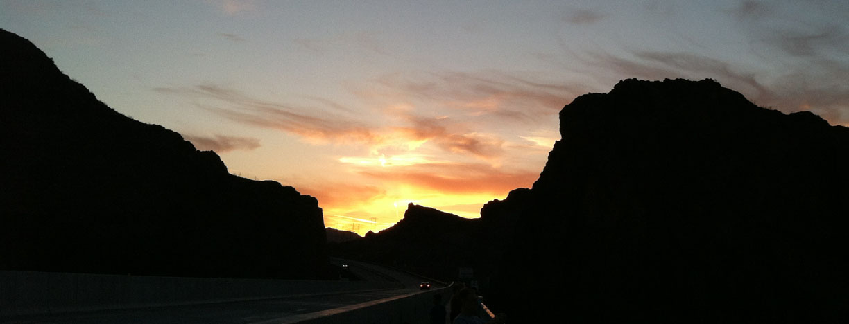
We made our way out of the park on Highway 127 just as the sun dipped down in the western sky. We got a few photos at the California/Nevada state line and then made our entrance into the Longstreet for the night. A great day with great friends.
Enjoy this video and the rest of these pictures from our trip!
Peter at the wheel of the ILX; Sofyan in the backseat
Backseat vantage point: something I’m not used to seeing!
Sunset over the Hoover Dam bypass bridge at the AZ/NV state line
View from our hotel in Las Vegas: Excalibur
Catching the water show at Bellagio
Saturday morning: A destination in mind
Ruins in an abandoned Nevada town
Next stop: Furnace Creek
Thanks to Jason for some awesome “rolling shots” of the ILX
We made it
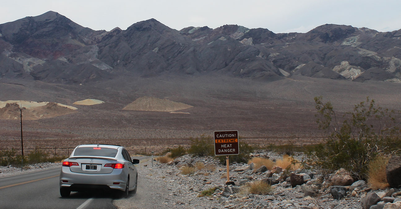
Sign reads: CAUTION! EXTREME HEAT DANGER
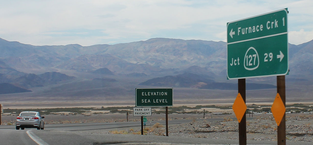
Elevation: Sea level as we made our way toward Furnace Creek
How’s $5.59/gallon for Premium sound?
Lunch spot
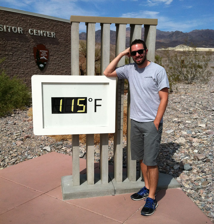
A brisk 115 degrees Fahrenheit at the National Park Visitor Center
Although, the ILX only showed 113 degrees at the time
Shot of the ILX in the TL sideview mirror
Warning at Badwater Basin. “Walking after 10 a.m. not recommended.”
Checking out the sights, 282 feet below sea level.
Pit stop along the “20 Mule Team Canyon” trail.
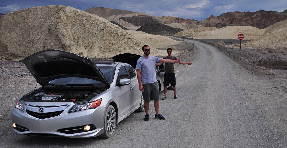
Hitchhiking due to broken down Acuras. Not.
Stovepipe Wells
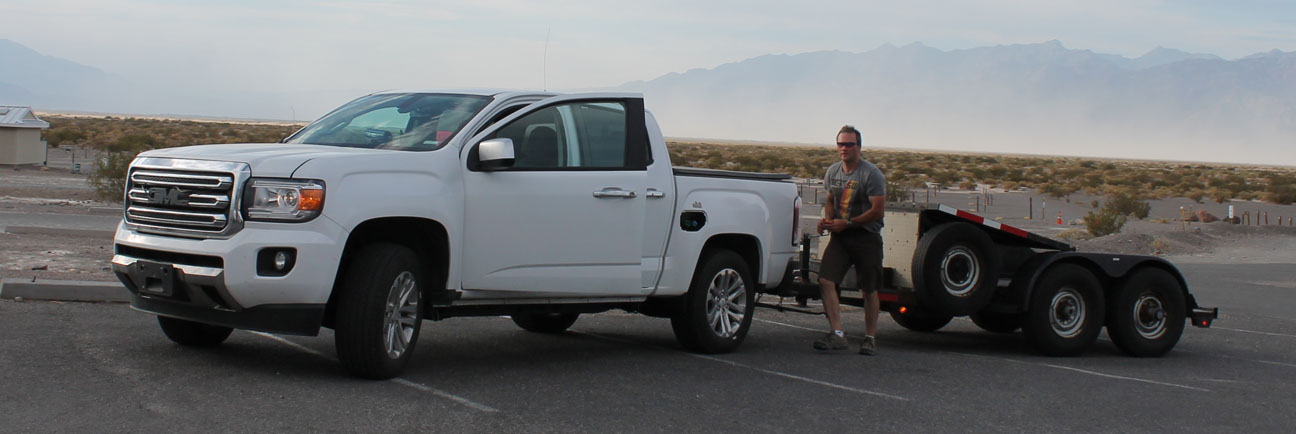
GMC Canyon Diesel prototype that was out for hot-weather testing near Stovepipe
Crossing back into Nevada from California for the night
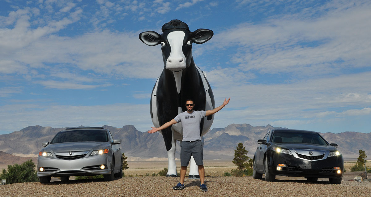
Sunday morning’s return drive to Phoenix: Gigantic cow
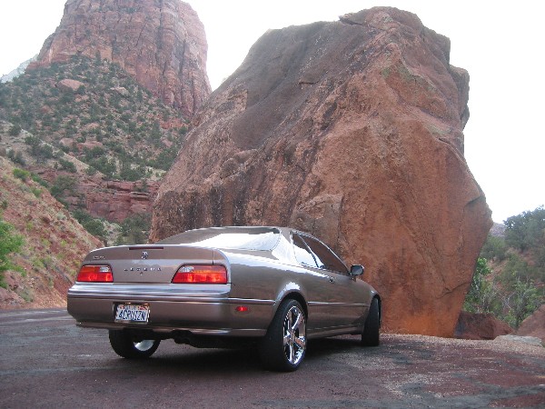
Red sandstone at dawn is one of my most favorite things ever. This April 2007 picture of my Legend at Snow Canyon State Park in southwest Utah captures some of the beauty that can be observed during that peaceful time of day.
Capitol Reef National Park, September 2006:
Utah Highway 12, approaching Bryce Canyon National Park on Highway 12. I had chrome 16″ OEM wheels on the Legend at the time.
Just a 45 minute drive from my hometown in St. George, Utah lies the mouth of the stunning Zion National Park, established in 1909.
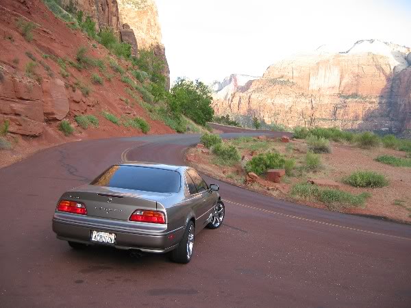
Massive sandstone cliff walls border a narrow canyon with the Virgin River at the base. This has always been one of my favorite road trip destinations. The first time I remember taking my Legend there was on June 13, 2004. This was back when it had 18″ Mille Miglia chrome wheels on it.
Following is a picture I took at the time, when my car had just 140,000 miles on it:
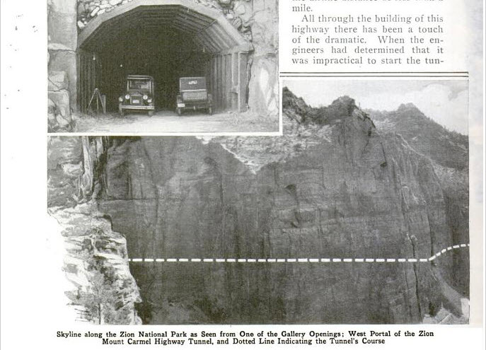
At the time it was completed in 1930, the Zion – Mt. Carmel Tunnel was the longest non-urban tunnel in the United States. It’s a 1.1 mile tunnel with 5 “window” openings that were carved at various intervals through the sandstone rock. This picture from a 1930 issue of Popular Mechanics shows the route taken by the tunnel, which took 3 years to complete.
Stopped at one of the windows / “galleries.” When the tunnel was originally built, cars were allowed to pull out at these openings and enjoy the view.
On June 27, 2005, I took a 1,000-mile “Utah Tour” trip when I rolled through the tunnel at about 3:45 in the morning. About halfway through the tunnel, I stopped the car, shut it off, and turned off my lights. I have never felt such complete and utter darkness and silence as I did at that moment in time. That memory has stuck with me as one of my fondest road trip memories.
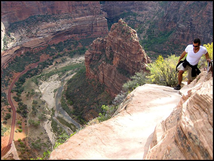
Angel’s Landing is not the best hike selection for those afraid of heights. At only 5 miles in distance round-trip, it’s not the distance that’s daunting – it’s the elevation gain of 1,500 feet and treacherous terrain.
During ascent, a series of 21 tight switchbacks are soon followed by a trail that requires chain hand-holds to maintain balance and direction. Huge, sheer drop-offs on either side can give a sense of dizziness. Reaching the final peak at 5,785 feet in elevation requires a great deal of bravery.
View from the top, June 2004. Look at that mop of hair I had (at left in the picture):
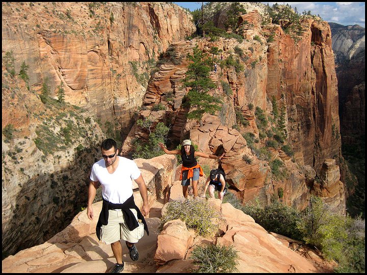
I’ve hiked Angel’s Landing three times and it’s felt like a different experience each time. These are pictures from one time I hiked it in October 2010.
The little red ribbon at left in the below picture is the two-lane road at the valley floor, thousands of feet below.
Here’s the last ascent before reaching the summit. No turning back now!
For any looking for an unbelievable national park experience, I highly recommend a trip to Zion!
This week I drove past Amy’s Baking Company in Scottsdale. This place was home to a bit of a social media disaster this week. If you recognize the name, you’ll know what I’m talking about!
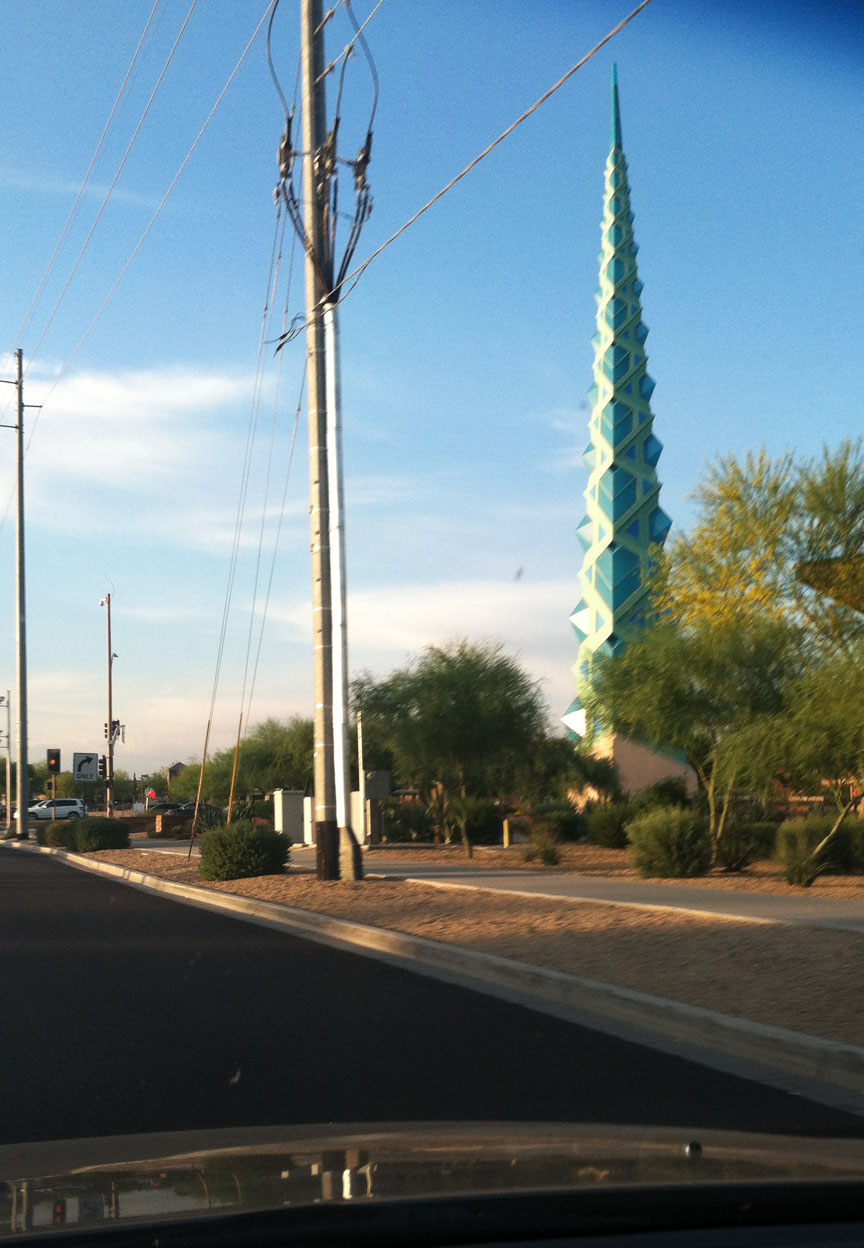
And I also saw the Frank Lloyd Wright spire. This was originally designed to be on the grounds at the Arizona state capitol, but it instead ended up being placed in a shopping center. The spire was designed by Wright in 1957 but wasn’t constructed until 2004. It’s made up of 1,700 individual pieces of steel and it weighs 75 tons!
The spire lights up blue at night so I’ll have to stop back by for another picture sometime soon.
Best part of my commute:
ILX Updates
The 2014 ILX is now on sale as of two days ago. The new model now comes with 8 additional standard features for the base model including the 17″ alloy wheels and an active noise cancellation system. Further refinements to the interior include upgraded leather seating surfaces, door panel trim, and other features. It’s hard to believe it’s already been almost a year since I got my ILX. I’m still loving it!
Some of you have already found me on Instagram. If not, look me up under @tysonhugie.
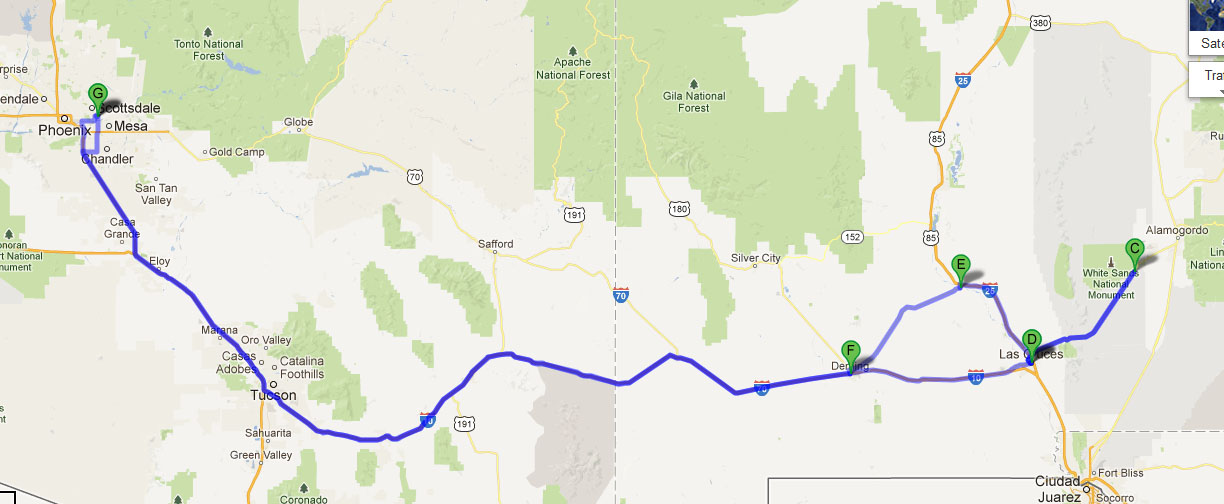
Ever since my friend Jason and I met up in Bisbee a couple of months ago, we’ve been wanting to coordinate another drive together. This time, I put the planning responsibility on Jason and traveled to his hometown in Las Cruces, New Mexico. I grabbed my friend Chris and we hit the road around 3:00 p.m. on Friday afternoon to head eastbound on Interstate 10 from the Phoenix, Arizona area.
This rainbow sighting happened just north of Tucson.
For dinner, we pit stopped at one of my favorite restaurants: Texas Roadhouse. I love this place so much that I downloaded their app to my iPhone. For any who are seeking recommendations, I like the 6 ounce sirloin (medium), with sides of steamed veggies and mashed potatoes. Best $9.99 I’ve ever spent for a steak dinner!
I had to capture the above picture inside the restaurant since the “Be Legendary” sign was calling my name.
Our drive that night was 394 miles of all-interstate driving until we got to my Jason’s house right off I-25 in Las Cruces. The ILX achieved 32.4 miles per gallon even though for a good part of the drive I had the cruise control set at 80 miles per hour. The rest of the time, speeds varied since we went through pockets of heavy rain.
Jason and I didn’t waste any time before pulling out my huge atlas and laying the ground work for our travels the following day. He’s done quite a few travels in his Honda Accord coupe which are being captured on his blog, Driven for Drives.
I got the chance to learn quite a bit about Jason. He and I actually met “electronically” via this blog, but in-person this was only the second time we’d met.
Jason and his friend Jouhl are entrepreneurs. They operate a business called Wisebliss which specializes in bonsai trees. But these aren’t just any bonsai trees, these are hand-crafted “biobonsai” miniature trees made from a plant material that needs absolutely no care. Finally a plant that even I could keep alive.
Check out Jason and Jouhl’s website here. They’ve got some really neat stuff.
I also browsed through Jason’s extensive collection of car magazines. The first one that I grabbed was a 1993 Motor Trend “New Car Issue” that had a write-up on the Legend.
Saturday morning was a sunny day in Las Cruces, with an expected high temperature in the 60’s.
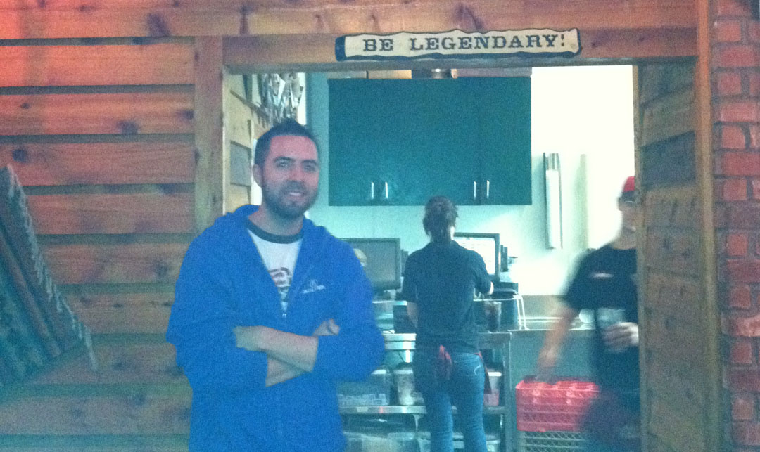
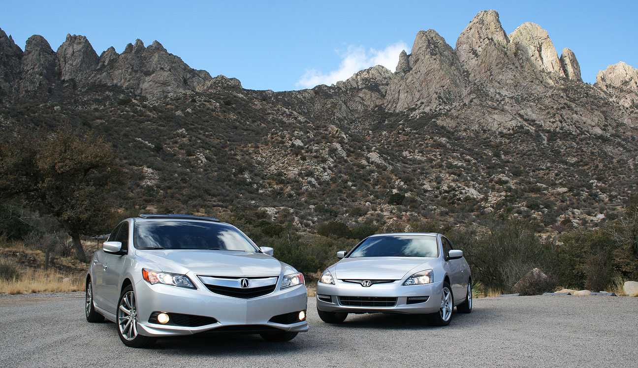
Jason, Tyson, Chris
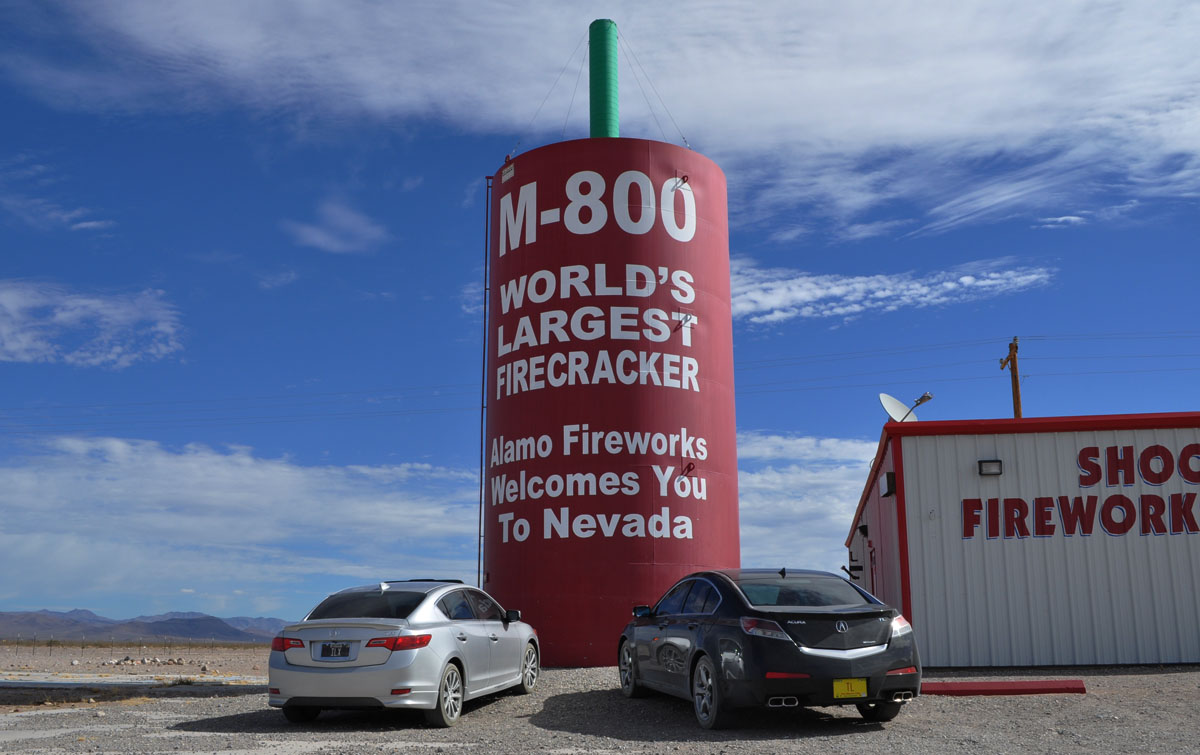
First order of business was a photo-op at none other than the World’s Largest Chile! I’ve been known to seek out lots of “largest” things, including the largest firecracker, which is located in Nevada.
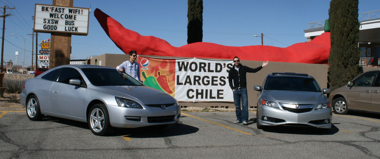
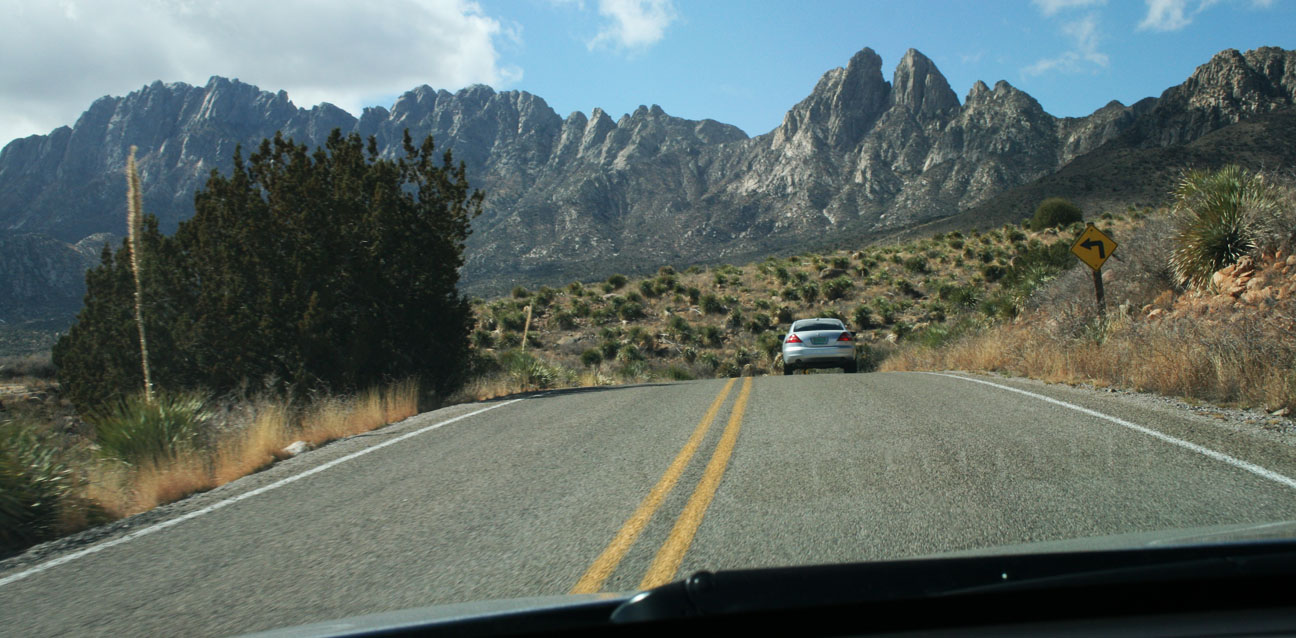
From there we headed eastward on US-70 toward Organ Mountain. A sign on the roadside told us we were fewer than 40 miles away from our destination.
Along the way, we took a twisty one-lane side-road toward Aguirre Spring.
Following Jason
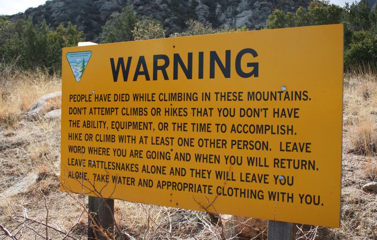
This warning sign means business!
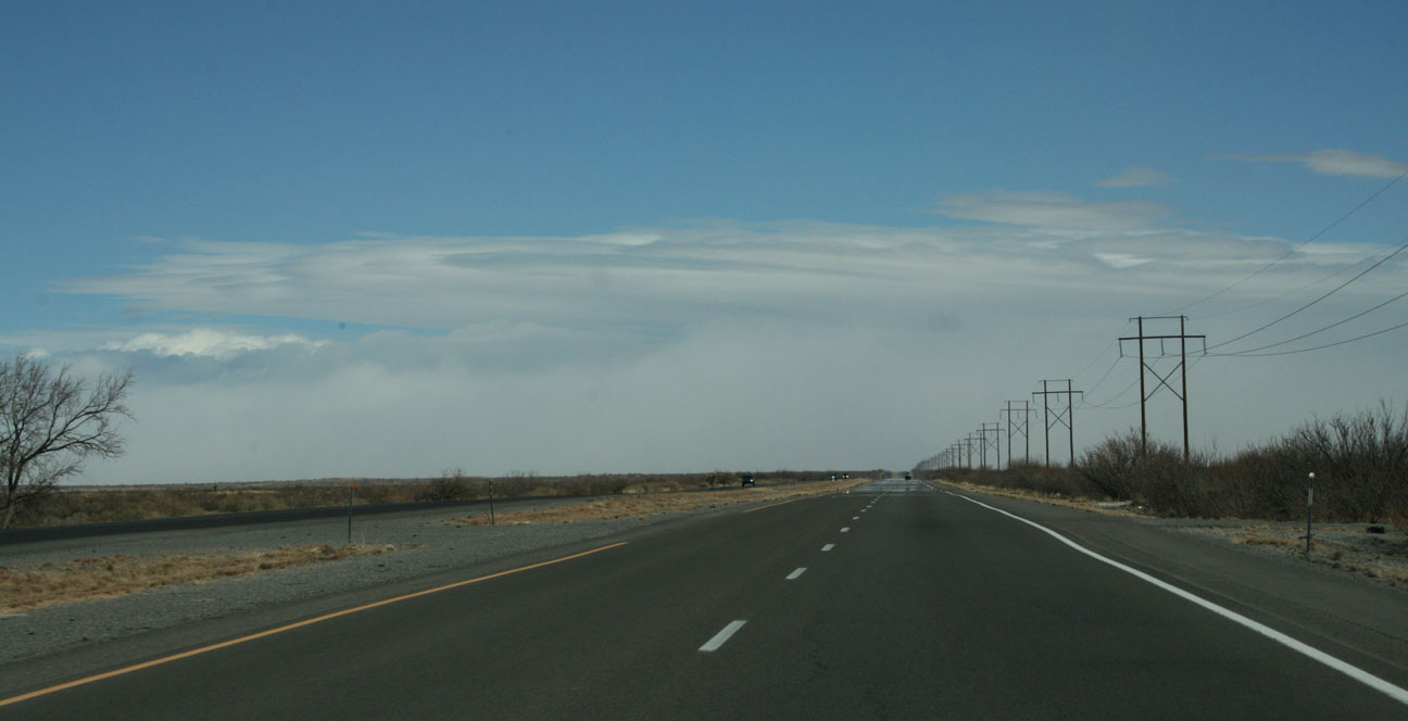
After we made our way back to US-70, weather ahead looked good but there were clouds looming in the distance. Or were they not clouds after all?
Jason in hot pursuit this time (well, not really, since we were both going only 70 mph) as I took the lead for a little while.
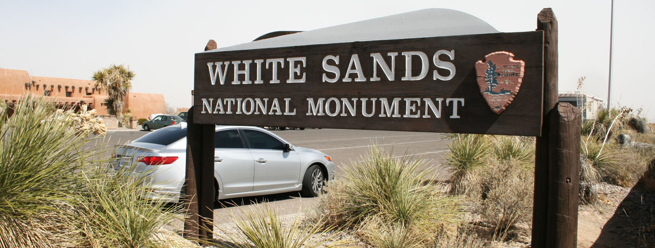
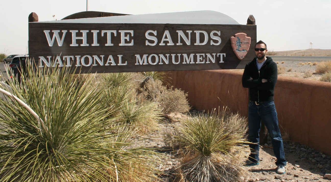
It was around this time that Chris spotted a Silver Moon Acura ILX going the opposite direction as we were. Looked great going down the road. I think that was the first Silver Moon I’ve seen in “real life” outside those sitting on a dealership’s lot. Finally, we made it to White Sands and pulled off toward the visitor center at our left.
White Sands is a field of white sand dunes in the southwestern part of New Mexico. It covers over 143,000 acres and was designated a national monument by President Herbert Hoover in 1933. The “sand” actually consists of gypsum crystals, and this site is the largest gypsum dune field in the world.
Entry was $3 per person, but Jason picked up the tab for all 3 of us. Thanks, Jason! I owe you.
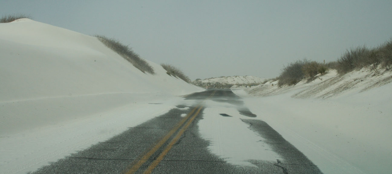
The two-lane highway headed north into the monument area. Heavy winds had pushed sand across the roadways. Chris told me that they actually use sand plows to move it out of the way as necessary. It looks a lot like snow!
Some parts of the road were quickly getting drifted as the sand got kicked up by the wind. What I’d thought were clouds earlier in the afternoon were in fact caused by sand in the air. *cough, cough*
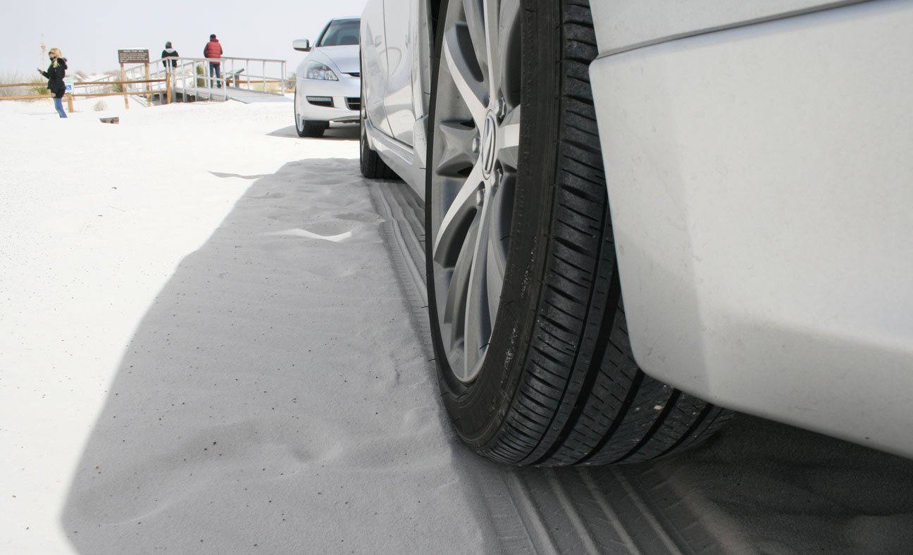
We made it to a parking area and took a break to soak in the surroundings.
Much like the scenic Monument Valley drive that I did a few weeks ago, White Sands also offers an un-paved loop for people who want to get a little more up close and personal with these sand dunes.
It truly felt like we were in another world!
The area is extremely remote. There is a missile testing facility just north of the monument called the Trinity site. This is where the first atom bomb was detonated in 1945.
Here you can start to appreciate how windy it was. Even with sunglasses on and my hoodie pulled over my head, I got sand all over the place. In my hair, eyes, mouth, and nose. All part of the experience!
And it wouldn’t feel right to have a world of sand at my disposal without kicking off my tennis shoes and digging in my bare feet.
It was around this time that I gave Jason the opportunity to take the ILX for a spin. He commented on how “solid” the drivetrain felt. Clutch effort, he noted, was significantly lower than in his Accord. He liked the width and diameter of the steering wheel and he commented that he exhaust note made the car sound aggressive.
Back on Hwy 70, we were cautioned about the traffic coming toward us from either direction at 70-80 miles per hour.
It was only about 45 minutes until we arrived back in Las Cruces and veered north on Interstate 25.
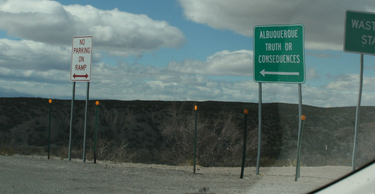
Exit 241 was for Hatch, New Mexico. A sign indicated that “Truth or Consequences” was north of us. I’ve always thought that was a funny name for a town. The town was originally called Hot Springs, but it was changed in March 1950 to be named after a game show on TV! More about that here.
The exit for Hatch was about 30 miles north of the Hwy 70 interchange on I-25. Shortly off the freeway, we drove past “Hot Damm Chile” and the opportunity for a picture was too much to resist.
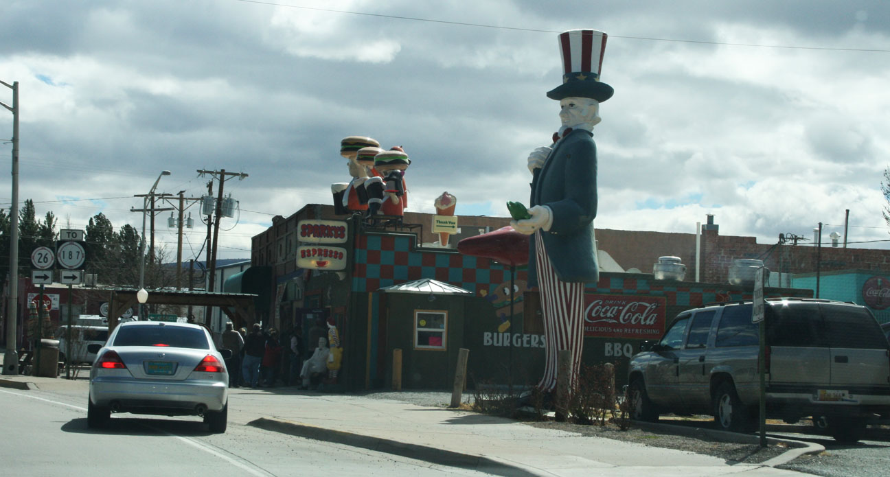
Hatch, New Mexico is the Chile Capital of the World. There is even a Chile Festival held each Labor Day which can attract up to 30,000 people to the small town of fewer than 2,000 residents. We had to give the famous “Sparky’s” Restaurant a whirl, so we followed Jason there.
I opted for the Green Chile Cheeseburger pictured here, coupled with steak fries and followed by a root beer float. They’re serious about this burger being “world famous.” In fact, each time a customer ordered this burger, the clerk would exclaim, “World Famous!” as she rang up the total. The burger & fries only came to $5.99.
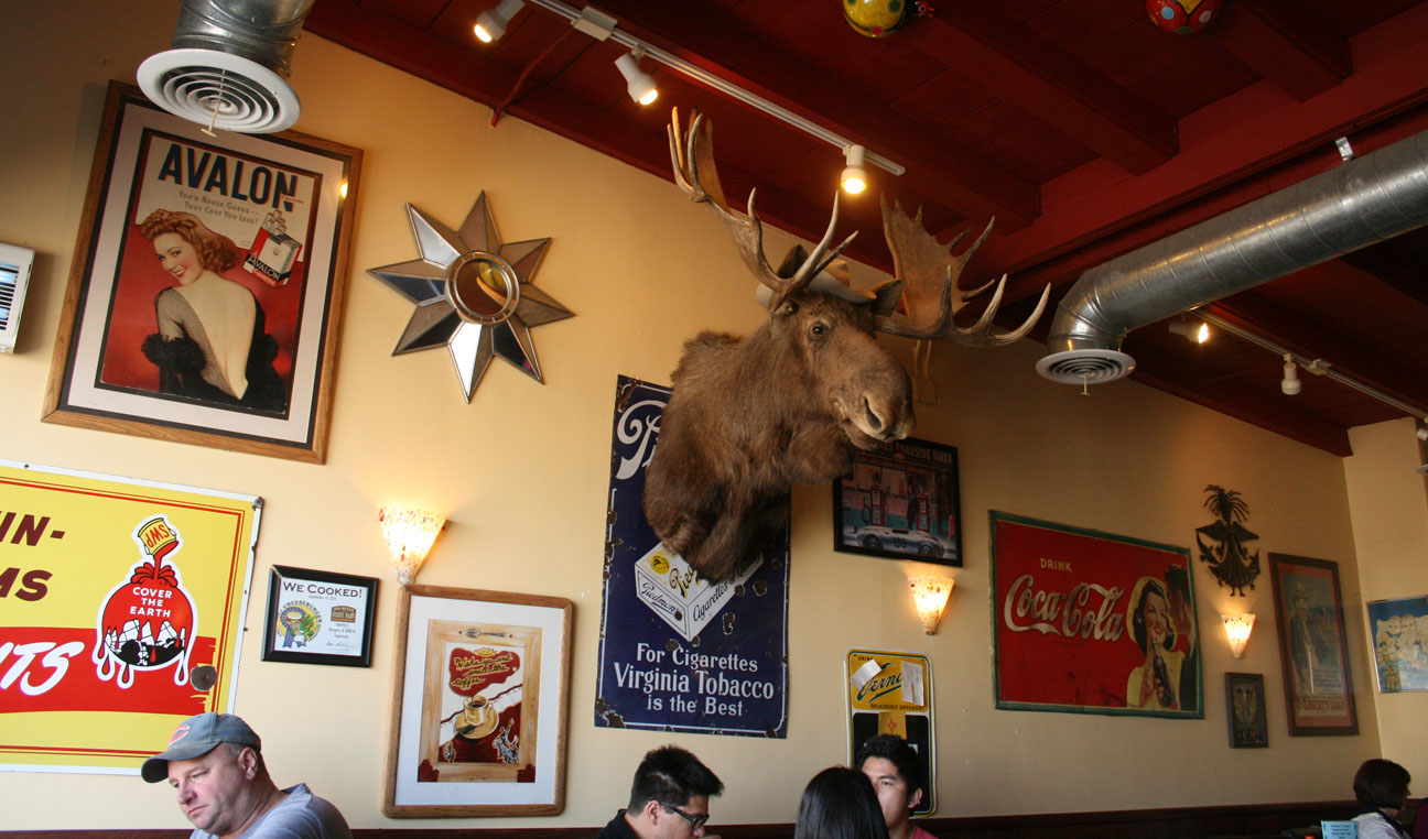
Odd decor was the name of the game around here.
We all ordered the same delicious thing.
This was the juiciest burger I’ve ever eaten. Absolutely melted in my mouth. So good!
The last picture I got as we started our 377-mile return trip to the Phoenix area was this shot of an Adopt-A-Highway sign on Hwy 26 just south of Hatch.
The misplaced apostrophe drove me nuts. When I shared this with a friend of mine via text, he said, “Lol, maybe they should try cleaning their stores before committing to a highway.” I got a good laugh out of that.


![IMG_4452[1]](https://drivetofive.com/wp-content/uploads/2013/05/img_44521.png)