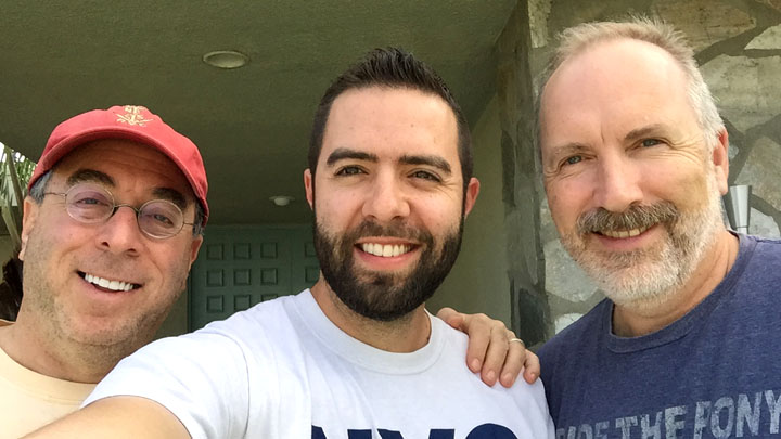
I got home from work this afternoon and found a package in the mailbox addressed to “The Road Trip King.”
Thanks, Alex, for sharing that awesome “AQRA” Illinois Route 66 plate! I have some of the coolest friends!
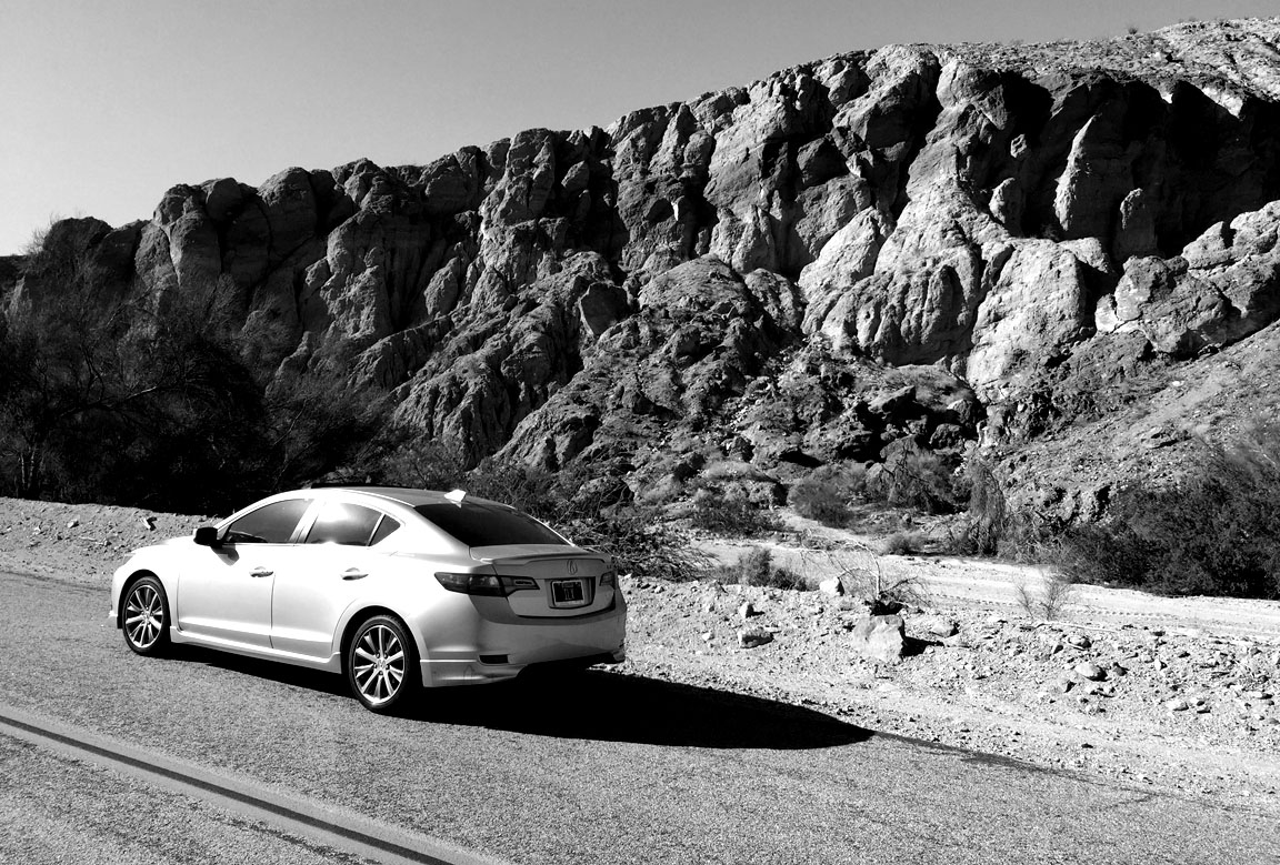
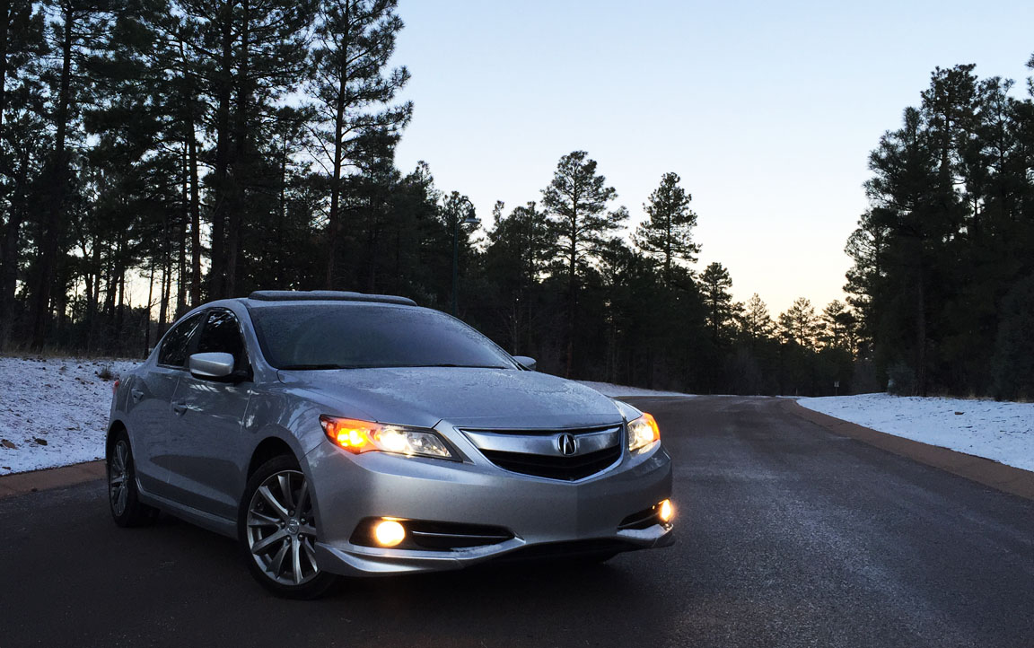
As much as I enjoy my solo time on the open road, I always welcome the chance to have a road trip companion (or three). This time, my car transported some very important cargo, including my mom, my grandmother, and my aunt.
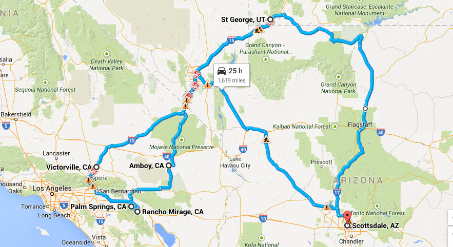
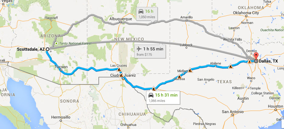
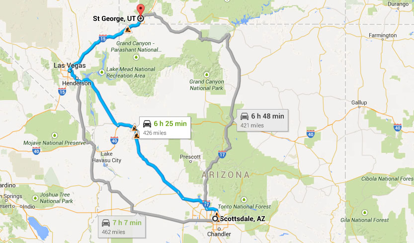
My overall drive consisted of four roughly 400-mile-each stretches of road: Phoenix to St. George, Utah; St. George to Joshua Tree, California; Palm Springs to St. George; and then returning home to Phoenix. It seems that Palm Springs has been on my frequent destination list lately. I was just there a couple of months ago for a visit to Thermal Raceway as part of our NSXPO 2015 planning activities. This time, the purpose of our trip was to attend a surprise birthday party for my grandma’s brother, Reo. The first part of my journey was the drive up Highway 89 from Flagstaff on Thursday night.
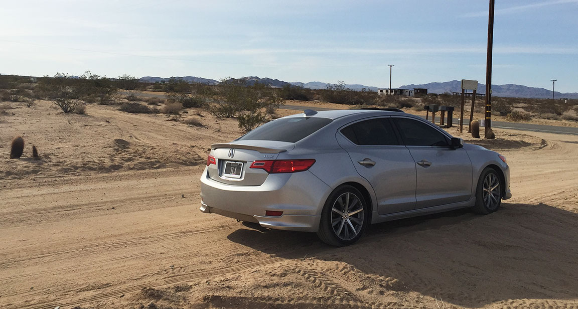
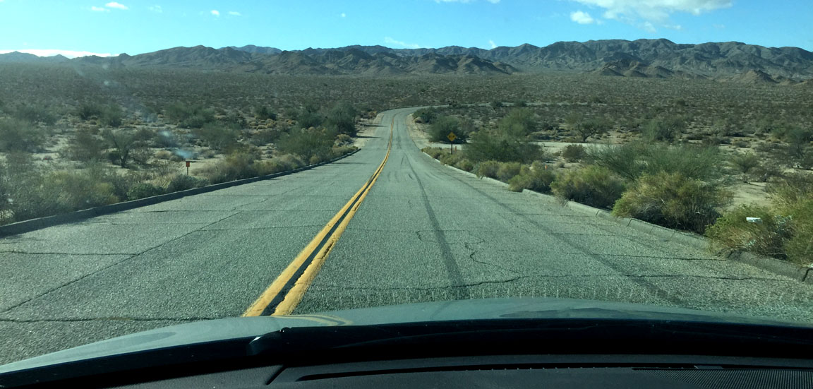
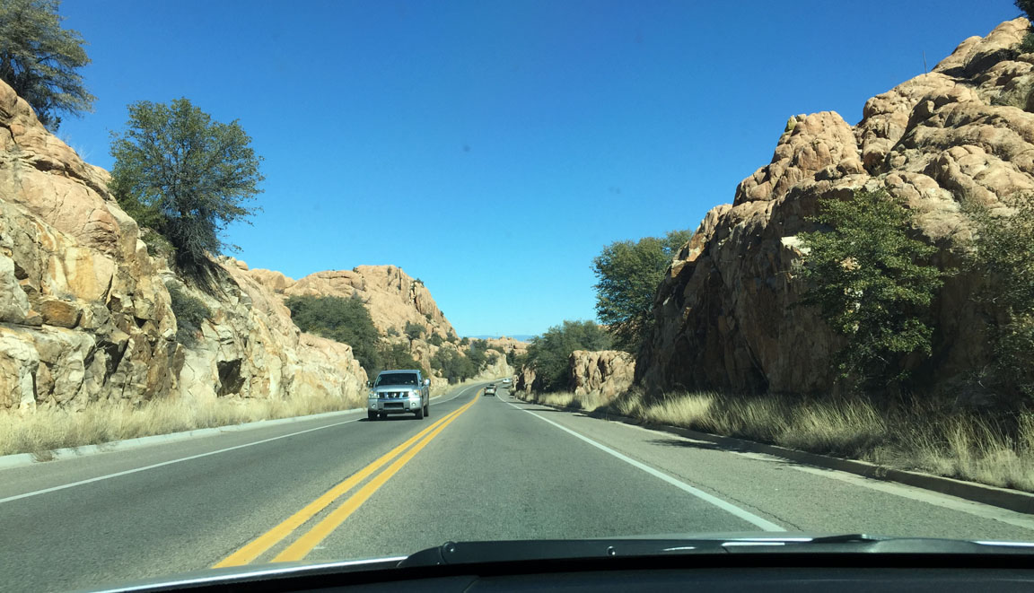
By midday on Friday, I’d picked up my 3 fellow road trippers and we hit the highway, headed for southern California by way of Las Vegas, Nevada. As soon as we exited at Nipton Road on Interstate 15 southbound after crossing into the California state line, I knew we were in for a roller coaster ride. For the next 75 or so miles, the Morning Star Mine Road took us through the Mojave National Preserve (the same route a friend and I took last November).
While the desert was a beautiful place to be, it’s also a very rugged and dangerous environment to be because of the extreme weather and remote location. Luckily the temperatures were friendly to us. Road conditions, however, were less than optimal. There were potholes the size of manhole covers and at least 6-8” deep. We definitely smacked a few of those at 55-65 miles per hour and felt the impact.
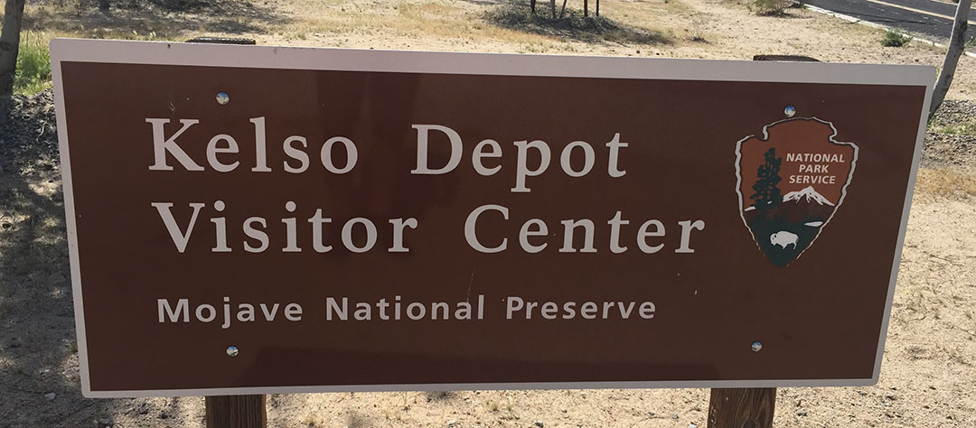
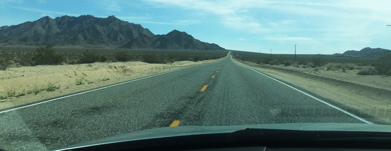
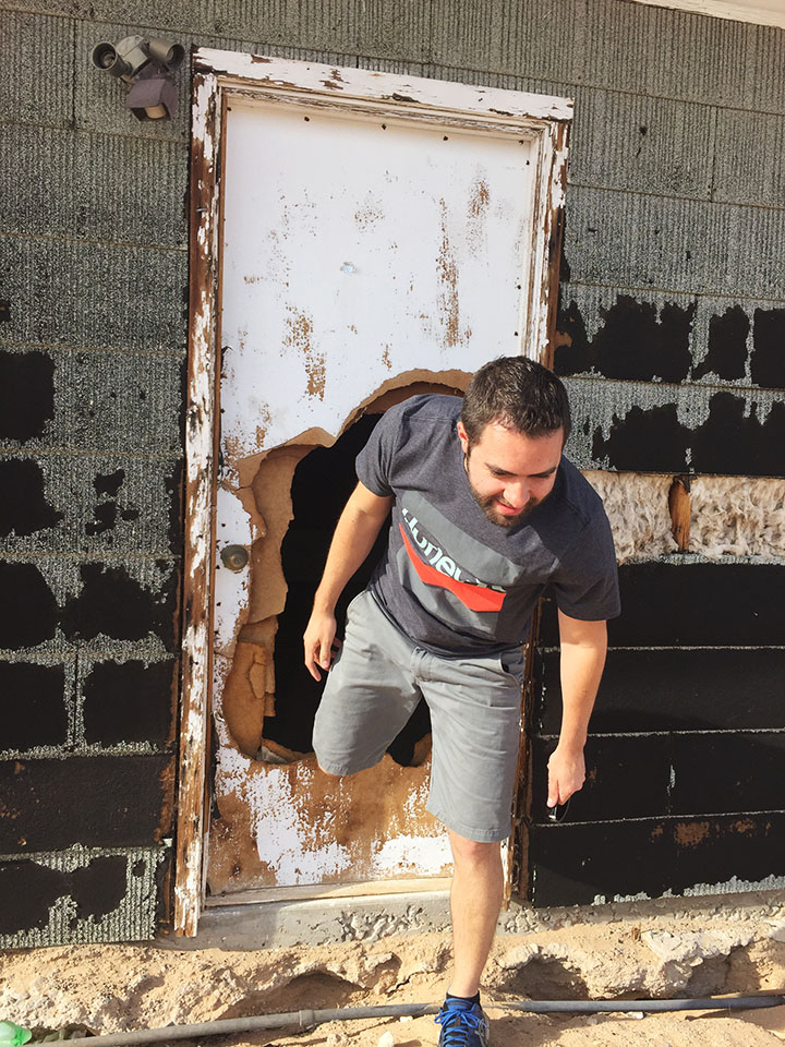
After we had driven through the desolate towns of Cima, Kelso, and Amboy, we started closing in on the community of Twentynine Palms, named for the trees found there by Colonel Henry Washington in 1852 while completing a survey of the area. Aunt Jodi piped up from the backseat. “Look, there’s one of those homestead shacks I was telling you guys about!” Sure enough, it was time for a history lesson and a prime opportunity for a pit stop.
As it turns out, in this “Wonder Valley” region of the Mojave Desert, there are hundreds of teeny homes that dot the landscape. And by teeny, I mean they’re typically no larger than a one-room, 12-foot-long rectangle. These structures started springing up around 1938 when a homestead act was put into place, granting up to 5 acres of land to settlers in exchange for just being willing to build a structure on the property. Very few of them have endured the test of time. In fact, probably 9 out of 10 have crumbled to nothing more than a few walls and a caved-in rooftop. Here’s a very interesting article from 2004 in the Los Angeles Times about the history and fate of some of these homes. We stopped to get an inside look at one of them.
Our evening was spent watching the sunset from the second-floor balcony of the High Desert Lodge on Twentynine Palms Highway after a delicious chicken enchilada dinner at Mi Casita Nueva Mexican Restaurant down the road.
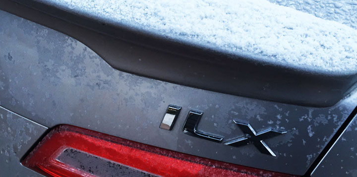
The next morning, we had places to go and people to see. Right off the bat, a special occasion took place on Highway 62 through Morongo Valley: My ILX rolled 120,000 miles.
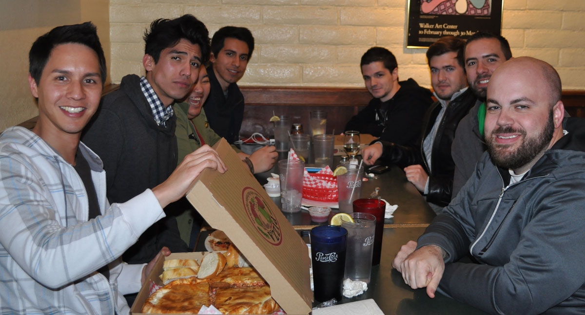
We took Indian Canyon Road on into Palm Springs for a hearty breakfast at “Bit of Country.” After a quick visit to friends Scott & Sandy, it was time for the grand event: My grandma’s brother Reo’s surprise 85th birthday party. All of our time in the car was made worthwhile in the space of just this one-minute video clip:
After enjoying several hours of food, family, and friends, it was time to set sail yet again. For the return leg of the trip, instead of going through the Mojave Preserve we opted to take interstates 10, 210, 215, and 15, which would take us a bit longer distance-wise but would probably be just as fast as the back roads.
The last stop on our adventure was in a teeny town on the outskirts of Death Valley National Park called Baker, California. There’s not much to see in Baker aside from its 134-foot-tall thermometer — the largest in the world. The thermometer’s height is symbolic of the record 134-degree Fahrenheit temperature recorded in nearby Death Valley in 1913. The structure was built in 1991 and restored in 2014.
What makes the Baker thermometer even more special to me was that it was the first place I ever did a “photoshoot” of my 1994 Legend coupe on the day that I bought it: March 26, 2003.
Sunday morning’s Easter egg hunt with the kids was a hoot, and after that it was back to the road for my return leg to Phoenix.
Hope everyone enjoyed the weekend as much as I did!
Climbing out of one of the homestead houses in Wonder Valley
Howdy. First of all, let’s cut to the chase and get acquainted with the native language of Texas before we go there. “Y’all” is used when addressing 2-3 people. “ALL y’all” is in reference to a larger group. The tricky part is when y’all becomes possessive. Example: “Is that y’all’s car?” See, I don’t even know if I’m comfortable using that many apostrophes in one phrase.
For a couple of months now, some friends and I had been planning on a Texas trip. From the beginning, I had always told them, “I’m driving. I’ll see you guys there.” I resisted multiple pushes to book a flight. It’s not that I have any problem with getting on a plane, but for me, the journey is as much of a vacation as a destination. Thirty hours in a car sounds like a pretty good time to me. And you’re reading this because you probably agree.
The last time I was in Dallas was September 2013 for some diesel truck races with my dad & brothers. However, I cheated that time and took a flight to/from on Southwest Airlines. Aside from that, I’ve been through the DFW area a number of times on my cross-country adventures, and it’s a fun place to make a stop.
I departed last Wednesday after work and headed as far as Las Cruces, New Mexico. Jason of Driven for Drives welcomed me and my ILX with red-carpet treatment for our overnight stay at his place off Interstate 25. The next morning, it was off to the races. I had places to go and people to see. Motivation for the drive was provided by a limited-edition Starbucks “Birthday Cake” frappaccino (thanks to my friend Jim for the travel tip!) which I picked up at the location on George Dieter Road in El Paso.
Over the next 10 or so hours, I watched West Texas fly by in all its grandeur. My life became a country song: I was surrounded by boots, spurs, pickup trucks, and blue jeans. When I rolled into the Pecos, Texas “Stripes” gas station on Interstate 20 (only part of which had actual concrete pavement) around mid-morning, I took a look around me and felt a little out of my element. Everyone in line at the Subway inside had on flannel except for a woman with 1980’s hair and polka dot leggings. Culture shock.
I zoomed back onto the interstate via the “feeder” (frontage road) and re-set the cruise control at 83 miles per hour. Most of that area has an 80 mph limit which helps the miles go a little more quickly. The problem with maintaining that speed in an Acura ILX is that the engine is whirring at nearly 4,000 RPM even in 6th gear. Luckily I had 15,605 amazing songs on my iPod to drown out the motor noise.
By dusk I had entered into the western end of the 7-million-resident Dallas – Fort Worth “Metroplex” and its maze of under-construction freeways. My friends welcomed me with a collective roll of the eyes. Was it really worth all that time in the car? They asked me. To keep things easy and share some of my trip highlights, I’ll itemize my list here and you can judge for yourself whether you blame me for driving.
After 2,205 miles, I can confidently say it’s a trip I’d make again and again. Hope you enjoy taking a passenger seat to some of these neat attractions, and thanks as always for coming along.
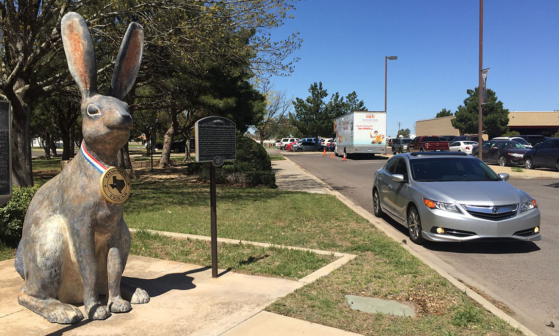
1) Odessa: World’s Largest Jackrabbit
In 1932, the teeny Texas town of Odessa became home to the world’s first jackrabbit roping competition. During the town’s annual rodeo, Grace Hendricks roped a rabbit from horseback in 5 seconds and won. The jackrabbit roping competition was met by outcries from animal lovers and was discontinued until 1977 when a second competition was held. After that, the Humane Society put a stop to things with a court order. Today, an 8-foot-tall rabbit stands at the Chamber of Commerce on 8th Street.
2) Odessa: Replica Stonehenge
Just a few miles away from the rabbit statue, I entered the campus to the University of Texas, Permian Basin. We’re all probably familiar with the “original” landmark Stonehenge in the United Kingdom, but this one was erected only 11 years ago. Most of the slabs on display here are 19 feet tall and weigh up to 20 tons each. The layout of the stones is accurate to the real Stonehenge, but the sizes are a little bit smaller. Pictured in the far background is a Home Depot. This is definitely not England.
3) Colorado City: Radio Station Microphone Sign
There’s a radio station called KVMC that’s been broadcasting since the 1940s. A couple of decades later, someone took a picket fence and made a piece of artwork out of it, creating a giant replica of the original microphone. It still stands today in front of the radio station along the frontage road to Interstate 20.
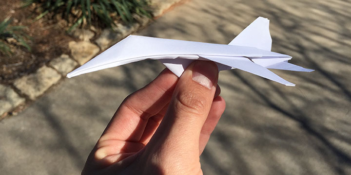
4) Abilene: World’s Largest Paper Airplane
On 1st Street in Abilene at the Sparhawk Art Gallery / Bed & Breakfast, there’s a 30-foot-long version of a paper F15 aircraft. This one, however, actually appears to be made of wood. When I pulled into the narrow Sparhawk parking lot, I immediately spotted the aircraft toward the back and rolled there for a few photographs.
When my work there was through, I started to drive away and a woman came running out of the small building with something in her hand – a “regular sized” paper airplane. I rolled down my passenger window, thinking perhaps I was getting in trouble for taking pictures on private property. “Here!” she said. “You have to take this with you!” and she handed me the paper airplane. Soon, a man named Donovan came out too. I got out of the car to talk to both of them, and Donovan handed me a second airplane. He had folded both of them. “They don’t fly well, but I only used one sheet of paper each, and a tiny drop of glue.”
5) Abilene: Dino Bob & the Slug Bug
This work of art dates back to the late 1980s when artist Bob Wade perched a Volkswagen Beetle on top of a garage, with a dinosaur nibbling on it. The dinosaur and VW were moved in 2007 to their current location where they oversee a facility for children’s literature.
6) Abilene: World’s Largest Buffalo Skull
Here’s another fun landmark not far from Dino Bob. Sculpted in 2012 by artist Joe Barrington, this buffalo skull measures 26 feet across and weighs 2 tons. The eye sockets are big enough to crawl through. I resisted the temptation to try that out. This is located at a visitor center called “Frontier Texas.”
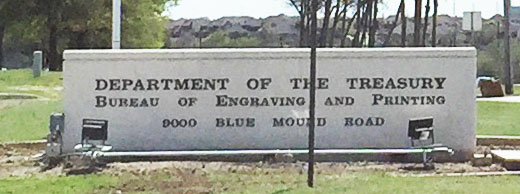
7) Fort Worth: U.S. Bureau of Engraving & Printing
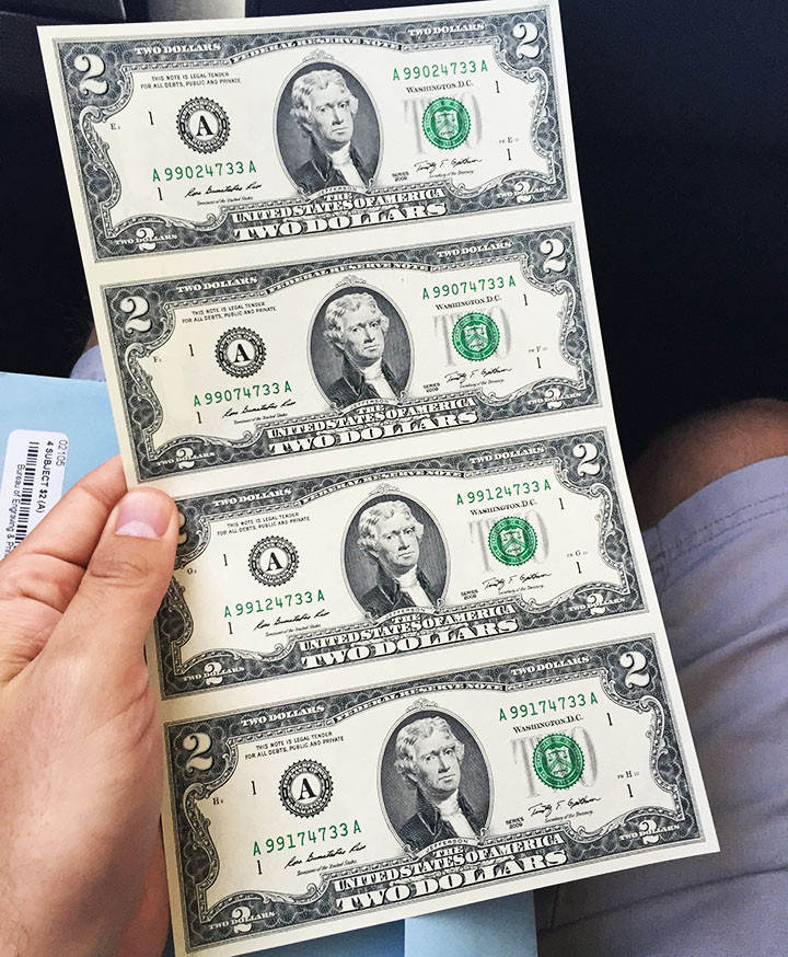
This is one of only two places in the country where paper money gets printed (the other is in Washington, DC). Photos here are scarce – in fact, I got yelled at by someone in the lobby of the Security building for even taking this picture of the sign from the road. Before we were allowed inside, all cell phones had to be left inside our car. But the inner workings of this building are fascinating! We took a 45-minute self-guided tour on an elevated catwalk that actually overlooks the factory floor, its machines, and the production staff. I paid $22.50 for an uncut sheet of four $2 bills at the gift shop. How about a few fun facts?
The estimated life span of a $1 bill is 5.9 years
The estimated life span of a $100 bill is 15 years
There have been no bills printed in denominations greater than $100 since 1969
Each production day, the facility I visited prints $17 million in currency per hour
“Paper” money is actually mostly cotton and part linen
Now you know!
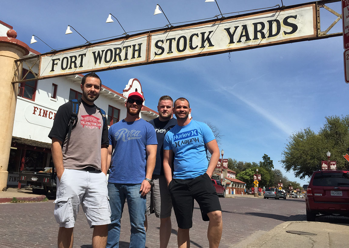
8) Fort Worth: Fort Worth Stock Yards
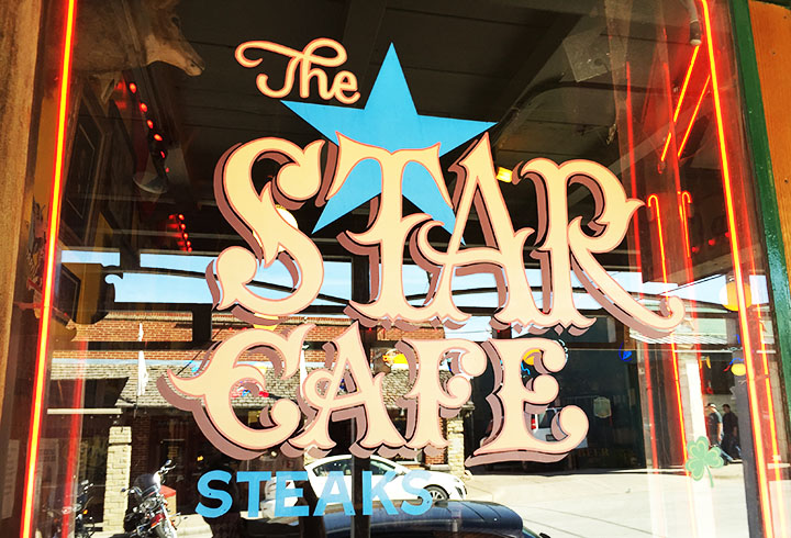
Here, a 206-acre area that used to house a huge livestock market is now a historic district that retains its Wild West heritage with saloons, rodeo grounds, and souvenir shops. Originally inhabited in the 1860s, Fort Worth Stock Yards officially opened up in 1890 and became a historic district in 1976. My friends and I enjoyed wandering around and exploring the pedestrian-friendly blocks. We had delicious lunch including bottled IBC Root Beer at a restaurant called Star Cafe.
9) Fort Worth: Water Gardens
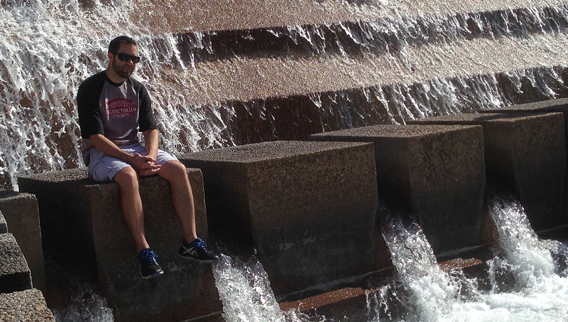
The Water Gardens are located right in downtown and have been there since 1974. Within the 4-acre park, there are several different water features including an “aerating” pool and a “meditation” pool. My favorite feature was the Active Pool which is a terraced waterfall that steps down 38 feet below ground level. Visitors can step down into the base of the waterfall next to a pool at the bottom. The roaring sound from within the center is amazing. I took a short video to show the experience. I panned around from inside the waterfall, then recorded going up the steps to exit, then did a pan of the overall facility. This particular pool was redesigned from 2005-2007 after 4 people died there. It is now 7 feet more shallow than it used to be.
10) Irving: Dr. Pepper Bottling Plant
This is the home of the Dr. Pepper Snapple Group in Irving. Perfectly visible from Highway 482, we pulled off the road quickly here to get a picture of these massive tanks designed to resemble soda cans.
Texas and its people were most welcoming, and I can’t wait to go back again. The drive would be worth it even if just for the food: Tillman’s Roadhouse in the Bishop Arts District on 7th Street gets high ranks from me. First of all, the mac & cheese with bacon is amazing, and secondly: YOU CAN COOK S’MORES AT YOUR TABLE! They bring miniature stoves out along with a variety of marshmallows, some chocolate squares, and poker sticks. What a way to do dessert!
Please enjoy the rest of the pics if you’d like.
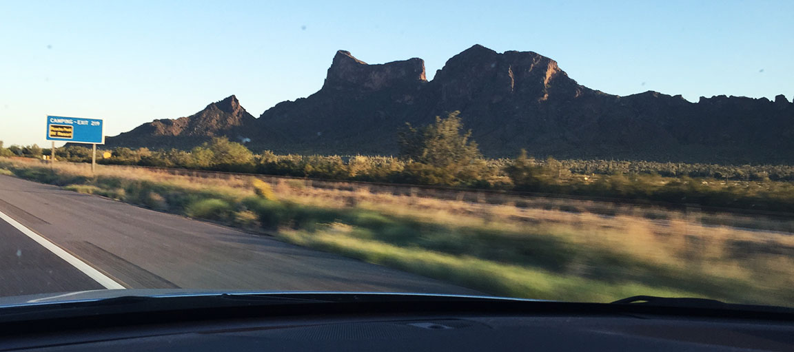
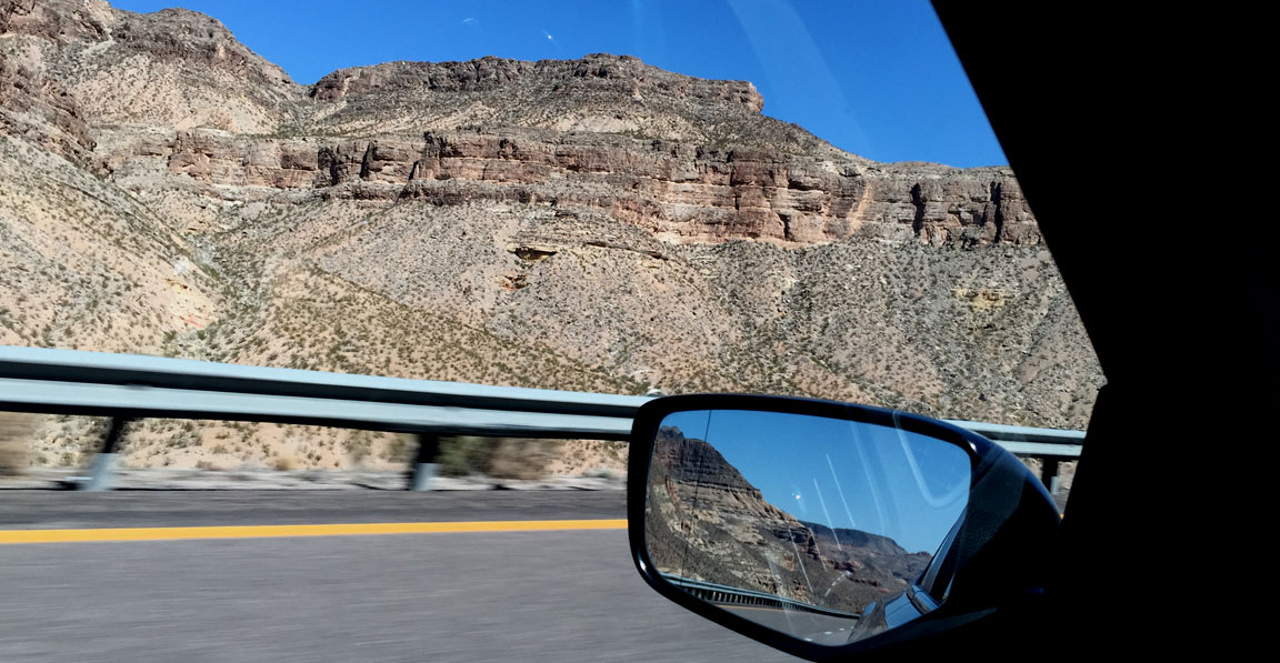
I-10 eastbound, passing Picacho Peak in Arizona
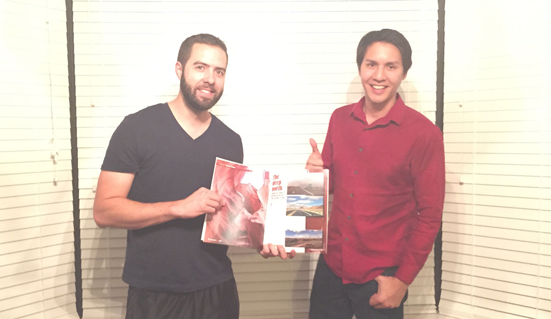
Overnight stay with Jason and a look at our recent March-April 2015 feature in Arizona Driver
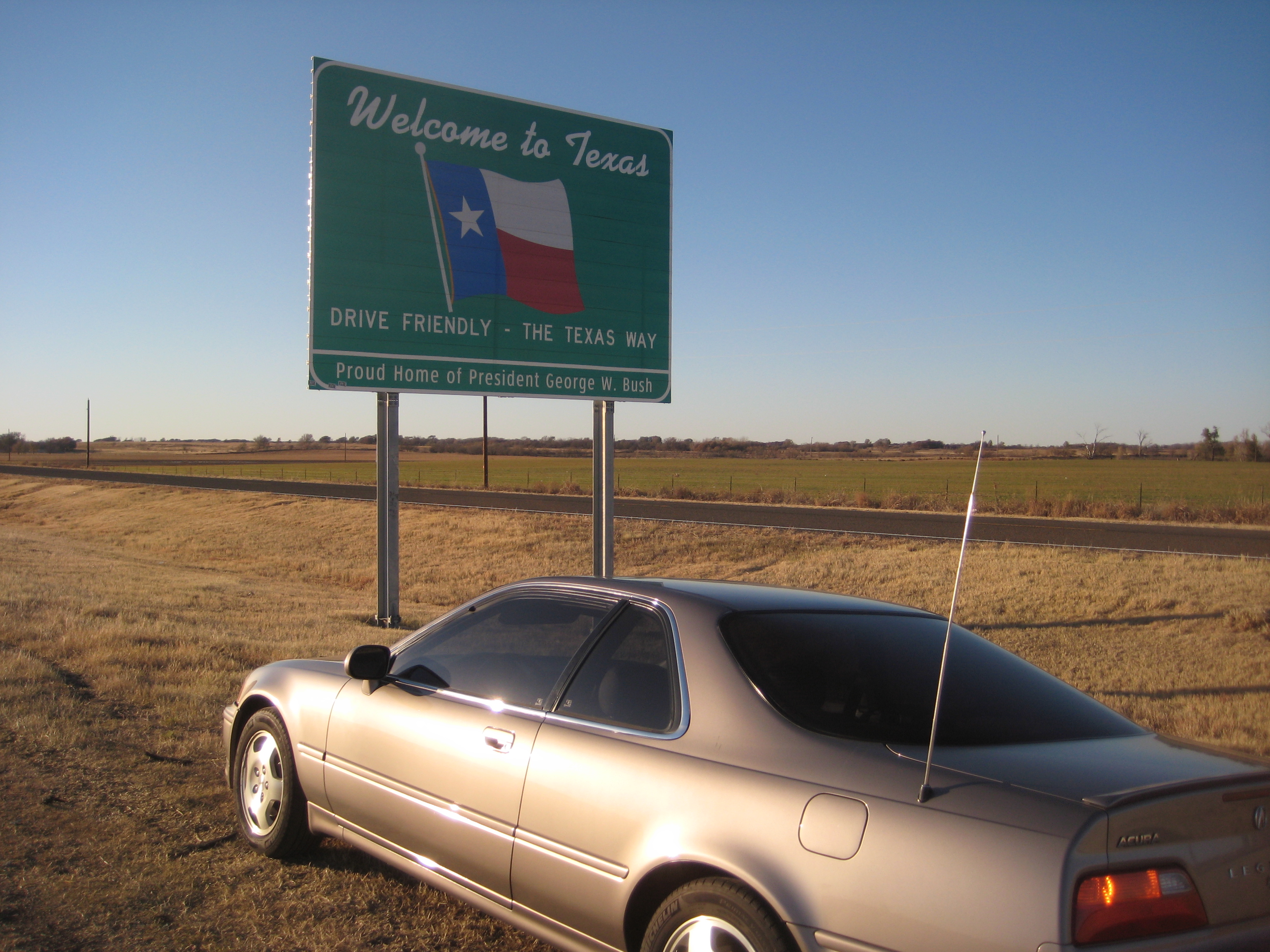
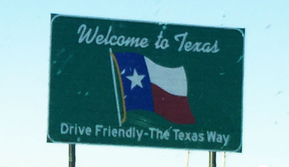
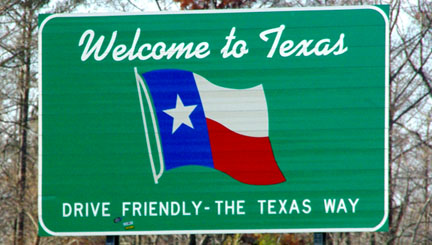
Drive Friendly – The Texas Way
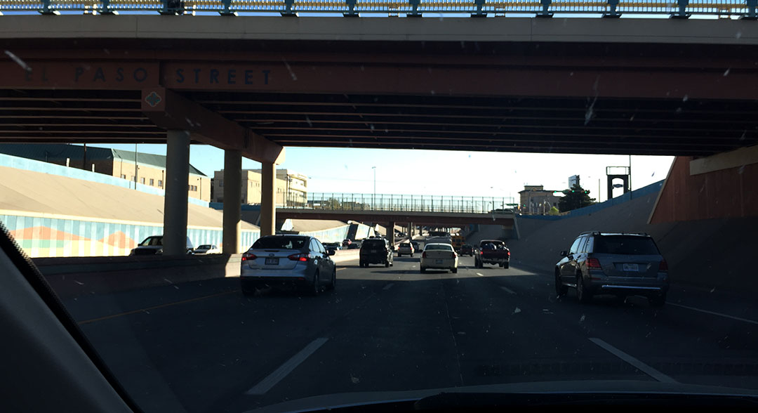
Interstate 10 through El Paso, Texas
“Happy Birthday” Frappaccino at Starbucks in El Paso (yes, it has pink whipped cream)
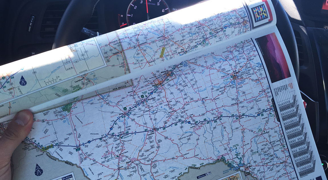
Old school maps. That’s how I roll.
Those mountains are in Mexico.
This is how close I was to the international border (blue dot).
I-10 / I-20 split. From here, I headed toward Dallas.
Stonehenge in Odessa
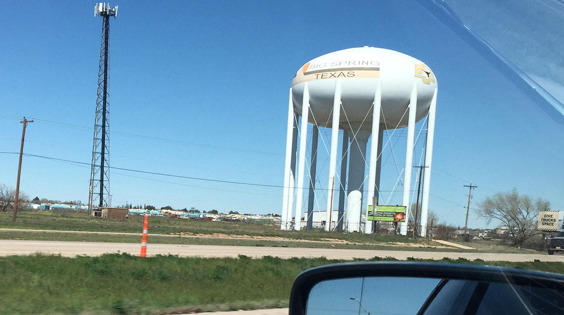
Lots of water towers! This one, in Big Spring.
Crumbling building in Colorado City, Texas – and a dually pickup truck that is a perfect representation of the “typical” west Texas automobile of choice.
Paper airplane from Donovan at the Sparhawk Art Gallery in Abilene.
Getting closer!
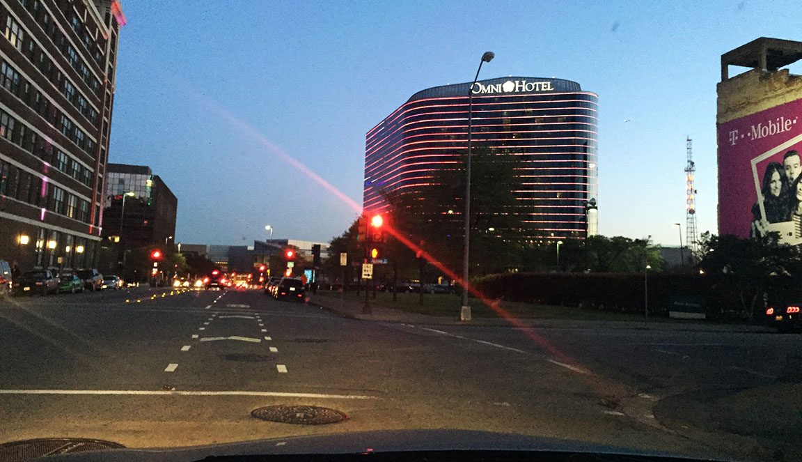
Hotel for the first two nights: Omni.
View of central Dallas from the 22nd floor of the Omni hotel.
Brunch with friends in Oakcliff area.
$22.50 worth of money! I think the Bureau of Engraving & Printing ripped me off.
Roadside scene in Fort Worth, Texas near the Stock Yards.
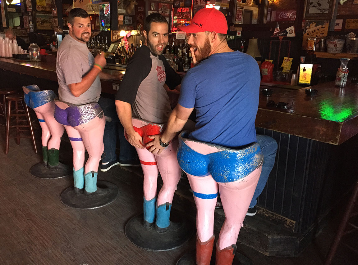
Check out those bar stools! Scott, Tyson, Kyle, showing some skin & booty.
Lunch spot.
Entering the Active Pool at the Fort Worth Water Gardens.
Hanging out near the pool.
“Only in Texas” will you see a banner like this at the entrance to your hotel.
Dinner at Tillman’s Roadhouse
Hotel for night 3: Aloft in Las Colinas area of Irving, Texas
93 octane! Didn’t feel too bad paying $2.64 for the rich stuff.
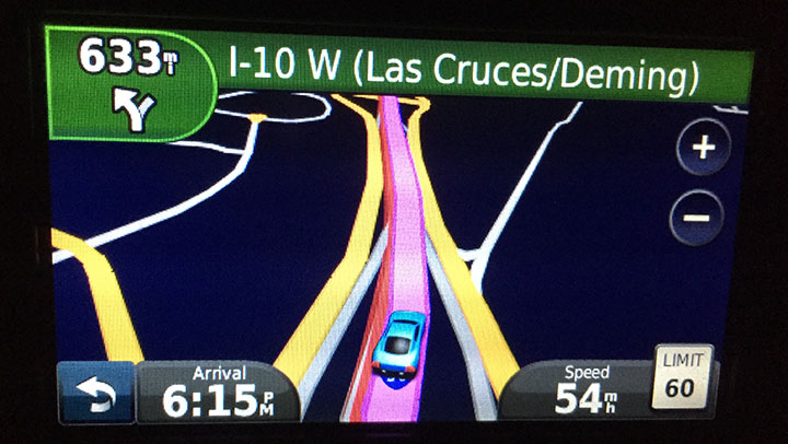
Definition of an easy drive: Next turn in 633 miles!
Sunrise in my rearview mirror departing the Dallas – Fort Worth Metroplex on Sunday morning.
Homeward trek to the I-10 / I-20 split again.
Fuel & stretch stop in Van Horn, Texas. Home of the Sands Motel. My favorite part of the sign was the spray-painted “American Owned” comment along the bottom.
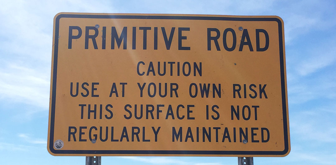
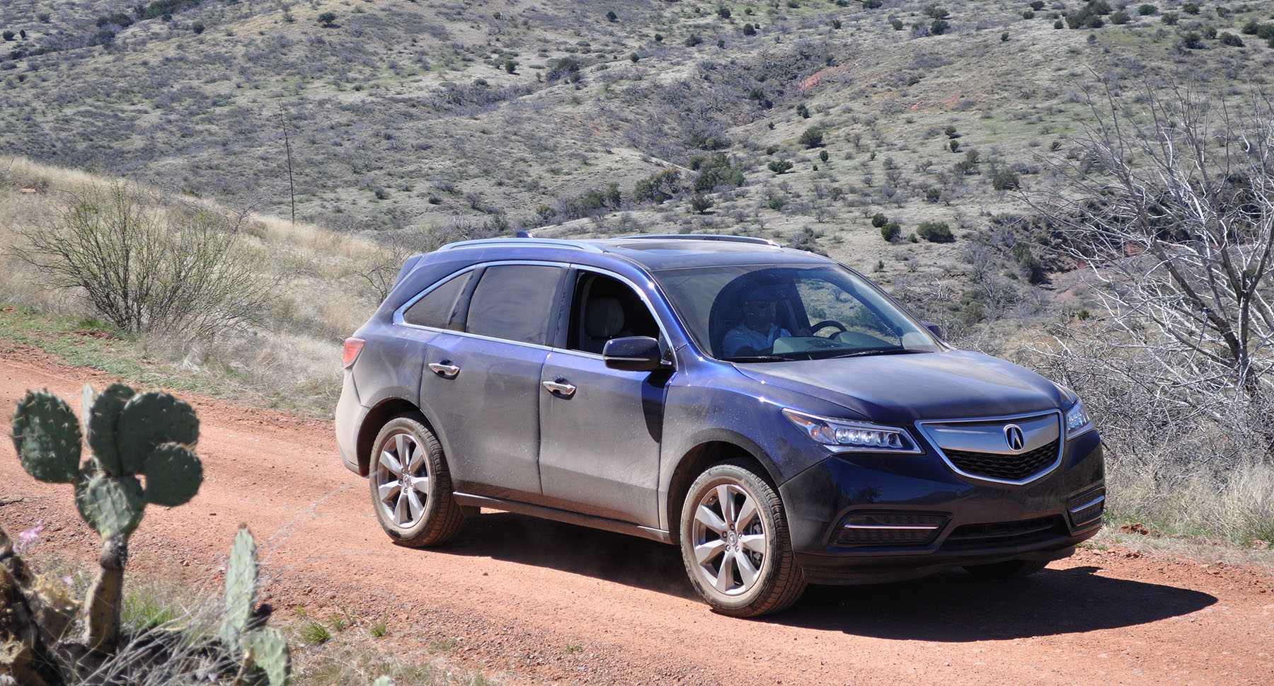
“What are your weekend plans?” asked Carin at Great Clips while she worked the sides of my head with the hair clippers. “I’m going on a little off-road drive with a few friends,” I told her. I could see the wheels spinning figuratively in her head, probably thinking of some extreme rock-crawling adventure with Jeep Wranglers. “What are you going to drive?” “An Acura MDX,” I told her. “Wait, isn’t that a luxury car?” I took a minute to educate her. What’s the point of having a four-by if you aren’t going to use it?
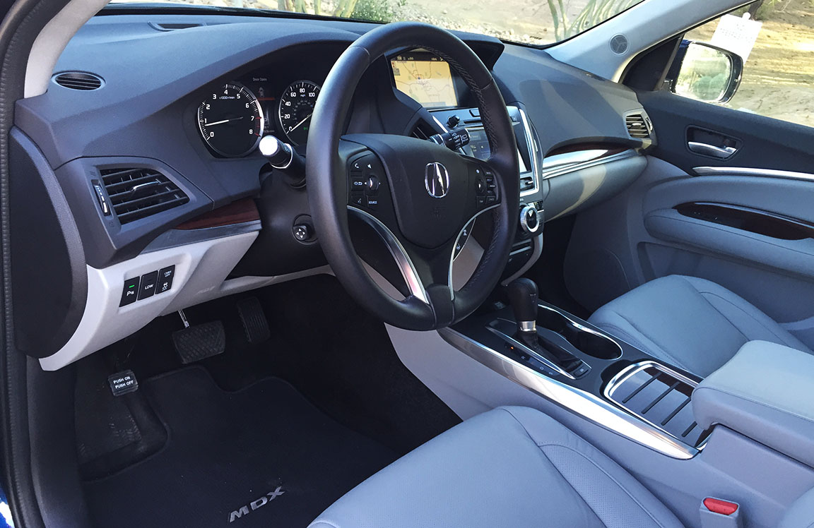
In November 2013, I did a full review of the then-new 2014 Acura MDX. For the 2015 model year, the MDX carries onward unchanged (“if it ain’t broke, don’t fix it!”) and I was again this year given the chance to put Acura’s best-selling SUV through a real-world driving evaluation over the past week. My test MDX was born in Lincoln, Alabama but already had over 7,000 miles on it by the time it arrived at my house. It was painted Obsidian Blue Pearl and loaded to the max with option packages. Bottom line on the as-tested vehicle was $57,765. I’ll share details about those options later on.
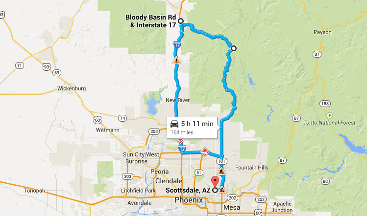
For a chance to exercise this luxo-SUV on a variety of road conditions, I asked around and got a few recommendations. The route that we chose would give us a taste of freeway, two-lane, and off-road sections over the course of its 160-mile length.
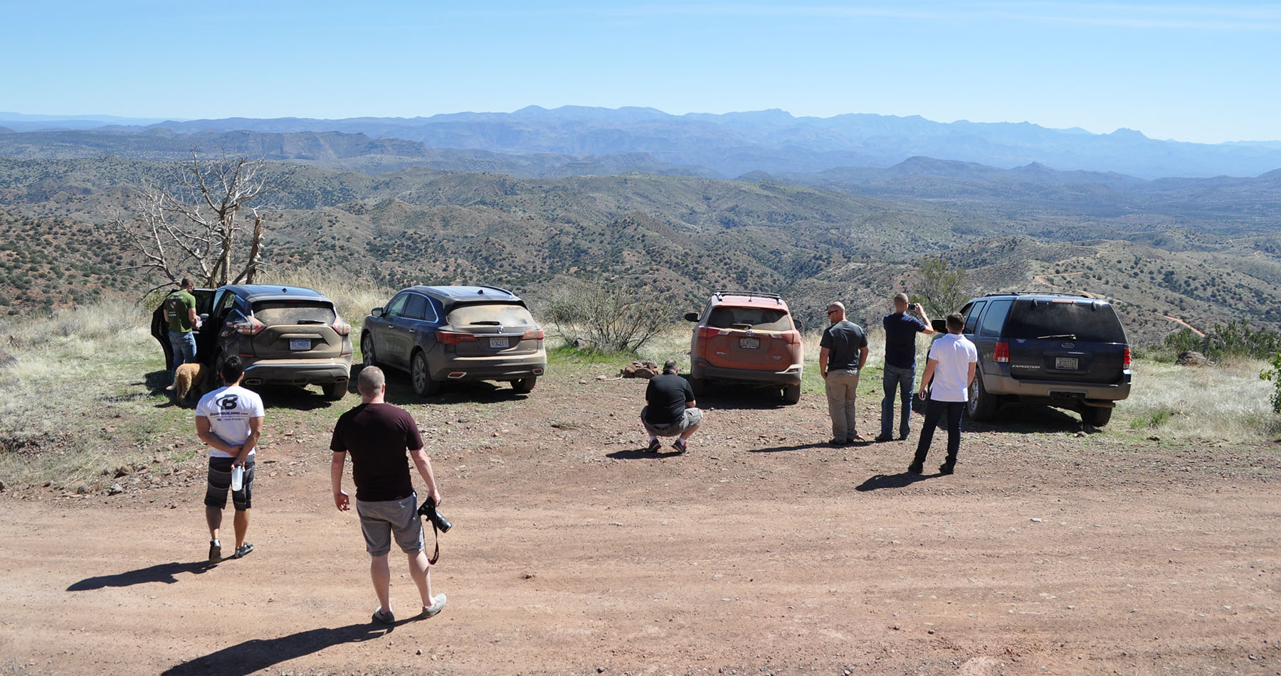
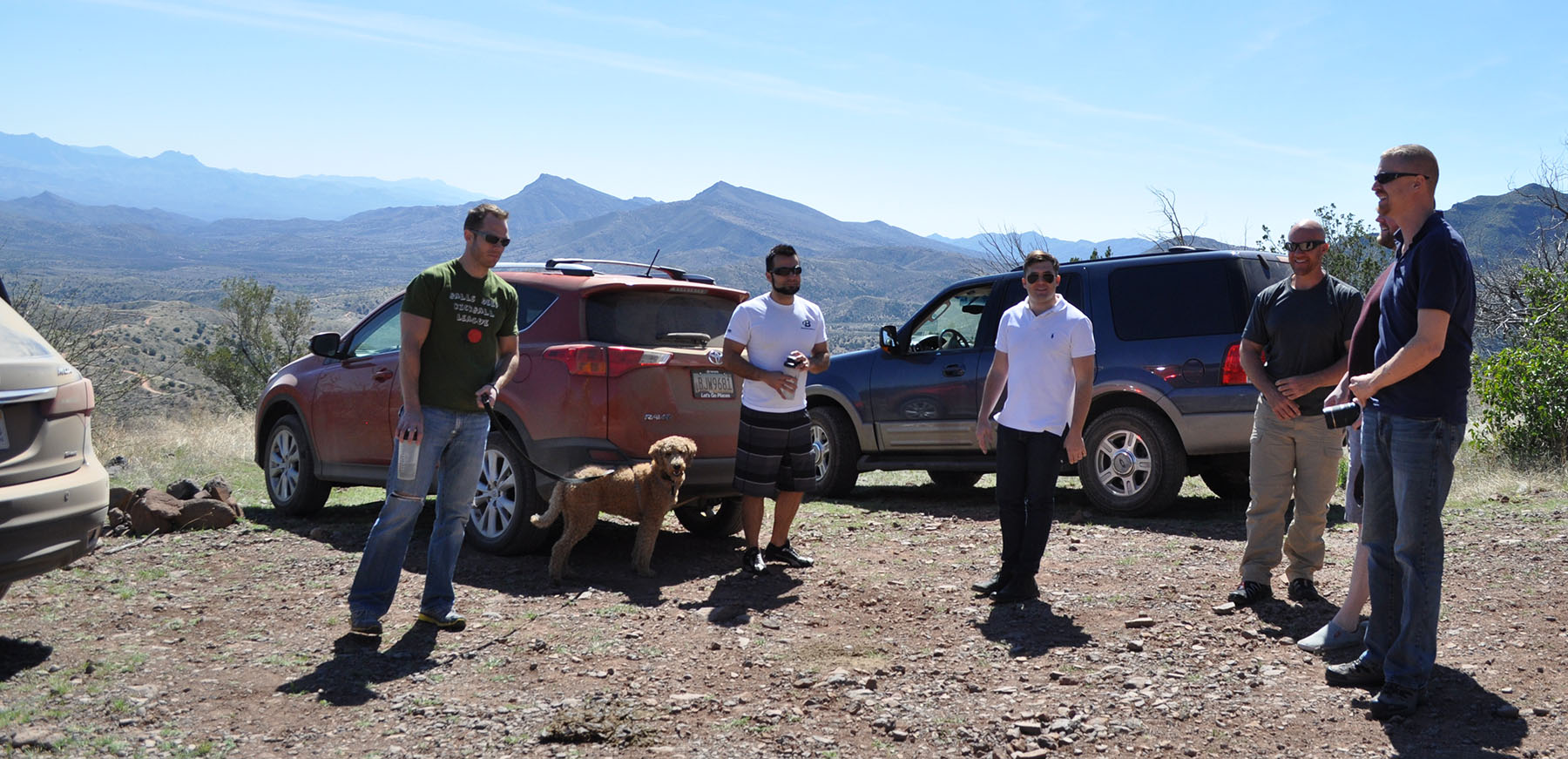
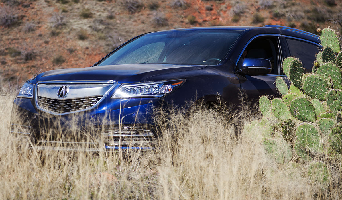
From Scottsdale, eight of us headed out on Sunday morning with a foursome of varied sport utility vehicles: 2003 Ford Expedition, 2015 Nissan Murano, 2015 Toyota RAV4, and the 2015 MDX. The grades on Interstate 17 climb sharply from the Phoenix Valley toward Flagstaff. The MDX cruised comfortably at 75-80 mph and it’s difficult to tell you’re even going that fast – wind/road noise is near non-existent. Our destination was Forest Road 269, also known as “Bloody Basin Road.” It takes off from I-17 at mile marker 259. From there, the pavement ends and the fun begins as the road heads eastward through some remote backcountry that is rich in history.
Along the way, we would be passing by Indian ruins and other abandoned dwellings. Bloody Basin gets its name from a series of armed conflicts between new settlers in the area and the native Apache people. One particular massacre happened in 1864 when a party led by a man named King Woolsey killed 29 Indians. Legend has it that the stream ran red with their blood. Bloody Basin Road goes through the Agua Fria National Monument, a 50,000-acre area that contains some well-preserved ancient ruins that were occupied between 1250 and 1450 AD.
But you didn’t come here for a history lesson. How about that MDX? Over 50 miles of rough dirt road later, I can attest: This SUV is as refined in rugged territory as it is on a high-class date to the symphony. Bloody Basin dished out its fair share of terrain that made us raise our eyebrows in wonder: Do we have enough ground clearance? Is this going to scratch one of the wheels? How deep is that water? No task seemed too difficult to undertake. The MDX’s MacPherson-strut-equipped suspension kept Chris’ Starbucks beverage from sloshing around too much on the washboard ruts. And that, in his book, was enough to give it a firm stamp of approval.
Prior to the off-road portion, Mike in the Expedition had remarked: “I brought tow straps in case we need to pull any of these ‘cute-utes’ out of the rough stuff.” Well, Mike didn’t end up needing those straps after all. In fact, we rolled onward confidently in the comfort of ventilated seats, XM radio, and tri-zone automatic climate control. Heck, if we’d had enough riders, I could have had people in the back seat watching movies on the ultra-wide 16.2″ DVD system with headphones!
Meanwhile, each of the dozen or so vehicles which passed us going the opposite direction gave us the same look of, “What do they think they’re doing here in that?” It seemed like all the other vehicles on the trail were lifted 4Runners or full-size pickup trucks. The route was full of scenic photo-ops so we took advantage of the chance to pull over and enjoy it (and, to give the dog Jake a chance to stretch his legs and lap up a little bit of water).
At one point we decided to take a steep side trail to the top of a small mountain. The MDX 3.5-liter V6 pulled the vehicle effortlessly to the summit without even requiring a lot of throttle input. It produces 290 horsepower and is mated to a 6-speed automatic transmission that can be manually shifted with paddles on the steering wheel for maximum control.
King of the hill! No sweat.
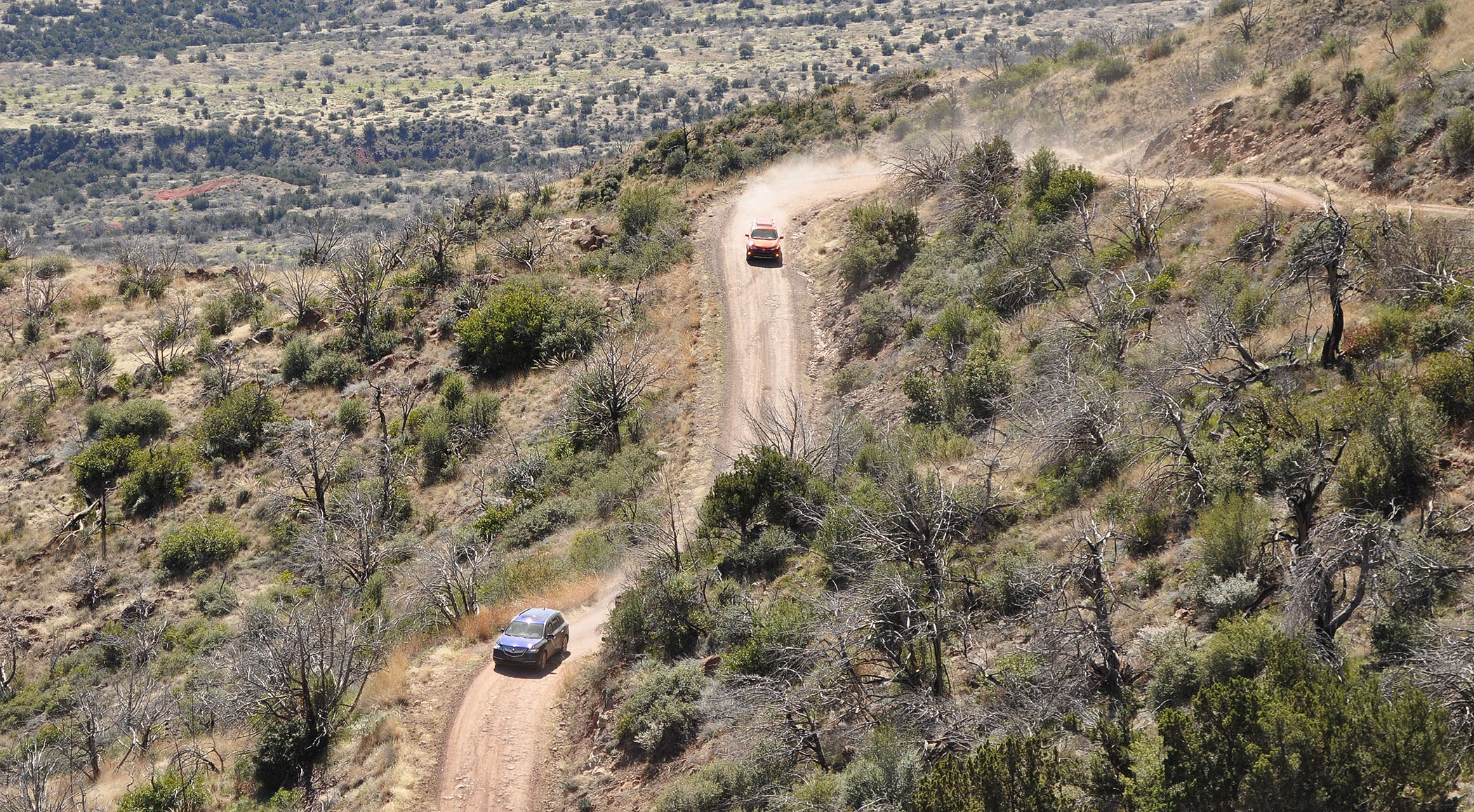
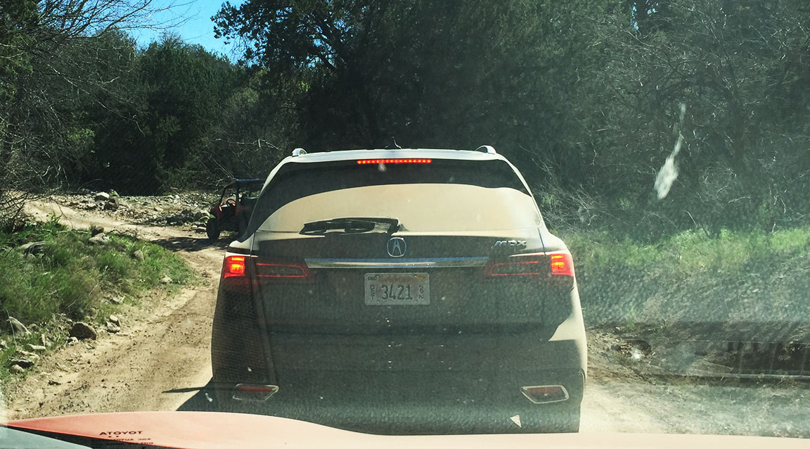
After about 27 miles, we made it to the junction with Forest Road 24, also known as Seven Springs Road, where we hung a right and continued on in the rough stuff. That trail passes by a recreation area with picnic tables and a creek. Eventually it becomes Cave Creek Road and goes past Sears Kay Ruin which I visited last year. By this time, we were all ready to kiss the asphalt because we’d been eating dust clouds for the last few hours.
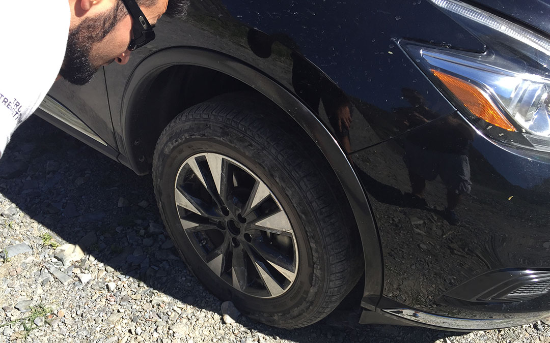
Beau and I were following Matt & Alan and I noticed that Matt’s right front tire looked low. Sure enough, it quickly deflated and we all pulled over for some emergency roadside action. In a matter of minutes, they’d thrown on the donut and we continued on our way.
The remarkable thing is that despite everything we’d thrown at it, the MDX alignment continued to track straight and true. Not one shimmy, shake, or rattle, manifested itself once we got back to paved civilization. In fact, the MDX out-paced the other 3 vehicles by sprinting through some fun corners on the two-laner heading past Bartlett Lake. The Super Handling All-Wheel-Drive system shows its value both on-road and off. Multiple times throughout the day, people remarked about how composed and sure-footed the ride was. It inspires confidence to be in a vehicle that is capable of virtually any type of terrain.
I spent $4 at the self-serve coin-op car wash and by nightfall, the MDX looked as good as new again. It’s a vehicle that gives the creature comforts of a luxury sedan, the people-hauling capability of a minivan (it seats 7), and the go-anywhere versatility of a 4×4. Coming from my daily driver ILX, I enjoyed the higher step-in height and the more empowering sense of “presence” on the road. It’s no wonder the MDX is Acura’s best-seller. Many thanks to the folks at Acura for allowing me a few days behind the wheel.
Here are the rest of the pictures and a short 1-minute video from our little day-trip.
Entering Agua Fria National Monument – before getting too dirty.
Pit stop overlooking the Tonto National Forest
Ridin’ dirty
Obsidian Blue started looking like Dirt Brown.
Jewel Eyes
Rav, MDX, Murano, taking a break along Seven Springs Road
Bloody Basin is part of the 3,000 mile route from Mexico to Canada called “Great Western Trail”
So. Much. Dust.
Matt & Alan swapped out the Murano spare tire here alongside the road.
Lunch at Big Earl’s Greasy Eats in Cave Creek. I’ve blogged about it before.
MDX Equipment, As-Tested
MPG 18 city, 27 highway, 21 combined
Tech Package:
Navigation system with Voice Recognition
ELS Premium Audio System with 12 Speakers
HD Radio
Tri-Zone Climate Control
LED Puddle Lights
Advance Package:
Collision Mitigation Braking System
Sport Seats with Perforated (and Ventilated!) Leather
Remote Engine Start
Lane Keeping Assist System & Adaptive Cruise Control
Entertainment Package:
16.2″ DVD Rear Entertainment System with Wireless Headrests
Most people wouldn’t consider it worthwhile to drive nearly 900 miles for a < 24-hour stay at a destination. But, I guess I’m not “most people.” I took off on Saturday morning and headed for my hometown in southwest Utah to spend a little bit of quality time with my family there. I’ll spare a lengthy road trip recap because I’ve blogged about the route dozens of times in the past, but I did manage to get a few pictures that might be worth sharing.
Here’s the Virgin River Gorge section of Interstate 15. For about 10 miles, it winds along the base of a canyon next to the Virgin River. Here’s what makes this very short stretch of road unique, though. It’s located in Arizona, yet it connects a town in Nevada (Mesquite) with a town in Utah (St. George).
St. George is home to about 77,000 people – at least as of a recent 2013 census.
My brother Bentley and his wife Kyann were very welcoming at their home.
One of the highlights of the trip for me was driving my brother’s fully restored 1968 Chevy II Nova SS. It’s powered by an LS3 V8 motor and it has a T56 6-speed manual transmission. The car was dyno-tested a couple of months ago at 416 horsepower at the wheels (so, a little more than double what I’m used to driving daily). I fell in love with this car by the time I had driven it to the end of his street. The burbling sound of a V8 and the endless torque made me want to get a little naughty and light up the tires. I managed to behave myself.
With my nephew Beckam
Interior of the Nova. The gauges, steering wheel, and radio you see here are all aftermarket. There’s not much on this car – aside from the body itself – that’s original to the car’s 1968 model year specifications.
Made a couple special visits, including a shopping trip with my 3-year-old niece.
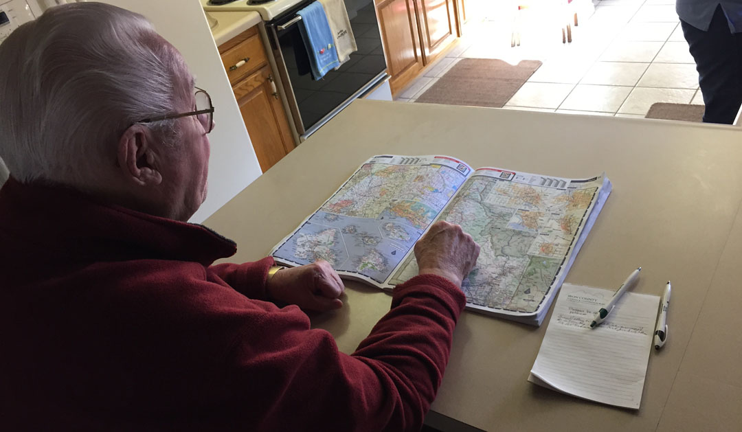
Also did a little route planning with grandpa. He gave me some tips for a drive to Idaho that I’ll be taking with my dad later this year. Stay tuned for more on that in the coming months!
Sunday morning’s return drive to Arizona via Highway 89A through Fredonia, Arizona. The Ship Rock Motel looks to have been abandoned many years ago. At one point I believe some of the rooms had been converted into apartments but as of today it appears the entire facility is pretty much condemned.
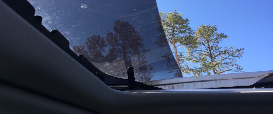
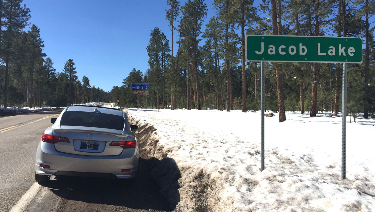
As the road crested to 7,900 feet in elevation at Jacob Lake, there was snow on the sides of the highway.
It was a perfect chance to crack open that moonroof and watch the pine trees fly by.
Arriving Jacob Lake. This is the junction with Highway 67 which serves as the gateway to the north rim of the Grand Canyon. I’ll be visiting that area again in late May for a rim-to-rim Grand Canyon hike.
Don’t even think about using a phone on some of the roads in that area. “No Service” is the only way to roll.
And that reminds me why that piece of road made me so happy.
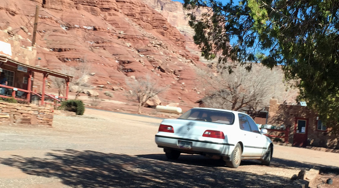
Just the open road, some good music, and a chance to clear the head. My next stop was in Marble Canyon along the Vermillion Cliffs. I happened to spy a 1991-92 Legend L sedan there.
A few pictures along the road in that area.
Endless hiking opportunities.
Waiting for a gust of wind to topple this fist-shaped rock onto my car.
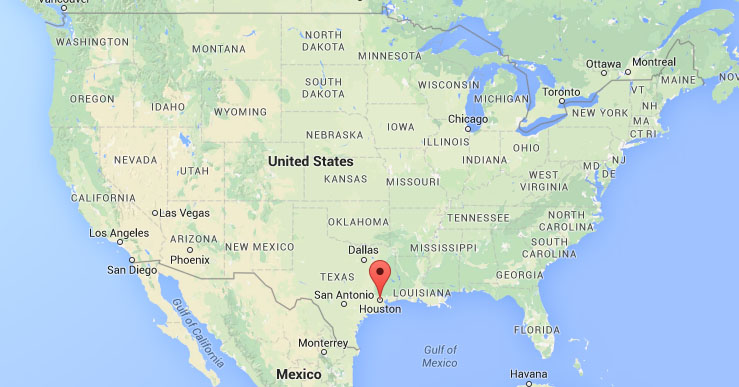
Hope you enjoyed the pics. One more announcement while I’m posting this today: For its 11th Annual Event, NALM is going back to where it all started way back in 2005: The Lone Star State.
The Houston-based ground team has won the bid and has been selected to host this year’s National Acura Legend Meet.
So, it looks like I’ll be going to Houston from September 24th through 27th to attend this special event. The planners have a great itinerary planned including a track day at MSR Houston, a dealership open house at John Eagle Acura, and a car show at Mayday Garage. Here’s a look at where the event has been held in prior years.
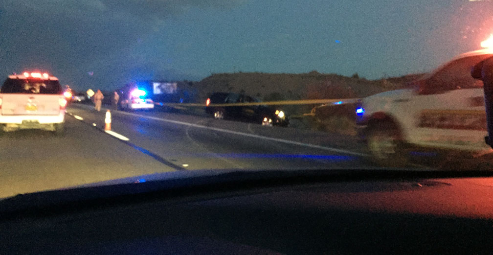
Panic attack. It’s alarming to see flashing red & blue lights in your rearview mirror, especially when they seemingly come out of nowhere. It was a normal Interstate 10 commute across the desert on Saturday evening until three or four black & white Ford Explorer highway patrol vehicles blasted up from behind and passed me like I was sitting still. I’d guess they were doing at least a buck-twenty on the speedometer. I exhaled in relief that they weren’t coming for me, but I thought to myself, “I’m going to see them again.” Sure enough, I’d just crossed over the California/Arizona line into my home state and traffic came to a halt. There were enough red & blues in the distance up ahead to light up a Vegas nightclub, so I knew things didn’t look good.
For 45 minutes while I sat in the ILX at mile marker 2, I entertained myself with Instagram and some classic 1990’s CDs I’d brought along (who doesn’t love a little K-Ci & JoJo, Creed, or Everclear?). A few vehicles started turning around in the median to head back to Blythe but I decided to try and wait it out — whatever “it” was. I got out of the car and grabbed my sweatshirt out of the backseat, then wandered over to the driver’s side of a semi truck that was idling next to me. Its driver was on his cell phone examining a spot on the fender of his truck. Except, it wasn’t just a spot. “Bullet hole,” he pointed and said when he saw me walking up. What I thought was just an accident was in fact the result of a high-speed chase and shots fired!
So that’s why every police cruiser in eastern California was blocking the road ahead. The truck driver said he’d seen a black SUV fly past and he’d heard a noise but at the time didn’t realize a stray bullet had come his way. I started chatting it up with a few of the drivers in the I-10 parking lot around me. There’s something about being stranded together in a traffic jam that makes people band together – it’s like we all shared this common bond and we wanted to swap conversation about what we thought was going on up ahead. I spoke for some time with a man and his sister who were en route from Oxnard, CA to Tucson, AZ with a Penske moving truck.
On the bright side, the traffic delay was a nice pause on my drive and a chance to see the desert sunset. After another thirty minutes or so, we finally were allowed to creep past the carnage of a rolled “getaway vehicle” black Chevy Tahoe and continue on our way. So, that was probably the peak of excitement from my 9 hours in the car on Saturday.
Why the drive? This was a “business” trip, in a sense. Each year, the Acura NSX Club of America (NSXCA) Board of Directors votes on submitted bids for an annual NSX gathering called NSXPO. It just so happens that the 2015 event will be held in Palm Springs, California. Three colleagues and I are putting the puzzle pieces together to organize the itinerary for our event which will be held in October and is anticipated to draw over 200 vehicles. Some of you may recall when I took my drive to Idyllwild last fall to scope it out as our proposed drive route for NSXPO.
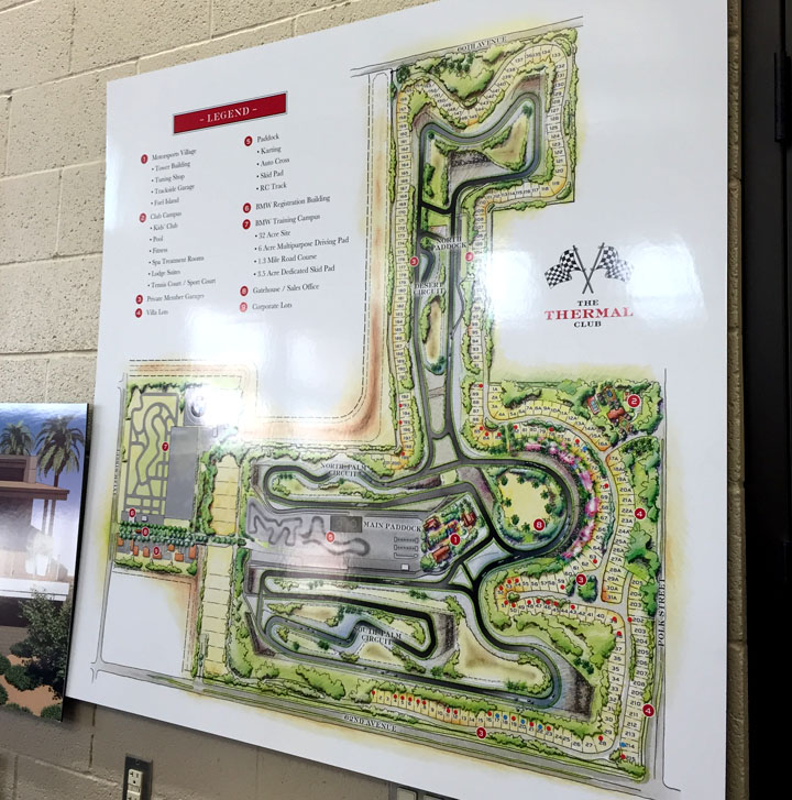
This time, the recon mission was to check out our racetrack facility. The Thermal Club, located in Thermal, CA is a members-only facility that has 4.5 miles of freshly-paved, beautiful track. Administrators have graciously agreed to host our group during NSXPO so Chris, Les, JC, and I met up to get an exclusive tour. From the Cottonwood Springs exit off Interstate 10, I drove through Box Canyon toward the town of Mecca about 20 miles away – this was all “new” road to me, and the scenery did not disappoint!
Thermal lies just a few miles north of Mecca and there’s really not a heck of a lot there – except this glorious track.
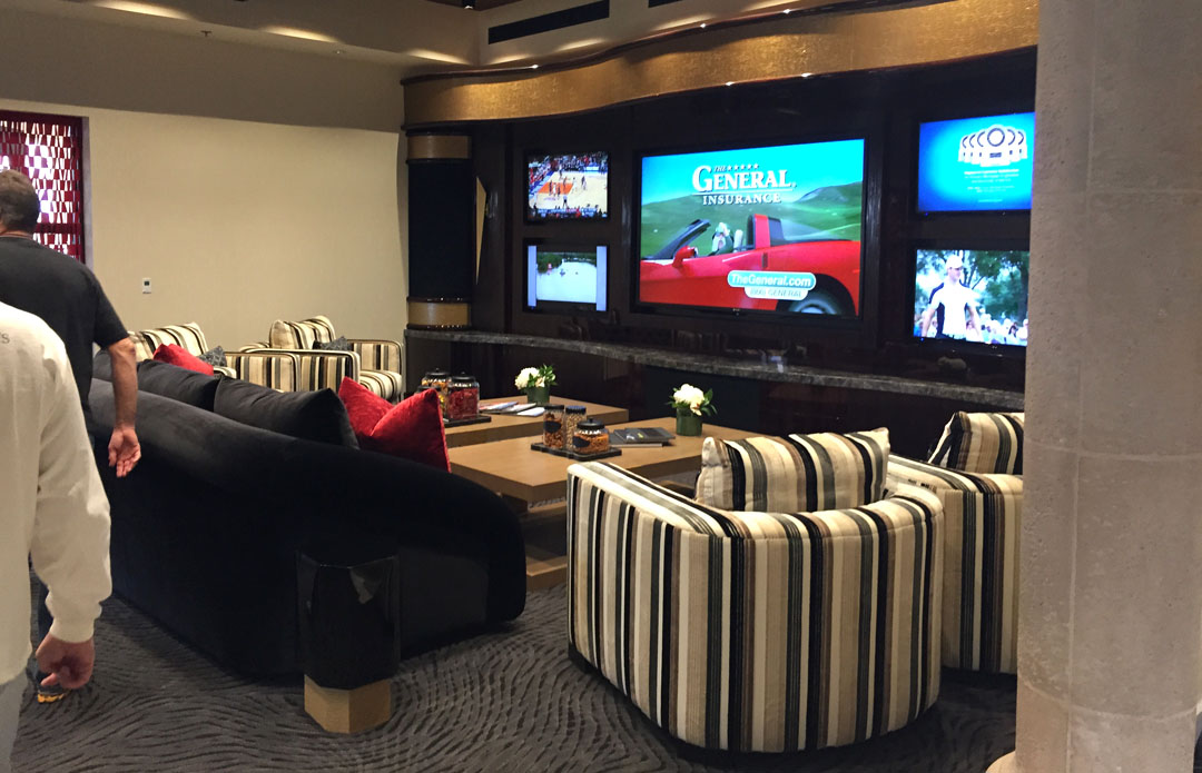
Thermal Club is a high-class place for high-speed cars. What was once just a remote piece of land next to the airport has been developed into an oasis for car nuts. The first thing I noticed after the security guard granted me access from the gate on 62nd Avenue was that BMW had a Performance Center on-site. At couple dozen “M” cars were parked and awaiting test drives as part of a training program. I was surrounded by cars worth more money than I’ll make in my lifetime. During our tour, we walked through a garage that had three Bugatti Veyrons in it. That’s $3.9 million worth of cars!
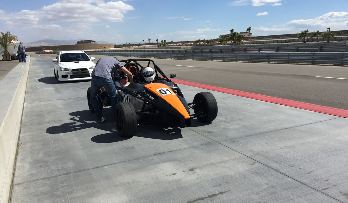
The highlight of our visit was getting to ride as passenger in an Ariel Atom while Thermal member Rahul drove each of us around on the track. What a riot that car is! Powered by a 2.0 liter Honda 4-cylinder motor, the Atom is so light and nimble that it seriously felt like a go-kart. Well, a go-kart on steroids, caffeine, and with rockets attached to it. I don’t think I’ve experienced that many G-forces in a very long time. Thanks, Rahul, for the test ride!
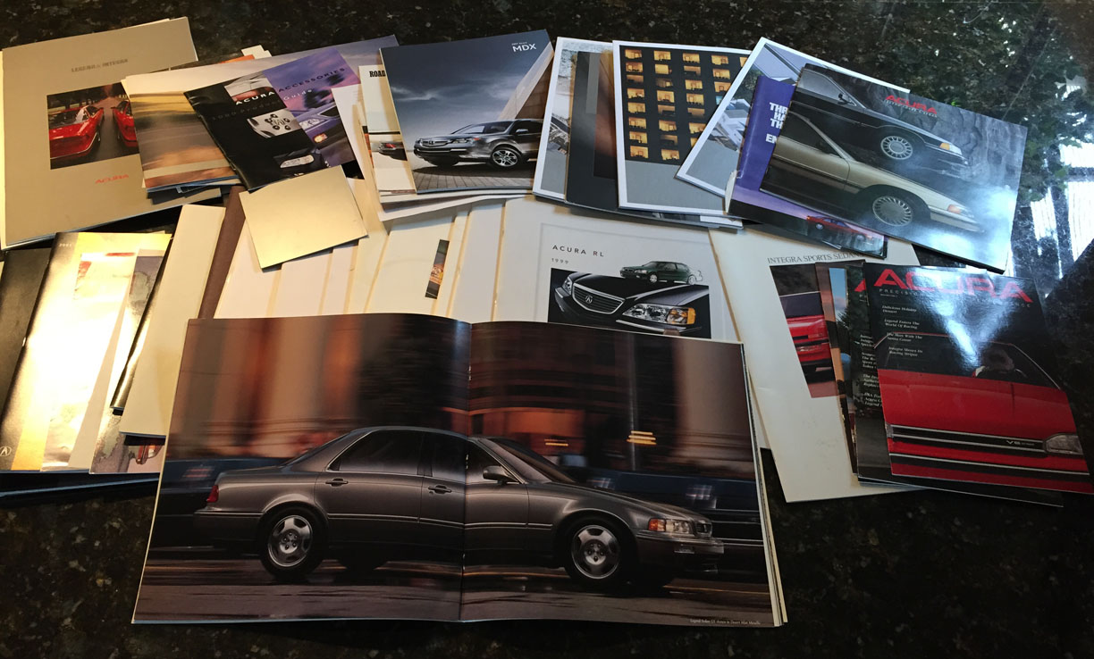
The last stop on my SoCal adventure for the day was to pick up a box full of goodies from my friends Scott & Sandy. Acura brochures! Scott worked for over a decade with Acura’s ad agency and managed to collect a bunch of materials (43 pieces, in fact) that he decided to share with me, knowing how much I geek out over auto literature. Check out all these beauties.
Thanks for joining on the drive. Here are the rest of my pictures.
Headed westbound on Interstate 10 and rocking out to my CDs
Exit 168 would take me to Box Canyon
Road headed to Box Canyon
A few shots from within the canyon itself
You know it’s a light traffic day when you can be comfortable stopping in the middle of the road for a picture
Just before exiting the canyon
Arrival at Thermal and seeing a lineup of BMW performance cars
Thermal racetrack, looking toward the west
Interior of one of the Thermal Club buildings
Thermal Club map showing the 4.5 miles of track, and the homesites surrounding it
Beautiful day in Palm Springs
Visiting my friends Sandy & Scott in Palm Springs
Stuck in traffic later that evening on I-10 eastbound
Finally getting past the incident after a long wait
Does anyone else agree that I must own this sweater from the a 1988 Acura magazine?
I recently saw one of those “You know you’re from such-and-such place when…” lists. It talked about the joys of living in sunny Arizona — a place where the best parking spot is determined by shade, not by distance. One of the items on the list was “You no longer associate bridges or rivers with water.” That is pretty true! We have dozens of bridges that cross over dry riverbeds. Many times, the only times those rivers get wet is during our rainy “monsoon” season in late summer.
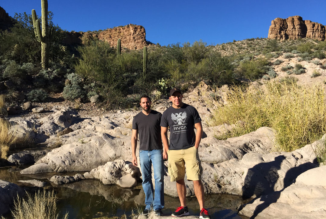
For some reason, it’s tough for people to believe that we do have our fair share of water here in the Grand Canyon state. Central Arizona has a couple of beautiful reservoirs that I’d been wanting to check out for some time now, and I thank my friends Peter and Jack for cluing me in on them.
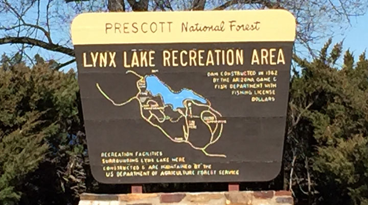
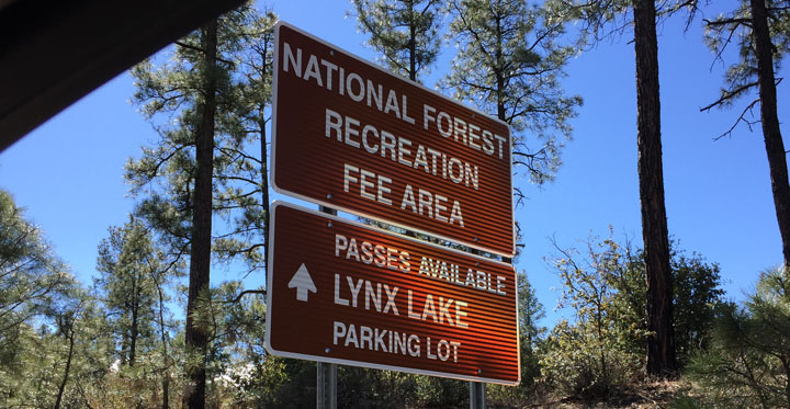
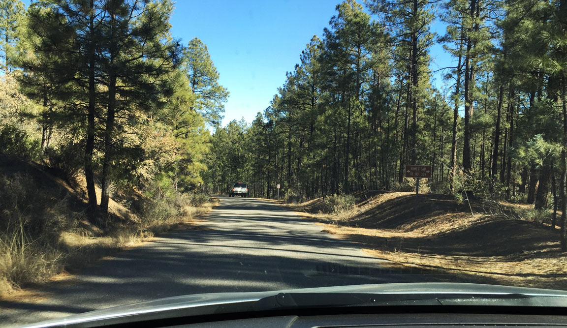
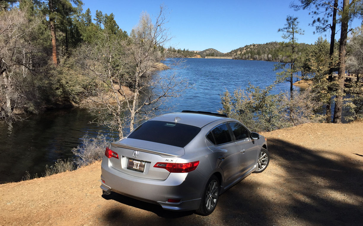
The Prescott National Forest covers 1.25 million acres of land in north-central Arizona and is an easy getaway (< 2-hour drive) from the Phoenix area. The key draw is the climate, since temperatures can be up to 20 degrees cooler in the summertime than they are in Phoenix. I took off on a Saturday morning and headed north on I-17 to do a little exploration of my own. Traffic was on the heavy side until I broke away on Highway 69 toward the Prescott Valley area.
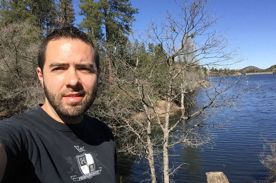
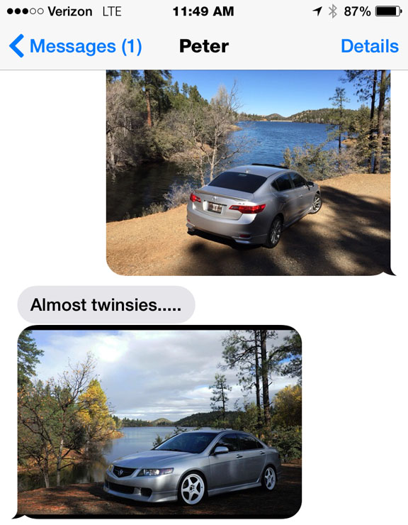
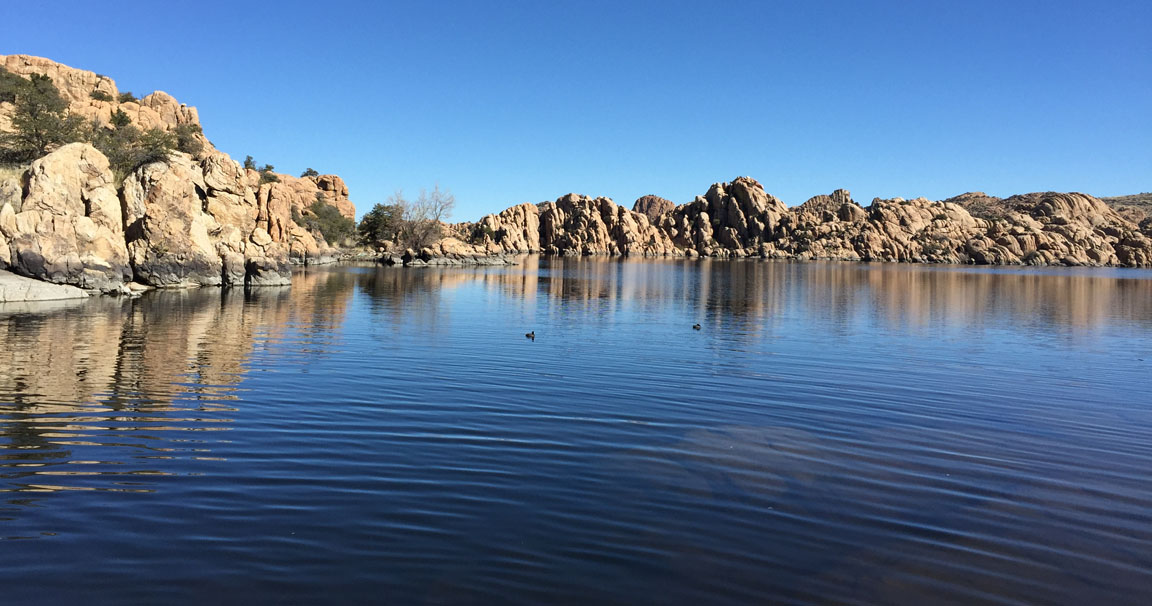
A few minutes from downtown Prescott, Lynx Lake is a hot spot for fishermen since it’s stocked regularly with rainbow trout by the Arizona Fish & Game Department. It covers 55 acres and was formed in 1952 when a dam was built on Lynx Creek downstream. I took a little one-lane road to a parking area along the south end of the lake. I didn’t linger longer than a few minutes for pictures. Oddly enough, when I sent a picture of my car to Peter, he responded within minutes by sending me a picture of his car parked in the exact same spot. Great minds think alike.
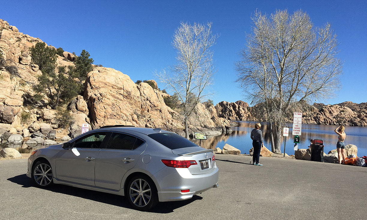
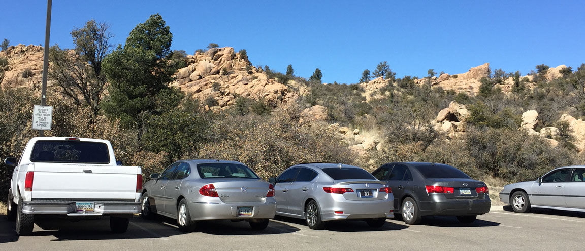
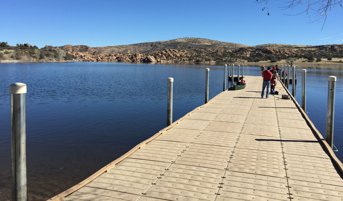
Just 7 miles away from Lynx lies an even larger body of water called Watson Lake that dates back to the early 1900s and covers 70 acres of area. I paid my $2 day-use entry fee using the automated machine at the entrance to Watson Lake Park, then cruised around to see what this place was all about. A group of 25 or more motorcyclists had overtaken one of the parking lots, so I continued driving around and found the entrance to a boat ramp. I figured – what the heck – and drove down the ramp. Unfortunately, parking was not allowed so I had to loop back to the visitor lot to leave the car there. That was fine since it was a perfect 70-degree day and I wanted get out of the car and hike around anyway.
Watson is surrounded by a variety of sandstone rock formations. Water conditions were calm and I watched a few people launch kayaks from the ramp. For being a Saturday, things were pretty calm and quiet, tourist-wise. I plopped down on a rock and just soaked in the scenery (and sunshine) for about 20 minutes. When the time came to exit the park, there was a lineup of a half-dozen cars waiting to pay at the gate and enter. I rolled down my window down and held out my parking pass. A woman in a black Honda Civic graciously took it from me when I offered it to her. Saved her $2!
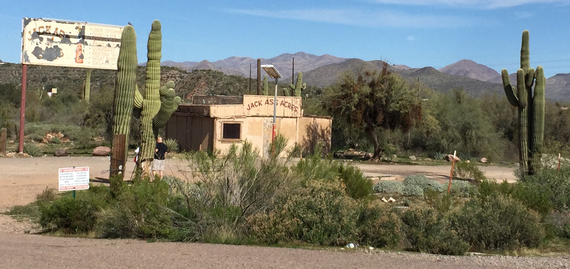
I had just one more place to visit before my trip was complete. I’d recently learned of Jack Ass Acres in New River off I-17 just north of Phoenix, so I pulled off the interstate long enough to get this picture. Jack Ass was once a gas station, convenience store, and souvenir shop but it appears to have been abandoned for decades. The building’s roof is crudely lined in barbed wire and the paint it peeling from every panel. Still, it makes a fun pit stop!
It was a fun day experiencing some of Arizona’s beautiful scenery and I hope you’ll enjoy the rest of the pictures here.
Heading toward Prescott Valley on Highway 69
Quick stop in the historic town of Dewey-Humboldt
Lynx Lake entrance
Approaching the parking area at Lynx Lake
Access to Lynx is via this one-lane, pine tree-lined, loop
Photo-op at Lynx
The ILX parked momentarily on the boat ramp at Watson Lake
Driving back up the boat ramp at Watson to the parking lot
Unfortunately, no swimming allowed!
A kayaker sets sail
Back to the parking lot
Another area of the lake with a dock
Heading back home, northbound on Highway 89
That’s not confusing at all. Two highways named “89A”?
Jack Ass Acres as seen from New River Road
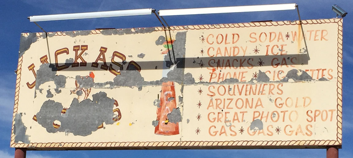
Jack Ass sign
Starting this Wednesday, I’ll be in a 2015 Acura TLX for a week to drive & review it. Where will I go? Wait & see!
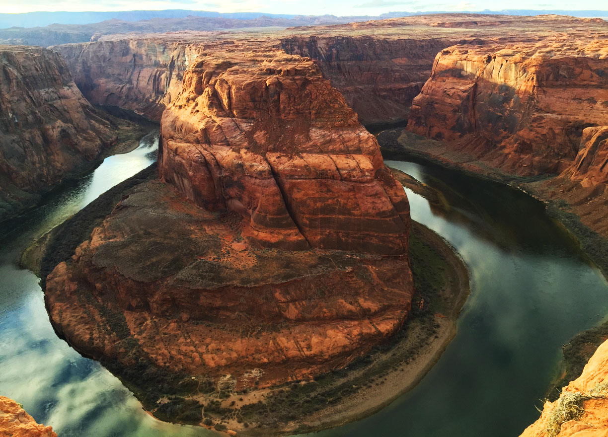
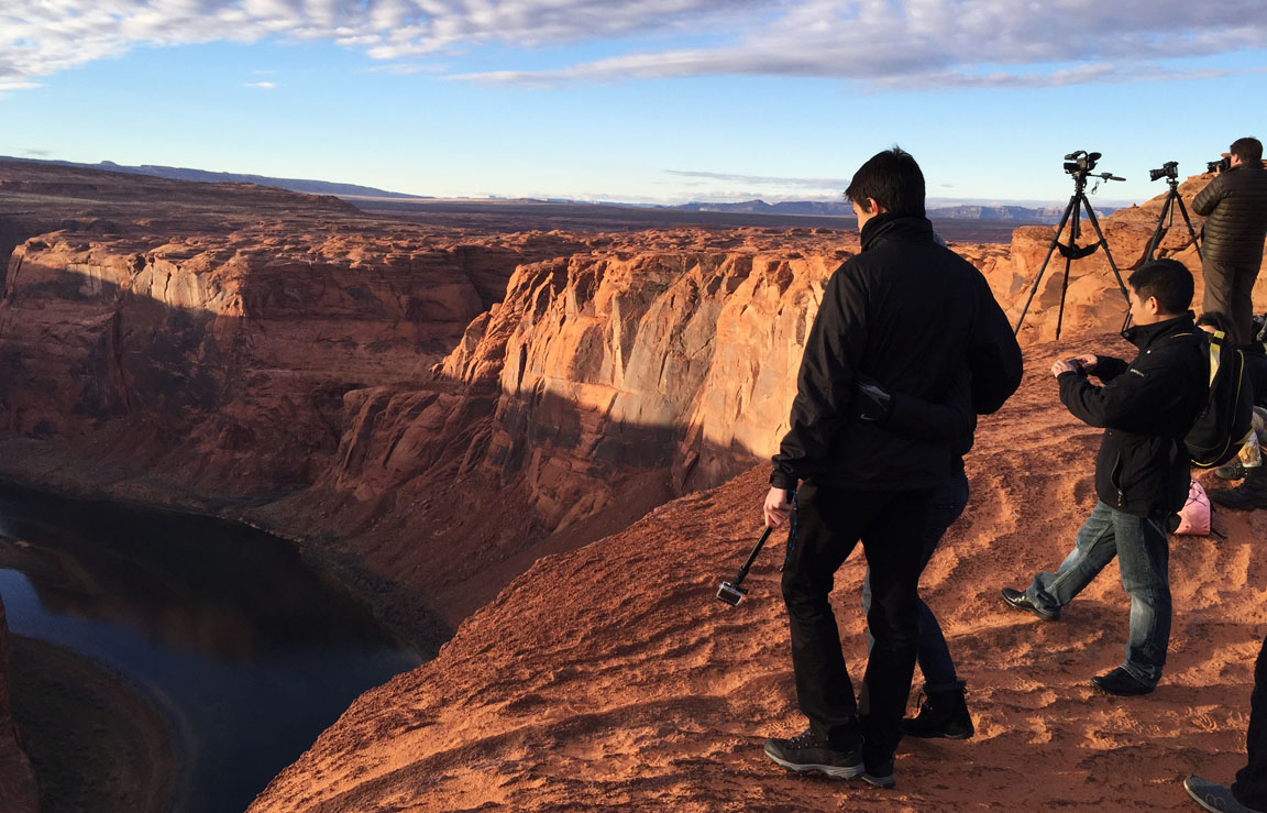
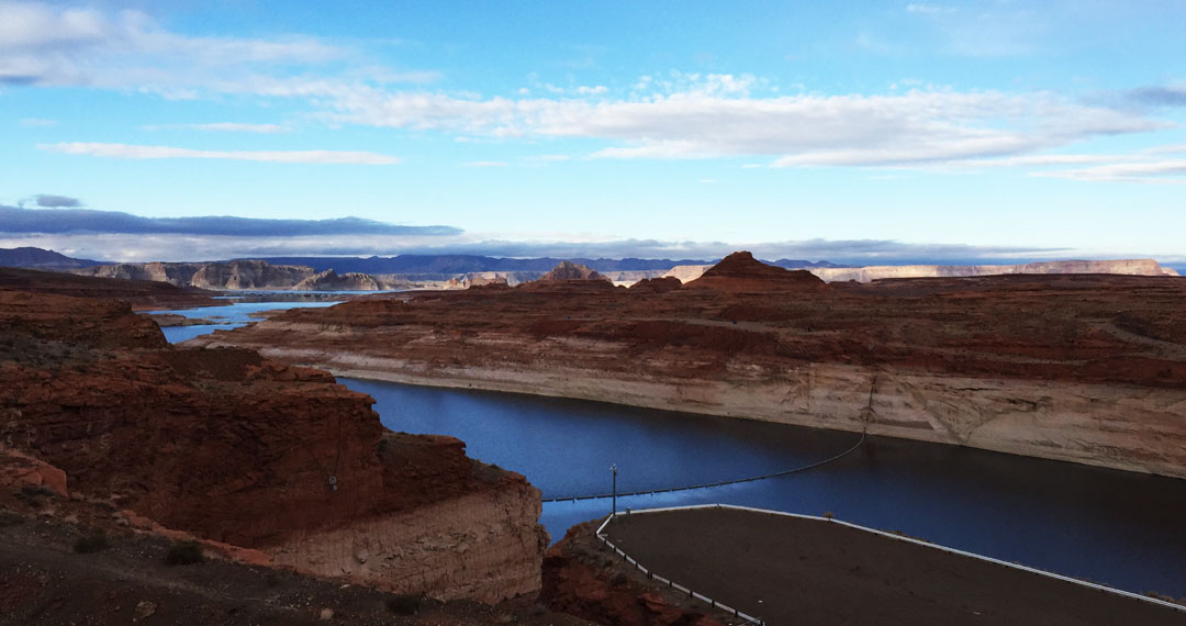
The story of our weekend’s canyon crusade left off when we had finished visiting the Utah/Arizona state line after our hike through Antelope Canyon. But the fun wasn’t over quite yet. Turns out, the timing was perfect to make a sunset-time visit to nearby “Horseshoe Bend.” That name refers to a section of the Colorado River where it makes a 180-degree turn just south of Page, Arizona. We were not prepared for the grandeur of this site!
Just a 3/4-mile hike from the trailhead, we stood at the edge of a 1,000-foot dropoff that rivals the nearby Grand Canyon. We had to hike along the rim of the canyon with care, as the sand on the rocks made for a slippery surface. None of us felt particularly like taking a freefall to the Colorado, though Peter stood on a pretty precarious looking ledge as if he entertained the idea:
Here I dangled my legs out a little.
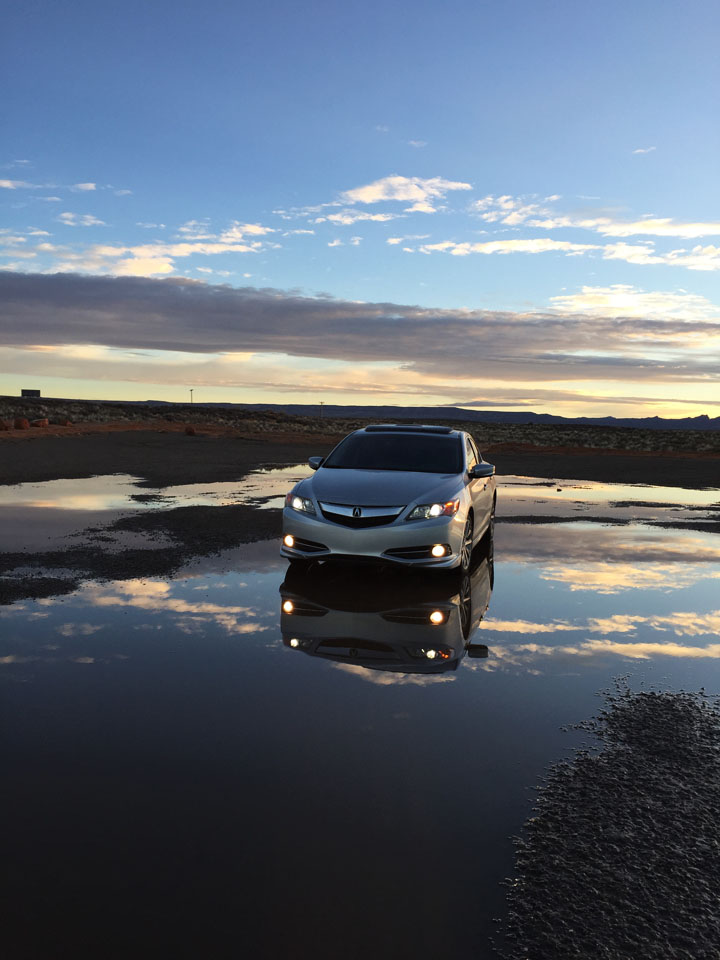
Sunset lighting and some fresh rainwater puddles in the trailhead parking lot made for the perfect photo-op on our way back to Page. Can you believe these pics we got of the ILX?!
Our night finished out with an enjoyable Italian meal at Strombolli’s. Best of all? We banned all electronic devices. Here’s how that played out: At one point, someone realized that all eight of us were iPhone users. Naturally, we had to stack all the iPhones up in the center of the table for a picture. This triggered an idea. “Hey,” I said. “Let’s challenge ourselves to leave these phones here for the entire meal and not touch them.” I saw some fear struck into the eyes of a few, but we all agreed. And what a great hour it was! Talking — without feeling the need for constant text-messaging and Facebooking. Just like in the olden days. Stephen missed out on 24 text notifications but the rest of us only had a few.
iPhone Jenga
We all crashed out after an exhausting day and a dip in the Comfort Inn hot tub. Sunday morning, I peeked out of our second-story hotel window and saw that the sky was completely clear and there was a thick layer of frost on every vehicle in the parking lot. Sure enough, my weather app confirmed that was was a mere 30 degrees outside.
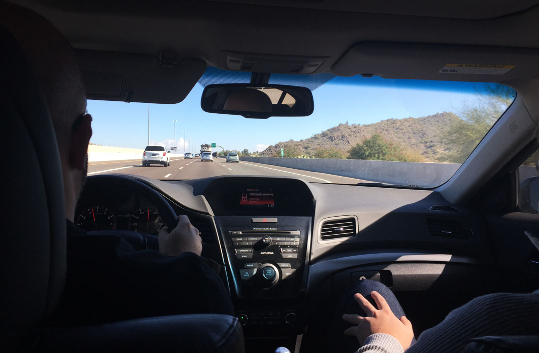
We fueled up on hot breakfast in the lobby and headed out on our return to Phoenix by about 9:30 a.m. In Flagstaff, we had a driver change and Peter took the wheel while I lounged in the back seat. Peter commented that he felt that the ILX was faster than his Acura TSX which has a similar horsepower rating. He had a great collection of tunes to entertain us with for the 2-hours remaining in our drive: hits like Billy Joel’s “For the Longest Time,” and Aerosmith’s “Dude Looks Like a Lady.” Nice selections, P!
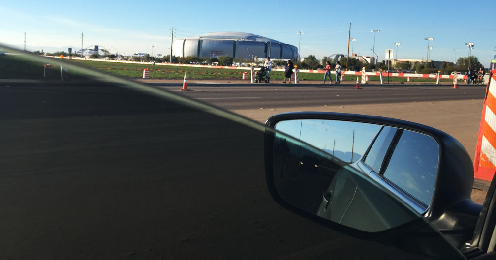
Phoenix was crawling with Super Bowl festivities so my friend Scott and I couldn’t resist the temptation to drive over to the University of Phoenix Stadium in Glendale later that afternoon to see some of the chaos. Sure enough, road closures, coned-off lanes, parking attendants, and plenty of police presence kept us from getting very close to the venue. I did still manage to get a picture of the ILX in front of Super XLIX! It was taken sometime during the second quarter of the game.
Please enjoy the rest of these pictures and a short video from Horseshoe!
A few photographers waiting for perfect sunset lighting
Pretty amazing all around
Silhouettes of our group
Back at the trailhead, some pics of the cars in the puddles
Talking on 8 iPhones at once at dinner
Chilly Sunday morning
Highway 89 southbound with the San Francisco peaks in the distance, approaching Flagstaff
Peter at the wheel of the ILX, and Chris in shotgun
Driving past the Super Bowl while it was going on!
Super Bowl pic with my buddy Scott from Massachusetts (obvious Pats fan)
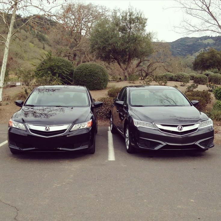
Hey, did everyone see the side-by-side of the 2013-2015 ILX next to a 2016 model? Thanks to Acura Connected for the image. What are your thoughts on the changes?
Saddle up for a drive! We’re past due for some high adventure.
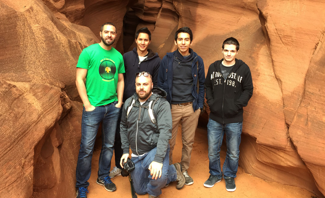
The area along the Utah-Arizona state line is one of the most oft-photographed locations in the southwest. The Grand Canyon, Vermillion Cliffs, Monument Valley, and other landmarks offer endless opportunities for backcountry exploration in some remote – and stunning – desert landscapes. This weekend, I took a couple of friends to a little-known slot canyon located on the Navajo Indian reservation near the small town of Page, Arizona: Antelope Canyon.
Named originally for a herd of antelope that freely roamed the area, this canyon is a very sacred place to native people who live in the vicinity. From the Navajo Nation website:
To older Navajos, entering a place like Antelope Canyon was like entering a cathedral. They would probably pause before going in, to be in the right frame of mind and prepare for protection and respect. This would also allow them to leave with an uplifted feeling of what Mother Nature has to offer, and to be in harmony with something greater than themselves. It was, and is, a spiritual experience.
Like other canyons in the area, Antelope was formed over time by erosion from rainwater which has cut the deep channels in the sandstone rocks while also smoothing the edges to create the “flowing” appearance of the walls. Since 1997, the canyon has been accessible via tour guide only. Part of the reason for that is because the dangers of slot canyon hiking can be extreme: that same year, 11 tourists were killed by flash flooding in Antelope. Back then, the ladders going down into the canyon were wooden and got swept away. Today, metal ladders are bolted into place. The “upper” canyon that we hiked didn’t require any ladder access.
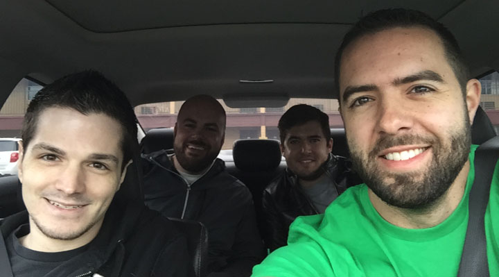
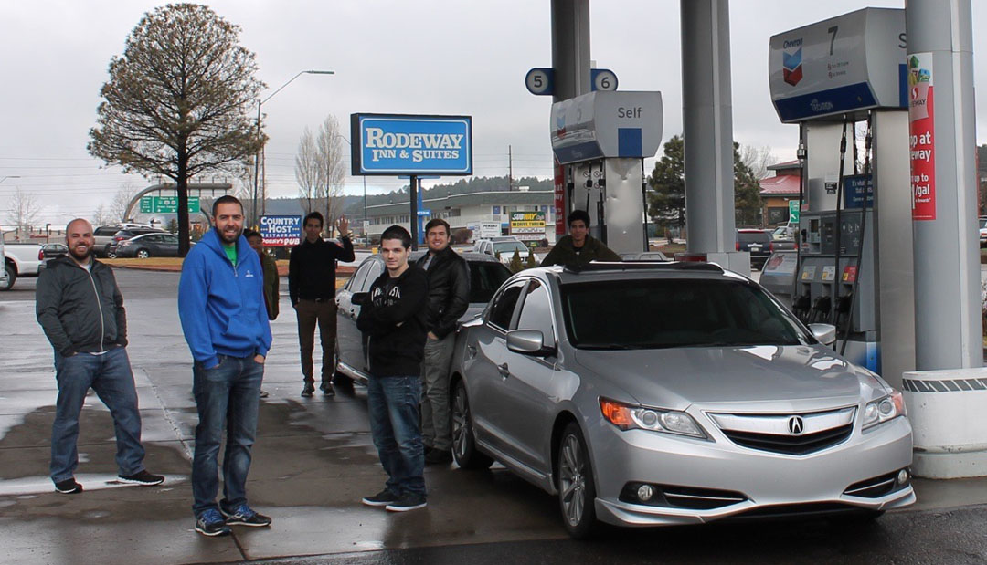
Caramel frappaccino in hand (or in cupholder, rather), I cued up the windshield wipers on the ILX on Saturday morning at 7:00 a.m. and set out for the rainy open road with three friends: Chris, Peter, and Stephen. Our drive northward on I-17 to Flagstaff was wet and foggy, but we arrived just in time to meet up with a car-full of other roadtrippers who would be joining us for our excursion. Jason of Driven for Drives brought along Alec, Jennifer, and Jouhl in his recently-acquired 2004 Mazda 6. Now with 8 of us in total, we had about 130 miles left to go before hitting our destination.
Highway 89 descends from Flagstaff’s pine-covered 7,000 feet in elevation to the barren, yet beautiful, red sandstone valley below at around 4,300 feet. We entered the Navajo Indian reservation which covers 27,000 square miles and spreads across Arizona, New Mexico, and Utah. By this time, the sun had started peeking through the clouds and the scenery was non-stop. I kept a close eye on Jason’s Mazda’s headlights in my rearview mirror and he didn’t fall too far behind.
By about noon, we’d rolled into the small town of Page, Arizona. Page thrives on tourism thanks to being on the shores of nearby Lake Powell and close to Antelope Canyon. However, because January is off-peak, we found very little traffic or difficulty getting a table at lunch right away for our large group. The “super burrito” at Fiesta Mexicana hit the spot – and soon, we were ready to go canyoneering.
Much like the early pioneers must have arrived in covered wagons, we donned our sweatshirts climbed into the bed of a lifted Ford F-250 pickup with a blue canopy overhead and our tour guide from Antelope Canyon Tours gave us the lowdown. “It’s a 20-minute drive to the mouth of the canyon,” she said, “and half of that will be on a dirt road.” Sure enough, before long we were bouncing along in a sand-covered wash toward Upper Antelope Canyon.
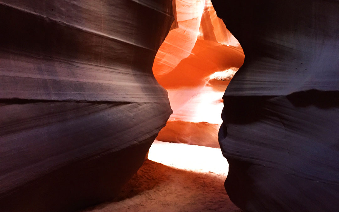
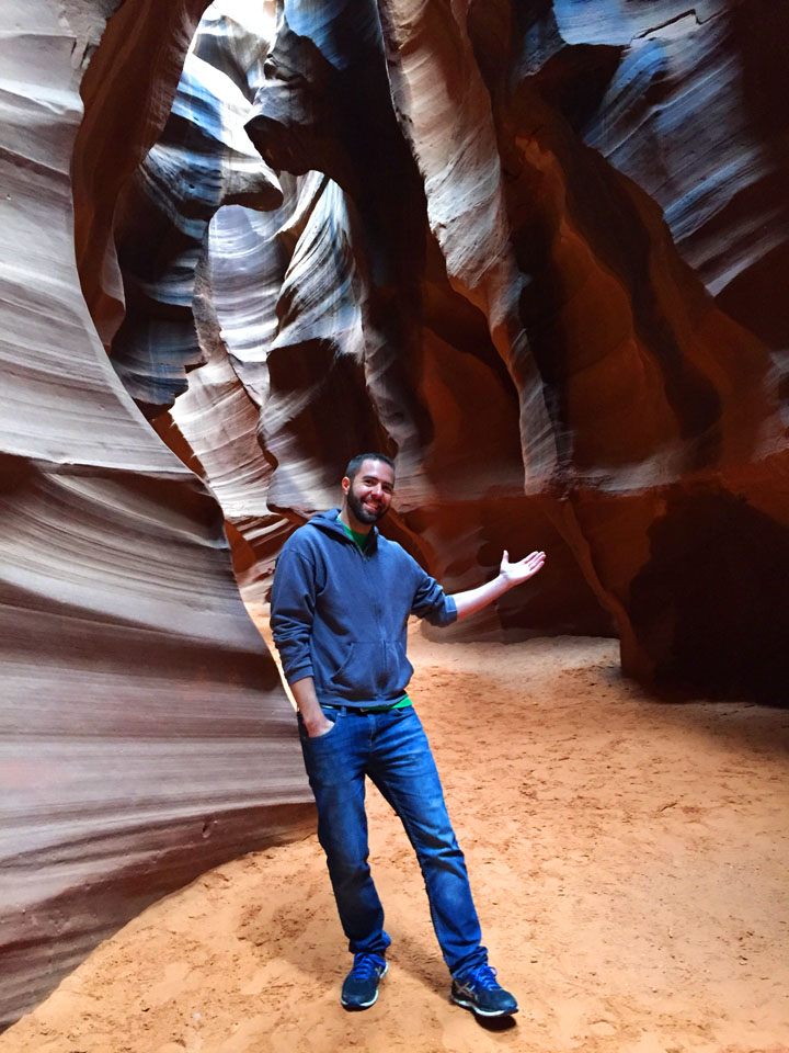
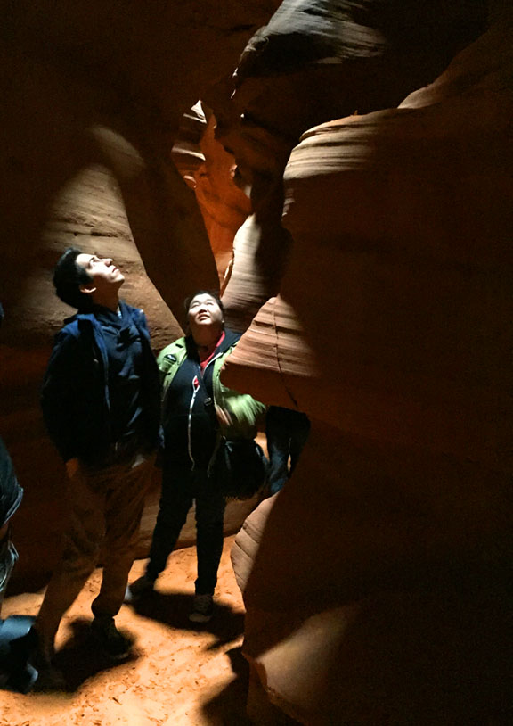
This particular stretch of the canyon is only 1/4 mile long but has some of the most incredible rock formations I’ve ever seen. With each turn, our guide would shine her flashlight and point out different features & shapes: the face of Abe Lincoln, the “Heart of the Canyon,” a pattern that looked like it was woven, and many others. We did the best we could to get some pictures along the way but in the 120+ foot depths of the canyon and under mostly overcast skies, many times it was too dark for a photo to do it justice.
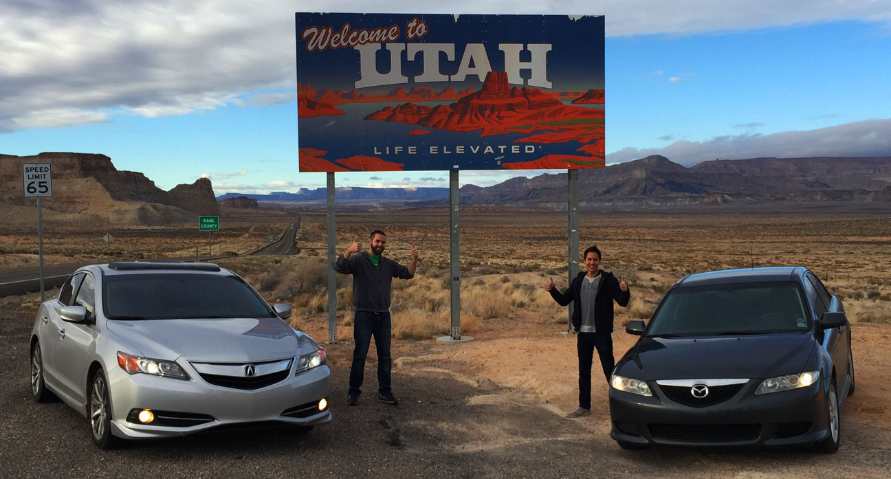
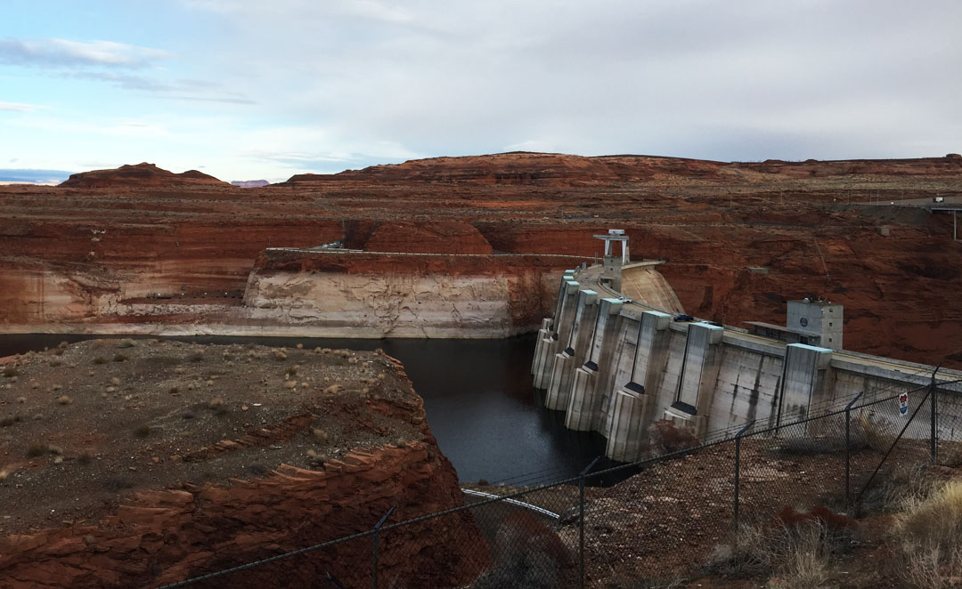
The next chapter of our day was a quick jaunt to the Utah state line just a few miles north on Highway 89, for the sake of a couple individuals in our party who hadn’t yet been to that state. Jason turned over the Mazda to me for part of that drive, and I fully enjoyed it! We had thought of touring nearby Glen Canyon Dam but the visitor center had closed at 4:30 p.m. right as we arrived, so we had a brief pow-wow in the parking lot to decide our next move.
And for that next move, you’ll have to tune in next time! It’s special enough that it deserved its own post. Thanks for coming along, and enjoy the rest of these pics and a short video in the meantime.
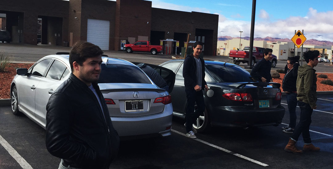
Road trippers Stephen, Peter, Chris, and Tyson
Approaching Flagstaff on Interstate 17 northbound
I’m okay with those gas prices in Flag!
Gearing up to head out
Suspension bridge in Cameron, Arizona: Built 1911, it’s 680 feet in length. It was damaged by an overload of sheep in 1937 (!) and was retired in 1959.
The “Little Colorado River” which that bridge crosses. Looks pretty muddy to me.
Lunchtime for some hungry travelers in Page at Fiesta Mexicana
Our limousines for the next portion of the trip
Awaiting our 1:30 p.m. tour departure in Page
Peter, Stephen, Chris, Jouhl, and Jason riding along in the back of the truck
Entrance to Upper Antelope Canyon
Inside the canyon
Views all around
Jouhl and Jennifer looking up
Tyson and Jason
Tyson, Jason, Jouhl, Stephen – and Peter in front
And the entire group, on our way back through
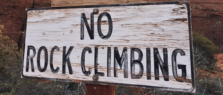
Not allowed!
Back at Comfort Inn – Room 324 gave me a perfect view of the cars.
Utah state line with Jason
Lake Powell – 9 trillion gallons’ worth! I took the ILX across this lake on a ferry last year.
Glen Canyon Dam, completed in 1966
Hey, check out that milestone!
Until next time. Oh, and a shameless plug! Mom’s Lexus is for sale. Link!
Sometimes a quick getaway from the hustle and bustle of the city is just what you need to recharge. The teeny town (read: Population 6) of Tortilla Flat, Arizona is a step back in time to 1904 when it served as a stagecoach stop during construction of nearby Roosevelt Dam. Today, the town retains its wild west heritage and welcomes dozens of weekend visitors, just like me, who need an occasional break from the urban grid.
Exiting US 60 at Idaho Road, Arizona Highway 88 winds itself through the Superstition Mountains for about 18 miles as a two-laner lined with gigantic saguaro cacti leading up to the townsite. The bright blue desert sky didn’t have a stitch of cloud in it, and temperatures were perfect for windows-down and moonroof-open cruising, so I hit the road with a few friends:
Chandler, Jack, and Midge (the Border Collie) joined me for Saturday’s eastward trek in the ILX. My favorite part about the drive to Tortilla Flat is that the road has two one-lane bridges near Canyon Lake. It takes careful planning & coordination with oncoming traffic to decide “who’s up next” when it’s time to cross.
Tortilla Flat’s only restaurant, Superstition Saloon, was busy with an early afternoon lunch rush, but we got seated right away. Lining the walls that surrounded us was a wallpaper of a very unique type: Dollar bills. The walls, pillars, and sometimes even the ceiling, were absolutely covered in $1’s. Each one had a handwritten Sharpie message inscribed on it. I noticed that most of the bills near our table were dated around 2009. I asked the hostess at the front desk, “How much money is on these walls?” She told me the bills totaled up to around $200,000! The burger with green chili slices was exceptional, and Jack’s open-faced “Killer Chili” burger with homemade chili on it looked pretty tasty, too.
We felt like hiking around a little bit after lunch, so we wandered across the street and down to Mesquite Creek which is a tributary of the larger Salt River. Midge loved romping around on the boulders and playing fetch with any stick she could get her mouth on. A couple of times she took a dip in the water for a gulp or two. The dangers of the desert became apparent when Midge inadvertently got her paw stuck on a branch of cholla cactus. The cholla’s needles are incredibly grabby – even to the point of seeming “sticky.” Chandler had to perform a few minutes of extraction to clear the needles from Midge’s paw while she patiently waited.
Quick photo-op with Jack.
We noticed that a couple of people were coming out of the General Store with ice cream cones, so the temptation overcame us and we went for some dessert too. I recommend the waffle cone and chocolate! We were in a “country” mood for the return drive so while Jack dozed off in the backseat, Chandler and I treated our ears to a few hits from Tim McGraw and Sam Hunt. Midge may have caught a few minutes of shuteye, too. Here are the rest of the pictures from our adventure.
Clean ILX after a hand-wash late last week.
Menu cover to Superstition Saloon restaurant.
A look inside the restaurant.
Some decor outside the General Store.
Mine replica and some fun antique artifacts in the surrounding area.
Nothing quite like a bright blue sky.
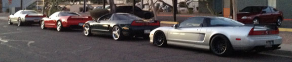
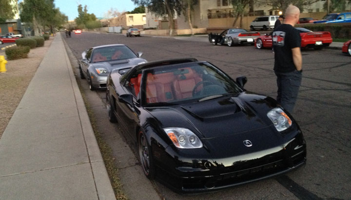
Acura NSX meet-up later that evening with a few friends. I drove my 1992 down to meet up with everyone.
Group at dinner.
Few other blurry pictures, but you get the idea. We have a a great group of NSX enthusiasts here in Arizona.
Few more of the cars.
Formula Red is such a great color on these cars. But, I might be biased.
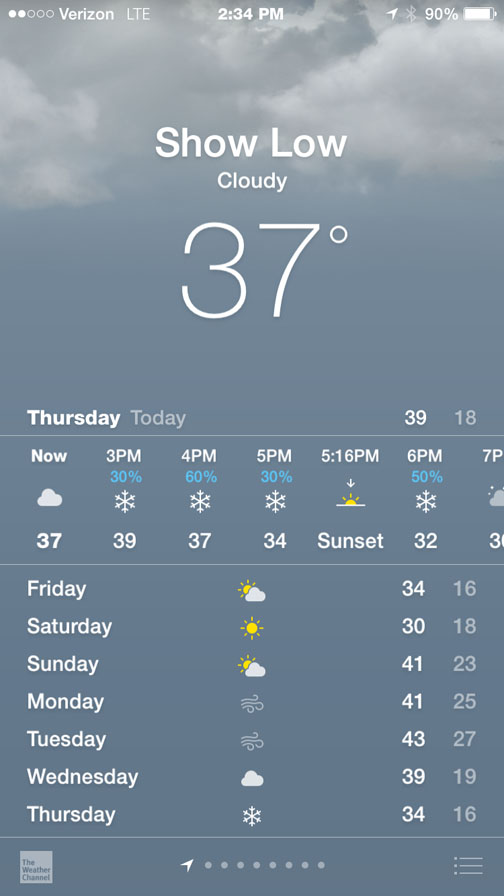
There’s no feeling quite like the “life flashing before your eyes” panic you get when you’re running to a car and lose your footing on a sheet of ice on the sidewalk. Silly me, I should’ve known better than to disregard the freezing conditions when I bolted to the ILX at 7:22 a.m. this morning to start my 3-hour return drive to Phoenix from the mountains in Show Low. I’d give $1 to see what I looked like trying to stay upright while balancing a laptop bag and my backpack on my shoulder. Somehow, I didn’t meet the pavement head-on and as soon as I caught my breath again, I was laughing it off.
It was just 17 degrees when I started the car – and as many of you know, its battery is already near-dead. Luckily, the ILX cranked to life and I turned on BOTH seat heaters, cranked the temperature to “Hi” and activated the defroster. That was before I realized the windshield was covered in ice and I couldn’t see a thing. My Chase Sapphire credit card made a decent impromptu ice scraper as I cleared an area large enough to see out of before driving out of the neighborhood.
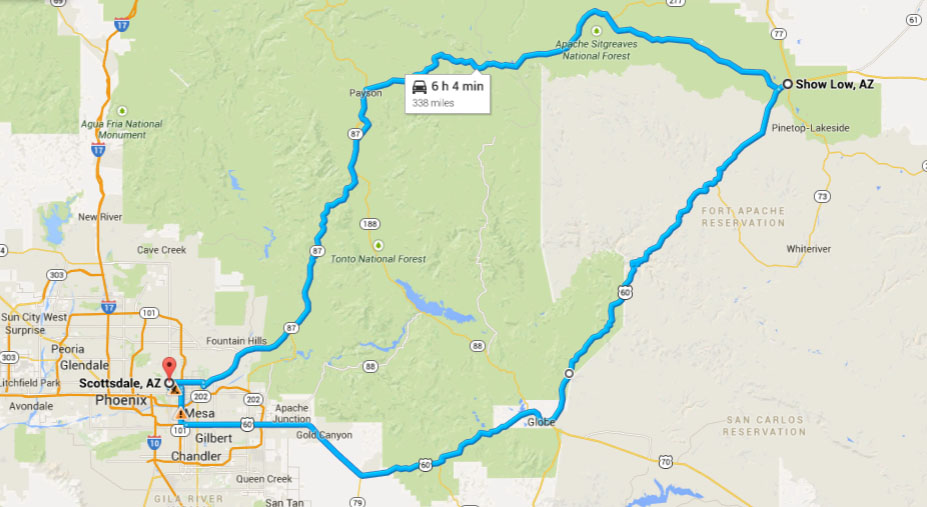
The Phoenix-to-Show Low drive on Christmas morning yesterday was a repeat of one I’d taken exactly a year prior. It seems to have become a bit of a tradition for me to get in the car and venture to the Sitgraves National Forest when most others are opening presents and sipping on hot cocoa. Here’s last year’s trip write-up when I took the same route, which will detail the driving experience of the Salt River Canyon – one of Arizona’s most scenic day-trips. Today, I’ll focus more on the town I visited on Route 60 after passing through that canyon.
After cruising eastward from Mesa on Route 60 toward the mining towns of Superior and Globe, I rolled through the canyon and took a series of pictures of the rest stop at the base – which was closed last year but has since re-opened. The steel arch 1934 bridge across the Salt River and its 1996 replacement made for a nice photo op while I wandered around the facility before continuing up the other side of the canyon. My playlist, by the way, for the ascent consisted mostly of Peter Cetera music. Songs like this one were being blasted.
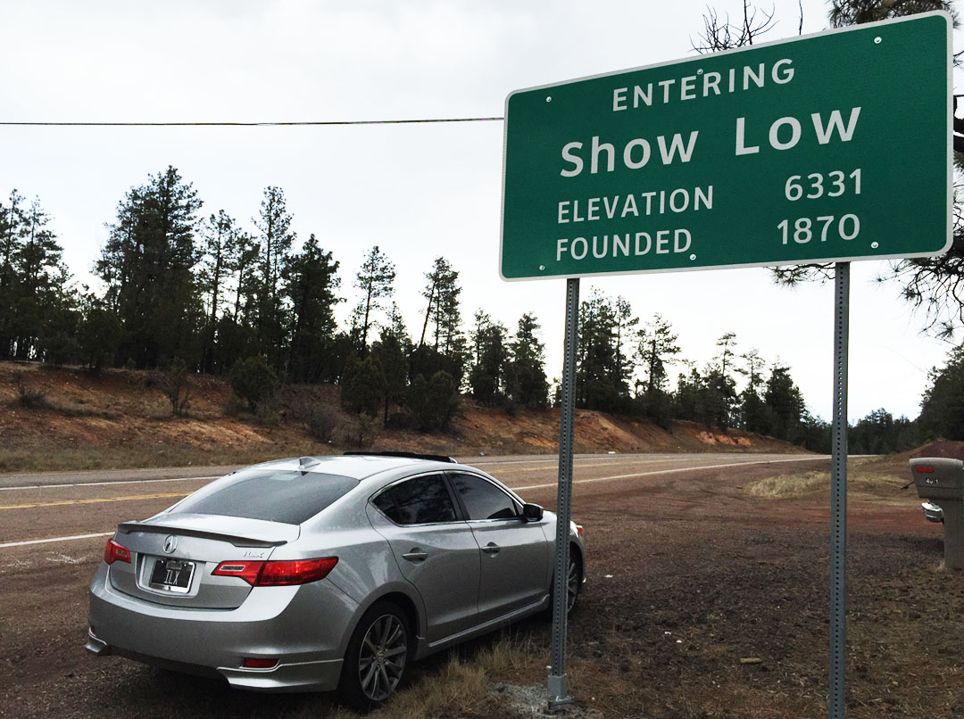
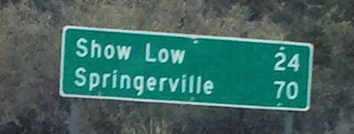
Show Low is a neat little community in the White Mountains that was established in 1870 and incorporated in 1953. Due to its elevation at just over 6,300 feet, the town experiences all four seasons, unlike Phoenix which somehow skips over winter altogether. Legend has it (see what I did there?) that the town’s name has roots in a poker game between two early settlers of the area, Corydon E. Cooley and Marion Clark. The area in consideration comprised 100,000 acres and they decided whoever could show the lowest card would be the winner, and the other person would have to move. Cooley had the deuce of clubs and won the game. Today, Show Low’s main street is called Deuce of Clubs.
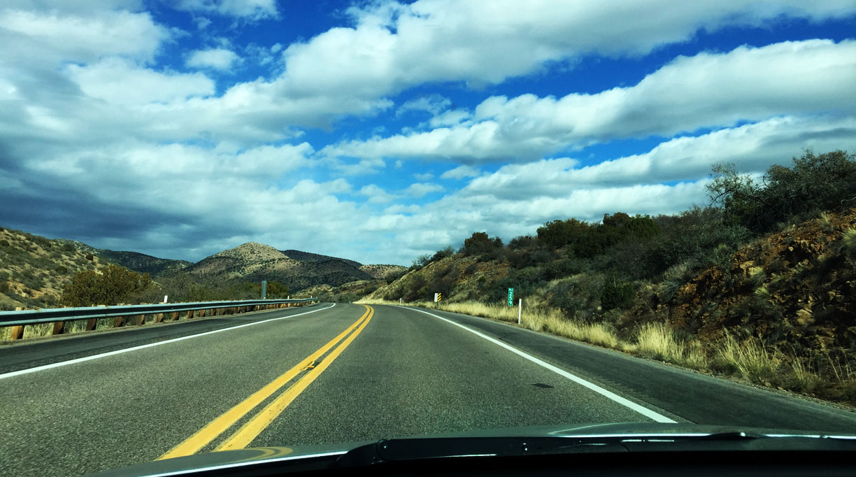
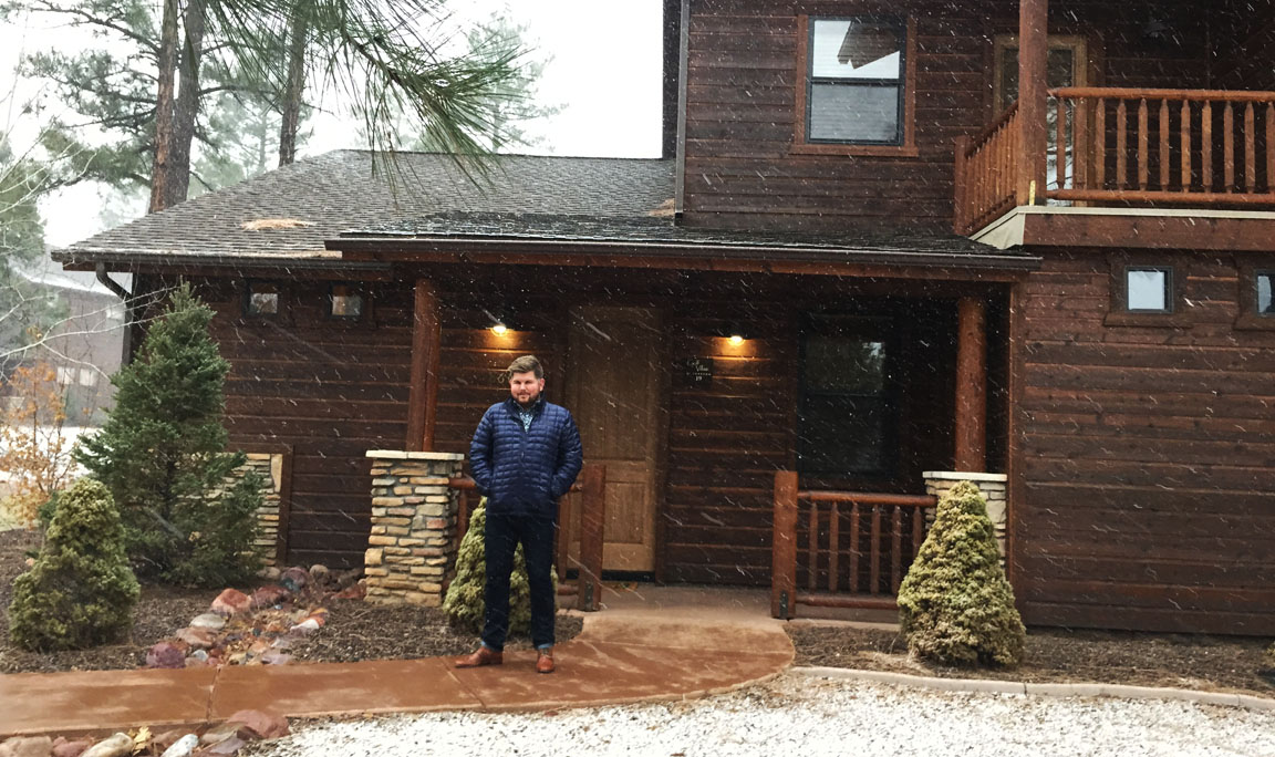
A friend of mine had rented a cabin near Torreon Golf Course that provided a cozy place for a group of us to crash out. But first, I attended his family’s Christmas dinner and feasted on 3 full courses of deliciousness. Friday’s return trip to Phoenix offered up some amazing views of snow-dusted landscapes and bright, blue sky. Road conditions between Heber and Payson on Route 260 were slippery due to the prior night’s snowstorm, but I took things easy and made it home safe and sound in just a little over three hours.
Thanks for coming along on the drive! Here are the rest of my pics.
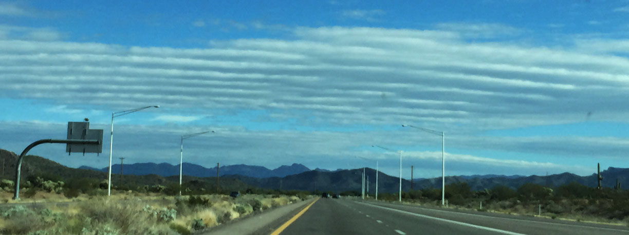
Loved these organized, linear cloud formations approaching Superior on US Route 60
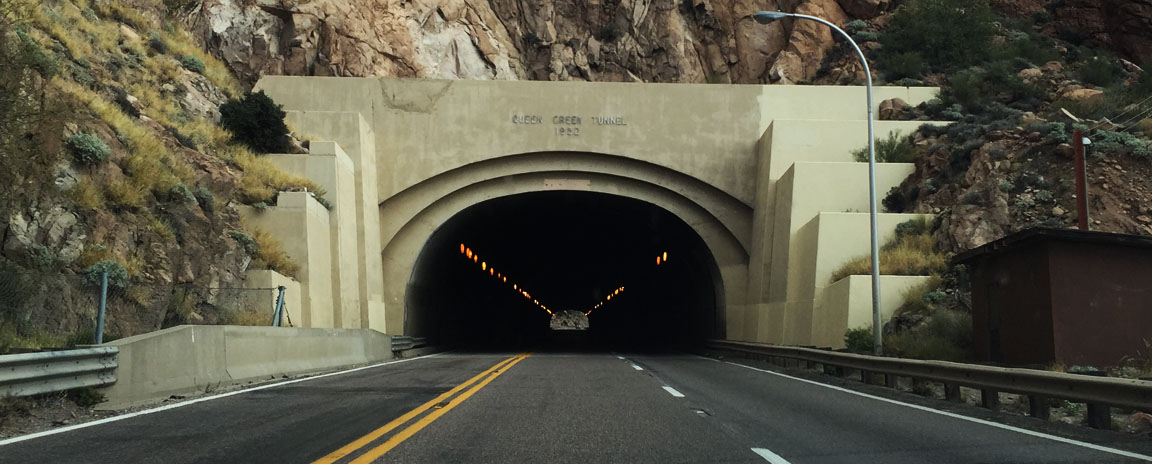
Queen Creek Tunnel, constructed 1953
Heading up Route 60 from Globe, Arizona. I had the road to myself.
Self-explanatory.
Each time the sun broke through the clouds, it would ignite the hills in vivid colors.
Some rock formations in the distance.
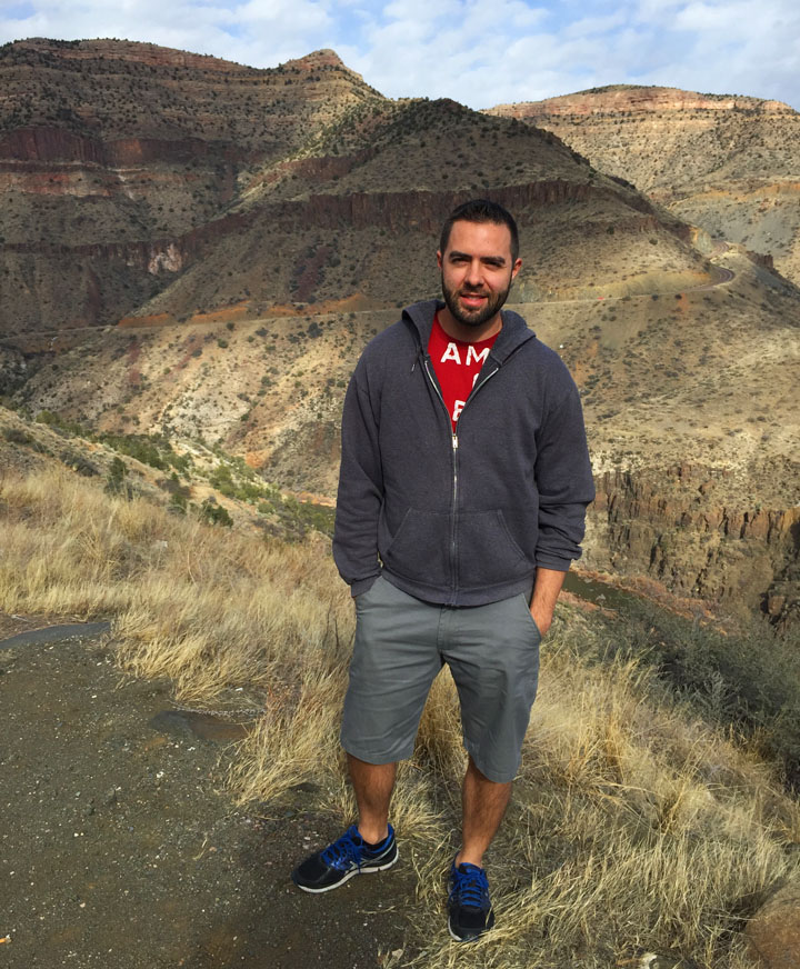
I asked some nice tourists to take my picture.
Parking at the rest area at the base of the Salt River Canyon.
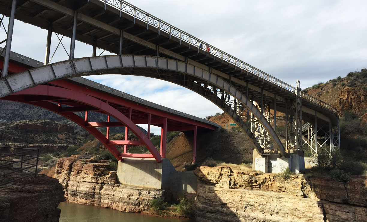
1996 (background) and 1934 (foreground) bridges across the Salt River
This is the one that carries all the automobile traffic today.
Graffiti on the red bridge.
Perched and enjoying the scenery in the canyon before getting back into the car.
I love how ornate the 1934 steel bridge is. Today, it’s only open to pedestrian traffic.
View from the steel bridge, looking up the Salt River.
Looking back toward the steel bridge from the parking area.
Heading back up the canyon, and stopping to check out this teeny little cabin.
Back at the top of the canyon after the 2,500-foot ascent on curvy roads.
Getting closer to Show Low!
Just in time for some light snow flurries. Brrrrr!
Nightly accommodations at the cabin at Torreon Golf Club.
My friend gave a gift to himself, from himself. At least that’s a good way to ensure you get what you want!
Friday morning frost.
The ol’ credit card ice scraper trick.
Quick picture while I let the car warm up before heading out on the 3-hour return drive.
Crisp as can be. I love a big blue sky.
Heading westward on US Route 260 toward Payson.
Lowest that I saw the temperature dip to. This is probably a record for the car, in the 2.5 years I’ve had it.
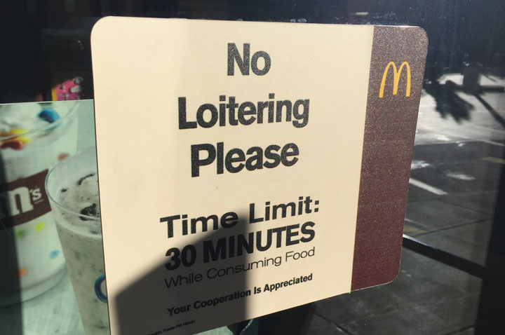
Breakfast in Payson, Arizona: Ever seen a McDonald’s that will kick you out if you stay longer than 30 minutes?
Quick break along Highway 87 on the descent back to the Phoenix area.