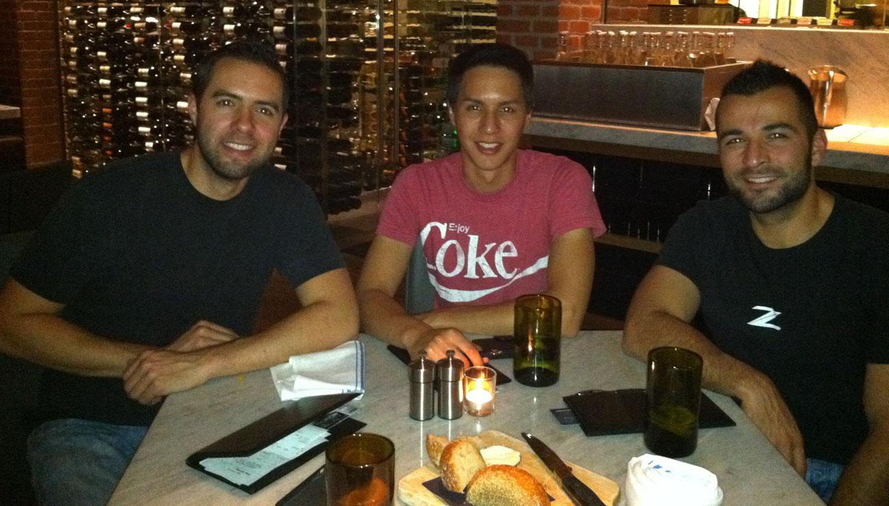
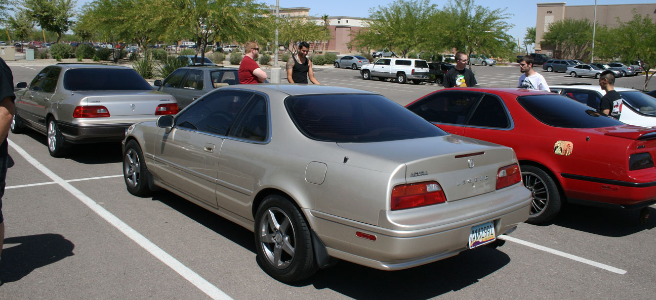
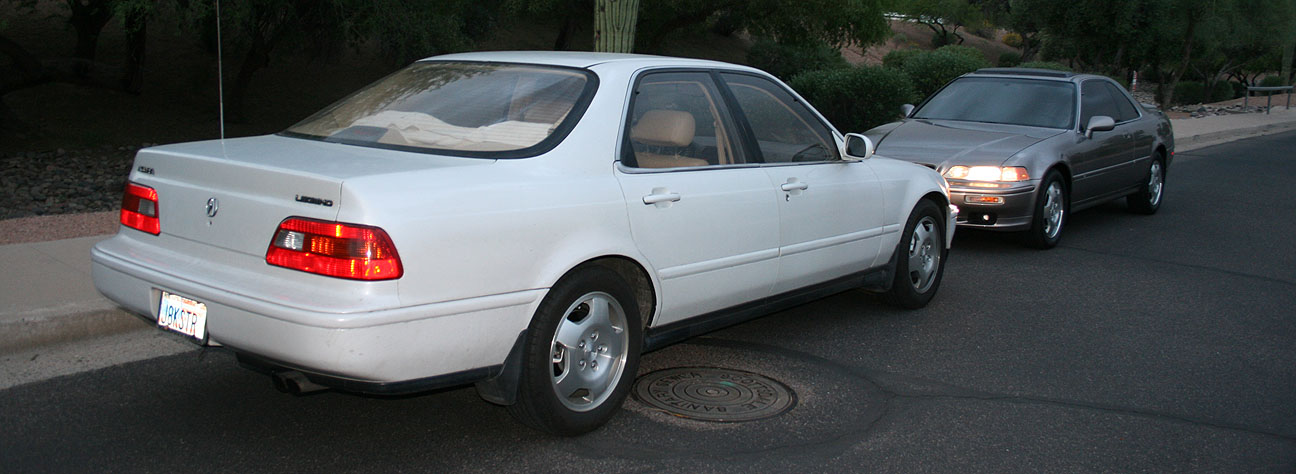
Posted in Arizona, Legend on July 31, 2013 by tysonhugie
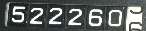
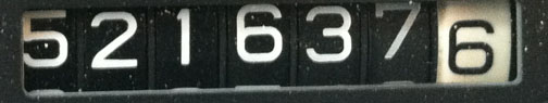
Odometer (Legend): 522,664
Odometer (ILX): 47,508
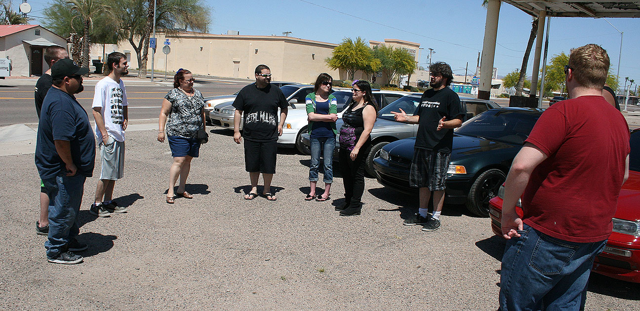
I’m one of 221,789 people who call Scottsdale, Arizona home. The city is located in the Phoenix metropolitan area and was incorporated in July 1951. It probably seems to many of my readers that I must not like where I live, since on any given weekend I’m usually on an Acura trip far from home. Truth is, though, that I love it here.
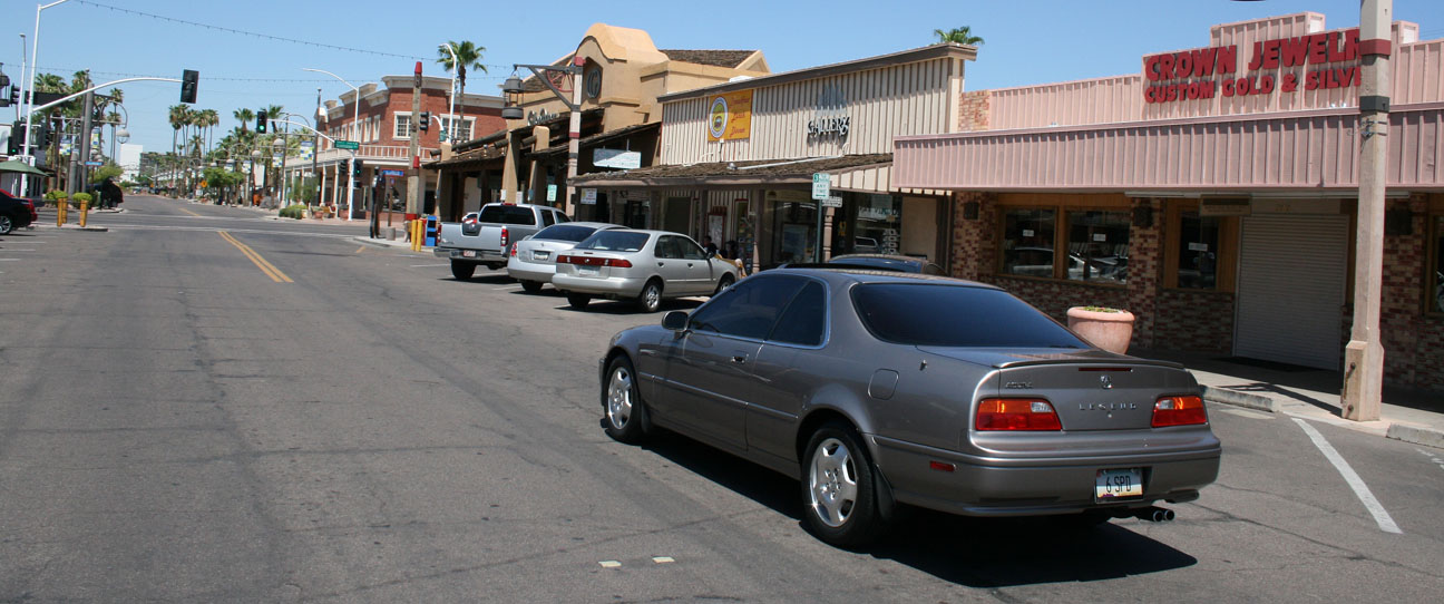
On Sunday, I took a morning cruise in the Legend to downtown Scottsdale which is only about 10 minutes from my home. “Old Town,” as it’s called, refers to an area at the intersections of Scottsdale Rd & Indian School Rd that is the hub of area night life, commerce, and culture. I had brunch with my friend Kati at RnR Restaurant & Bar.
Fueled by a delicious omelet & a tall glass of orange juice, I took the Legend around to see a couple of the sights.
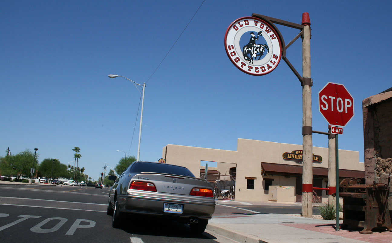
The city’s seal is a mounted cowboy, and there are signs of him standing on various corners in the Old Town area.
Some fun facts about Scottsdale, thanks to Wikipedia:
Scottsdale in 1993 was named the “Most Livable City”, in the United States by the United States Conference of Mayors. This title is notoriously lampooned across the state because of the high cost of living in Scottsdale. It is continually ranked as one of the premier golf and resort destinations in the world, with a sizable portion of tax revenue being derived from tourism. It is also home to the Phoenix Open Golf Tournament and the Barrett Jackson car auction held at WestWorld.
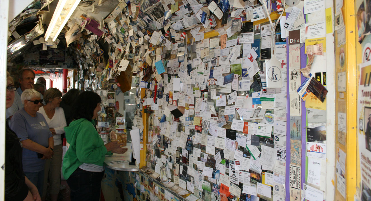
At 4005 North Scottsdale Road lies Sugar Bowl – the best place in town for foods, ice cream, pastries, and candy. It’s been around since 1958.
On May 29th, I had dessert there with my friend Kevin and I confirm that the hot fudge sundae cannot be beat.
Sugar Bowl’s claim to fame is that it has been featured in many of the “Family Circus” cartoons by artist Bil Keane. Bil lived in Paradise Valley, Arizona and was one of Sugar Bowl’s famous customers.
Bil even wrote a note to the owner of the restaurant on this cartoon that’s hanging at the entrance. Bil passed away in November 2011 but his son Jeff continues to draw the Family Circus cartoons.
Old Town is a fun place to walk around and check out the mom & pop shops.
Just a few blocks away lies the Scottsdale Fashion Square Mall, one of the 20 largest shopping malls in the country.
The “Old West Meets the New West.” Below, the Adobe Mission lies at the intersection of Main Street & Brown Avenue. It was built from 1931-33 and restored in 2000.
Thanks for coming along on the tour of my hometown!
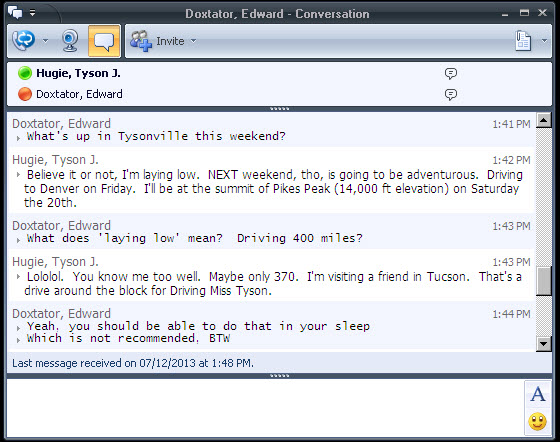
An instant message conversation with a colleague at work went something like this on Friday.
Apparently my coworkers know me too well. I can’t sit still for long.
It’s times like these during the peak of Phoenix summer heat when the 4 million of us who live in the Phoenix metropolitan area ask ourselves, “Why?” Why do we live in this oven of a city? The answer shows up in the fall when Mother Nature unplugs the heater and we bask in perfect winter weather from October through May.
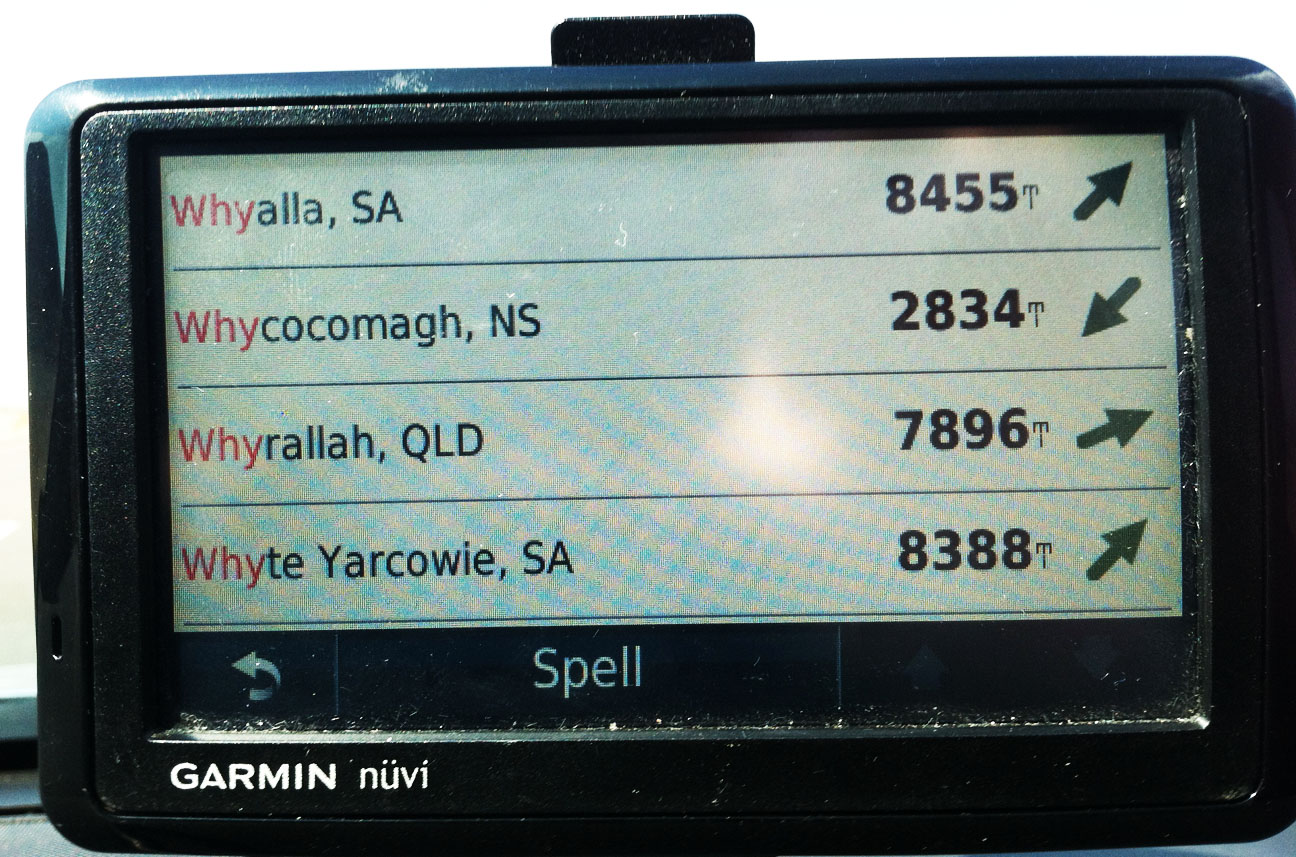
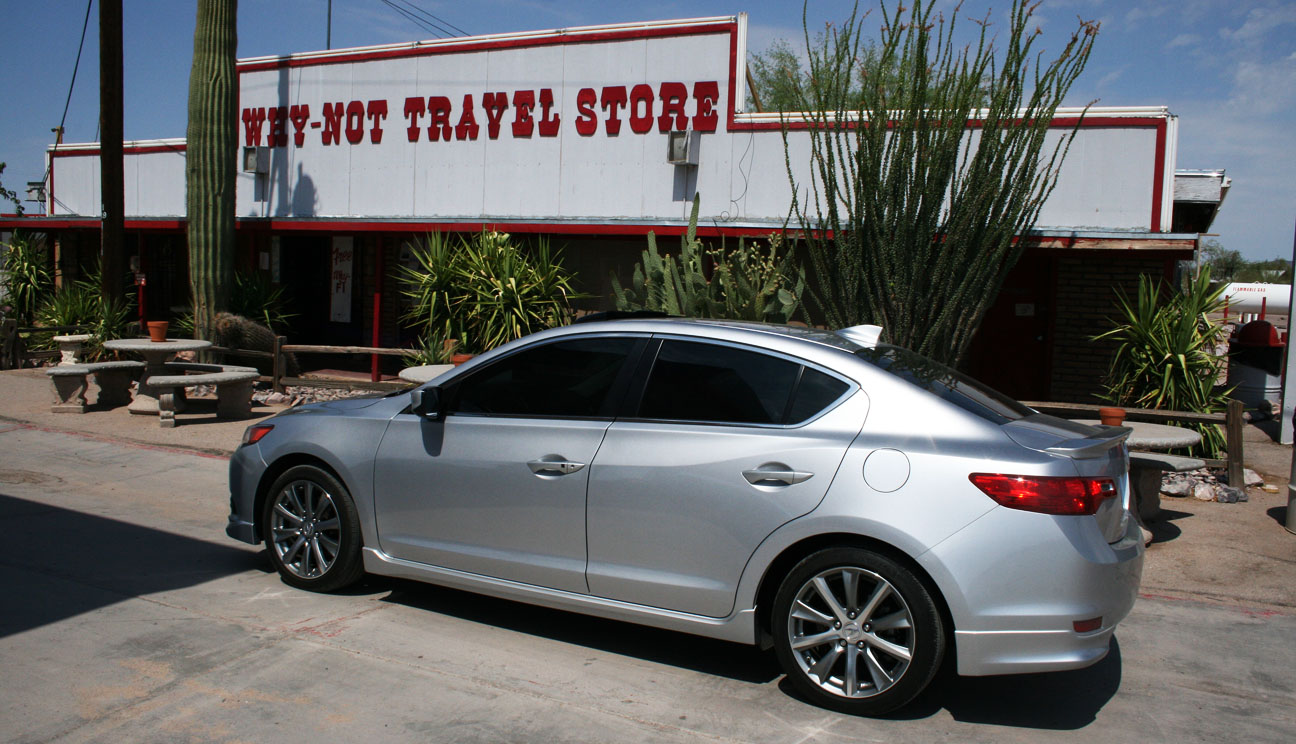
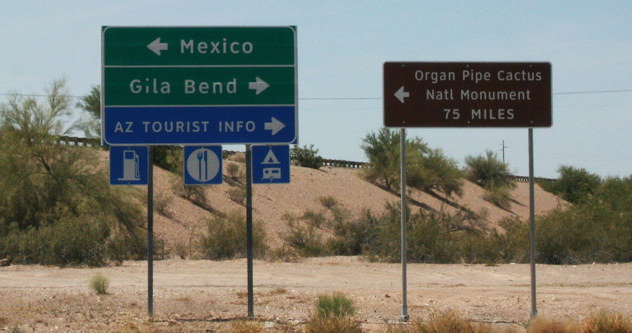
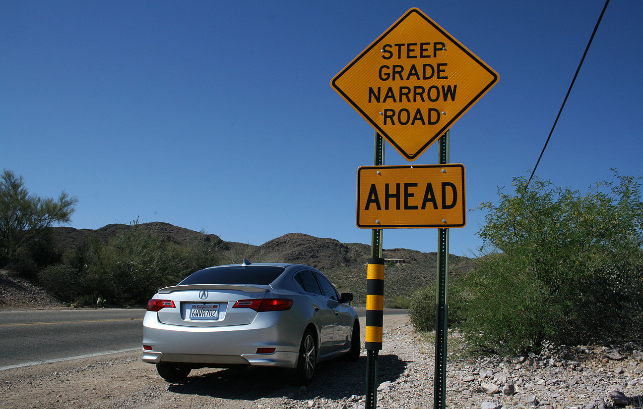
The word “Why” took on a whole new meaning this weekend. “Why” is a place in southern Arizona. It’s a place so small and insignificant that even my Garmin Nuvi GPS unit didn’t know what it was.
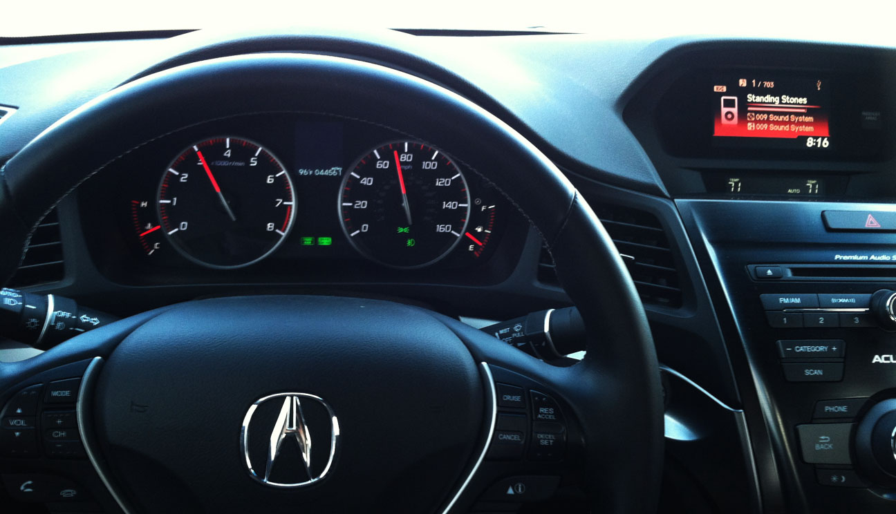
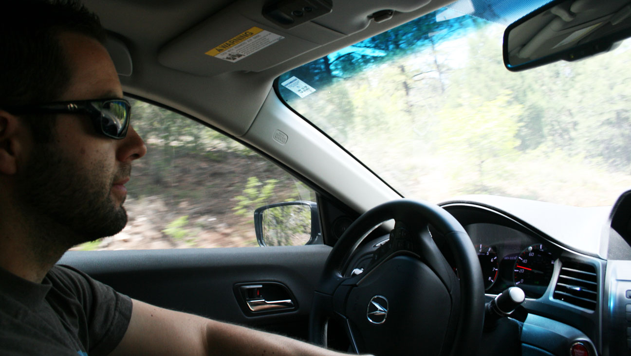
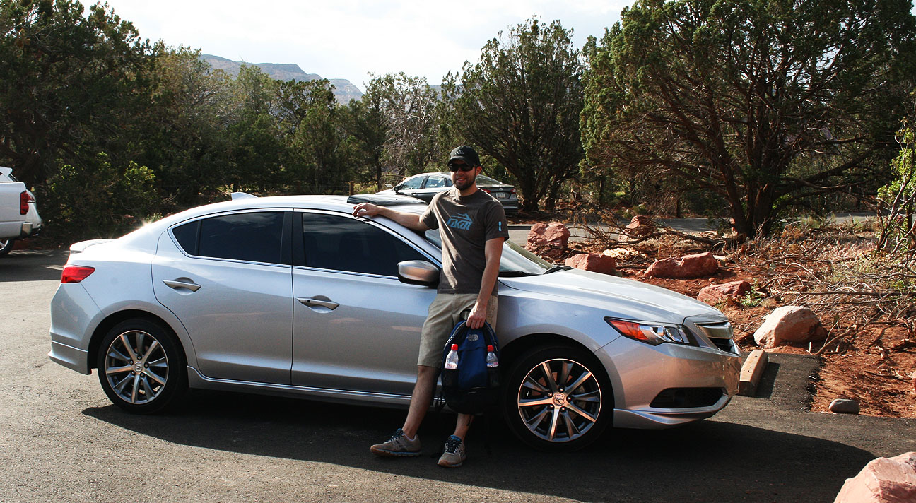
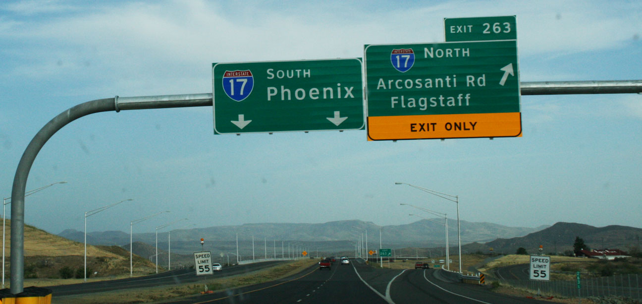
You’re telling me there’s no other town named Why for at least 2,800 miles from here? This place must be special. I was determined to see what this little speck on the map had to offer. As it turns out, the drive was most rewarding. On a cool summer morning (that’s 96 degrees at 8:16 in the morning for us Phoenicians), I set out westbound on Interstate 10 in my 2013 Acura ILX 6-speed.
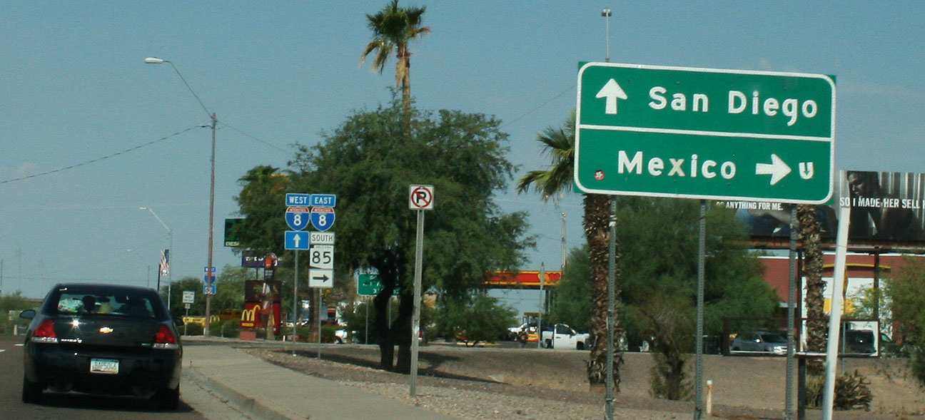
At Arizona Highway 85, I headed south for 35 miles to Gila Bend.
This blog entry brought to you in part by Fertizona: Arizona’s largest agricultural fertilizer and crop protection retailer. (Not really, but I thought the name was clever).
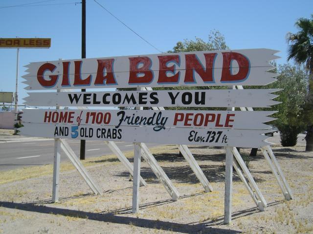
Gila Bend: Home of 1700 friendly people and 5 old crabs. The 5 crabs’ names, by the way, are written out on the smaller sign below. Seriously!
After passing through town, which didn’t take longer than a minute or two, I headed even deeper south. Next stop: Mexico.
Without a passport, I wasn’t going to get too far, but there were plenty of shops willing to sell me a Mexican insurance policy. Here’s one such example where they actually sell Mexican insurance at a DRIVE-THRU. Can I get a chimichanga with that policy?
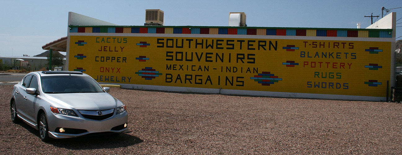
Just a bit down the road in Ajo, Arizona (Ajo is Spanish for “garlic”), I found the ultimate one-stop shop. Cactus, jelly, copper, onyx, jewelry, T-shirts, blankets, pottery, rugs, and… swords?! Good to know!
Ahh, here we go. Getting closer – the sign told me I was just 10 miles from Why. Rocky Point, at 103 miles from this sign, resides in Mexico. It’s a popular summertime destination for Arizonans seeking beach-time. It is, in fact, the closest beach to Arizona. Remember that country song, “Oceanfront Property In Arizona”? Well, that ocean’s in another country.
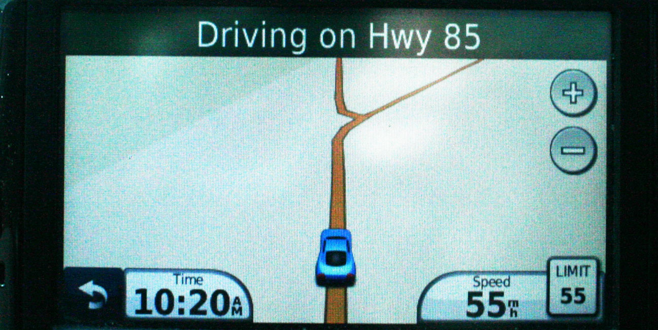
We now learn why Why is called Why. The map below from my GPS illustrates it best. When the unincorporated town was formed, it lied at the intersection of Highways 85 and 86. They roads came together at a “Y.” Since the law at the time required a town’s name to be at least 3 letters long, it was spelled out W-H-Y. Safety concerns later on prompted the creation of a traditional “T” style intersection instead of the original Y.
At last. I made it. Surprisingly, there’s enough customer traffic for a few businesses to stay afloat out there.
Here’s that piece of road that’s now curved where it used to go straight down.
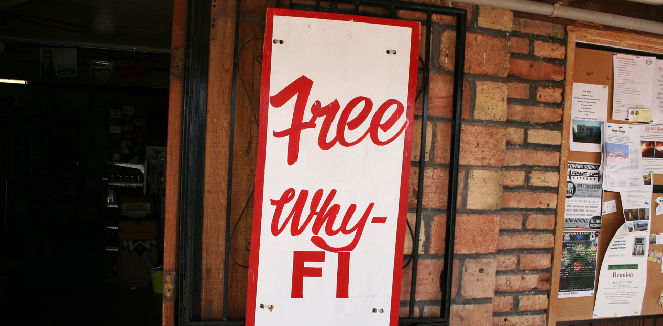
No trip to Why would be complete without a stop at the Why Not Travel Store.
Because you can get Free Why-Fi. Love it.
I made a bathroom break out back and continued on my way. I’d seen all that Why had to offer.
At only about 25 miles from the Mexican border, it was ironic that Madonna’s “Borderline” chose to play from my iPod on the ILX’s 7-speaker Premium Audio System at this time. I rocked it out with plenty of volume.
Eastbound on Highway 86, I had the road to myself. Except when I passed this guy. He didn’t even flinch when I laid on the horn.
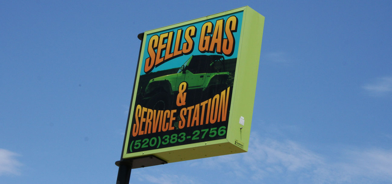
The next place of any significance on my drive was Sells, Arizona. Sells was pretty quiet except for the marketplace. It’s on Indian land and is the capital of the “Tohono O’odham” Nation. A service station by the name of Sells Gas sits on the main drag through town. I bet they… sell gas.
Over the course of my 6 or so hours behind the wheel today, I encountered dozens of border patrol vehicles. The Ajo-Why-Sells-Tucson area is a hotbed of immigrant activity. For this reason, it’s heavily policed. I was stopped briefly by officers here, just east of Sells on Highway 86.
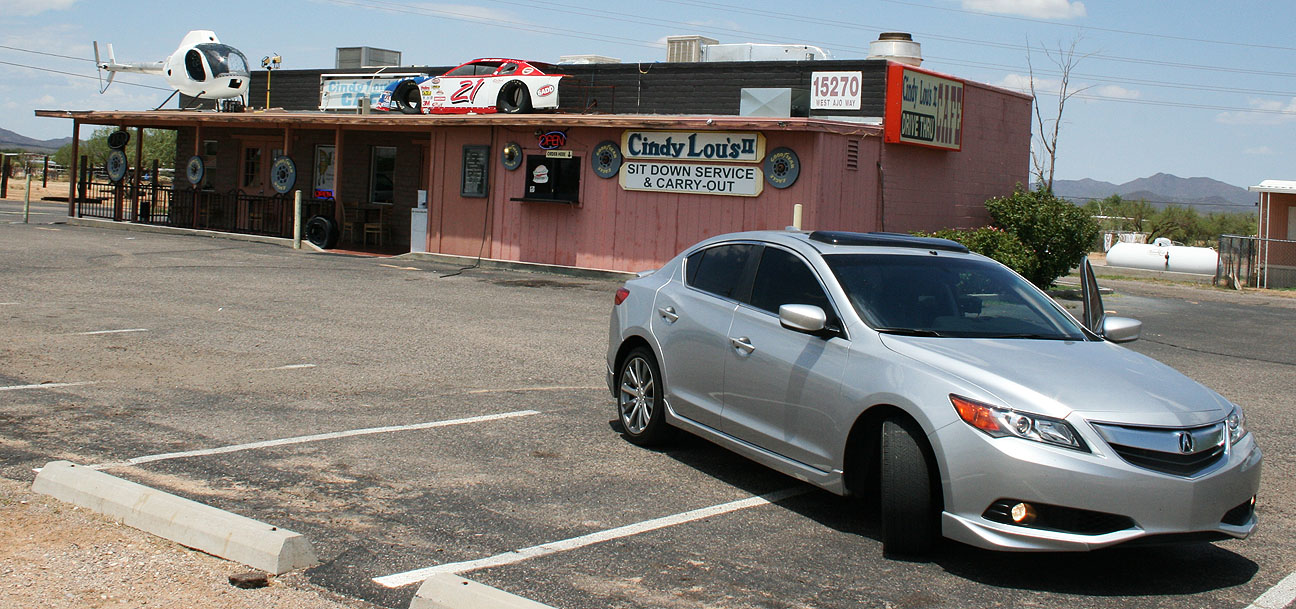
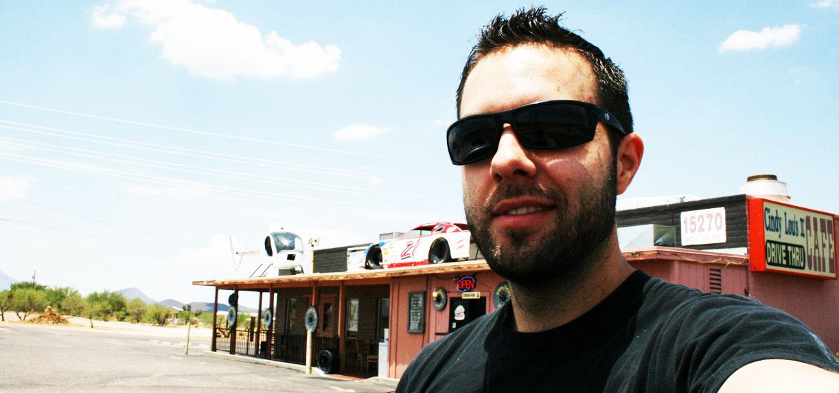
For a brief moment while I neared Tucson, I thought I’d driven my ILX into Dr. Seuss’ Whoville. Wasn’t there a Who named Cindy Lou Who? Apparently Cindy Lou Who opened up a restaurant out here called Cindy Lou’s Cafe. Tacos are only $1.25!
Now we’re cookin’.
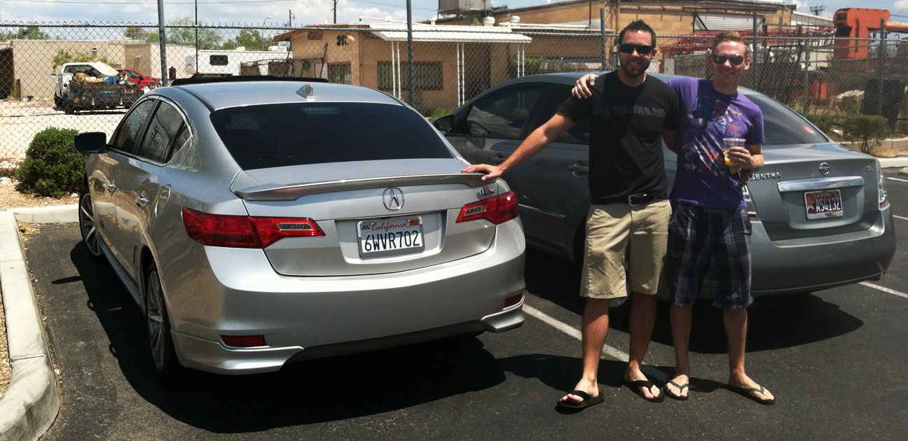
Last stop on the journey was a meet-up with my friends Nick & Kurt in Tucson for a bite of Mexican grub.
Hope you enjoyed the trip to Why! Now, if I could only find out if there are towns named Who, What, and Where.
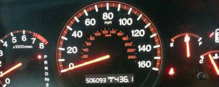
In high-mileage news: My friend Jason linked me to a website about a 2005 Honda Accord Coupe EX V6 that’s gone the distance. Here’s the thread on the 7th Generation section of the DriveAccord.net forums.
The odometer reads just over 506,000 miles. The car was owned since new by a territory salesman in Minnesota and every service record is accounted for. The timing belt was changed every 100,000 miles. Reportedly, the only items which have failed are the starter, the power steering, and the battery.
The new owner paid $6,000 for the car. He plans on modifying it with visual & suspension upgrades. I’d leave it alone!
Time for a little 4×4 action in my luxury car… again.
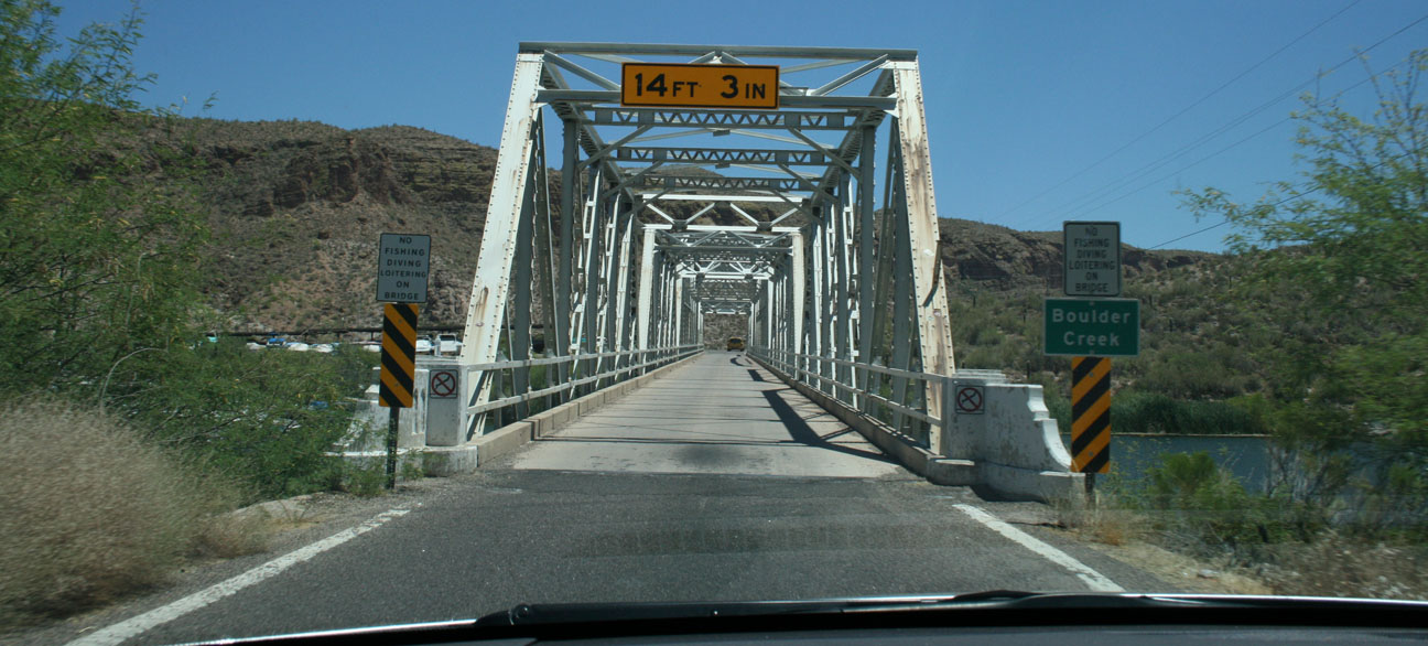
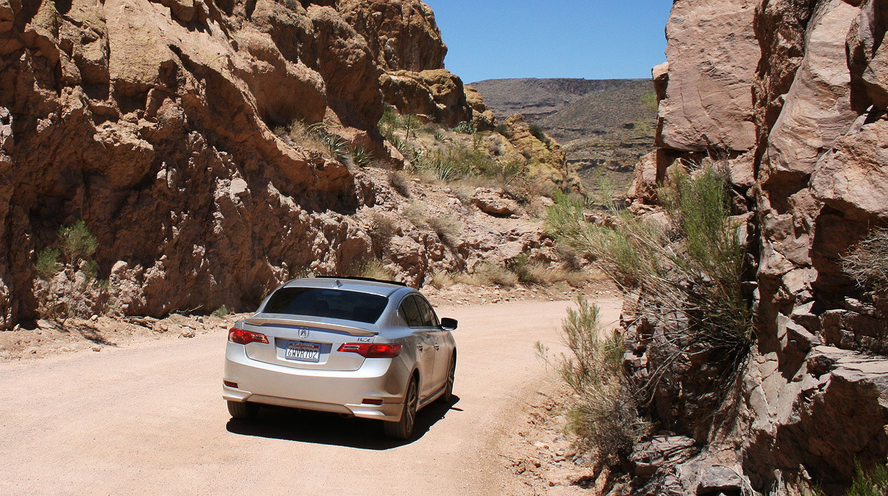
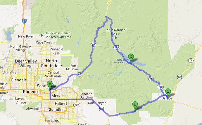
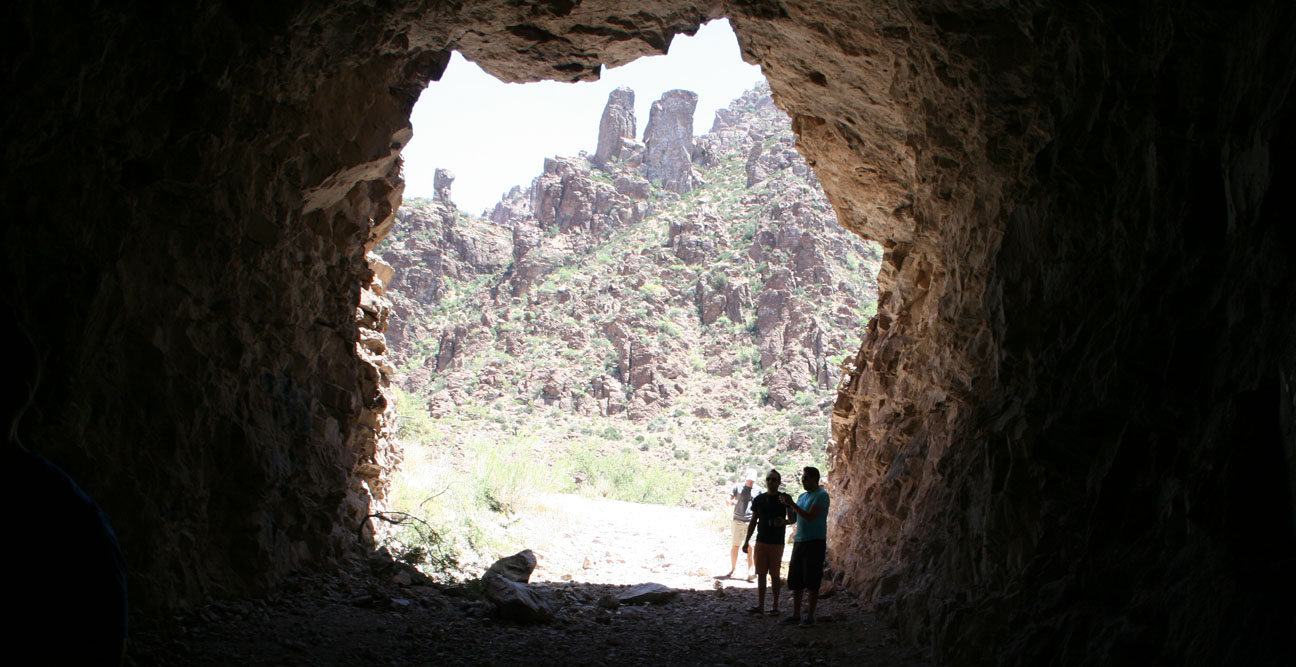
In March 2008, I took my Acura Legend where (maybe) no Acura had gone before: a dirt road that was once the main way to get from Roosevelt, Arizona to Apache Junction, Arizona. The total drive distance when going this route is 45 miles. To avoid the dirt road and go around it on paved streets, the distance is significantly longer at 79 miles. The “Apache Trail,” as it became named, is also known as Arizona Highway 88 and to this day is one of my favorite roads to drive.
Here’s the video for those who’d rather watch than read:
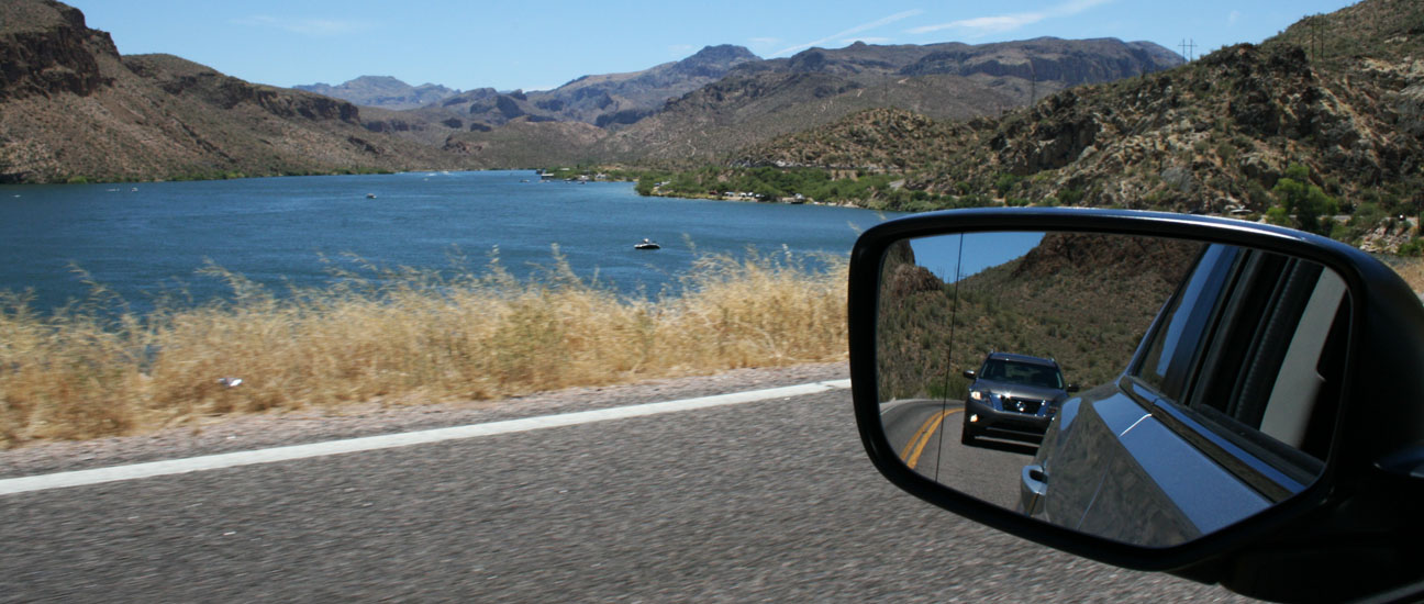
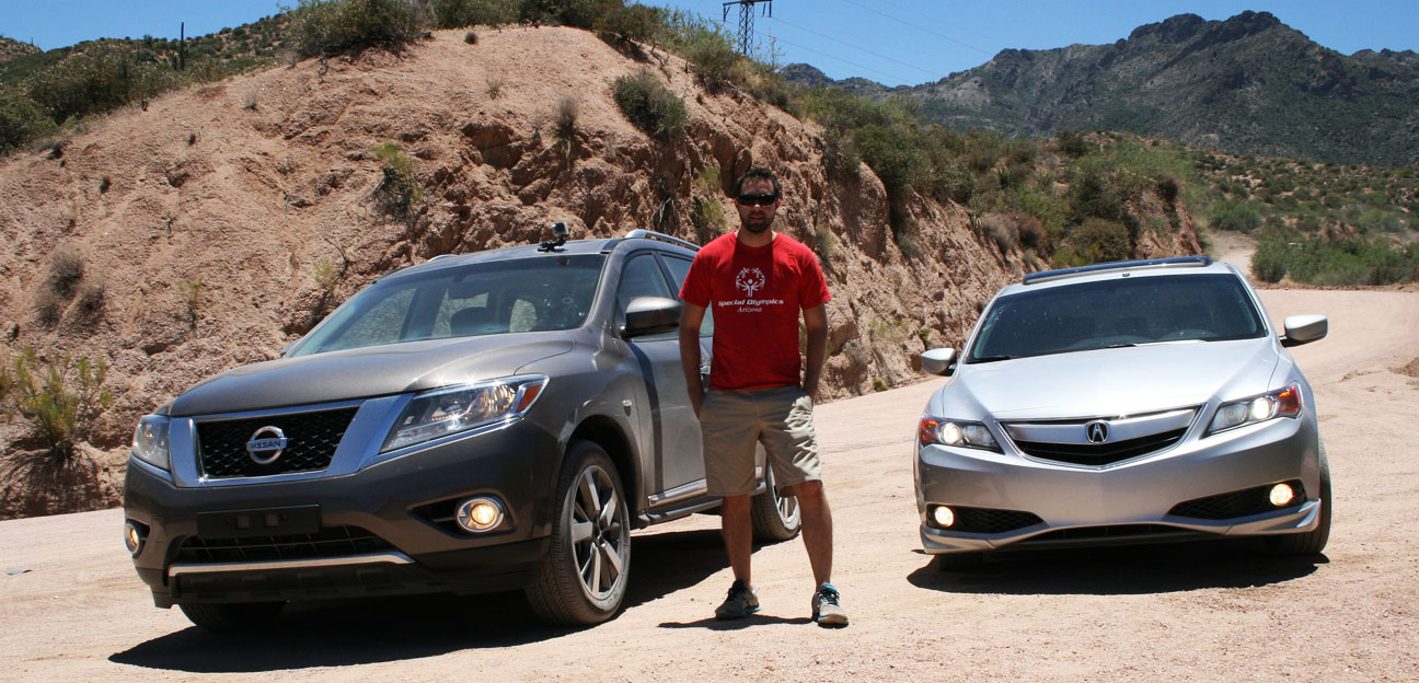
My friend Matt and I decided to do a little Sunday drive and some sightseeing in the Superstition Mountains east of the Phoenix valley, so we set out in two vehicles: My 2013 Acura ILX, and his work-issued 2013 Nissan Pathfinder. Highway 88 is lined with rivers and lakes, including Canyon Lake pictured below.
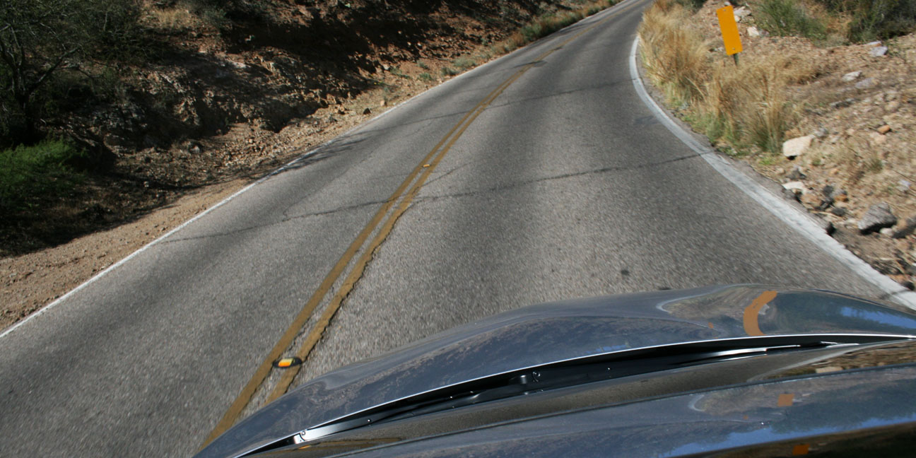
For the most part, it’s a fun, twisty two-laner with very few passing lanes. There are two one-lane bridges to cross.
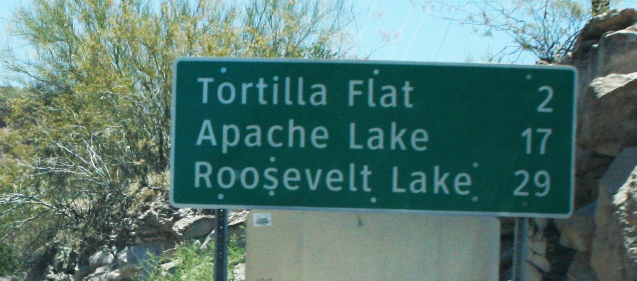
We made our way toward Tortilla Flat which was once a common stopping point when the Apache Trail was more heavily traveled.
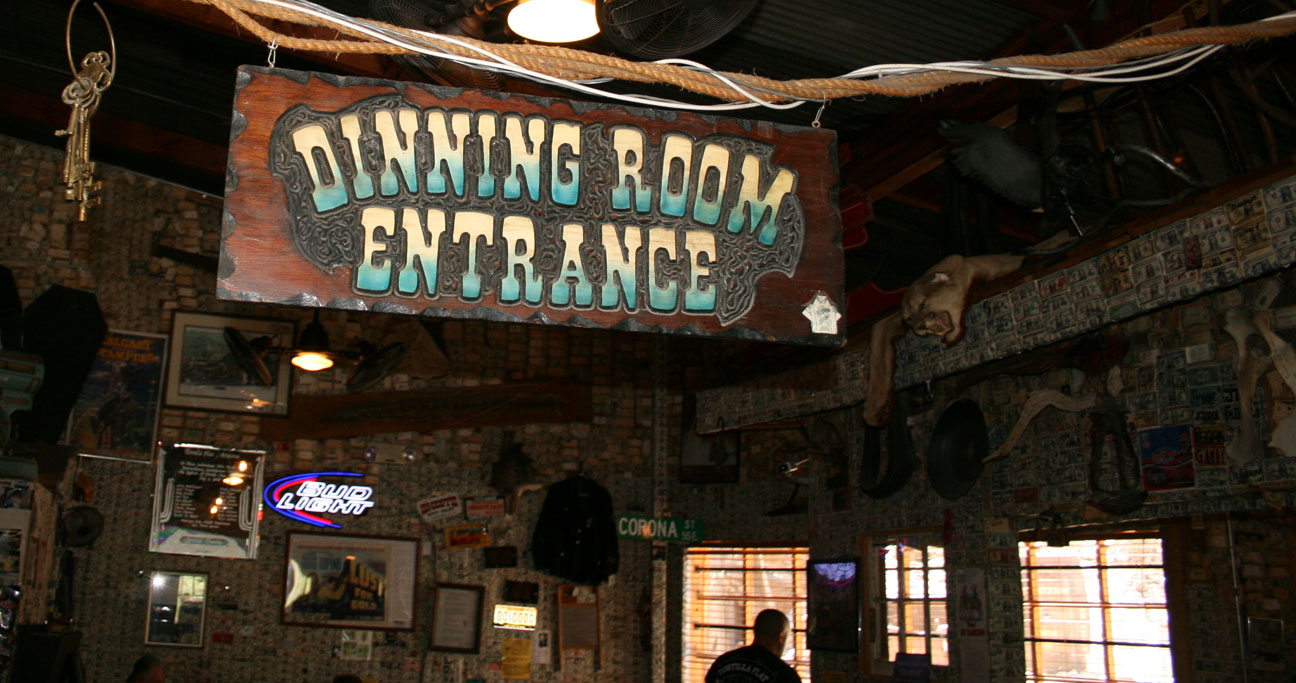
Quick pit stop in Tortilla Flat for a bathroom break. We parked next to a nice 370Z 6-speed.
The misspelling about the “dinning” room entrance at the Tortilla Flat restaurant is almost too far fetched to be true. I think they’ve left it there intentionally to add to the quirkiness of this place. The walls are absolutely covered with $1 bills. I would have added my own, but I needed to save my $1 bills for a car wash later in the day. You’ll see why.
Though once home to a motel, Tortilla Flat is now just a place to grab food and supplies.
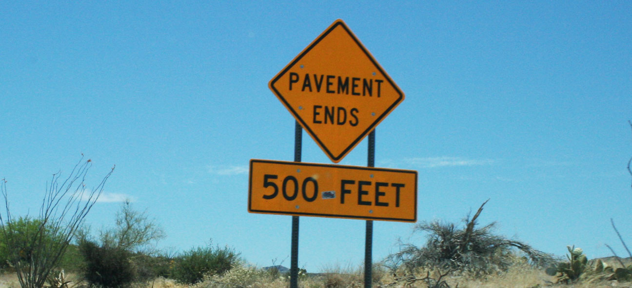
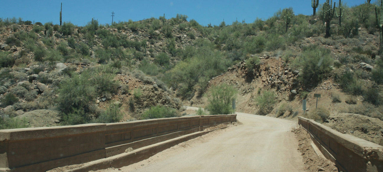
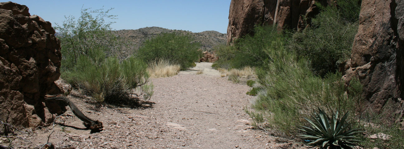
The road continues paved for several miles beyond Tortilla Flat, but then:
For the next 22 miles, we curved around rocks & rivers as we made our way toward Roosevelt Lake on the graded dirt road.
There were several one-lane bridges to cross. This one crossed over Fish Creek.
The ILX handled the adverse terrain with poise. I did have to disable the traction control system to get maximum grip – on some of the washboard ruts, the system would disable power to one of the front tires and keep me from maintaining momentum.
I got a picture with our two transport vehicles. The 2013 Nissan Pathfinder was featured back in March on a trip to Bagdad, Arizona. It’s a Middle Eastern-spec vehicle with speed in kilometers per hour on the gauge cluster.
Saddle up – we’re off again.
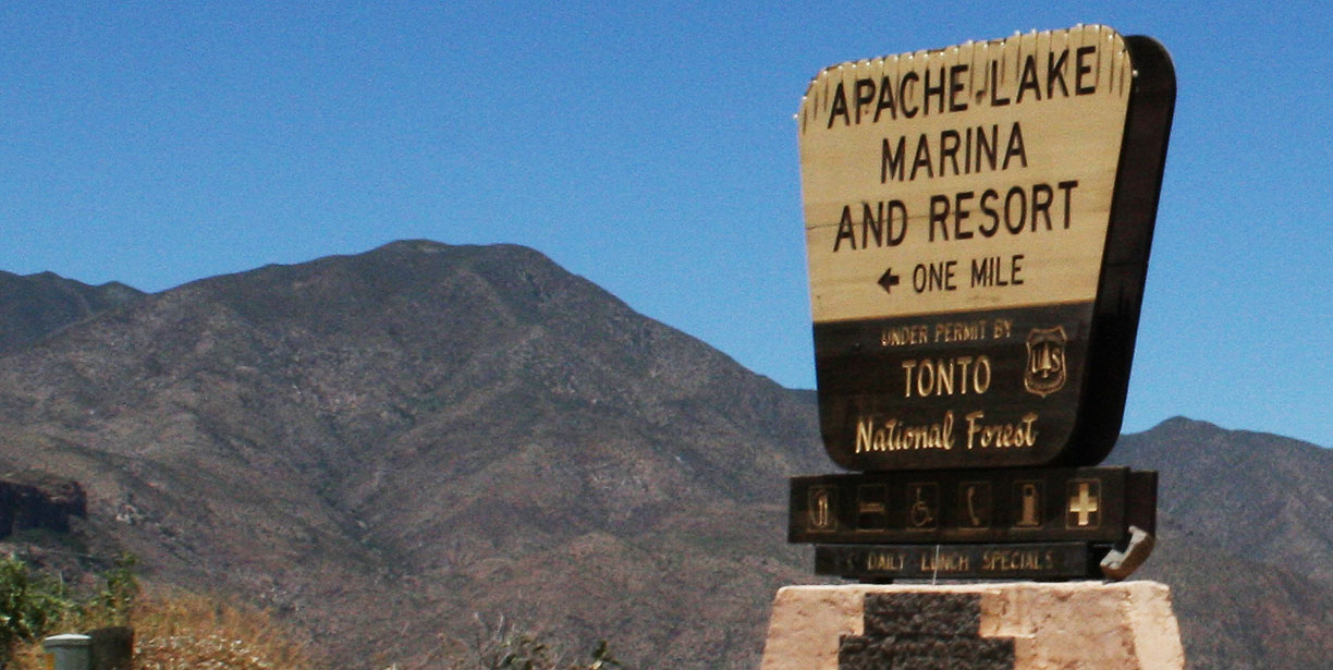
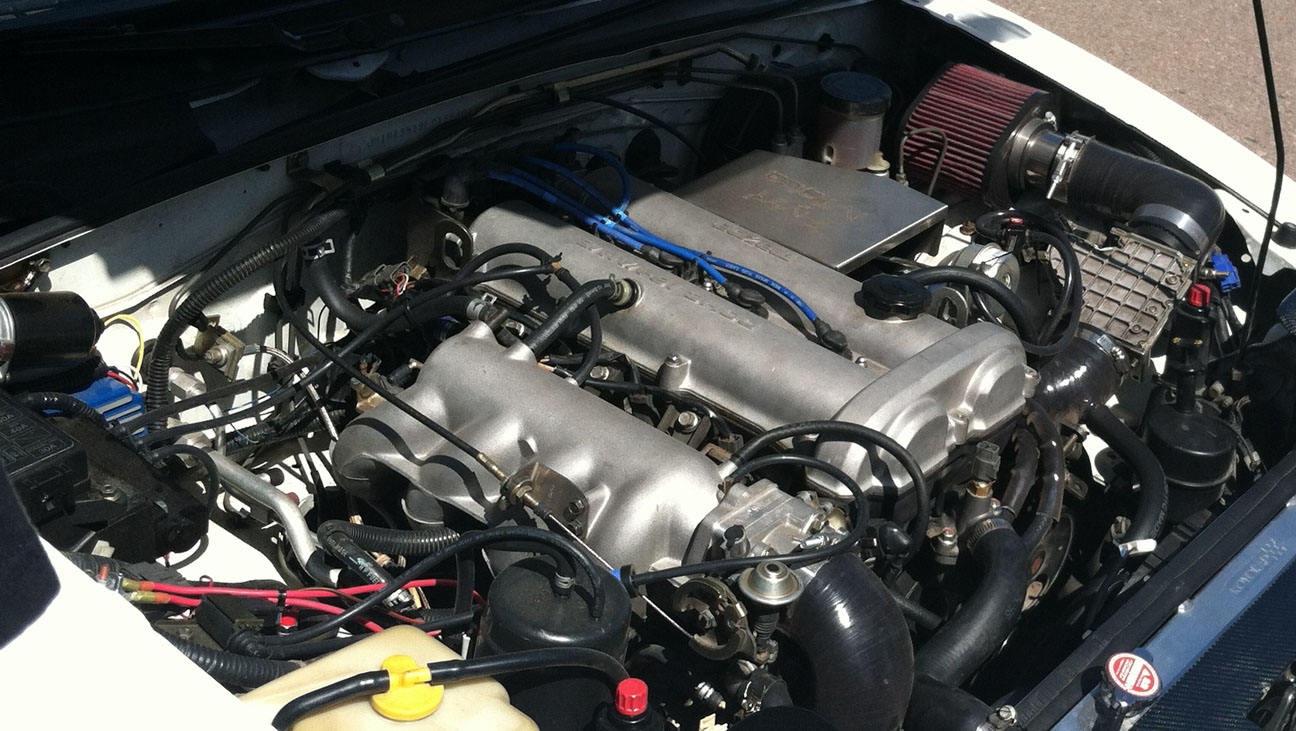
Matt and I traded off taking the lead on the drive. I ate his dust for a good part of it. I think my ILX will probably be due for an engine air filter change at its next service. The suspension did a great job of absorbing the uneven road. There were a few sights to see along the way, including the Apache Lake Marina.
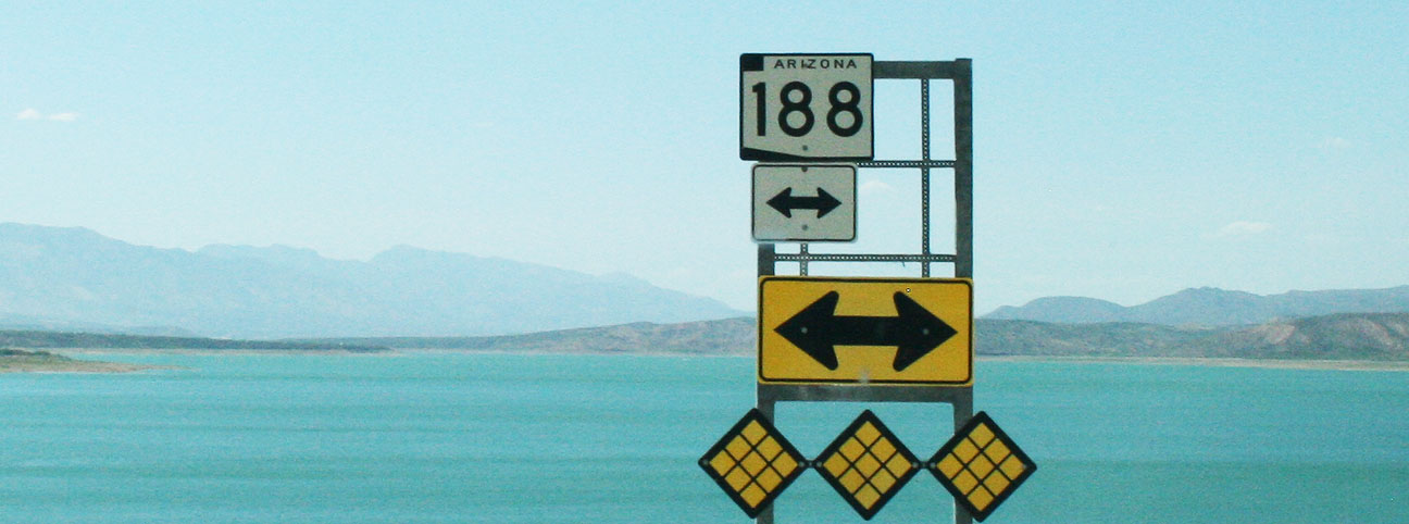
Soon we were just 12 miles from the junction with Highway 188.
A few more bridges, and we were home free.
The road descended in elevation until we again met up with the Salt River. From there, we followed it upstream toward the Roosevelt Dam.
Some of you may recognize this place from a drive a few weeks ago when I went with several friends to check out the Roosevelt Dam and its impressive accompanying bypass bridge.
It was a great trip and one that I’d highly recommend!
I’ve got a few other random news bits before signing off for this weekend’s entry:
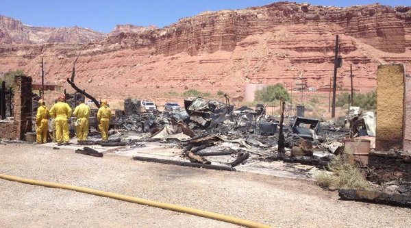
1) In November 2012, I drove the ILX back to Phoenix from southern Utah, and I took a picture at the historic Marble Canyon Lodge on Highway 89A in northern Arizona. Phoenix news station 3TV ended up using my picture in an article this week after the lodge burned down. Check out slide 6 of 6 with the ILX parked out front! Screen capture below.
Pretty sad to see the 1920’s lodge end up like this.
2) Anybody hear about Irv Gordon’s latest in his 1966 Volvo? He’s only 30,000 miles away from hitting 3 million miles!
Here’s the video. This guy’s an inspiration. I’ve tried contacting him to introduce myself but haven’t had any luck yet.
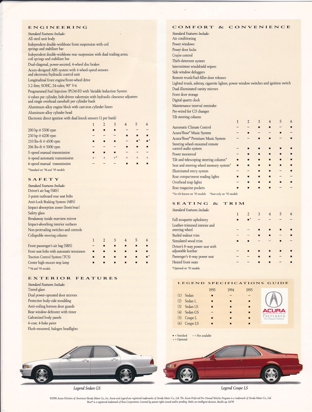
3) I scanned some old Legend promotional materials this week. I’ve got a huge collection of magazine articles and brochures related to all things Acura, but specifically about the Legend. Here’s a reprint from Road & Track magazine.
It’s kind of fun to read the specifications for the Legend Coupe & Sedan from a “Preferred Pre-Owned” brochure.
4) It’s 4,052 miles from Scottsdale, Arizona to Prudhoe Bay, Alaska on the Arctic Circle. This would be the road trip of all road trips. My friend Ben told me he’s interested in doing the drive someday, and the more I look into it, the more obsessed I get with it. Would anyone like to come along?
5) Congrats to my friend Chase from Austin, Texas who just picked up a 2013 Fathom Blue Pearl Acura ILX 2.0 on Friday!
Just 23 miles on the odometer when he took delivery!
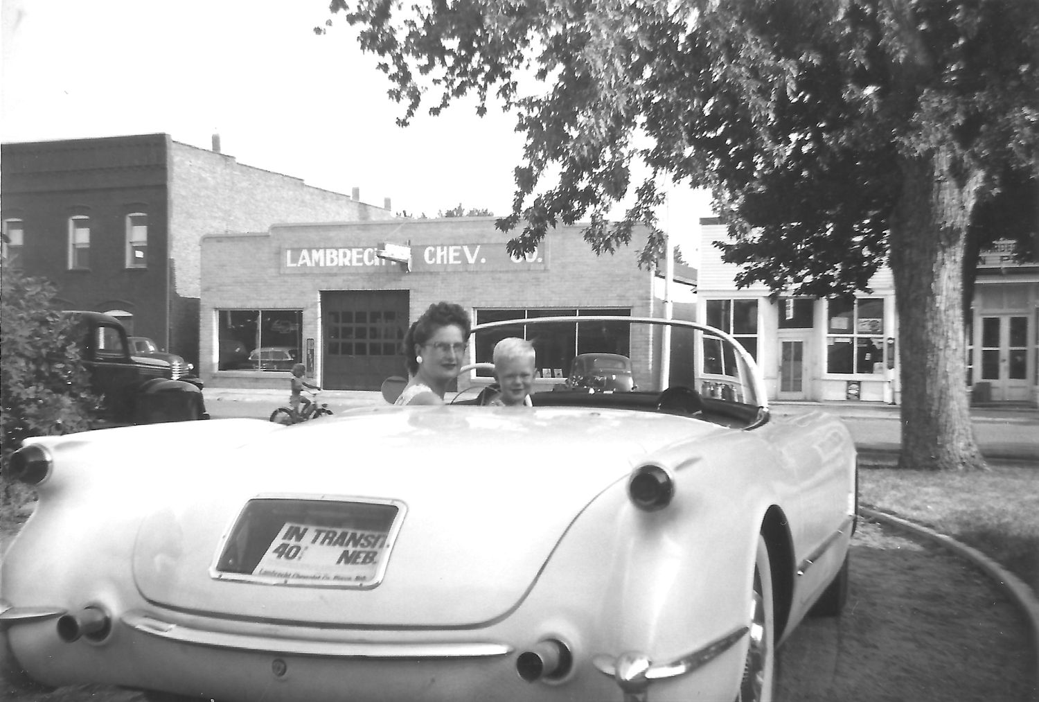
6) Speaking of ultra-low mileage, ever heard of a 50+ year-old vehicle with fewer than 10 miles on the odometer? It’s really possible. A friend today told me about a classic car gold mine of sorts in Pierce, Nebraska: a Chevy dealership that’s been closed for decades and which houses dozens of “new” cars that have never been sold. A 1958 Cameo pickup truck with 1 mile on the odometer seems like a pretty unreal find, but it does exist. The truck, and nearly 400 other vehicles, will go up for auction this September as the owners of the now-closed dealership (now in their late 90’s) liquidate everything.
Would you believe I made it all the way to Miami and back for a day trip? Sure did! Miami, Arizona that is. The small copper boomtown about 80 miles east of Phoenix was just one of the many destinations that I visited in my 2013 Acura ILX with a few friends today. Here’s a 4-minute recap in country music form.
Eastward ho on US-60 we went, in search of tunnels, lakes, and bridges.
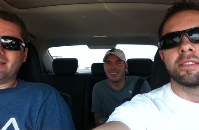
These two lucky chaps shared the ILX with me while a few of our other friends drove separately. Kevin got shotgun and Brian had the back seat to himself. There was plenty of room for all.
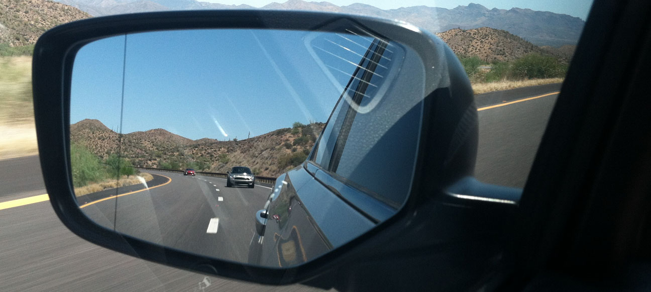
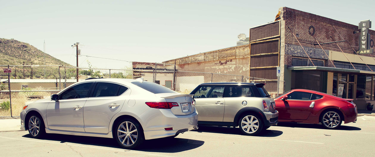
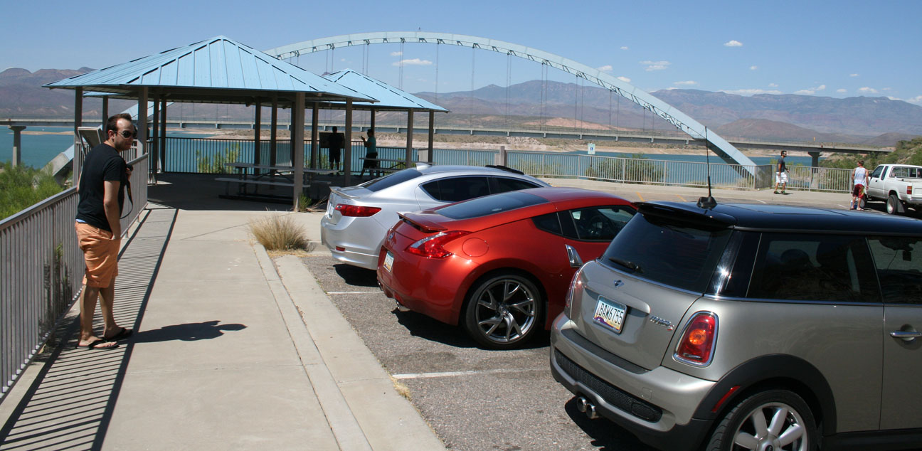
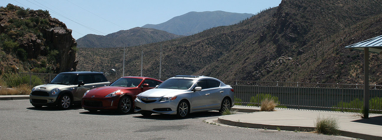
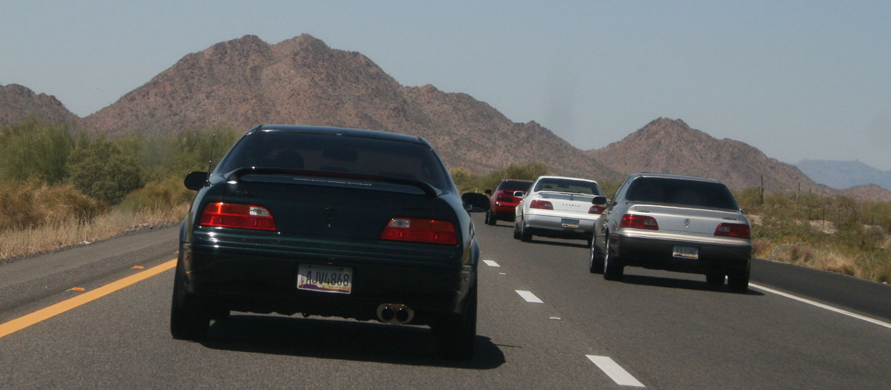
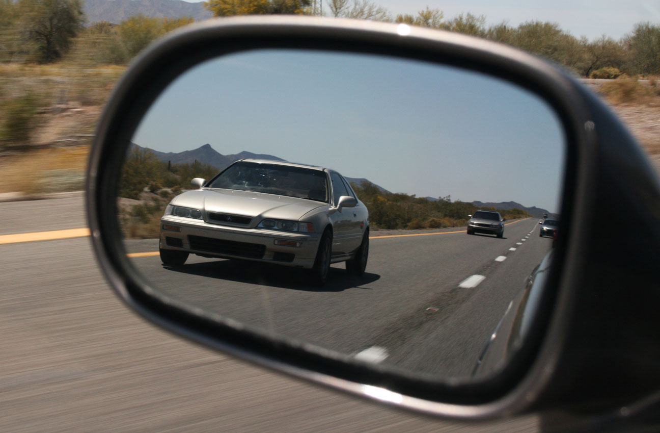
In the rearview you’ll see the participants in today’s road rally. Brock brought his 2007 Mini Cooper S 6-speed and Matt brought his 2013 Nissan 370Z Sport 6-speed. I took the lead and we headed for the hills.
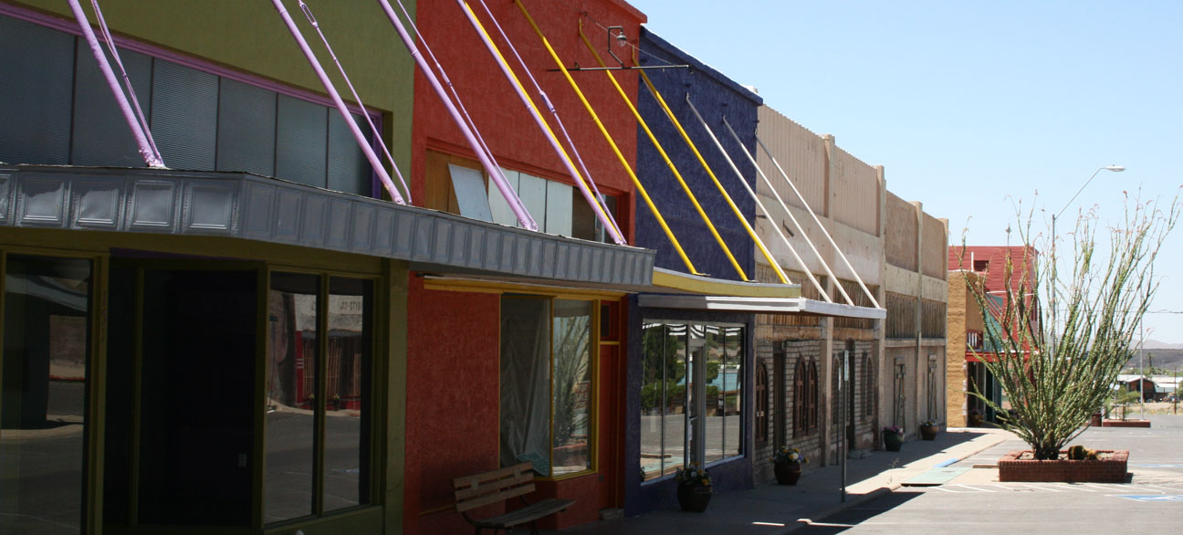
First stop was Superior, Arizona, which from the looks of things is far from “superior” in any way. Buildings here on Main Street have been vacant for decades. Superior’s history starts in 1875 when the Queen Creek Mine started producing copper that brought thousands of prospectors to the area. Mine operations have largely been shut down, but a few hearty residents (3,000, to be exact) continue to call this place home.
Our stop here was merely for a photo-op with of the ghost-towned buildings that lined this once-busy thoroughfare through town. The cars in today’s drive were all 6-speed manuals, but that’s about all they had in common.
Thanks to Brock for this great shot!
Not a single business was open for customers along this stretch. We peeked inside a few of these. One was a diner that looked 100% complete inside. It was almost as if the owners and patrons had simply vanished from existence and left everything in place.
It’s an eery feeling to walk around in a community that showed so few forms of “life.” We saw only a few other people out and about early on Sunday afternoon.
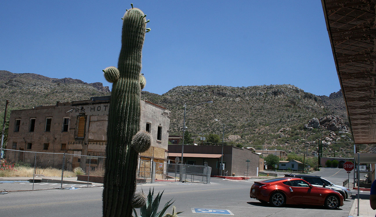
We saw it fitting to take a picture of Matt’s 370Z in front of the historic Hotel Magma, constructed in 1923. Matt’s Z’s official color is “Magma Red.”
A lonely cactus watches us as we bring more excitement to town than it’s probably seen for a few days.
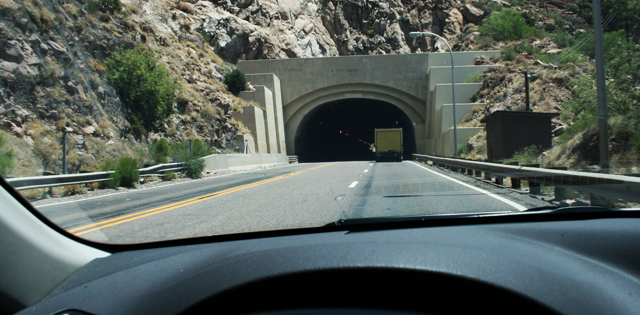
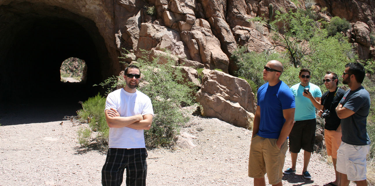
Just a ways up the road, the drive took us through the 1952 Queen Creek Tunnel. Originally striped as two lanes in each direction, it now has just two lanes uphill and one downhill due to wider lanes than the standard when it was constructed. It’s roughly 1/4 mile long. Matt got on the gas of his 370Z inside so we could all listen to his exhaust note.
Just at the north end of the tunnel, we pulled out into a gravel area and admired the scenery.
This picture shows the current (yellow line) highway where the Queen Creek Tunnel cuts directly through the mountain. The curvy road toward the bottom of the frame is the pre-1952 highway alignment. It also included a short tunnel, called the Claypool tunnel. This was a critical piece of infrastructure for travelers going from Superior to the next town.
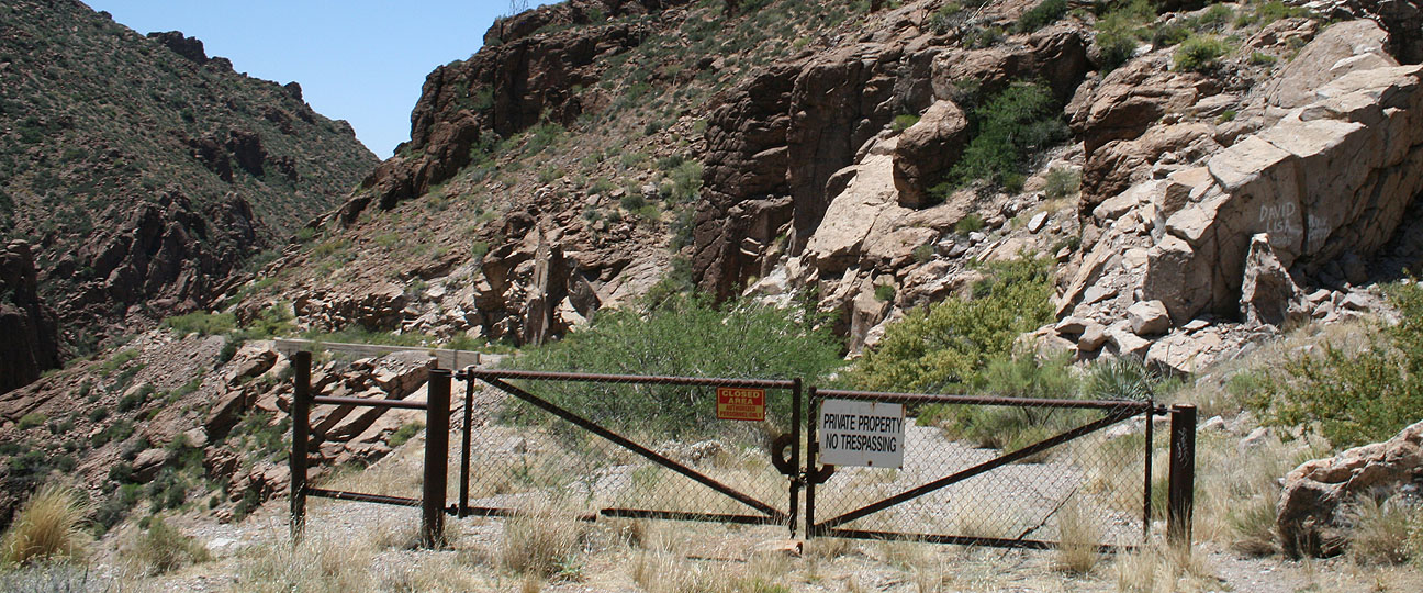
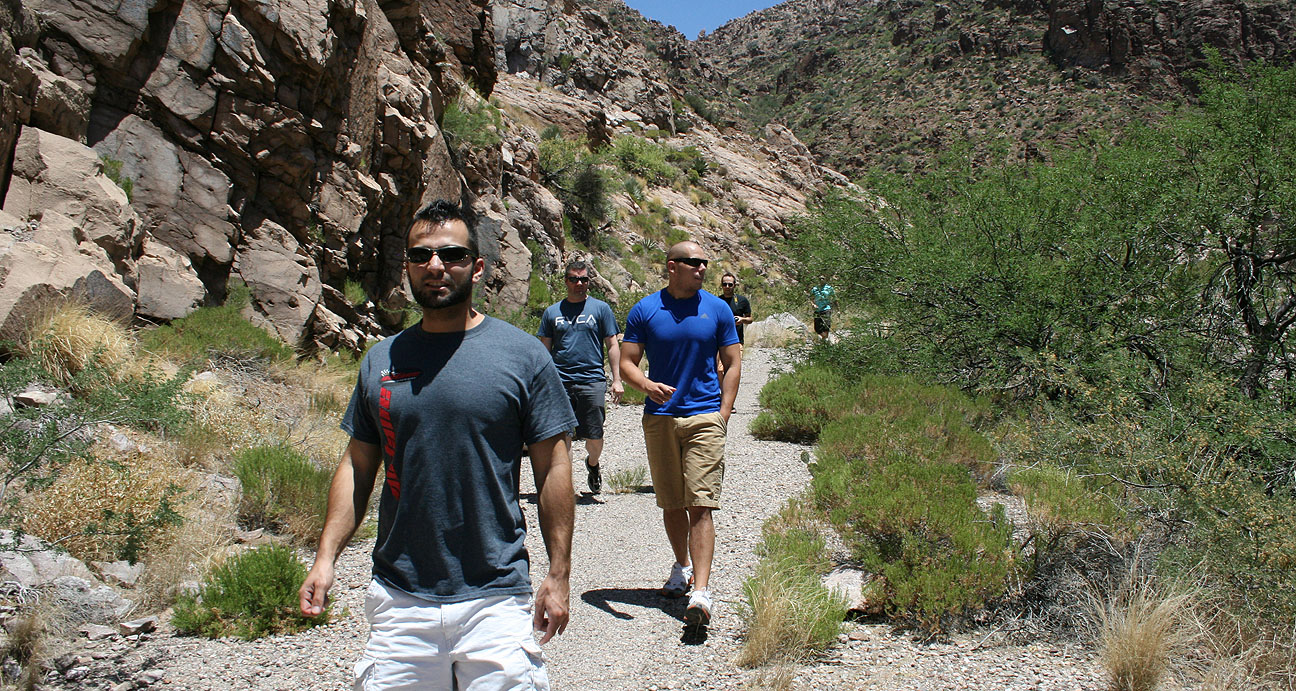
Claypool tunnel is now completely closed to automobile traffic but it can be reached in a short 15 minute hike from the current road. We crossed through this gate and went to check it out.
Temperatures over 100 degrees Fahrenheit didn’t melt our appetite for adventure.
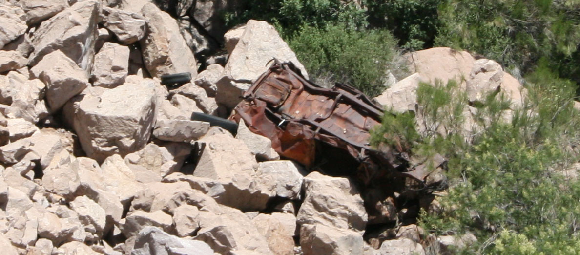
Peering over the edge of the road, we saw the remains of some auto wreckage in the ravine below.
Jack admires the scenery. Though it’s been over 60 years since this stretch of road was in service, we could still see plenty of areas where the blacktop and even painted road lines are still clearly visible.
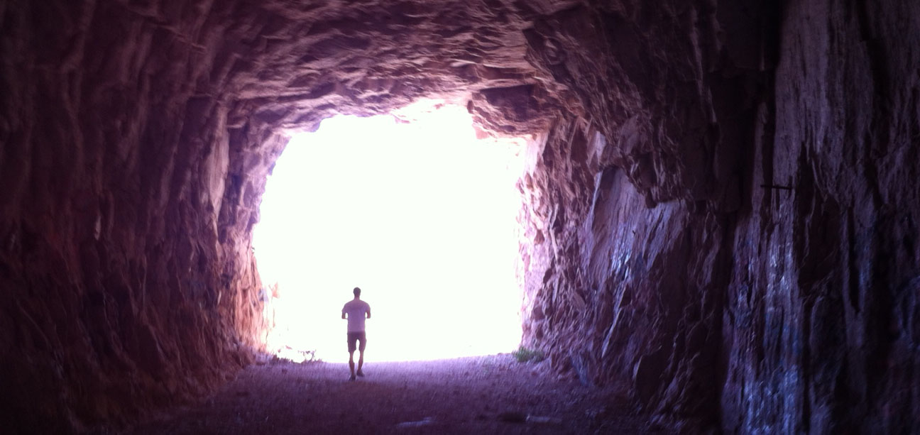
Soon, we could see the Claypool tunnel.
Aside from the sound of our shoes crunching along in the dirt, we heard unmistakable squeaking sounds coming from the ceiling. Connor pulled out his cell phone to see if this tunnel would allow him to “check in” on his FourSquare app, and indeed our suspicions were confirmed when he saw what it was called there: “Bat Cave.”
Jack captured this picture of me walking along. It looks like something from a sci-fi film!
It’s amazing how crudely built this tunnel was. There is graffiti on the walls but it’s litter-free and relatively undisturbed.
Coming out the other end, it’s difficult to tell that this was even at one time a road.
Here I am playing tour guide and telling the others about the history of the tunnel that I’d learned online. They just roll their eyes at me when I start spouting off random facts and trivia. I love geeking out on stuff like this!
Time to make our way back to the cars and continue the journey.
These guys definitely have the right level of enthusiasm.
Here we are, entering Miami. Not to be confused with the Miami, Florida that’s 2,361 miles away from my house — this one is a lot closer.
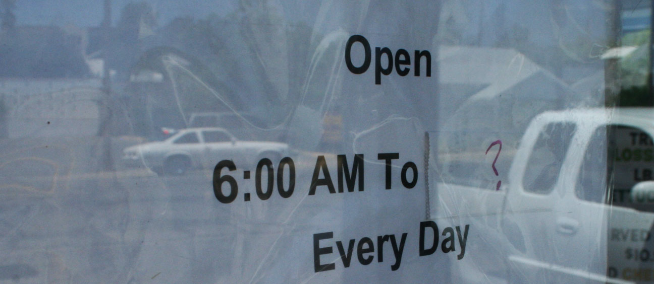
A few miles down the road, we’d seen all that Miami had to offer (which wasn’t much), and we entered the next town of Globe. Lunch was at Jerry’s Restaurant – one of the “safest” looking places in town. As much as I love hole-in-the-wall type food joints, I respect the health of my travel companions so I wanted something that seemed clean and had decent reviews.
Just don’t try and come here too late in the day. Looks like they leave their closing time up in the air (Noted by “?”).
Inside, our party of 7 overtook the place. It was a quiet Sunday afternoon in Globe.
Fueled up and ready to journey onward.
My ILX crossed the 40,000 mile mark less than a mile after leaving Jerry’s.
Thirty miles, later up Highway 188, we saw this bridge looming ahead of us. This was the famous Roosevelt Lake Bridge.
This junction is where Highway 88 leads back to the Phoenix area via a 20+ mile dirt road and. We opted not to do any off-roading this trip, but I’ve driven that stretch before in the Legend.
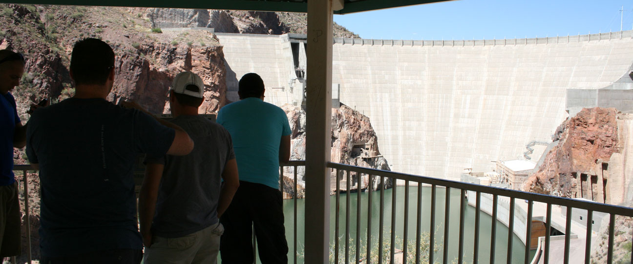
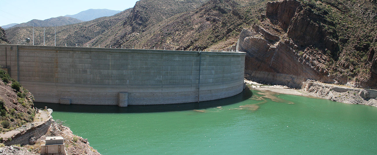
We drove as far as where the pavement ended before looping back to get a glimpse of the Roosevelt Dam.
A picture truly does not give a sense of the massive size of this dam. Built between 1905 and 1911 and named for then-president Theodore Roosevelt, the dam currently stands 357 feet high. I say currently because the dam when originally built was 280 feet high, but in the 1990’s it underwent some reconstruction that made it much larger. There were 41 workers who died during construction of the original engineering masterpiece.
Still, in 1911 the Roosevelt Lake that the original dam created was the world’s largest artificial reservoir. The lake today contains over 1 million acre-feet of water. It also put the original town of Roosevelt under water!
Here’s some information I learned from the Bureau of Reclamation about the dam and its newer bypass bridge.
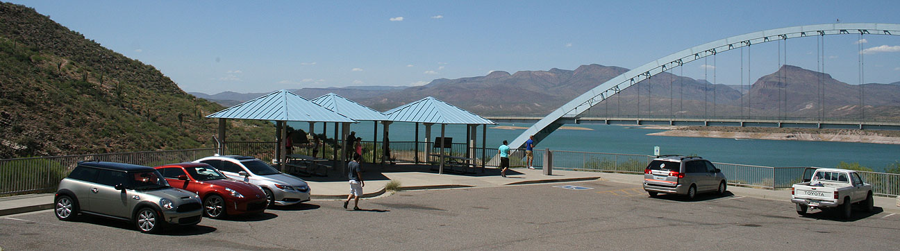
Prior to completion of the bridge in October 1990, traffic drove over the top of the dam. The bridge itself earned rare distinction when the bridge was named one of the top 12 bridges in the nation in November 1995. The American Consulting Engineers Council cited the bridge for overall design, size, eye-appeal and design challenge. Other bridges cited were the Golden Gate Bridge and Brooklyn Bridge.
The $21.3 million bridge was built to take traffic off the top of Roosevelt Dam. Roosevelt Lake Bridge is the longest two-lane, single-span, steel-arch bridge in North America. The bridge, spans 1,080 feet across Roosevelt Lake providing two-way traffic. The original dam-top roadway was designed to allow two Model-T Fords to pass abreast, but today’s recreational vehicles and full-size automobiles are too wide to permit two-way traffic.
Here, we parked our vehicles in the overlook and viewed the bridge from a distance.
The bridge was painted blue so that it would blend in with the sky. I’d say they matched the color quite perfectly.
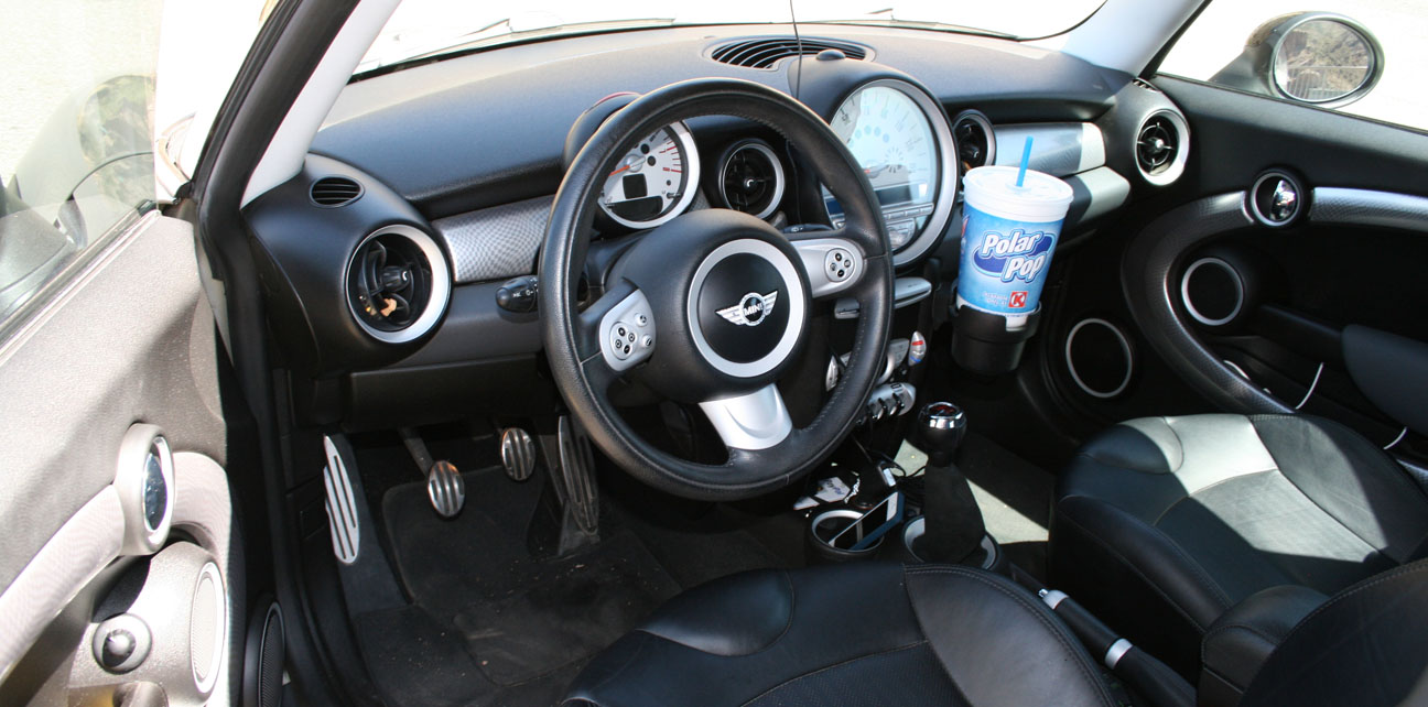
Check out the interior of Brock’s Mini Cooper with just 50,000 miles on it.
This is the view from the other side of the dam.
Notice that the road on the bridge has a slight upward curvature. This is because if the bridge was level, drivers would have the perception that the roadway was sagging — not a good sensation when you’re driving 150 feet above the water!
One more shot of the rides, anxious for the last leg of our journey.
Group shot: Brian, Tyson, Jack, Matt, Kevin, Connor, Brock
We cruised back to Highway 188 and headed northbound.
Here’s what it looked like to cross that 1,080-foot bridge.
Our last stop was for some refreshing drinks (remember, it was a 100-degree Arizona day!) at the Butcher Hook restaurant, store, and saloon in Tonto Basin.
Highway 87 took us home.
Thanks to my friends for coming along – whether in person, or vicariously through the blog post.
From the narrow, twisty roadways of an 1876 mining town in the Black Hills, to the red rock sandstone landscape of Sedona, to the tree-lined and steep grades of Oak Creek Canyon, I experienced some of Arizona’s finest roads and skies yesterday.
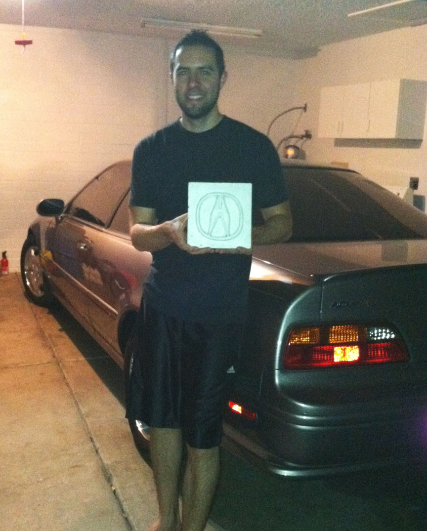
Many thanks to Jason from Las Cruces, New Mexico for making the 400-mile trip to the Phoenix area to join me for this weekend’s trip. This was the third time I’ve partnered with Jason for a Drive to Five feature. We met previously for a trip to Bisbee, Arizona in January and then for a trip to White Sands National Monument in New Mexico in March.
First order of of business when Jason arrived was to check on those model cars on my rooftop. He was impressed at how well they’ve held up considering they’ve endured 3 years of Phoenix inferno.
Dinner at Phoenix’s “Central Bistro” on Friday night with my friend Matt. Jason and I both recommend the Bolognese pasta!
This was an extra nice gift: Jason presented me with a hand-made ceramic tile featuring a 3D “A” emblem. This is now proudly displayed in my home. I wish I had those kind of craft skills!
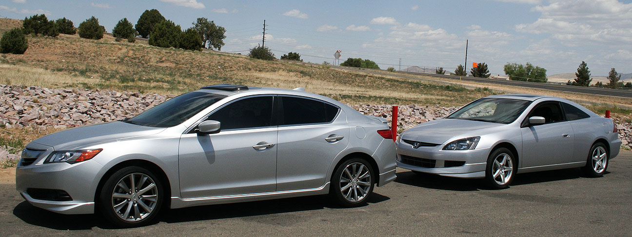
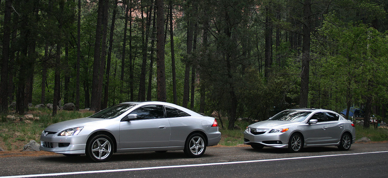
Saturday morning, bright and early, we revved up our Honda engines and set sail for the alluring cooler temperatures of northern Arizona. But first, I treated myself to a blueberry muffin from Starbucks. My friend Chris took the shotgun seat of the ILX for the duration of the drive and Jason followed us in his silver 2004 Honda Accord coupe 6-speed.
Coming from an Acura Legend with zero cupholders, I was pleased to note that all FOUR of the cupholders in the ILX were used that at morning. Our Starbucks beverages took the center console and we each had a water bottle in our door pocket. This car can transport almost as many beverages as a minivan!
Our cars filled up on some 91 octane fuel at the Circle K on Phoenix’s 7th Avenue & Loop 101 before we headed out from the Phoenix Valley.
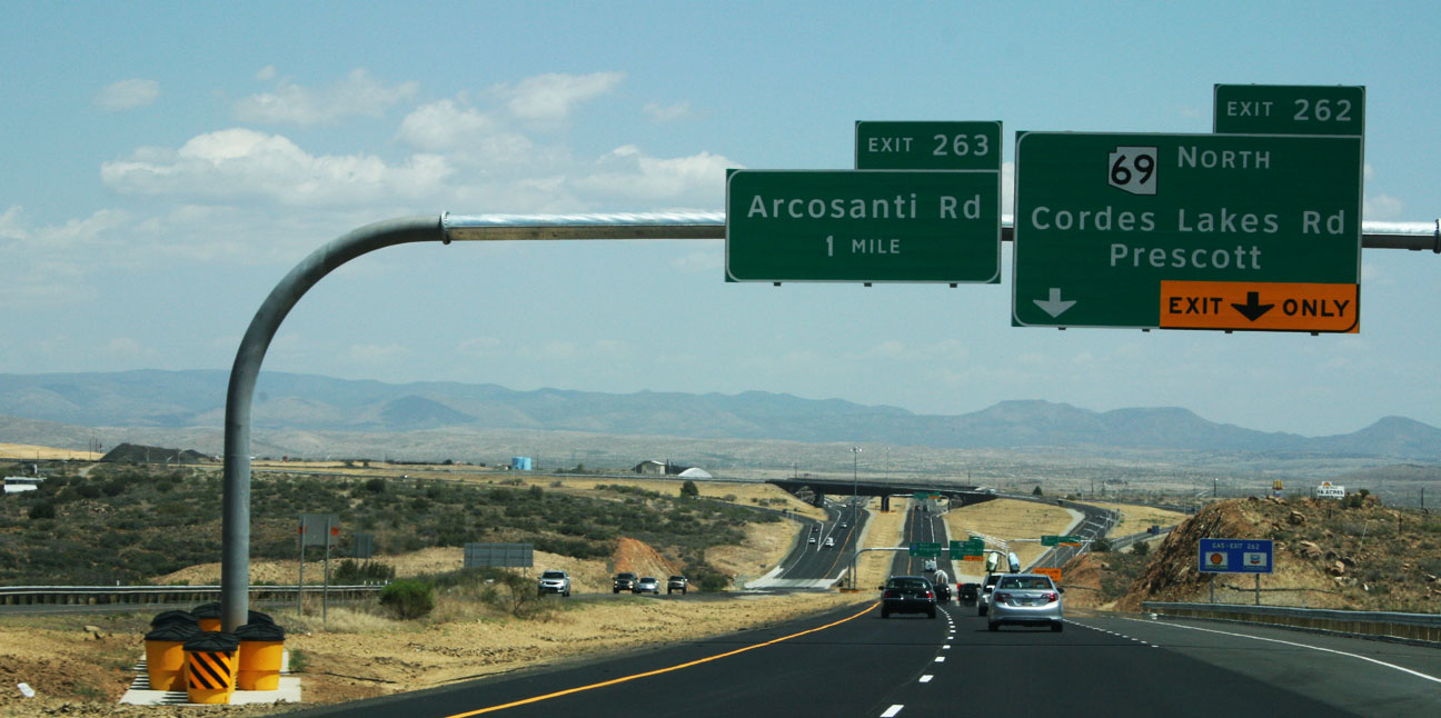
Fewer than 50 miles up Interstate 17, we veered west on Highway 69, northbound toward Prescott, Arizona.
Here, we awaited the third member of this caravan.
Austin arrived shortly in his 1987 Acura Legend. It has over 280,000 miles on the body itself, but the engine and transmission are not original to the car. Lovingly referred to as “FrankenLegend” by its owner, the car’s engine is upgraded to a 2.7 liter (as opposed to a 2.5), and the transmission was swapped to a 5-speed from an automatic. The original 1986-1990 Legend sedan has a classic bodystyle and Austin’s is in nice shape!
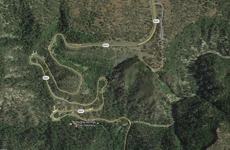
The next 19 miles of two-lane highway up Highway 89A would lead us through some very technical and fun curves leading to our lunch destination in Jerome, Arizona.
Chris zoned out for a bit from the passenger seat and when he started waking up, he commented, “I didn’t even realize you were driving a manual transmission, those shifts were so smooth.” That’s what I pride myself in! Perfection in rev-matching. While an automatic transmission may offer faster paddle-activated control, there is no substitute for a traditional three-pedal manual transmission for an engaging driving experience.
We climbed to over 5,000 feet in elevation and the temperatures dropped as we did so. Jerome’s high temperature for the day was in the high 70’s Fahrenheit — absolutely perfect weather for a moonroof-open cruise.
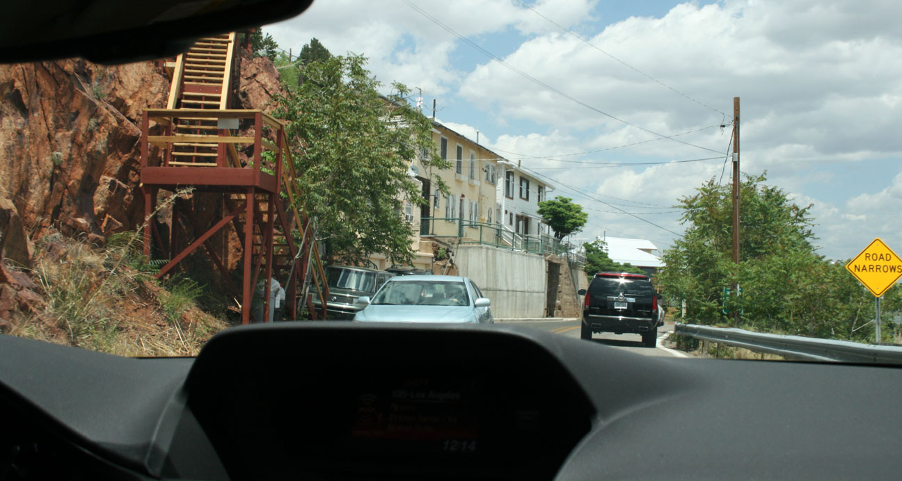
Jerome, like many of the other towns where I’ve taken my readers in recent months, got its start as a copper mining town in the 1800’s. Once having a population as high as 10,000 people, it’s now home to fewer than 500 people. The town is built precariously on the side of “Cleopatra Hill.” Roads are narrow (some are one-way) and steep.
Here’s a view of Jerome that I took from the Jerome Historical Society Museum. This town was named “Wickedest Town in the West” in 1903 by the New York Sun.
We were greeted by heavy traffic as there were special events taking place in town. Jerome is a very popular Saturday destination for bicyclists, motorcyclists, and car clubs.
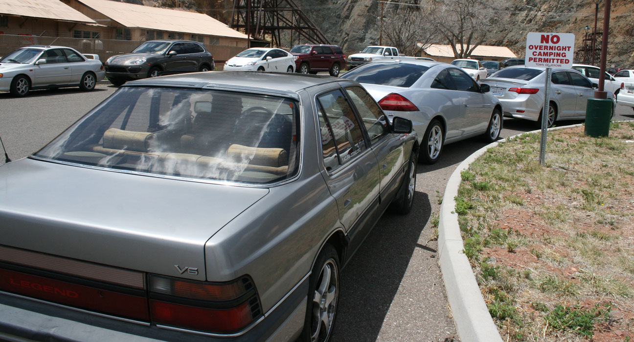
We parked our trio of Hondas at a lot a few blocks from town and walked over to find a lunch destination.
Brandon, pictured at right in the black shirt, and his girlfriend Alishaba met up with us as well. More about Brandon’s Acura shortly.
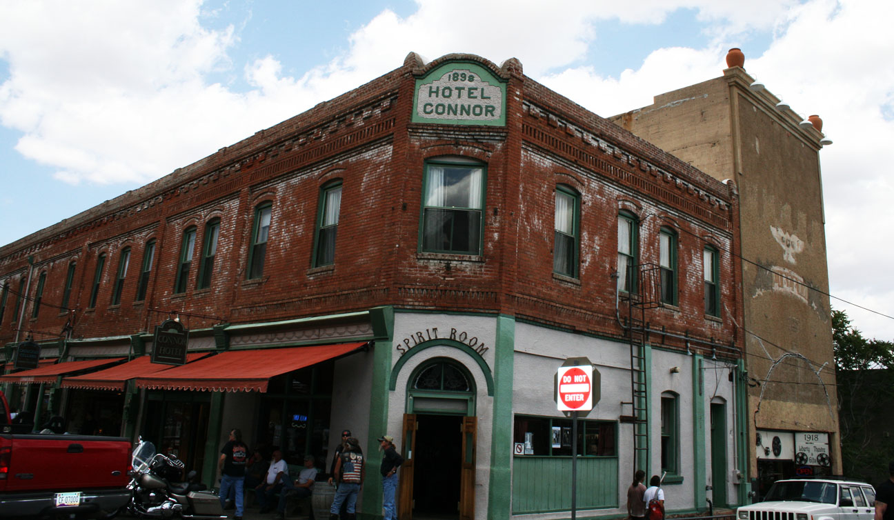
We walked past the Hotel Connor, built in 1898. It has 20 rooms on the second level that were first rented for $1 per night. From the hotel’s website:
After it reopened [after a fire] in August of 1899, it enjoyed a heyday of being one of the finest lodging establishments in the booming mining towns of the West. The hotel had its own bus for delivering guests to the train depot, and was full to capacity much of the time. It was one of the earliest buildings in Jerome to be fully wired for electricity, and each room had a call bell for service.
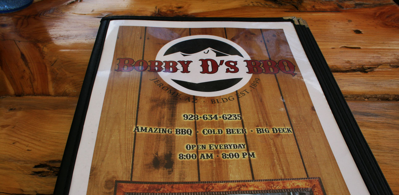
Just down the street, we were lured in by the smell of sweet barbeque sauce so we stepped inside Bobby D’s BBQ for a bite to eat.
The pulled pork definitely hit the spot! Bobby D’s is built on the site of an 1899 restaurant called the English Kitchen which was demolished after the last mine closed in 1953. The building has been rebuilt and boasts amazing food.
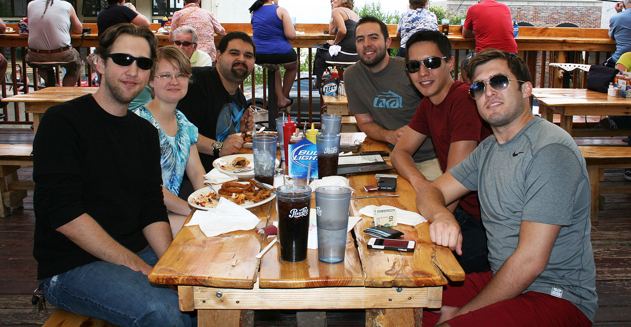
Left to right: Brandon, Alishaba, Austin, Tyson, Jason, Chris
Jerome’s curves mean business. This hairpin at the end of Main Street is one example.
Now we got to check out Brandon’s car. Brandon is as Legend-crazy as I am, and this 1995 Sherwood Green LS Coupe 6-speed is his 8th. It’s nicely equipped with the OEM cell phone, gold emblem package, and 16″ chrome GS wheels. Brandon has upgraded the engine to a 3.5 liter from the 1996+ Acura 3.5 RL, but the car retains its original 6-speed manual transmission.
The car looks great for having over 220,000 miles on it.
Time to say farewell to our Legend friends and continue the drive!
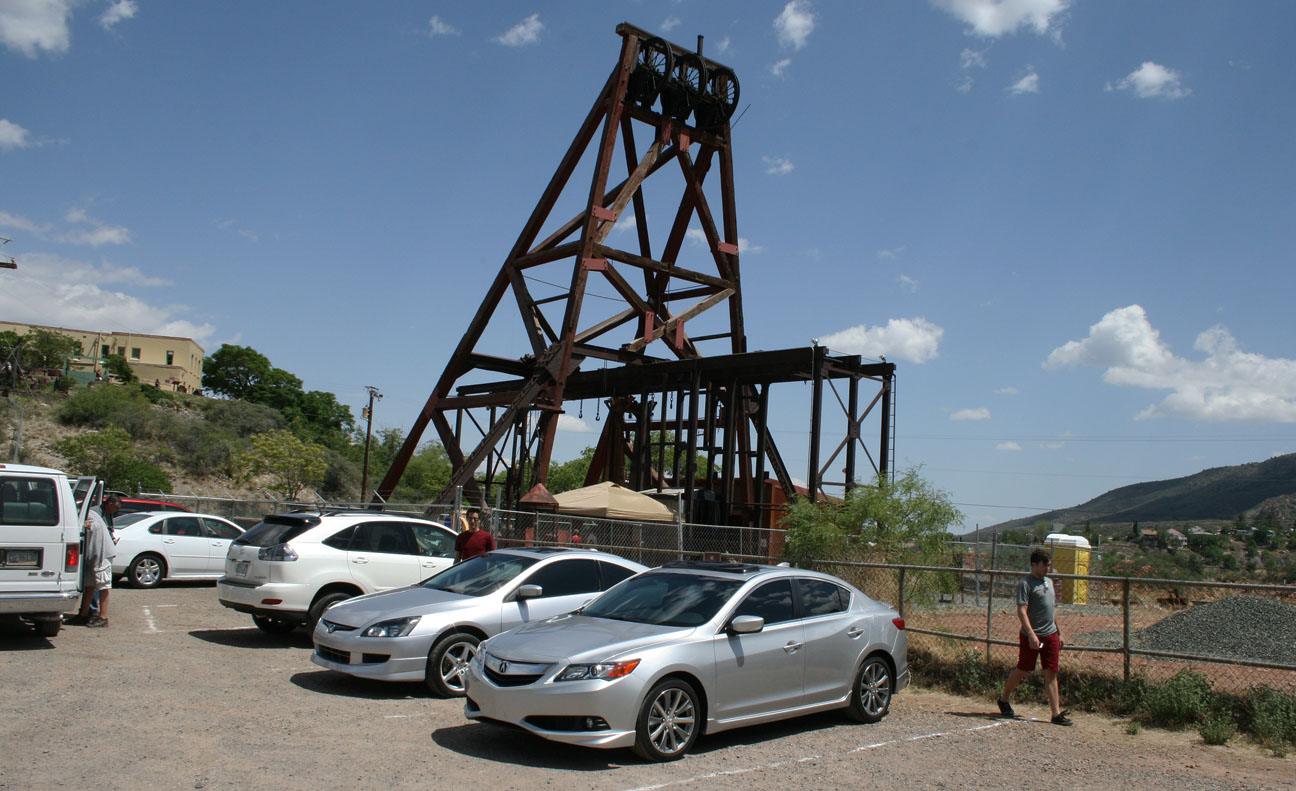
Just down the street, off Douglas Road, we weaved up to the Jerome Historical Museum’s “Audrey Headframe Park.”
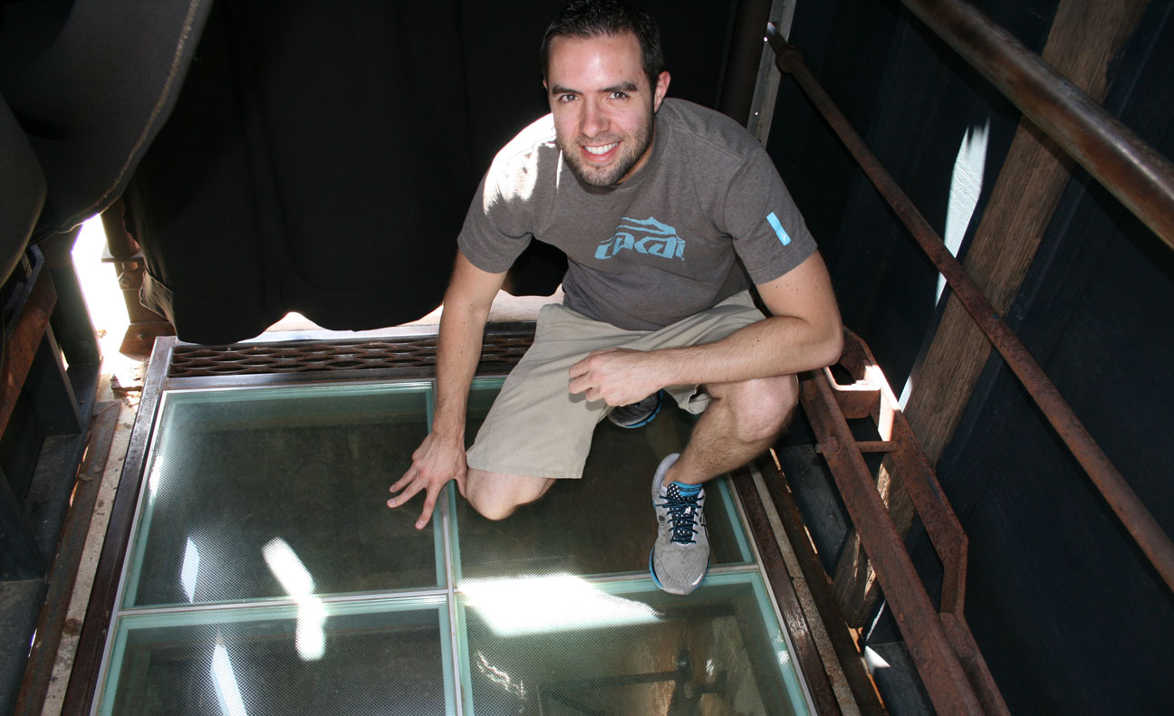
Named for the adopted daughter of the mine’s superintendent, this is the oldest piece of mining equipment in Arizona. Admission is free and the park is open daily from 8 to 5. The main attraction? This special glass floor.
In that picture, I am standing over a mine shaft that is 1,900 feet deep. To put that into perspective, look at how the depth of the shaft absolutely dwarfs the height of the Eiffel Tower and the Empire State Building!
Looking straight down. The shaft was built in 1918 and over $125 million worth of ore was harvested here. Though tough to tell from this picture, there are lights and mirrors going all the way down the shaft to help capture the sheer depth of it. It was a bit unnerving to stand there!
Though mining efforts in Jerome closed in 1953, over the 77 years that it was in operation, Jerome’s mining industry produced over 33 million tons of copper, gold, silver, lead, and zinc ore.
Time to head toward Sedona!
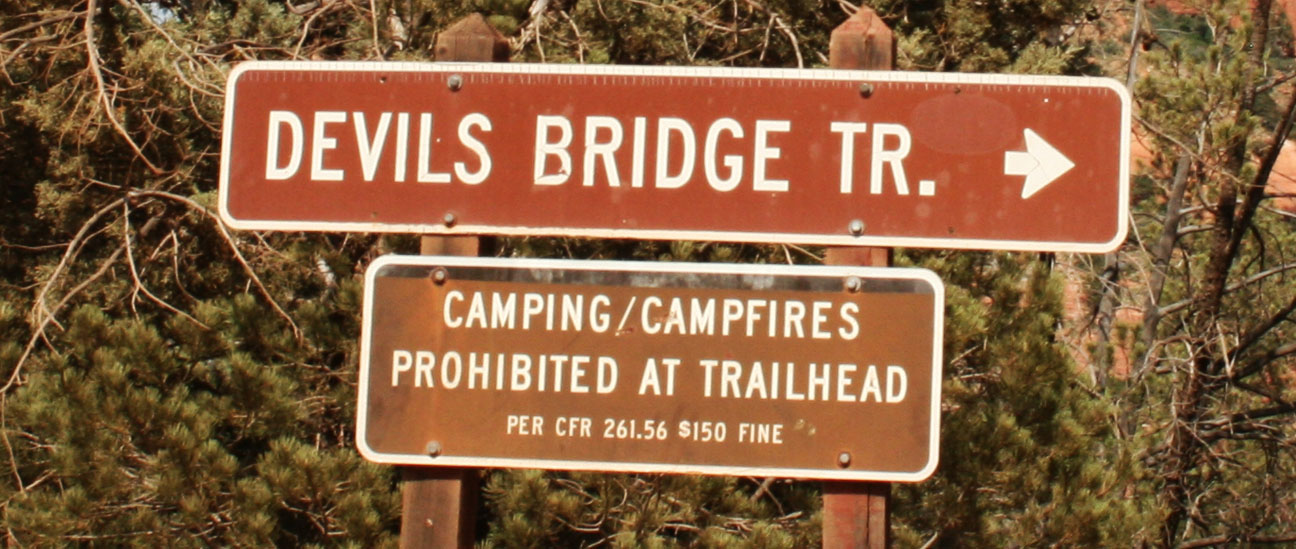
We wanted to stretch our legs a bit and enjoy the perfect weather, so we went to a trailhead of the Devil’s Bridge Hike off Dry Creek Road, just west of Sedona on Highway 89A. An even closer trailhead is accessible via 1.3 mile dirt road, but it’s only suitable for high-clearance vehicles. My ILX would have easily bottomed out if I’d attempted to drive it there. Here I’m giving a thumbs down to the fact that I can’t take my car on this dirt road.
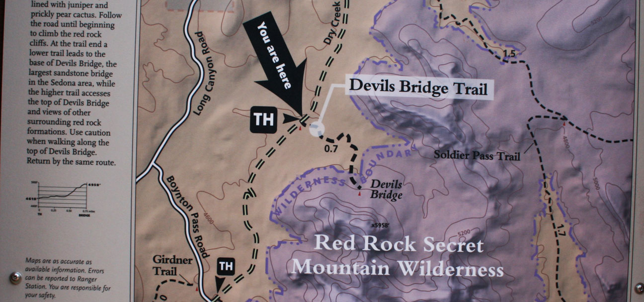
After hiking those 1.3 miles down the road, Jason and Chris and I arrived at the “official” start to the trail.
From here, we were only about a mile from the bridge.
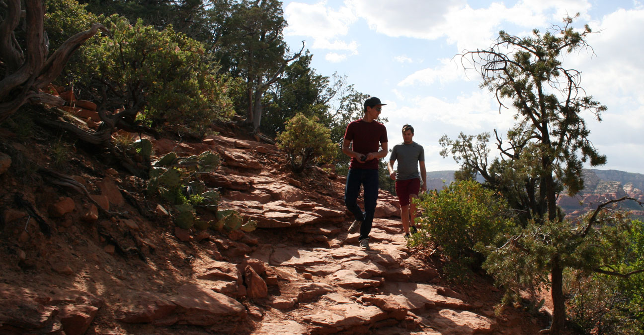
Jason led the way as we headed toward our destination. Few other people were out hiking; it was a special experience being out in the wilderness in such a beautiful landscape.
We climbed 400 feet in elevation on natural red sandstone rocks until finally laying our eyes on the prize.
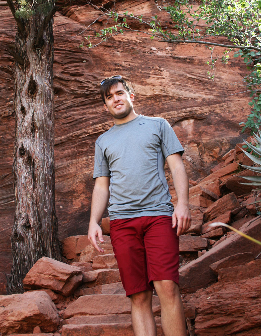
Devil’s Bridge is the largest natural sandstone arch in the Sedona area. It’s 50 feet above ground. For this shot, we had another hiker take our picture after we carefully crept out to the narrowest section of the bridge. I enjoyed sitting for a few minutes to admire nature’s beauty before we started heading back out.
Time for the descent.
And relieved to get back to the driver’s seat after my shoes became full of red sand. It had taken us roughly 2.5 hours to complete the journey.
The first place I thought of for some much-needed refreshment was the Red Planet Diner, where I had eaten in January with other friends who joined for a Sedona day trip. I had to poke fun at Chris for a bit. Red Planet is famous for its burgers, yet he ordered a teriyaki bowl. Notice the employee in the background has a black T-shirt which reads, “Welcome Earthlings.”
I went for something a little more simple: grilled cheese and a root beer float.
This time, I let Jason take the lead and he took us up a road toward the Sedona airport. Picturesque views surrounded us there.
The last thing on our to-do list for this trip was to drive Highway 89A the remaining 30 or so miles to Flagstaff, Arizona. This stretch of road climbs in elevation to a heavily wooded forest called Oak Creek Canyon.
This is the type of road where Jason’s Accord and my ILX felt right at home. Both of our cars are equipped with manual transmissions for maximum control and have suspensions that are designed for handling the curves with balance. We were lucky that traffic was minimal, so when the hills begged for a little speed, we responded.
Chris did his best at video recording the above twisty section. Thanks to Enrique Iglesias for the soundtrack! I’ve got to invest in a GoPro camera for better stability one of these days.
At the end of the line, Highway 89A meets up with Interstate 17 which is where we parted ways with Jason and he headed to Flagstaff, while Chris and I returned to Phoenix.
I’ve come a long way since this picture was taken in 1982. Many thanks to my great mom for always riding along on my Drive to Five travels, whether online or in person. Happy Mother’s Day!
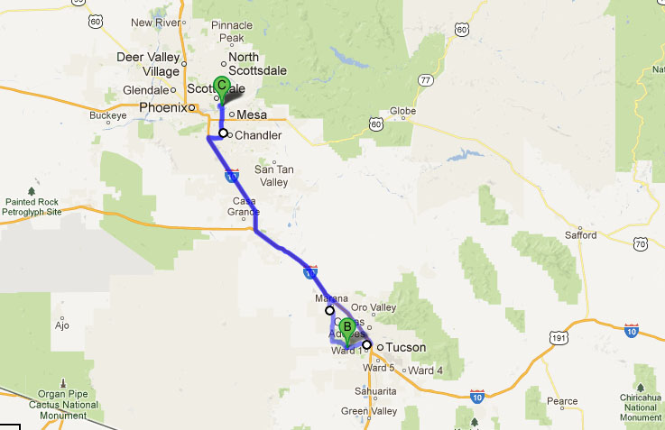
Today I’m going to take you to 5 different destinations in the Tucson, Arizona area that I visited yesterday in my 2013 Acura ILX 2.4 6-speed. I headed out on Interstate 10 eastbound to make the ~120 mile drive from the Phoenix area with a few hot spots in mind. Here they are, in the order I saw them.
1. Sentinel Peak / “A” Mountain
The University of Arizona was the first university in the state. It was founded in 1885 and currently there are about 40,000 students participating in its programs. In March, 1916, a huge “A” was constructed on the side of Sentinel Peak just west of town. It’s a basalt rock formation that measures 160 feet tall by 70 feet wide. After the September 11, 2011 terrorist attacks, it was painted red, white, and blue (also the school’s colors) but it’s since been whitewashed.
This is the View of the “A” as seen from Interstate 10 just before exiting the freeway at Congress Road (slightly hidden behind that tree).
Nearing Sentinel Peak Road, I saw a sign that indicated I was getting close to the A. This marker could easily be mis-read as “a mountain,” instead of “A” Mountain. Either way, I continued my ascent up the 2,900-foot elevation gain to the summit.
Much like at Gates Pass where I traveled a few weeks ago, there were several forewarnings about the grade and width of the road as I approached the section with greatest elevation gain.
The road becomes one-lane and one-way as the top of the peak approaches. This was a fun little stretch of road in the 6-speed-equipped ILX as I downshifted to get maximum torque while looping around the top of the mountain.
Strangely, though, this road has no guardrails. It can get a little dicey trying to wind up the hill when bicyclists are trying to share the narrow roadway.
Finally at the top of the peak, I took a picture of my car with downtown Tucson in the background. Tucson is the headquarters of Pima County and is home to over 500,000 people. Since air conditions were favorable, I was able to clearly see downtown Tucson in the distance.
Facing south, the outskirts of town were visible.
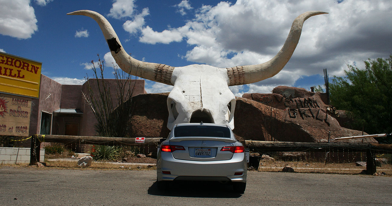
2. Longhorn Grill: Amado, Arizona
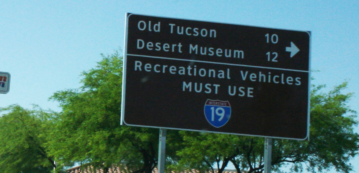
In my endless search for the most offbeat destinations I can find, I stumbled across this restaurant in southern Arizona shaped like a longhorn skull in Amado. My trip to the Longhorn Grill required a 33-mile southbound drive on Interstate 19 which I talked about in my post on Saguaro National Park. I-19 is unique in that it’s perhaps the only interstate in the country that’s signed with metric distances. Amado is a tiny teeny 295-person town, so the few businesses in operation there were easy to spot.
Before I checked out Longhorn, I first pit stopped across the street from it at Cow Palace.
Cocktails, steaks, sandwiches, and package liquor are found here. This is definitely a one-stop shop. Cow Palace has hosted movie stars and other notable personalities since the 1930’s. There’s a picture of John Wayne hanging in the entrance.
The restaurant is open daily from 7:00 a.m. to 8:00 p.m. I didn’t dine there, but I did take a look at the menu and there are some great sounding selections, including:
Bacon Wrapped Filet: Tender and lean 6 oz filet with roasted garlic butter. Served with baked potato, smashed red potatoes, palace beans, fries, or Spanish rice. Includes vegetables, fresh baked bread and your choice of soup or salad. $24.99
And for dessert:
Giant Sticky Bun: House made cinnamon roll baked in brown sugar, butter, and cream glaze. $4.99
This is a storage container sitting near the main lobby of the restaurant where meats are shown. Customers may purchase special cuts of steak that are aged for 7, 14, or 21 days.
At noon on a Saturday, this place was dead. I caught a few glances with the bartender who probably wondered why in the world I was taking pictures of his restaurant. It looked like it’d make a great place to host a party, though!
Next door to Cow Palace lies the “Mini Market Amado Market Market.” I wonder if they’ve sufficiently communicated the fact that this is a market?
My gaze quickly shifted to those 30-foot-tall horns mounted on the building looming behind me: the long-awaited Longhorn. This building was built in the 1970’s and has been home to a variety of different companies — most recently, a steakhouse. The restaurant has been closed since mid-2012, so I can’t help but wonder if perhaps the Cow Palace put this place out of business. Competition is fierce in this one-horse (one-cow?) town!
The temptation was just too great to overcome when I saw a small one-lane road leading off into the middle of nowhere, so I switched the ILX into 4×4 mode (not really, but there were unpaved stretches that did require higher clearance) and began exploring a little.
As it turns out, there wasn’t much at all to see out there, but as always, the drive afforded plenty of scenic photo-ops including this railroad crossing.
3. 25-ton Tiki Head
Exactly one week after pit-stopping to see Giganticus Headicus on Route 66 in the northern part of the state, I decided to find its sibling. I made my way back to Tucson via I-19 (again, notice the metric signage in the picture below). Speed limits are still posted in miles per hour instead of km/h.
I exited at 22nd Street on the same exit that goes to Silverlake Rd & Star Pass Blvd. Talk about a confusing interchange!
On my way to get lunch with my friend Josh, I drove past Chapman Acura, the Tucson area dealership, and saw that they had a nice Silver Moon ILX 2.0 automatic on the lot with aftermarket wheels.
Josh is a long-time Acura fan and currently owns two Integras. I featured his white Integra turbo in a blog post a few months ago, and his daily driver Integra is the red one shown here.
Here that tiki head. The story on this one starts around 1969 when entrepreneur Lee Koplin built a miniature golf course east of Interstate 10 on Speedway Boulevard. The golf course, called Magic Carpet Golf, survived until 2007 when it went out of business. The fate of the tiki head, along with many other stucco sculptures, was quite uncertain at the time.
Thankfully, the head found its new home at 305 North 4th Street, seven miles away from where the miniature golf course was located. It now sits atop a bar called The Hut. It reportedly cost $20,000 for the bar to procure and transport the head by sawing it off its base.
Interestingly enough, nobody wanted the sphinx statue from Magic Carpet which weighed in at several tons. It ended up getting bulldozed in 2011.
4. 30-foot-tall Neon Cactus
Just a little up the road from The Hut stands a huge tribute to neon signs of old. This illuminated cactus was constructed in 2010 on a road that was the first divided highway in the state of Arizona.
The south side of the cactus reads “Miracle Mile.” The name is in reference to a title given by Arizona Highways magazine after the road’s completion in 1937. Since the road had a median, it was considered the “miracle mile of safety.”
I found a picture of what the cactus looks like at night. I’ll have to go back and check it out soon.
5. Muffler Man
We don’t know much about this fiberglass statue on Stone Avenue except that he’s an artist’s rendition of Paul Bunyan and watches over an intersection while holding an ax. The first muffer man on record was constructed in 1963 and since then many more have followed. Most often, these statues are 18-25 feet tall and carry mufflers, tires, or other automotive parts in their hands. This guy looks like he’s got a fresh coat of paint.
Hope you enjoyed getting acquainted with a few of Tucson’s offbeat attractions! Driving around to find them in my Acura ILX felt a bit like a scavenger hunt. It sounds nerdy, but each time I found one I got a little more excited than I probably should have.
My last stop on Saturday night was the Scottsdale Pavilions car show. This is a parking lot near my place that fills up every single Saturday, year-round, with all sorts of vehicles. I happened to park next to a souped up Subaru.
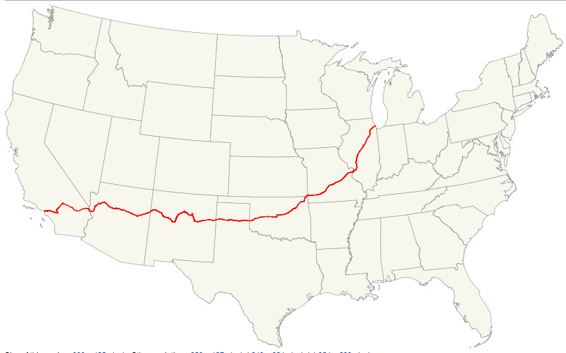
For this weekend’s ILXcapades, we find ourselves venturing back to the heyday of automobile travel as we know it. Route 66 – the “Mother Road” – has long been known as the most talked-about corridor in popular culture. Its entire length ran about 2,400 miles from Chicago to Los Angeles, but the road was decommissioned 28 years ago in the mid-1980s. This is a map of the original route.
Since then, it’s been bypassed, bulldozed, or otherwise forgotten except for in a few special sections where Route 66 heritage is embraced. I’ve driven a couple of those areas (Oatman in the Legend in 2007 and Flagstaff in the ILX last September). My friend Jack and I took my 2013 Acura ILX on a 9-hour adventure to explore some yet-unseen roads in northwestern Arizona. Our first stop was the Wikieup Trading Post off Highway 93.
Wikieup is known as the “rattler capital of the world” due to the number of rattlesnakes in the area.
And they aren’t kidding! This is one snake skin on display hanging on the wall above the door to the restrooms.
On the road again and playing one of my all-time favorite driving playlists: the Top Gun soundtrack. The ILX Premium Audio System definitely did the song “Danger Zone” justice when blasted at max volume of level 40.
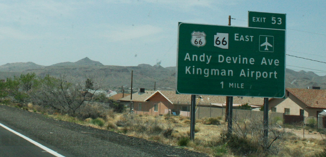
Once we approached Kingman, it was clear we’d entered Route 66 territory.
We went to the historic part of town where a yearly classic car “fun run” was taking place. Streets were closed off and there were vendors, entertainers, and classic cars all over the place.
By now, we’d worked up an appetite and the sign for “Mr. D’z Route 66 Diner” was calling our names. Mr. D’z was once a small cafe & gas station in the 1950’s and 1960’s. It’s now the hub of several annual car shows.
I went with the “Route 66 Bacon Cheeseburger” and a frosty mug of homemade root beer. I do recommend it!
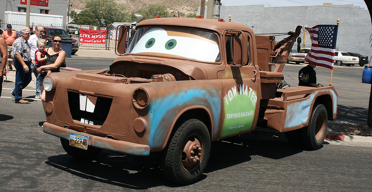
Out front, we saw a few eye catching rides, including this tow truck inspired by Tow Mater from the 2006 Disney / Pixar movie “Cars.” More about Cars later.
Let’s get this Route 66 party started!
Here I’m posing like Vanna White next to a destination marker showing where Jack and I would be headed in the ILX shortly.
Our friend Mike was in town as a judge for the classic car show so we met up with him briefly.
Then, Jack and I were on our way.
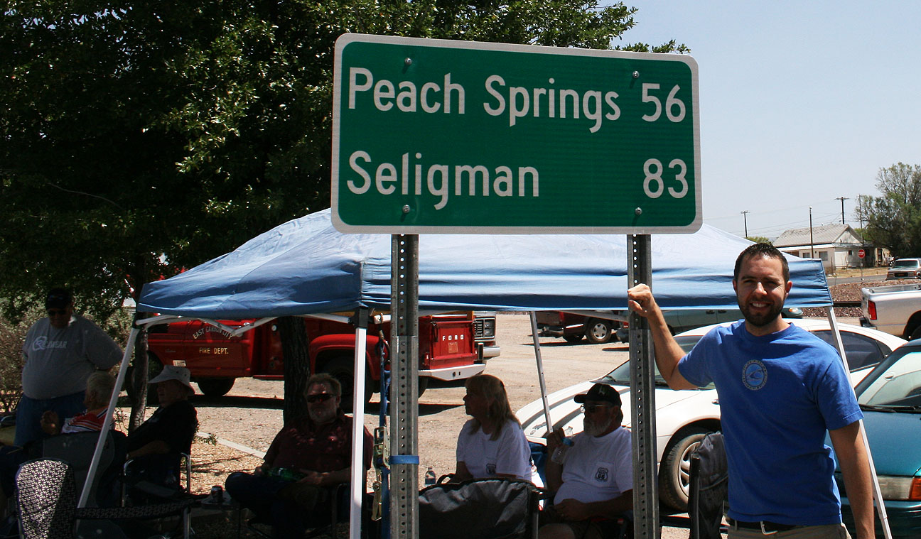
The 83-mile section of Route 66 between Kingman and Seligman is a well-preserved stretch of old 66 that’s stuck in a time warp, and that’s why I wanted to drive there so badly. Traveling the same point-to-point via the parallel Interstate 40 would shave off over 20 miles and probably 1/2 hour of drive time, but this drive wasn’t about speed, it was about taking time to experience the sights along the way.
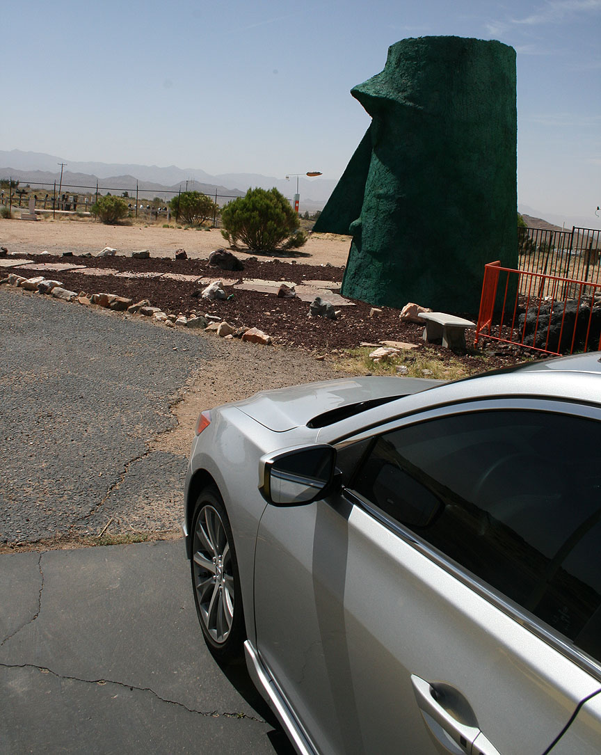
The road heads northwest from the Kingman area and quickly slims down to 2 lanes from 4. Not far up Route 66, we saw the (now abandoned) Kozy Corner Trailer Park. There are a couple special things about this particular trailer park.
First of all, the trash can warns everyone nearby that it’s full of baby rattlesnakes. I didn’t peek inside to confirm that.
And secondly, you might have noticed that giant green head sitting out front. That is called “Giganticus Headicus.” It’s 14 feet tall and was created in 2003 by someone named G. Arnold.
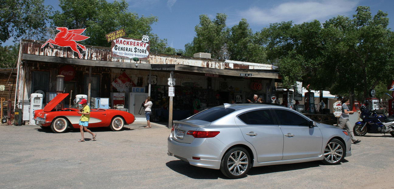
Continuing on, our next pit stop was the general store in Hackberry, Arizona. Here we found all sorts of collector “stuff.”
Antique collectors: plan to spend awhile here.
75 degrees and sunny for our drive – couldn’t have asked for better weather! Speed limits varied from 35-65 and the ILX 6-speed made a great cruiser.
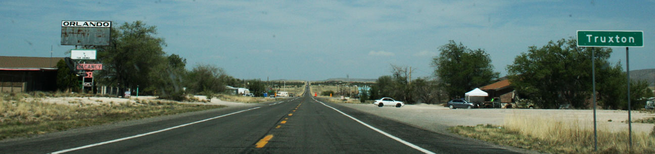
It only takes a blink to miss some of these small towns that we passed through. Truxton is one example. From the entrance of town limits to the exit took only a few seconds to drive.
But those few seconds were entertaining, nonetheless. I enjoyed seeing these old motels and there seemed to be a lot of classic cars parked alongside the road for sale in places like this.
About halfway to our destination of Seligman, we passed through a town called Peach Springs. Traffic through Peach Springs died down sharply after Interstate 40 was opened about 20 miles south in 1978. According to Wikipedia, Peach Springs “survived as the administrative base of the Hualapai Indian tribe but suffered irreparable economic damage.”
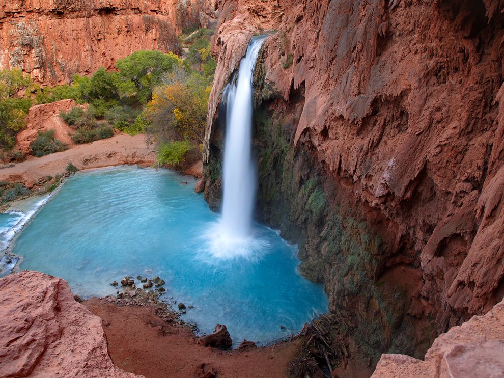
Just 55 miles northeast of Peach Springs, visitors will find the Hualapai Indian tribe town of Hualapai Hilltop. This place serves as the trailhead for an 8-mile hike that drops into the Grand Canyon and now-famous 120-foot-tall Havasu Falls, a place which has been on my to-see list for several years now.
The town itself is pretty run-down with the exception of the Indian-run visitor center.
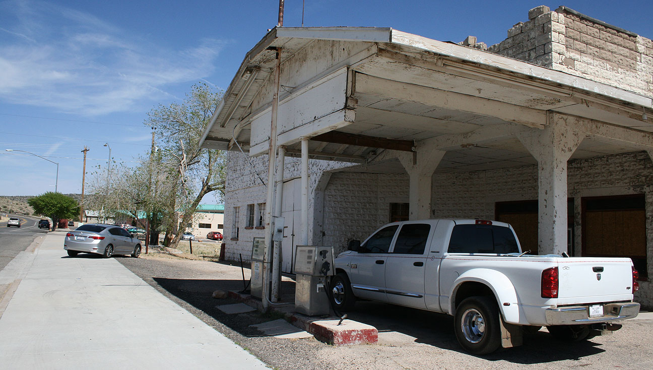
I did find this photo-op worthwhile, though. This is an old service station dating back to the 1920’s.
A nearby informational sign reads as follows:
Historic John Osterman Gas Station: This property was listed in the National Register of Historic Places on March 15, 2012. The John Osterman gas station was one of several privately owned and operated businesses in the town of Peach Springs during the 1920s through the 1950s. The building, constructed by Osterman in 1923, was a vernacular design of poured concrete block and built in the tradition of the “House with Bays” form. It featured an office resembling a small house and a series of attached garage bays. The design, in addition to allowing the sale of gasoline and other automotive products, is indicative of the large amount of repair work the station undertook over the years.
It looks like the pumps out front still read $2.99 / gallon which means it wasn’t closed that long ago.
For the next 37 miles, we dodged tumbleweeds and cruised alongside the train tracks as we continued eastbound. There were several “Burma Shave” roadside sign sequences that I enjoyed. These types of signs were a huge part of roadside America from 1925 until the 1960’s. They are small signs spaced at periodic distances alongside the road to advertise a brand of shaving cream. Here are a few of them that Jack and I took note of:
IF YOU DON’T KNOW
WHOSE SIGNS THESE ARE
YOU HAVEN’T DRIVEN
VERY FAR
Burma Shave
ANGELS WHO GUARD YOU
WHEN YOU DRIVE
USUALLY RETIRE
AT SIXTY-FIVE
Burma Shave
And finally, toward the end of the route:
JUST THIS ONCE
AND JUST FOR FUN
WE’LL LET YOU FINISH
WHAT WE’VE BEGUN
????
The last stop on this historic drive was in the small town of Seligman, home to fewer than 500 people. It’s the birthplace of Route 66 (at least they’d like to think so).
When Disney/Pixar was putting together the 2006 film “Cars,” director John Lasseter met with the business owners in Seligman to talk about the town’s history as a stopping point on the Mother Road. He ended up basing the fictional town of Radiator Springs loosely on Seligman. To jog your memory, here’s the cast of the film, including star Lightning McQueen.
The grammar Nazi in me wanted to step into this gift shop and tell them they’d spelled “memorabilia” wrong, but I guess a misspelled word here and there is what keeps a place like this even more interesting.
I’d heard of Roadkill Cafe but never knew it actually existed. Here Jack is standing with the ILX in front of such a place. The slogan here is “You Kill It, We Grill It.”
Some of Roadkill’s entrees are:
Splatter Platter
Swirl of Squirrel
Big Bagged Stag
Highway Hash
Main Street looks a lot like one would expect. It’s a tourist trap in every way, but I loved it.
For me, the most awaited point of interest had arrived: Snow Cap Drive-In, seen in the background here:
Delgadillo’s Snow Cap Drive-In has greeted motorists for 60 years. Its founder, Juan Delgadillo, died 9 years ago but the enterprise continues serving up great food AND a great cultural experience for those who make a stop there. Delgadillo’s son and daughter run the business today. A 1936 Chevrolet with a Christmas tree attached to the back of it is on permanent display out front (seen at left below).
Where else can you find menu selections like “dead chicken”….
And “cheeseburgers with cheese”? Truly this place is worth checking out if you’re looking for something offbeat.
Don’t get too comfortable, though, because sleeping in the restroom out back is prohibited.
Inside the Snow Cap, the walls are lined ceiling-to-floor with pictures and business cards from guests who have visited since this place opened in 1953. I added my business card to the mix.
The line was fairly long but I was determined to sample something off the menu. Meanwhile, we became acquainted to some of the other visitors. Most were from other countries! Snow Cap had a lot of entertaining pictures and signs, including this one about the company’s credit manager, Helen Waite, that took me a few attempts to understand. Say it out loud a time or two:
These ladies were hilarious. They have a plastic mustard bottle that they “squirt” at customers and a piece of yellow string comes out the tip. I thought for sure I’d have mustard all over my shirt when I looked down. I asked if I could have a small ice cream cone and she brought me a miniature one. Then I asked for a lemonade and she said, “Would you like ice with that?” I said, “Yes please,” and this is what she came out with:
The jokes kept rolling when she asked if I wanted a “straw” and she handed me a piece of hay instead. When it was time to get my change back from a $20 bill, she started passing out my change to OTHER CUSTOMERS. Ha! We got all that cleared up and headed outside… via the door with two different handles. Did I say this place is offbeat?
Jack and I wandered around the backyard of Snow Cap while we enjoyed our vanilla ice cream cones.
That pretty much wrapped up our Route 66 adventures as we soon got on Interstate 40 and took it to Highway 89. After heading south on Highway 89, we passed through the tiny communities of Paulden and Chino Hills in the 55 miles until we reached Prescott, then we headed over to Interstate 17 via Hwy 89A and then Hwy 69. I enjoyed rowing the 6-speed ILX through its gears on these back roads.
Later in the evening, I met up with my friends Kevin and Kelvin. Kevin is the proud new owner of Modern Steel Metallic 2013 Honda Accord EX. After having driven a Toyota Corolla for 12 years, I nudged Kevin into the Honda dealership and he was really impressed with what the Accord had to offer. He’s thrilled with his new ride!
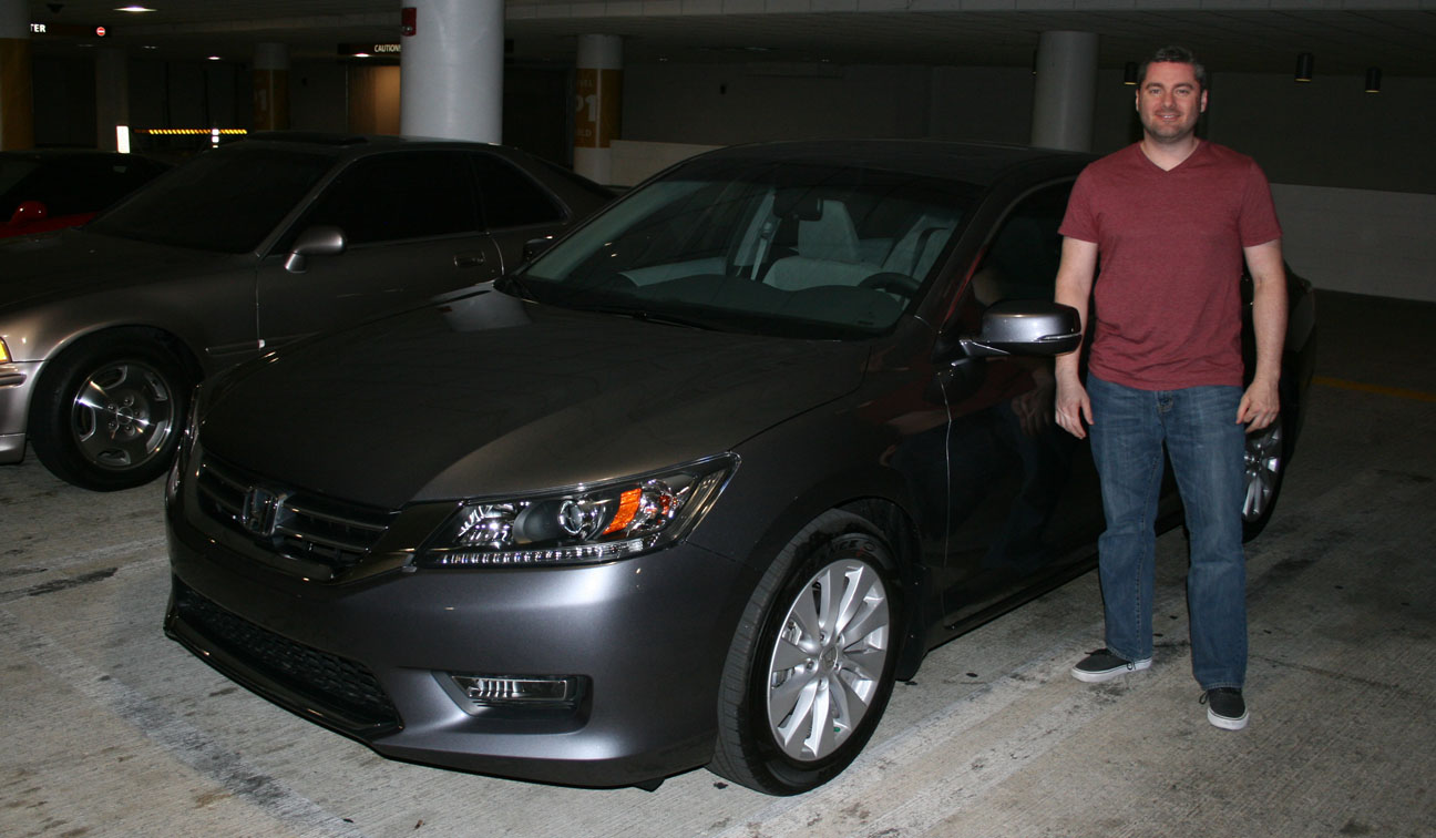
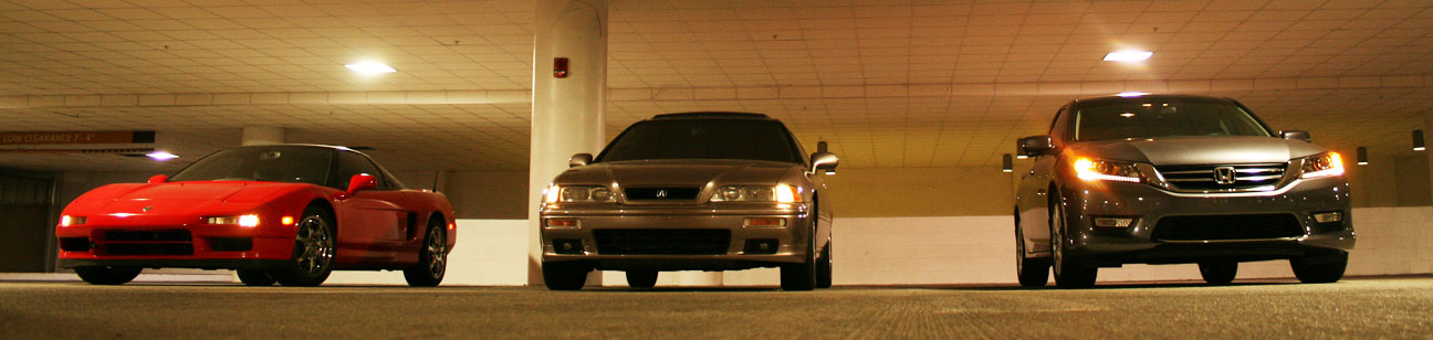
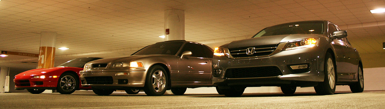
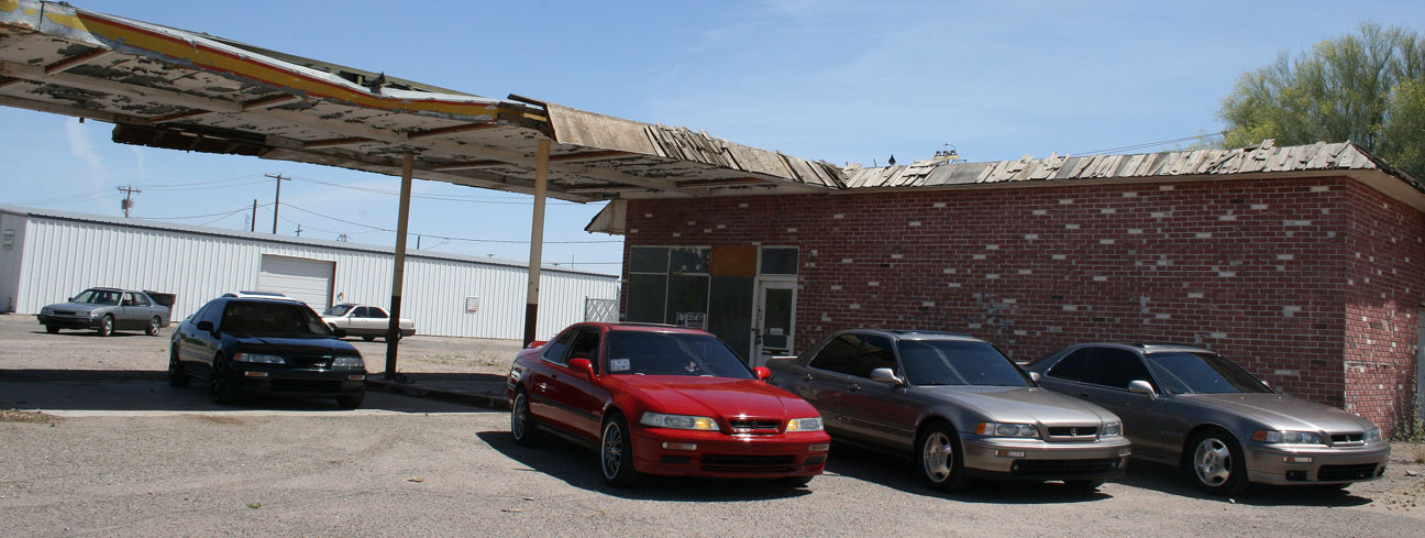
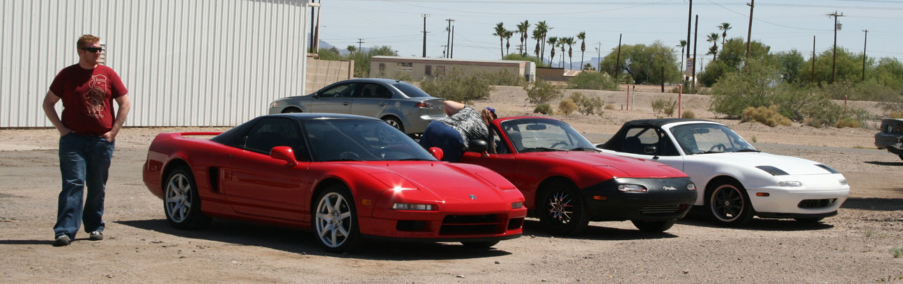
We got a few pictures with Kelvin’s 1993 NSX, my 1994 Legend, and Kevin’s 2013 Accord at a parking garage in Scottsdale.
Here’s a family portrait if I’ve ever seen one! These people are as crazy about Acura as I am.
There aren’t quite enough Acura ILX owners to get a meet together in my area yet, but I’m still hanging out frequently with the old Legend crowd. I’ve been going to Legend meets for over 10 years. This weekend, I got together with a bunch of other Acura fans and we took a scenic drive to lunch. Final stats:
8 Legends
2 Miatas
Trip Distance: 192 Miles
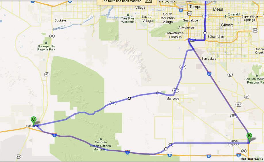
This was our initial meet-up in Casa Grande, Arizona.
We made our way via Florence Boulevard to Interstate 8 which would’ve led us to San Diego, California if we stayed on it about another 5 hours. Exiting at Gila Bend, this sign gave an idea just how close to the Mexican border we were.
As the entrance sign at the west end of town announces, Gila Bend is home to fewer than 2,000 people. Or, more specifically, “1,700 friendly people, and 5 old crabs.” Thankfully, we didn’t meet any of those crabs during our short visit.
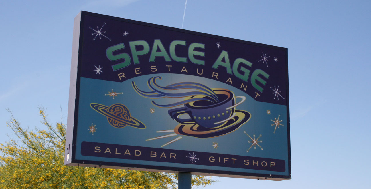
Gila Bend was founded in 1872 and named for a 90-degree bend in the Gila River near where the town is located. The Space Age Lodge and Restaurant opened in 1963 and has been a signature landmark on the main road through town ever since.
On Saturday, our group took over part of the dining room and enjoyed the space-themed decor as well as the cuisine. The chicken quesadilla was most excellent, and if my friend Ari’s chocolate milkshake tasted half as good as it looked, I bet that was tasty too. The restaurant itself is also known as “Outer Limits.”
If it’s offbeat, I’m probably going to want to eat there! The theme here reminded me a lot of the Red Planet Diner in Sedona, Arizona where I went with some friends back in January.
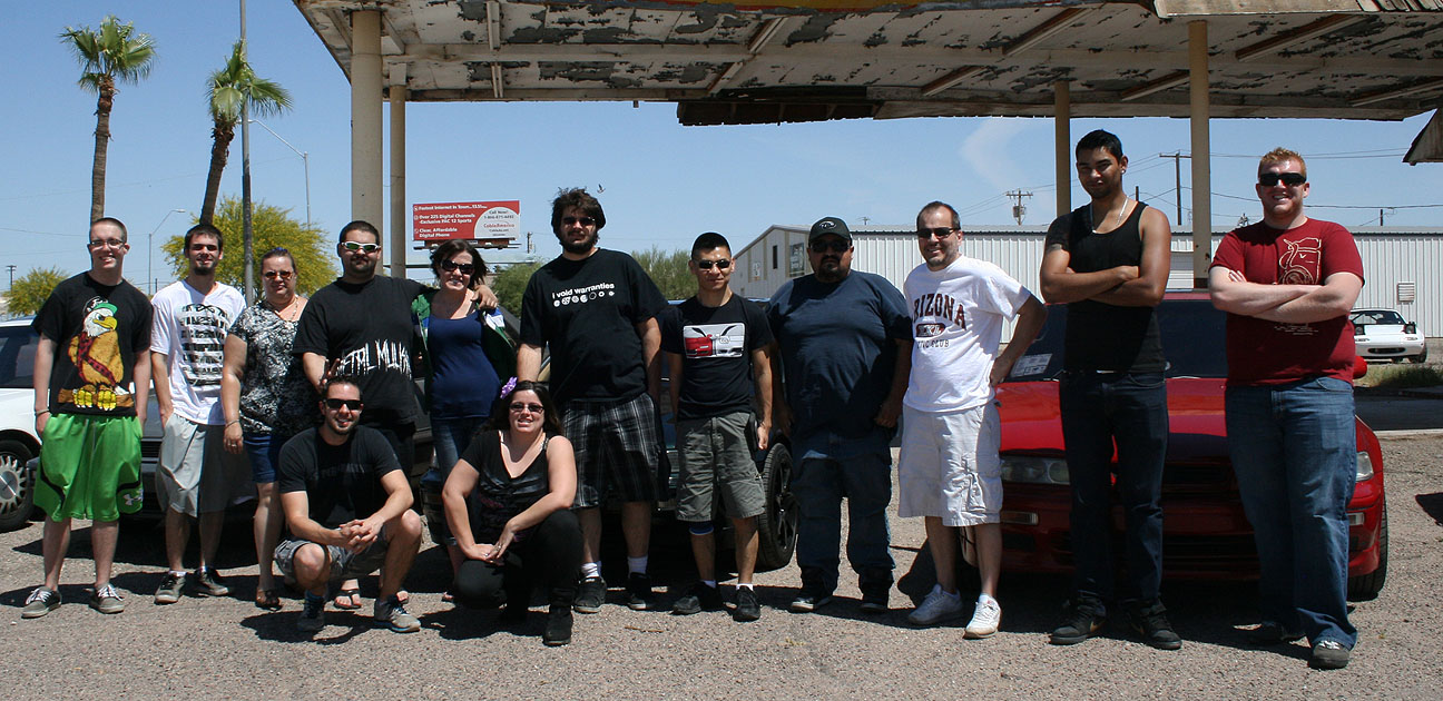
Joe, Michael, and Ari
Tyson, Robert, and Gabe
Kelvin and Ian
There was a special occasion for our Legend meet. Long-time Legend enthusiast Rosalinda chose to spend her 29th birthday with us. Mark and Rosalinda have shared many of their special days with their brothers and sisters from the Acura family. Even their wedding in 2009 had multiple individuals from the Legend forums invited.
Here’s a video of our group’s talent (or lack thereof) at singing happy birthday to her:
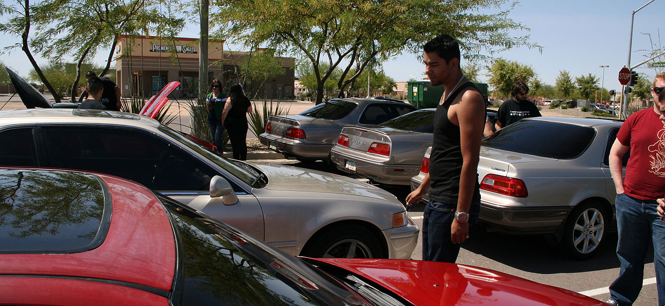
Back outside, it was time to line up the cars for a traditional photoshoot. This looks like we’re preparing for some type of group huddle but we were really just shooting the breeze and talking cars.
Here are the individual rides and a little bit of information on each. First is Austin’s 1987 Legend sedan. This car is was the oldest in the bunch but still ran amazingly. Austin swapped the transmission on this car from an automatic to a 5-speed several years ago. He also owns a Sherwood Green 1994 Legend GS. Legend owners, I’ve found, often prefer to own multiple versions of the car.
This is Gabe’s 1992 Legend LS coupe: yet another Legend that has at one point in its life undergone major surgery. This car is special because the motor itself is in fact out of a 1997 Acura 3.5 RL. Gabe’s car is equipped with a 5-speed manual transmission and he’s got a lot of nice upgrades both inside and out.
Here’s the newest member of our Arizona Legend owners club: Joe. Joe picked up this 1995 Legend LS coupe just a couple of weeks ago from a local craigslist listing. It’s a Cashmere Silver Metallic automatic with about 150,000 miles on it. Joe is glad to be onboard with the Legend family and aside from an intermittent ABS light illuminating on the dashboard, says that the car is running great.
Here’s Jordan’s 1991 Legend L coupe. Jordan’s done some motor work on this one. Instead of being equipped with a “Type I” 200-horsepower engine, it’s been swapped to a 230-horsepower “Type II.” Jordan has a full exhaust system and some other performance upgrades to keep himself ahead of the pack when it comes to acceleration.
And this is Rosalinda’s 1993 Legend sedan, with the appropriate license plate “93LEGND.” This is a custom two-tone paint job that is one of a kind. The car is running on 17″ wheels from a 2004 Acura TSX. This is actually a set of wheels that I used to own and I told to the Bandonis a few years back.
Here’s Michael’s 1994 Legend LS sedan. This car is painted pearl white but it used to be Desert Mist Metallic like mine. Michael’s got some suspension upgrades like Koni red struts and he does all the work himself.
This is my 1994 Legend GS sedan 6-speed. I’ve had it for 5 years but it usually gets driven fewer than 2,000 miles per year. When I picked this car up, the intent was to have a replacement for the Legend coupe, which at the time had over 300,000 miles on it and I thought might be nearing the end of its useful life. As we now know, that Legend coupe never ended up dying. The sedan turned over 144,000 miles on its way to the meet.
These are some rolling shots from our drive westbound on Interstate 8 from Casa Grande to Gila Bend.
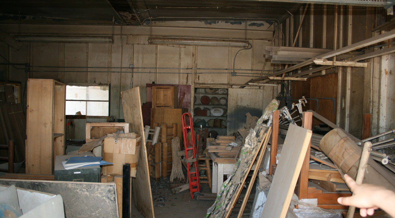
The abandoned gas station where we took our pictures was a destination in itself. Anyone who follows my blog knows that I have a fascination with creeping around abandoned places, so I couldn’t resist taking a peek inside this one.
The roll-up door on the side of the building was already open, but inside it looked like just a bunch of junk.
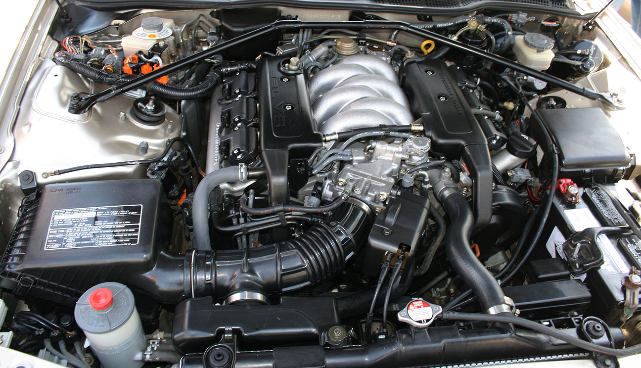
Rosalinda’s 1993 Legend definitely won the award for the cleanest engine bay. Immaculate!
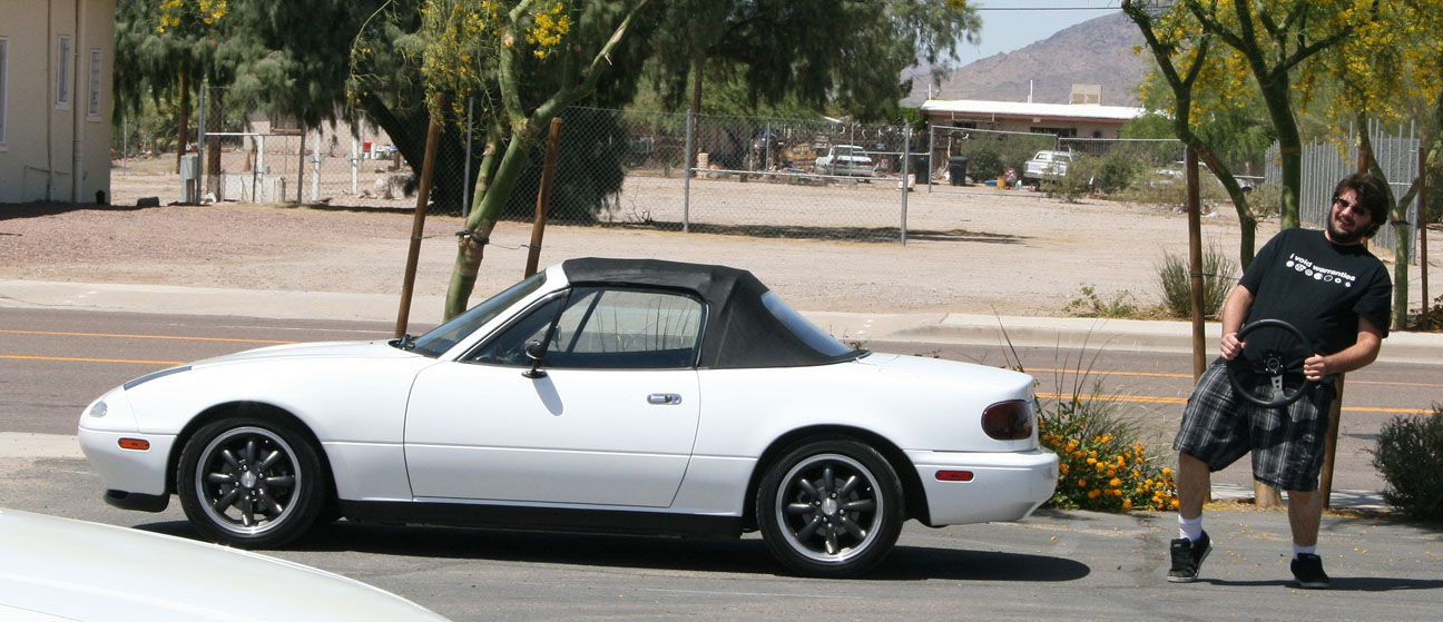
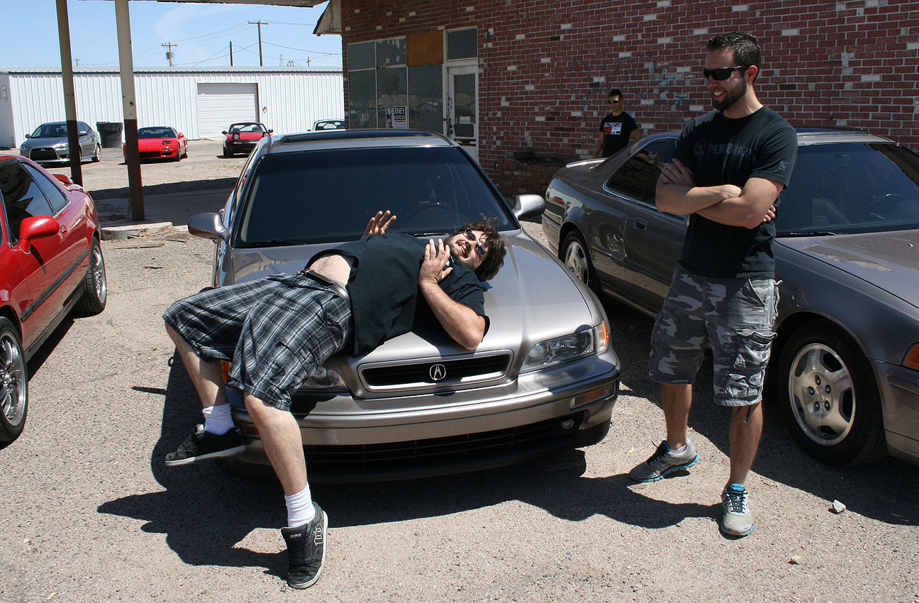
It seemed only fitting that Mark wore his “I void warranties” T-shirt, based on the Miata he was driving.
Here’s Mark (and his steering wheel) goofing off in the Space Age parking lot. Mark’s Miata packs quite a punch. It’s got over 270,000 miles on the body but the entire drivetrain has been enhanced.
Turbo! Mark’s 5-speed Miata would undoubtedly out-accelerate and out-handle any of the Legends at the meet. He’s also equipped it with a full rollcage. This is a race-ready ride if I’ve ever seen one.
And, it’s tradition for Mark to sprawl out across the hood of my car at meets so we carried on that legacy.
This is Ian’s 2012 Mitsubishi Lancer. Ian’s been a part of Drive to Five since I first met him over a year ago and he was driving a Civic Si at the time. The Lancer is a nice replacement!
A few other pictures from throughout the day.
Gabe captured this picture of me driving back to the Phoenix area via Highway 238.
It was great to once again reunite with old friends and share our love for these great cars.
Today, I did a little junkyarding in the 2013 ILX. There’s a local “pick & pull” yard in Chandler, Arizona where you can pay $2 (and bring your own tools) and help yourself to any parts you’re looking for.
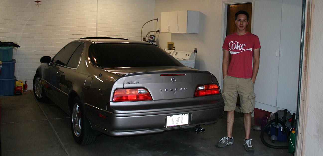
Among the treasures I walked out with, I found a “Type II” badge from the intake manifold of this 1994 Legend GS sedan automatic.
It looks right at home placed on the 2.4 liter powerplant of the ILX, right? Ha!
I have always loved the bodystyle of the 1987-1990 Acura Legend coupe like this:
I found one of those cars in the junkyard, too. It was in pretty sorry shape.
However, the taillights looked good and they are particularly rare, so I grabbed them. The 1990 model year was the only year when the lenses were clear / red as opposed to amber / red. I’ll clean these up and re-sell them.
Gotta love scavenging. Hope everyone’s had a nice weekend!
The Phoenix-to-Tucson Interstate 10 corridor is already a familiar route for my Acura ILX 6-speed. I’ve driven those 120 miles many times — it’s nice to escape the big city (Phoenix metro area is home to 4 million) for a smaller town feel. Tucson has just over 500,000 residents and affords great attractions — and more importantly, great roads.
Many months ago, I learned about a must-see “driver’s road” called Gates Pass that existed in the mountains west of the Tucson valley. It wasn’t until today that I was able to actually experience it.
Making my way out of the Phoenix area, I veered east on Interstate 10 from Loop 202.
About 96 miles after hopping on the 10, I exited Speedway Boulevard in Tucson and noticed that there were signs guiding me to Old Tucson to the west.
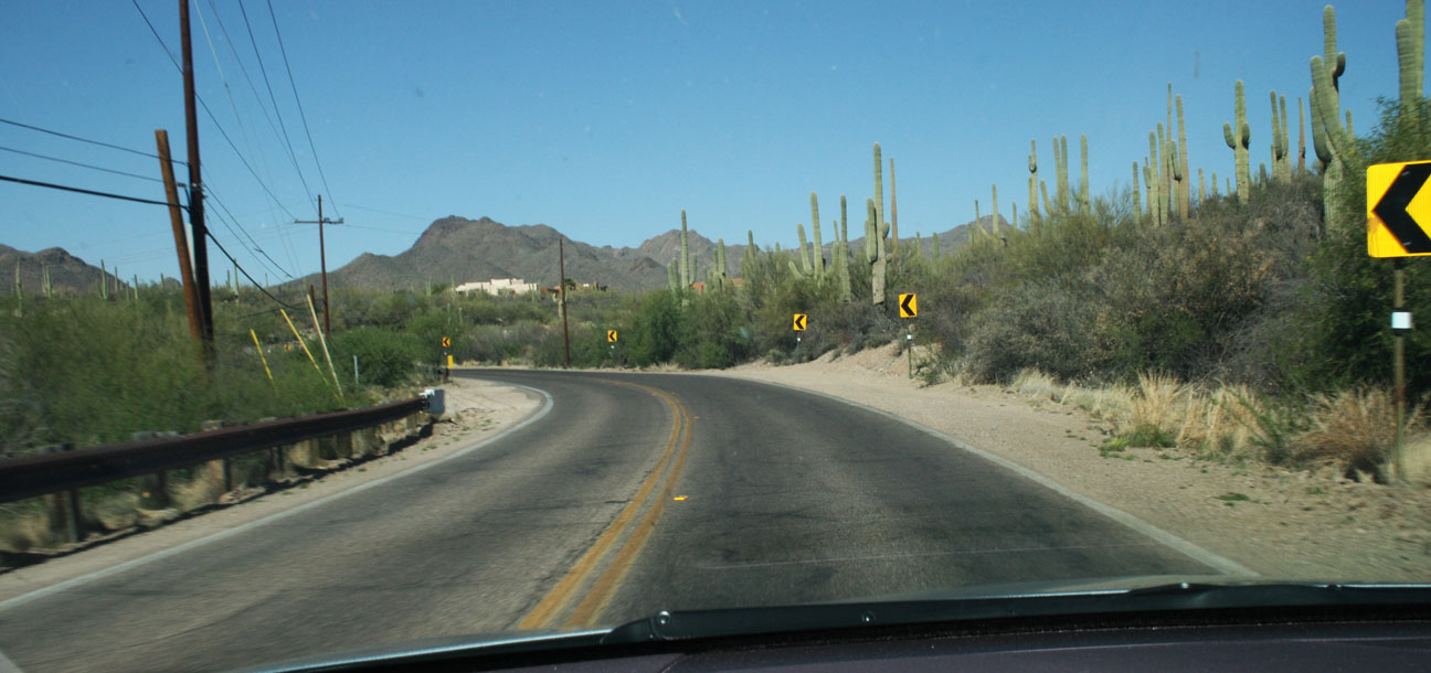
Saguaro cacti thrive in this dry, desert environment. Speedway Boulevard soon slimmed down to 2 lanes from 4, and I started seeing warning signs for Gates Pass.
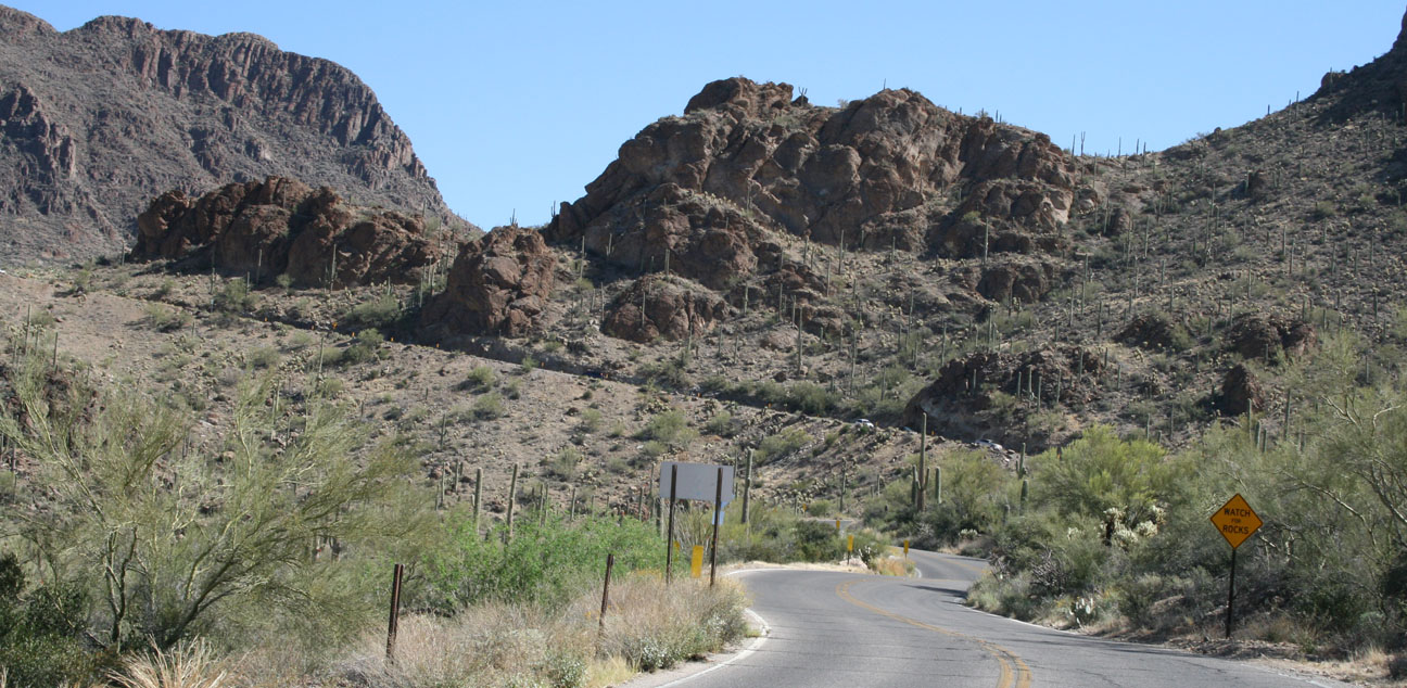
Gates Pass is a scenic stretch of road that was named after Thomas Gates. It originally dates back to 1883 when he wanted a shortcut through the mountains. The road officially starts 7 miles west of Tucson after exiting Interstate 10 at Speedway Boulevard. Though only a very short 6 miles in length, it’s notorious for being dangerous.
Gates Pass is one of the most dangerous areas to drive around Tucson. The road is narrow and winds around the edge of a large mountain with just a few feet space between the edge of the road and a deep drop off to the valley below. Because of this driving danger, Gates Pass is not open to commercial and large vehicles over 40-50 feet long.
Well, here we go!
Entering Tucson Mountain Park, which encompasses about 20,000 acres of land and established in 1929.
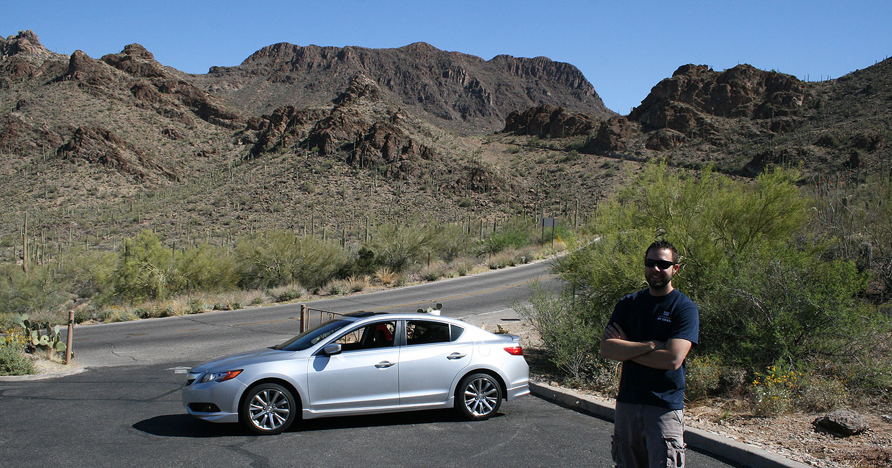
Getting creative with camera angles. I took it slow and enjoyed the scenery. Thankfully, there was very little traffic.
I pit stopped at a pullout to enjoy the view for a few minutes.
And soon thereafter, I descended the cut of road seen in the background here. No guardrail, just some 10 mph curves that have to be handled very carefully – especially when bicyclists are encountered (which is what happened to me!).
I met a very nice couple who took this picture for me. I asked, “Make sure the car’s in the picture too,” which of course led them to ask why. I ended up spending about 15 minutes telling them everything about the car and the blog. They loved it! And I did, too.
Continuing on Gates where the terrain leveled out a bit. There were a few more pullouts for photo-ops.
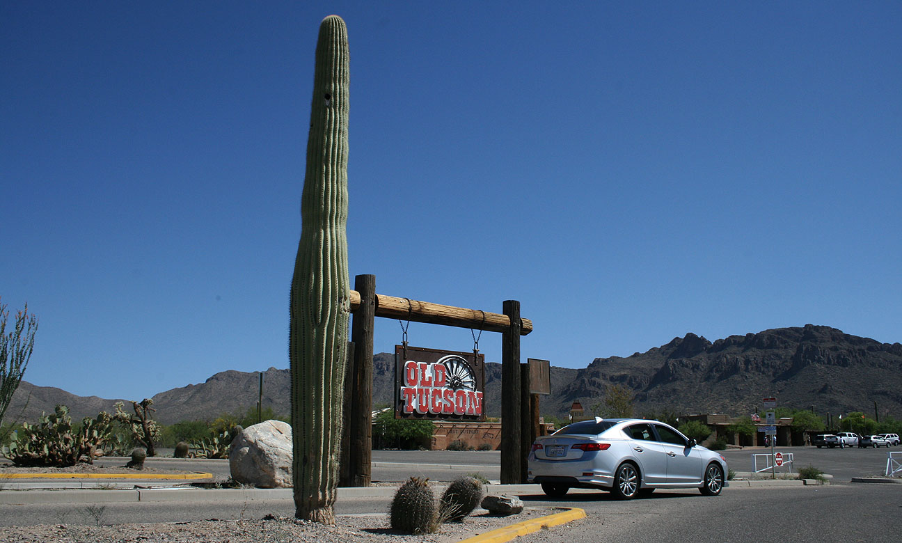
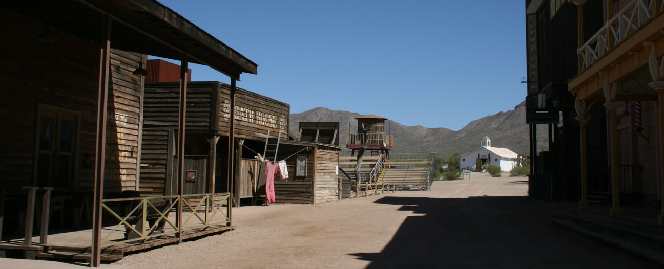
After my drive through Gates, I made a stop at Old Tucson. This is an old movie set dating back to 1938. It was first used as a backdrop in the movie “Arizona” (1940) but has since been used in over 400 movies, TV shows, or other features, most of them Westerns.
Entry is $17 for adults but Arizona residents get a $3 discount. I arrived just in time for the doors to open at 10:00 a.m.
When I set foot into Old Tucson, I truly felt like I was teleporting myself 150 years into the past. Dirt streets surround over 60 buildings that have been created as part of movie sets over the years. Even the employees wear period-correct clothing and ride around on horses. I had to be mindful to watch the ground for horse droppings!
Here’s a (poor quality) video that I shot with my iPhone while wandering around. The soundtrack that I added seemed very fitting.
I took a 30-minute walking tour with about 25 other people. Old Tucson gets its name because it’s actually modeled after the original Tucson, Arizona from the year 1863. When Old Tucson first opened, Gates Pass was only a 1.5-lane dirt road and was very treacherous. Still, 15,000 people attended opening day and paid 25 cents each for admission.
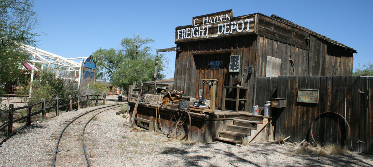
This original 1939 adobe building is modeled after the first school house in Tucson, built in 1868. In some films, though, this building was used as a bar instead.
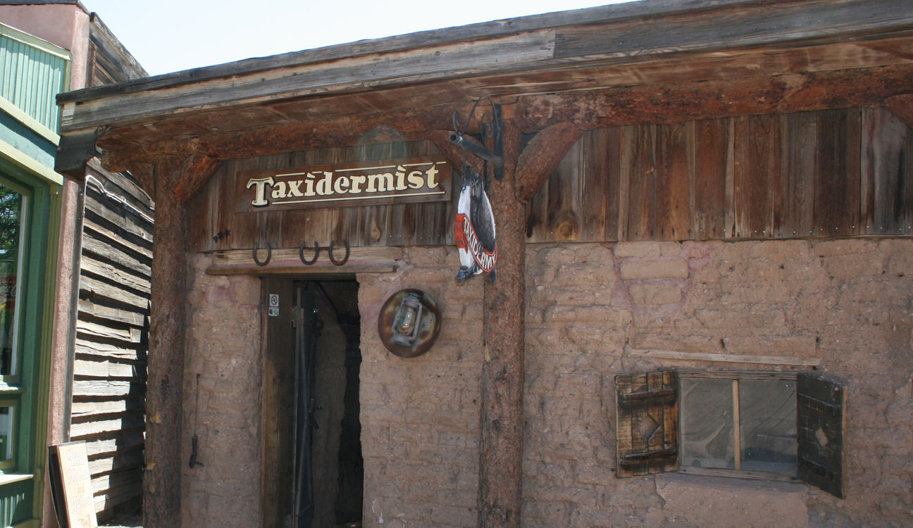
John Wayne, Clint Eastwood, Elizabeth Taylor, and Kurt Russell are just a few of the stars who have walked these streets. This taxidermy shop is one of the original 1939 adobe buildings as well.
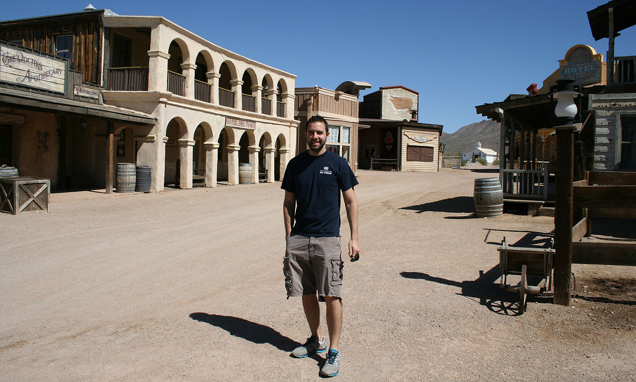
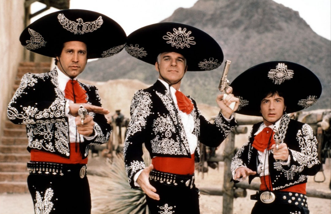
Here I am standing in front of the Hotel Del Toro. This was used in the 1986 movie “Three Amigos.” That film was supposed to be set in Mexico — thus the reason for the Spanish looking architecture seen here.
I could almost feel the presence of Chevy Chase, Steve Martin, and Martin Short! The mountain behind them in this picture is clearly visible while standing on the main street in Old Tucson.
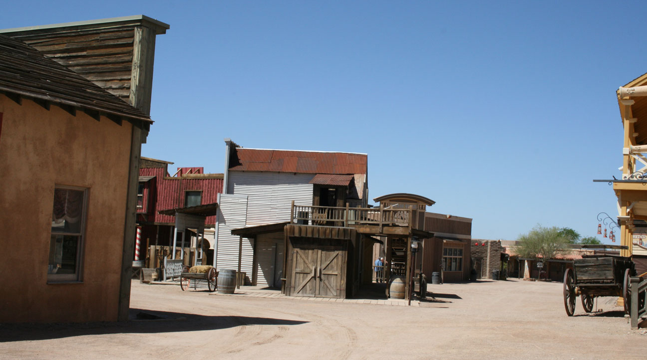
Here are a few other shots from around the town. There are various shops throughout the grounds.
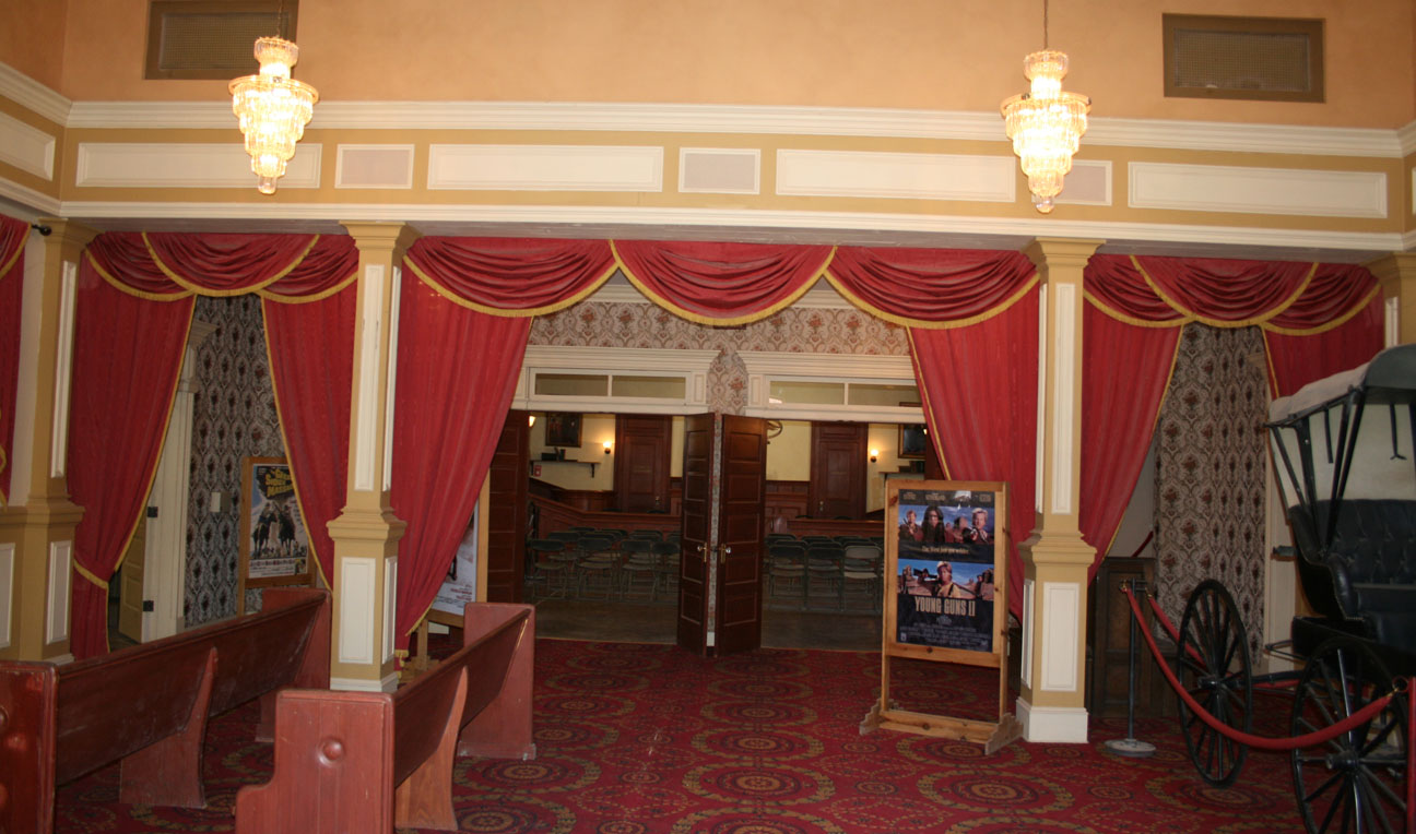
The Saloon and Hotel below doubles as a 13,000-square-foot sound stage and it was built in 1968.
In the distance below, the Mission can be seen. Unlike most of the other buildings in Old Tucson, this is not a “four-sided” building – it’s only a facade. The original Mission burned down in a 1994 fire and the replica didn’t have an interior.
Stagecoach rides were available at the O.K. Corral for $3. I didn’t take the time to do this, nor the (free) 7-minute train tour, but the next time I go back I will definitely check them out!
Speaking of trains, on display at the north end of the facility is this 1872 steam locomotive. It was used in the film Union Pacific in the late 1930’s, as well as the Clint Eastwood film “Joe Kidd.” At one point during this locomotive’s life, it was even shipped to Switzerland to appear in a movie there.
Here’s a look inside the courthouse, furnished and ready for its next film debut.
No Acuras allowed. We travel by horse & carriage around here!
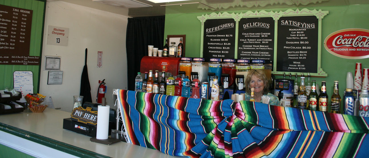
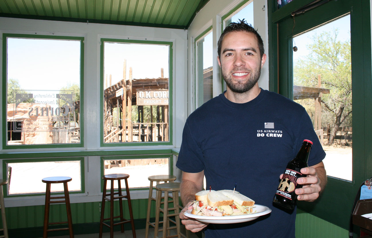
This was my favorite place in all of Old Tucson: Rx Elixir. It’s a sandwich shop and soda counter.
Peeking out from above that colorful Mexican blanket is Sharon, the operator of the Rx Elixir. I went with the Cold Turkey & Cheese Sandwich for $9. It was a huge sandwich! Sharon fixed it up with sourdough bread and some homemade pesto mayonnaise. I highly recommend it.
Here I am about to indulge in my delicious and wholesome lunch. That ice cold Sioux City Sasparilla root beer really hit the spot to wash it all down.
On my way out, I went inside another of the buildings and saw this prop cannon that was used in the John Wayne 1960 film “The Alamo.”
Last shot with the ILX next to an original lift on display out front.
From Old Tucson, I headed north on the curvy, two-lane Kinney Road. This was a great driving environment for the ILX with its tight suspension and 6-speed transmission. I drove past the western region of Saguaro National Park.
That’s a wide road!
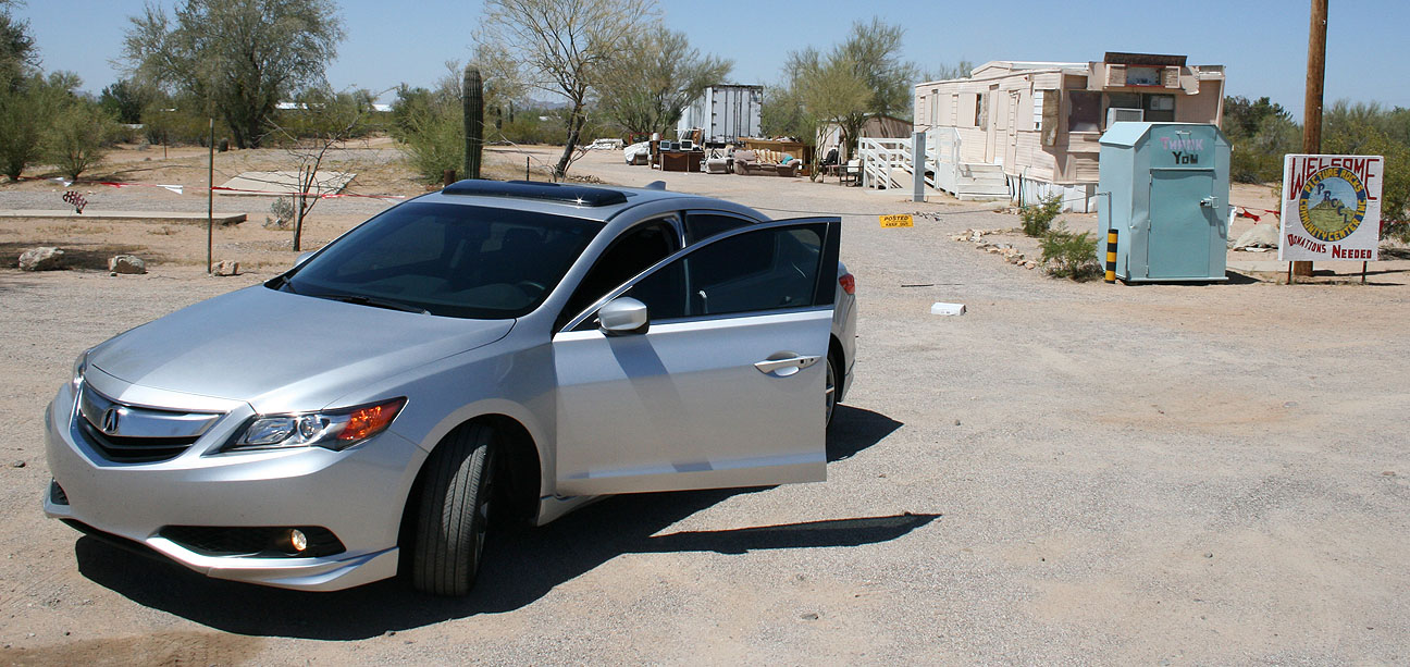
This small wooden sign caught my eye in a tiny town called Picture Rocks (population: 8,139).
The Community Center, as it turns out, is that trailer in the background below. It’s no wonder the sign says “Donations Needed.” This place has seen better days!
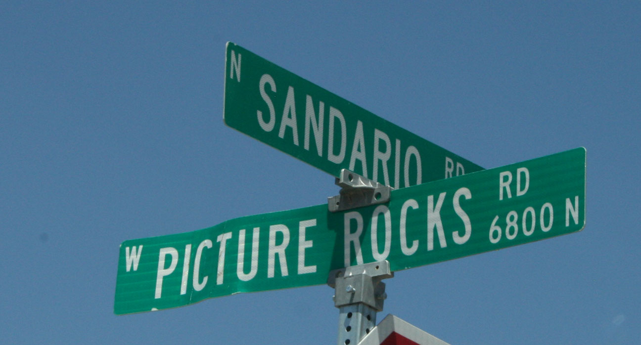
Just a bit further up the road at the intersection of Sandario & Picture Rocks, I found a very special place.
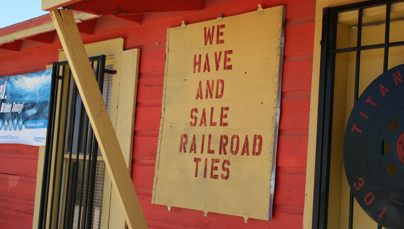
Ladies and gentlemen, I think I’ve found my next auto mechanic: Titan Tire & Wheel. Just to be sure you won’t miss it, it’s painted bright red and yellow.
But wait! There’s more. They also have and “sale” railroad ties, in case I’m ever looking for any! Talk about one-stop shopping.
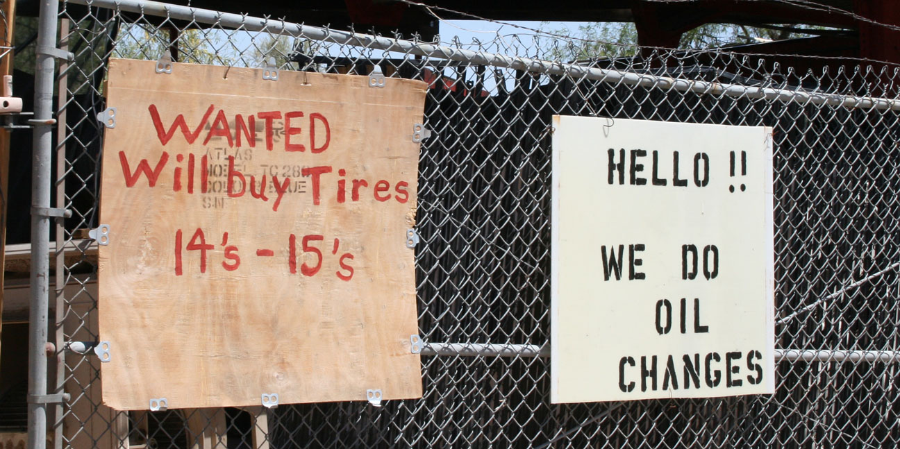
Batteries too! Well, I’ll be darned.
Whoa! HELLO!! They do oil changes. Think they’ve got 0W20 oil in stock for my ILX scheduled maintenance?
Kidding aside, I love places like this. And I’d happily let them work on my ILX. Maybe just for a tire rotation.
🙂
The ILX flew past this lineup of mailboxes so quickly that I didn’t have time to count them, so I promptly pulled over and looped back. There were 37 of them in a row! Some in decent shape, others barely standing.
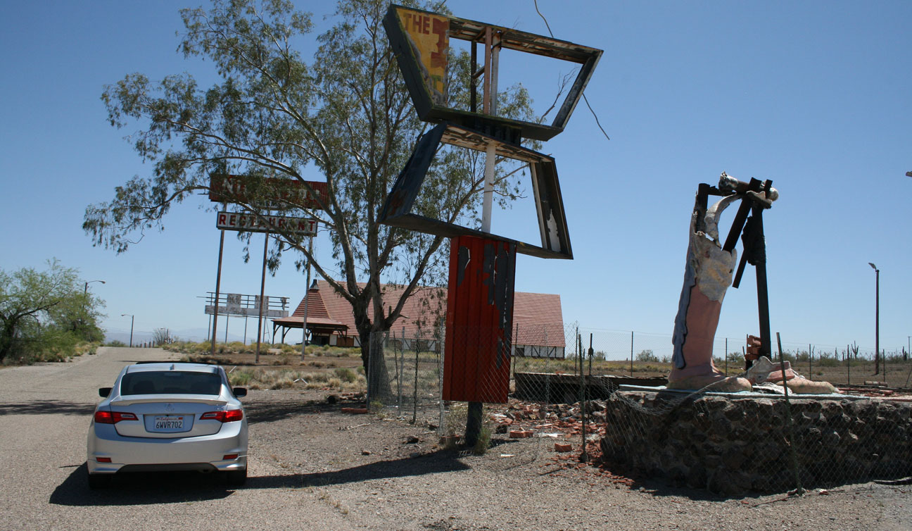
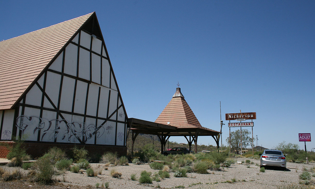
There was just one more place that I wanted to check out on today’s adventure: Nickerson Farms Restaurant in Picacho, Arizona off Interstate 10. After having inhaled that turkey sandwich at Old Tucson not long before, I was far from hungry. But Nickerson isn’t the place I’d go to satisfy my appetite anyway. You see, the restaurant’s been closed for over 30 years.
That old boot next to the sign presumably used to have another one next to it.
This particular Nickerson Farms is believed to be the best-preserved of of all the Nickerson “hulks” that are still standing today. It was in operation from the early 1960’s until 1979. Since then, it’s been completely abandoned.
In the below picture, see the vehicle parked in the shade underneath the arch that’s farthest away? That is a blue 1980’s Pontiac Sunbird. When I pulled up behind it in the ILX, a young man shot up lightning-fast in the driver seat. He’d been napping in there. I think I gave him the scare of his life this afternoon! After parking, I assured him that I was “nobody,” and that I didn’t care if he was catching some shuteye on the shade. It looked like he’d been living in his Pontiac for some time.
Since the building is clearly visible from Interstate 10, it’s become the victim of plenty of acts of vandalism over the years. Windows are boarded up. The brick facade on the exterior has crumbled entirely.
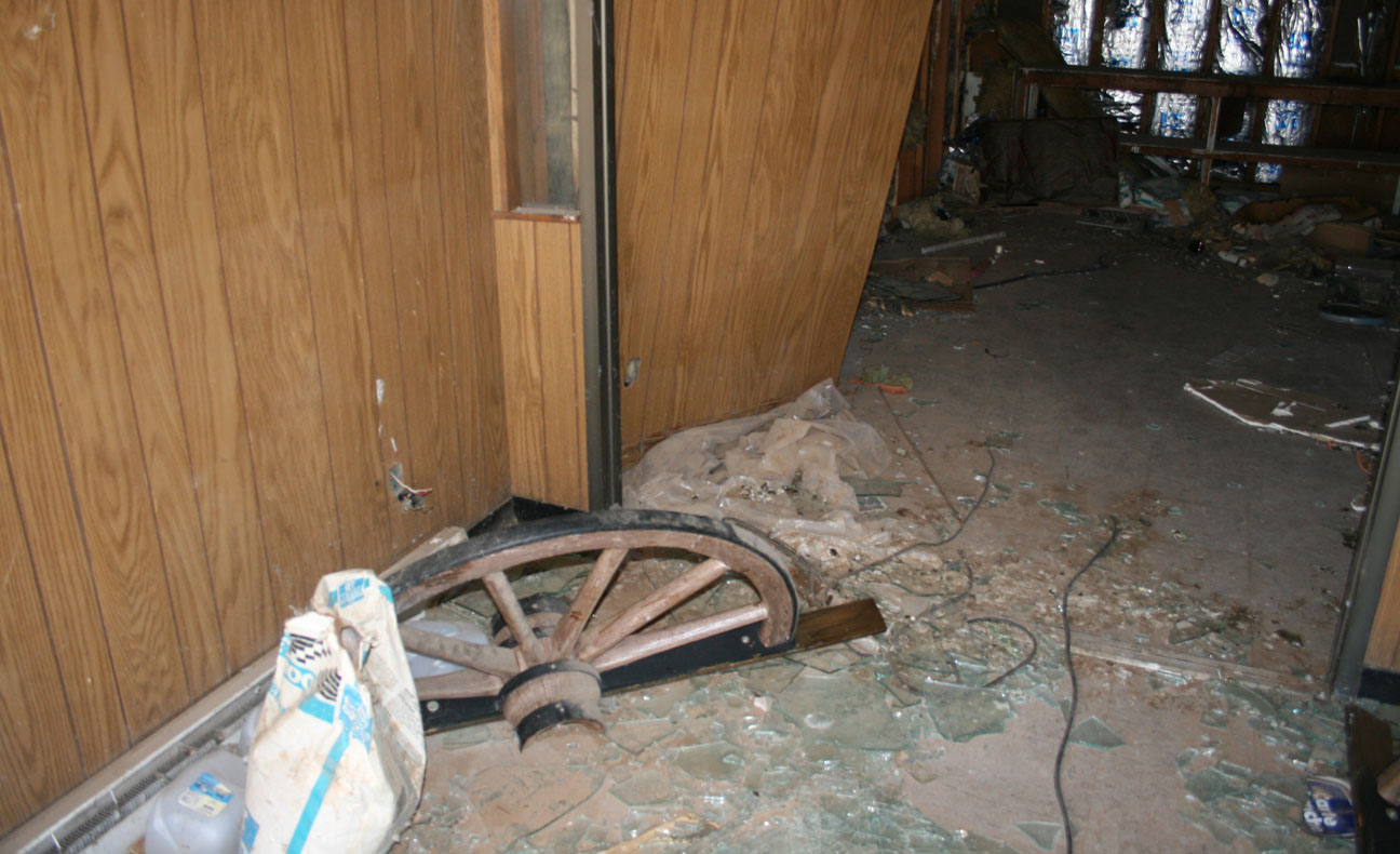
The dual glass doors at the entry way were broken out. I ducked underneath the handle and let myself inside the building to take a look around. I was glad to be wearing tennis shoes instead of flip flops due to all the glass on the floor.
The creepiest part about this place was that the original red Naugahyde diner booths are still there, covered in over 3 decades worth of dust. There were enough holes in the walls to allow a little bit of natural light inside the building, but I relied on my camera’s flash to capture the scene better than my eyes could.
Books and garbage littered the floor. I looked down and saw this little gem: A 1990 Buying Guide Issue from Consumer Reports. I couldn’t resist flipping to the section on Acura vehicles. Page 165 has the comments on the Acura Legend, which at the time was still in its first generation:
The Acura Legend felt sporty. Handling was precise and acceleration strong. Seating was roomy and very comfortable. The Legend has an excellent repair record. Bumper test damage: None.
Time to get out of there – this place was giving me the creeps. Back out the broken glass door I went.
And homeward bound with yet another fun Acura adventure under my belt. Thanks for coming along as always!
Ham, sausage, bacon and sharp cheddar. Those fine ingredients are the makings of the Country Combo omelet at my favorite brunch place in Phoenix: The Good Egg on Central Avenue. On Sunday morning, the Acura ILX made its way there with its cousin, a 2006 TL owned by a friend of mine.
Jeremy’s TL has just 111,000 miles on it. The 2004-2008 TL bodystyle has been a longtime favorite of mine. This TL is powered by a 270-horsepower, 3.2 liter 24-valve V6 engine. Jeremy regularly gets 29 mpg on the highway.
After brunch I had a few minutes to kill so I continued down Central Avenue to the south.
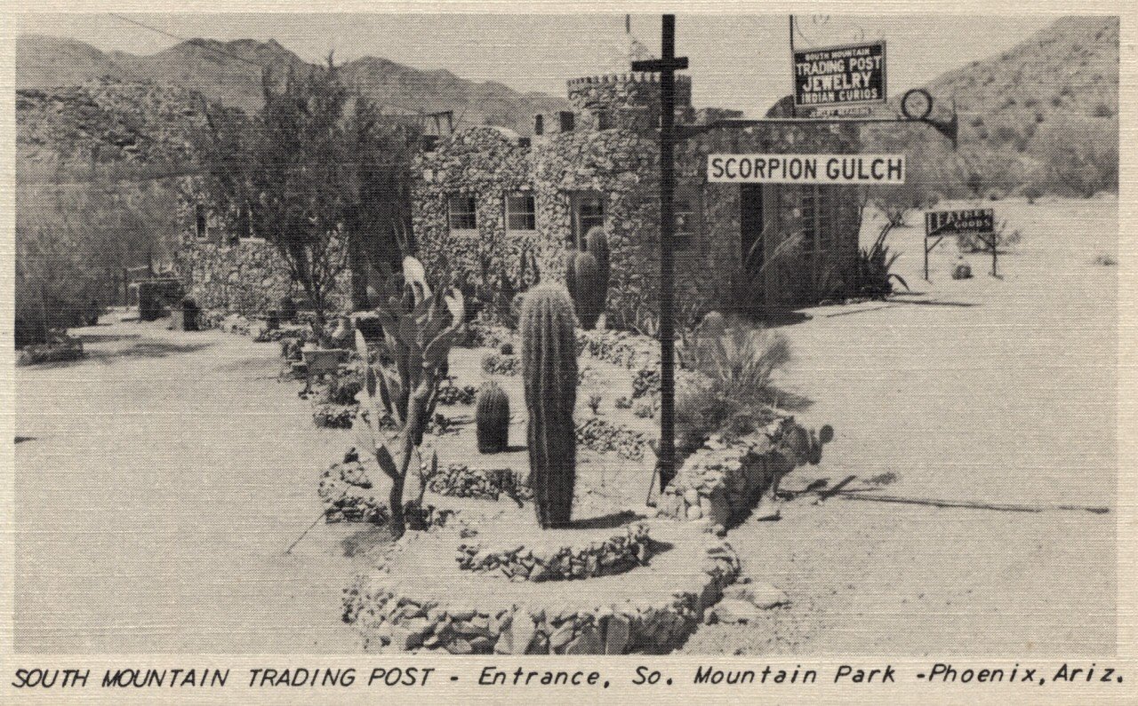
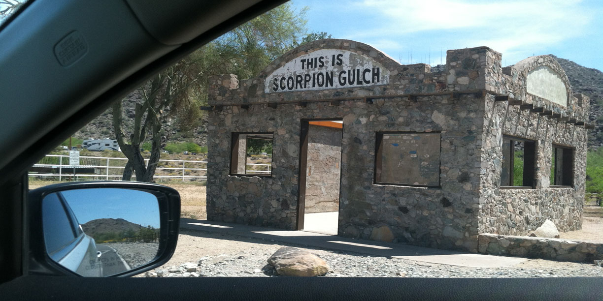
At the entrance to 15,000-acre South Mountain Park lie the remains of a building that was once a candy store. The building was constructed in 1936. As of the 1960’s when the owner was in his 70’s, it was still in operation. It’s called Scorpion Gulch. Here’s a picture of the area from an undated historic archive:
Oddly enough, I’ve lived in Arizona for over 7 years and never even seen a scorpion, but apparently they’re out there. I’ve probably jinxed myself and will have one in my shoe tomorrow morning when I get dressed.
During late 2012 and early 2013, a “stabilization” effort took place at Scorpion Gulch wherein new window frames were outfitted for the building and the roof was removed (it was too dangerous before). Only the walls remain.
From a 1966 article about Scorpion Gulch:
In 1936, Lunsford purchased the 100 feet of frontage. He personally hauled the rock and built the store with living quarters attached where he and his wife lived and operated the business. His wife died several years ago and Bill now lives alone.
He doesn’t make much money, what with giving away bottles of pop, and he is one of the few remaining merchants who sells penny candy. He probably gives away more candy than he sells. He just can’t resist giving away candy and pop to his “grandchildren” who lack the necessary money.
It would’ve been great if Scorpion Gulch was still in business so I could buy a drink and a treat.
Does anyone else get nervous like me when they see these “SEVERE TIRE DAMAGE” devices that you can’t back over?
Fun with a mirror in a parking structure in central Phoenix.
And some raindrops later in the week that did little more than muddy up the car.
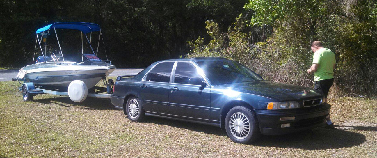
At the other end of the country, Alan in Florida is putting his 1992 Acura Legend sedan to the test. He recently pulled a boat with his car. Now there’s a fine looking tow rig if I’ve ever seen one. I’m sure he turned a few heads at the marina.
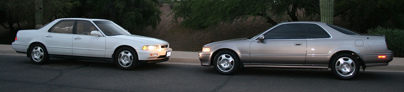
On Monday night, I had a visitor from out of town. Jake has a 1992 Acura Legend LS Sedan in Sirius White Pearl with 135,911 miles on the odometer. He’s had it since Fall 2011 and and it’s in excellent condition!
Keen-eyed Legend enthusiasts will notice that Jake ditched the factory 15″, 20-spoke from 1992 and replaced them with some really nice refinished 16″ GS wheels. His updates carried on to other parts of the car, too.
Up front, a body-color front grille graces the hood. And inside, Jake has incorporated a GS shift knob. He went to great lengths to track down some dual piston “Type II” brake calipers and installed those too.
Jake’s next plans for the Legend are some new leather and possibly some window tint.
Thanks for stopping by, Jake!
Finally, I recently came across a list of the 27 “official” Parkways, Historic Roads, and Scenic Roads in the state of Arizona. It’s time to start crossing these off. Here’s the list (website allows download of the 6-page PDF).
One in particular that caught my eye was Sky Island Parkway. So many nearby roads begging to be driven!