Archive for the Ghost Town Category

Drive to Five Review: Nevada Ghost Towning in the 2017 Acura MDX Sport Hybrid

Posted in Ghost Town, MDX, Nevada, Utah, Vehicle Reviews on February 13, 2018 by tysonhugie

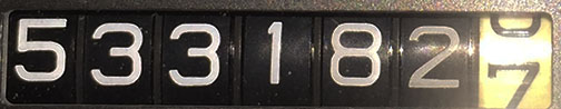
Odometer (Integra):  246,192

Odometer (MDX):  5,756

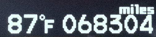
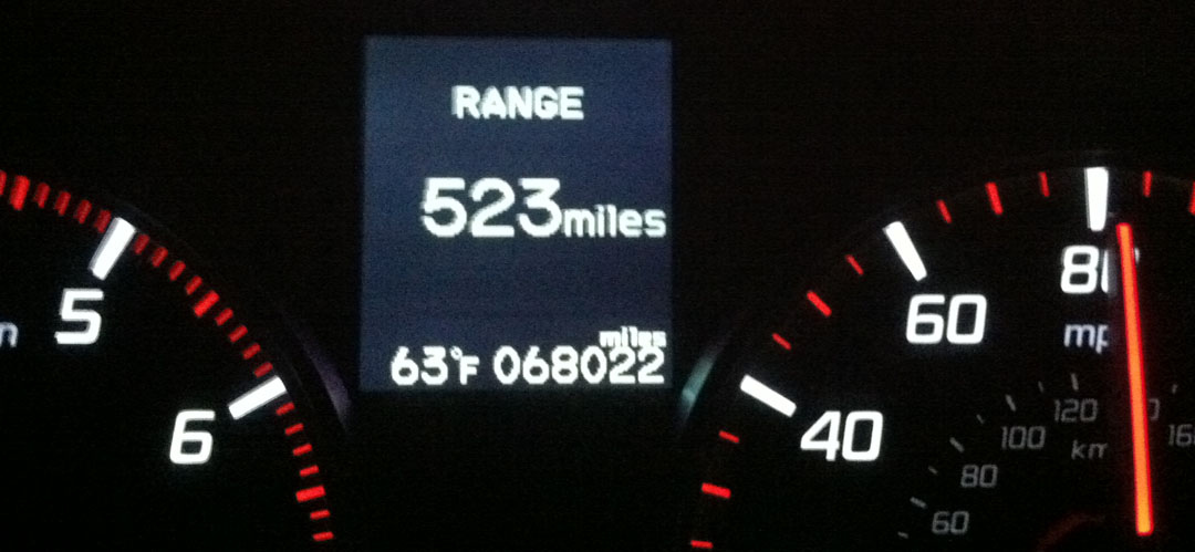
Trip Distance:  1,056 Miles

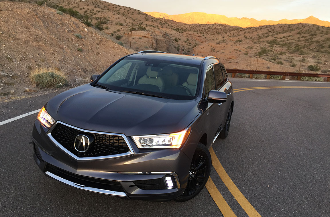
I needed a workhorse to travel back to an 1800s mining town this past weekend and Acura gave me just the right vehicle for the job.  After now completing over 1,000 miles in the latest iteration of its 3-row SUV, I can say with a certainty that the latest MDX is a capable, fun-to-drive machine that offers up first class comfort for a trip of that distance.  Do I have to give it back?

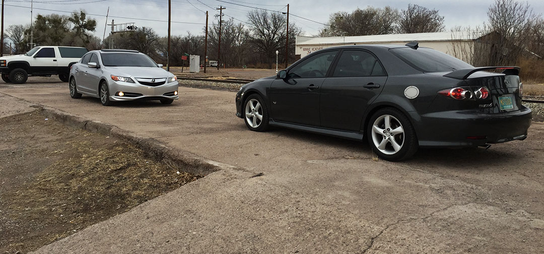
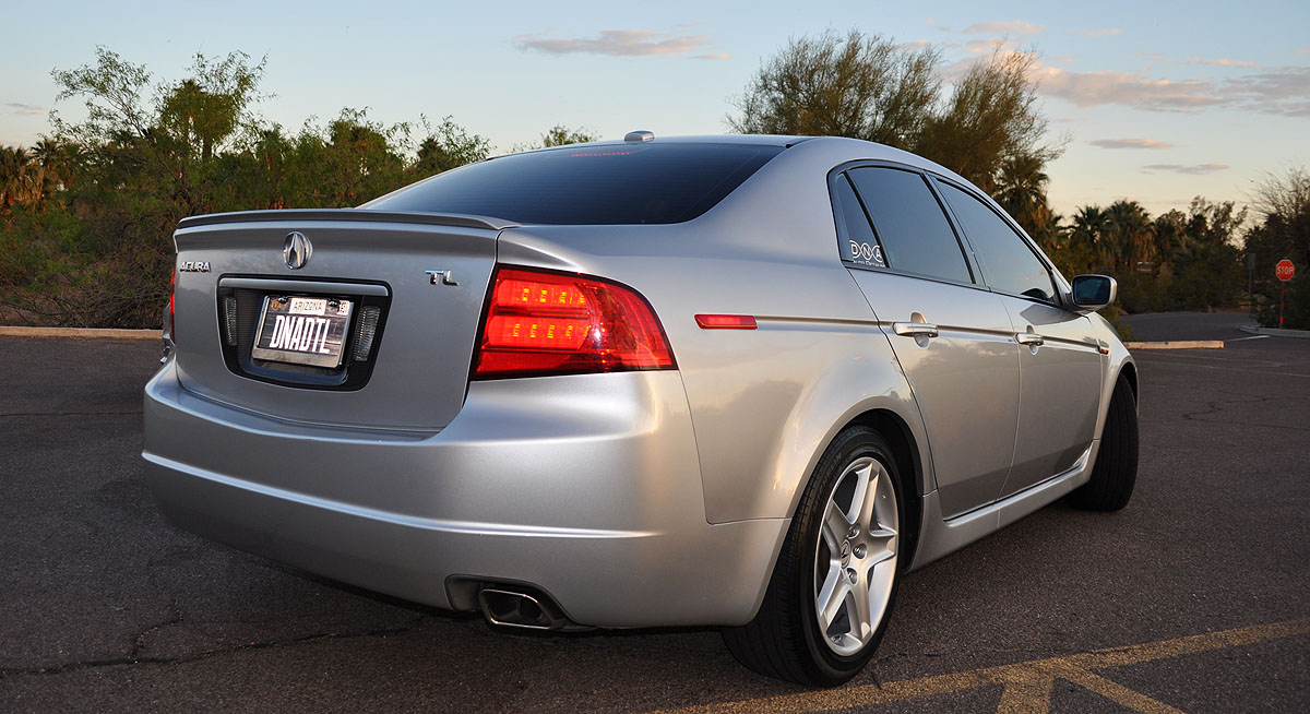
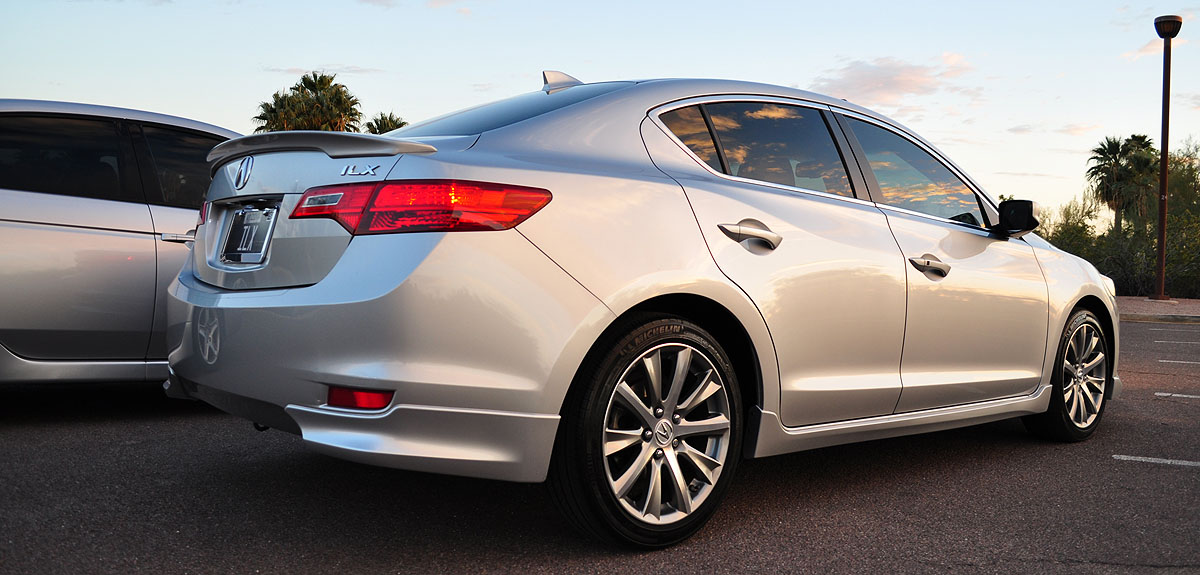
This now marks the fourth time I’ve put a third-generation MDX through its paces.  Here are some prior reviews from here on the blog:

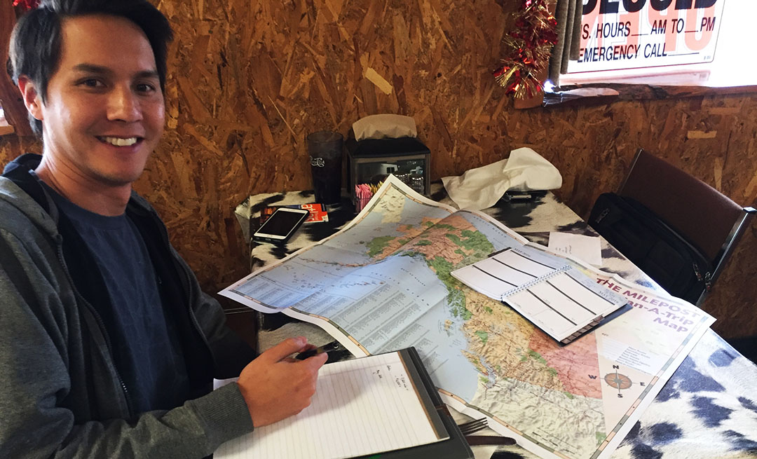
Coming up in April, Las Vegas, Nevada will once again play home to a regional Acura NSX club meet-up called WestFest.  Last year, the event brought out over 50 cars and 80 people.  As part of the planning committee, my role is to establish and plan out the logistics of a scenic group drive to be held on Saturday, April 28th.  It’s not easy to come up with drives for a caravan of that size.

Considerations:

  • Where haven’t we been yet?
  • What will traffic & weather patterns be like on the day & time of our trip?
  • What are the road conditions – are they appropriate for a group of sportscars?
  • Are there any tolls or park fees to consider?
  • How can we keep everyone together, or does it make more sense to split the group?
  • Are there places for fuel and snack stops along the way?

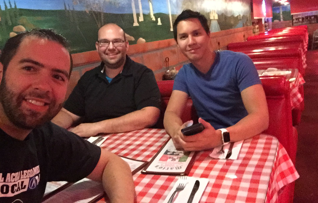
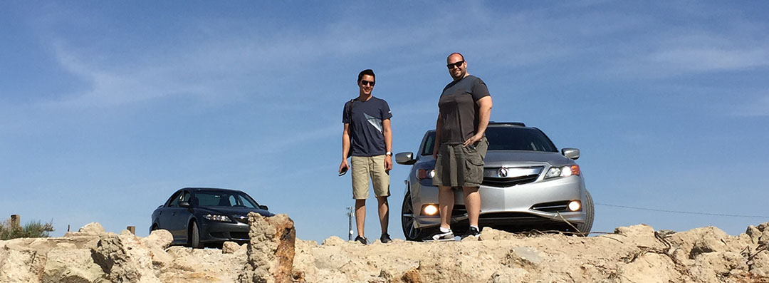
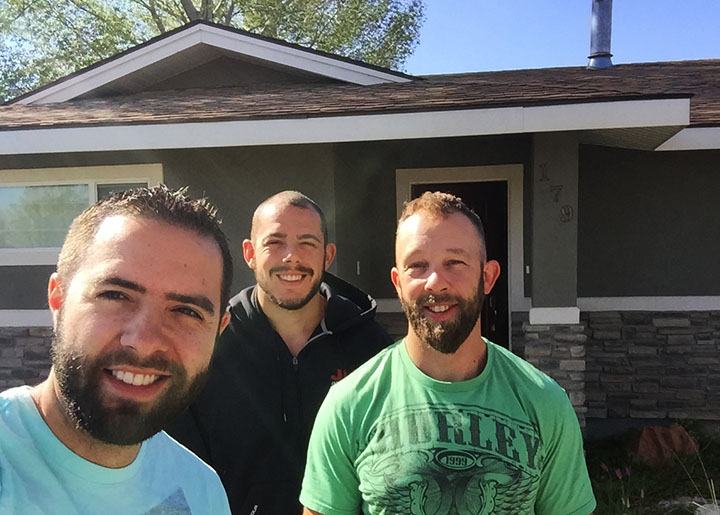
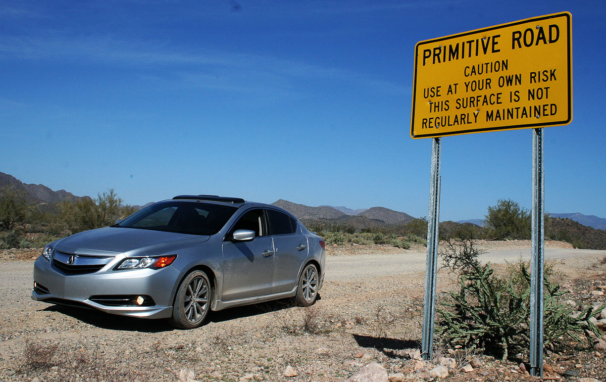
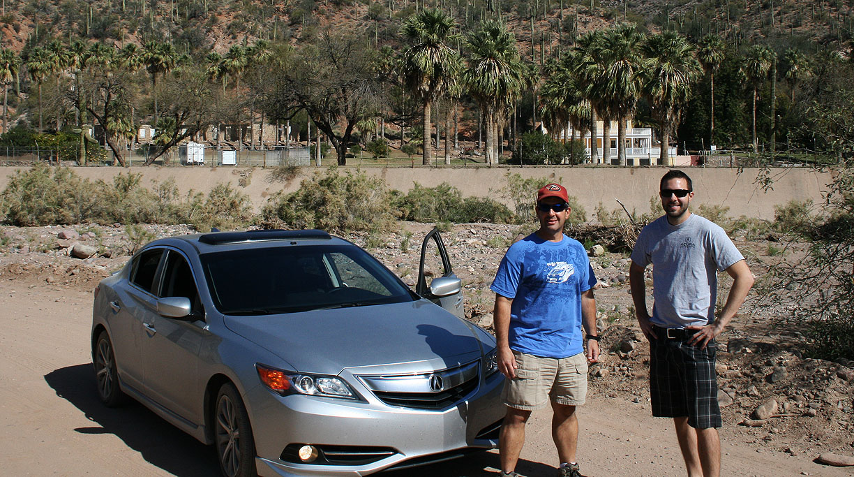
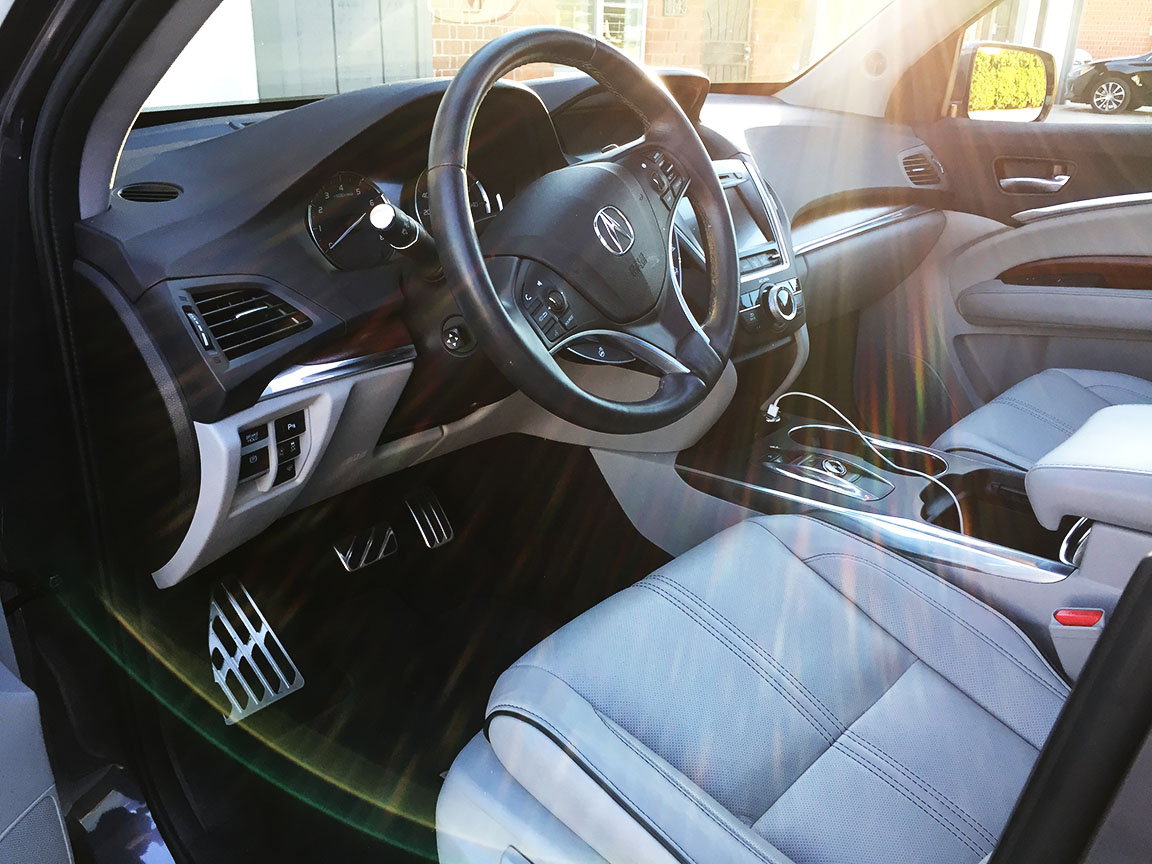
As one can imagine, it takes a great deal of effort to coordinate such an activity.  I partnered up with my friends Dane and Brandon, both Las Vegas locals, to take the MDX out on Saturday morning and scout the terrain.  It was the perfect vehicle for our expedition to the desert:  Second-row accommodations are posh, with captains’ chairs and plenty of space all around.  There are of course independent climate controls for passengers in those areas.  Meanwhile, I pampered myself up front with a heated seat heater, heated steering wheel, and convenient cup holder for my iced caramel macchiato.  You’d think we were going to the local shopping mall and not to the middle of nowhere.

Our drive route for the day was about 160 miles and took us 4 hours from start to finish, including our sightseeing and lunch stops.

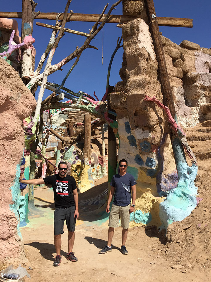
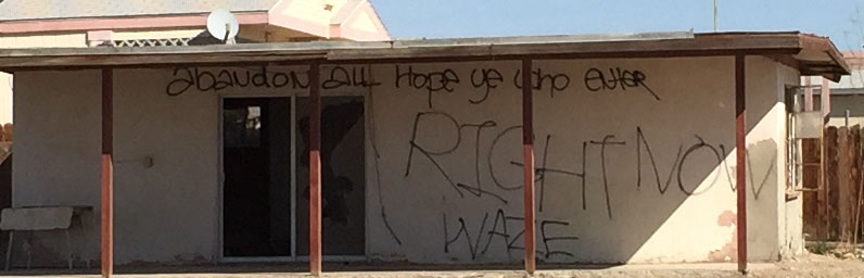
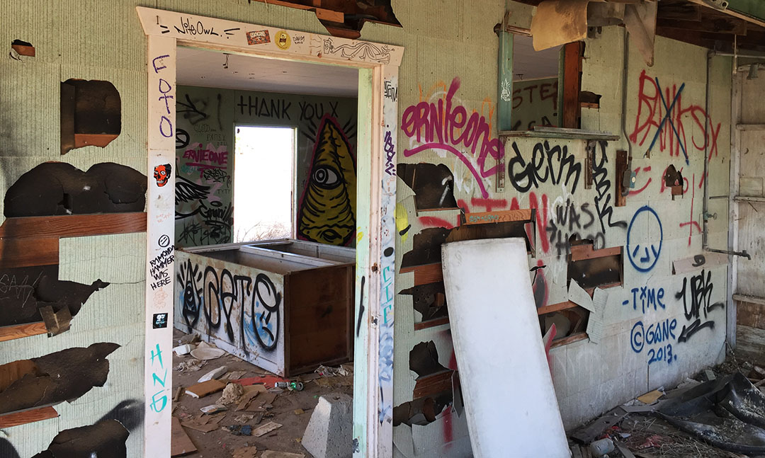
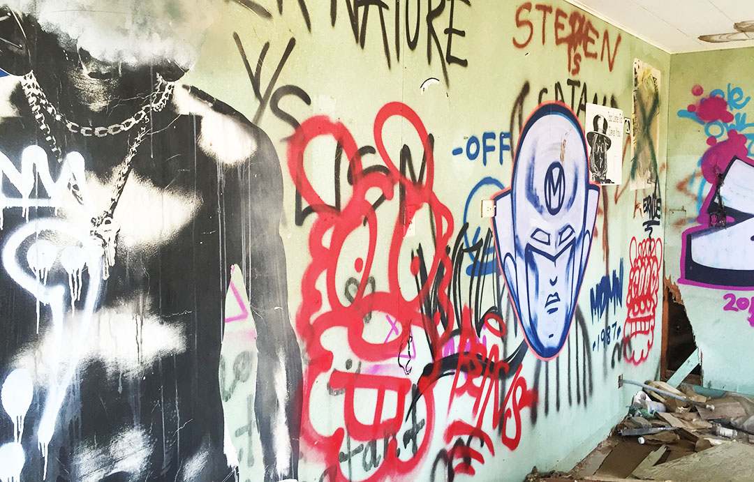
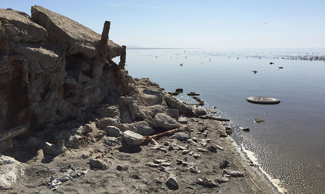
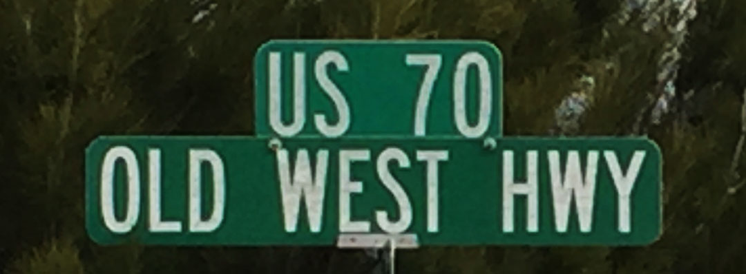
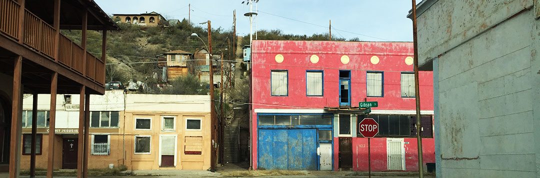
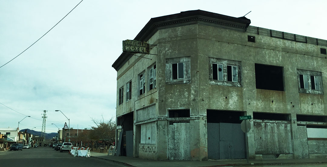
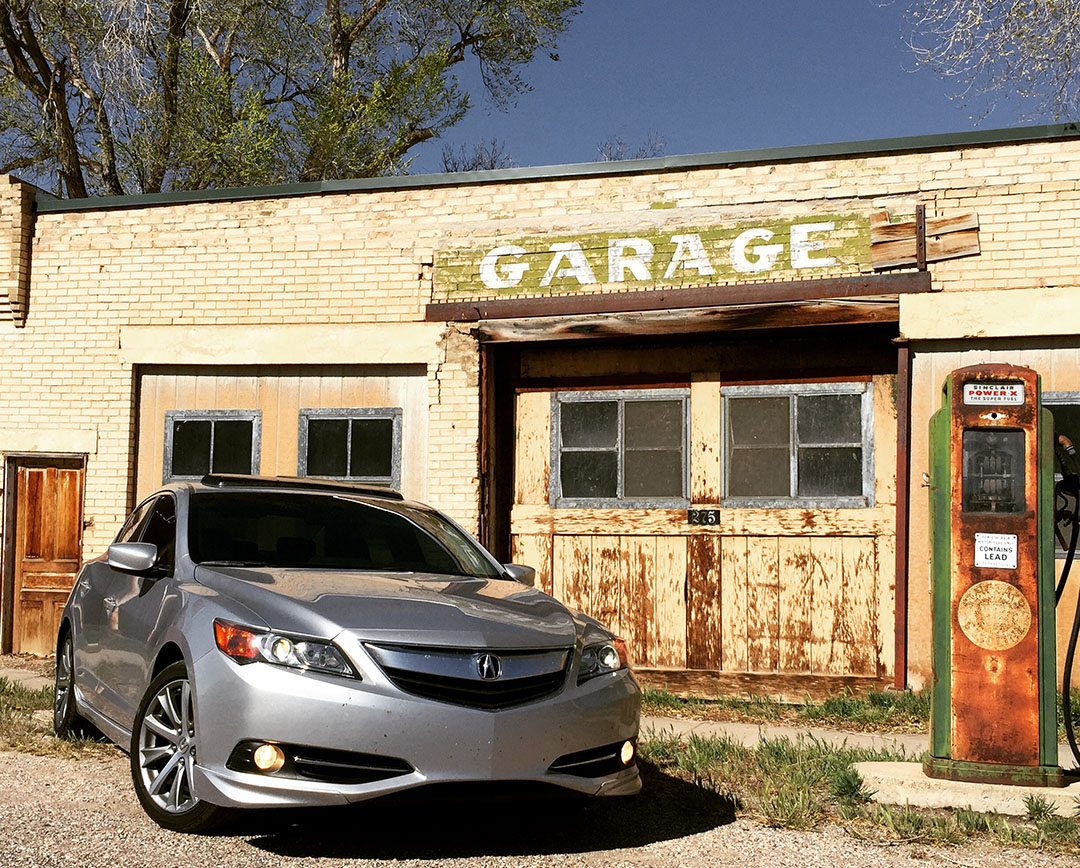
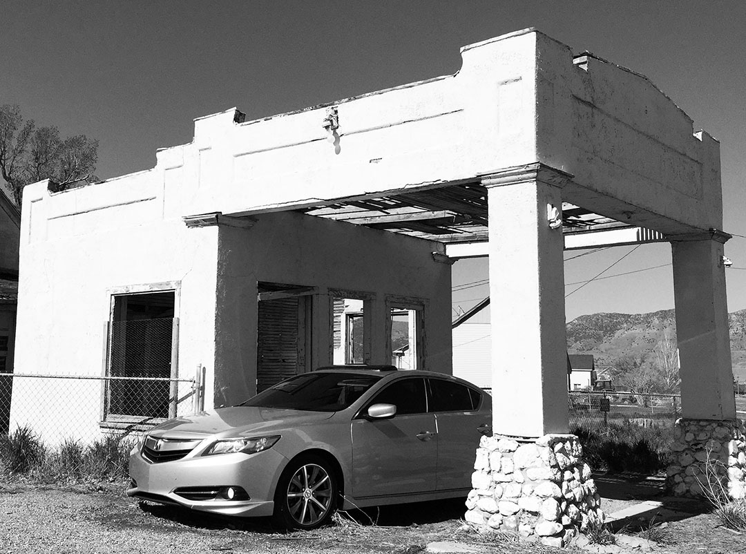
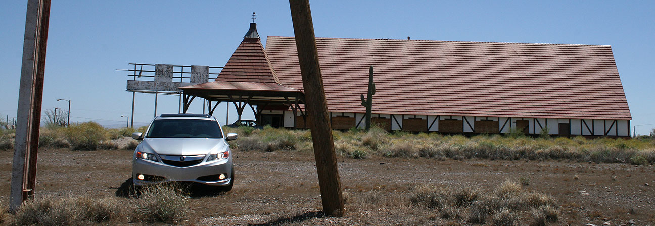
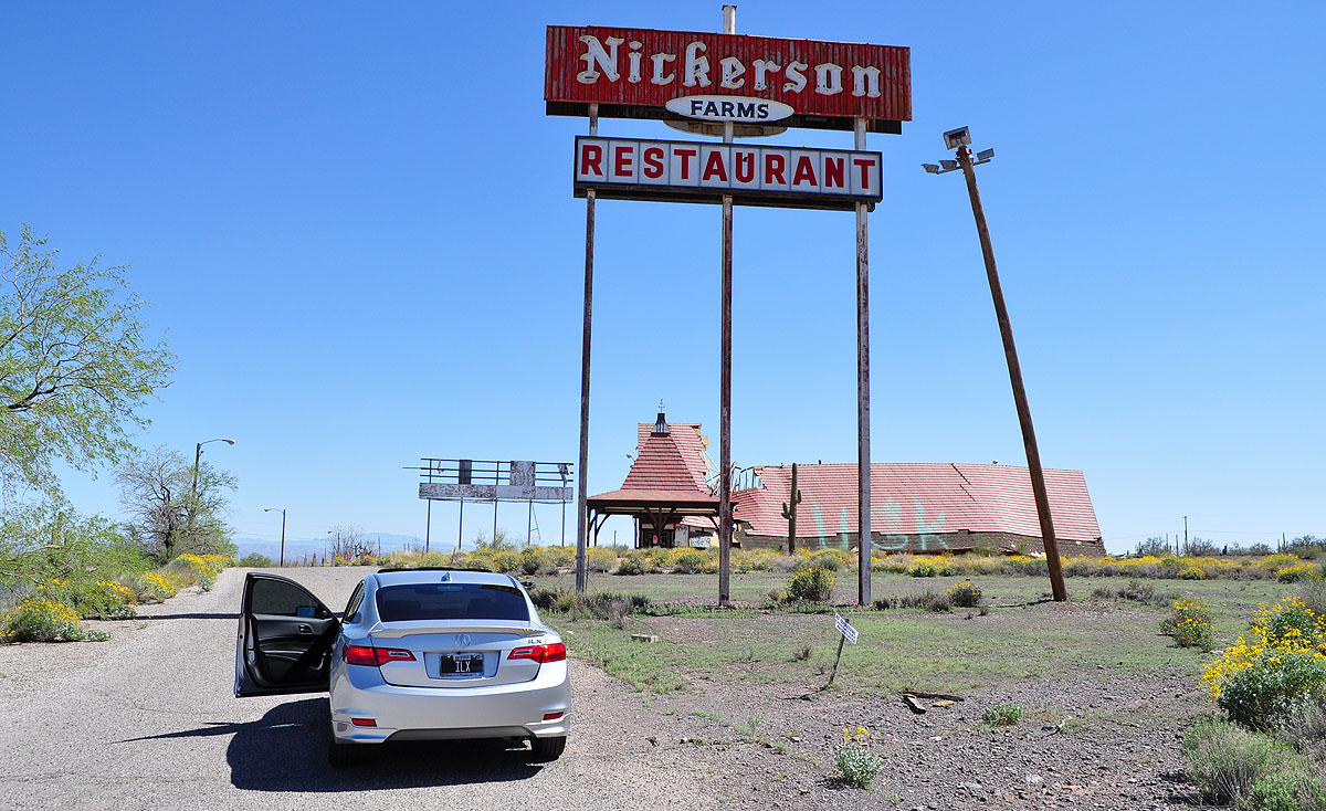
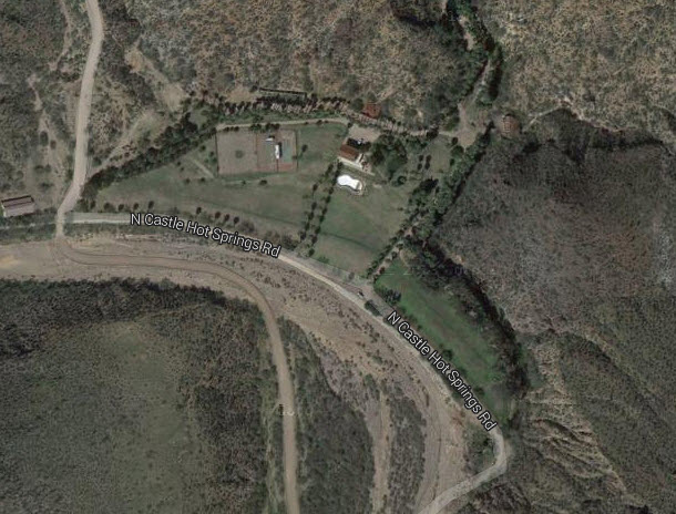
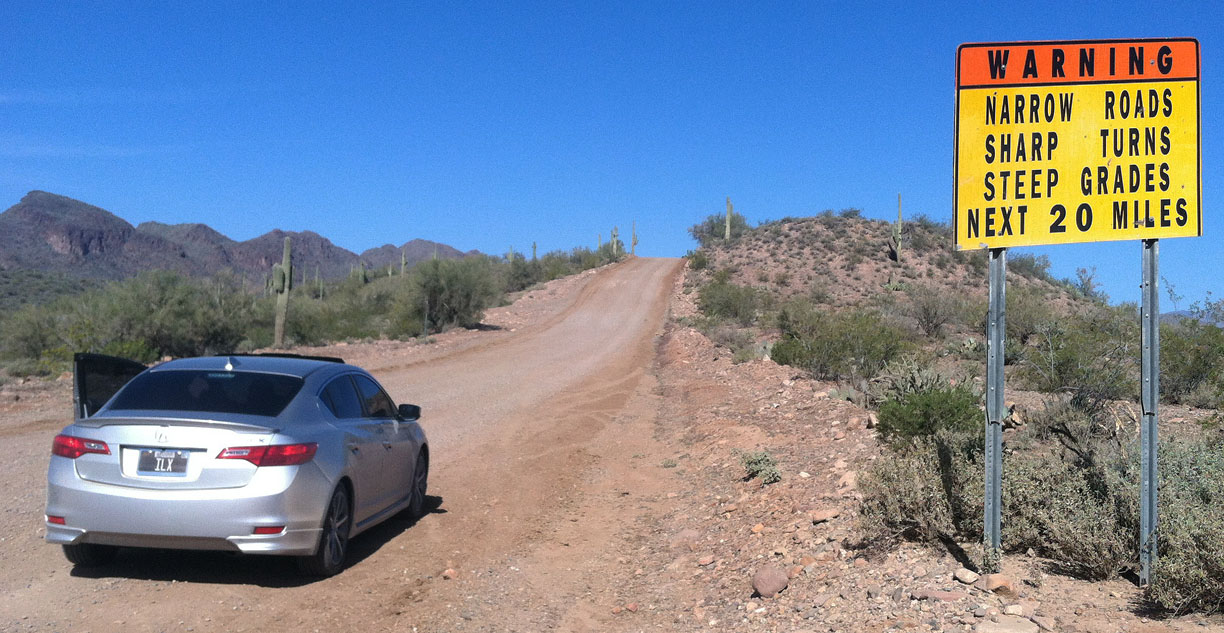
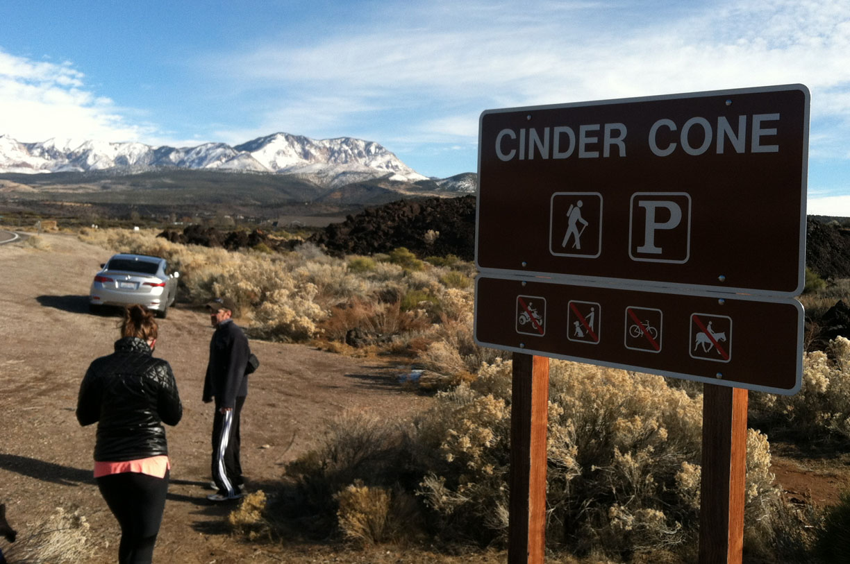
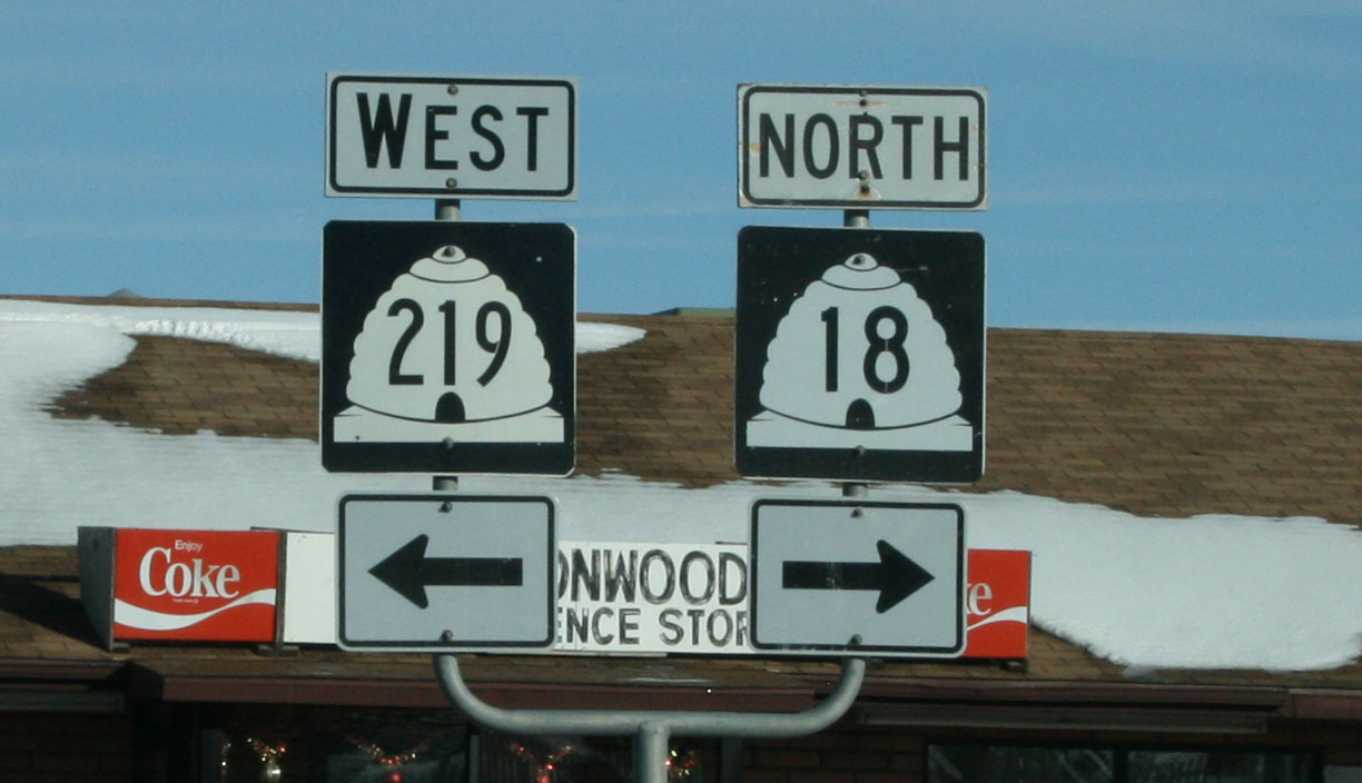
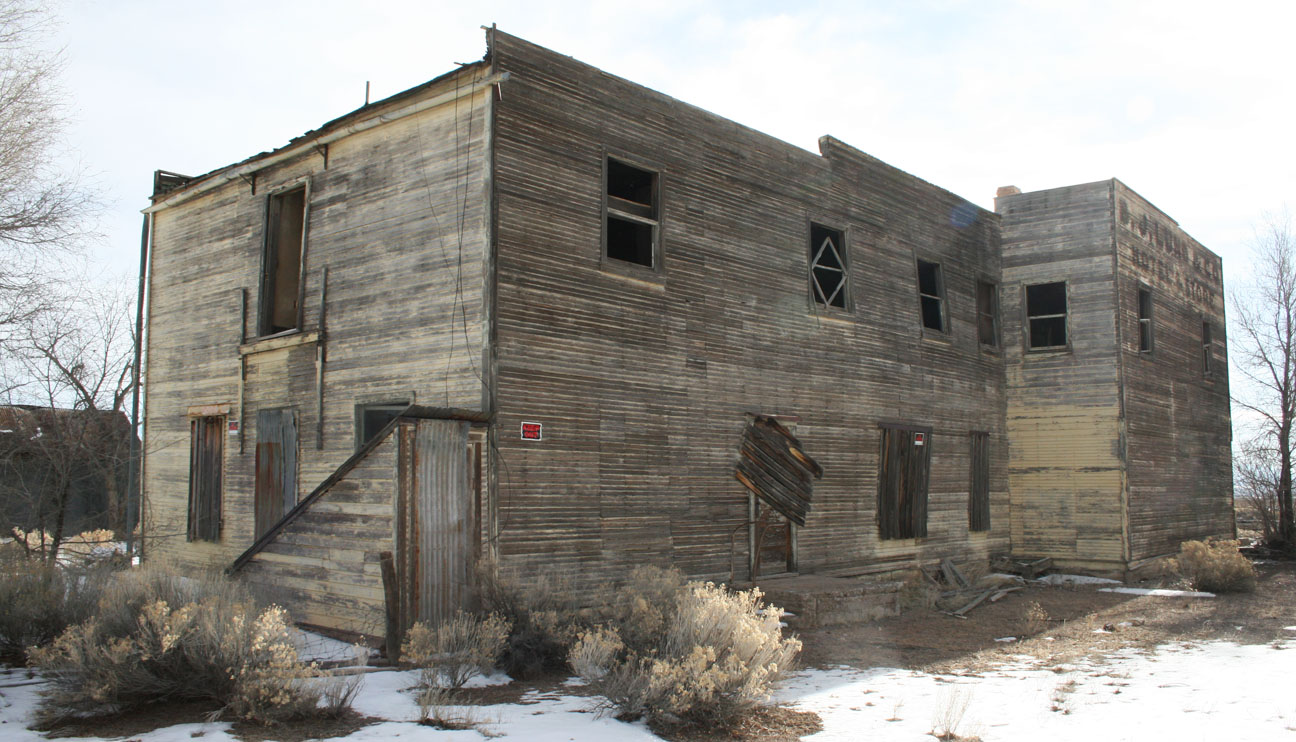
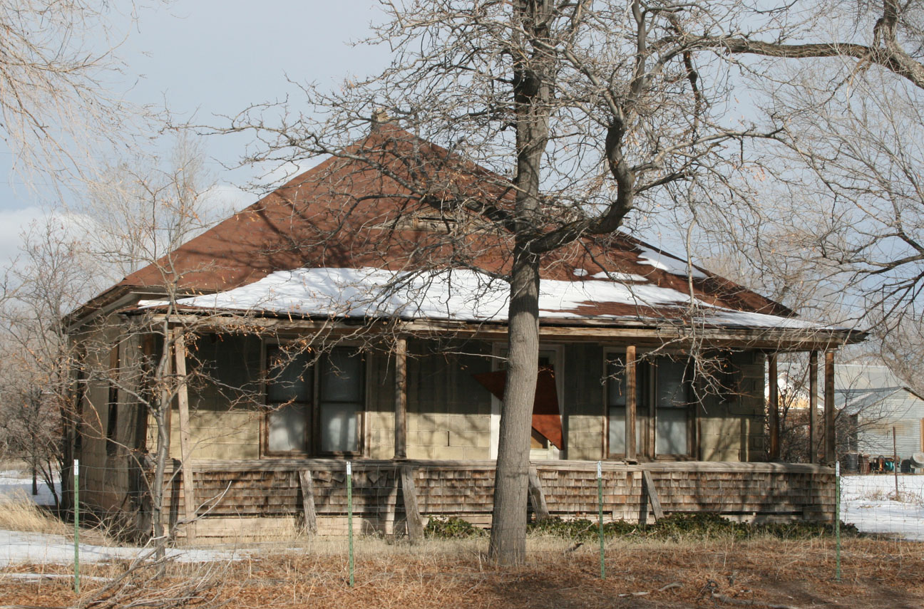
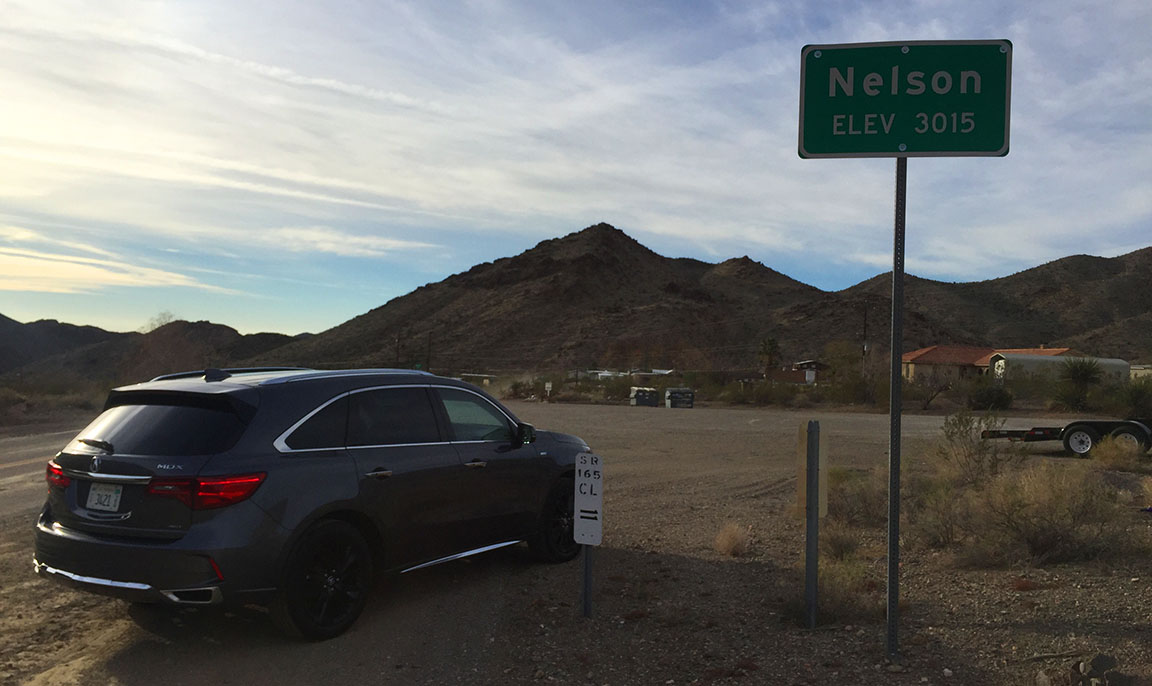
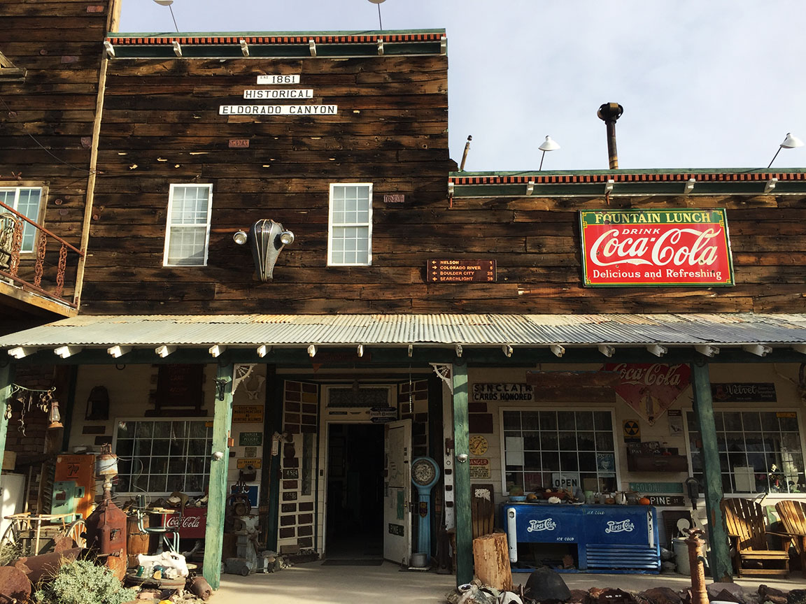
Nelson, Nevada is one of many ghost towns in the vast expanses of land around the southwest.  It’s nestled in El Dorado Canyon, about 12 miles off Highway 95 to the east.  If you blink, you might miss the turnoff, so it’s a good thing Dane was coaching me from the passenger seat on where to make my exit at Highway 165.  We passed only one other vehicle on the way into Nelson from there.

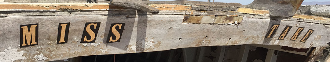
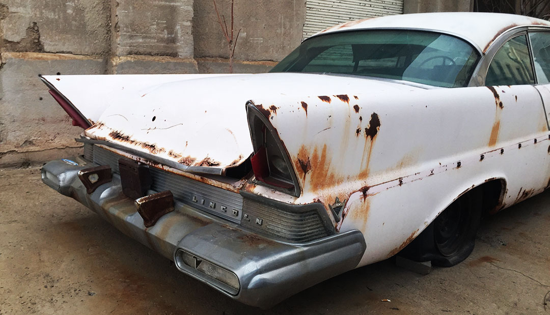
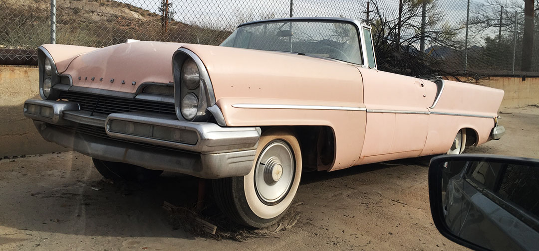
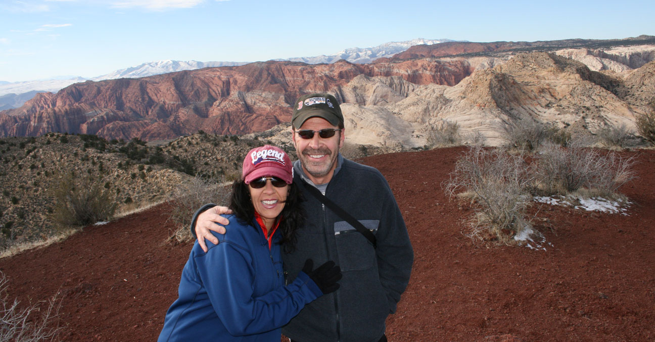
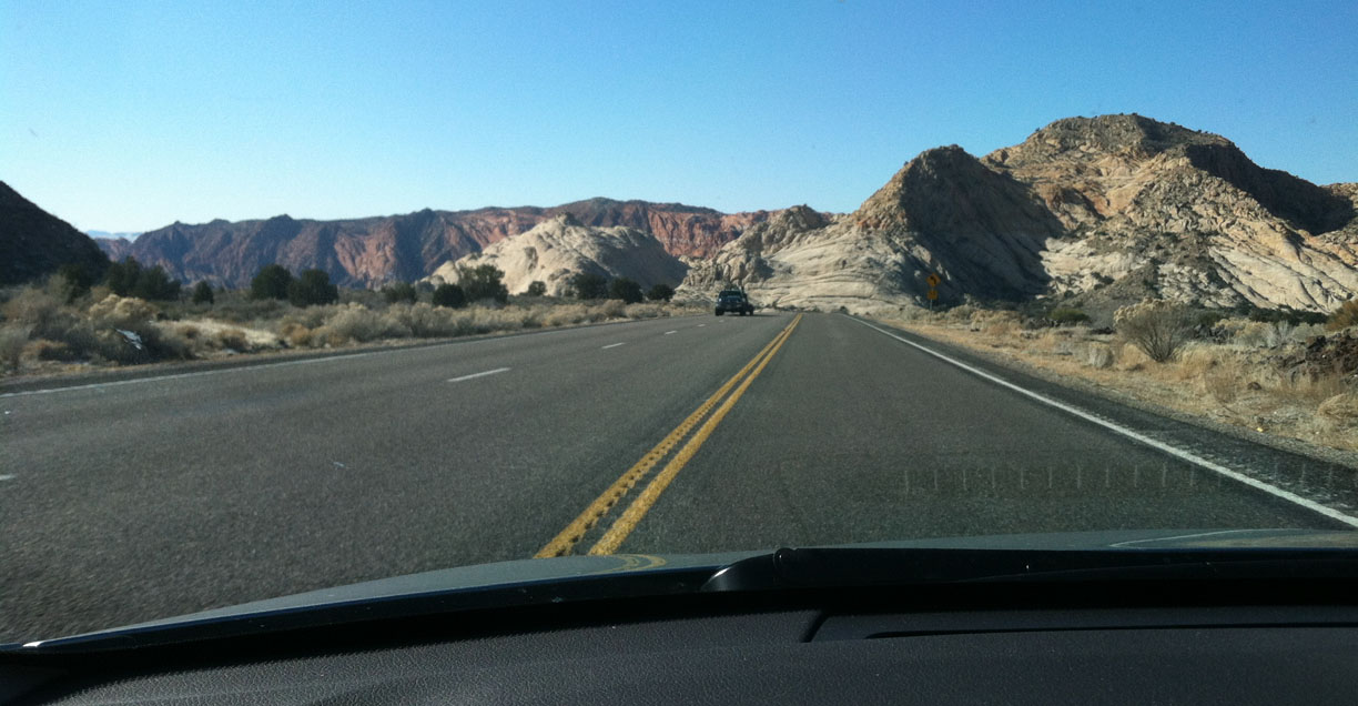
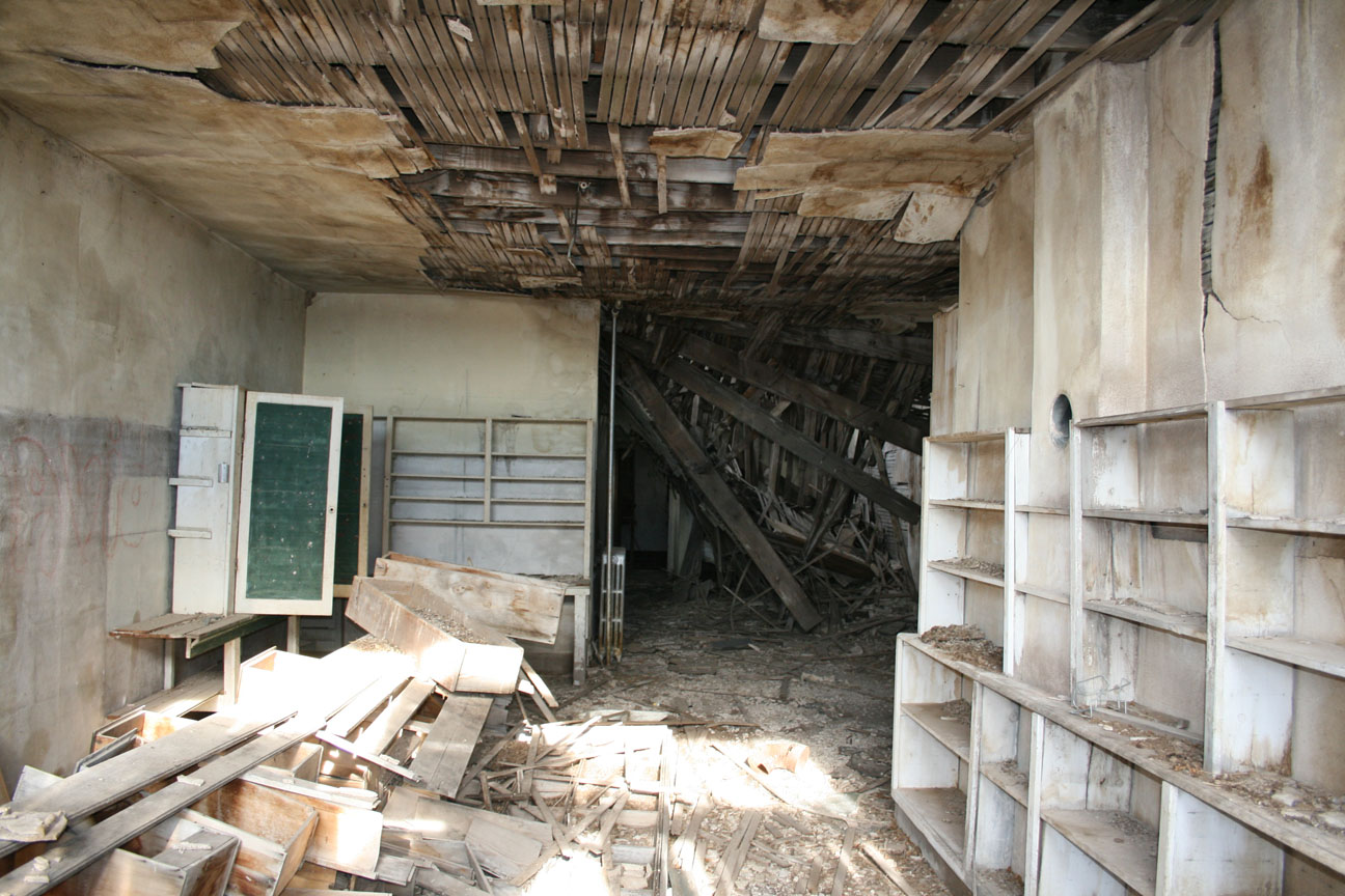
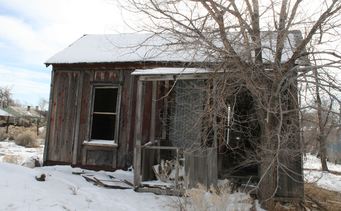
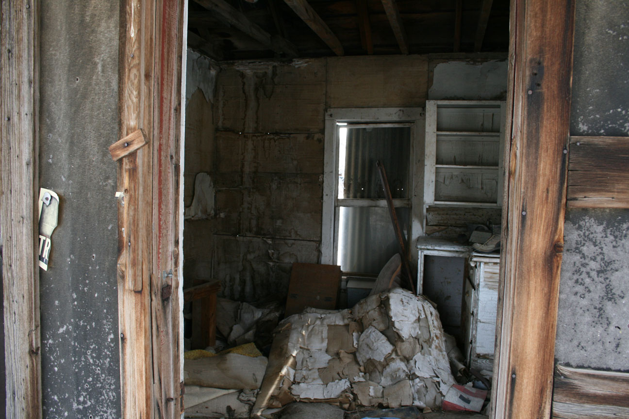
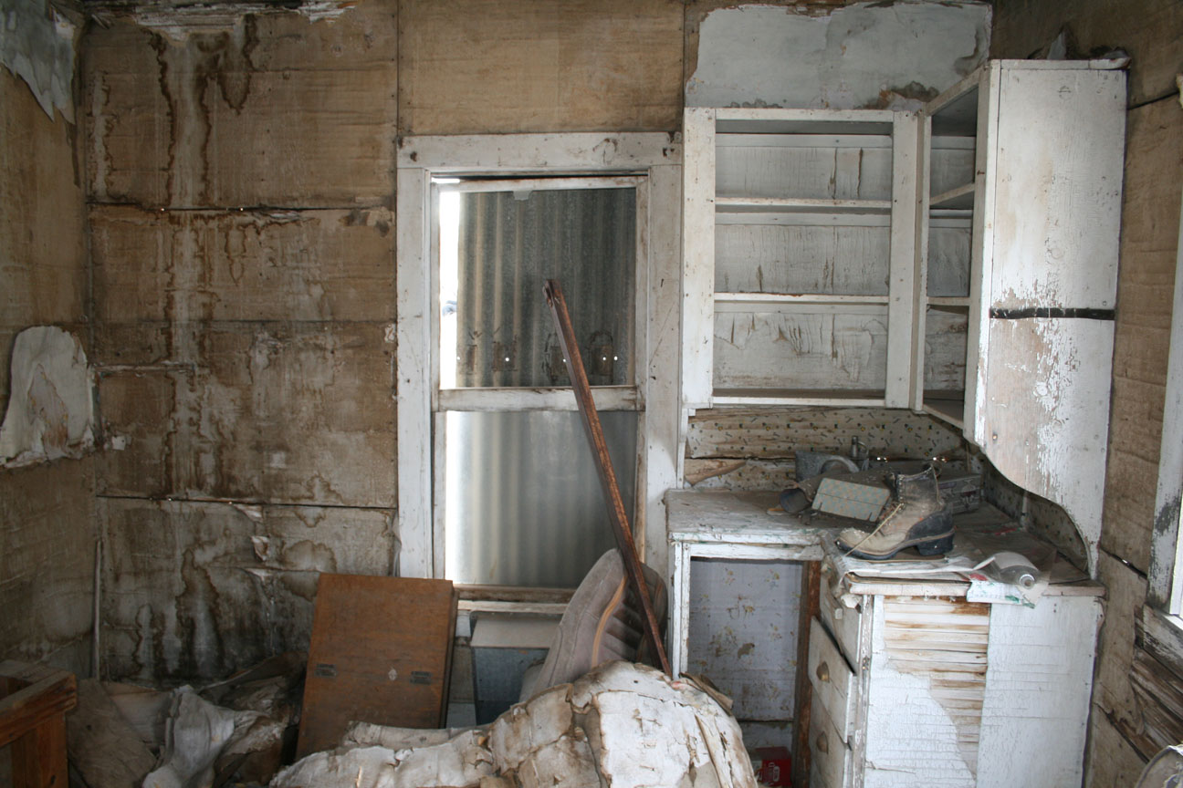
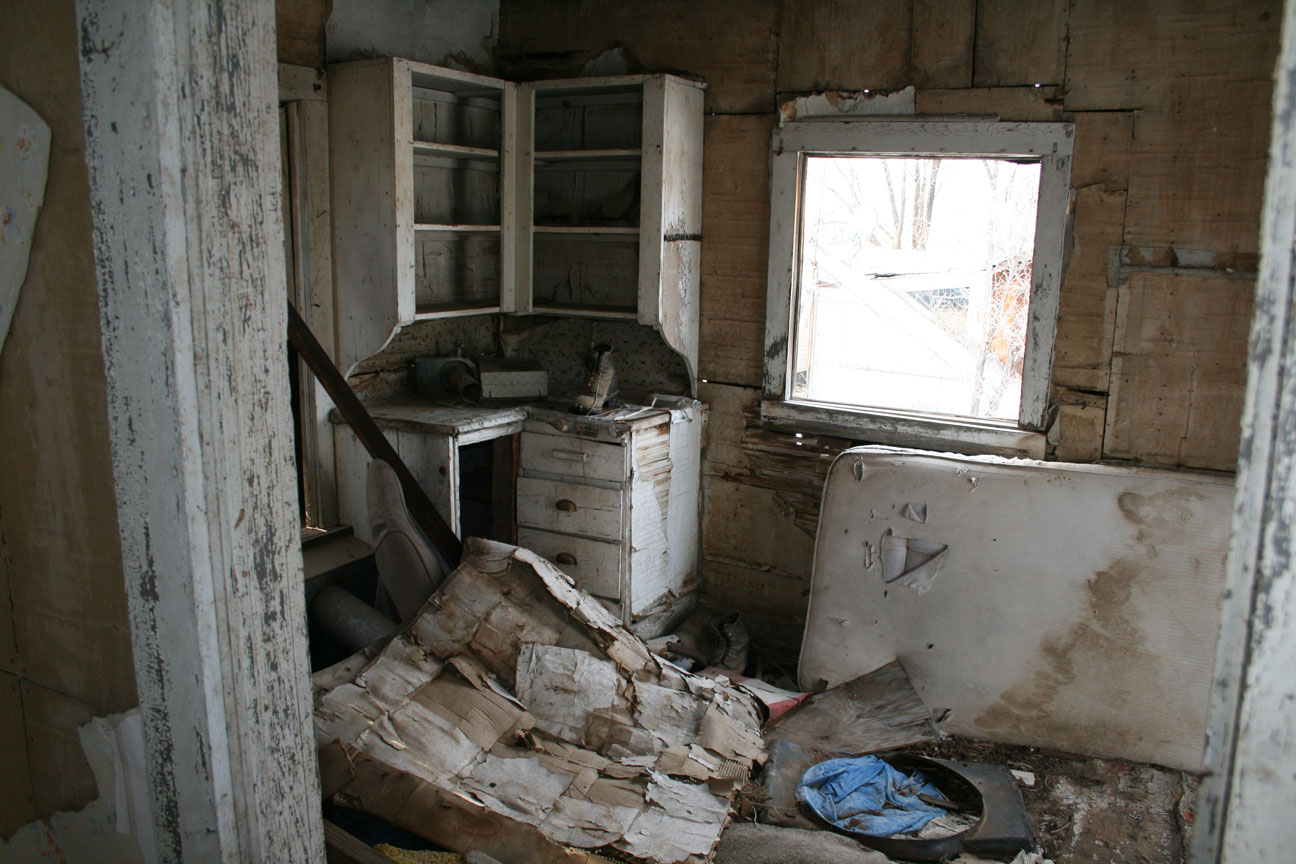
The two-laner got a little more narrow, a little more rough, and more curvy as we dipped down in elevation toward the Colorado River.  Soon the buildings of the old mining town came into view, along with dozens of old cars left out to the elements with windows down (or broken out) and interiors rotting away.  I parked the MDX in a dirt lot and we got outside to wander around a little, noting how silent it was outside aside from the scuffling sound made from our shoes on the gravel.

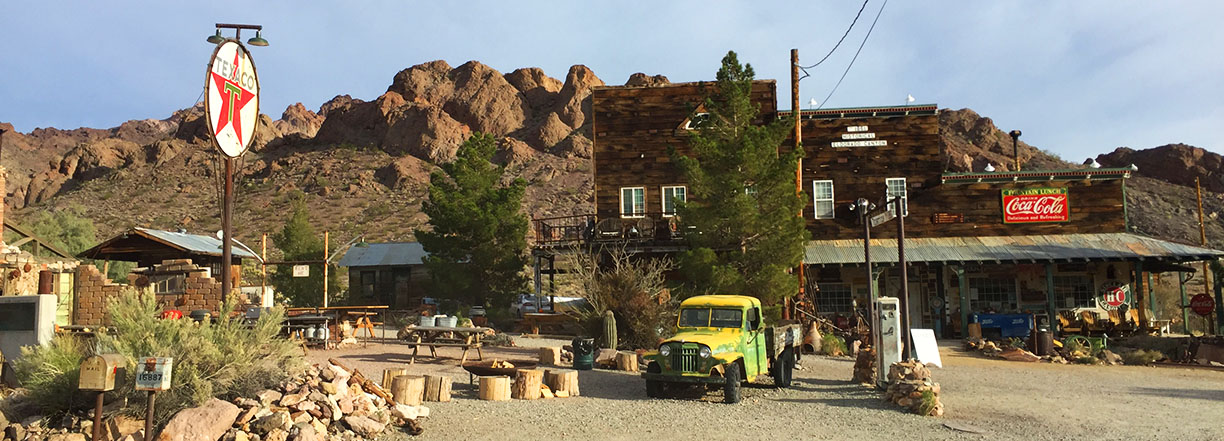
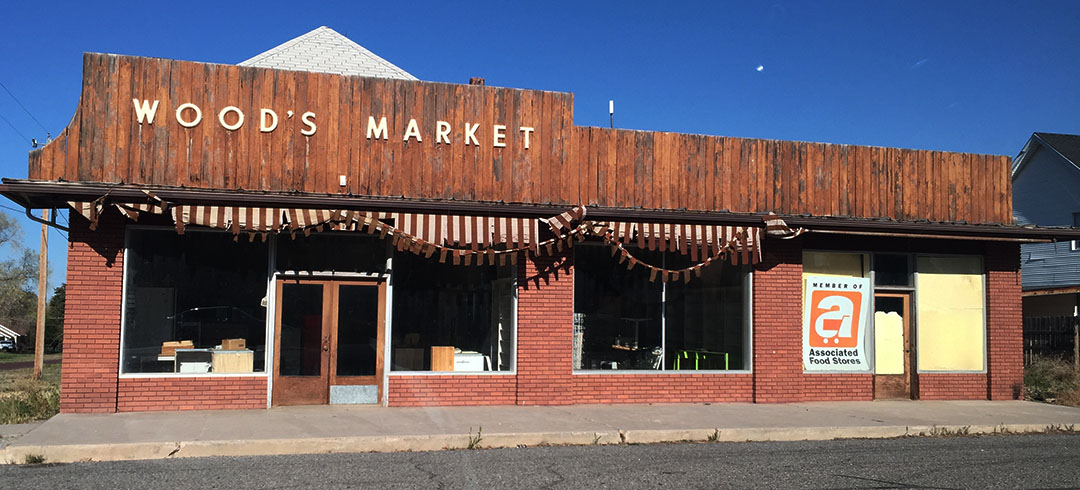
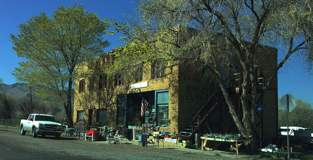
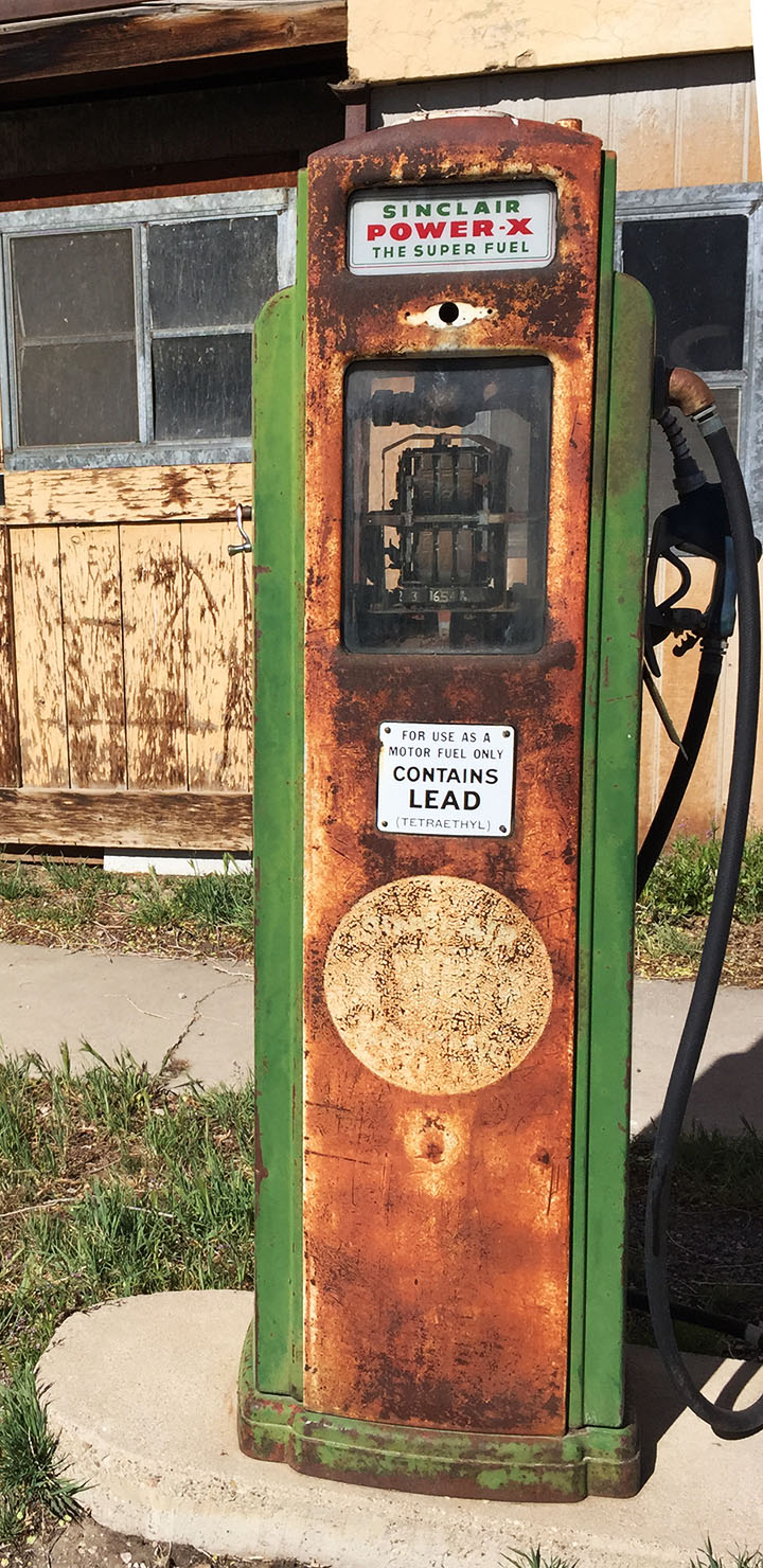
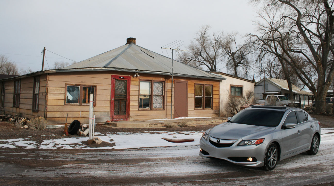
We must have been the first tourists in town that day, because an old man came out of what appeared to be the main general store and put away the ‘closed’ sign while inviting us inside.  The wooden building doubles as his home, but he sells all sorts of remnants of the Wild West in there.  My favorite display was an exhibit of some the various films that the town of Nelson has appeared in, including the Kurt Russell classic “Breakdown.”

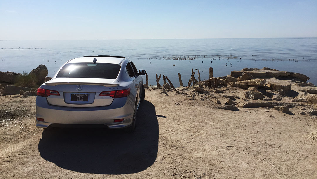
Luckily for us (and unlike Kurt Russell’s red Jeep Grand Cherokee in that movie), the MDX was didn’t give us any check-engine lights or troubles of any nature.  We snapped a few photos in Nelson before continuing eastward another few miles to where we could nearly drive right to the banks of the mighty Colorado River on a dirt road.  There was a nice paved turnaround spot that I think will make for a perfect photo-op for the group of NSXs at the April event.

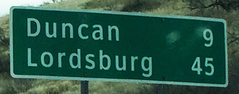
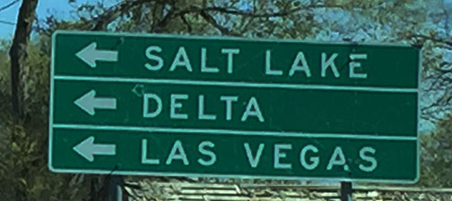
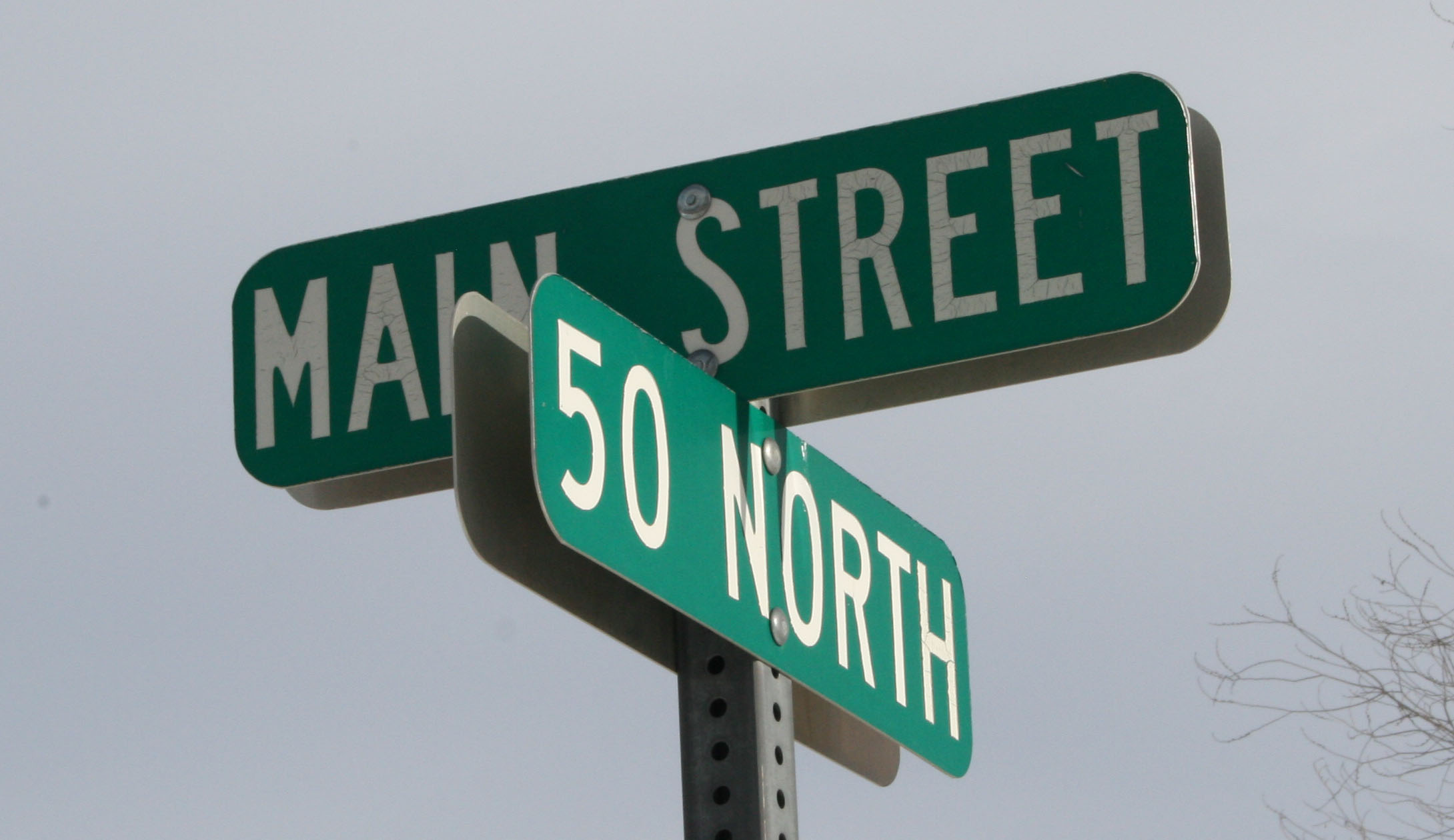
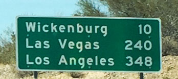
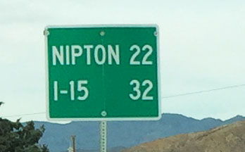
Our next destination on the drive loop was Searchlight, Nevada – a teeny spot on the map that (like most small towns in that area) – got its start as a mining community in the late 1800s but mostly dried up by the mid 1950s.  The name came from one of its original prospectors who said, “It would take a searchlight to find gold out here.”

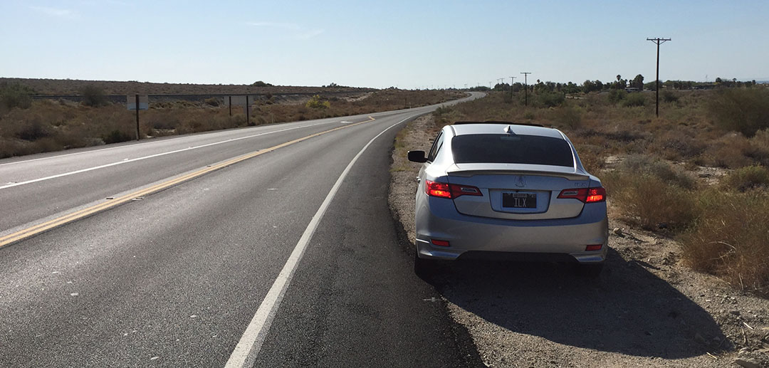
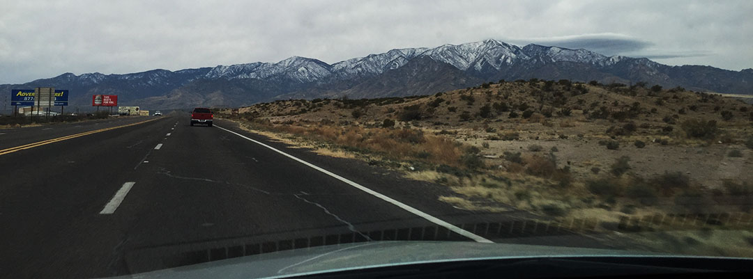
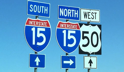
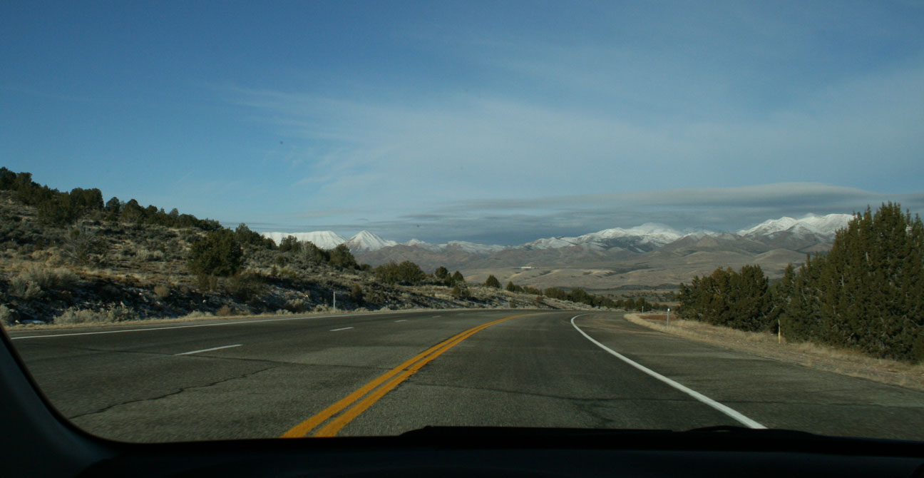
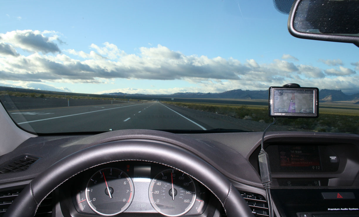
Dane, Brandon, and I rolled onward toward Highway 164 westbound and then over to Interstate 15 northbound.  I hit the gas on the onramp.  For a full size SUV that’s loaded down with technology and comfort niceties, the MDX still scoots down the road with more than ample power.  I observed an overall combined MPG of about 26 despite going heavy on the throttle a few times.  Range on a full tank is in the high 400s.

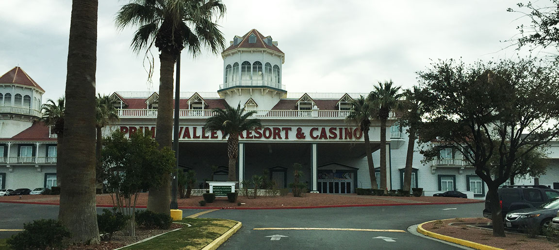
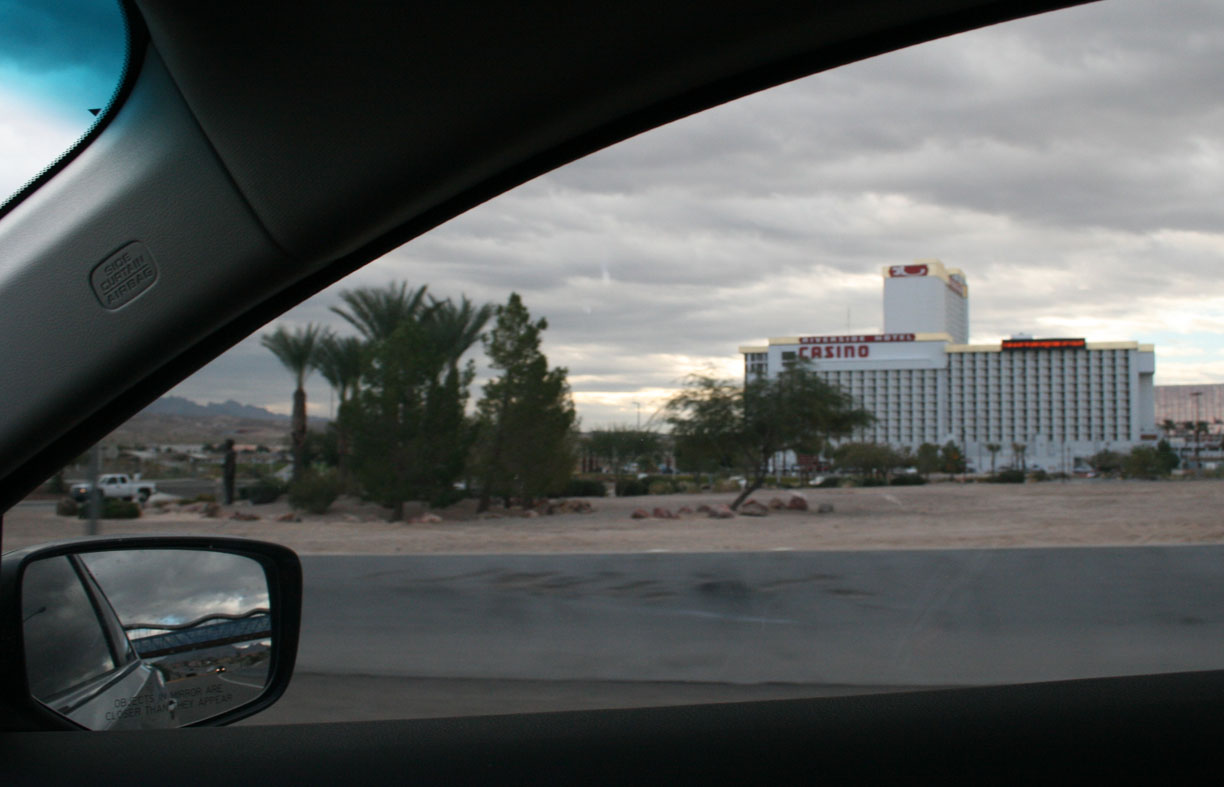
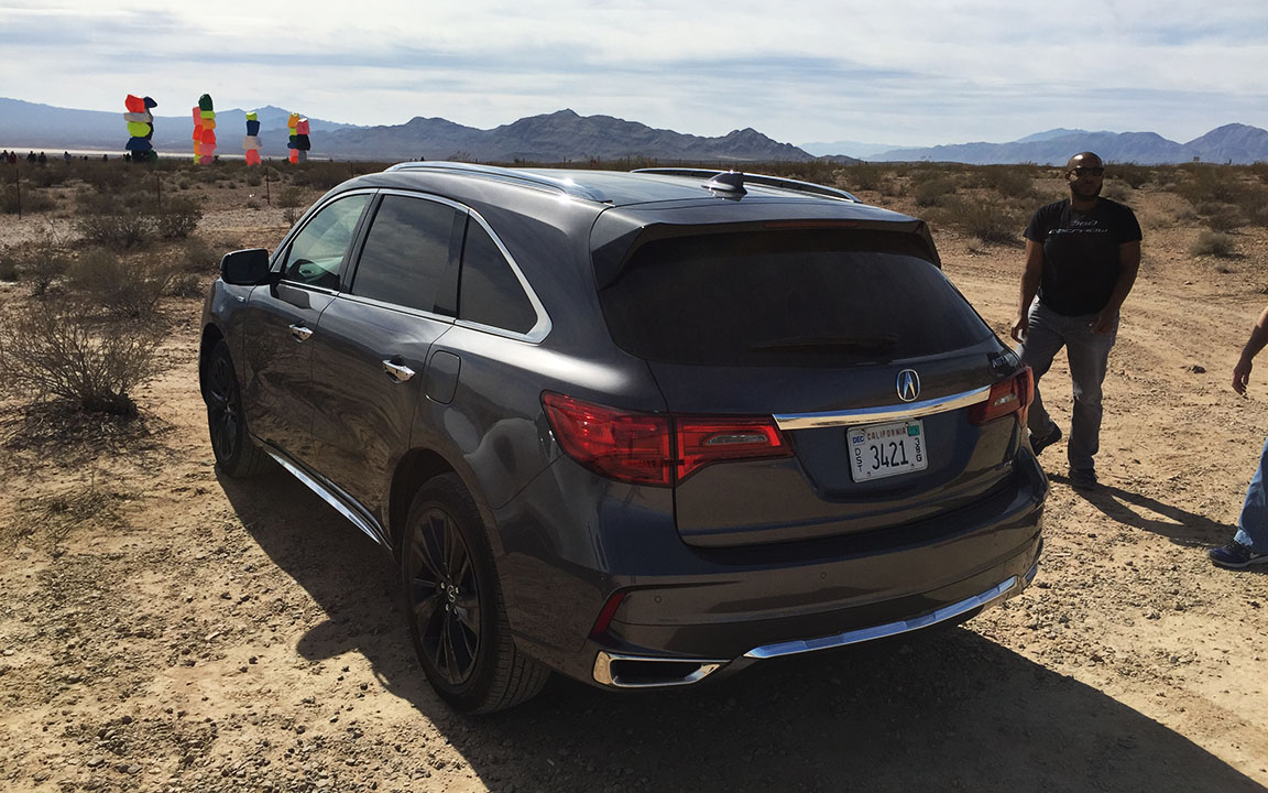
The Country Club Buffet at Primm Valley Casino, right along the California-Nevada state line, satisfied our hunger before we made our last stop of the day.  Stacked along the east side of I-15 are 7 columns of vividly painted boulders, referred to as “Seven Magic Mountains.”  The massive rocks were cut from a nearby quarry and painted fluorescent colors by Swiss artist Ugo Rondinone.  The art installation was opened in 2016 and will be removed sometime this year, so I was glad to get a chance to see it.

The MDX stickers at $58,000 as-tested, including Tech & Advance packages with a full suite of AcuraWatch driver-assistance aids.  I found the LKAS (Lane Keeping Assist System) to be helpful but could do without the ACC (Adaptive Cruise Control).  I much prefer to set a cruise speed and have it be maintained – with the Adaptive engaged, the vehicle starts slowing down well in advance of approaching a vehicle ahead, so you have to change lanes very early which isn’t always possible or convenient.  It’s something I could learn to live with, but just an observation.  The only other gripe I had was with the aesthetics of the black wheels.

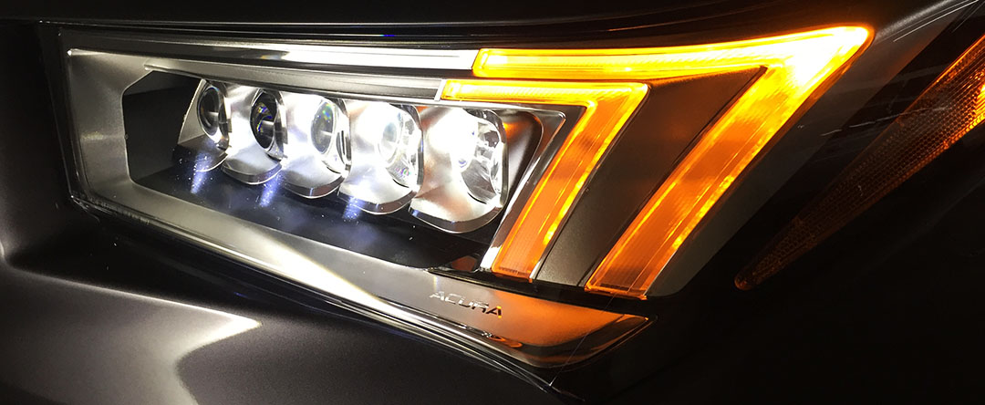
There’s a lot to love about the MDX.  Those captivating jewel eye headlights with LED turn signals are just as much “function” as they are “form.”  The ELS Studio Premium audio system will knock your socks off.  I set the bass and the subwoofer to maximum levels for optimal punch, and it retained crisp clarity all the way up to max volume level 40.  Sirius XM channel “90s on 9” never sounded so good.  And if it’s solitude you want, a quiet cabin is easy to achieve too.  I sailed along at 75 mph with minimal wind, road, and engine noise.  The MDX’s 7-speed dual-clutch transmission keeps the revs low at those speeds.

It was tough to give the keys back after being pampered for 7 days, but I was glad for the opportunity to sample the high life!  Below is a 7-minute video and a collection of other photos from my week with the Modern Steel Metallic MDX.  Thanks, Acura, for the loaner!
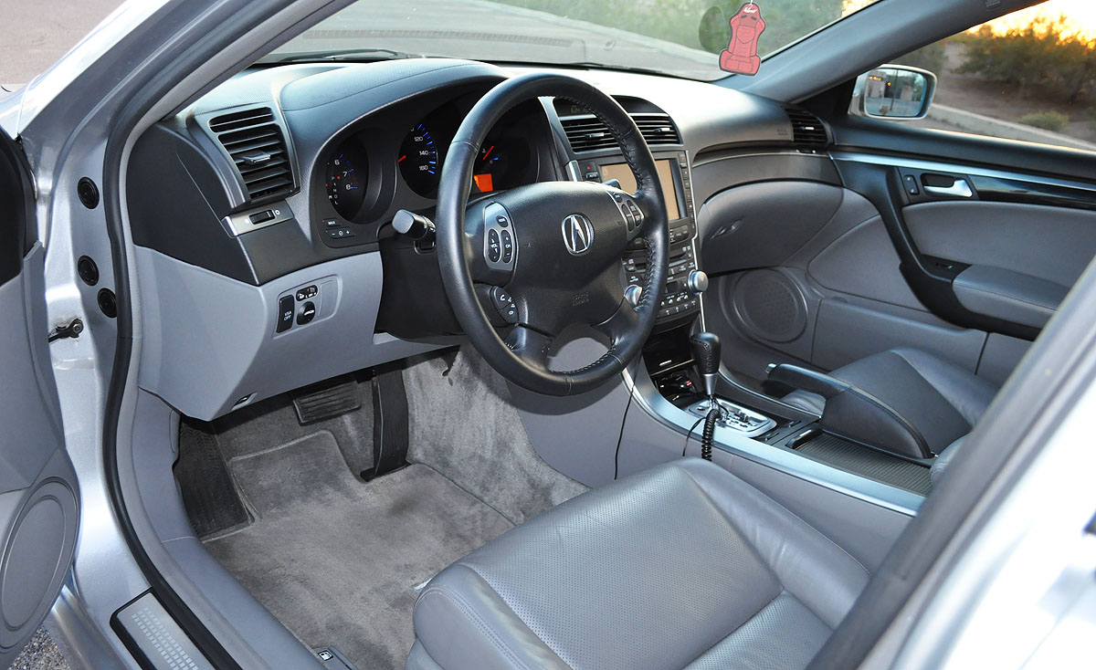
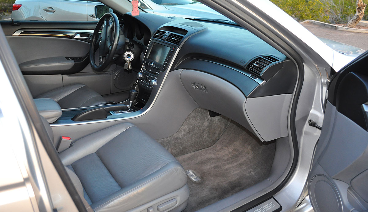
Back seat comfort

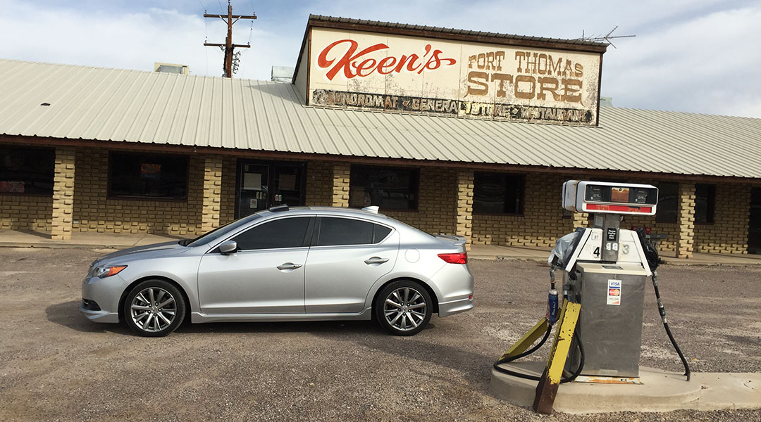
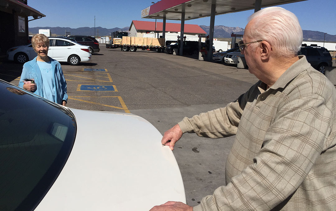
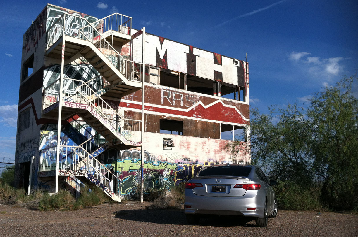
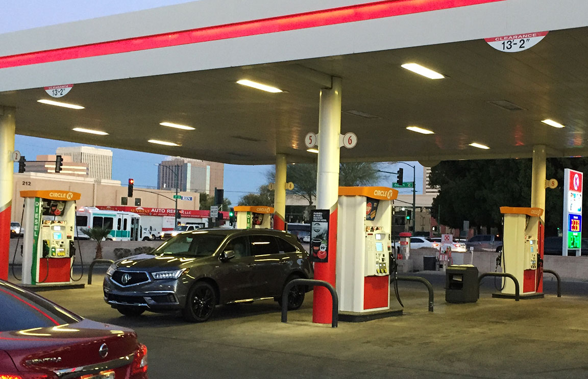
Fueling up at Circle K in Phoenix

And we’re off!

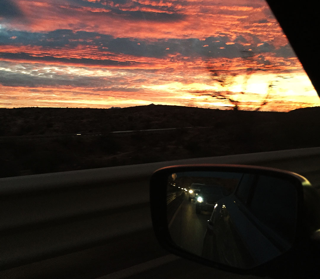
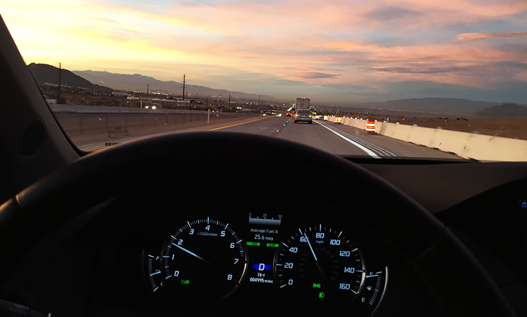
Rolling into Las Vegas at sunset

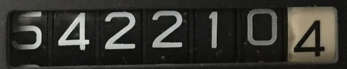
5,000 mile milestone!
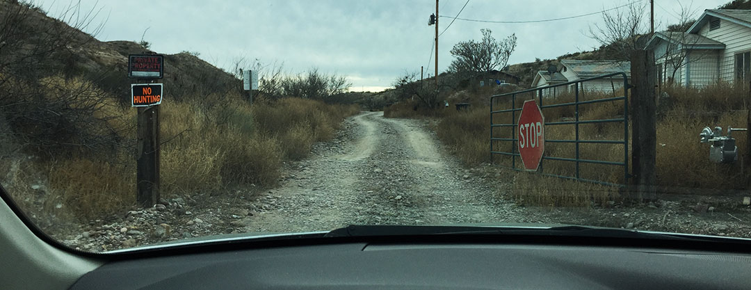
Arrival in Nelson

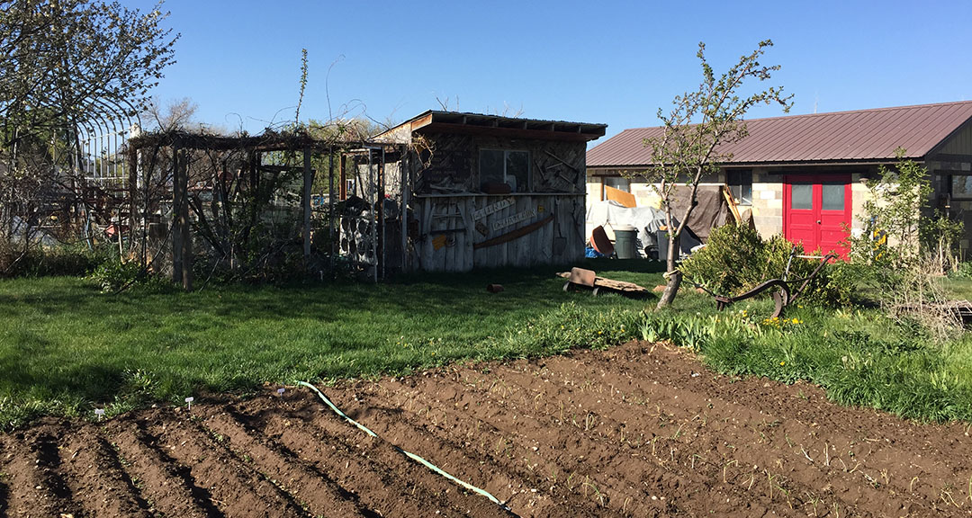
The ‘general store’ in Nelson

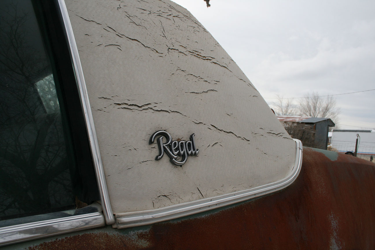
Loved this 1950 Buick!

Next stop:  Interstate 15

Red carpet treatment!  Brandon & Dane getting the door at Primm Valley

Seven Magic Mountains in the Nevada desert

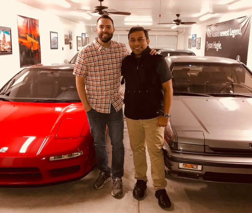
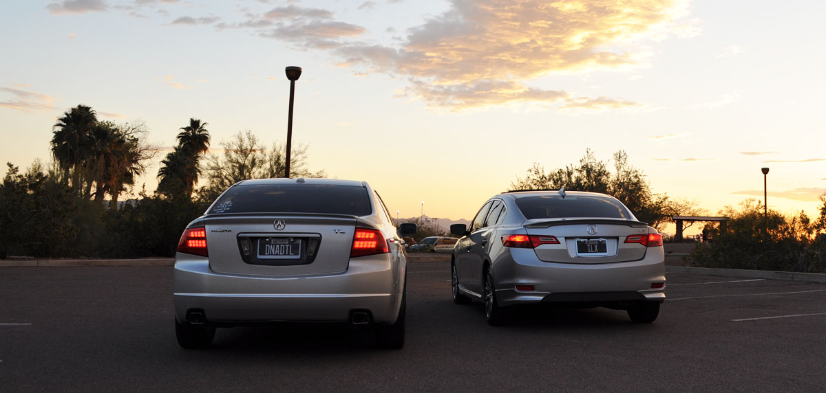
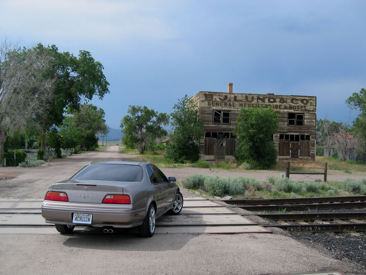
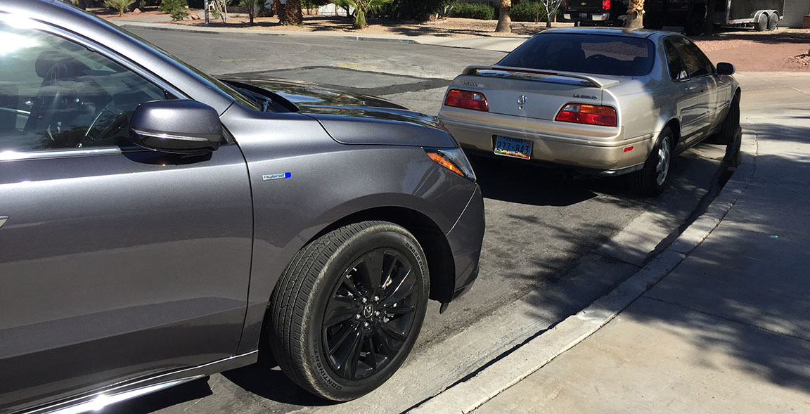
Brandon’s 1993 Legend L 6-speed coupe

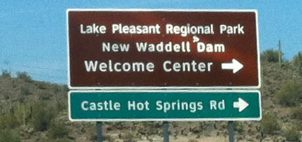
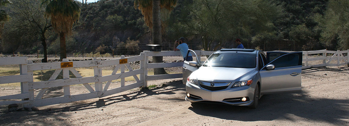
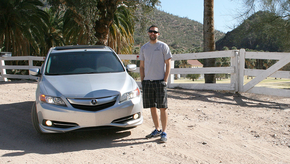
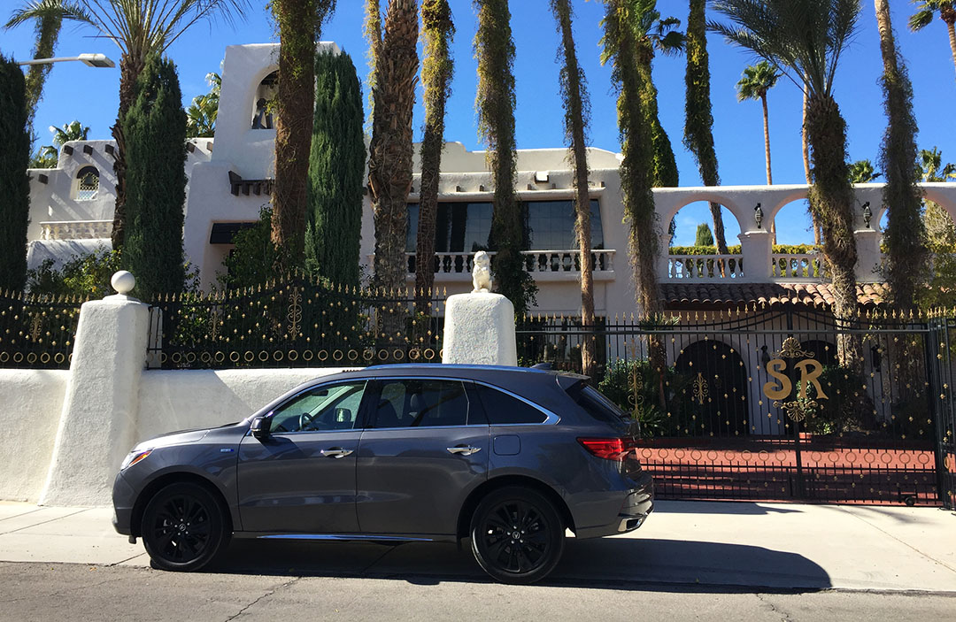
MDX parked in front of Siegfried and Roy’s house in Las Vegas!  See the “SR” on the gate?

Thanks for coming along for the ride!

Salton Sea, California Road Trip Part 1: Bombay Beach & Salvation Mountain

Posted in California, Ghost Town, ILX, Road Trip on March 20, 2016 by tysonhugie

Odometer (Legend):  542,210

542210

Odometer (ILX):  157,959

157959

Trip Distance:  315 Miles

scottsdale_niland

I have a not-so-secret fascination with abandoned places.  There’s something that pulls me in and makes me wonder, “Why’d everyone leave?”  For that reason, the Salton Sea in Southern California made its way onto my must-see list a long time ago, and I just this weekend got around to finally checking it out.  My friends Jason and James joined for the party.

salton)sign

Once a popular destination for tourists (“The Miracle in the Desert”), this is one lake that’s definitely not on anyone’s recreation radar anymore.  It’s more salty than the Pacific Ocean, and getting 1% saltier in each passing year because it has no outlet.  It’s still California’s largest lake and, a surprise to many, was actually created by accident.

postcard_salton

For millions of years the Colorado River flowed through the Imperial Valley where the Salton Sea is located.  It’s at a low point in the region and positioned right over the San Andreas Fault.  Before 1905, the lake bed was mostly dry, but an engineering “accident” diverted gallon after gallon of irrigation water there for two full years before repairs were completed and the inflow stopped.  In that time, the lake bed filled up and even overtook some small towns.  The small influx of water that now makes its way into the sea is enough to keep its level current, though it’s anticipated the level will progressively get lower between now and 2021.

trio

Today the Salton area has a certain allure to it for those of us who love off-beat destinations.  Where else can you find a banana museum, remains of a mobile home park, mud pots, and a giant painted mountain all in a day’s drive?  My road trip partners and I were determined to see what kind of stuff we could uncover.  After a hearty breakfast at Denny’s on Saturday morning, we departed from our motel in Indio and headed along Highway 111 which hugs the eastern shores of the lake.  We were in three vehicles:  my 2013 Acura ILX, James’ 2016 Chevy Malibu (press / loaner car), and Jason’s 2004 Mazda 6.

banana_sign

Sadly, the International Banana Museum – which really appeared to be no more than a convenience store with a little building attached – was shut down when we pulled up.  From the looks of the bars over the windows, it felt more like a prison of some sorts.  A typewritten note was taped to the front window stating that the hours were 12:00 p.m. to dusk, so I guess we missed that opportunity since it was only about 9:00 a.m.  At least it saved us the $1 admission fee.

yacht_club

We next visited the North Shore Beach & Yacht club, which sounds all sorts of classy, but it’s really not.  Maybe at one time it was.  Today it’s been restored – it’s a nice looking mid-century modern building designed by Albert Frey and originally built in 1959.  It was abandoned by 1984 and left to vandals and pillagers until a 2009 grant allocated some money toward the rebuild.  We peeked our heads in only long enough to see that were was a gymnasium and some sort of community center.

niland_sign

Random geography lesson:  Calexico is a town on the border with Mexico.  Its Mexican counterpart across the international line is Mexicali.  I like how they’ve mixed “California” and “Mexico” in the naming of those cities.  Another 25 or so miles down Highway 111, I hit the right blinker and led our threesome of cars onto “Avenue A” in Bombay Beach, California.  In the 1950s and 1960s, Bombay Beach was a popular resort destination, even called a paradise.

bombay_entry

But that all changed within the first couple of decades as the ecosystem changed and the quality of the water deteriorated.  People departed en masse by the 1990s as dead fish washed up on the beaches.  While pretty from afar, the beaches are no place for sunbathing.  The water is dirty and it smells about like you’d expect it to.  The few residents who remain live in trailers and must keep to themselves, since we didn’t see a single soul out and about in any yard.  Our drive took us down to 5th Street where we proceeded to make a loop – or square, rather – around the entire town.

bombay

Our attention was quickly drawn to the ruins we were passing.  There were abandoned homes lining the street with elaborate graffiti paintings all over them.  I backed the ILX into one driveway of a home that looked almost move-in ready.  NOT.

bombay_house

We drove up over a dike and to the beach which had a wooden boat on a stand.  The water’s edge was littered with dead fish and the flies were abundant. Allow me to introduce my new boat:  “Miss Take.”

dead_fish

miss_take

tyson_boat

I decided we should stop for a soda at the Bombay Market and that was a cultural experience in itself.  Talk about a one-stop shop.  I found the 7-Up I wanted, but what surprised me was the variety of other stuff available.  “Step right in to the gift shop area,” said a sign.  But there was no separate area.  It was just a single shelf.  There were T-shirts for sale with the logo “Living In Paradise.”  Surely out of sarcasm, right?  Maybe not!  A woman in a straw hat behind us in the check out line had nothing but raves to say about the town.  “I just came from Indian Wells and it’s the most stuck-up place I’ve ever been,” she said.  “Bombay is at the complete other end of the scale.”

ski_inn

We made one more pass through the center of town, make sure to note that the bar there, “Ski Inn,” is the lowest bar in the western hemisphere.  That must be due to the fact that Bombay Beach is America’s lowest elevation community, at 223 feet below sea level.  (Reminded me of when I visited the lowest point in North America, Badwater Basin in Death Valley).  I was ready to move on so we hit Highway 111 to our next wacky destination near Niland, California:  “Salvation Mountain.”

james_tyson_jason

So here’s the scoop on Salvation Mountain:  A guy named Leonard Knight spent his lifetime dumping buckets of paint onto a hillside in the barren desert, creating both a living space for himself as well as a religious statement for all who pass by.  The site is absolutely vibrant with colors and covered in Bible verses and Christian sayings.  “God Is Love” is a recurring theme.

yellow_brick

A yellow-brick (but not really brick) path leads up a stairway to the cross perched atop the tallest portion of the site.  We took a walk through the area and noticed that people had been leaving keepsakes of all sorts in different rooms – driver licenses, student ID cards, photographs. The construction method for Leonard’s creation was similar to the way the Navajo Indians built their hogans – hay bales and straw were the main building materials.  The place reminded me a little of Phoenix’s Mystery Castle.

tyson_jason_salvation

Knight spent the last years of his life in a long-term care facility for dementia, and he died in 2014, but the site lives on thanks to volunteers who staff it daily.  Oh, and they are taking donations of latex paint if anyone has a gallon or two to spare.

Thanks for joining for this first part of the trip.  Come back for the second half next time!

More pics here.  First, a pit stop in Quartzsite at the Tyson RV & Mobile Home Park, with my road trip snack essentials.

tyson_sign

Dinner on Friday night at Mario’s Italian Cafe in Indio with James & Jason

group_marios

Jason checking his oil in the 187,000 mile 2004 Mazda 6 on Saturday morning pre-departure.

jason_oil

Int’l Banana Museum sign

banana_sign_3

Your $1 entry fee is refundable if you make a “purchace.”

banana_sign_2

NSBYC:  North Shore Beach & Yacht Club.  A lot more exotic sounding than it really is.

yacht_sign

Looking southbound on desolate Highway 111 along the eastern shores of the lake.

ilx_rear

Graffiti in Bombay Beach:  “Abandon All Hope Ye Who Enter.”

abandon_help

Needs a little TLC, but a great fixer-upper.

bombay_house_inside

I hope this graffiti isn’t some sort of gang sign that could get me in trouble (Leif, if you’re reading this, I’m thinking of you!)

graffiti

The ILX looking over Salton Sea.

ilx_salton

Garbage and dead fish all over the place.

salton_sea

Jason and James

jason_james_bombay

Perfect for a swim, no?

salton_water

T-shirts in the market

bombay_shirts

Entrance sign to Salvation Mountain

salvation_sign

Painted truck at Salvation Mountain

bible_truck

More very soon!

Saturday Drive to Greenlee County: Town of Duncan, Arizona

Posted in Arizona, Ghost Town, ILX, Road Trip on December 20, 2015 by tysonhugie

Odometer (Legend):  540,423

540423

Odometer (ILX):  149,872

149872

Trip Distance:  481 Miles

scottsdale_duncan

Come back with me to 1883 today.  About 5 miles from the New Mexico state line lies a community that I’ll introduce you to.

tyson_duncan

Duncan’s story mirrors that of so many other small towns of the Old West:  Mining origins, bustling and prosperous earlier years, and a steady decline from then onward.  Today, the 696 people who live there are hearty.  After all, they’ve survived two devastating Gila River floods that nearly wiped out the entire town, not to mention a widespread fire.  To top it all off, the main highway through town – once a critical east-west thoroughfare – was bypassed about 30 miles to the south by Interstate 10 in the 1950’s.  Duncan was left high and (not so) dry for the next several decades.  It’s a small town in every sense: The people all know one another.  Traffic lights are non-existent.  And the locals look at you with a raised eyebrow and ask, “You came to Duncan, why?” if you tell them you’re visiting.

duncan_building

old_west_hwy

It seemed only fitting that before visiting Duncan, I visit Dunkin (Donuts).  So, I grabbed a bagel and beverage in Scottsdale around 7:30 in the morning before beginning my journey.

ilx_at_dunkin

My day started out eastbound on US Highway 60 on a voyage back in time.  By the time I’d driven 100 miles, I’d already passed through a half dozen teeny little towns that were past their prime:  Places like Miami, Claypool, and Globe that survive – barely – on the mining industry thanks to nearby Freeport McMoRan copper extraction operations.  I stopped just a couple of times for photos at abandoned sites and to explore some back alleyways with their boarded-up windows and rickety looking exteriors.  I also stumbled across a collection of four 1950’s Lincolns tucked away on a side street, some in better condition than others.

miami

lincoln

In Globe, I cut to Highway 70 and continued heading toward New Mexico.  I rolled on a two-laner through the San Carlos Apache Indian Reservation which covers 1.8 million acres in eastern Arizona.  No reservation would be complete without a casino or two, and I exercised restraint by not stopping at the Apache Gold Casino Resort, lined extravagantly with palm trees that looked very out of place in this barren landscape.  I also was tempted to make a stop at the “Rock-A-Buy” rock shop on the roadside, but decided to press on.  I arrived in Duncan at 11:58 in the morning, just in time to pull my Acura ILX into Bart Tipton’s Saloon – long since boarded up – for a photo next to a 1950’s Chevy fire truck that probably hasn’t moved in quite some time now.

duncan_distance

duncan_arrival

Church bells rang out the 12:00 hour, and I received a wave from a woman on the patio of the Riverfront Lounge across the street.  She was probably mumbling to herself, “Damn tourist.”  I think I had the only vehicle in town newer than about a 1990 model year.  Jason arrived not long afterward in his well-traveled Mazda 6 sedan and we dined at the only place available for lunchtime grub:  Tumbleweed Cafe / Patio / Lounge at 206 Old West Highway.  Jason and I had work to do:  The purpose of our meet-up was to lay the preliminary ground work for a 2016 Alaska drive we’ll be taking together next May.  It’s now been 10 years since my dad and I took a similar 7,500-mile round-trip drive to Fairbanks and back in my Legend, and I’ve been wanting to go back.

tumbleweed_sign

The Western Burger hit the spot while Jason and I took a detailed look at timing, destinations, and budget topics for our Alaska trip.  You’ll see coverage of that adventure in its entirety next year, and I’m excited to take you all along for the ride.  Our very young waiter made a fuss at the cash register when we went to pay the bill for lunch.  “You guys had to wait awhile; I’m going to take 10% off your bill,” he said.  I told him not to worry about it.  The total for our meals was only $20, and we’d been busy chatting it up about Alaska, anyway.

jason_mapping

Duncan was the perfect meeting point for our Saturday drive because it represented a 3.5 hour one-way drive for me and a 2.5 hour drive for Jason.  We took some time to explore the town – or what’s left of it – now that we were well-fed.  A few blocks west of the restaurant lies a concrete platform that was once home to a railroad station.  A drive down “East” Street (which is more gravel than paved) reveals older homes that have clung to their foundations in spite of the floods that came through the area, as well as empty lots where not-so-lucky homes used to reside.  We got a few looks from locals who were setting up for an outdoor picnic of sorts in their front yard.

bakery

Next we rolled up to a park that at one time was probably the pride of the town.  In 1998, a jet fighter plane was perched on top of a hill just south of town in recognition of the men and women of the Armed Forces who had served from the Duncan area.  Today, the park is in a sort of disrepair.  The adjacent swimming pool looks like an algae breeding ground, and the landscaping looks like it hasn’t seen much attention in awhile.  Still, we got a good overview of the valley from there and the winding Gila River in the distance.

aircraft

Our last stop was at Germaine’s Emporium, an elaborate collection of antiques, toys, books, and just general “stuff” right on the main highway.  There were only two other customers there – locals, I think.  Jason and I walked through the series of 5 or 6 rooms that were crammed with artifacts on shelf after shelf.  I didn’t have cash on hand (shame on me), but Jason loaned me $1.40 so I could buy a cute little hardbound New Testament that was probably 100 years old.

It was time to split ways, so I said farewell to Jason and we headed in opposite directions on the Old West Highway.  I looped home via an alternate route – interstate this time, instead of back roads.  The I-10 experience is far less interesting but also far less involved than going through all the little towns on US 70 and US 60.  I set my cruise control at 78 miles per hour and whizzed through Willcox, Benson, and Tucson on my way home, arriving just in time for a Saturday night out with friends.  Enjoy the rest of the pics below!

Morning visit to Dunkin Donuts on Hayden Road in Scottsdale

tyson_at_dunkin

Abandoned building in Miami (Arizona, that is)

miami_ilx

Traveler Hotel in Miami.  I think it’s closed, but that’s just a guess.

hotel_miami

Who can identify the year of this Pink Lincoln?

lincoln2

Roadside abandoned service station on US 70

building_on_70

Restroom facilities are long-since left to ruin

restroom

Even Keen’s “Fort Thomas” Store was shut down, with a lonely dry gas pump out front

fort_thomas_gas

Pictured here is the Simpson Hotel in Duncan, built 101 years ago and still in operation today.

simpson_hotel_duncan

Some of the other cars around Duncan, including a decent-shape 1985 Honda CRX.

crx

One-stop shop!

hildas

Exploring a dirt road up a canyon south of Duncan, until I got to a No Trespassing sign

canyon_road

Owner will finance!  Should I buy some property in Duncan?  Fixer-upper, for sure.

home_east_st

Rock church in Duncan

church

Lunch is served.  And the curly fries were better than the ones at Arby’s!

burger

Elevated concrete platform where a train station used to reside

platform

Kool Spot RV Park and its elaborately painted (not) sign

kool_spot

View of Mount Graham as seen from US Highway 191 between Safford and Interstate 10

graham

And finally a sunset as seen while stuck in bridge construction traffic on I-10 near Benson last night

sunset

Thanks for joining!

Here are a few other fun links to take a peek at today.

Have a great week, everyone.

Weekend Roady: Wedding in Salt Lake City, Utah

Posted in Ghost Town, ILX, Road Trip, Utah on April 20, 2015 by tysonhugie

Odometer (ILX):  123,150

123150

Odometer (Legend):  533,182

533182

Trip Distance: 1,454 Miles

scottsdale_to_slc

11:10 p.m., Saturday night.  Intersection of 600 West and 100 South.  Dark alleyway near the train tracks.  It felt like a horror movie in the making already.

I took the driver’s seat of the ILX, pushed in the clutch, and punched the “START” button.  Something seemed off.  The exhaust sound – it was louder than I’d anticipated.  My ears were drawn to the back of the car.  Slowly I turned around to look over my right shoulder.  Glistening in the moonlight were hundreds of pieces of broken glass, and wide open to the outside air was my right rear window – or what used to be my window.  I’d just been a victim of vandalism.

ilx_window_broken

Back outside the car (with it still running and headlights now turned on), I walked around to assess any potential body damage, but didn’t find any.  My next thought – was anything missing?  I reached for the trunk release button and opened it up.  My laptop computer and suitcase were still in there.  At this point, a microscopic feeling of relief crept in.  I debated about calling the police right then and there – but, what good was a police report going to do in a city 700 miles from home?  I already knew I’d be out of pocket a few hundred bucks for a new window regardless.

It wasn’t until I got a few blocks away, sitting at a stop light on West Temple, that the thought dawned on me:  MY WORK LAPTOP.  I had two computers in the car.  The second one had been sitting on the floor in its black bag behind the passenger seat of the car.  Gone.  At that point, mind racing, I did dial 9-1-1.  The operator calmly told me I’d need to submit the police report online.  So, instead of continuing on to have a good time with my friends, I went back to where I was staying and got on the SLC PD website to fulfill that action immediately.  What a night.

i15_signs

The rest of the weekend more than made up for that horrible incident, but I will forever remember the night of April 18th and the 10-hour return drive from Salt Lake City to Phoenix with no right rear window the following day.  Thankfully for most of that stretch, I was on Interstate 15 southbound with its 80 mph posted speed limits so it went by quickly.

My 1,400-mile weekend trip’s purpose was to attend the wedding reception of my cousin Kelsee who got hitched at the Salt Lake City Mormon temple.  Along the way, I made a bunch of special visits that broke up the trip and made it memorable.  The first place I had to check out was the teeny town of Holden, Utah off Interstate 15.  I knew Holden wasn’t going to be of any great size when I saw the “NO SERVICES” sign attached to the exit sign on the offramp.

holden_exit

Sure enough, it’s a quaint farm town with a couple of boarded up stores and probably a higher population of livestock than human beings.  The town was established in 1855 as a Mormon pioneer settlement.  A sign at the entrance to town states the following about the people of this community:

Residents of Holden still radiate the enduring qualities bequeathed them by their hardy pioneering ancestors:  thrift, perseverance, and a strong, abiding love of God.

My friend Chandler grew up in this community and just happened to be there, so I paid a visit to him and his family.  They certainly do radiate those qualities!

woods_market_holden

tyson_jack_chandler

At Chandler’s recommendation, I again pulled off the interstate in Scipio, Utah about 15 miles further north on the interstate.  Originally settled in 1859, Scipio has never really ‘boomed’ but rather lingered in the population range from 300 to 500 people in the last 150 years.  Today, the main street – “State” – has an antique store that still looks to be in business.  A couple of other buildings are most decidedly NOT in business.  I positioned the ILX in front of a couple abandoned gas stations for pictures.  Those old pumps are my favorite.

ilx_scipio_garage

After lunch with my dad & stepmom in Salt Lake, I visited my friend Branson and rode around his neighborhood at a whopping 10 miles per hour on a Yamaha golf cart. I also took a peek at Branson’s 164,000-mile 1995 Acura Legend LS coupe 6-speed.  He takes great care of it.  Branson and I originally met through a Legend enthusiast forum in 2003.

ilx_legend

Branson and I decided to take his nieces and nephew for a mini road trip in the ILX to Herriman, about 7 miles away.  There, we checked out a 2,800-square-foot home that was built in 2011 and modeled after the feature home in the 2009 Pixar movie “UP.”  However, unlike the home in UP, this one didn’t levitate with balloons!  It sure did stand out, though, amidst all the monochromatic, cookie cutter homes surrounding it.

Here’s what the Pixar movie house looks like:

up_house

And the real deal:

up_hous

My cousin’s wedding reception was a top-notch affair at the Ivy House on 600 East in downtown Salt Lake.  It was great to reconnect with friends and family members there.

tyson_kelsee

The randomest thing of all was when I ran into my grandparents at a gas station in Beaver, Utah on the way home.  I ended up following grandpa’s white 2000 Toyota Avalon the rest of the way to their home in St. George, about 100 miles away.

grandma_grandpa

As for a conclusion to the dramatic opening story:  My employer issued me a new laptop computer within 2 hours of my workday today, and my ILX goes in tomorrow morning for a $349 rear window replacement at Safelite so all will be well soon.

Thanks for coming along for the trip!  A few more pictures are below.

Chandler’s family’s backyard with garden in Holden, Utah

farm

Entrance sign to Holden at the north end of town on Main Street

ilx_in_holden

Antique store on State Street in Scipio, Utah

scipio_antique_store

Sign back to Interstate 15 from State Street

scipio_sign

Another abandoned service station in Scipio

ilx_scipio_gas_station

Location of that service station – intersection of State & Center

state_center_scipio

Loved this old pump

gas_pump

Lunch with dad & stepmom (and friend Jeremy) in Salt Lake at Cheesecake Factory

cheesecake_lunch

Shot of the “UP” house in Herriman

ilx_up_house

Love the Wasatch Mountains!  It was a perfect weather day.

slc_mountains

Springtime is in full swing in downtown Salt Lake.  Here I was parked just outside the Ivy House reception center.

ilx_on_street

Fueling up next to mom & Todd in their 2010 Volkswagen EOS in Nephi, Utah

ilx_eos

Urban Exploration: Beeline Dragway

Posted in Arizona, Ghost Town, ILX, Road Trip on May 21, 2014 by tysonhugie

Odometer (Legend):  529,551

529551

Odometer (ILX):  79,709

79709

I’m not usually one to trespass.  I’m a clean-cut, straight-A-student kind of guy.  But deep down inside of me, I’ve always liked exploring buildings that are off-limits.  I guess part of the thrill is that of potentially getting caught.  One of my favorite adventures recently was exploring an old deserted ghost town called Modena, Utah in fall 2012.

For 5 years now, my weekday afternoon commute has taken me through the Salt River – Pima Indian Community.  Daily I’ve passed within 50 yards of this looming 3-tiered abandoned structure south of the Beeline Highway, but I’ve never taken the time to dig deeper — until yesterday.  I decided to finally see if it was even possible to access the building.  I hit the brakes in the ILX and took my next left-hand turn.  Just before entering the driveway of an abandoned double-wide trailer, I veered onto a one-lane dirt road and pointed the car toward the concrete building to the east.

approach

I could tell that the road at some time was paved, but decades of aging had returned it almost completely to earth.  I dodged a couple of huge potholes.  Soon, I saw that the square building had a 10-foot-tall chain link fence all the way around it (and barbed wire looped around the top).  Except, there was an opening just wide enough to drive through.  It was too tempting to resist.

fence

I pulled the ILX into the fenced-off area and hopped out for a few pictures.  One step out of the car and noticed the pavement was glistening in the sunlight.  “Crap,” I thought.  The entire ground was absolutely covered in shards of glass from broken bottles.  I was hoping my Michelins would hold on.  And they did.

glass

stands2

I hurriedly took a couple of shots with my cell phone since my Nikon was at the house.  The north end of the building at the ground level was totally open, so I peeked inside.  Elaborate graffiti artwork adorned every surface, and a few stray pieces of garbage at the far end of the room were probably someone’s furniture at one point.  I didn’t take the time to climb the staircase and view the upper floors of the building, but I’d like to go back – and armed with a better camera.

graffiti

stands

So what is this place?  Its history dates back to 1963 when it was known as the Beeline Dragway.  It was opened that year as a 1/4-mile drag race track.  In those days, races were held on Saturday nights in the summertime and on Sundays in the winter – with some cars hitting speeds up to 200 miles per hour.

dragway_sign

dragway_old

The raceway has been closed since 1975 when the lease expired with the Indian community.  It has since been replaced by larger, much more modern facilities elsewhere in the valley including Phoenix International Raceway (PIR) and Wild Horse Pass Motorsports Park.  Unfortunately, today there’s not much left of the Beeline Dragway.  Some 40 years after its closure, the only memory of Beeline that still stands is this graffiti-tagged main building.

inside

graffiti2

Here’s an overhead view of the area.  Beeline Highway is along the top, with the lone building in the center of the screen as the structure which I entered.  The track itself extended horizontally toward the east from the main building.

overvie

I like to think about what the reaction would have been if, 50 years ago, I pulled up at Beeline Raceway in a 2013 Acura ILX.  For the 12 years that it was open, this building was witness to the height of the muscle car era.

beeline2

I found this really neat video from 1969 when the Beeline was at its heyday.

Thanks to D25 reader Ryan for sending me this pic of his TL arriving in his home state of South Dakota.  Nothing like a little road trip to kick-start the summer.

ryan_tl

And a huge congratulations to our Italian reader, Francesco, on hitting an impressive 320,000 kilometers in his Fiat!

francesco_320k

Thanks to all of you who continue to share your milestones with me.  Keep ’em coming.

ILX + TL Photoshoot: Silver Bullets

Posted in Arizona, Ghost Town, ILX, Reader's Ride on March 16, 2014 by tysonhugie

Odometer (Legend):  529,008

529008

Odometer (ILX):  70,444

70444

Greetings, fellow roadtrippers.

I decided to break in a new (to me) Nikon D90 camera and get a few sunset pictures of my ILX and a friend’s TL on Friday night.  You first met Devan and his 2006 TL back in October.  The TL is equipped with the Tech Package and finished in a brilliant Alabaster Silver paint.  We think my Silver Moon ILX paint may be just a tiny bit lighter in color than the Alabaster.  Devan’s car has 81,000 miles on it and runs great.  These pictures were taken at Papago Park near the Tempe / Phoenix border.

tl_ilx

In the background is “Hole in the Rock” — an area where visitors can hike up to a natural sandstone opening in the rock and admire the view.  After eight years of living in the PHX area, I still haven’t hiked that.

devan_tyson_3

Devan and I both have the ‘Agriculture’ vanity license plate option on our Acuras.  Its black & white design compliments a silver car well.

backs

You may notice that Devan has also done some subtle updates to the nose of his TL with some Plasti-Dip treatment on the front grille.

devan_tyson_2

A closer look:

fronts

Face-off.  For having debuted a full 10 years ago, the 3rd generation TL design still looks modern today.

ilx_tl

Nice looking pair of Acuras.  I wonder how long it’ll take me to pass Devan up in mileage?

ilx_tl_front_left

As a professional detailer, Devan takes great pride in keeping his Acura immaculate.  Follow his work on @dnaautodetailing on Instagram or on his Facebook page.  Just view that interior:

interior_tl

Now, usually when I post interior pics, I crop out door jambs because they are unsightly and dirty.  I intentionally left Devan’s pictured here because they are JUST SO CLEAN.

interior_tl_2

It was a great Arizona evening.  We are blessed with great sunsets nightly.

tl_left_rear

Finally, a couple of solo shots.  I do love those LED tails on the TL.

tl_right_rear_2

The ILX had received a bath, too, so it was looking rather nice in the evening light.

right_rear

Thanks Devan for meeting up!  Keep rolling that beautiful TL.

devan_with_tl

This weekend I’ve got family in town and I stuck around the Phoenix area.  My cousin Logan plays for the Williston State College Tetons baseball team, based out of Willison, North Dakota.  I went over to watch his team play a game at Chandler-Gilbert Community College on Saturday.

williston_rv_with_ilx

Perfect weather for a ballgame!

baseball

With uncle Dart and aunt Wendy.

dart_tyson_wendy

I also did a bit more urban exploration.  Many of you will remember last April when I took a drive on Gates Pass in Tucson, Arizona and visited Old Tucson Studios.  On the way back from that trip, I stopped an abandoned Nickerson Farms Restaurant in Picacho Peak, about halfway between Tucson and Phoenix.

April 14, 2013 – Notice the roof of the building still intact, despite having been out of operation since 1979.

nickerson_with_ilx

March 15, 2014 – The entire red roof of the building has now collapsed and the building is taped off with caution tape.  The entire surroundings are covered in “No Trespassing” signs (unlike last year) so I didn’t dare take a peek inside this time.

nickerson3

Another look from the front of the building

nickerson2

And looking from the south side

nickerson1

If it has to do with abandoned buildings, ghost towns, or anything of that sort, you know I’m interested!  Just point me in the right direction and throw me a camera.

Photoset: 2013 Acura ILX in the Arizona-California Desert Corridor

Posted in Arizona, California, Ghost Town, ILX, Road Trip on March 8, 2014 by tysonhugie

Odometer (ILX):  69,800

69800

“We seem to have a problem.  We’re running low on petrol.”  These words were spoken to me yesterday in broken English from a French tourist who had honked the horn of his white rental car to get my attention.  I’d been minding my own business getting some quality sunset shots of the ILX at an abandoned service station when my focus was interrupted with a horn honk that nearly sent me jumping sky-high.

Unfortunately for my fellow traveler, Interstate 10 is a lonely place when it comes to services.  The station we were standing in front of had been shuttered for easily a few decades.  The metal Chevron pumps out front looked like they belonged in a museum somewhere – weathered examples of a motoring era years in the past.

“Well, you’re 40 miles from Blythe to the east,” I told him, “and probably 20 miles from Chiriaco Summit to the west.”  As the sun continued to dip lower on the horizon, I could sense the urgency in his voice as he debated his options.  I encouraged him to continue toward Blythe.  His Nissan Versa couldn’t possibly need more than a gallon and a half to go those 40 miles, right?  I now wonder if he was able to make it.

Today I’ll share a few of the pictures from my drive toward California yesterday in the 2013 Acura ILX.

tysons_well_sign

First up, how could I have passed by this roadside attraction so many times in the past and never stopped to appreciate it?  A stagecoach stop that bears my own first name.  Located in Quartzsite at the far western end of Interstate 10 in Arizona, Tyson’s Well dates back to the 1870s and provided traveler accommodations.

tysons_well

Just down the road, the Tyson Mobile Home & RV Park greeted me with a larger-than-life sign with my name on it.

tyson_rv_park_sign

I’m ready to move right on in.

tyson_rv_park

And finally, that fated location where my French friend pulled off the interstate in hopes of finding his petrol.  Well, he wasn’t going to find any at this 24-hour service station. In fact, I’m pretty sure this one was a “zero”-hour service station in Desert Center, California.  The pumps were long gone.

station1

Down the road, the Family Cafe lingered as a memory of days gone by.  Miraculously, vandals have left the old fuel equipment alone and all the building’s windows remained intact.

cafe3

Red, white, and blue.  These must have looked nice when they were fresh & new.

gas_pumps

I could sure have gone for a gourmet meal, but I think the kitchen’s closed.

cafe2

I suppose you could take a picnic lunch, though, since this old wooden table out front appeared serviceable.

table

cafe

Think they sold 91 octane here?

pump

gas_pump

A bit further west down the old frontage road (which pre-dated I-10 by a long shot), I found a third abandoned station.  A skeleton of what was once the sign out front doesn’t give us any clues about the brand of fuel that was sold here.

abandoned_gas_station

I stepped inside for a look at the amenities.

window1

Windows were broken out, but by golly, the view was stunning.  Better than the view from my office, in fact.  Maybe I could telecommute from Desert Center?

window2

Great fixer-upper!

gas_station_inside

One-stop shopping.

station

The old wooden guard rails on this bridge could use a new coat of paint.

ilx_front_left

sunset1

Nighttime took over as I continued westbound.

Come back tomorrow for a detailed look at one of the most eclectic car collections I’ve ever visited, in Palm Springs, California.   You’re going to want to see this!

ILX Drive: Castle Hot Springs Resort, Arizona

Posted in Arizona, Ghost Town, ILX, Road Trip on February 22, 2014 by tysonhugie

Odometer (Legend):  528,711

528711

Odometer (ILX):  68,304

68304

Trip Distance:  120 Miles

primitive_road_sign_ilx

For a starting price of just $500,000, you can bid your way toward ownership of a 210-acre former resort in the remote desert north of Phoenix, Arizona!  Opened in 1896 as a relaxing getaway for dignitaries and the elite, Castle Hot Springs and its luxurious amenities thrived all the way through the 1950s and 60s.  U.S. Presidents Roosevelt, Wilson and Hoover were regular guests.

hot_springs_sign

Here’s a postcard from the 1950’s.  Nice place, huh?

castle_hot_springs_1950s

The hot springs themselves (yes, they do exist in Arizona!) produce some 180,000 gallons of water per day that’s between 118-120 degrees.  However, the resort has been closed since a December 1976 fire destroyed the main building.  At that time, the site was 40 miles from the nearest fire station, so assistance was too far out of reach.

fire_dec_1976

The resort never came back to life.  In the 38 years since that fire, it’s changed hands a few times.  A year ago, the entire piece of property was up for grabs for $5.7 million.  This coming Thursday February 27th, an auction will determine its next owner.  Remote doesn’t even begin to describe it.  Circled in yellow (top left) is the resort location.

circled

Here’s the aerial view of what the site looks like today.  Clearly visible is the white 125,000-gallon swimming pool.  Tennis courts are located to the left.

overhead

Despite the fact that the resort was closed and potentially even inaccessible, I was determined to make the trek in the Acura ILX today to see what this forgotten place was all about.  Having done a little bit of online mapping, I knew from Google satellite view that the road was unpaved for a long portion, but I read that conditions could be traversed with a passenger car if driven carefully.  Challenge: accepted.

I picked up two friends for the trip this morning:  Daniel, visiting from Charlotte NC, and Greg, a colleague from work.  Both are avid travelers and I knew they’d be good company.  We made our way toward the Carefree Highway and Lake Pleasant.  I was surprised to see only one sign for Castle Hot Springs as we exited the highway.  The rest of the drive we were winging it with what we thought was the correct route.  After we made it to the northwestern edge of the lake, the road turned to dirt.

warning_sign_with_ilx

river_bottom_road

For eight miles, I carefully weaved my way through the desert while stirring up a cloud of dust in the ILX.  Three of those miles were very especially rocky as the road followed the path of the riverbed, and I was lucky to have 6 inches of ground clearance to get around the obstructions in the road.  Finally as we rounded a corner, the palm trees of Castle Hot Springs came into view.  We’d made it!

tyson_greg_resort

To no surprise, the property was entirely fenced off with “No Trespassing” signs.  As the three of us chatted outside the gate about site, we were approached by two men who were walking up the road.  One of them began, “I’m surprised the caretaker isn’t already out here on her golf cart with a gun, running you guys off.”  Rough neighborhood, I guess!  As it turns out, this gentleman was a neighbor from down the road.  He said they’ve had problems with riffraff in the area – drugs, guns, killings, and (yes he really said this one) “people having lunch on our lawns.”   Basically, he’s trying to keep inquisitive people like us away.

private_party_keep_out

He did, at least, give us some interesting info regarding the state of the property.  It’s been zoned as a residence instead of commercial property now, so the chance of it being resurrected as a desert resort oasis is slim.  The land is in fact being parceled out into sections.  The springs are still active (though another area shortly up the road where springs used to exist has since been “capped off” with concrete because it attracted too many troublemakers).  It’s really a shame more people aren’t able to enjoy the springs.  Check out the photos below from our adventure in checking this place out!

Heading toward Lake Pleasant Regional Park

lake_pleasant_sign

And a right hand turn at Castle Hot Springs Road.  This was the last sign we’d be seeing for Castle Hot Springs.

castle_hot_springs_sign

15 or so miles later, we’d reached the end of the pavement.

dirt_road_start

Putting my tires and suspension to the test.

dirt_road

This notice stapled to the gate at the resort was in reference to the re-zoning effective 3/3/14

hearing

Scoping the place out as best we could from outside the white wooden fence.

ilx_front

Barn across the street

barn

Here we are!

tyson_with_ilx

The yellow building that sits near the swimming pool appears to be currently inhabited.  A trailer is sitting on the tennis courts.

yellow_house

This is the driveway to the property.  I wonder what kind of cars drove down this road in the early 1900’s.

castle_hot_springs_driveway

A bit further down the road, we found another palm-lined grassy area with a mysterious looking garage on the premises.  I have to wonder what’s inside there!

garage

Just before making our turnaround to head back to Phoenix.

ilx_dirt_road

Sharing the road with some cows

cow

I was surprised my Garmin GPS knew the name of the dirt road we were on

gps

Back to civilization we went.  For more on Castle Hot Springs including a neat look at what the pools look like today, and some scans from a 1907 brochure/pamphlet, check out this website.

ilx_on_dirt_road_2

No road trip is complete without great food, so we grabbed burgers at Wild Horse West near the intersection of Carefree Highway and Lake Pleasant Rd.

wild_horse_west

They weren’t kidding!  This thing was pretty amazing.

burger

I saw this range figure after a fuel-up earlier in the week.  I don’t know if the car is really capable of 500+ miles on a tank.  Has anyone with an ILX ever actually achieved that?

523_mile_range

Also spotted another place I may have to check out sometime.

arizona_legends

Have a great weekend, everyone!

Utah Holiday Travels

Posted in Ghost Town, ILX, Road Trip, Utah on December 24, 2012 by tysonhugie

Odometer (ILX):  23,385

23385

Dashing through the desert in a 201-horse, front-wheel-drive sleigh.  That’s how I kicked off my weekend on Friday after work.  When I wasn’t spending time with family or friends, I was behind the wheel of the Acura ILX over the last few days.  Here are the details of my travels!

About 3 hours (200 miles) into my drive, I stopped for a little Route 66 side-trip in Kingman, Arizona.  The original highway, now bypassed by Interstate 40, is called Andy Devine Road.  Even though it was after-hours, I made my way to the Visitor’s Center (which used to be the city’s power plant, thus is now named Powerhouse Museum).  There’s a marker here that denotes the site’s elevation:  3,333.3 feet above sea level.  A spike in the building denotes the exact location.

sea_level

powerhouse_sign

I circled the location of the sign in red here, on the building behind the ILX.  Photoshop skills at their finest.

ilx_at_powerhouse

When was the last time you saw a pay phone?  Better yet, when was the last time you USED one?

phone

Across the street, a 1928 steam locomotive was on display. This one was Santa Fe #3759 – a “4-8-4” style that was built in 1928 and ran until 1957 when it was donated to the city of Kingman.  It’s sat in its current location for 55 years!  The locomotive reportedly ran 2.5 million miles of service before its retirement.  Now that’s something a half-million miler like me can appreciate!  Each year during this season the train is decorated with Christmas lights so I got a few pictures before continuing on my way.

3759

3859

In Las Vegas I met up with Drive to Five fan Jessie, who is a proud Legend owner.  His Rosewood Brown 1992 L Sedan automatic has only 134,000 miles on the odometer.  Jessie strives to keep his car running in tip-top shape.  I was privileged to take it for a drive around the parking lot.

jessie_tyson_2

jessie_tyson

Saturday in St. George

Hike time!  On a cool (30-degree), crisp Saturday morning I picked up my mom, my stepdad, and our friend Holly for a trip up to Snow Canyon State Park by following State Route 18 which leads north from the St. George area.

driving

About 10 miles up the road, we arrived at the trailhead for the Cinder Cone hike.  The hike itself was only 3/4 of a mile long each way, but it traverses some rocky / jagged terrain and ascends about 500 feet in elevation.

cone

trailhead

trailhead_2

hiking

Reassurance marker along the way, though trail was clearly visible.

sign

Last stretch before reaching the summit.

almost_there

Freezing but still celebrating our arrival at the top.

celebration

The views from the top are spectacular.

view

tia_todd

Since Cinder Cone is an ancient (and now extinct) volcano, from the summit, the crater is still visible.

trailhead_3

Our descent went much more quickly and we soon enjoyed the comfort of the ILX and its heated seats to take us back to St. George.

snow_canyon

Sunday’s Ghost Town Road Trip

Modena, Utah.  It’s a town that I visited 7 1/2 years ago in my then-175,000 mile Acura Legend.  I felt like giving it another look to see what’s changed.  As it turns out, aside from a few more years of aging, it sits largely the same as it did in 2005.  On a crisp Sunday morning I headed out from St. George Utah via State Route 18 to explore some of southwest Utah’s backroads in the ILX.  Total distance was about 170 miles round-trip.

map

As I began my climb to the higher elevations, I started seeing white-capped mountains in the distance.

drive

Soon I was passing through Veyo, Utah (population of 483 people as of the 2010 census).  This giant red sign advertising Veyo’s famous pies caught my eye on the roadside.  More on that later!

veyo_pie

I decided to take an 8-mile detour to the east to visit a tiny town called Pine Valley.  This place is a popular cabin destination for folks in St. George who want to escape the triple-digit temperatures during the summer months.

pine_valley_sign

This was the first time my ILX had seen snow, so I pulled off for a quick picture.

snow

Arriving in Pine Valley via Grass Valley Road.  It was a crisp 27 degrees Fahrenheit according to the ILX’s exterior temperature readout.

arrival_pine_valley

I got a picture of the Pine Valley Mormon chapel, which was just starting to welcome its guests for the 10:00 a.m. Sunday service.  This chapel was built in 1868 by Ebenezer Bryce, who used the scheme of an upside-down boat.  Today, it’s the oldest continuously-used Mormon meetinghouse.

pine_valley_chapel_2

pine_valley_chapel

Next it was time to loop back to SR-18 and continue northward.  The summit on this road is elevation 6,150 feet.

SR18

At Enterprise, Utah, I veered right to stay on SR-18 for another 15 miles or so.

219_18

Closing in on my destination!  From the intersection of SR-18 at Beryl Junction, Modena lies another 16 miles west.  During this 16-mile stretch, I counted only two other vehicles that I encountered.  This is an extremely remote location!  Speed limits are 60 mph which seems agonizingly slow for the wide open stretches.

16_miles

wheel

Arrival!

Unfortunately, the Last Chance Saloon is no longer open for business. I would have loved a bite to eat.

last_chance_saloon

The 1936 schoolhouse is probably the best-preserved building in town.  From the “360 Cities” website regarding Modena:

“With the advent of the railroad in Iron County and its arrival in the Modena area in December 1899, Brigham J. Lund, along with two partners, E. M. Brown and Jose Price, started a small business venture here. In time they were freighting to St. George, Utah; Pioche, Nevada and Delamar. Lund soon bought out his partners and in 1903 incorporated under the name of B. J. Lund & Company. The name “Lund” is still found on several buildings in town including the General Merchandise & Hotel building. By 1903, a U.S. Weather Bureau office had also been established in Modena. The Last Chance Saloon now closed and boarded up is a reminder of a distant era.

The change from steam to diesel by the railroad brought about the demise of Modena which today is almost a ghost town. Only five families remain. There is a small convenience store/post office and a gas pump (no services available as of this writing) in town which served locals and others working the silver, iron ore, and beryl rock mines around the area. A stone school building is one of the more imposing solid structures in town. Edna Thorley 91, taught elementary school children in the building. She still lives in town and keeps up scrapbooks filled with memories of the past and present. Just north of town is the Modena cemetery.

schoolhouse

snow_road

B.J. Lund & Co:  General Merchandise & Hotel.  This place has been around for over 112 years.

lund_hotel

ilx_back_modena

I left the ILX parked for a time and wandered around on foot to explore some of Modena’s streets.  It was eerily quiet aside from the crunch of my shoes on the snow.  I intentionally kept quiet because I didn’t want to awaken any dogs that might be in the neighborhood.

hotel

I was able to boost myself up and peek inside the hotel’s main floor.  When I visited Modena in 2005, I actually went inside, but given the latest “No Trespassing” signs, I decided to play it safe this time.

hotel_interior

street_signs

Back side of the hotel.

hotel_back

And a few other buildings within walking distance.

building3

tracks2

Here’s a shot looking inside the General Store area of the Lund Hotel.  I wonder what this place would have looked like in its heyday – bustling with people and commerce as the steam locomotives brought people from near and far.

store_int_1

Here’s a fun “then and now” look.

June, 2005:

rrtracksmodena

December, 2012:

tracks

This building was at one time the post office.  When I visited in 2005, it had a (dry) gas pump out front which has since been removed.

post_office

Some background information here.  Can you believe this place didn’t have electricity until the 1940’s?

modena_sign

I was intrigued by this little 2-room wooden home.  Let’s take a look inside, shall we?

house_outside

house_entry

Someone left a pair of boots in there.

house_interior_2

Quaint little bedroom!

box_spring

And a stack of newspapers dated 1985. The one on top was dated January 21, 1985.  I wonder if someone was still living in this little home 28 years ago.

newspapers

house_interior_1

Another home.

building2

water_tower

Beryl Junction fire truck.

fire_truck

It was last registered in 1998.

fire_truck_plate

building1

There’s a cool, serene feeling about being the first person to walk or drive on freshly-fallen snow.

snow2

I’m as intrigued by abandoned cars as I am about abandoned buildings.  This Buick Regal 2-door caught my eye.

buick_back

The driver’s side door was ajar, so I went ahead and took a look inside.

regal

This interior is in pretty remarkable condition aside from the dust.  Throw a little vinyl conditioner on those seats and you’d be set!

buick_interior

Is that a CB radio I spy?

buick_radio

According to the license plate sticker, this car was last registered in 1989.  The odometer shows only 75,000 miles.

buick_front

Calling all Drive to Five car geeks.  Can anyone identify the year of this Buick?

buick_hood_ornament

Now’s when I really started getting a sense of adventure.  I drove past a road called “Old Modena” road.  I thought I’d give it a quick drive to see what was down there.  Except, this road quickly turned to dirt.  Well — make that mud.  So much for my clean ILX.

old_modena_rd_ilx

Just a couple of miles down the road, conditions got quite a bit worse or I would have continued.  The last thing I needed in this remote area was to get my car stuck.

muddy_road

old_modena_rd

I took the 9-mile drive to the Nevada state line.

nevada_line

Looks like I’m due for a car wash.

mud

utah_line

Looping back, I’d been thinking about those famous Veyo pies the whole time, so I grabbed a peach pie.

veyo_pie_peach

From there I took a new route home by heading west on Center Street.  The 2-lane highway curved through some 15-25 mph turns which were fun in the ILX.

Since this was a new stretch of road for me, it seemed fitting that this song came on my iPod.  I really enjoy this one from Linkin Park and I played it 3 times back-to-back.

Soon I was rolling through Gunlock, Utah.

gunlock_post_office

Gunlock’s fire engine looked to be in only slightly better condition than the one in Modena.  Gunlock is home to fewer than 300 people.

gunlock_fire_engine

Gunlock Reservoir State Park.

gunlock_lake

And now at the lower elevations, the beautiful red rocks of southern Utah lined the road.

road_2

road

redrock_back

That peach pie was amazing, by the way!

Christmas Eve – Return drive to Phoenix from southern Utah

Today’s final trip of the weekend was 453 miles.  Instead of taking the same ol’ route past Hoover Dam and down Hwy 93, I instead cut south at Boulder City on Hwy 95.  This is an arrow-straight multi-lane highway named Veterans’ Memorial Highway.  A series of signs along the roadside at certain intervals denote which veterans are to be remembered (there’s a sign for WWII, Vietnam, and others.  I remember noticing that the last sign said something to the effect of, “Veterans of the continual war on terror”).

map2

But first, I had something to see in Las Vegas.  Some of my readers may remember a cartoon called The Simpsons.  Well, thanks to Roadside America, I learned that there is in fact a home in the Henderson suburbs that was built after the design of the cartoon home in 1997.  It’s in the South Valley Ranch community off Boulder Highway.

south_valley_ranch

Check it out!  And disregard the filthy car, please!

simpsons_house

Compare to the cartoon version:

simpsons_house_cartoon

Pretty fun.  I wonder how many people drive by it each day for a picture.

Here’s where I veered off US93 and took the 95 southbound.  “Cal Nev Ari” (noted on the sign) is a 400-person community at an intersection of California, Nevada, and Arizona.

US95A

Lots of vast open land out here!  The speed limit dipped quickly to 25 mph as I rolled through Searchlight, Nevada.  This town is so teeny I couldn’t even find anything worthy of a photo-op.  Amazingly, at one time this was a boom town that had a population greater than Las Vegas.  Today, there are fewer than 600 residents.

US95

When I approached Hwy 163, I headed toward Laughlin Nevada.  The road drops sharply in elevation toward the Colorado River in the valley below.  Laughlin is the third most visited casino and resort destination, after Las Vegas and Reno.  I did not pit stop here but did snag a picture of the Riverview Casino out my passenger window.

laughlin_riverside_hotel_casino

The road climbs from the riverbed up to another pass and then on through Kingman.

to_kingman

And 3 hours later I was home sweet home in Scottsdale.

I’m exhausted from these travels and looking forward to spending the evening relaxing with friends.  Hope everyone has a safe and happy Christmas tomorrow.

Ghost Towns

Posted in Ghost Town, Legend, Road Trip on October 21, 2011 by tysonhugie

Odometer:  498,752

As crazy as it may sounds, driving an Acura isn’t my day job.  You’d think so, given the fact that I’ve put about 45,000 miles per year on my Legend since I bought it in 2003.  Some curious friends did the math once, in fact, and determined that I’ve spent the better part of a year *living* in my driver’s seat 24 hours a day, 7 days a week.  And that’s if I was consistently driving moderate highway speed the entire time!

Since I do get asked quite a bit:  My career is in the pharmaceutical biz.  I work as an analyst for a pharmacy benefit management company called CVS Caremark based in Scottsdale, Arizona.  The most important tool at my disposal in my cubicle at the office is a U.S. map because  I zone out frequently while daydreaming of road trip opportunities.  My colleague Michelle snagged this picture today.  I happened to be proudly wearing an Acura Polo shirt, too.

Over the next couple of weeks, I want to share some of the many adventures I’ve had in my Legend in its half million miles of travel.

If you had $299k to burn, you could have purchased a ghost town in June, 2005.  I was thumbing through the classifieds of the local newspaper at the time, The Spectrum, in St. George Utah and came across a unique classified ad:

GHOST TOWN. Owner financing. Motivated seller. Four homes, C-store, gas station, miscellaneous buildings. 32 city building lots, 2.5 acres highway commercial, five acres well and water, fixer-upper. 80 acres. All for $299,000. Modena, Utah. Call (719) 684-9044.

My curiosity got the best of me and I set out on an adventure to find out just what exactly this ghost town was all about.  It’s a tiny little town on the railroad tracks about 9 miles from the Nevada state line in southern Utah.  Modena was a center for commerce when the steam railroads would roll through town. When the diesel locomotive came around, the trains wouldn’t need to stop and Modena became obsolete. Slowly people moved out.

Here are some of the pictures I captured that day back in 2005.  The Legend had around 175,000 miles on it and was wearing 17″ Acura RSX Type-S wheels at the time.

The eery feeling of being in a desolate town was thrilling.  A boarded up gas station, old pickups for sale, not a soul around.  A couple of the run-down homes were visibly still occupied but most had “For Sale” signs in the windows.

Despite the “No Trespassing” warnings, I climbed into the largest of the abandoned buildings — the Lund Hotel.  Inside was quite creepy (especially considering that I was alone).  I went upstairs and there were still box spring sets for the hotel mattresses.  Shelves were still there in what used to be the general store on the main level.  Surprisingly, there was very little or no graffiti and all the fixtures were still intact.  I went up the staircase to the upper level – a bit unnerving since the hand railing was wobbly and I could see that the upper level floor had sunk in places and could potentially collapse at any time.  My cell phone wasn’t getting service at the time so I was also completely unreachable if something had happened.  All part of the experience!

This gas pump had long since dried up, but it still made for a nice photo-op.

Bummer – looked like the saloon had sealed its doors too.

On another occasion, in May 2005, I ventured to a different small southern Utah ghost town called Paria, off Highway 89A near Kanab.  This particular site was known for having been the backdrop for a number of “old west” movies from the 1940’s through 1960’s.  The area was first settled around 1865.  I had to do a little off-roading to get to my destination – probably 10 or so miles each way on a pretty decent condition dirt road.  There is just no landscape that can compare to the beauty of the southern Utah sandstone.

Lastly, I’ll share a picture of one more (now completely demolished) ghost town – appropriately named, “Nothing,” Arizona.  In February, 2007, I stopped for these pictures in northern Arizona off Hwy 93 between Wickenburg and Wikieup.  Population: 4.  Milepost 148 1/2.

The building in this picture has since been bulldozed.  The Legend was at 275,000 miles and sitting on TL Type-S wheels.  Looking pretty snazzy in the Arizona sunset.

Those are some of my Acura-assisted travels to the run-down buildings of yesteryear.

Sadly, as I’ve learned, time can take its toll on an automobile too.  Did anyone else notice the “mechanic special” 1994 Acura Legend coupe on Ebay right now?  It’s a near twin to mine in Desert Mist Metallic paint except in L model trim and with an automatic transmission.  This particular Legend, with VIN ending in production number 239, rolled off the assembly line in Japan just 593 vehicles before mine did, back in the end of 1993.  Now 18 years later, it has only 134,000 miles (26% of what mine has) but it looks like it’s been driven through a war zone.  Those were rough miles.

What a life this car has endured.  It’s classic reinforcement of my belief that high miles don’t necessarily mean much in the used car realm.  I’d rather have my 500,000 mile Legend any day of the week than this relic with 134,000.  People — take care of your cars and they’ll take care of you!

I’m off to Tampa, Florida tomorrow for the weekend (flying, though!).  The high-miler will sit in covered parking at Sky Harbor airport so don’t expect any huge trip report on Sunday.  I will, however, continue to post more frequent stories from my past Acura travels as I creep closer to the big milestone ahead.

Thanks for watching!  Drive on.