Posted in Arizona, Hikes, ILX on September 15, 2013 by tysonhugie
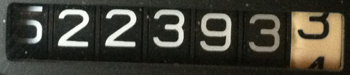
Odometer (ILX): 53,959
STILL 105? Let’s get past summer, already!
It’s a relatively low mileage weekend, but I’m making up for the fact that August was an 8,000 mile month. I feel like it’s okay for me to put the breaks on my hyper-mileage tendencies once in awhile.
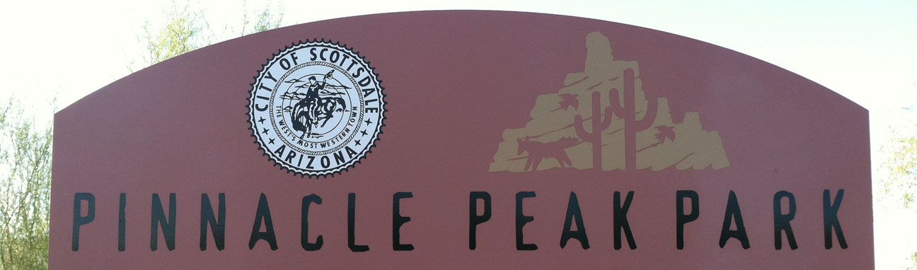
This week, my friend Tom is in town from Branford, Connecticut for some training for his work. It’s been fun to show him around the desert a little bit. This morning, we headed out at 6:30 in the morning (when it was “only” 83 degrees) for a hiking trail in northeast Scottsdale, Arizona called Pinnacle Peak (red marker in the below map):
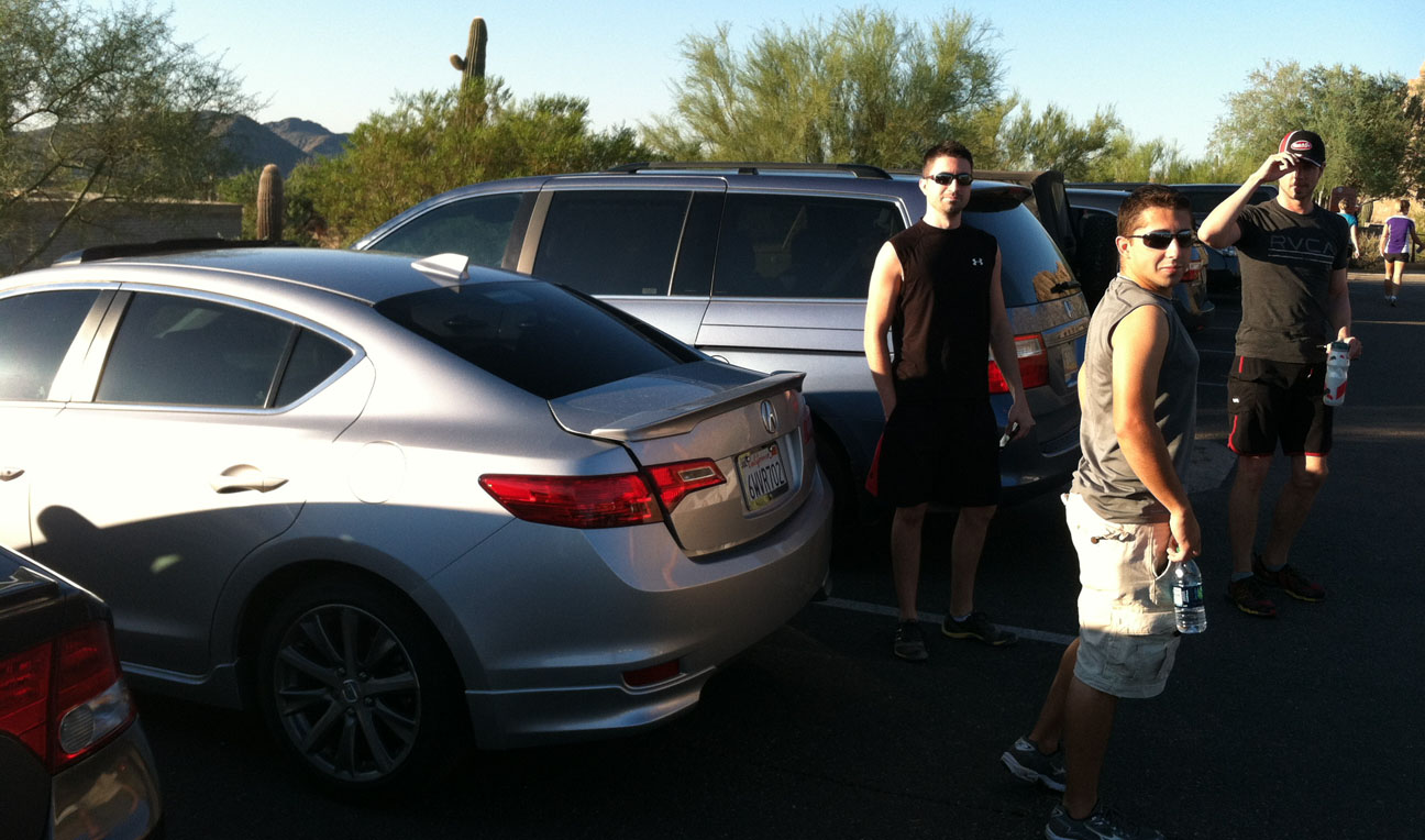
My other friends Paul and Brad came along for the ride, and we met up with my coworker (another Paul) for the 4-mile round-trip hike up this scenic mountain.
The parking lot at the trailhead was on the east side of the peak, and as we got closer to the mountain, we saw hikers zig-zagging up the face of the mountain.
It didn’t take long for us to start working up a sweat. Paul J led the way at a pace that pretty aggressive!
We passed a lot of other hikers, some who were even running up the mountain.
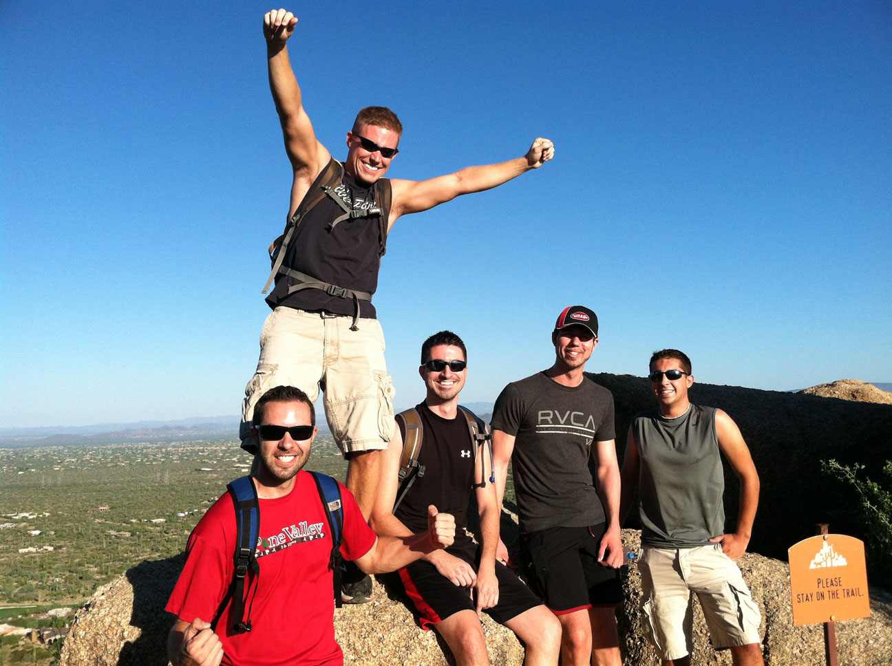
At the highest point in the trail (2,889 feet), we paused for a group picture.
Look at that enthusiasm! Paul J is up top, and the bottom row is (L to R): Tyson, Paul W, Brad, and Tom.
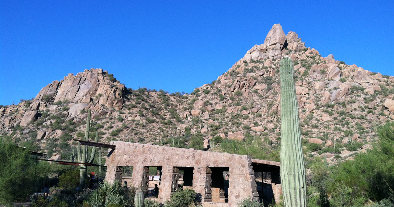
From here, the trail dipped down a thousand feet or so, then started climbing back up again as we circled the peak and started up another one. All the while, we were surrounded by gigantic saguaro cacti like the one pictured here.
Brad feeling victorious as we neared the end of the hike. In all, it only took us about an hour and a half.
And finally, after having finished the hike, we were glad to get back into the ILX and rest our legs. Brad is 6 foot 3 and commented that he still had ample head room in the back seat. Way to go, engineers!
We took Brad’s car to breakfast at US Egg. This is a 2013 Audi RS5. It’s a 450-horsepower beast, powered by a 4.2 liter V8 engine. I took my place in the back seat (which was snug, but not uncomfortable).
The exhaust note on this car is simply awesome.
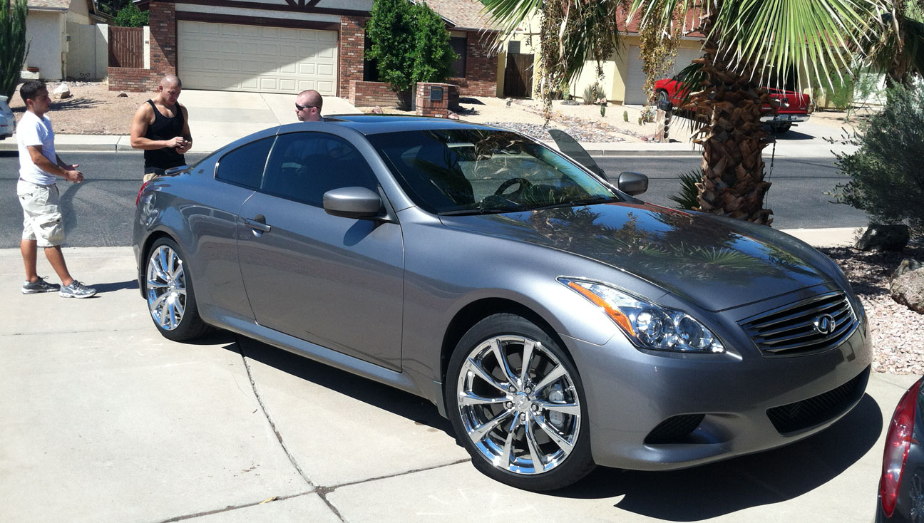
My other friend Brian came over this weekend to show us his “new” 2008 G37 coupe 6-speed. It’s just about the cleanest vehicle I’ve ever seen with 100,000 miles on it.
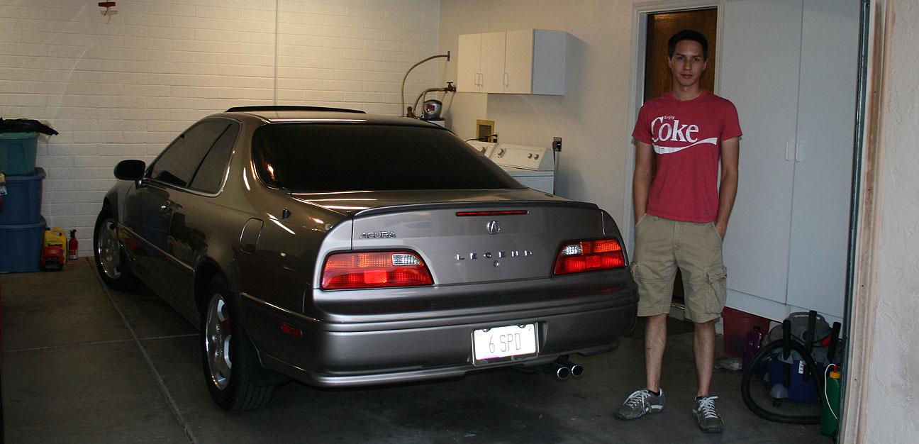
My Legend sedan came out to play for a little bit yesterday.
Out & about on Saturday night.
Tom took the wheel for a little while. He is very accustomed to the Legend, having spent a great deal of time driving one back home. He just recently got out of the Legend game and moved into a 2006 Acura TL 6-speed which he loves.
Stay tuned for a full review this week on the ILX that Tom has written up and submitted to Drive to Five.
Here’s a 4-minute video of the action. Watch for the dancing by my friend Rustin toward the middle of the sequence.
Kid’s got rhythm! 😉
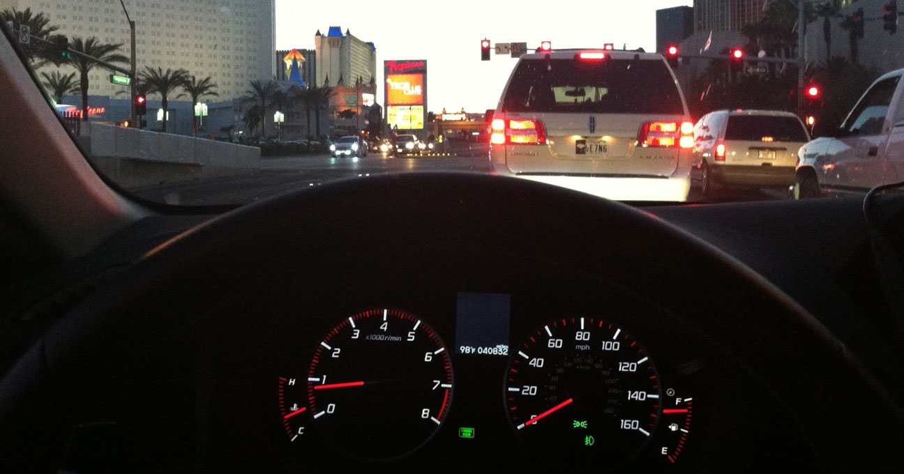
From the hustle and bustle of the Las Vegas Strip to one of the most remote, rugged canyons in the southwestern United States, the Acura ILX saw it all this past weekend. Since it’s just a 5-hour drive for me from the Phoenix area, Las Vegas is a frequent destination. My friend Kevin and I headed out last Thursday afternoon and set our sights on Sin City.
The Las Vegas Strip is a 4.2 mile stretch of Las Vegas Boulevard. A little known fact is this stretch of road is not in fact located within the City of Las Vegas, but rather in the unincorporated towns of Paradise and Winchester. The allure of the city brings in nearly 40 million visitors per year, and it’s home to over 20,000 conferences per year. Since all of those visitors need places to stay, 15 of the world’s 25 largest hotels are located in Las Vegas.
Kevin and I stayed at the castle-themed Excalibur Hotel that’s been around since 1990.
Gambling is big business here! The gambling revenue of the Las Vegas Strip is $6.2 billion per year. This city never sleeps. I’ve been on the Strip at all hours of the night – there are perhaps even more pedestrians out at 3:00 in the morning than there are at 3:00 in the afternoon due to the brutal desert heat!
We met up with a couple of other friends who were visiting from Calgary, Alberta. Kevin and I are in the front seats; Jeff and Jason in the back. The ILX was quite accommodating for the 4 of us and all of our gear.
Jason had never tried In-N-Out Burger before, so that was a must-see before we headed to Utah to do some hiking. All these great dining opportunities in Las Vegas, yet our Canadian friends wanted to have burgers!
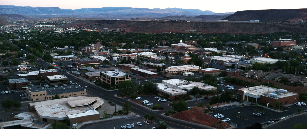
100 miles north of Vegas on Interstate 15, we arrived in my hometown of St. George, Utah and got settled in.
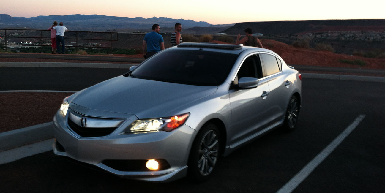
I showed my friends a few sights around town, including a great sunset viewpoint on the “Red Hill.”
St. George a community in the far southwest corner of Utah. It’s home to 74,000 people.
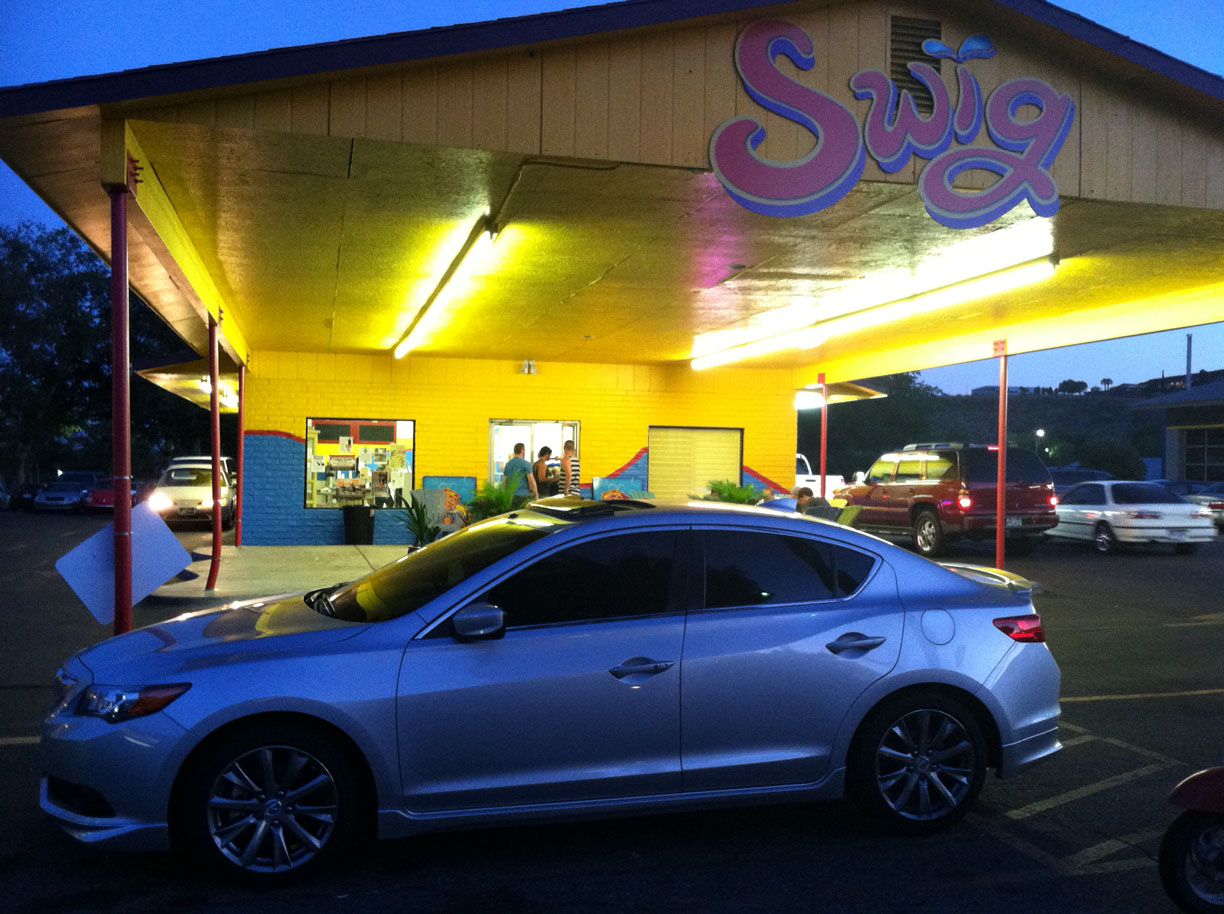
My sister-in-law recommended a stop at a place on St. George Boulevard called Swig. This place specializes in custom-flavored sodas. The top-selling beverage is called a “Dirty Dr. Pepper,” which includes coconut syrup.
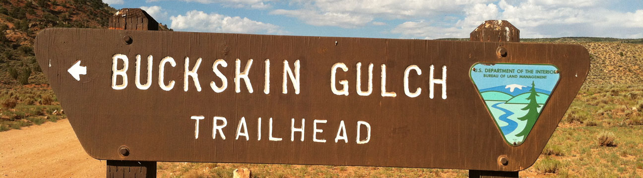
Saturday morning was hike day, starting bright and early at 6:30 a.m. Another friend, Rob (back seat, red hat) joined the party and we headed out on the 2.5 hour drive from St. George to the hike trailhead of Buckskin Gulch.
My mom and step-dad, Todd, followed in the 2003 Lexus GS430 as we paralleled the Utah-Arizona state line on Highway 389 eastbound.
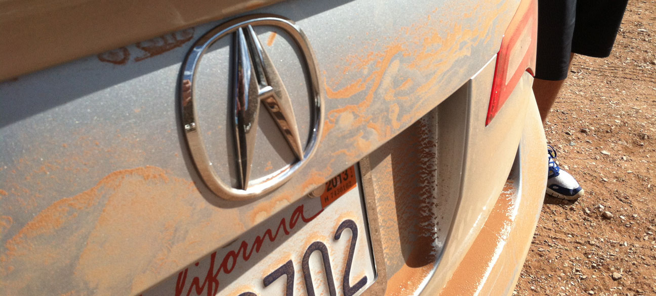
After a pit stop in Kanab, we continued 38 miles east on Highway 89 until we found a dirt road called House Rock Valley Road. It was time to get the ILX dirty. Aside from washboard ruts, the road conditions were pretty friendly for a passenger vehicle. This type of road would definitely be impassible for a two-wheel-drive vehicle in inclement weather, though.
In just over 8 miles, we arrived at the trailhead for the Wire Pass hike and the Buckskin Gulch.
This same trailhead is used to access a geologic formation called “The Wave.” However, hiking to The Wave requires a special permit, of which only 20 are issued per day. We weren’t selected for that hike but decided to explore that same area in a different direction.
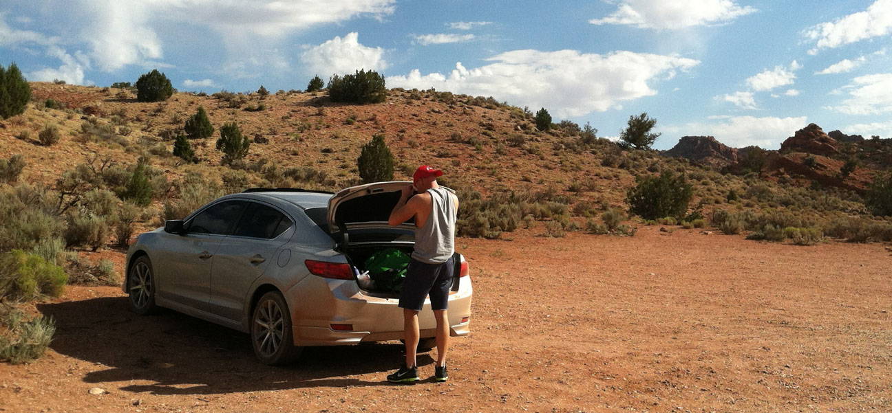
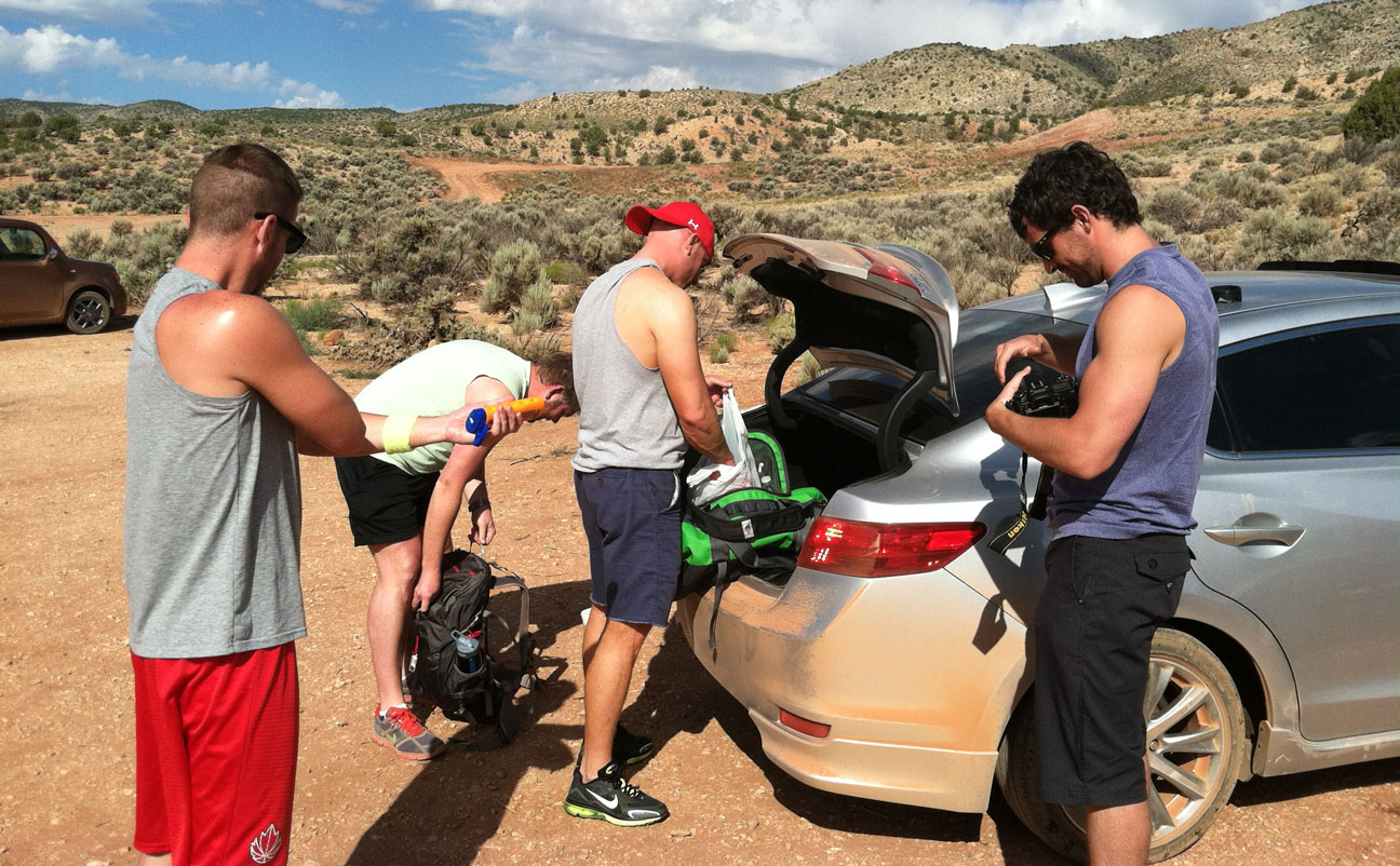
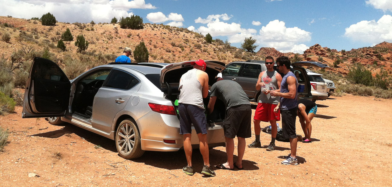
We parked our dirty cars and started gearing up for the hike ahead. With temperatures over 100 degrees Fahrenheit, we knew we had to pack plenty of water.
Pit toilets are available but there are no other amenities at the trailhead.
Blue skies and warm temperatures made it a perfect day to explore the great outdoors.
From an informative sign at the Wire Pass trailhead:
You’ll find no designated trails, developed campsites, signs, or facilities inside the wilderness boundary. The terrain is rugged and hiking conditions can change with the weather. Hikers should be in good physical condition and know how to navigate in a primitive backcountry setting.
The following sign warns hikers about the importance of being prepared.
For the first 20 minutes or so of the hike, we walked along this dried up riverbed.
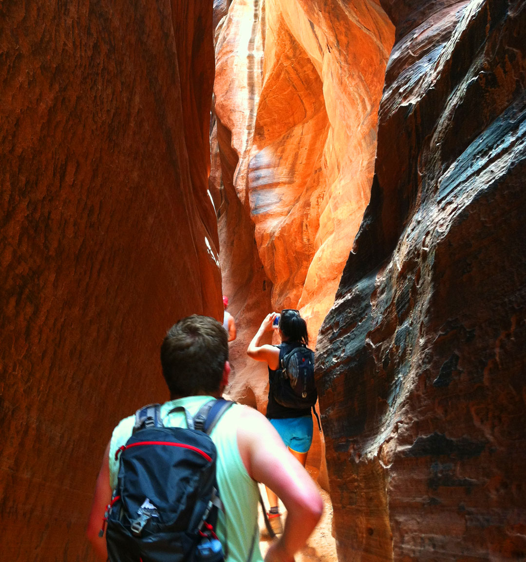
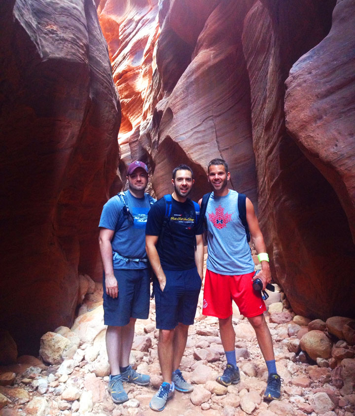
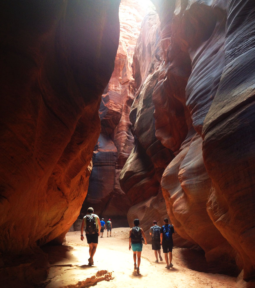
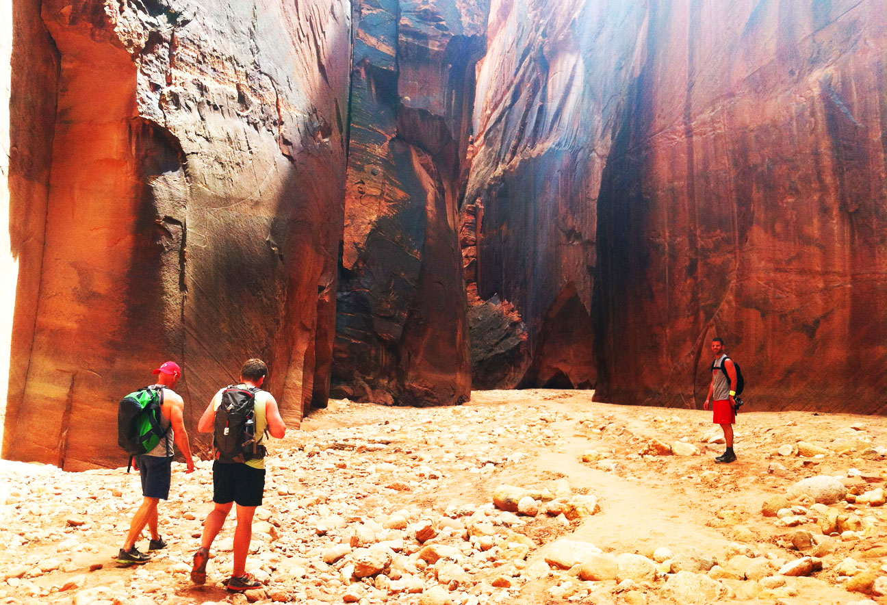
For the next 2.5 hours, we hiked deep into the wilderness through this awe-inspiring canyon. Buckskin Gulch was dry on the day that we hiked it, but during rainy season carries a high volume of water. It’s a tributary of the Paria River, which itself is a tributary of the Colorado River. Below, Jeff and Kevin are first arriving at the area where the passageway starts to narrow.
The canyon’s length is 13 miles and there’s only one place where hikers can exit mid-way through (called, appropriately, Middle Trail). That means once you’re in the slot canyon, there’s no way out for at least several miles. Here, Cathy and Rustin are leading the way through one of the very narrow sections. Can you imagine a wall of water coming at you if a flash flood happened here?
The width of the canyon varied anywhere from 2 feet to 40 feet, and the terrain of the canyon floor was diverse, too. Sometimes we were trudging through very fine sand and other times we had to step across river rocks.
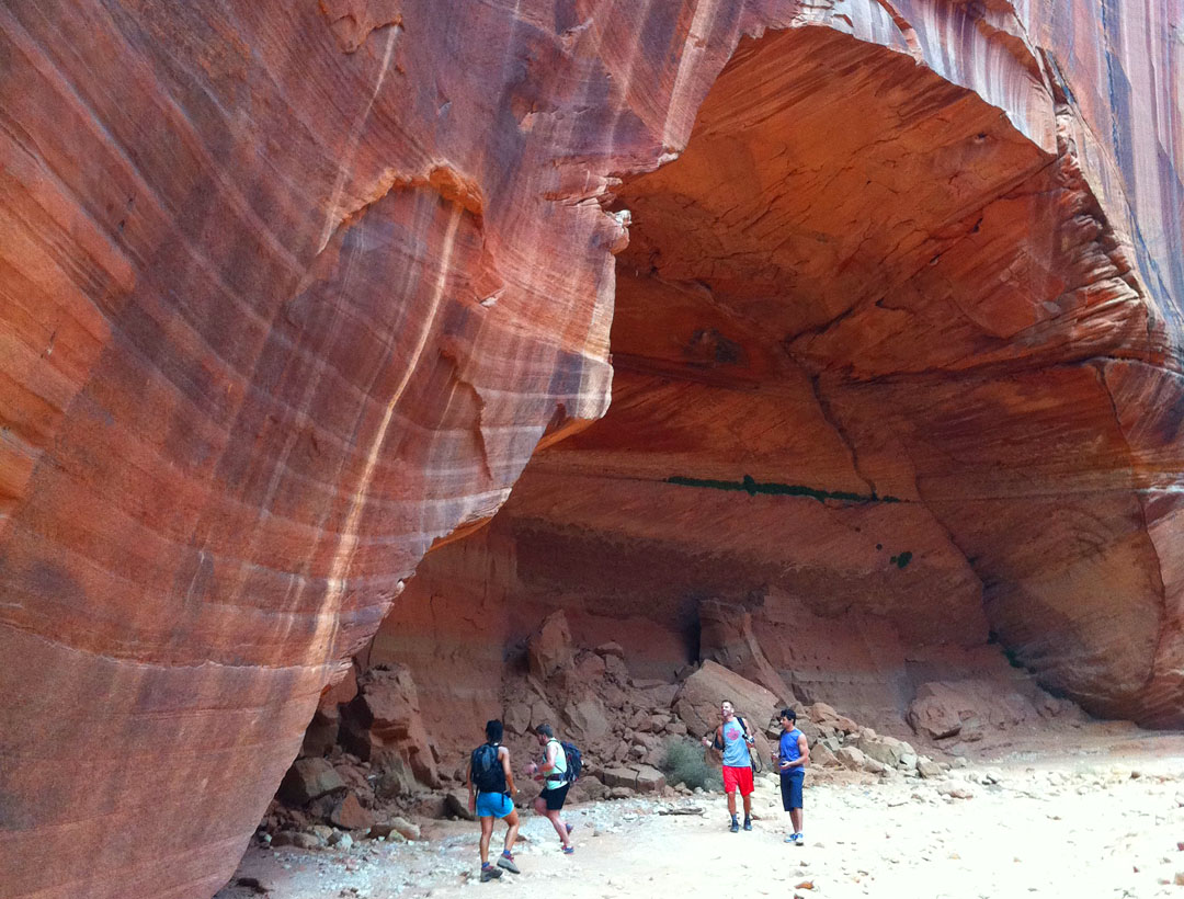
It’s impossible to capture the perspective of just how massive some of these rock formations towered over our heads. Around each corner, there was a new surprise.
Hieroglyphics from native Indian tribes were found on some of the rock formations. Natural arches are found in various places along the hike.
It’s incredible to see how nature has formed these sandstone passageways over hundreds of years. Here I’m pictured with Kevin and Jeff.
There was only one area where we encountered water, and it was easily passed via some logs and rocks which we could hop across.
One account that I read online said that during rainy seasons, the water level in places could require swimming.
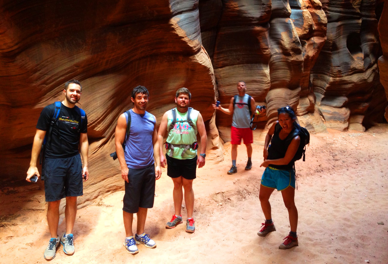
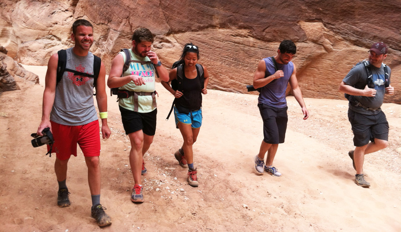
Enjoy the rest of these pictures that were captured on the hike, either by my camera or by others in our group.
Tyson, Jason, Rustin, Jeff, Cathy
Jeff, Rustin, Cathy, Jason, Kevin
This is the location where we stopped to have lunch and empty the sand from our shoes. Most of us had packed peanut butter & jelly sandwiches.
Photo-op with my mom at our picnic spot.
The return to trailhead seemed to go a lot more quickly than our descent. In all, we were hiking for nearly 7 hours and we only experienced a small section of what Buckskin Gulch has to offer. It was a relief to get back to the cars and rest our legs.
Get me some water!
Heading back out on House Rock Road, the ILX kicked up a cloud of dust for the 8-mile drive until meeting up with Highway 89 again.
As a testament to Acura comfort, even on a road with conditions like these:
These two tired hikers in the backseat were STILL able to fall sound asleep.
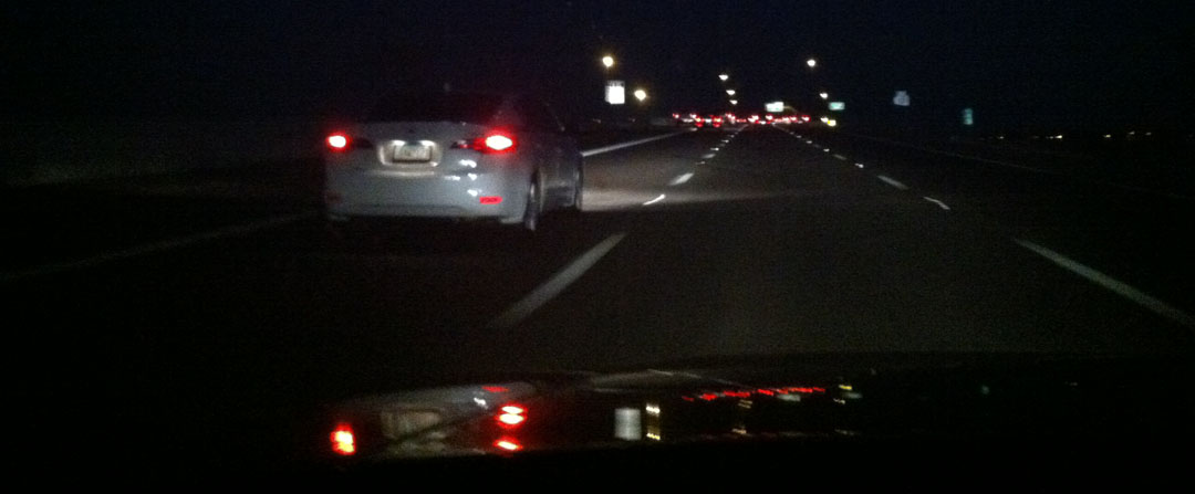
Here, we were reunited with Highway 89 which would take us back to Kanab, then St. George for the evening. It was good to be back on a smooth road. As I got up to 65 mph, I left a cloud of dust behind me as the wind blew off the car.
That was our hike experience! Glad I was able to spend some time with friends. We loaded up the car at the close of the weekend and reminisced about the good times we had shared. One day I hope to go back and hike Buckskin in its 13-mile entirety.
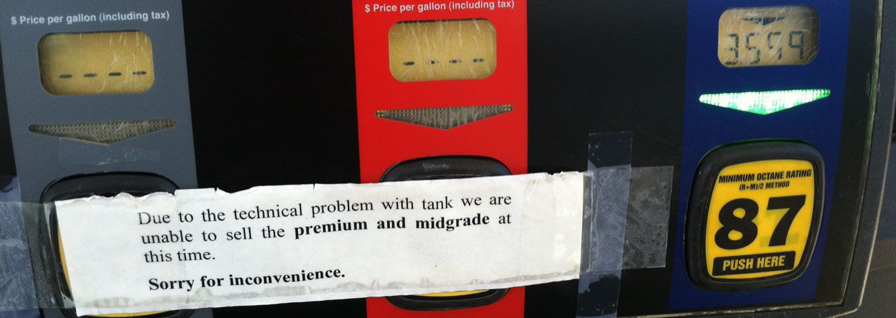
I had to top off with some 87 octane instead of Premium this trip, but didn’t notice any adverse performance.
Thanks for coming along!
The only use the Legend has had in the last few days was a drive last night to dinner, when ironically I was passed by a Bellanova White Pearl ILX Hybrid!
In closing, enjoy this ILX “A-Spec” rendering that was sent to me courtesy of digital artist (and Acura fanatic) “Hondatalover.” I need those wheels! Thanks, Dillon, for sending.
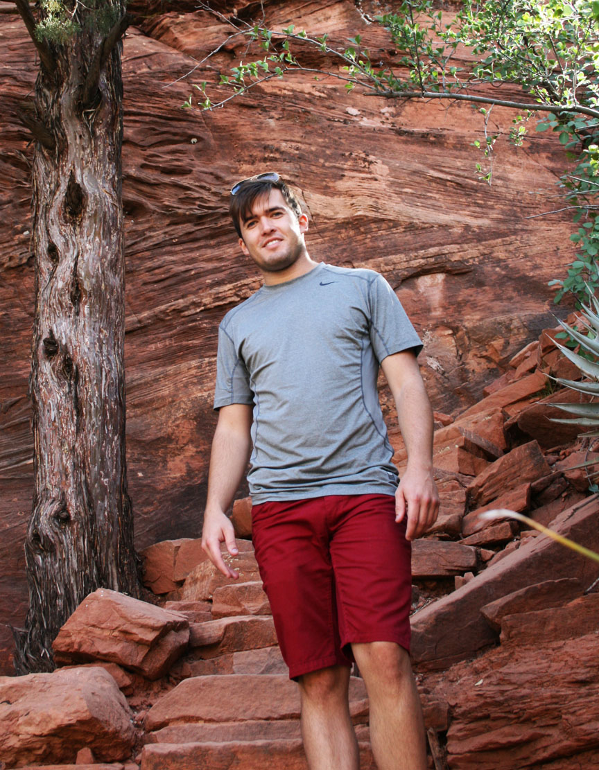
From the narrow, twisty roadways of an 1876 mining town in the Black Hills, to the red rock sandstone landscape of Sedona, to the tree-lined and steep grades of Oak Creek Canyon, I experienced some of Arizona’s finest roads and skies yesterday.
Many thanks to Jason from Las Cruces, New Mexico for making the 400-mile trip to the Phoenix area to join me for this weekend’s trip. This was the third time I’ve partnered with Jason for a Drive to Five feature. We met previously for a trip to Bisbee, Arizona in January and then for a trip to White Sands National Monument in New Mexico in March.
First order of of business when Jason arrived was to check on those model cars on my rooftop. He was impressed at how well they’ve held up considering they’ve endured 3 years of Phoenix inferno.
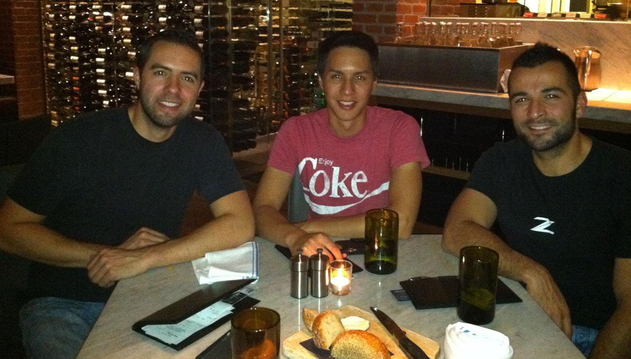
Dinner at Phoenix’s “Central Bistro” on Friday night with my friend Matt. Jason and I both recommend the Bolognese pasta!
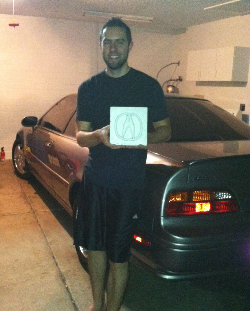
This was an extra nice gift: Jason presented me with a hand-made ceramic tile featuring a 3D “A” emblem. This is now proudly displayed in my home. I wish I had those kind of craft skills!
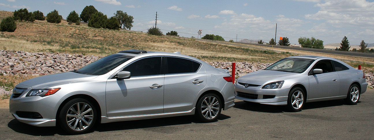
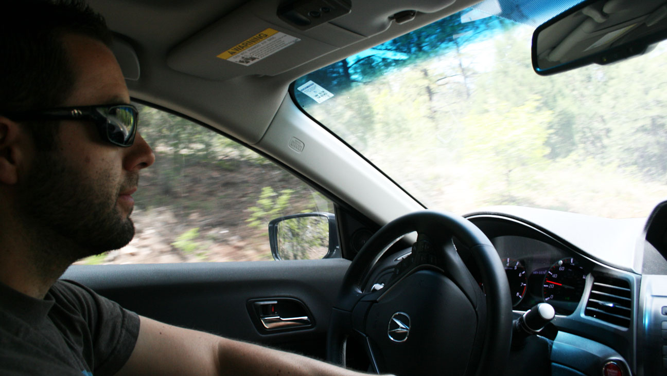
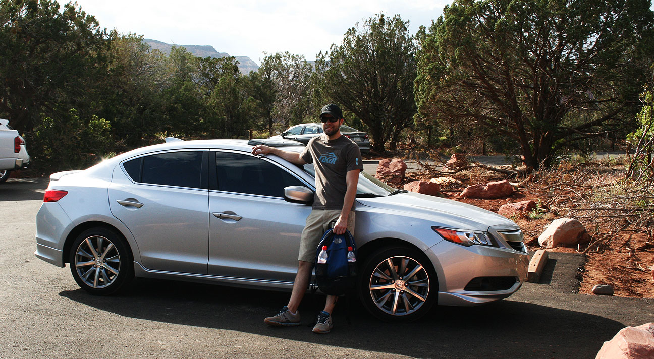
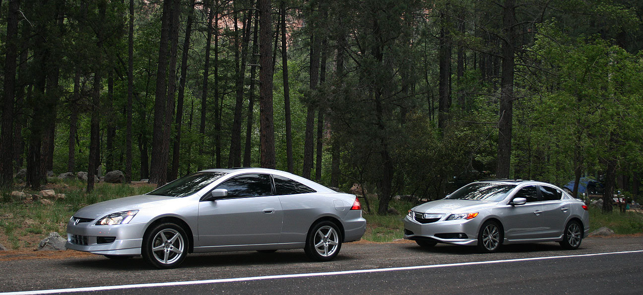
Saturday morning, bright and early, we revved up our Honda engines and set sail for the alluring cooler temperatures of northern Arizona. But first, I treated myself to a blueberry muffin from Starbucks. My friend Chris took the shotgun seat of the ILX for the duration of the drive and Jason followed us in his silver 2004 Honda Accord coupe 6-speed.
Coming from an Acura Legend with zero cupholders, I was pleased to note that all FOUR of the cupholders in the ILX were used that at morning. Our Starbucks beverages took the center console and we each had a water bottle in our door pocket. This car can transport almost as many beverages as a minivan!
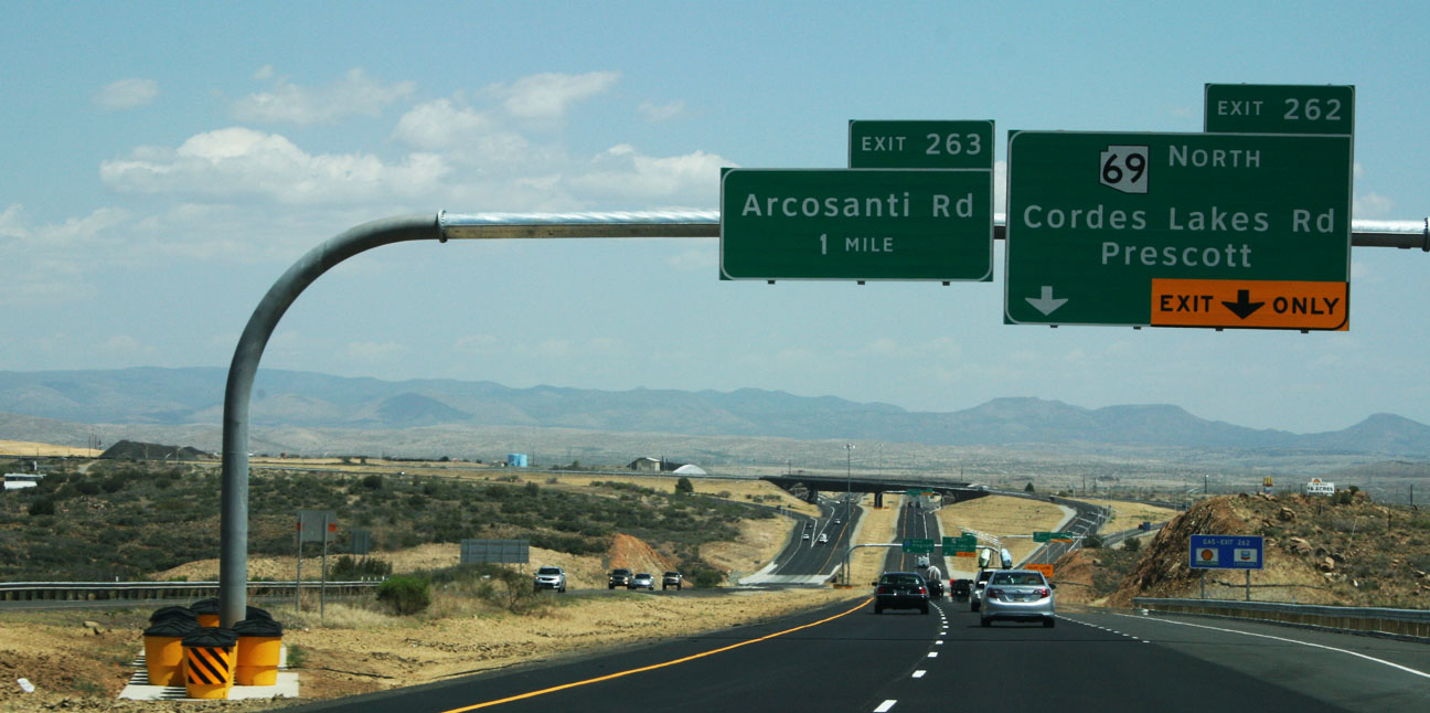
Our cars filled up on some 91 octane fuel at the Circle K on Phoenix’s 7th Avenue & Loop 101 before we headed out from the Phoenix Valley.
Fewer than 50 miles up Interstate 17, we veered west on Highway 69, northbound toward Prescott, Arizona.
Here, we awaited the third member of this caravan.
Austin arrived shortly in his 1987 Acura Legend. It has over 280,000 miles on the body itself, but the engine and transmission are not original to the car. Lovingly referred to as “FrankenLegend” by its owner, the car’s engine is upgraded to a 2.7 liter (as opposed to a 2.5), and the transmission was swapped to a 5-speed from an automatic. The original 1986-1990 Legend sedan has a classic bodystyle and Austin’s is in nice shape!
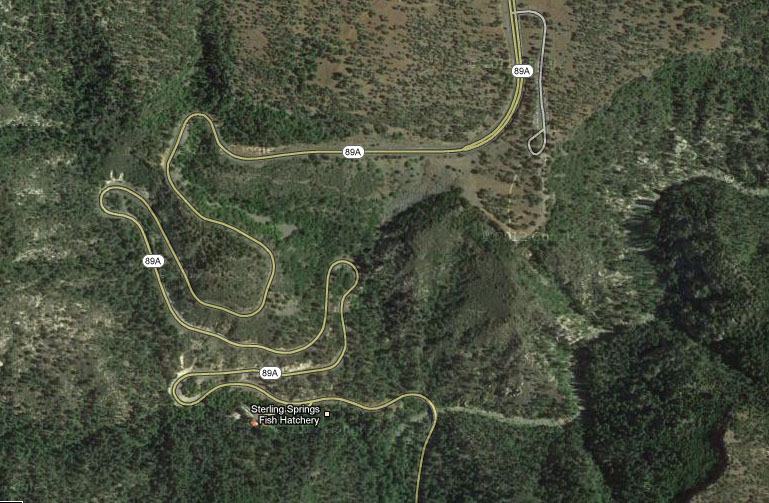
The next 19 miles of two-lane highway up Highway 89A would lead us through some very technical and fun curves leading to our lunch destination in Jerome, Arizona.
Chris zoned out for a bit from the passenger seat and when he started waking up, he commented, “I didn’t even realize you were driving a manual transmission, those shifts were so smooth.” That’s what I pride myself in! Perfection in rev-matching. While an automatic transmission may offer faster paddle-activated control, there is no substitute for a traditional three-pedal manual transmission for an engaging driving experience.
We climbed to over 5,000 feet in elevation and the temperatures dropped as we did so. Jerome’s high temperature for the day was in the high 70’s Fahrenheit — absolutely perfect weather for a moonroof-open cruise.
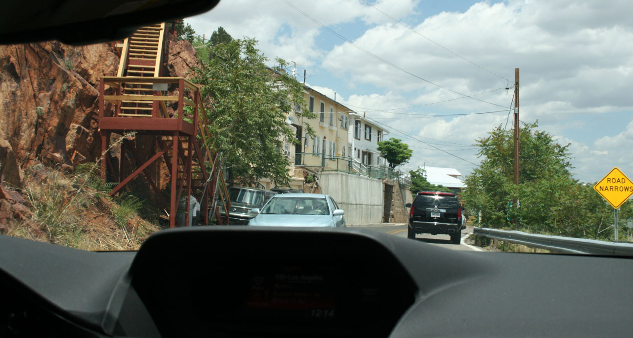
Jerome, like many of the other towns where I’ve taken my readers in recent months, got its start as a copper mining town in the 1800’s. Once having a population as high as 10,000 people, it’s now home to fewer than 500 people. The town is built precariously on the side of “Cleopatra Hill.” Roads are narrow (some are one-way) and steep.
Here’s a view of Jerome that I took from the Jerome Historical Society Museum. This town was named “Wickedest Town in the West” in 1903 by the New York Sun.
We were greeted by heavy traffic as there were special events taking place in town. Jerome is a very popular Saturday destination for bicyclists, motorcyclists, and car clubs.
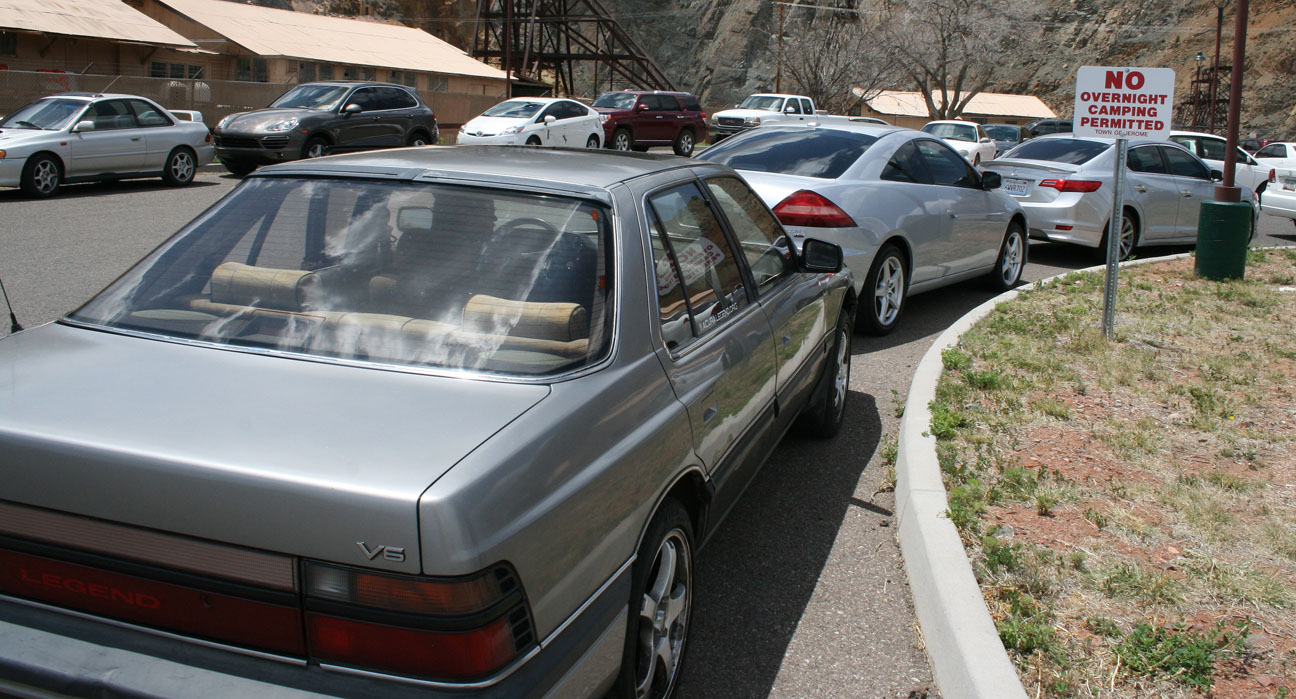
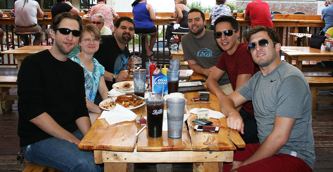
We parked our trio of Hondas at a lot a few blocks from town and walked over to find a lunch destination.
Brandon, pictured at right in the black shirt, and his girlfriend Alishaba met up with us as well. More about Brandon’s Acura shortly.
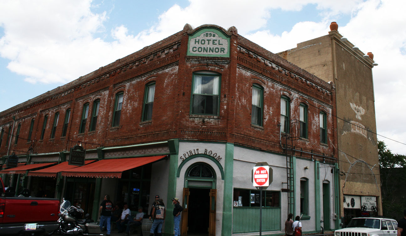
We walked past the Hotel Connor, built in 1898. It has 20 rooms on the second level that were first rented for $1 per night. From the hotel’s website:
After it reopened [after a fire] in August of 1899, it enjoyed a heyday of being one of the finest lodging establishments in the booming mining towns of the West. The hotel had its own bus for delivering guests to the train depot, and was full to capacity much of the time. It was one of the earliest buildings in Jerome to be fully wired for electricity, and each room had a call bell for service.
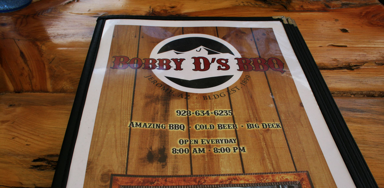
Just down the street, we were lured in by the smell of sweet barbeque sauce so we stepped inside Bobby D’s BBQ for a bite to eat.
The pulled pork definitely hit the spot! Bobby D’s is built on the site of an 1899 restaurant called the English Kitchen which was demolished after the last mine closed in 1953. The building has been rebuilt and boasts amazing food.
Left to right: Brandon, Alishaba, Austin, Tyson, Jason, Chris
Jerome’s curves mean business. This hairpin at the end of Main Street is one example.
Now we got to check out Brandon’s car. Brandon is as Legend-crazy as I am, and this 1995 Sherwood Green LS Coupe 6-speed is his 8th. It’s nicely equipped with the OEM cell phone, gold emblem package, and 16″ chrome GS wheels. Brandon has upgraded the engine to a 3.5 liter from the 1996+ Acura 3.5 RL, but the car retains its original 6-speed manual transmission.
The car looks great for having over 220,000 miles on it.
Time to say farewell to our Legend friends and continue the drive!
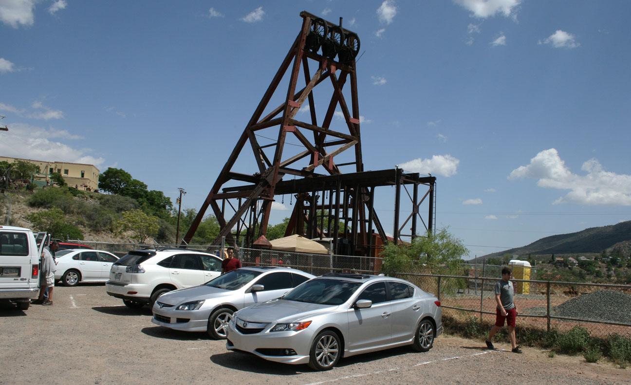
Just down the street, off Douglas Road, we weaved up to the Jerome Historical Museum’s “Audrey Headframe Park.”
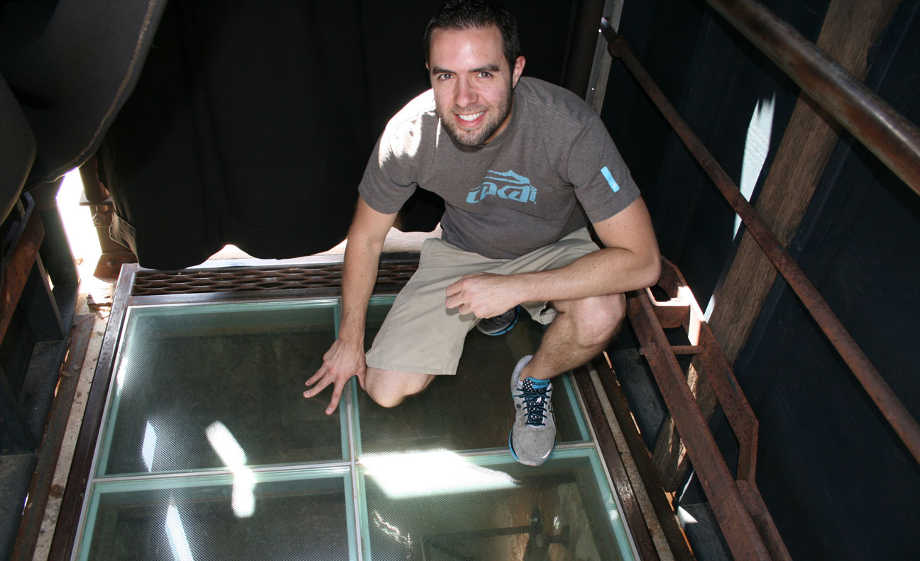
Named for the adopted daughter of the mine’s superintendent, this is the oldest piece of mining equipment in Arizona. Admission is free and the park is open daily from 8 to 5. The main attraction? This special glass floor.
In that picture, I am standing over a mine shaft that is 1,900 feet deep. To put that into perspective, look at how the depth of the shaft absolutely dwarfs the height of the Eiffel Tower and the Empire State Building!
Looking straight down. The shaft was built in 1918 and over $125 million worth of ore was harvested here. Though tough to tell from this picture, there are lights and mirrors going all the way down the shaft to help capture the sheer depth of it. It was a bit unnerving to stand there!
Though mining efforts in Jerome closed in 1953, over the 77 years that it was in operation, Jerome’s mining industry produced over 33 million tons of copper, gold, silver, lead, and zinc ore.
Time to head toward Sedona!
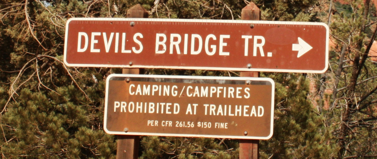
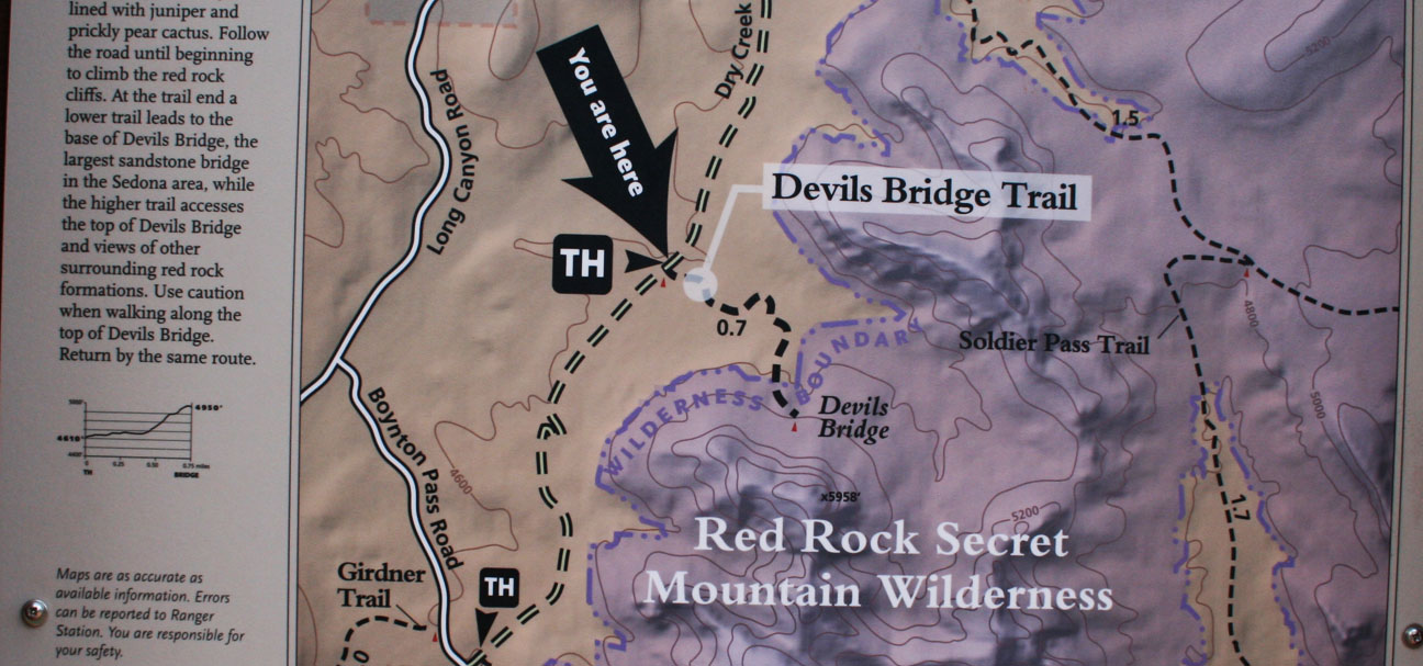
We wanted to stretch our legs a bit and enjoy the perfect weather, so we went to a trailhead of the Devil’s Bridge Hike off Dry Creek Road, just west of Sedona on Highway 89A. An even closer trailhead is accessible via 1.3 mile dirt road, but it’s only suitable for high-clearance vehicles. My ILX would have easily bottomed out if I’d attempted to drive it there. Here I’m giving a thumbs down to the fact that I can’t take my car on this dirt road.
After hiking those 1.3 miles down the road, Jason and Chris and I arrived at the “official” start to the trail.
From here, we were only about a mile from the bridge.
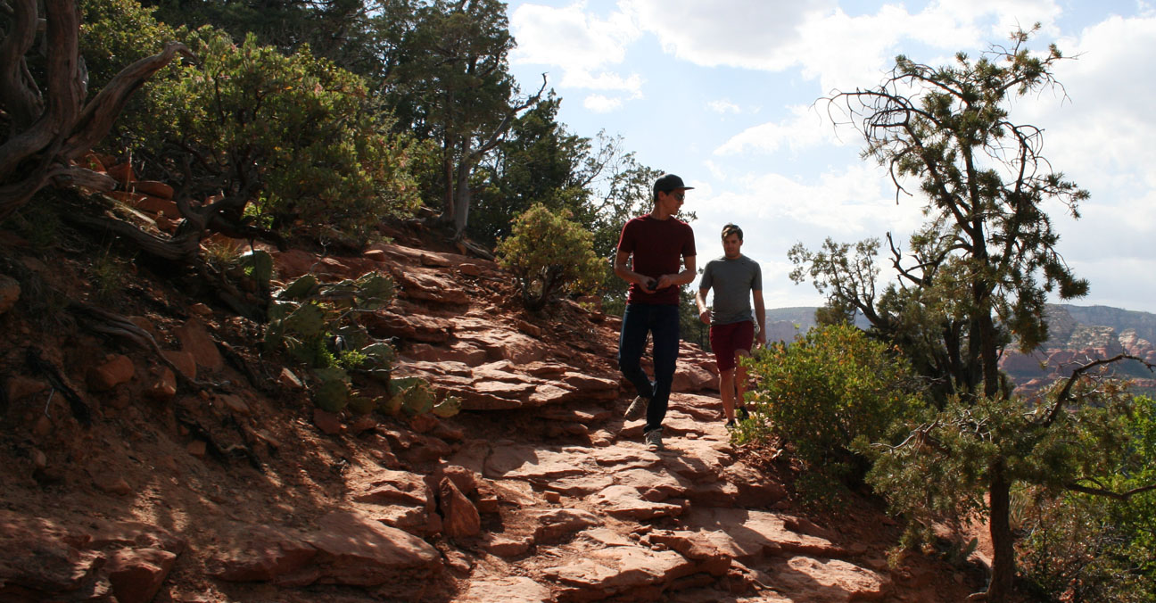
Jason led the way as we headed toward our destination. Few other people were out hiking; it was a special experience being out in the wilderness in such a beautiful landscape.
We climbed 400 feet in elevation on natural red sandstone rocks until finally laying our eyes on the prize.
Devil’s Bridge is the largest natural sandstone arch in the Sedona area. It’s 50 feet above ground. For this shot, we had another hiker take our picture after we carefully crept out to the narrowest section of the bridge. I enjoyed sitting for a few minutes to admire nature’s beauty before we started heading back out.
Time for the descent.
And relieved to get back to the driver’s seat after my shoes became full of red sand. It had taken us roughly 2.5 hours to complete the journey.
The first place I thought of for some much-needed refreshment was the Red Planet Diner, where I had eaten in January with other friends who joined for a Sedona day trip. I had to poke fun at Chris for a bit. Red Planet is famous for its burgers, yet he ordered a teriyaki bowl. Notice the employee in the background has a black T-shirt which reads, “Welcome Earthlings.”
I went for something a little more simple: grilled cheese and a root beer float.
This time, I let Jason take the lead and he took us up a road toward the Sedona airport. Picturesque views surrounded us there.
The last thing on our to-do list for this trip was to drive Highway 89A the remaining 30 or so miles to Flagstaff, Arizona. This stretch of road climbs in elevation to a heavily wooded forest called Oak Creek Canyon.
This is the type of road where Jason’s Accord and my ILX felt right at home. Both of our cars are equipped with manual transmissions for maximum control and have suspensions that are designed for handling the curves with balance. We were lucky that traffic was minimal, so when the hills begged for a little speed, we responded.
Chris did his best at video recording the above twisty section. Thanks to Enrique Iglesias for the soundtrack! I’ve got to invest in a GoPro camera for better stability one of these days.
At the end of the line, Highway 89A meets up with Interstate 17 which is where we parted ways with Jason and he headed to Flagstaff, while Chris and I returned to Phoenix.
Posted in Arizona, Hikes on April 17, 2012 by tysonhugie
Odometer: 511,008
Forecast says 97 degrees on Saturday! As temps creep up in Phoenix, Arizona, we’re taking advantage of every chance we get to enjoy the great outdoors before it’s time to hibernate in our air conditioned homes and workplaces. Yesterday, I hiked with a few friends to the 2,608 foot summit of Squaw Peak, also known as Piestewa Peak which was named in honor of the first Native American woman to die in combat in the US Military. The 1,200 foot elevation gain feels a lot like a stairmaster for the 1.2 miles each way of the hike.
Tyson, Tyler, Rustin, Matt, and Tanya
I spy. From the summit, I could still check on my car in the parking lot (circled in orange!)
This weekend I also had company from my friend Tyler from Utah who you’ll remember from my post featuring his white Prelude 4WS. Tyler was gracious enough to allow me some behind-the-wheel time of this great handling little sports car.
Finally – many thanks to my roommate for putting together this entertaining picture. Indeed, my Legend lacks a cupholder and my friends love to point that out. Anyone seen the movie Bridesmaids who can relate with me?