Archive for the Utah Category

Throwback Thursday: College Days at USU

Posted in Legend, Throwback, Utah on March 6, 2014 by tysonhugie

Odometer (Legend):  528,849

528849

Odometer (ILX):  69,158

69158

You know, I haven’t always lived where the palm trees grow.  From 2004-2005, I resided in the far northern reaches of Utah where people actually experience four distinct seasons, unlike in Arizona.  I earned my undergraduate degree at Utah State University in Logan, Utah.  USU was established in 1888 as a small agricultural college but today has multiple campuses and a total student body of over 28,000.

usu_logo

“Old Main” is the oldest building on campus, which dates back to 1890.  This photo was taken in August 2005.

old_main_aug_2005

In July 2012, my brand new ILX took its first trip to Logan.

ilx_usu_july_2012

Logan is about 80 miles north of Salt Lake City, and only 19 miles from the Idaho state line.

logan_utah

I had every intention of keeping my prized (then sub-150k mile) 1994 Legend out of the snow.  I even bought a “winter beater” – a friend’s 1991 Legend L coupe 5-speed with 186,600 miles on it.  Here’s a shot from October 30, 2004 – the very important key hand-off photo.  He sold me the car for only $700.

key_handoff_1991_legend

It’s hard to believe that was 10 years ago.  I wasted no time in getting the car cleaned up.  It was fun to have two Legend coupes for awhile.  Check out my dad’s collection of antlers in the garage!

two_coupes

I put that Charcoal Granite Metallic 1991 coupe to good use at college.  I hauled hundreds of pounds of canned goods during a local Thanksgiving food drive.  It was riding low on the suspension with all that weight in the interior & trunk.

legend_full_of_canned_goods

Thanksgiving 2004 with my friend Heidi in Nephi, Utah on the way back to college after the holiday.  Yes, those are 17″ wheels off a 2002 Lexus IS300.

heidi_with_1991_legend

Frosty winter morning in Cache Valley, northern Utah.

snowy

Unfortunately, my time with that particular coupe was cut short when it overheated on a date and blew the engine’s head gasket later that same year.  At one time, I also had a 1991 Honda Prelude Si 4WS that I used in the wintertime.

airportrd

Eventually, though, the 1994 Legend did have to report for snow duty.  And it surely did endure some extreme weather.  These were taken during & after one particular snowstorm in the winter of 2004-05.

buried

Thank goodness for front-wheel-drive and a heavy car.  The Legend did great in the snow.

IMG_2445

Digging out

IMG_2450

The good news is that during those winters, I lived close enough to campus to walk there and I didn’t have to deal with icy road conditions on a daily basis.  Even though I don’t miss the weather, I do miss the sense of community and school spirit that was overflowing at Utah State University.  Go Aggies!

ILX Drive to Southern Utah: Grandpa’s Birthday

Posted in ILX, Road Trip, Utah on February 8, 2014 by tysonhugie

Odometer (ILX):  66,553

66553

Trip Distance:  421 Miles

map_to_sgu

tyson_grandpa_doce

It had been too long since I stretched my highway legs for a good 5+ hour drive so I decided to hop in the ILX after work and head north to my hometown in St. George, Utah.  This time I decided to take the “back” way – instead of opting for a route that consisted of mostly split highways, I drove through the mountain passes and canyons of Highway 89, northeast of the Grand Canyon.  It was a relaxing 6.5 hours on the road.

Driving, for me, is an incredibly therapeutic activity.  It’s an opportunity to clear the head and forget about the stresses of life.  Friday was an insane workday at CVS Caremark.  I got into the office at 7:00 a.m. and didn’t even step up from the chair at my workstation to stretch until almost 11:30.  By the time I got into the ILX around 4 p.m., my nerves were on end.  I set my cell phone on the passenger seat, face down so I wouldn’t see any alerts.  I plugged in my iPod 80 gig, took off my shoes, and picked up a grande caramel frappaccino from Starbucks at the drive-through.  Things were looking better already.  For the rest of the evening, it was just me, the ILX, and the open road.

flagstaff_sign

Interstate 17 climbed aggressively toward about 7,000 feet in elevation and the temperature sank to the high 30s as I gained altitude.  By the time I got to Flagstaff, I’d witnessed a spectacular sunset in 15 shades of red, purple, and dark blue.  There was snow on the sides of the road but the lanes of travels were clear and dry.  North of Flag is when I got off the beaten interstate path and headed north toward Page, Arizona on Highway 89.  With each passing mile, I saw fewer cars on the road.  Soon I was able to drive for many miles at a time with my high beams on.  I rolled open the moonroof to see the stars overhead – more clearly than I’d ever seen them in the city.

hwy_89_night

I drove through the Navajo Nation and pondered what a hardy people they are, having endured a way of life in small towns with few of life’s luxuries.  Nearing the junction of highways 89 and 89A, a blinding light shone ahead of me.  “Bright oncoming HID headlights,” I thought.  Soon it became apparent that the light was not a car.  “Wow, someone has really bright yard lighting.”  And finally, I approached the light and realized I had come up on a massive road closure with a generator driving three high-power lights.  This was where Highway 89 was detoured due to this massive buckle in the pavement.  Heading left on 89A, the road got more narrow and curvy.  Nevertheless, I set my cruise control at 65 miles per hour and firmly planted both hands on the wheel.

At one point after climbing in elevation to 7,921 feet at Jacob Lake, Arizona, I pulled over on a scenic overlook and shut off the car and its headlights.  I rolled down my windows.  The moonlight illuminated everything around me in a glow, and the only sound I could hear was the wind rustling the trees.  I loved the momentary feeling of solitude and peace.  This was a good night to be on the road.  I arrived at my brother’s place in St. George at 11:03 p.m. – right on target from what I’d told him earlier in the day.

Today, I had the privilege of shuttling my grandpa, grandma, and aunt to lunch at the home of the best tater tots in town – Larsen’s Frostop.  This drive-in has been a key landmark on St. George Boulevard since 1965.  We had some burgers, tots, and desserts in the company of some other family members in honor of my grandpa’s 83rd birthday, coming up on Monday.

Here is a 30-second video slideshow from our lunch.  Thanks Aunt Jodi for putting it together!

Northbound Interstate 17

I17

Pit stop along the roadside near Camp Verde

ilx

“This Surface is Never Regularly Maintained” – spotted on a sign near one of the interstate’s offramps

primitive_road_sign

A year ago, Highway 89 near Page, Arizona collapsed and looked like this

sinkhole_arizona_hwy_89_2

Today, it’s still not yet repaired.  Traffic is detoured a long way around.  Here’s a photo at the road closure.

road_closure_on_hwy_89

Niece Vivienne will be 3 in April.  She’s full of energy.

viv_with_ilx

Lunch bunch en route to one of my favorite burger places

inside_car

Grandpa was riding shotgun

grandpa

My brother Bentley and his family met up with us.  His black Audi Q7 S-Line 3.0 liter supercharged was looking pretty clean.

cars_lined_up

Let’s eat!

arrival_frostop

Grandpa peeking in the window.

frostop_entry

A grilled cheese here is only $1!  We opted for a couple of Prince Burgers.

gpa_ordering

Chow time.

frostop

And back to Gpa’s Avalon Abode.  He’s got a white 2000 and a silver 2006 in the stable.

ilx_with_avalons

It was a great day with family!  Thanks for joining!

Did anybody catch this 1996 Lexus LS400 on Ebay with a mind-boggling 897,000 miles on it?  As of right now, bids are at $1,150 with a couple days left in the auction.

ls400

896977

Description as follows:

This vehicle has a CarFax and Odometer both stating 896,977 miles.  The vehicle, when I got it, needed the driver’s seat recovered and the paint was sunburned.  The seat has been recovered and the car has been painted.  This is an original Rust-Free Florida car.  The rest of the car is original and in good condition as the pictures show.  The only option on the car which doesn’t work is the factory radio.  It has a factory sunroof.  The car drives like a good 100,000 mile car would.  The car had no rust on it before it was painted.  This car has no motor noise, and it doesn’t smoke. The transmission shifts properly.  The CarFax, again, shows no accidents and actual miles.

Pretty sweet!  That car has averaged nearly 50,000 miles per year over its 18 years.

Catch the rest of my Utah trip sometime this coming week!

Weekend in Salt Lake City & Paul’s 10k Milestone

Posted in Utah on December 15, 2013 by tysonhugie

Odometer (Legend):  528,160

528160

Odometer (ILX): 62,221

62221

The Acuras hibernated this weekend since I opted to take a 90-minute flight instead of an 11-hour drive from Phoenix to Salt Lake City, Utah.  My uncle Brett’s reaction when I told him I’d flown up:  “Are you feeling okay?”  My family knows it’s out of character for me to choose a plane over a car, but given the unpredictable winter weather and limited timeframe, it made the most sense to fly the friendly skies.

It was a great weekend of visits with family and friends.  I’ll share just a few highlights.  First is of the Legend getting airport duty at the Sky Harbor Economy lot B, level 4.  In true “parking paranoia” fashion, I made sure I was the only vehicle on the entire row, and I parked at the extreme end, away from everyone else.

legend_at_airport

I was unprepared for what hit me when I walked outside Salt Lake International Airport.

slc_weather

Haze was right!

hazy

My friend Branson and I enjoyed a delicious brunch the following morning.

branson_tyson

He’s almost sold me on ditching the iPhone for an Android like his, after showing me that he can play Mario Brothers on it.  Take me back to 1985.

branson_playing_nes

No Salt Lake visit would be complete without a drop-in at Jody Wilkinson Acura.  JWA has taken care of me for many years as the area’s premier dealership.  They had a nice looking Milano Red 2014 Acura TSX Special Edition in the showroom, along with a Pomegranate Pearl 2014 Acura RLX.

tsx_se_rlx

Salesman James told me a little about the features of the 2014 TL Special Edition while we were there.

tl_special_edition

An ILX sat out front awaiting test drives.

fathom_ilx_at_jody

All in all, a great visit that made me feel right at “home,” even though I hadn’t driven my Acura to Utah.

tyson_at_jody_wilkinson_acura

That evening, I enjoyed a night with family, including my grandparents pictured here.  Grandma’s sweatshirt reads:  “I’m only wearing black until they make something darker.”  Her wardrobe is as predictable as it gets!

tyson_gma_russell

Later that night, I watched one of my favorite holiday films:  Home Alone.  There’s a scene in the movie where Santa Claus stalls out a 1982 Honda Civic after talking with Kevin McAllister.  The car looked a little bit rusty, but it’s still fun to see a classic Honda on the big screen.

home_alone_scene

It was great to get back to blue sky in Arizona this afternoon.  I had a perfect view of my house from seat 22F.

scottsdale_from_plane

Achievement Award for Paul

paul_tl_delivery

Over the weekend, my friend Paul rolled 10,000 miles in his 2013 Acura TL SH-AWD.  Here was the odometer when he took delivery on January 12, 2013.

paul_beginning_odo

And on December 14, 2013, he completed his first 10,000.  Congratulations, Paul!

paul_ending_odo

ILX Drive: Shinob Kibe Hike in Southern Utah

Posted in Hikes, ILX, Utah on December 1, 2013 by tysonhugie

Odometer (Legend):  528,062

528062

Odometer (ILX):  61,263

61263

shinob_aerial

It’s tradition in my family to do a little hiking each Thanksgiving weekend.  Even though I lived in St. George, Utah for almost 10 years, I had never heard of “Shinob Kibe.”  The name comes from a Paiute Indian deity who was considered protector of the tribes.  From what I’ve been able to learn, Shinob means “great spirit” and Kibe means “mountains.”  The butte that we climbed also has significance in aviation history:

Back in the 1930s, the Civil Aviation Authority was trying to figure out a way to help guide the small mail-carrying aircraft that were traveling between Los Angeles and Salt Lake City.  A series of concrete navigation arrows were constructed on the ground at 10-mile intervals throughout the length of that trip.  The concrete arrows are still in place today.  From overhead, they look relatively small, but they are actually 70 feet in length.

Each arrow had a 51-foot-tall steel tower constructed next to it.  A (one-million-candle-power!) rotating beacon at the top of the tower would illuminate the arrow.  More on this here:

Even the dumbest of air mail pilots, it seems, could follow a series of bright yellow arrows straight out of a Tex Avery cartoon. By 1924, just a year after Congress funded it, the line of giant concrete markers stretched from Rock Springs, Wyoming to Cleveland, Ohio. The next summer, it reached all the way to New York, and by 1929 it spanned the continent uninterrupted, the envy of postal systems worldwide.

This is a map of what that network of arrows looked like at one time.

mail_arrows_route

Here’s the navigation arrow that we hiked to on Shinob Kibe, as seen from Google satellite images:

overhead_arrows

The hike itself was relatively short but the elevation gain was intense, with a climb of about 750 feet in less than one mile.  When we made it to the summit, it was a special feeling to stand on that historic arrow and recognize its importance.  There was a log box there where we signed in with our names & the date.

Yesterday, I made the return 430-mile drive to my home in Scottsdale, Arizona.  Along the way, I took a couple of impromptu detours.  The first was a stretch of old US Highway 91 between Littlefield, Arizona and Mesquite, Nevada where I captured this picture in the morning light.  I had the road to myself!

ilx_on_highway_91

The second was a short visit to an 1860’s mining town north of Kingman, Arizona called “Chloride” which I’ll save for a separate blog entry in the near future.  Below are the photos and video that we took during our hike at Shinob Kibe.

On Friday afternoon, we loaded up the Acura ILX with with bottled waters and a few snacks for the ascent.

ilx_at_holms

Tia, Todd, and Tyson in Transport to the Trail.  Is that enough T’s for you?  Some other friends followed in a separate vehicle to meet us in Washington where the hike began.

tia_todd_tyson_in_ilx

We parked at the trailhead which is now part of a residential community on Paiute Drive.  Back in the 1930s, there were no homes anywhere near this area but suburban growth has brought development right to the base of the mountain.

todd_with_ilx

Soon we were on our way to find this elusive navigation arrow.  Pictured here are Melynn, Holly, and myself (notice, with trail notes printed and in-hand!).

melynn_holly_tyson

Todd and Tia making their way up the face of the mountain.  We initially had a tough time finding the trail itself, so we forged our own way until we met up with it.

todd_tia_hiking

Melynn was taking a breather to admire the surrounding views.

melynn

Late afternoon weather was optimal.  We got our cardio workout in while burning off some of those Thanksgiving calories.

danielle_mitch

After we zig-zagged our way up the face of the peak, the trail leveled out a bit.  Just a bit further up the sloping grade, we could see a post with a metal box attached to it.  We had arrived!

hiking_up

Here I was standing at the tip of the arrow, at elevation 3,228 feet.

tyson_at_shinob_kibe_arrow

Danielle and Melynn set to work signing us into the register.  There were multiple filled notebooks inside the metal box.  The summit is also a popular place for geocaching.

signing_log_book

The concrete arrow today is still in decent shape with surprisingly little cracking.  The center square pad is where the 50-foot-tall tower once stood; we could still see the base of the metal tower that had been cut off.

arrow

Mitch, Tyson, Todd admiring the arrow.

mitch_tyson_todd

Standing at the top of the world – or at least on top of one of the many peaks in Washington County, Utah.

todd_tia_tyson_waving

The view from this area is stunning, since it wraps a full 360 degrees.

mitch_holly

Tia was visibly a bit nervous to be standing on the edge of a several hundred foot dropoff.

todd_tia

Holly and I weren’t too concerned, however.

tyson_holly_at_summit

Group shot (thanks Melynn for taking it!):  Todd, Tia, Holly, Tyson, Mitch, Danielle

shinob_hike_group

The descent went quickly.

hiking_down

And soon, we had arrived back at our chariot!

tyson_holly_with_ilx

Sunday’s return to Phoenix started around 7:30 in the morning, as I made my way down Interstate 15 to the Arizona state line on a crisp November day.

arizona_welcome

The detour along old Highway 91 took me across this old bridge that’s barely wide enough for two cars to squeeze by one another going opposite directions.  I love exploring infrastructure like this, and I took the opportunity to park the ILX and walk around beneath the bridge for a few minutes.

hwy_91_bridge

My last oil change in the ILX was on August 17th, 2013 at 52,237 miles.  At 61,016 miles (8,689 miles later!), the “Maintenance Minder” popped up and alerted me that remaining oil life was at 15% and instructed me to schedule an A13 service.  I spoke on the phone with Acura of Tempe and learned that an A13 includes oil and filter change, tire rotation, and replacement of the transmission fluid.  I’m scheduled for that service tomorrow.

schedule_a13_service

Until next time!

ILX Thanksgiving Drive to St. George, Utah

Posted in ILX, Utah on November 28, 2013 by tysonhugie

Odometer (Legend):  528,058

528058

Odometer (ILX):  60,756

60756

Trip Distance:  430 Miles

map_to_sgu

Hello readers:

Just a quick note of gratitude to those who have followed my travels for the 2.5 years since Drive to Five was born.  I thank you for your continued interest and I look forward to having you along (digitally, anyway) for each and every future trip!

Today, I drove to my hometown in Utah to spend a couple of days with family and friends.  By 7:00 in the morning, I was at the junction of Loop 101 and Interstate 17 in north Phoenix.

interstate17

My next turn was at Highway 74, the Carefree Highway, where I had the two-laner to myself as I made my way toward Wickenburg, Arizona.  Dawn and dusk are my favorite times of day to drive.

carefree_highway_ilx

Nestled midway between Mesquite, Nevada, and St. George, Utah lies a campground called Virgin River Canyon.  It’s home to 75 developed sites and overnight use costs $8.  I haven’t ever stayed there but it’s a scenic place to pit-stop along Interstate 15 in the Virgin River Gorge.

ilx_virgin_river

This stretch of I-15 was one of the most expensive pieces of road ever constructed, at an estimated $100 an inch.  That’s because it plows through huge sandstone cliffs and required a great deal of time & effort to complete.

virgin_river_gorge

Once I arrived in St. George, Utah, I visited my favorite car photo backdrop:  Pioneer Park on the Red Hill.  Pioneer Park covers 52 acres and is a rock climber’s paradise.  Growing up, I spent a lot of time there with friends.

ilx_at_pioneer_park

Here are a few Thanksgiving shots that I captured of the ILX.

ilx_pioneer_park_2

It was a perfect day for windows-down cruising in St. George, with plenty of sunshine & temps in the 60’s.

ilx_redrocks_2

ilx_red_rocks

Soon, it was time to head over for dinner with the family, including grandma.

tyson_doce

Smells like home cookin’!

todd_tia_doce

On the agenda for tomorrow:  A local hike that’s sure to provide some stunning views.  More on that later this weekend.  Thanks again for following, and Happy Thanksgiving to you all!

“Fall Fuel Fest” 2013: St. George, Utah in the ILX

Posted in ILX, Road Trip, Utah on November 3, 2013 by tysonhugie

Odometer (Legend):  527,669

527669

Odometer (ILX):  58,270

58270

Trip Distance:  860 Miles

utah_route

The route between Phoenix, Arizona and southern Utah is all-too familiar for my Acura ILX.  It knows the way instinctively between these two points after having traveled it so many times in the past.

ilx_front

As daylight dawned on cool Arizona Saturday morning, I had already been on the road for a couple of hours, sipping a Shamrock Farms chocolate milk and listening to some new music in my collection:  namely, “Driving My Life Away,” by Eddie Rabbit.  Could any song be more fitting for me?  Here’s my favorite line:

Those windshield wipers, slappin’ out a tempo

Keeping perfect rhythm with the song on the radio

sunrise_in_ilx

It took about 6.5 hours, with a stop in Kingman for gas, bu finally I exited Southern Parkway at Desert Canyons Drive.

ilx_in_st_george_2

Ahead, I was in store for an afternoon full of motocross and diesel truck events, sponsored in part by my brother’s business, H&S Performance.  The event was called Fall Fuel Fest.

ilx_in_st_george

This little guy just turned 2 years old.  He’s my nephew Beckam, and he knows enough about trucks to be dangerous.  Case in point:  my step-mom put him in the driver’s seat of an F-250 and watched his actions.  Beckam got the keys from the center console and found the ignition to insert them.  This kid!

tyson_beckam

Vendor booths lined the main alleyway of the Fall Fuel Fest on a perfect November afternoon in southern Utah, with the high temp around 70 with sunny skies.

vendors

My brother Bentley was interviewed by a radio announcer.

bentley_announcer

I last hung out with the H&S crew when they took a Ford Lightning and raced it in Ennis, Texas at the National Hot Rod Diesel Association World Finals.

tyson_hs_booth

Just down the way, trucks were lining up to compete in a dyno competition.

dodge_dyno

Pictured here are my brother Bentley and my mom.

bentley_mom

And here I am with my dad and my stepmom — all proudly sporting our H&S apparel, head to toe.

craig_tanya_tyson

The gray 2011 Ford Powerstroke pickup here has been souped up with some performance enhancements.  It’s powered by a 6.7 liter V8 and has a 12″ lift and 40″ tires.

trucks

Later that night, it pulled about 550 horsepower on the dyno!

ford_dyno

I was tasked with driving this big rig back to the office after the event closed. The instrument panel is information overload!  I must say I enjoyed being the king of the road for a few miles.

ford_gauges

One highlight of the evening was watching a world-record jump in a four-wheeled ATV.  Ryan Piplic drove this ATV at over 80 mph to hit a ramp and fly over a distance of 155 feet.  Here’s the occasion on video.

During a break in the afternoon, I visited my other brother Payton who has been playing a lot lately with his 2002 Lexus IS300.  I featured the car on Drive to Five back in February when he was just getting started with modifications.

ilx_is300

Payton’s car is now an absolute monster when he gets on the throttle, thanks to a turbo upgrade.  It was recently dyno tested and achieved 360 horsepower and 390 pound-feet of torque.

lexus_front_left

We took this baby for a spin.  He picked up so much speed that when he slowed back down abruptly, the brakes were smoking.

lexus_front_right

A fine sunset awaited us that night.

tyson_peace

While I was in my hometown, I took a few minutes to step back in time nearly 14 years by taking a picture of my ILX in the same place on the road as the pictures with my original Honda — the 1989 Prelude Si.

IMG_9352

The home color and the landscaping are now different, and I was a little off on the placement, but you get the idea.

IMG_9353

Today, I made the drive back to Phoenix, with my step-mom Tanya relieving me from driving duties for about 1.5 hours, between Kingman and Wickenburg, Arizona.  She commented on how easy it was to get used to the controls.  It had been at least a couple of years since she last drove a stick shift!  Her current ride at home is a 2013 Acura MDX.

tanya_driving_ilx

It was nice to have someone else take the reins for awhile while I kicked back in the passenger seat.

Have a great week!

ILX Drive to Utah: St. George Marathon

Posted in ILX, Road Trip, Running, Utah on October 6, 2013 by tysonhugie

Odometer (ILX):  55,836

55836

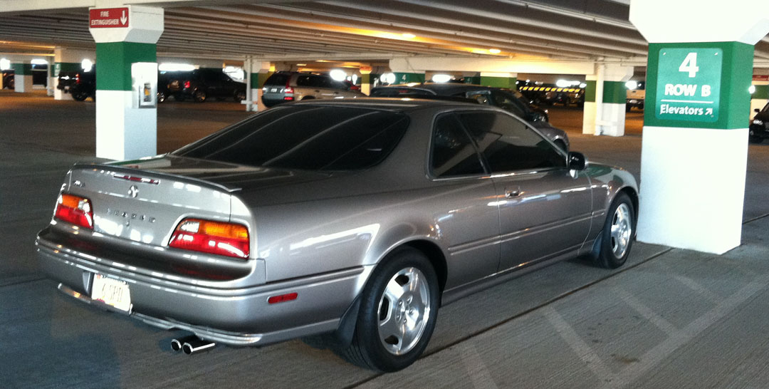
Odometer (Legend):  527,113

527113

What does it take to travel 26.2 miles?

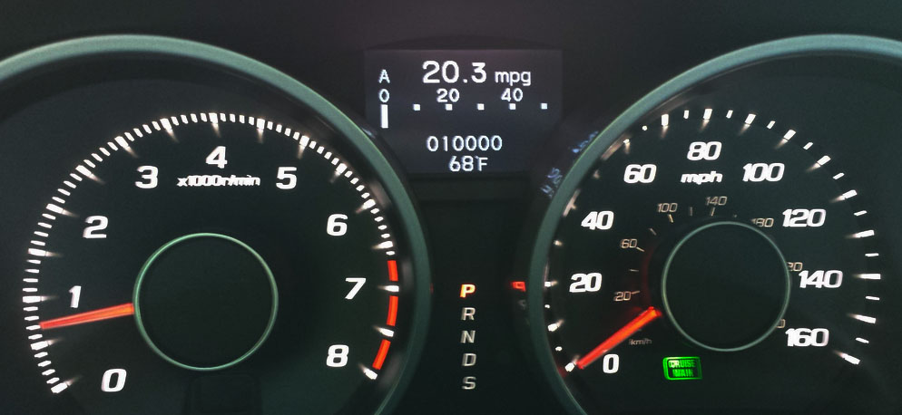
When I’m in my 2013 Acura ILX, it requires about .79 gallons of premium unleaded gasoline.

mpg

When I’m equipped with nothing more than a pair of running shoes, the fuel requirement is a bit more involved.

  • 1/2 bagel with peanut butter
  • 5 bites of a chocolate mint “Builder Bar”
  • 3 “GU” energy gel packets
  • 1/2 a banana
  • 6 orange slices
  • est. 1/2 gallon of water and/or gatorade
  • and 1 red vine licorice strip at mile 18

I think my car wins by a landslide in terms of efficiency.  Let’s talk about running.

The very world’s first marathon dates back a very long time:

The modern marathon commemorates the run of the soldier Pheidippides from a battlefield at the site of the town of Marathon, Greece, to Athens in 490 B.C., bringing news of a Greek victory over the Persians. Legend has it that Pheidippides delivered the momentous message “Niki!” (“victory”), then collapsed and died, thereby setting a precedent for dramatic conclusions to the marathon.

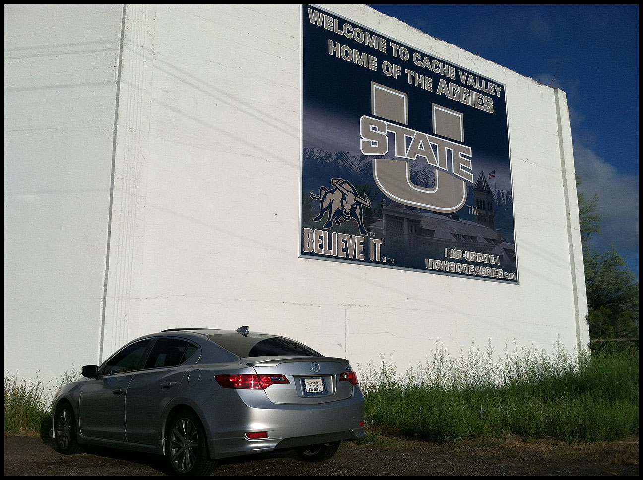
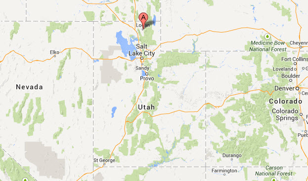
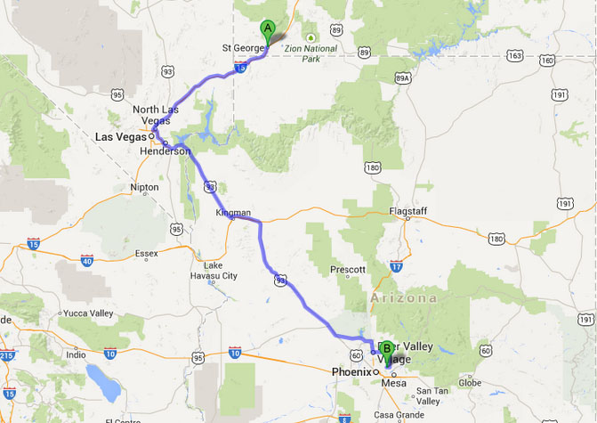
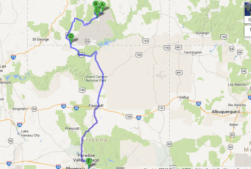
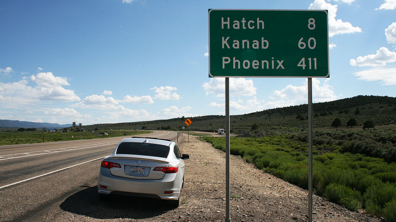
Say what?  We commemorate the event of this soldier’s death by subjecting ourselves to the same tortuous treatment?  You bet we do.  And sometimes we even have fun doing it.  This weekend, I drove my Acura ILX about 850 miles round-trip to my hometown of St. George, Utah to compete in a marathon hosted there.

sgu_map

I’m happy to report that I did survive the event and even performed a little better than anticipated.  This was the 5th time I’ve finished this race, and I plan on competing again next year. The ILX, as always, made the trip to Utah flawlessly.  I invite you to follow along on the journey via the photos below.

jeff_tyson_marathon_finish

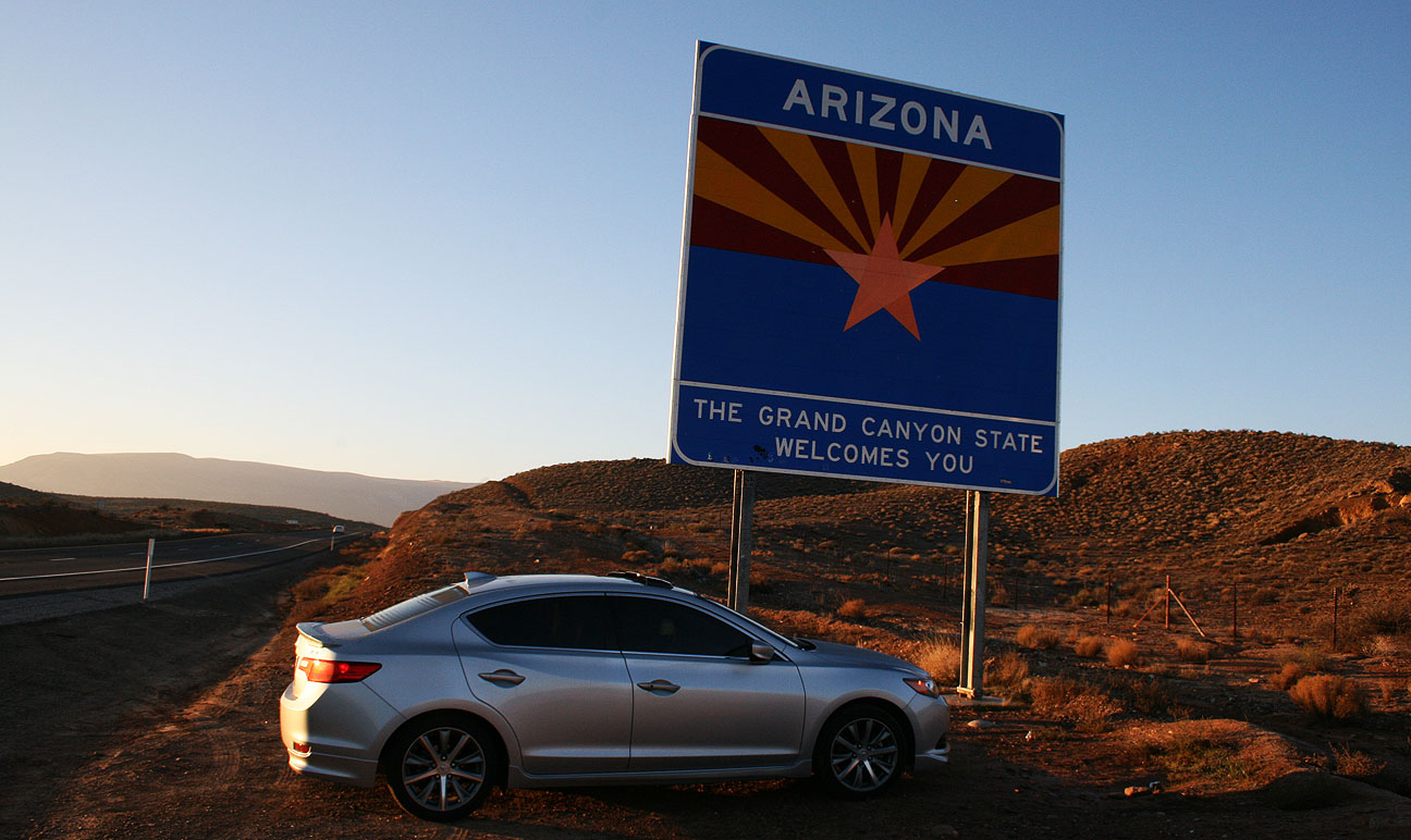
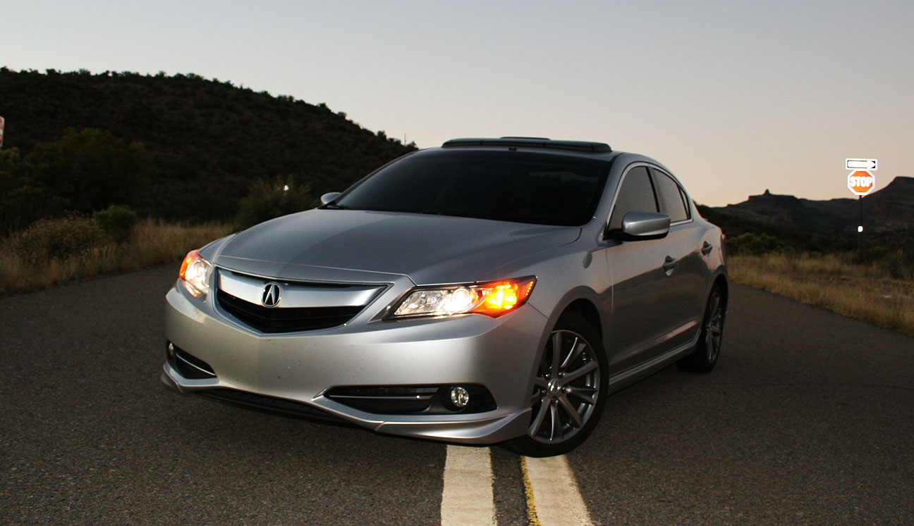
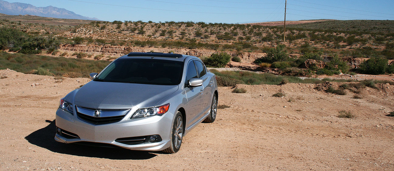
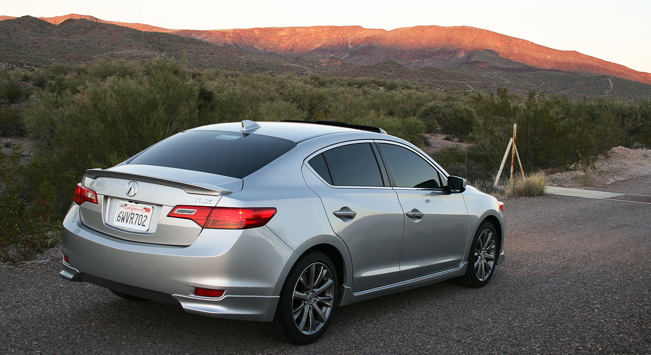
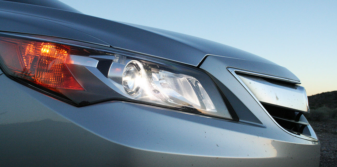
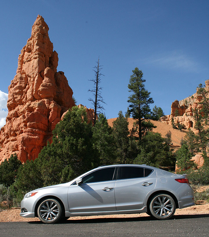
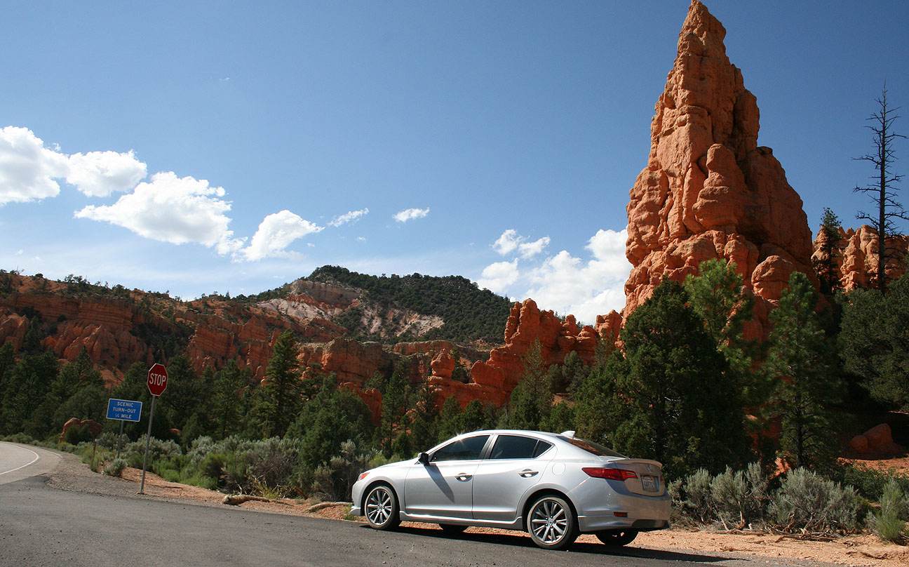
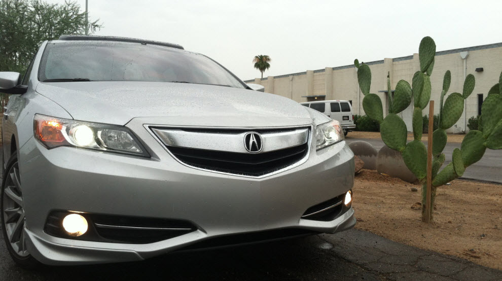
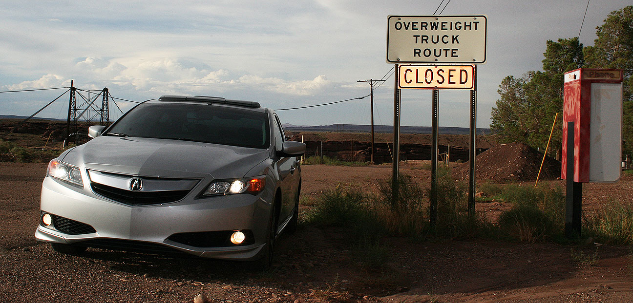
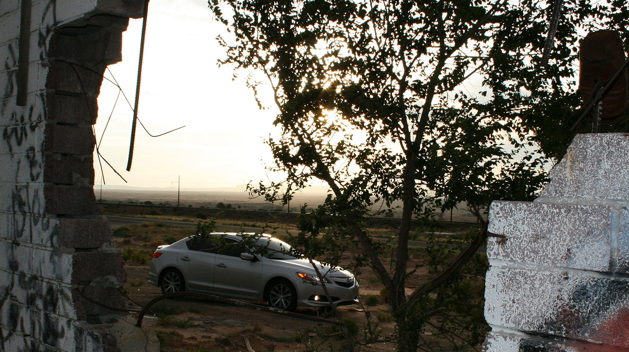
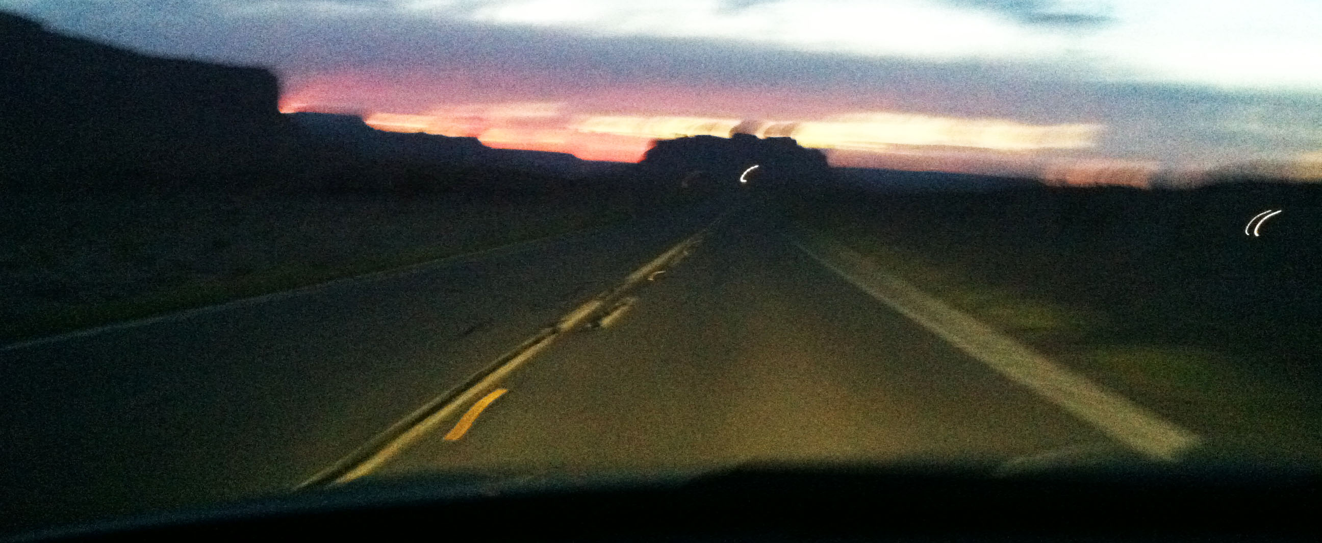
Highway 93 between Wickenburg and Wikeup, Arizona offered a nice backdrop for some photos as I was rolling through last Thursday evening.

ilx_in_sunset

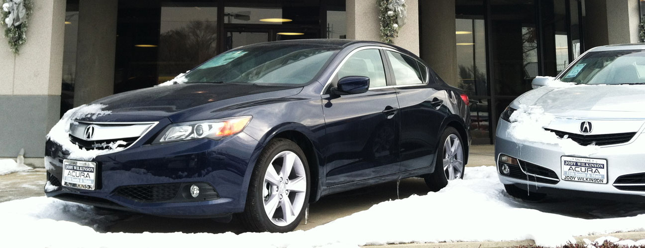
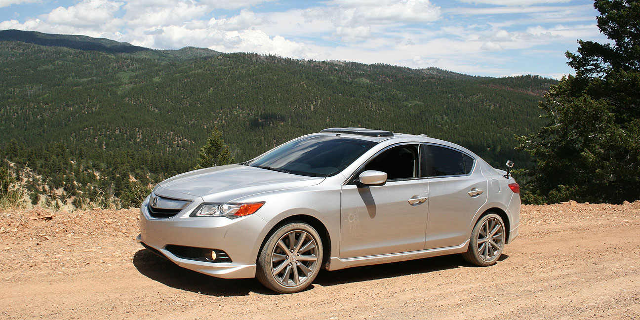
Dusk is my preferred time of day to take car pictures.  The ILX has great lines:

ilx_reflection

ilx_front_right

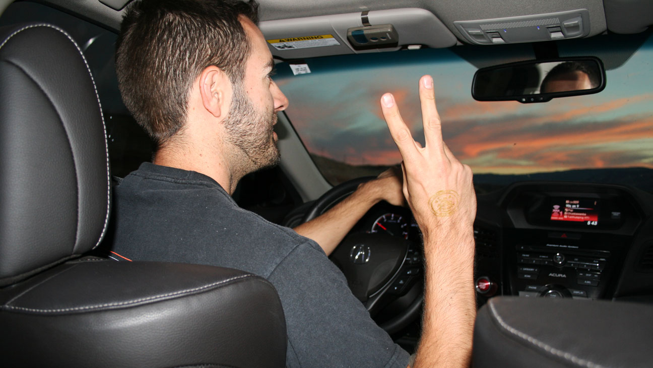
The face of determination.  In the 16 months I’ve had the ILX, it’s probably made this trip to Utah a dozen times.

front_end

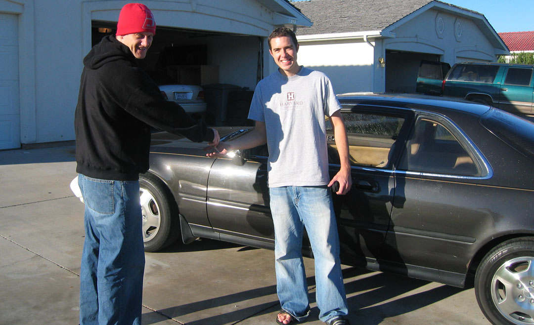
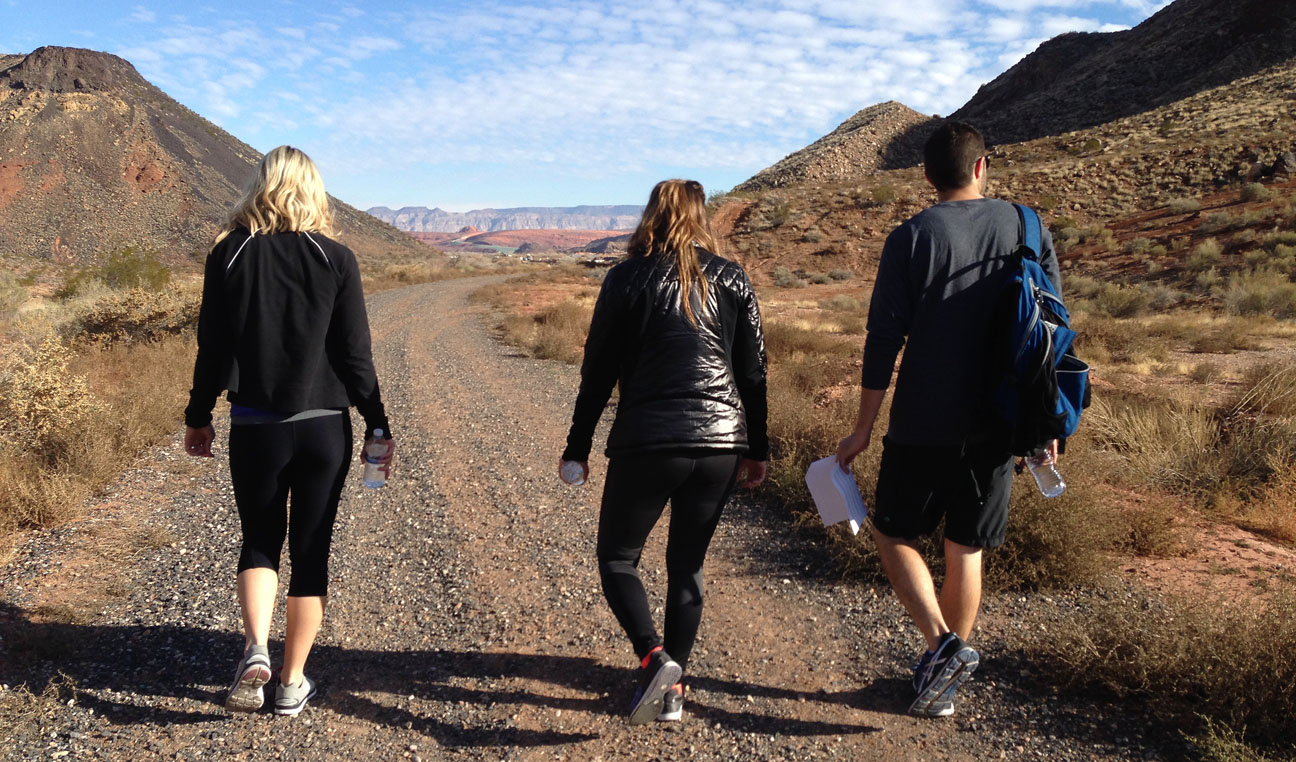
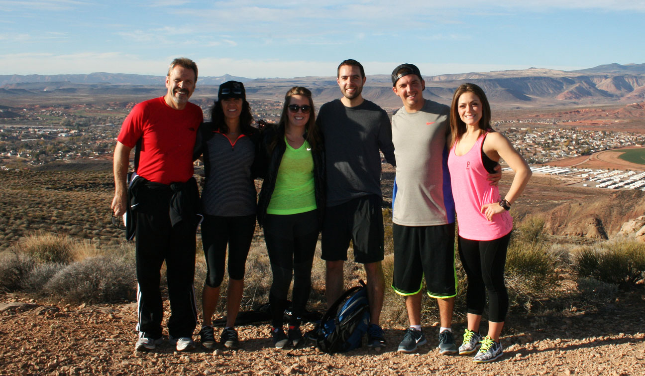
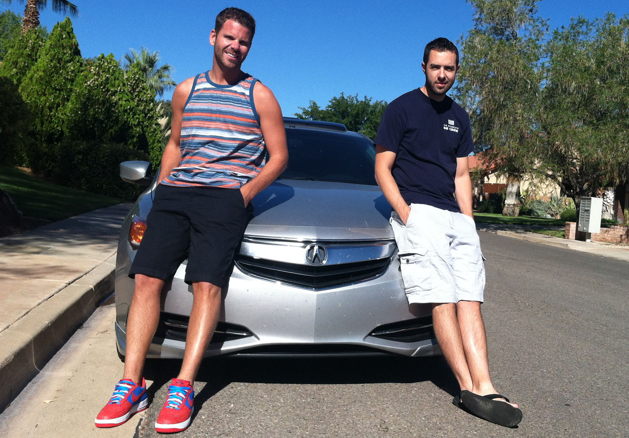
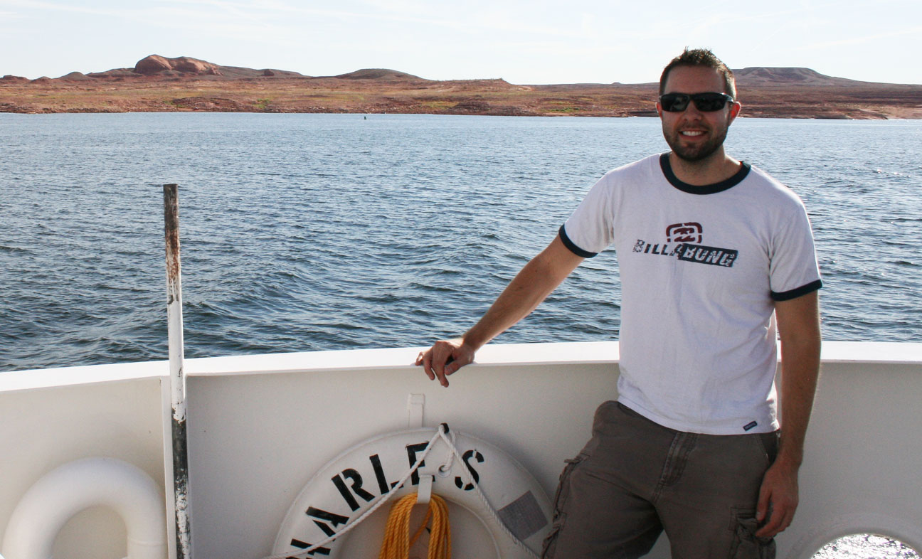
First order of business upon arrival in Las Vegas, Nevada was picking up my friend Jeff who’d flown down from Calgary, Alberta.  Jeff is a marathon runner, too, and a quick one at that.

jeff_tyson_ilx

No trip to St. George would have been complete without seeing these little munchkins, my nieces & nephews.

kiddos

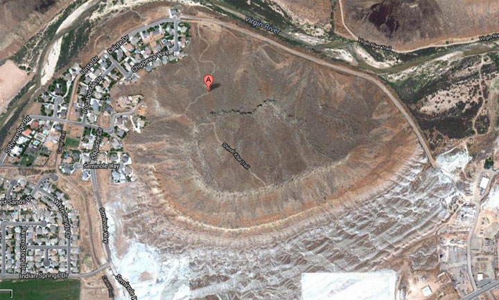
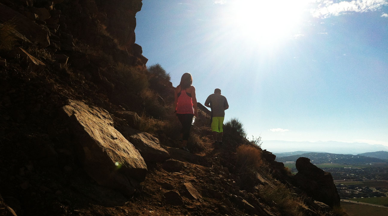
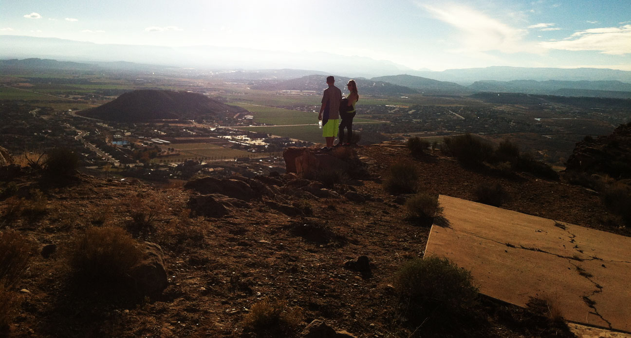
Jeff and I did a little climbing in the red sandstone rocks just north of town.  The word “Dixie” painted on the rock has been there for over a hundred years.  The area was settled originally by Mormon pioneers who were from the south.  The area’s climate made it a great place to grow cotton, so St. George became known as “Utah’s Dixie.”

dixie

ilx_front_left_redrocks

Race day!  Early on Saturday morning after a 40-minute bus ride to the start line, we freezed our buns off in 40-degree temperatures with lots of chilly wind until things got underway.

pre_race

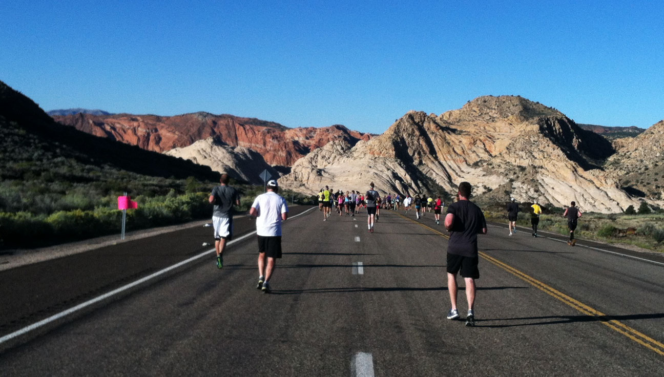
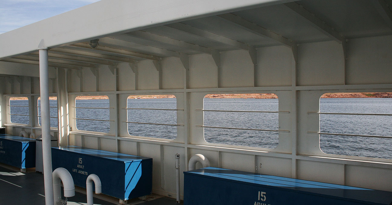
And we were off!  Jeff and I (and my mom, who was also running) got separated from one another right away in the crowd.  For the first couple of miles, runner traffic was heavy.  I took the below picture at around mile 14 when Snow Canyon State Park came into view.

snow_canyon

I wonder what was on my playlist at the time.  Typically, the songs I like best when I’m running are ones that have a good beat.  Here’s one example on YouTube which is a remix of the Cranberries song “Zombie.”

marathon_selfie

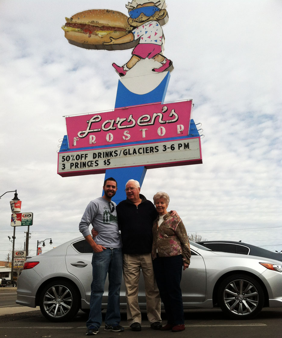
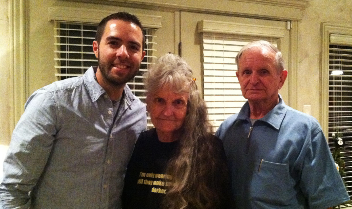
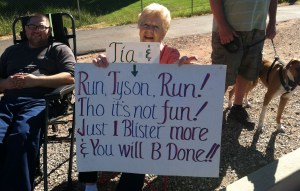
My fan club (of which Grandma is president!) was alongside the road at about mile 24.  She’d put together a sign for me.

gma

If I’d been running this race prior to 1924, I would have crossed the finish line then.  The “original” marathon distance was 24 miles, but an additional 2.2 miles were added at the Olympic games in London so the race could finish in front of royal family’s viewing box!

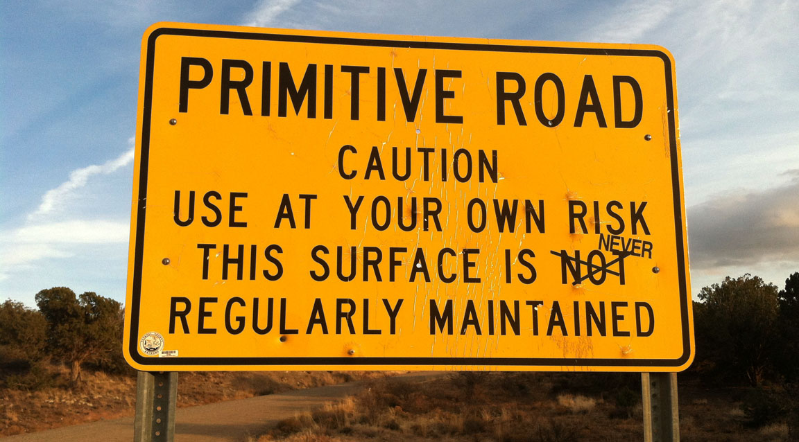
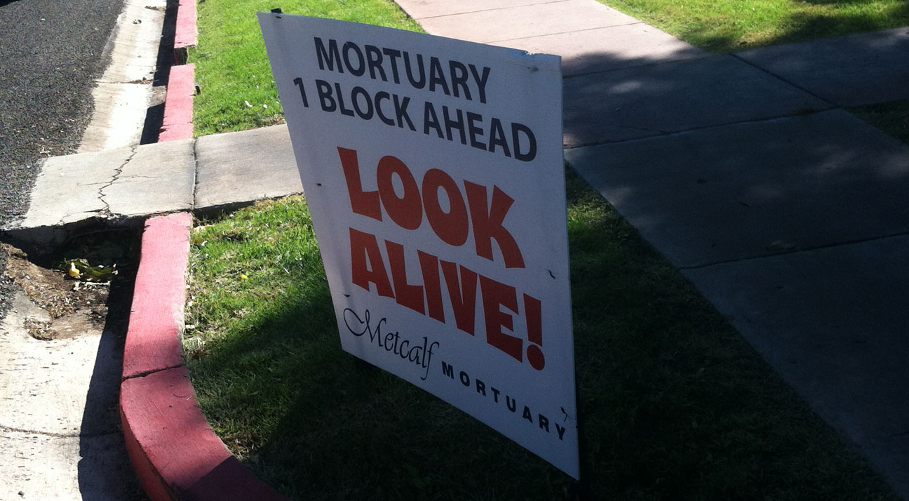
There were lots of clever signs along the road, including this one near a mortuary.

mortuary_sign

Others that I laughed at:

  • “WTF” (Where’s the Finish!?)
  • (with a picture of Sweet Brown) “Tired?  Ain’t Nobody Got Time for That!”
  • “Run Faster.  I Just Farted.”
  • “Worst Parade Ever.”
  • “That’s Not Sweat.  It’s Your Fat Cells Crying!”

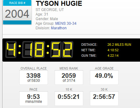
Whatever the message, it was great to have a diversion from the pavement and I love the crowd support that is always in abundance at the St. George Marathon.  My final stats are shown on the graphic below.  My finish time was 4 hours, 18 minutes.  That put me smack-dab in the middle of my “age grade.”

results

When we dig a little deeper into the data, it’s easy to see how much I was slowing down toward the end.  I started out with a sub-9-minute mile, but by the end I was taking nearly 10 minutes per mile.

splits

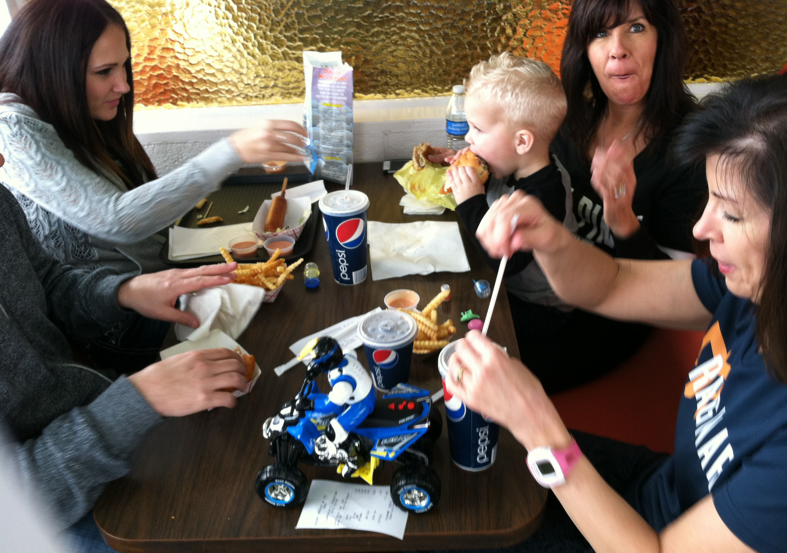
Jeff blazed through the race in 3 hours 28 minutes.  My mom’s finish time was 4 hours, 3 seconds!  I was the slow poke of the group. We treated ourselves to popsicles, fruit, bread, water and all kinds of other refreshments at the finish.

tyson_tia_jeff

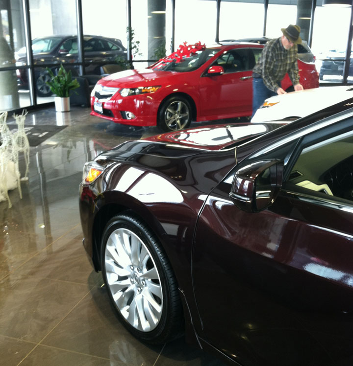
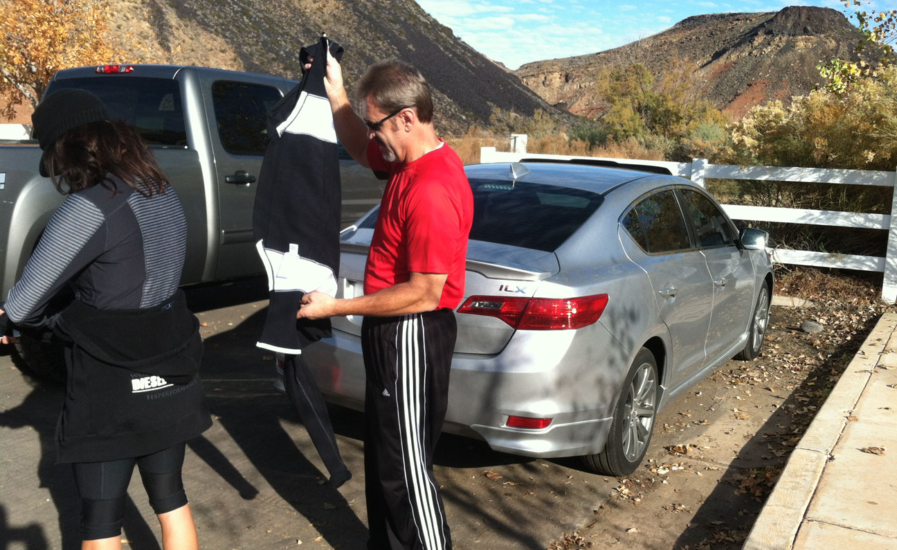
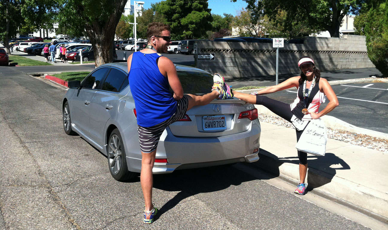
The first place winner in my division, Bryant Jensen, finished in 2 hours 15 minutes!  That works out to a 5:15 minute mile pace.  Unbelievable speed to maintain for that kind of distance.  Below, Jeff and mom were taking time for a stretch.  Hey guys, easy on the paint job please!

jeff_tia_stretch

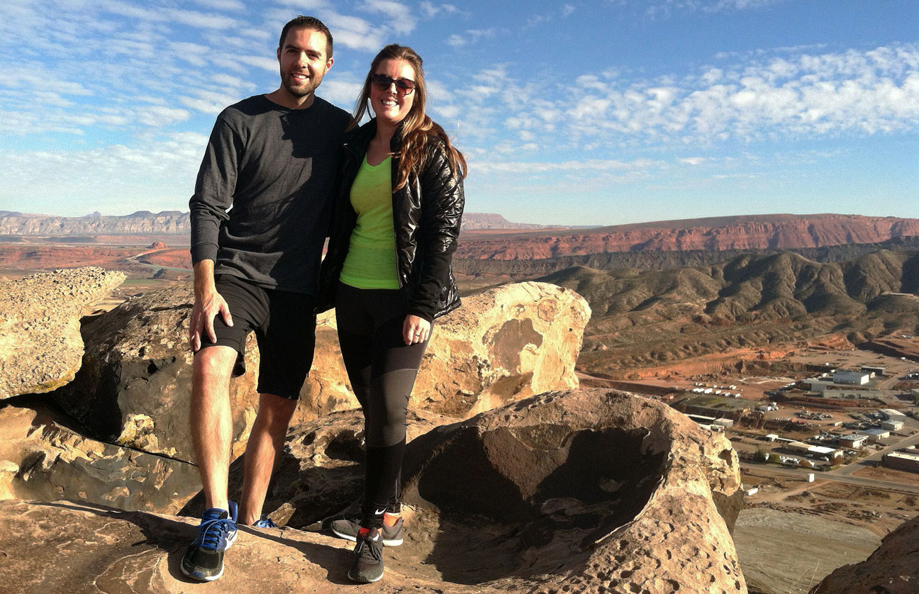
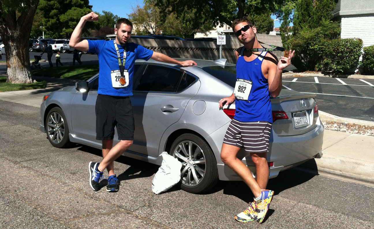
Cheesy photo-op required.

tyson_jeff_ilx

Time for Play-Doh with the kids.

play_doh

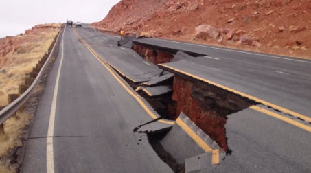
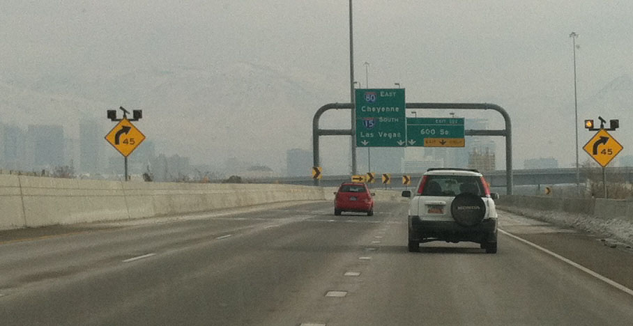
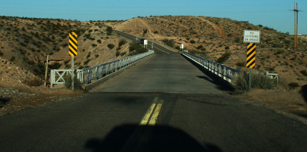
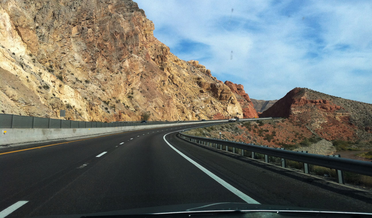
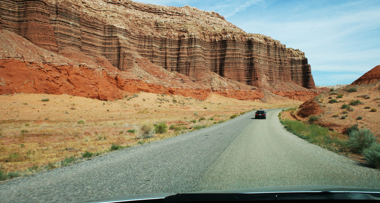
Just a few hours of relaxation later, Jeff and I departed through the Virgin River Gorge on Interstate 15 southbound to make the 100-mile trip to Las Vegas, Nevada for the night.

gorge

A true oasis in the desert, this city gets a little more colorful every time I visit.  Las Vegas is a true 24/7 entertainment destination.

mgm_grand

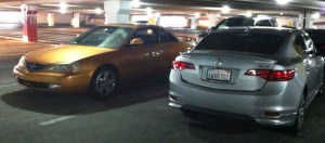
I parked next to a Sundance Gold Pearl 2001 Acura CL Type-S at our hotel, the Mandalay Bay.

cl_ilx

Later that evening, we did some walking (or better yet, hobbling) around to see some of the sights.  The New York-New York Casino is famed for its architecture in the likeness of the NYC city skyline, except with somewhat miniaturized buildings.  There’s a roller coaster that circles the property.  I won’t be riding it any time soon!

nyny

We ran into our friend Deena on the Las Vegas Strip.

tyson_deena

Pictured here are Paris and Planet Hollywood casinos.

vegsa

It was a great night out on the town, though I was exhausted from the run earlier in the day.

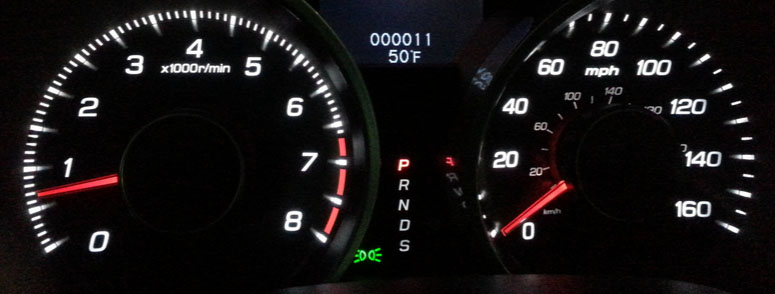
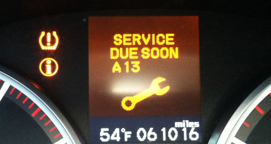
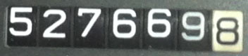
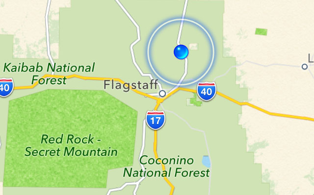
This morning on my drive home to Phoenix in Boulder City, Nevada, I hit a fun milestone in the ILX.  If only the outside temperature had been 6 degrees cooler, this would have been 55,555 miles at 55 miles per hour in 55 degrees.

55555

Adios!

ILX Trip to Southern Utah Part 3: Hell’s Backbone & Bryce Canyon

Posted in ILX, Road Trip, Utah on August 6, 2013 by tysonhugie

Odometer (Legend):  522,703

522703

Odometer (ILX):  48,732

48732

Leg Distance:  519 Miles

leg3

Welcome to the third and final chapter of last weekend’s wild ride in Utah with 2013 Acura ILX.  Fueled up by my tasty Trout Quesadilla after lunch in Boulder Utah on Saturday, I had a renewed vigor for travel.  My friend Ryan and I were determined to conquer one last road before we called it a day:  Hell’s Backbone.

Hell-Backbone_big-650x388

Seen along the ridge in the above picture, Hell’s Backbone (Forest Road 153) was built in the mid-1930s as an alternate route between the towns of Escalante and Boulder, Utah.   It was constructed by the Civilian Conservation Corps and created a means for the first automobiles to reach Boulder.

Print

Highway 12 is notoriously one of the most beautiful in Utah.  Someday I plan on driving it in its entirety.

12_scenic_byway

Just a few miles south of Boulder on Highway 12, we veered right and entered Hell’s Backbone Road.  Again, Ryan led the way in his 230,000 mile Audi A6 while I followed in the 48,000 mile Acura ILX.

entering_hells_backbone_road

We were lucky to not encounter adverse weather conditions during our drive, as muddy roads would have made this route impassible for passenger cars.  Notice I had my GoPro video camera mounted on the car’s rear quarter panel for part of the drive.

acura_ilx_driving_hells_backbone

The dirt road reaches an elevation of 9,000 feet and skirts the edge of Box-Death Hollow Wilderness.  Midway through the 38-mile stretch of gravel road lies the the one-lane Hell’s Backbone Bridge (originally constructed in 1933).

tyson_hells_backbone_sign

From an informative sign on-site:

The original bridge was in use until the early 1960’s, when its decaying timbers started to groan and squeak ominously as vehicles crossed over it.  The faithful old wooden bridge was replaced by a steel and concrete reinforced structure.  That bridge was replaced in 2005 by the present bridge which is wider and stronger than the two previous bridges.

This thing still looks pretty skinny to me!  I wonder what it would’ve looked like in 1933.

acura_ilx_bridge

Ryan and I took a breather from driving and spent awhile hiking around the area.  It was perfect weather.

acura_ilx_in_utah

Here, Ryan (carefully!) climbed on top of one of the sandstone spires.  A fall would have been fatal at that height.

ryan_climbing_hells_backbone

Pictures do not do justice to the depth of the canyon and the many layers of it.

view_hells_backbone_tyson

All aboard!  Here is the ILX crossing the bridge.

acura_ilx_hells_backbone

I was met by a truck coming the opposite direction and had to back up to let it pass.

acura_ilx_on_hells_backbone_bridge_utah

Hell’s Backbone Road went on to join with Pine Creek Road, which is what we followed to the town of Escalante, Utah.  In all, we traveled around 38 miles on the dirt backroads.

fueling_escalante_utah

Here, I took the chance to go ahead and top off my fuel tank with some $4.09 premium fuel at the only gas station in town.

escalante_utah_fuel_choices

And from there, since Ryan and I had completed our mission, I started contemplating the drive home.  Unfortunately, as the GPS screen capture illustrates below, there was no direct way to get where I was going.

garmin_route

Through the towns of Henrieville, Cannonville, and Tropic, we headed westward on Highway 12.  I love old homes like this one, and I’d especially like to take a peek inside if the opportunity presented itself.  Looks like this one’s even for sale!

old_house_escalante_ut

Bryce Canyon, just up the road, is one of 5 national parks in Utah.  I started seeing some impressive rock formations and knew that we were getting close.

acura_ilx_bryce_canyon

Sure enough, we rolled up to the entrance. Given the long day that Ryan and I had already experienced, we opted out of entering the park.

tyson_at_bryce_canyon_sign

However, we still enjoyed plenty of the surrounding area’s scenery, including this tunnel on the highway.

tunnel_utah_hwy_12

And these scenic pull-outs where I couldn’t resist stopping for a picture.

ilx_red_canyon_2

This place specifically is called “Red Canyon.”

ilx_red_canyon

Finally, we’d reached our separation point.  From the junction at Highway 89, Ryan would be heading north and I’d be heading south.

departing_hwy89_12

That Phoenix destination marker must’ve been identified with me in mind.  I can’t imagine many travelers in that part of Utah are driving to Phoenix.

hatch_kanab_phoenix

It felt really good to finally be honing in on my target destinations as I got close to Flagstaff, which is only 2 hours from Phoenix.

return_trip

My ILX performed like a hybrid from an MPG perspective!  From the time I reset my trip meter when entering Hell’s Backbone until the time I arrived at home, 515 miles later, I averaged 38 miles per gallon.

38_mpg

That concluded Saturday’s travels!  Here’s a video wrap-up of the entire weekend:

hybrid1

Anybody notice a new feature here?

Thanks for coming along for the ride, as always!

ILX Trip to Southern Utah Part 2: Burr Trail

Posted in ILX, Road Trip, Utah on August 5, 2013 by tysonhugie

Odometer (Legend):  522,698

522698

Odometer (ILX):  48,688

48688

Leg Distance:  73 Miles

burr_trail

Fresh off the Hall’s Crossing ferry boat on the north side of Lake Powell at Bullfrog Marina last Saturday, Ryan and I already had a pretty good idea where we’d be heading next in our vehicles.  We wanted to scope out a route called the Burr Trail, one of the most remote yet scenic roads in Utah.  This route is primitive in sections as it winds through the backcountry.  Here is a little info on Burr Trail, courtesy of the National Park Service:

John Atlantic Burr was born in 1846 aboard the SS Brooklyn somewhere in the Atlantic Ocean.  He and his family lived in Salt Lake City, then later moved south and established the town of Burrville, Utah, in 1876.  John Burr soon developed a trail to move cattle back and forth between winter and summer ranges and to market.  This cattle trail through the rough, nearly impassible country around the Waterpocket Fold, Burr Canyon, and Muley Twist Canyon came to be known as the Burr Trail.

I lived in Utah for over 20 years and had never even heard of Burrville, but I looked it up on Google Maps and realized why:  It’s teeny.  Here’s the whole town today.

burrville_utah_satellite_view

After heading north from the marina on State Route 276 for about 4-5 miles, we turned west on Burr Trail.  There were no signs or markings aside from this lonely one.

burr_trail_entrance_utah

The National Park Service has posted written instructions online on what to expect for each mile of the drive.  These were most helpful as Ryan and I made our way through what was new, unfamiliar territory for both of us.

burr_trail_notes

Our eyes were wide open to appreciate the chiseled mountains that surrounded us in various shades of red.

following_ryan_on_burr_trail_utah

Just a little ways into the drive, our plans were nearly foiled.  There’s a part of the Burr trail that floods when the lake level exceeds a certain measurement (3,695 feet, to be exact).  See the note here in red on a map:

powell_map_burr_trail

The lake’s level appears to currently be at or near that level, because Ryan and I saw a wash ahead of us with muddy ruts that I was almost positive my car wouldn’t be able to get through.  I had Ryan go first in his Audi, and then I had him video record me crossing – just in case anything funny happened, of course.

Thank goodness for those 6 inches of ground clearance!  I used them all.

With that out of the way, we continued onward on Burr Trail.  For a time, the road straddled a ridge with canyons on both sides.  Then we left the pavement for what ended up being 15 miles of off-roading.

acura_ilx_burr_trail_3

The printouts that I’d taken with me had a lot of warnings regarding the dangers of driving this road in inclement weather.

acura_ilx_burr_trail_2

A bit further up the road, Ryan and I entered the park boundary for Capitol Reef National Park.  Unlike most other national park entrances, though, this one has no entry fee.  It’s so remote that it isn’t even staffed.  There’s a small signpost which reads “PARK INFORMATION” and holds a wooden box containing brochures.

acura_ilx_capitol_reef_np_burr_trail

Even though summer travels are in full swing, Ryan and I only saw a couple of vehicles in the 2 hours that we were on the Burr Trail.  This road is truly under-appreciated, and I’m okay with that.  It’s something amazing to be able to stop your vehicle, shut off the motor, and hear absolute silence.  That’s what we experienced.

burr_trail_scenery

A sign at the fork in the road ahead ensured us that we were on the right track, but still 42 miles from our next destination in Boulder, Utah.

burr_trail_distance_sign

I had Ryan take the lead in his Audi and gave him plenty of space so that I didn’t have to eat his dust the whole time.  Not long after he got out of my line of sight, he came on our 2-way radio and said, “Dude, this just got real.”  I knew the sights ahead were going to be awesome.  And they were.

burr_trail_following_ryan

Massive stone canyon walls loomed above us on 3 sides as we started up a series of very tight switchbacks.  Road conditions were poor in some spots.  There were washboard ruts that gave my car’s Traction Control System a workout as my Michelin tires tried to get a grip in the loose gravel.

burr_trail_rocks

We made it up the steep grades and pulled over to take a look at what we’d just driven up.

acura_ilx_front_burr_trail_utah

The winding dirt road in this picture was the road behind us.  To truly appreciate the picture, click it to enlarge, and follow the line all the way from the background to the twisty foreground.  This is my kind of road!

switchbacks_on_burr_trail_utah

It’s worth noting here that for a long chunk of our day, including this stretch, Ryan and I had zero cell phone service.  If we’d had any issues we would have been a long hike away from any civilization.

no_service

At the top of the switchbacks, we saw Peek-A-Boo arch to the right.  This is said to resemble an unblinking eye in the horned head of a giant lizard.

peekaboo_arch

Finally we were back on pavement as we entered the Grand Staircase-Escalante National Monument.  It was established in 1996 and protects over 1.8 million acres of land.

acura_ilx_grand_staircase_sign

Still the road was narrow in many places and had no markings whatsoever.

red_rocks_burr_trail_utah

Ryan and I commented to one another via our walkie-talkies how surprised we were at how quickly the landscape can change in just a matter of miles.  We went from red rocks to white rocks as we got closer to Boulder, Utah.

approaching_boulder

Parched and ready for a break, the Hell’s Backbone Grill beckoned us.

hells_backbone_sign

The restaurant, which had a rustic lodge feel to it, was hidden in these trees.

hells_backbone_grille

Ryan and I were the only ones there for lunch!  Well, except for a cat named Jezabel who sat on a chair in the patio.  I tried something new to me:  Smoked Trout Quesadilla.

hells_backbone_menu

“Where the food is heavenly” is a fitting slogan; this really did hit the spot.

trout_quesadilla

The ILX took a few deep breaths outside after climbing Burr Trail.

acura_ilx_parked_outside_boulder_utah

Ryan and I topped off our stomachs with dessert.  My hot fudge sundae even had an orange flower stuck in it.

tyson_ryan_at_hells_backbone_grill_boulder_utah

The “Country Corner” service station pictured below is long-since closed, but we grabbed some beverages and headed out for the next chapter of our trip:  Hell’s Backbone Scenic Byway.  Would the road live up to its ominous sounding name?  Find out next time.

country_corner_boulder_utah

ILX Trip to Southern Utah Part 1: Lake Powell

Posted in ILX, Road Trip, Utah on August 4, 2013 by tysonhugie

Odometer (ILX):  48,648

49648

Leg Distance:  491 Miles

leg1

Coming to a blog near you:  A 3-part series about this weekend’s trip to Southern Utah’s red rock backcountry.  The Acura ILX 6-speed hit the highway again for a 1,083-mile on- and off-road adventure that I’m looking forward to sharing with you.

The intent of this trip was to meet up with my friend Ryan who had joined me on the Arches National Park trip back in February.  We were determined to check out some of the most scenic roads that Utah has to offer.

Friday afternoon’s departure from the Phoenix, Arizona area left me soggy as I hit monsoon rainstorms about two hours into my trip, in Flagstaff.
rain_flagstaff_arizona

About 50 miles north of Flagstaff on the Navajo Indian Reservation, there’s a bridge crossing the Little Colorado River near the town of Cameron.  An old suspension bridge seen in the background here was built in 1911 and spans 680 feet.  It was damaged by an overload of sheep in 1937!  However, it was repaired and continued to carry automobile traffic until 1959 when it was replaced by a newer bridge just to the east.

highway_89_overweight_truck_route_arizona

Because of the weight restrictions imposed on the bridge, there was a secondary route that truckers were required to follow, called the Overweight Truck Route.  Signs for that bridge are still in place but the route is now closed.

acura_ilx_overweight_truck_route_cameron_arizona

I still took the ILX to explore a little about what’s left of that old alternate route.

highway_89_oversize_truck_route_cameron_arizona_acura_ilx

There’s a lot of neat road history in this area.  An old stretch of Highway 89 parallels the current highway.  I saw this section where it had buckled in various places over a wash crossing, forming a zig-zag of concrete.

highway_89_crumbling_arizona

I branched off to the northeast on Highway 160 and headed in the direction of Four Corners, stopping along the way to get a picture at the remains of a service station.  Standard Oil, dating back to 1870, was once the largest oil refiner in the world.

standard_oil_products_acura_ilx_2

This particular station looked like it hadn’t seen any customers for at least half a century, though.

standard_oil_co_acura_ilx

As dusk fell, I was rolling northward on Highway 163 through Monument Valley.  Traffic was light and this was a great chance to enjoy the open road and the amazing scenery that surrounded me.

sunset_hwy_163

The employee at the front desk of the Super 8 Motel in Blanding, Utah, told me after I’d checked in for the night, “You’ve got a really nice car.”  I glanced outside to where it was parked.  It did look rather photogenic in that light.

acura_ilx_checking_in_at_super_8

Ryan arrived at about this same time in his black 1996 Audi A6 Quattro.  We called it a night fairly early, because we wanted to be rested up for the next day, when we’d be seeing this. (Photo Credit for this pic)

lake_powell

Lake Powell is a body of water on the Colorado River that covers over 250 square miles.  That makes it the second largest man-made reservoir in the United States.  Creation of this lake was made possible by construction of the Glen Canyon Dam which was completed in 1963.

glencyndam23_jdg

It took 11 years for the water to fill up to the high water mark!

lake_powell_july_1987

The above picture of me with my dad was taken in July 1987.  Lake Powell was a favorite boating destination for my family when I was growing up.  Here’s another classic from a few years later (I’m on the right).

hugies_at_rainbow_bridge_lake_powell

The arch seen in the background there has a story of its own.  Lake Powell is home to Rainbow Bridge National Monument, a 290-foot-tall sandstone natural bridge that had been seen only by the Native Americans until 1909.

scenery_highway_276

Ryan and I decided to transport our vehicles across Lake Powell via a ferry that’s been in operation since 1985 called Hall’s Crossing.  The drive from Blanding to Hall’s Crossing was 88 miles via scenic byways 95 and 276 .  As seen here, the rate for vehicles is $25 so we were prepared with cash to pay our fares.

ferry_costs_acura_ilx_utah

This curvy two-laner was prime environment for the 6-speed ILX.  I found I rarely needed to downshift to get up the grades.  Interestingly enough, we only saw one other vehicle on this road, and it ended up being a ferry employee who blew past us. She must’ve been late for work!

hwy_276_to_halls_crossing

Soon we could see a sliver of blue water in the distance.  We’d arrived at Hall’s Crossing.  The road to this crossing was completed in 1969.

tyson_at_halls_crossing_lake_powell

The park ranger let us in the marina without paying the $15 per vehicle fee, since we were just going to catch the ferry rather than spend time boating.  Her instructions were, “Don’t recreate.”  As in, recreation, not re-creation.  Still sounded funny to use that word in such a context.

arriving_halls_crossing_lake_powell

As we got closer to the ferry dock, it became apparent that the water level looked pretty low.

arriving_halls_crossing

I’ve since learned that Lake Powell’s water level fluctuates greatly depending on rainfall and other factors; it is now at its lowest point in 5 years.

driving_down_ferry_ramp_lake_powell

After a 30-minute wait for our 9:00 a.m. departure, the ferry attendant waved us onward and the ILX climbed the ramp to get on the boat.

driving_onto_ferry

The ferry is 3 lanes wide.  I would estimate it could accommodate 15 or so vehicles.  Ryan and I were in our element!  A ferry operator came on an intercom and instructed everyone that we could exit our cars and wander around.

tyson_ryan_with_acura_ilx_on_ferry

Here was the ILX’s parking space for the 30-minute ride from Hall’s Crossing to Bullfrog Marina.

acura_ilx_on_ferry_lake_powell_utah

And we’re off!

ferry_moving_lake_powell

Notice the water line evident behind us as we made our way across the lake.

tyson_ryan_on_ferry

Because of the way Lake Powell is laid out and how it extends into so many different canyons, there are nearly 2,000 miles of shoreline – more than the west coast of the United States!

powell_map

I was able to stand at the back of the ferry and watch the waves which we were creating.

ferry_wake_lake_powell

Views surrounded us on all sides as we motored past houseboats, ski boats, and jet skis.  When people see the ferry coming, they get out of the way!

lake_powell_ferry_view

Captain Tyson at your service.

tyson_on_halls_crossing_ferry_lake_powell

The ferry itself was only built about 13 years ago but to me it looked much older.

ferry_utah_dept_transportation

All too soon, our joyride was over but another one was yet to begin.  After we exited the lake, Ryan and I plotted out our game plan for where we’d take our cars next.  I think you’ll enjoy the next piece of the story.  Stay tuned.

exiting_ferry_acura_ilx