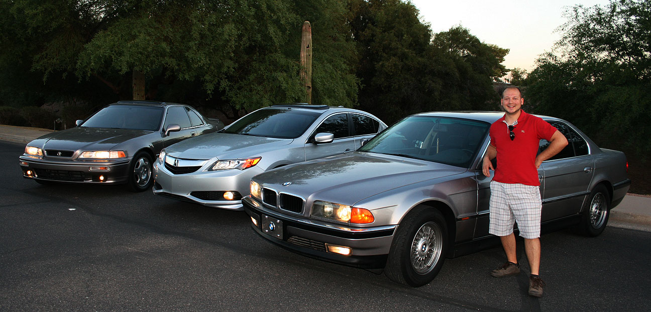
Today, I’m going to spotlight 4 people who deserve some recognition for being either an Acura fan or a Drive to Five fan.
First of all, most die-hard Legend enthusiasts will already know that Christopher Brian Bridges – better known as rapper, entrepreneur, and actor Ludacris – has been driving a 1993 Acura Legend for many years, since before his days of stardom. In this recent video clip of an interview with Chelsea Lately, he talks about his pride and joy Legend. Notice he mentions the fact that it has over 240,000 miles on it. Love it!
To Ludacris: You’re nearly halfway there!
Here’s Luda’s car.
Our next feature is Cody who I’ve introduced before. He’s got an exceptionally clean Legend sedan that looks like like a twin to the one Luda drives, except with just a fraction of the miles. This 1993 L sedan 5-speed has fewer than 70,000 miles on it.
Check the “after” picture of his window tint from a few days ago. Looks much better!
Next, we’re sending some congratulations to the other side of the globe where Francesco who we’ve been following for quite some time now has just completed 280,000 kilometers in his Fiat. Can’t wait to see him roll the big 3-0-0!
And finally:
Another Drive to Five reader, Michael, stopped by this evening to visit. He’s got a high mileage 1997 BMW 740 iL. This beauty has over 270,000 miles on the original drivetrain.
Michael’s BMW sports some impressive amenities. The interior (which I forgot to photograph) is in fantastic shape for being 16 years old.
Great looking luxury cars right here!
Thanks for the visit, Michael!
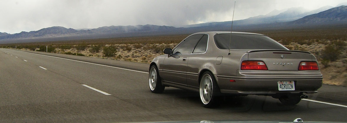
Here’s a flashback picture from December 2006 with my Legend sedan & coupe in Logan, Utah. Interestingly enough, I didn’t even own the sedan until 2 years later. I was just visiting the prior owner at his office when I took this.
And a pic my friend Ben found from NALM (National Acura Legend Meet) 2007 in Las Vegas, Nevada. The Legend was wearing 19″ Racing Hart C2 wheels at the time.
I rolled the bit 522,222.2 this week and I’m already getting anxious for 555,555.5.
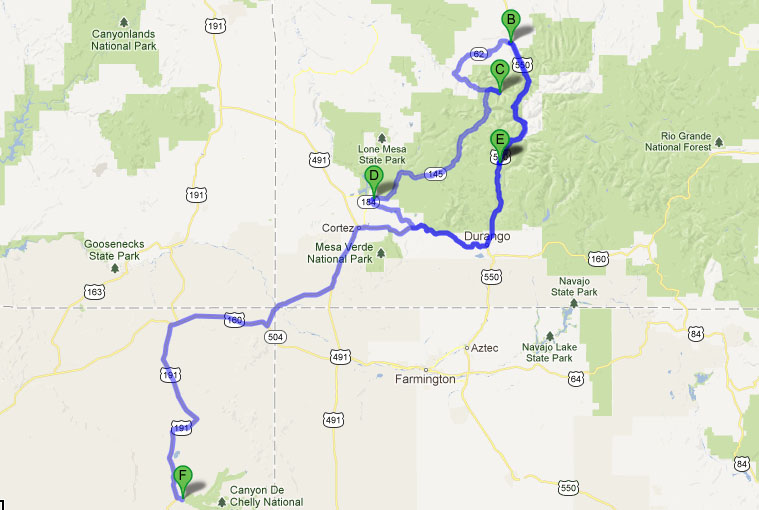
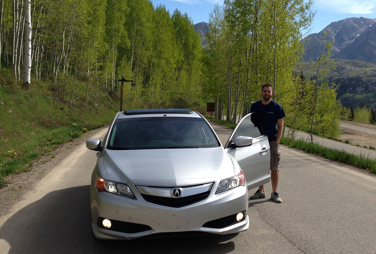
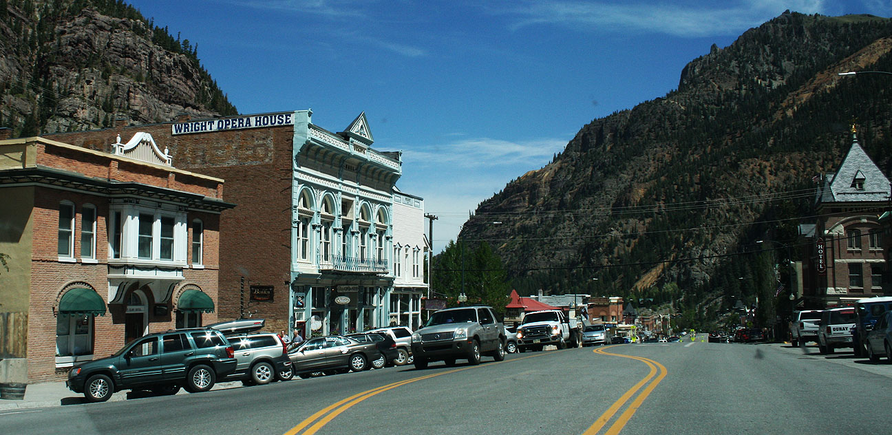
Almost home! Welcome to Part III of my trip write-up about my Memorial Day 2013 travels to southwestern Colorado in the Acura ILX, totaling nearly 1,300 miles over the 3-day weekend.
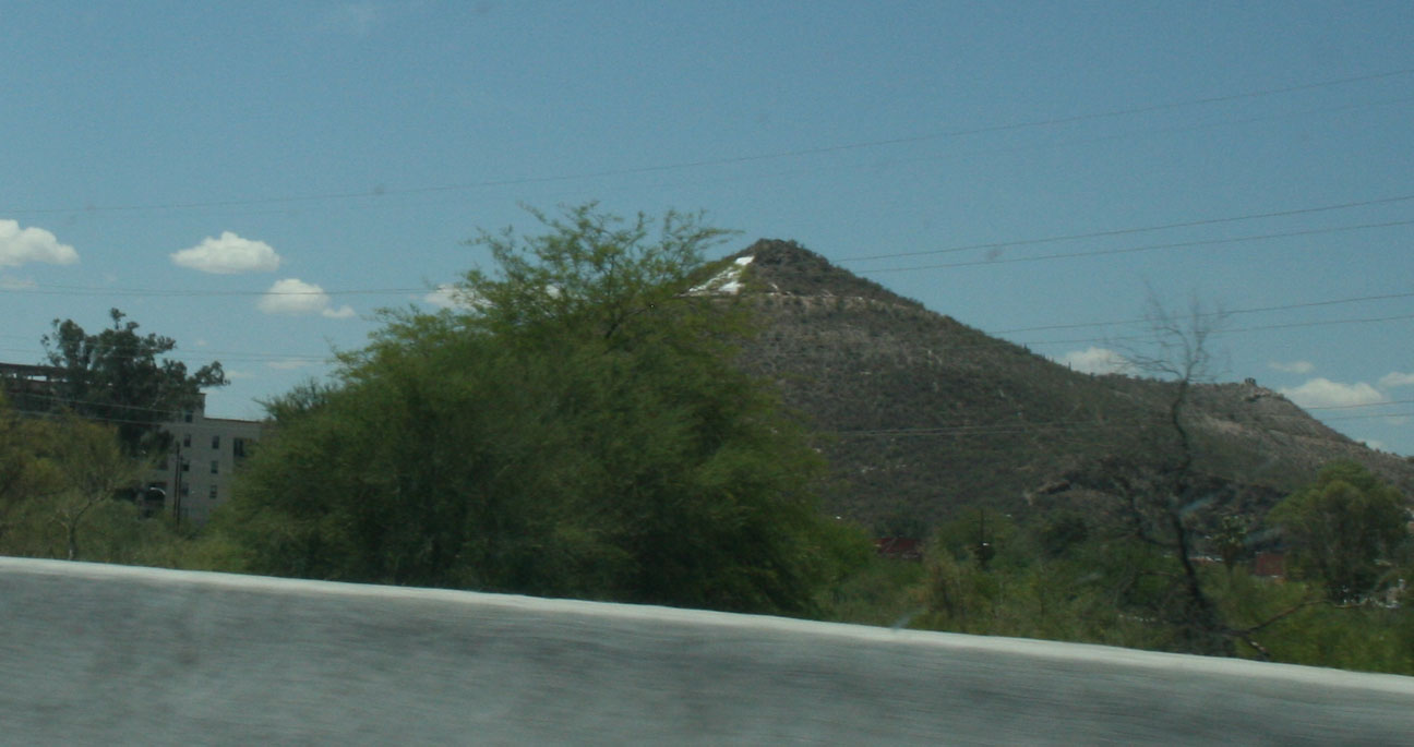
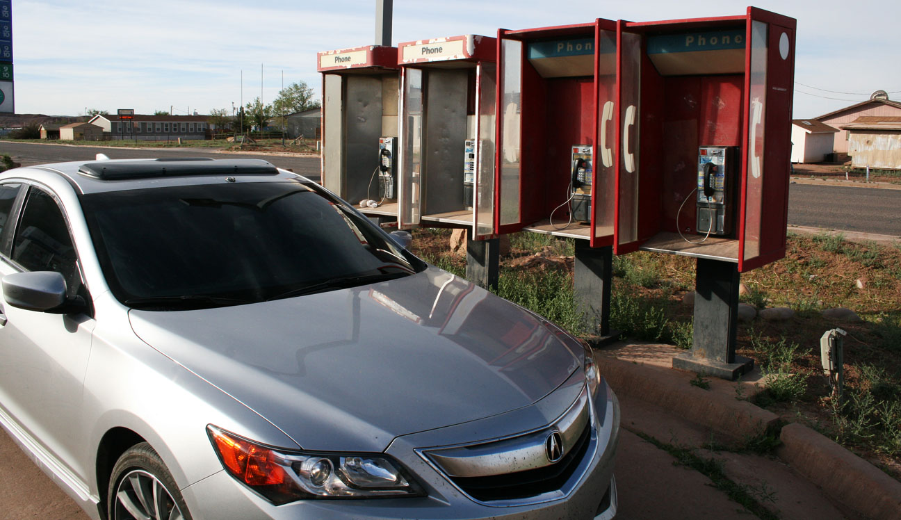
Monday morning, I took my time getting up and about at my hotel in Chinle, Arizona (pronounced chin-lee). The name itself is derived from a Navajo term that means “flowing out,” since this location is where the water comes out of the adjacent canyon. One point of notable historical significance is that Chinle was the location of the 1864 peace conference between the Navajo people and Kit Carson that ended the war between the Navajo tribe and the United States.
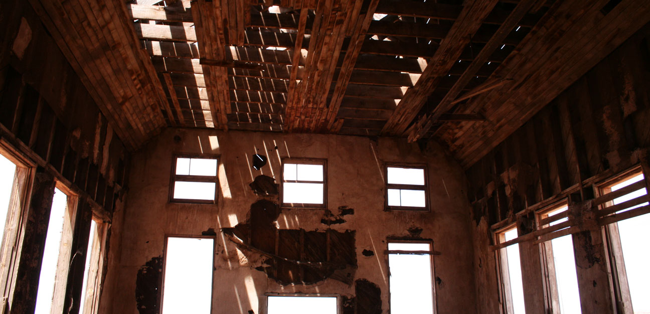
These old phone booths are an indication of just how behind the times this community is. It all appeared pretty run-down during my brief drive through.
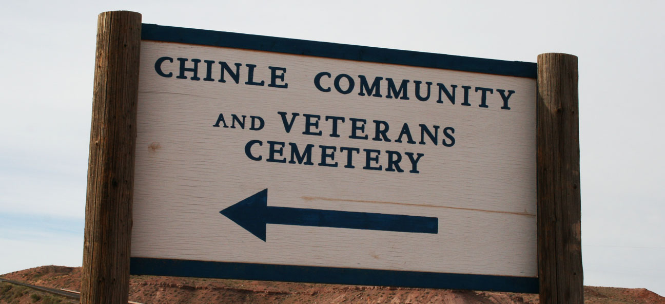
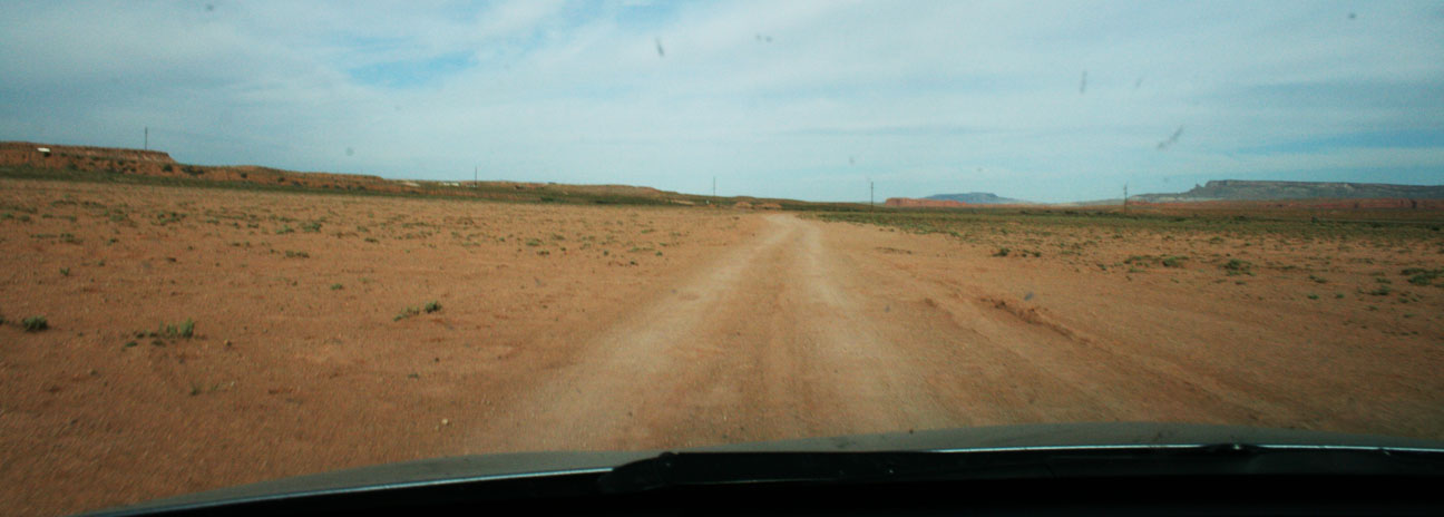
Just a little bit out of town on Highway 191, I saw a small one-lane dirt road leading off to the east. As I got closer, I noticed that the sign said this road would lead to the town’s cemetery. Since it was Memorial Day, I saw it fitting that I should go.
Notice, the south side of the sign said “Cemetery.”
And the north side of the sign spelled it “Cemetary.” This sign was clearly confused.
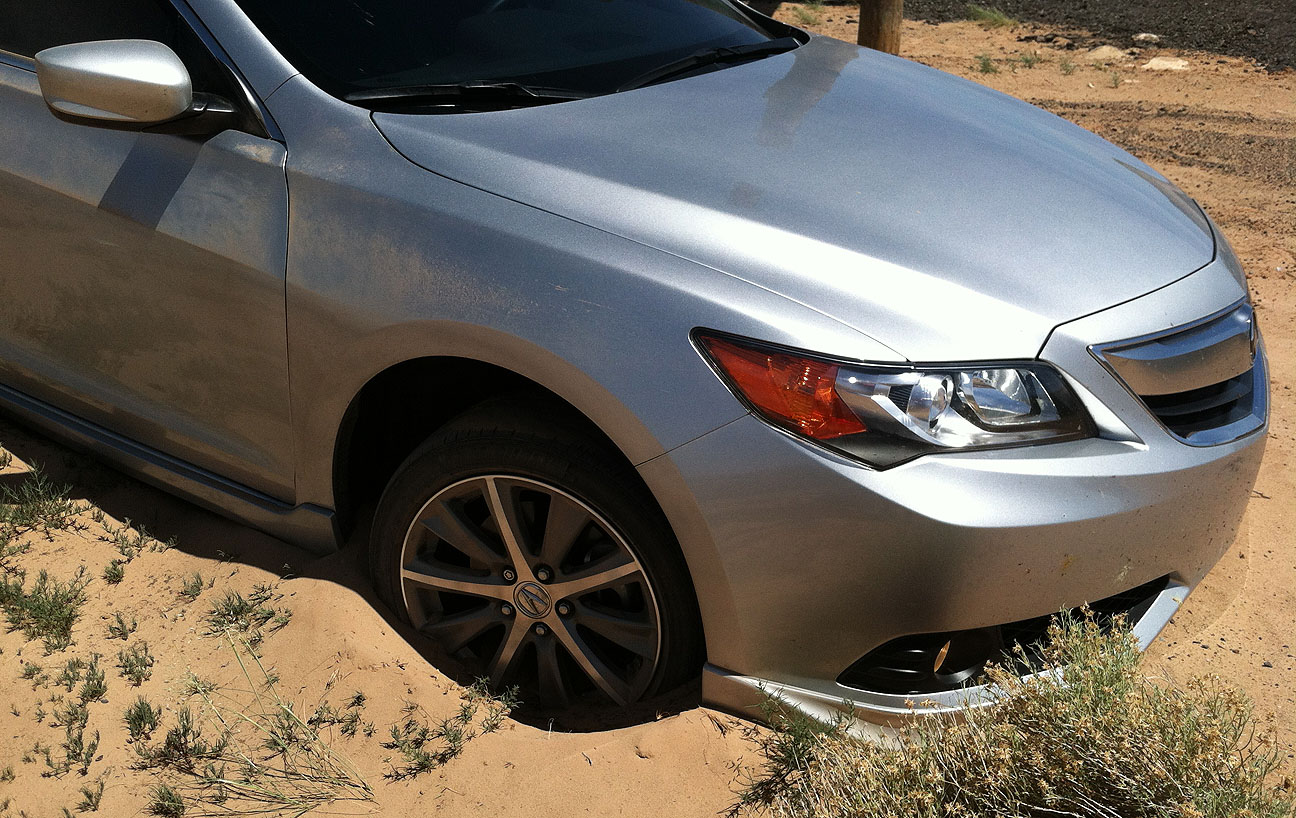
Here’s what the road looked like. It seemed to lead off into the middle of nowhere. I was careful not to take things too quickly in my ILX and road conditions were pretty good considering it was a dirt path.
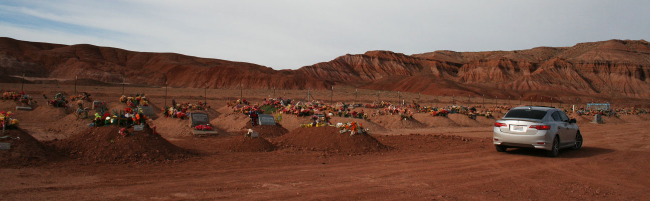
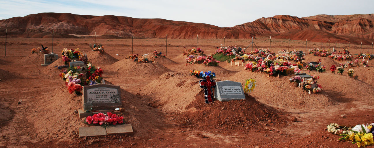
Probably 2 miles down the road, I got to the location of the cemetery. There is a dirt mound for each gravesite, but at this point I’m not clear on whether that means the bodies are buried above ground or below.
I took a few minutes to pay my respects.
I can see why the Navajo nation has selected this place for its graveyard. It is very remote, secluded, and quiet. There was a very peaceful feeling about it.
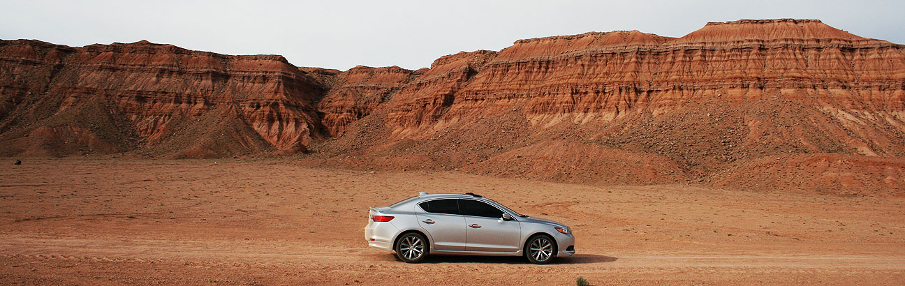
Back on my way I go.
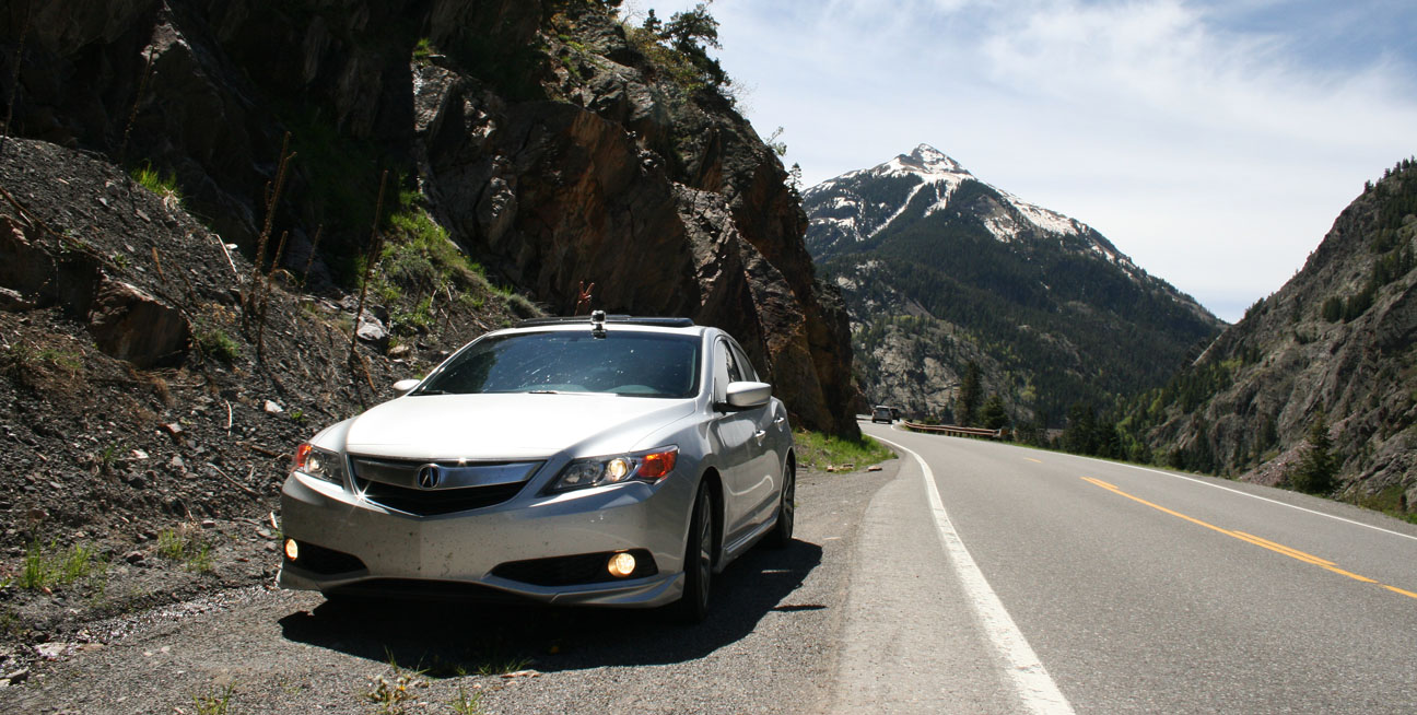
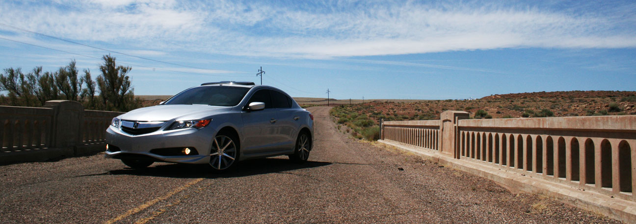
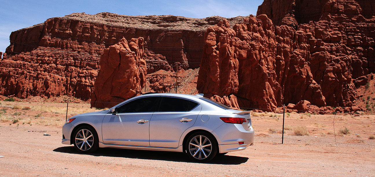
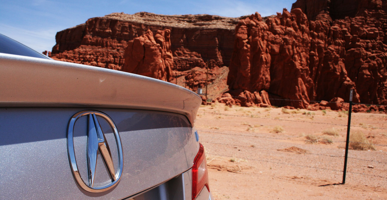
Loved this picture which captures the lines of the ILX in front of a picturesque background.
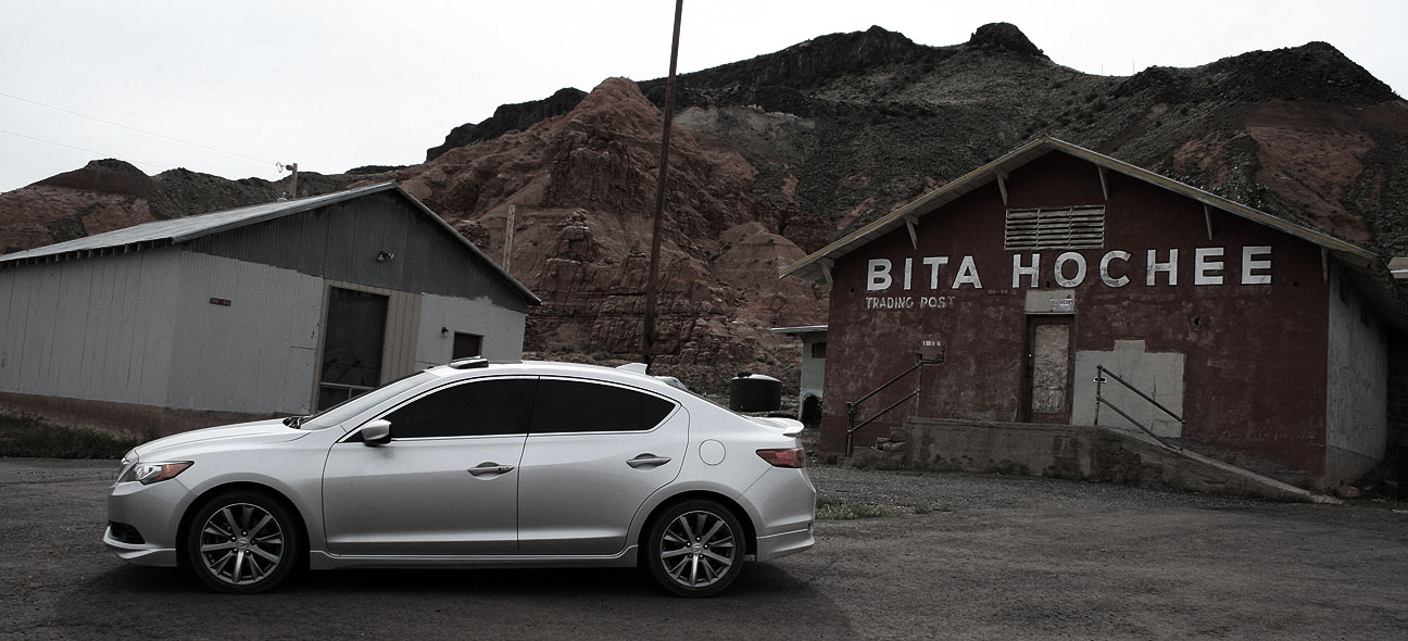
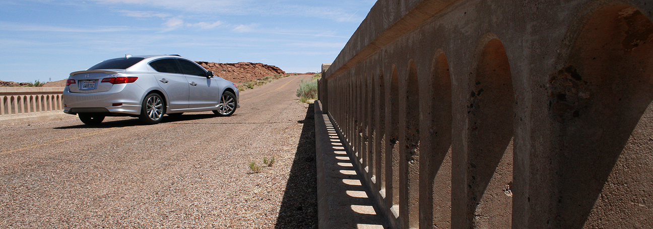
The only other picture I took on the way home was at a (closed / abandoned) trading post called Bita Hochee.
In the 730 miles since I reset the car on Sunday morning, the ILX achieved 38.6 miles per gallon.
Here’s a 5-minute, 40-second video which captures the entire 25-mile drive from Silverton to Ouray, Colorado in a speed that’ll give you motion sickness if you watch the screen too closely. Watch at your own risk!
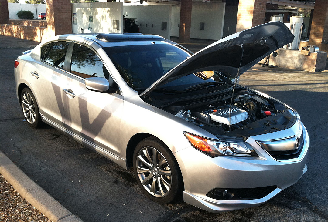
ANDDD, after all of that, I’d say it was time for a car wash.
I decided an at-home wash job was not going to suffice, so I spent $2 at the local coin-op car high-pressure station.
Bugs-be-gone!
Squeaky clean.
I took a few moments to wipe down the interior and all-weather floor mats, too.
It cleans up pretty nicely for having about 40,000 miles on it already. This week I also made an upgrade to the license plate lighting. At left is the new LED bulb; on the right is the stock bulb. The car definitely now has a more upscale look to it at night.
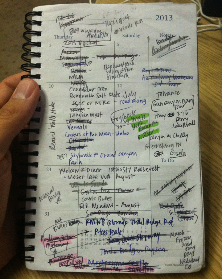
Thought I’d share this messy page from my day planner. This started out as my list of “to-see” driving destinations for 2013. Notice how many of them I’ve already crossed off. And the list continues to grow.
Welcome back! This is Part 2 of 3 in my write-up about this past weekend’s Memorial Day trip to Colorado in the ILX. Part 1 is here.
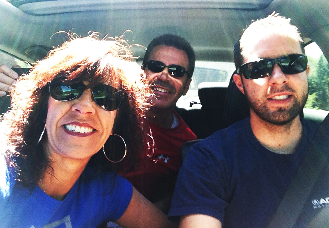
Sunday morning, I woke up to crisp temperatures in the mid 30’s Fahrenheit and bright blue skies in Durango, Colorado. It was a perfect day to enjoy the great outdoors on some of the most famous “driving roads” in the country with my mom and my step-dad.
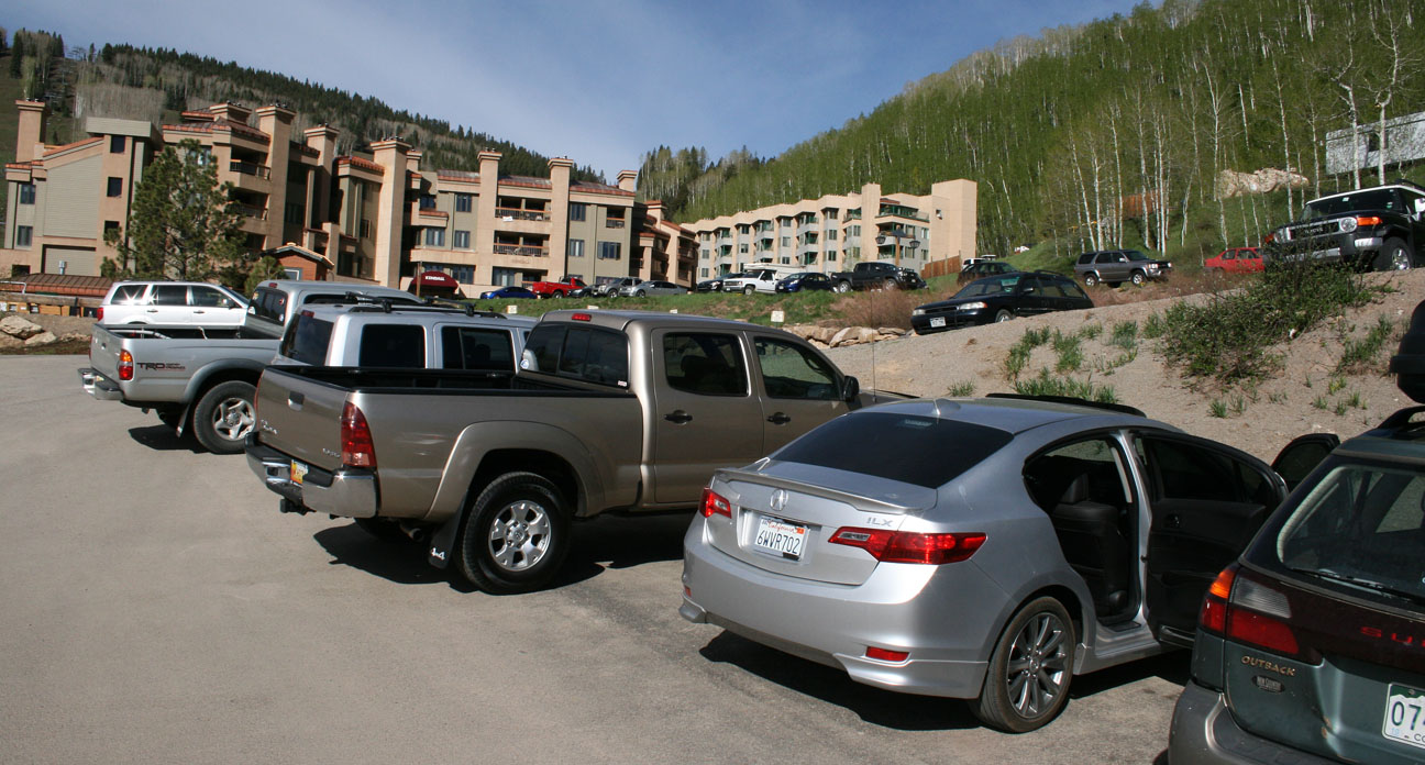
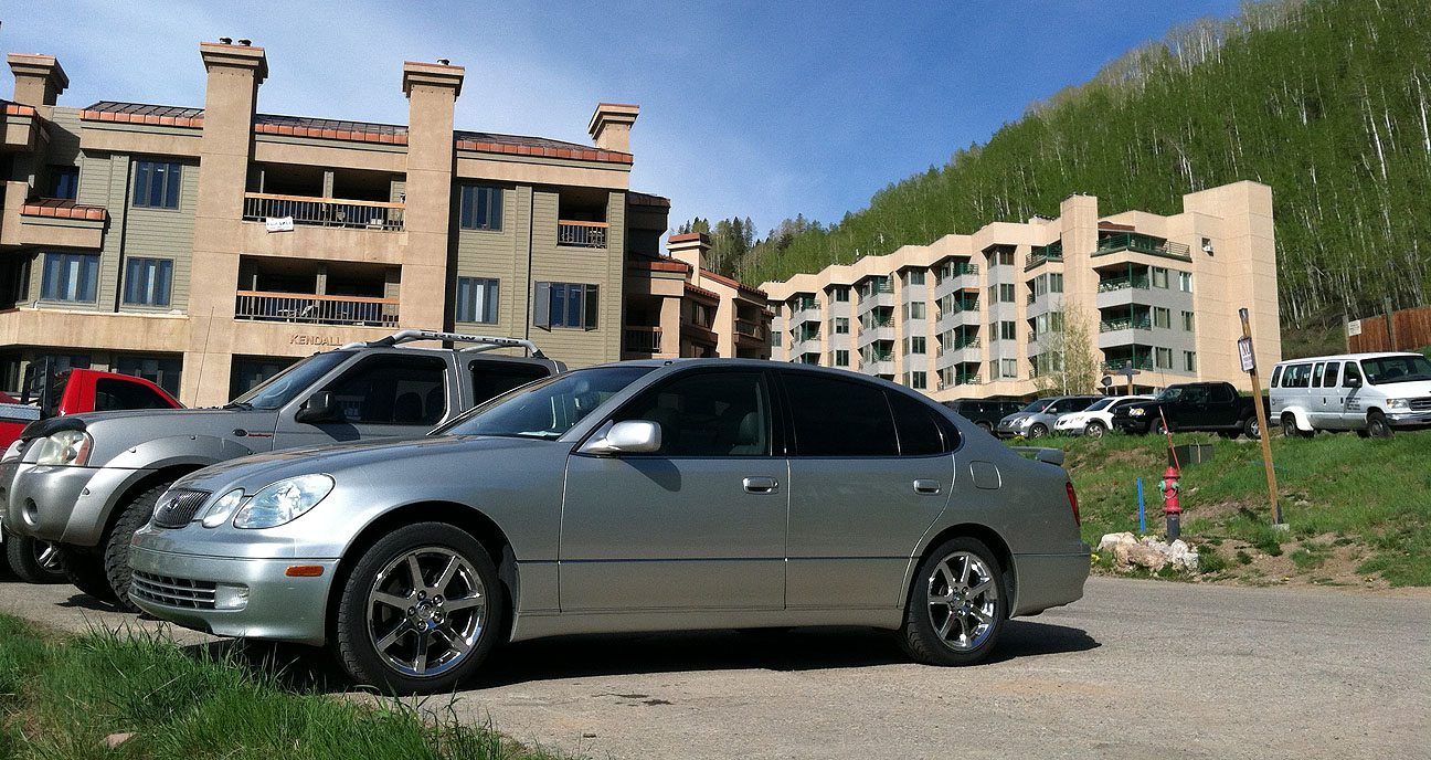
We left behind my mom’s 2003 Lexus GS430 in favor of my 2013 Acura ILX.
Fueled up and ready to rock & roll, we headed northbound on U.S. Highway 550.
I took the opportunity just a few miles up the road to attach my GoPro Hero3 video camera to the roof of the car. You’ll see the video footage from this at a later date – I’m thrilled with how it turned out.
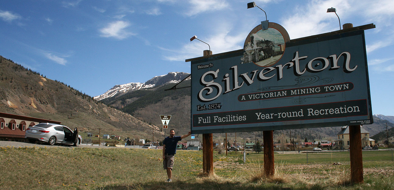
Our first stop was just about 20 miles up the road. Silverton is a beautiful community at a striking 9,300 foot elevation. I could really start to feel the effect of the thin air as I powered my way up the mountains to get there. Winters are so harsh here that many of the business are only open for 6 months of the year: from the first part of May until the end of October.
Total land area of the town itself is only .8 square miles.
A Jeep excursion company offers summertime recreation to visitors who come to this area.
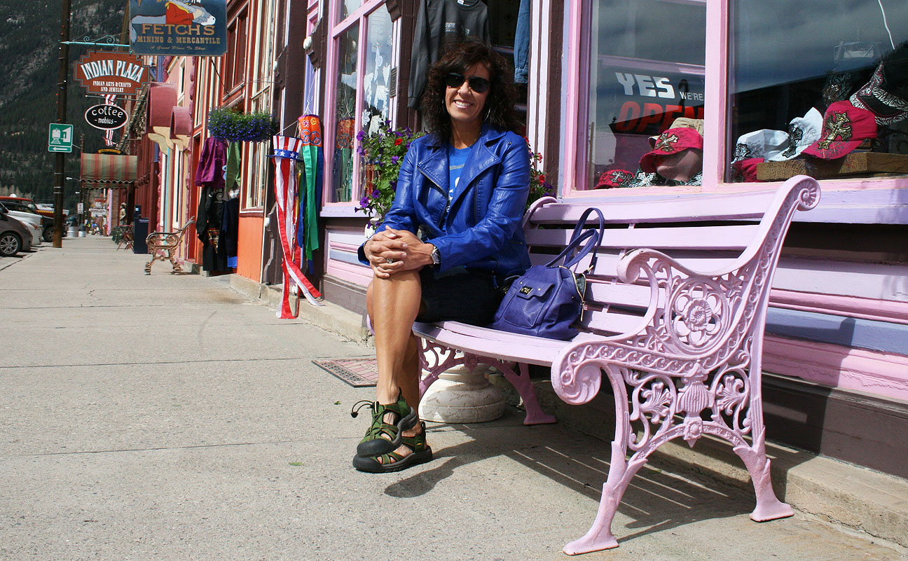
We parked the ILX and took some time to walk around and enjoy the cool weather and unique shopping opportunities.
There are about 600 brave residents who call this place home year-round.
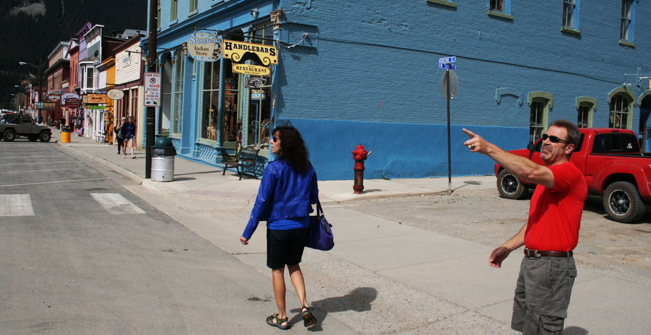
A trip to Silverton wouldn’t be complete without a little bit of shopping for silver. We stepped into this store to have a look at the selection. The sign on the black door of the safe behind the employee in this picture says: “Yes, this was a bank from 1882 to 1939. No, it was never robbed.”
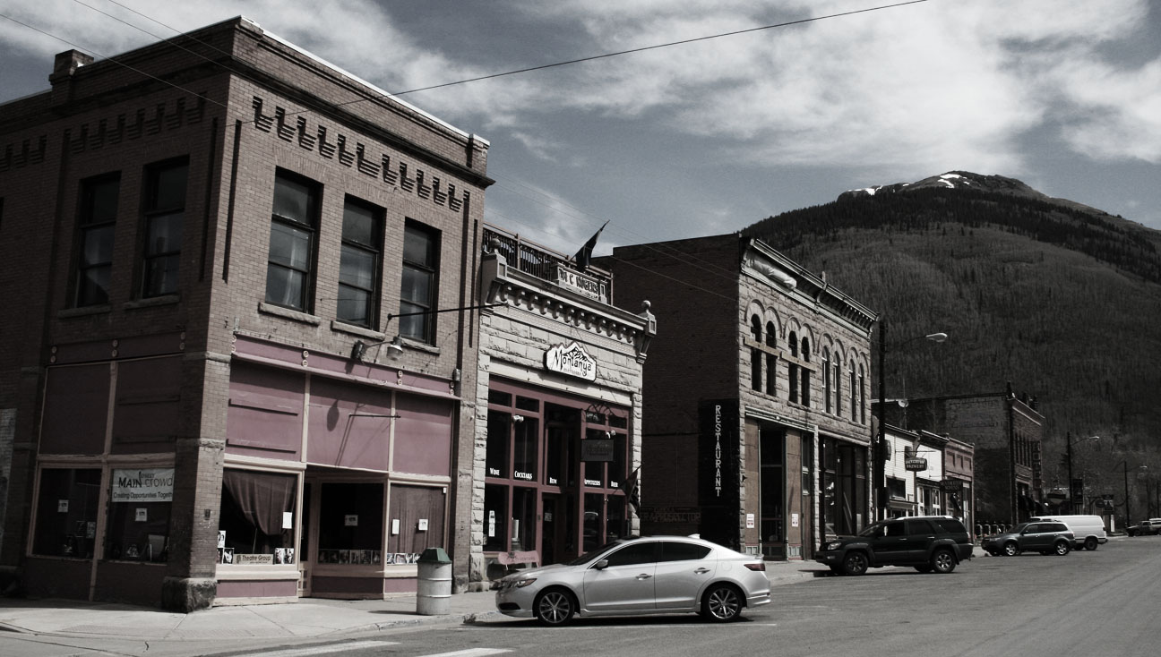
Colorfully-painted buildings line the main road, called Greene Street.
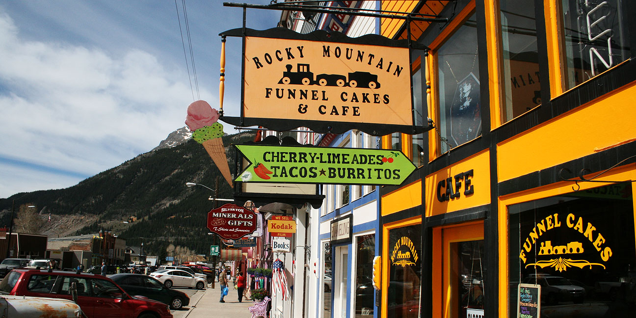
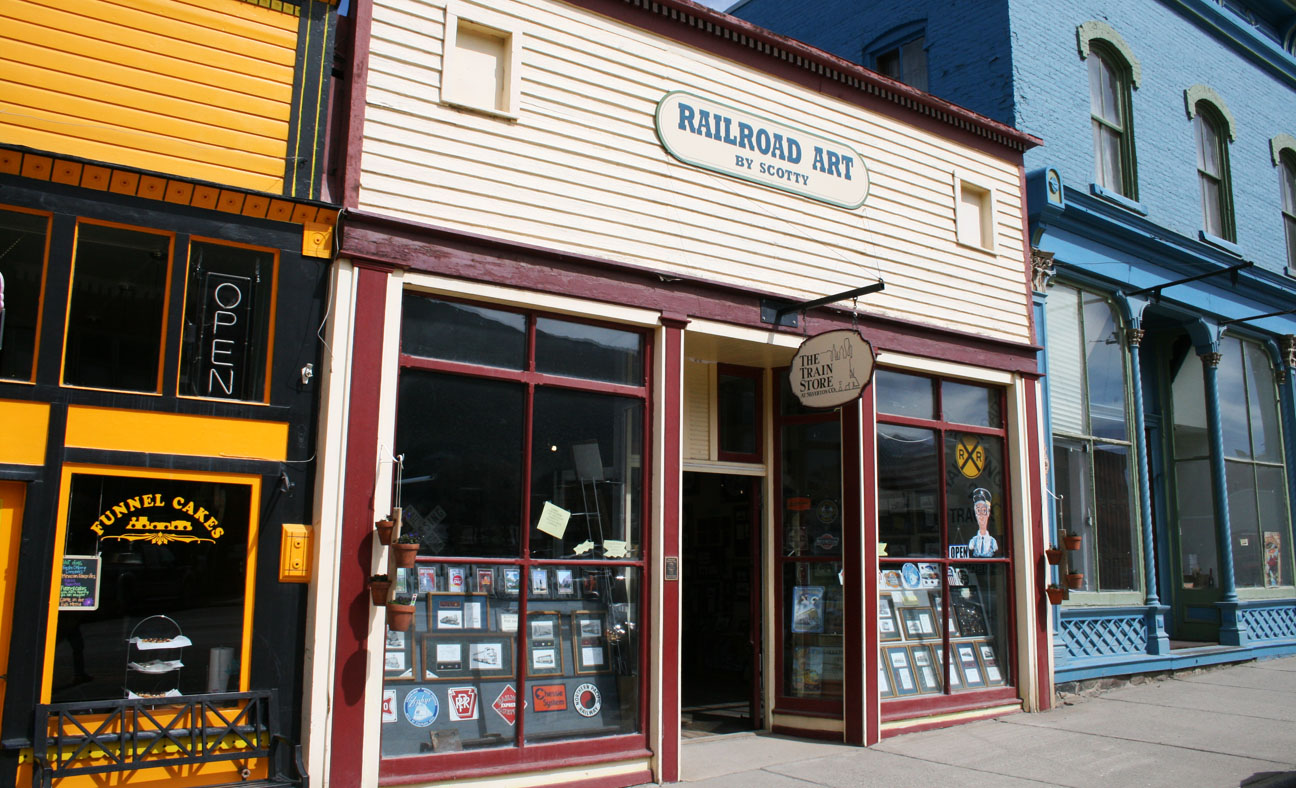
The below “Railroad Art” store is for sale for $85,000 if any of my readers are entrepreneurs who’d like to invest! Silverton is one of the hubs to the Durango-Silverton Narrow Gauge Railroad so the railroad industry is one of the most important sources of income for this small community.
Don’t get too comfortable on that park bench, mom; we’ve got places to go!
Your eyes don’t deceive you; that’s a 4×4, lifted red Checker taxi cab parked outside Ortega’s Old Town Indian Store.
Let’s get this show on the road, I say!
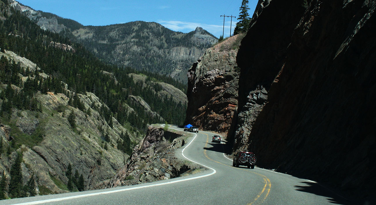
The Million Dollar Highwayofficially starts in Silverton and goes 25 miles north to Ouray. It’s part of the San Juan Skyway Scenic Byway. From Wiki:
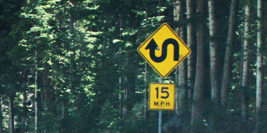
Though the entire stretch has been called the Million Dollar Highway, it is really the twelve miles (19 km) south of Ouray through the Uncompahgre Gorge to the summit of Red Mountain Pass which gains the highway its name. This stretch through the gorge is challenging and potentially hazardous to drive; it is characterized by steep cliffs, narrow lanes, and a lack of guardrails; the ascent of Red Mountain Pass is marked with a number of hairpin curves used to gain elevation, and again, narrow lanes for traffic—many cut directly into the sides of mountains.
My eyes were open wide for the amazing scenery that we’d soon be experiencing.
The twisties were endless. I’m afraid to think of what the road conditions would be like in any kind of inclement weather. The sport-tuned suspension on the Acura ILX made light work of the hairpins.
And we all enjoyed the Colorado sunshine streaming through the moonroof.
The Million Dollar Highway as we see it today was completed in 1924, but it dates back to 1883 when it was constructed as a toll road. The origin of the road’s name is not known for sure, though two one idea is that it cost $1 million per mile in the early 1920’s to build the road, and another idea is that the fill dirt that was used during construction contains $1 million in gold ore.
Hang on!
At one area on the road, a concrete “overpass” of sorts has been built to keep avalanches from wiping out the highway. We drove underneath it and continued on our way.
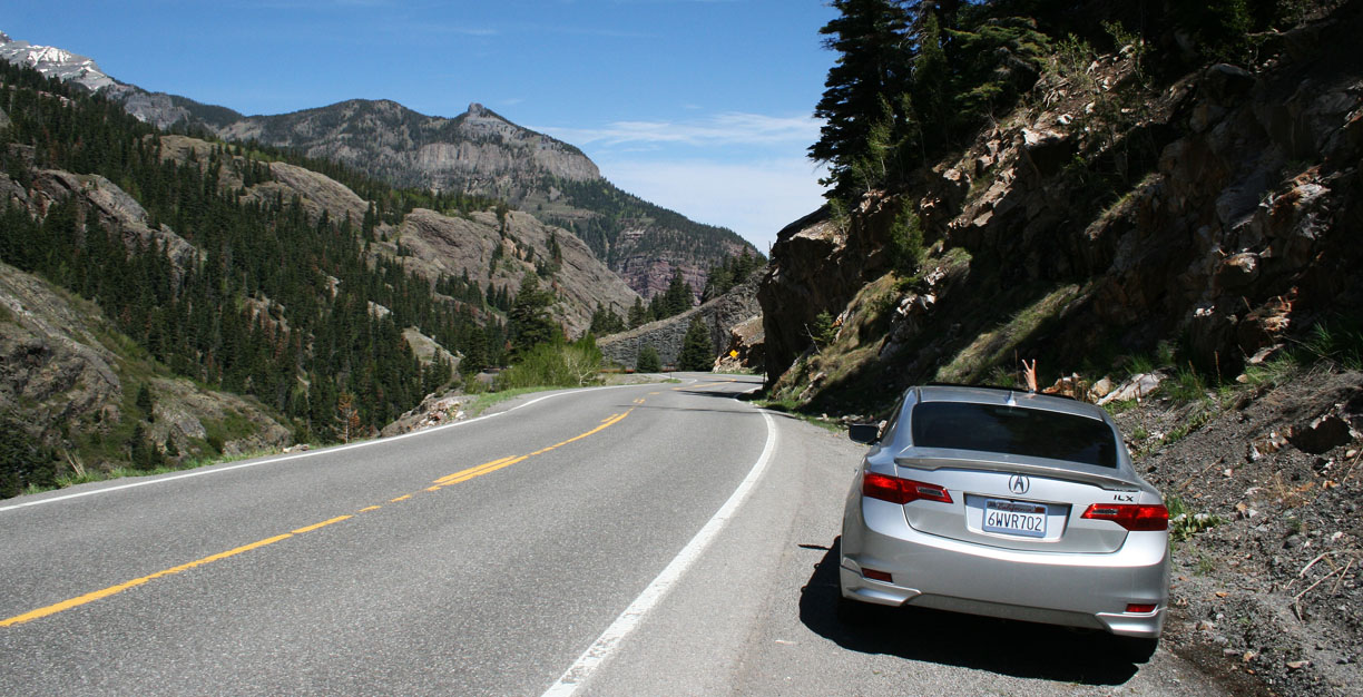
Here’s where the road really started to show its character.
This is an honest-to-goodness white knuckler. No guard rail, narrow lanes, and a steep drop-off on one side.
In one of the rare places where there was a shoulder wide enough to pull off the road, I shot a picture of the car.
Look for mom’s “peace sign” hand gesture out the moonroof.
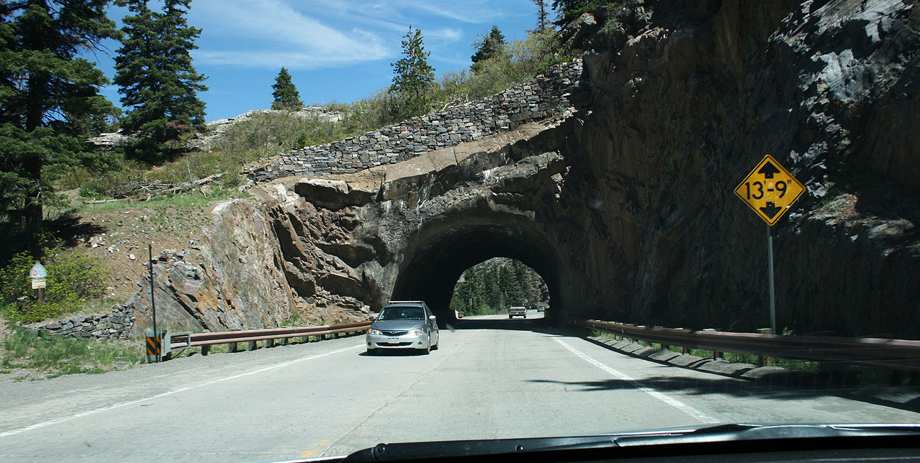
The only tunnel along the MDH is this short one.
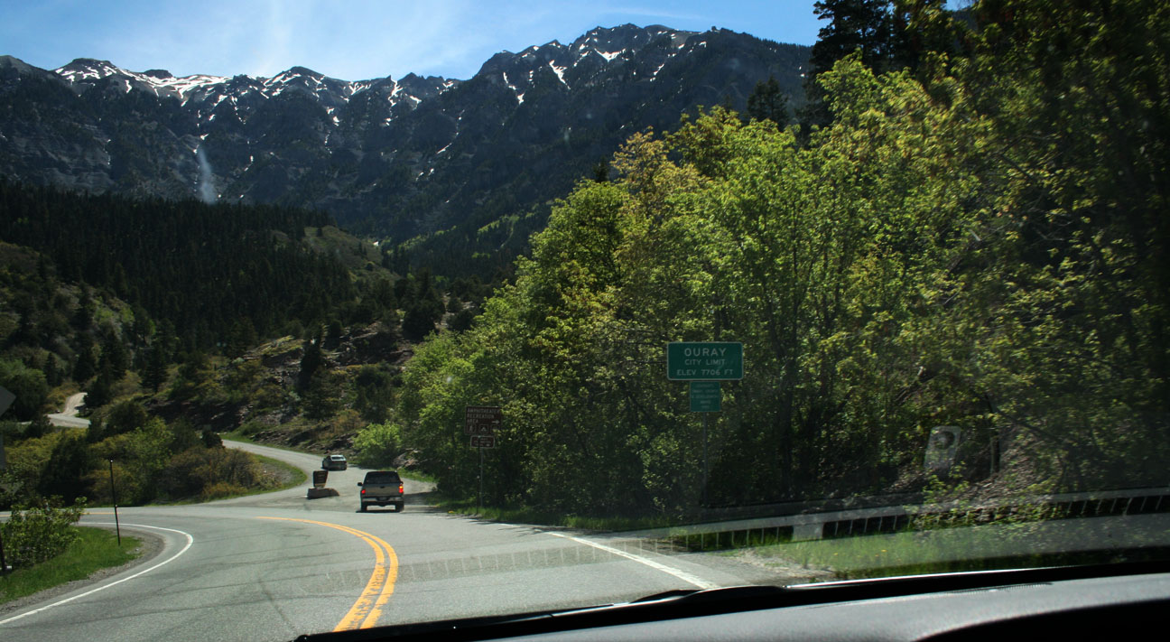
Another small mining town awaited us a few miles north. Here we’re entering Ouray, Colorado: Elevation 7,706 feet.
I love the architecture of these old towns. It feels like taking a step back in time to pass through them. Prospectors first arrived here in 1875. The town was named after a chief of the Ute Indian tribe that was native to the area.
This type of scenery is unlike anything else in the country. Ouray’s economy is based on tourism as the town is referred to as the “Switzerland of America.” It’s boxed in on 3.5 sides by steep mountains. I also learned that this place is the winter ice-climbing capital of the United States.
Candid shot by mom. Get that camera out of my face!
Panoramic vistas surrounded us as we made our way westbound on Highway 62 in Ridgway, Colorado.
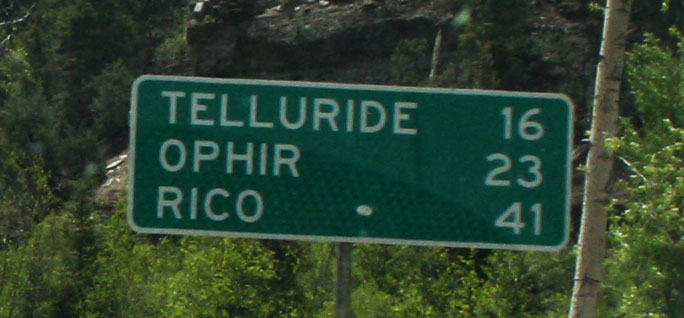
23 miles later, we hooked up with Highway 145 and headed toward our next stop: Telluride.
Found it!
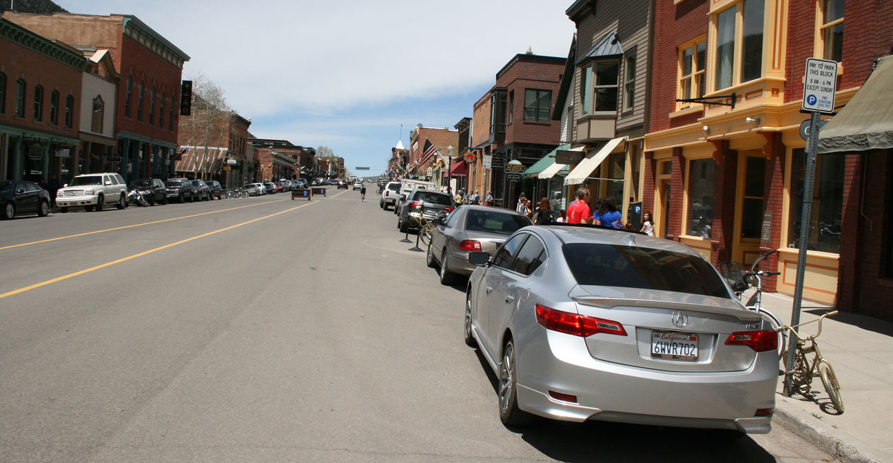
Telluride, like many of the other small towns in southwestern Colorado, got its start as a mining boom town. Today it’s a recreation hub for skiers, hikers, and ATVers year-round. It’s home to just over 2,500 people. The first ski lift wasn’t installed until 1972.
Traffic was tough to come by along the main road (Colorado Avenue) but we snagged a space and walked around.
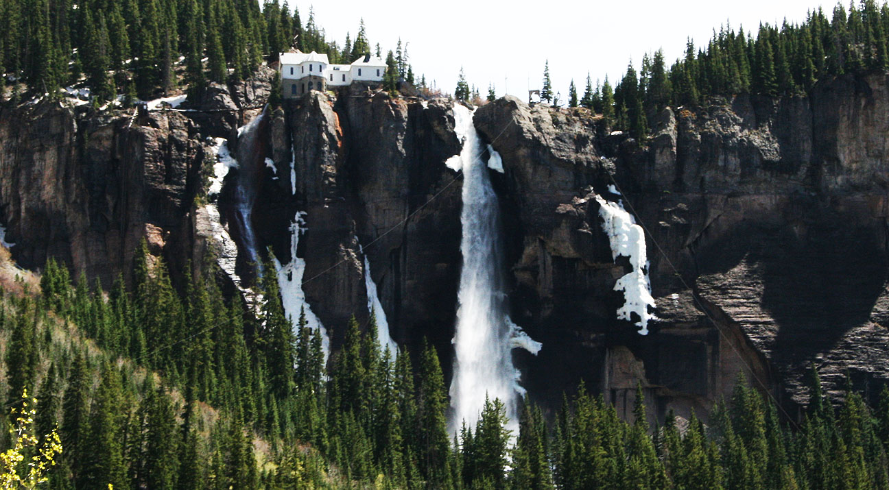
In the background of the below picture, a waterfall is clearly visible that cascades from the mountaintop to the valley below.
The layout here looks a lot like Silverton and Ouray, but Telluride boasts a festival of some sort almost every single weekend of the summer. While we were there, the “Mountainfilm” festival was going on.
Check out those gnarly mountain bike tires!
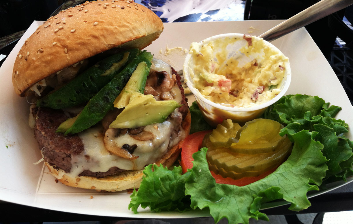
Lunch was at a place called Maggie’s. The mushroom & Swiss burger hit the spot!
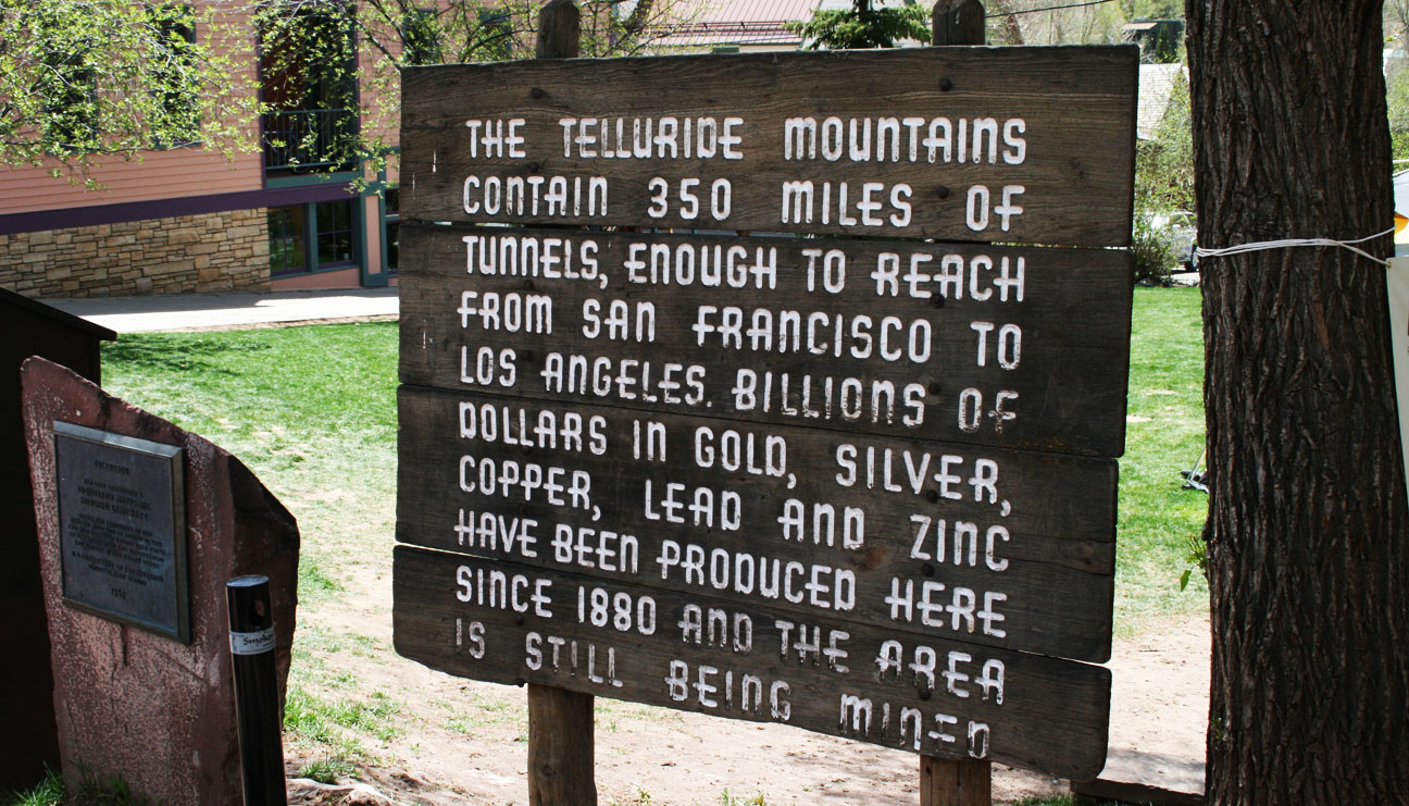
A sign along Colorado Avenue tells us that the tunnels in the mountains surrounding Telluride would reach from San Francisco to Los Angeles.
One of the main reasons I’d wanted to see Telluride this trip was to check out a place called Bridal Veil Falls. I learned that a trailhead started at the east end of town, so we headed there on Colorado Avenue. The pavement ended and we continued a bit further. Soon, though, it became clear that this road would require a high-clearance vehicle, so I parked the car and we hiked.
Spy shot by mom. Sneaky, sneaky.
Here’s a glimpse at the ILX parking space; the waterfall can also be seen the very far top left edge of the picture.
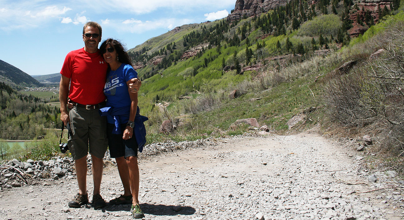
Quick photo-ops for Todd & Tia.
And one for Tyson.
Just a little ways up the road, a stream crosses the roadway. I was tempted to dip my feet in but I held back!
Bridal Veil Falls are the tallest free-falling falls in Colorado. They reach over 360 feet in height. A power plant and a private home sit at the top of the falls. The power plant was built in 1907 to supply power to a local mine, but it only operated until 1953. The view must be incredible from up there!
Even from our vantage point probably a mile away, we could still hear the gushing water as the sound echoed off the canyon walls. We didn’t end up hiking the rest of the steep trail but continued back to the car.
The rest of our return trip to Durango on Highway 145 took us to summits of over 10,000 feet in elevation.
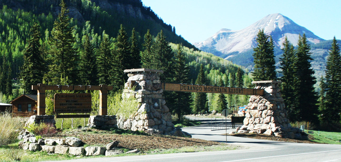
Back at the Durango Mountain Resort, I dropped off my mom and Todd. I had a bit further to travel to my nightly destination.
Back down the canyon I went.
Back through Durango, Cortez, and descending to the desert, I once again abandoned the green forest and became familiar with the barren landscape of the desert.
At 331.8 miles driven since the start of the day, I noticed that somehow I’d achieved a miraculous 40 miles per gallon. That’s even better than the ILX hybrid is supposed to get! It helps that most of the day’s travels were at conservative 35-60 mph in 5th & 6th gear. But still, I was very impressed!
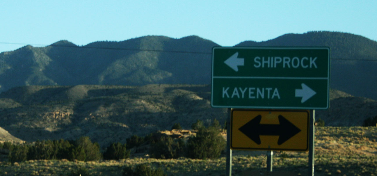
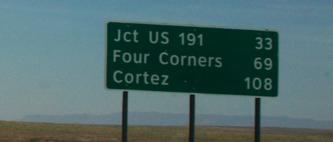
At the intersection of Highway 160 and Highway 504, I stayed on Highway 160 and headed toward Kayenta.
And as dusk descended, I took Highway 191 south.
This time of day is my absolute favorite time to drive in the desert because of the way the sunset ignites the red sandstone colors.
I pulled over for just a few pictures before I ran out of daylight.
And about 60 miles later, I’d arrived at my hotel in Chinle, Arizona on the Navajo reservation.
Tune in next time for the last day of travels for this Memorial Day escapade!
A couple of hours ago, I opened the front door at home to a Dish Network salesman whose first question, pointing to the ILX in the driveway, was “What’s with the bug graveyard on the car?” I told him I’d just gotten back from a 3-day trip to Colorado and he offered to clean the bugs off for $5. I thanked him, but declined his offer.
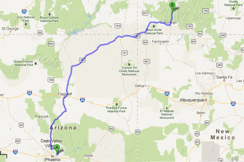
Saddle up, pardners. This weekend’s roughly 1,300-mile trip was so extensive, I’ll be breaking it up into 3 separate blog entries. It would be a shame to let a holiday weekend go to waste, so I took advantage of the opportunity to get out of town and explore some new territory in a neighboring state. Ever since I published my post on my Road Bucket List back in September 2012, I’ve been itching to make it to Colorado to check out the so-called Million Dollar Highway.
My drive started out on Saturday morning with an ascent from the Phoenix area to Flagstaff, Arizona via Interstate 17.
In Flag, I headed north on Highway 89 toward Page.
Flagstaff, established in 1882, prides itself for being the “World’s First International Dark Sky City.” It was designated on October 24, 2001. Here’s what I’ve learned about the meaning of this title:
The International Dark Sky City designation is given to identify towns and cities “with exceptional commitment to and success in implementing the ideals of dark sky preservation and/or restoration, and their promotion through quality outdoor lighting.
Based on this, my guess would be that Flagstaff is a great place to view constellations!
North of town, I crested a summit and began to drop to the desert valley floor below.
There’s an abandoned stretch of old Highway 89 just to the east of the existing, newer, road. It’s about 4-5 miles long and it’s still serviceable, though being overgrown by weeds and with flaking paint stripes.
I always like to take this side road because of a small bridge at the north end of it. It didn’t cost me any extra time since it parallels the other highway and reconnects at the other end.
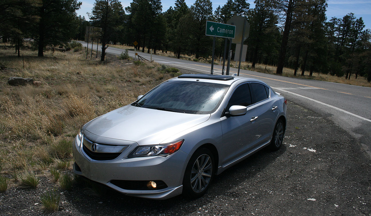
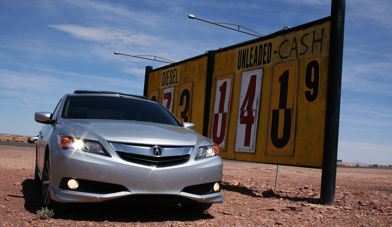
Cameron, Arizona is a small community located where Highway 89 and Highway 64 intersect. It’s the gateway to the South Rim of the Grand Canyon. Gas prices at the local service station were not clearly communicated. $1.41 for unleaded? I’ll take it!
I branched east on Highway 160 toward Tuba City, Arizona. This tall wooden building on the north side of the highway caught my eye, so I pulled over for a closer look.
This appears to be a schoolhouse and it dates back to the late 1800’s. The town of Tuba City was named after Tuuvi, a Hopi Indian leader. Tuba City was founded in 1872 my members of the Church of Jesus Christ of Latter-day Saints. Tuuvi converted to the LDS religion and various members of the local Indian tribes migrated to the area because of its natural springs. Inside the schoolhouse, there’s not much left except a place for birds to nest.
Playing around with color contrast makes this an eery place. I probably wouldn’t go crawling around in there after dark.
I spent most of the remainder of the afternoon continuing through the Indian reservation. Various roadside attractions dotted the highway, including this Anasazi Inn which backs right up to some magnificent red rocks.
I’d soon be crossing through all 3 of these next milestones.
I’ve said it before, but I absolutely love the color contrast between bright red sandstone rock formations and a blue sky. Landscapes like these are a great opportunity for pictures. I can only imagine how awesome this background would look at sunset.
The ILX’s Silver Moon Metallic paint job reflected the sunlight with a glare. It’s a good thing I was wearing shades. At 80 degrees Fahrenheit, it was an absolutely perfect day to be out on the road.
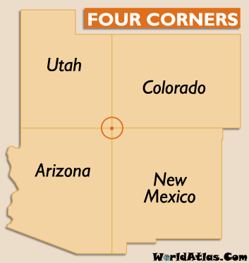
Next up: Four Corners
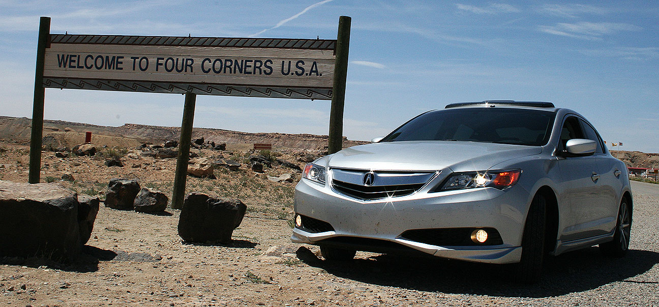
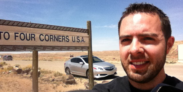
Open daily from 8:00 a.m. to 7:00 p.m., the Four Corners Monument is the only place in the United States were visitors may stand (kneel) simultaneously in 4 states at one time. I was disappointed to learn that this was a cash-only operation ($3), and I didn’t have any on me. However, I’d already seen this before on a prior trip in the Legend.
The attendant at the booth was nice enough to let me loop around in the ILX and grab a picture in the meantime.
I should’ve left those sunglasses on; that sun was BRIGHT!
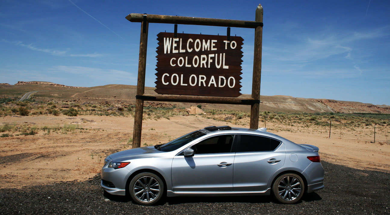
Just up the road on Hwy 160, I entered “Colorful Colorado.” Wouldn’t that sign make a great photo opportunity?
I thought so, too. But you might’ve noticed that my Michelin tires look awfully messy there. And that’s because….
… I got stuck in the sand. Hopelessly, unmistakably stuck. What began as an attempt to simply loop around the sign ended in my front end digging itself endlessly into a hole. By the time I realized what was happening, the quicksand had already done its job. I pondered next steps. The Four Corners monument was just 1/2 mile up the road, so I threw on a baseball cap and got ready to hike up the road and ask for help. Miraculously at that very second, I saw this guy pull in:
A good samaritan saved the day! This was “Joe,” who’d seen me trying to free the ILX from the sand. He said he had chains and offered to pull me out. Talk about timing. As I helped him get the chain hooked up, I quickly snapped this picture with my phone. The ILX has a conveniently located tow hook right underneath the rear bumper.
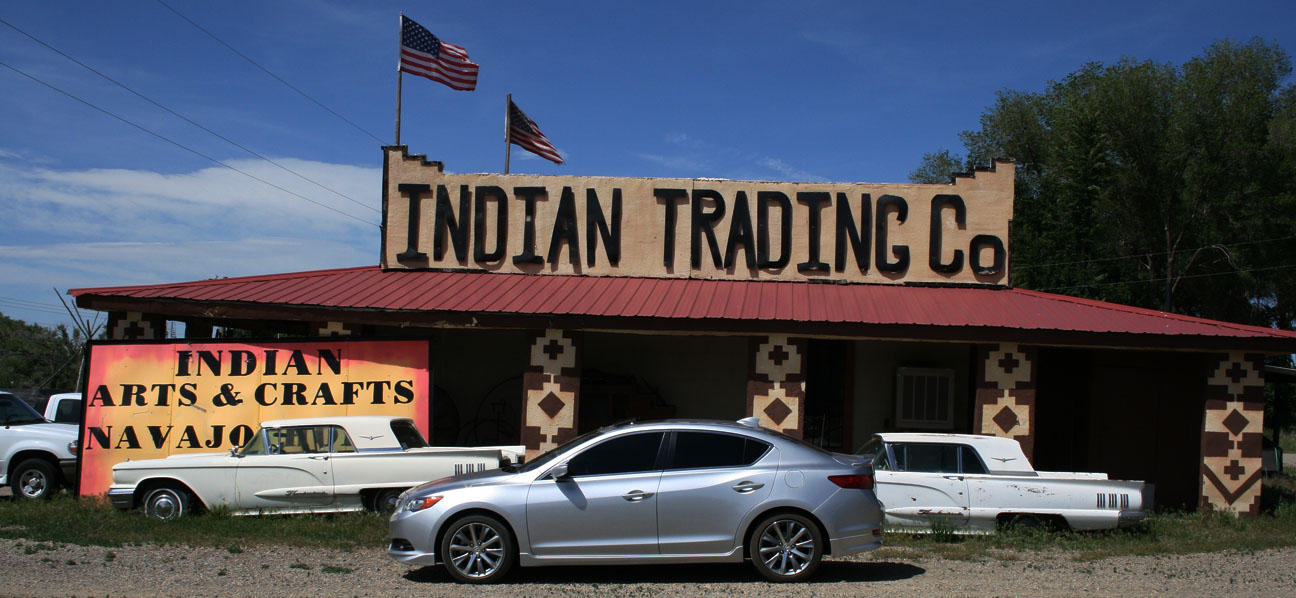
Just minutes later, he’d freed me from the sand and I gave him a hearty handshake and a thank you. Joe, if you ever read this, I owe you one! Grateful to be back on my way, I stopped just a moment at the Indian Trading Co just south of Cortez. There were two classic / matching Ford Thunderbirds sitting on the south side of the building.
Cortez is home to only about 9,000 people.
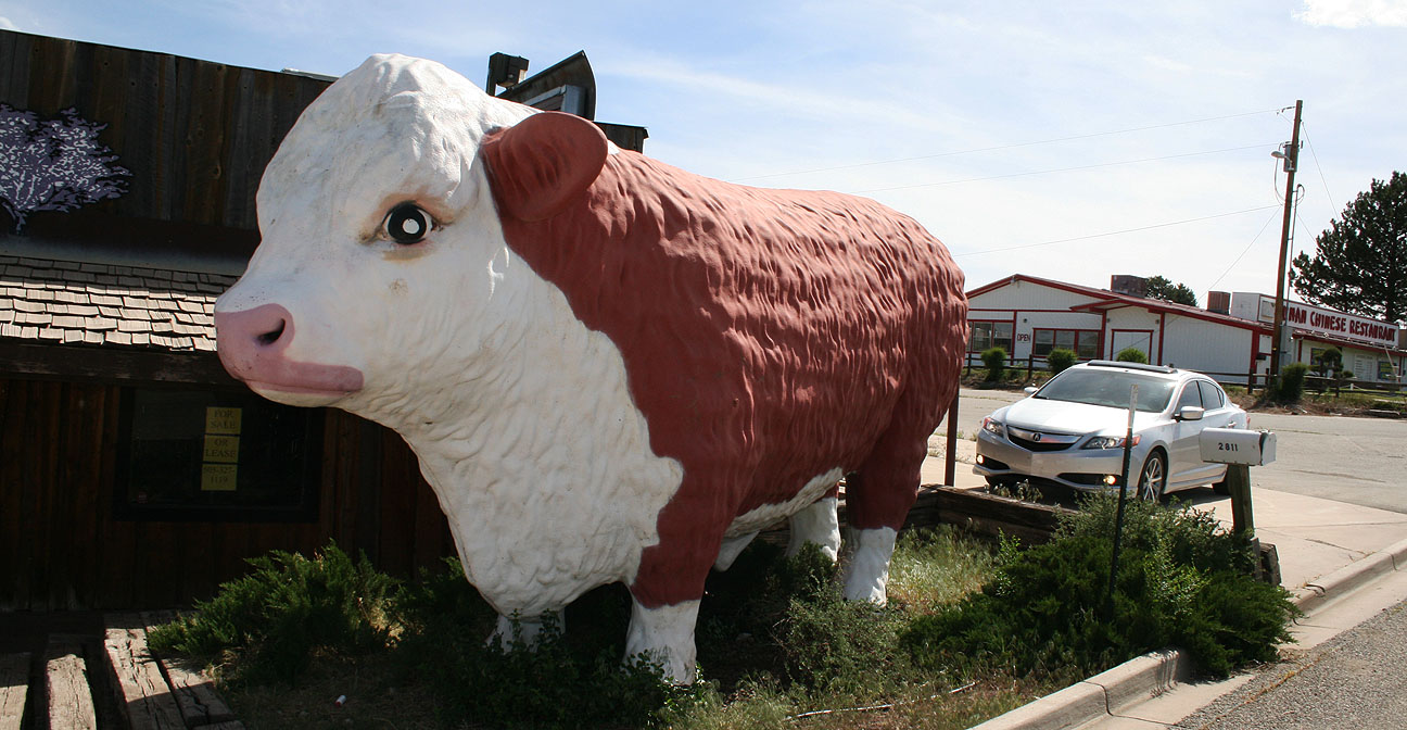
And one humongous cow. The now-closed “Purple Sage Rib Company & Saloon” was a great opportunity for a picture. It reminded me a little of the Longhorn Grill I visited a couple of weeks ago in Amado, Arizona.
Just east of Cortez lies Mesa Verde National Park. It comprises over 52,000 acres, making it the largest archaeological preserve in the United States. It is best known for its cliff dwellings that date back to the years 600-1300. I didn’t pit stop there; I’ll save it for a future trip.
I breezed past this Sinclair gas station on Hwy 160 and noticed a giant orange banner covering the entrance sign. It read: TOXIC SITE, and in smaller letters just above that, “Massive Petroleum Spill.” Yikes.
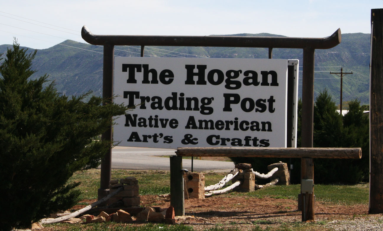
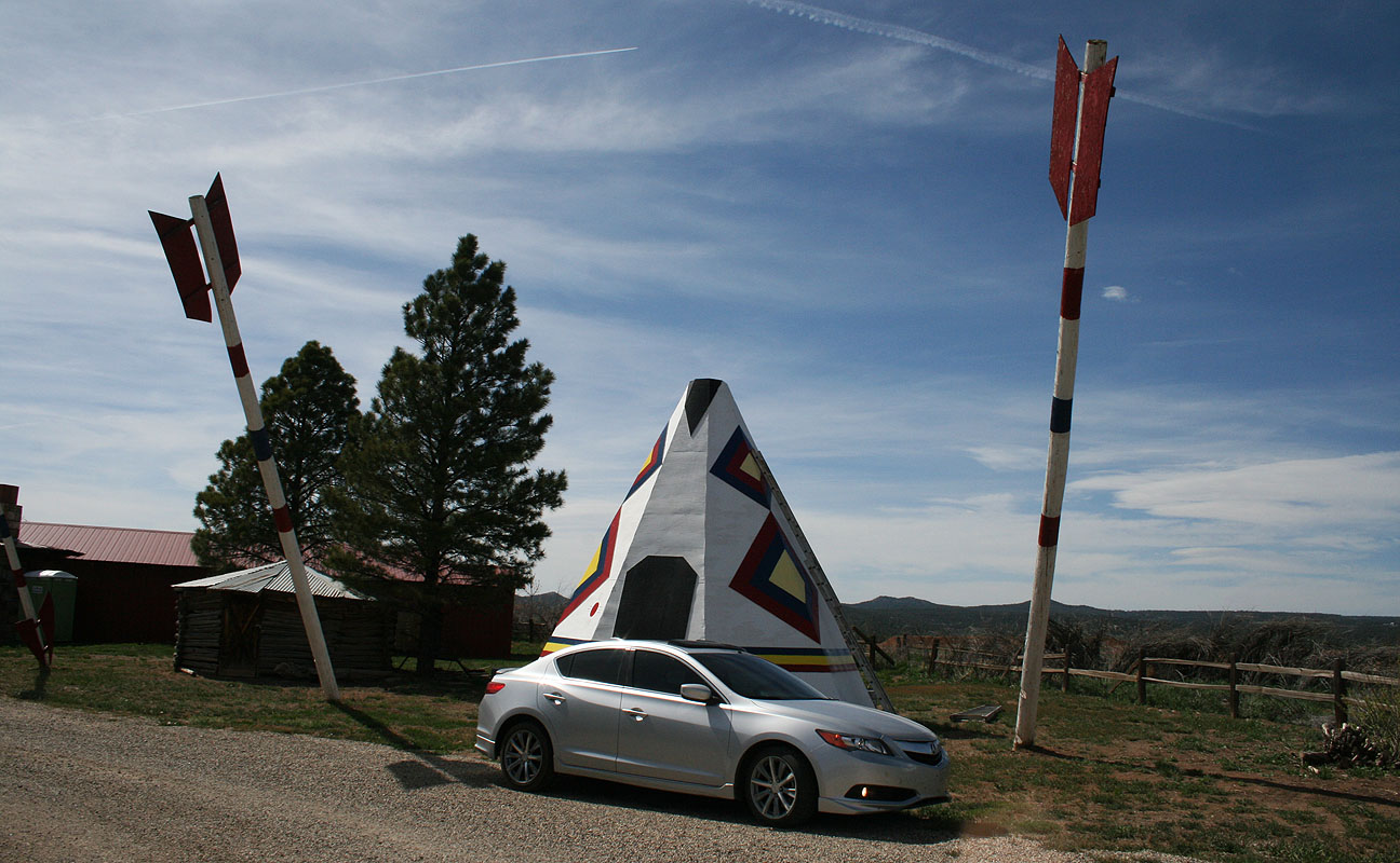
Soon I arrived at The Hogan Trading Post in Mancos, Colorado — home to one of the coolest roadside attractions I’ve seen.
Massive arrows made out of telephone poles! These poles have been outfitted with arrowheads and lodged in the ground at an angle.
I happened to stop by at the very moment when the teepee and the poles were being repainted.
I asked the guy, “How are you getting those lines so perfect?” “Just eyeballing it,” he said. Impressive!
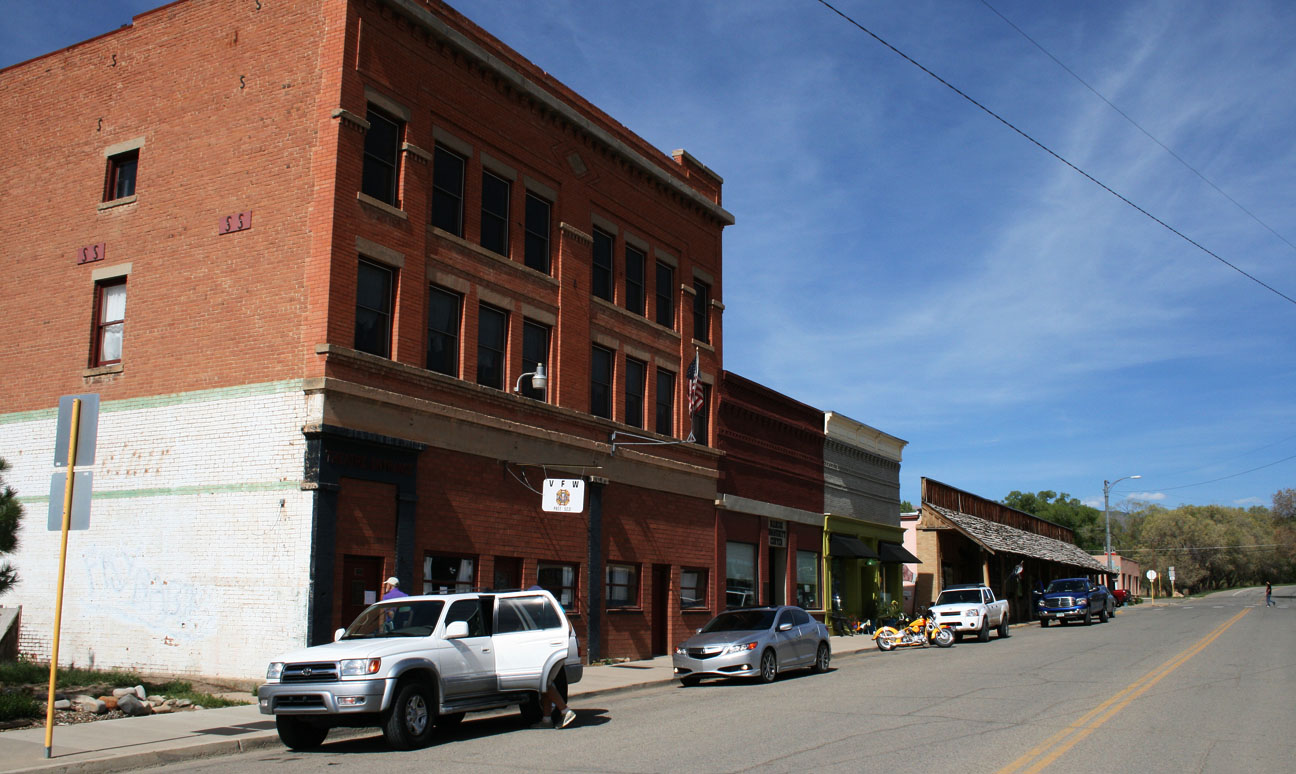
Mancos is situated in a beautiful green valley. Pictured below on Business Loop 160 through the historic part of town is the Wes Potts Memorial Theatre. It was originally the Mancos Opera House, dating back to 1910.
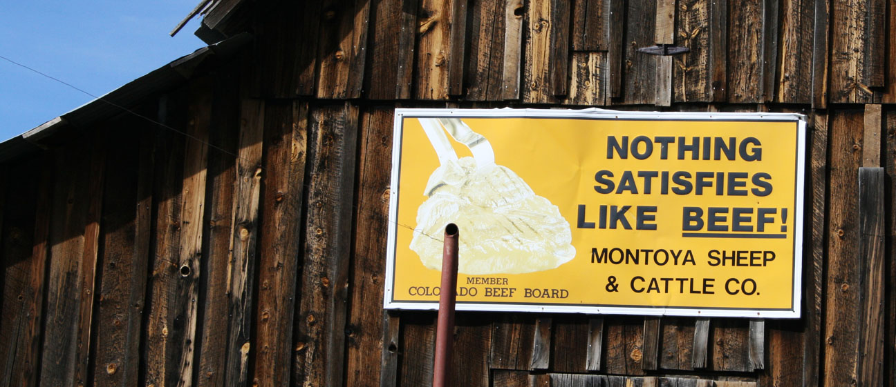
Beef: It’s so satisfying. Spotted on a building alongside Hwy 160.
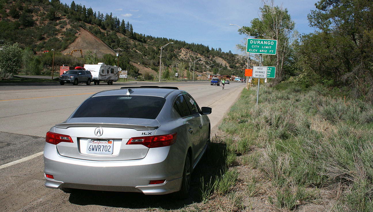
I made it! Entering Durango: Elevation 6,512 feet.
Here’s where I first saw a sign denoting Hwy 550 – the famed “Million Dollar Highway.”
Main Avenue was bustling with bicyclists, motorcyclists, pedestrians, and automobile traffic. Durango’s history dates back to 1881 when it was established by the Denver & Rio Grande Railroad. Today, it’s home to fewer than 20,000 people.
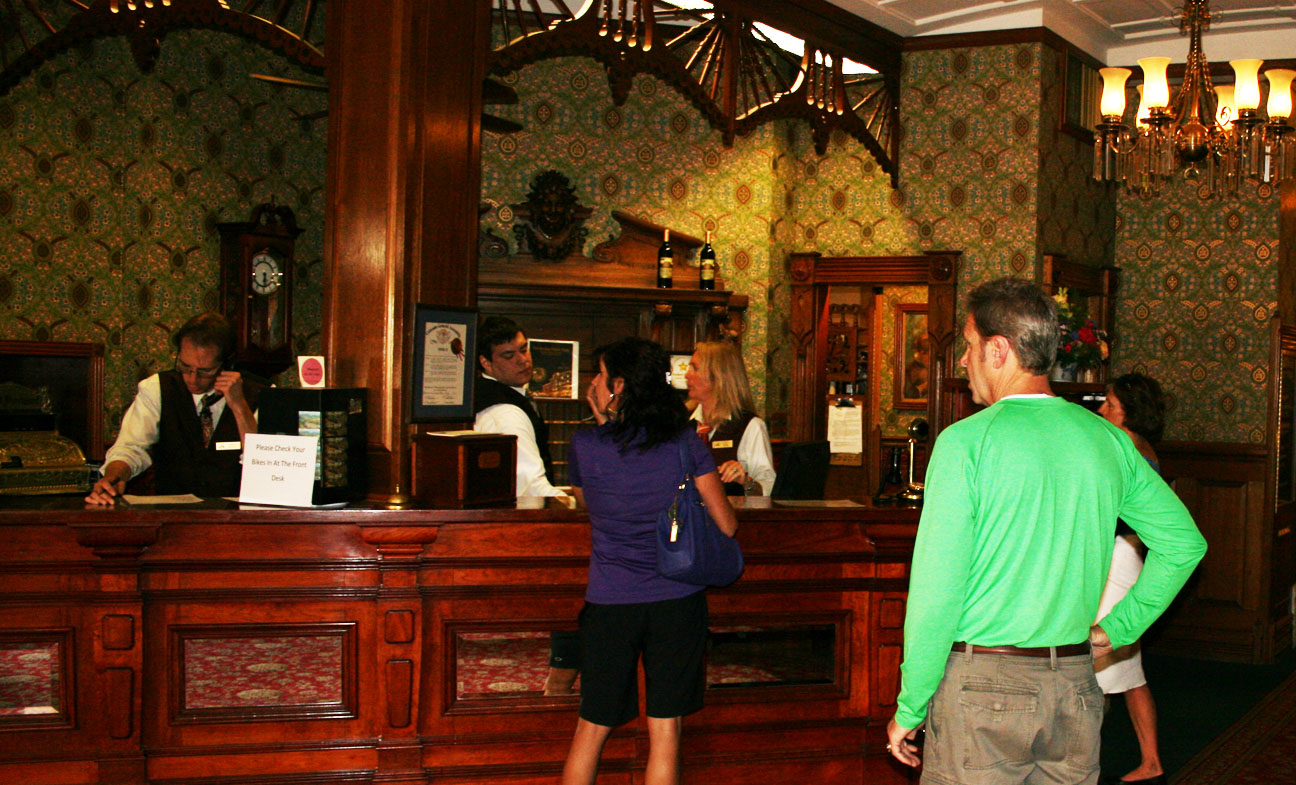
One of my favorite buildings was this historic Strater Hotel. It opened in 1887 and is an example of American Victorian architecture. Author Louis L’Amour stayed here frequently in room 222 when he was working on his western novels.
Inside, the front desk probably looks a lot like it would have looked back then. The owners have tried to preserve the historic integrity of the facility, and I say they succeeded brilliantly. I met up with my mom and step-dad at this time, and we checked the place out.
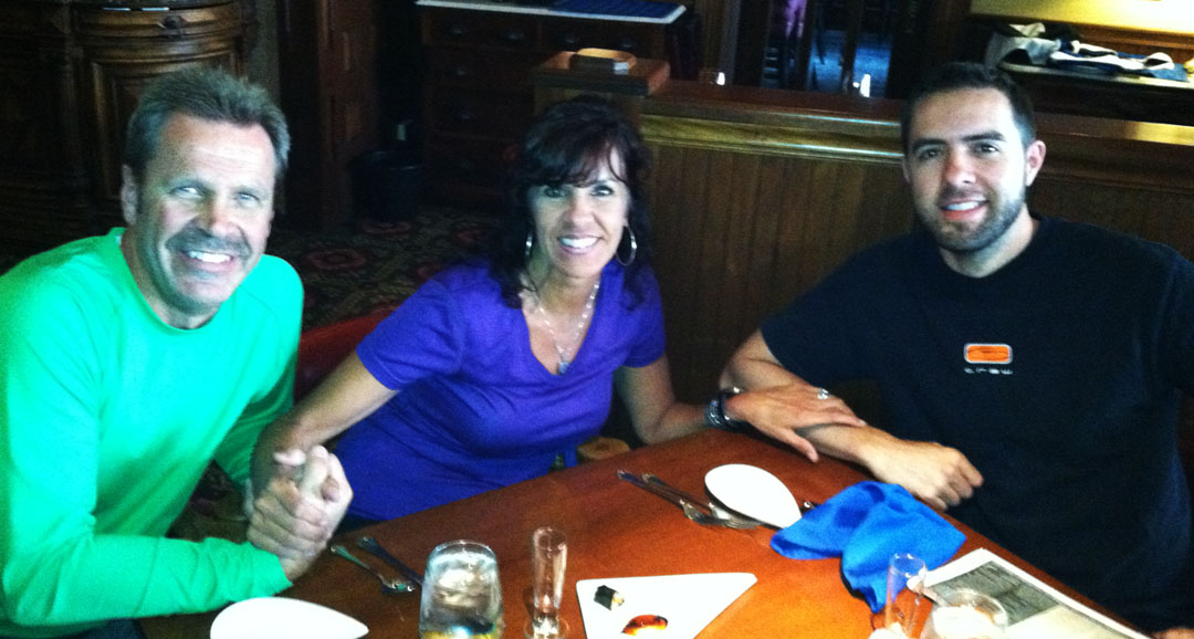
Adjacent to the hotel lies the Mahogany Grille where we ended up getting dinner.
I went for the pan-seared Salmon, one of several delicious sounding entrees.
Todd, Tia, Tyson
Before sundown, I had a few minutes to wander around town. At the south end of Main Avenue lies the station for the Durango & Silverton Narrow Gauge Railroad. Originally put in place to haul ore, it’s now a passenger train line that runs 45 miles between Durango and Silverton. Someday I’d like to go back and ride this.
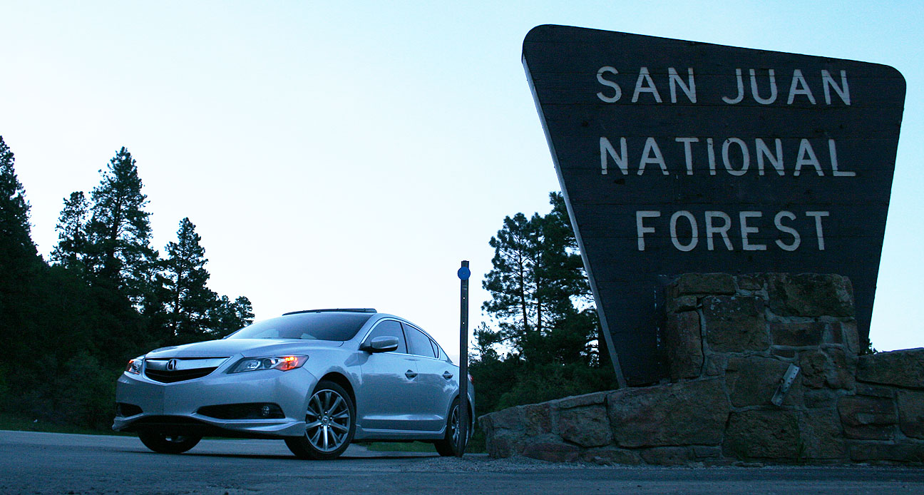
As day 1 drew to a close, I headed north 26 miles from Durango to the Durango Mountain Resort. Steep canyon roads offer plenty of passing lanes, thank goodness. Cooler temperatures were a relief from the Arizona heat that I’ve been used to.
I entered the San Juan National Forest which covers over 2,900 square miles of western Colorado.
The following day, I’d be experiencing the real adventure. For that, you’ll have to tune in next time.
To many people, a car is much more than a mode of transportation. A vehicle carries with it a lot of memories. I really liked this video about how a man sought after a 1948 Plymouth Convertible to give it to his parents for their 60th wedding anniversary. The Plymouth was the same bodystyle as one they’d owned when they got married.
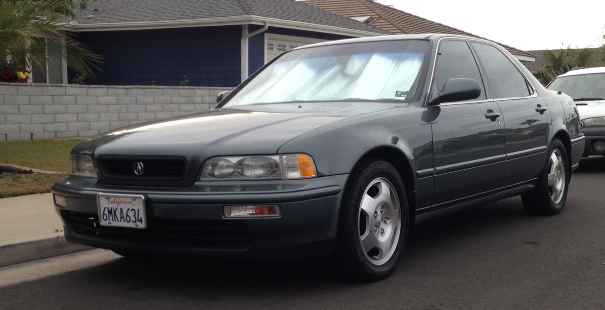
There’s one car to which I can attribute the root of my Acura fascination.
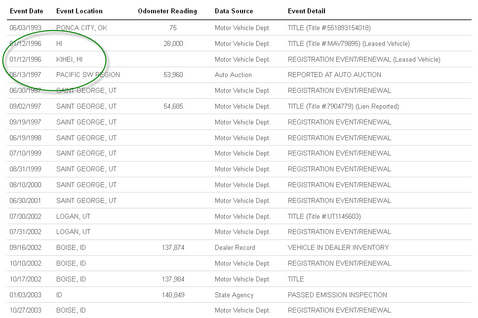
My mom purchased a Geneva Green 1993 Legend L sedan in the summer of 1997. It had 53,960 miles on the odometer and was offered for sale by a small local dealership in St. George, Utah called St. George Auto Center that has since closed. The car had an interesting history. It had spent 2 years of its life in Maui, Hawaii. Here is the screen capture of a recent AutoCheck report:
My mom picked up the car for $19,995. I was 15 years old at the time and I loved the car. She let me take it on dates through high school after I got my license.
Here’s a picture from the day we bought it in June 1997.
Temporary tag:
Other pics from over the years.
Detailing day. Check my red 1989 Honda Prelude Si in the background.
A new set of 16″ polished aluminum Optima wheels, clear marker light lenses, and chrome fender trim had been added. This would have been around 1998.
Later, we went for maximum “bling” and put on a set of 18″ Niche Bella wheels. Mom had the hottest ride in town.
It was during this time that I also first started getting involved with the Acura Legend online enthusiast community, of which I’m still a part. In the late 1990’s, one of the first sites dedicated to this car was launched by a California-based gentleman named Jim Trinh. Jim’s 1991 Legend LS sedan, which he named Vivian, was the centerpiece of his site: Legend.org.
To this day, Legend.org is still up and running, though only as an archive. It hasn’t been updated for probably a decade.
I remember snail-mailing Jim some 5×7 prints of my mom’s car – yes, this was before I even knew how to scan and email, and Jim entered my name in the “2nd Generation” portal of the site under 1993. Two pictures are still there.
And one in the Gallery:
I was away for a couple of years from 2001-2003 and my mom sold the car during that time (in essentially mint condition!) for $7,000. Here is a picture of the date the sale happened in September 2002 at 137,984 miles.
That buyer traded it only a couple of months later on a Dodge pickup at a dealership in Boise, Idaho. That’s the last I heard of the car.
I’d tracked the Legend over the years via Carfax, so I knew it was still in Idaho (and has sustained a couple accidents). I had guessed the mileage must be well over 200k.
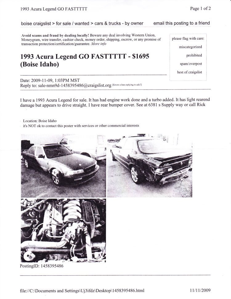
One day at work in 2009, I was waiting for an application to run on my computer, and (as I always do) I started browsing craigslist ads. Of all the cities to search, I clicked Boise for the heck of it. Searched for Acura Legend, and… there it was. It took just one look at the picture, and I knew this was the car. Aftermarket spoiler gave it all away. That spoiler was a gift to my mom on Mother’s Day 1998. The clear corner and bumper lights were things that I added.
I called the number in the craigslist ad. I asked him if he could read me the VIN to the car. When he got halfway through the number, I finished it for him. He couldn’t believe I knew the VIN of the car he had for sale. I told him the long story short about this car and asked him to send me some detailed pictures.
The story got even more interesting. This guy ran a town yard and had only owned the car about a month. The car, as it turns out, was involved in a high speed chase. A police cruiser had to do two pit maneuvers to get the car stopped and arrest the driver. That’s what the quarter panel damage came from. When I shared this story with the my friends at the Legend forums, they started calling this the “Outlaw Legend.”
A friend helped me track down two articles about the police chase:
As officers picked up the suspect vehicle again on Fairview, the decision was made that the driver was placing the public at extreme risk and the decision was made by BPD supervisors to pursue the suspect. Officers pursued the suspect east on Fairview to Five Mile, south on Five Mile, and west on Executive. Executive turns into Pine. At Pine and Eagle Rd, the suspect turned south. Two Boise Police officers used the PIT maneuver to stop the suspect vehicle. The suspect vehicle tried to drive away after the first PIT, so a second officer used the PIT maneuver again which finally stopped the suspect vehicle. Both the officer’s car and the suspect vehicle came to rest on Eagle Rd just south of Pine on the railroad tracks.
These are the pictures I received from Rick at the towing yard. The paint didn’t hold up too well, it appears.
And the next surprise: At some point during the car’s life it got supercharged by Idaho Speed Center! No wonder the police had such a time catching this guy.
The interior had seen better days.
Aftermarket stereo – probably worth more than the car was at that time!
Ouch!
The battery had been relocated to the trunk.
It was rough seeing the car in that kind of shape, especially after how well my family had cared for it back in the day. If it hadn’t been for a steep $1,600 pricetag, I might have picked it back up for sentimental reasons.
According to AutoCheck, as of April 2011 the car was still on the road in Boise because the registration was renewed that month. This means that someone must’ve spent the money to repair the body damage that happened in 2009.
Something tells me I haven’t seen the last of this one. I tried checking with the tow yard just a couple of months ago to see if they’d share any information about where it ended up, but they weren’t cooperative.
I guess it’s only a matter of time until it pops up again.
I picked up a GoPro camera this week so I played around with it on my commute to work this morning. Here is my 10-mile commute (15 minutes) shortened to just a little over 2 minutes. Enjoy!
I’m off to southwestern Colorado in the ILX tomorrow! I parked next to one of my favorite Hondas at lunch today: a 2001 Electron Blue Pearl Honda Prelude SH. Love that color. Hope everyone has a great holiday weekend!
From the narrow, twisty roadways of an 1876 mining town in the Black Hills, to the red rock sandstone landscape of Sedona, to the tree-lined and steep grades of Oak Creek Canyon, I experienced some of Arizona’s finest roads and skies yesterday.
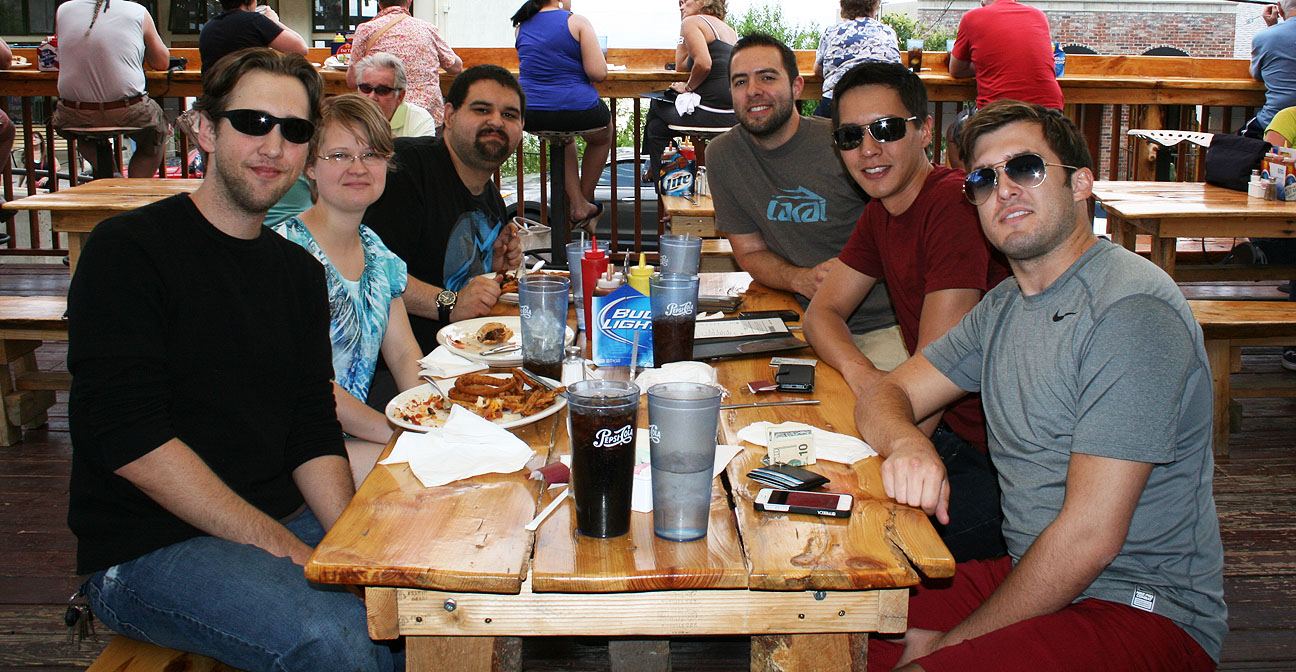
Many thanks to Jason from Las Cruces, New Mexico for making the 400-mile trip to the Phoenix area to join me for this weekend’s trip. This was the third time I’ve partnered with Jason for a Drive to Five feature. We met previously for a trip to Bisbee, Arizona in January and then for a trip to White Sands National Monument in New Mexico in March.
First order of of business when Jason arrived was to check on those model cars on my rooftop. He was impressed at how well they’ve held up considering they’ve endured 3 years of Phoenix inferno.
Dinner at Phoenix’s “Central Bistro” on Friday night with my friend Matt. Jason and I both recommend the Bolognese pasta!
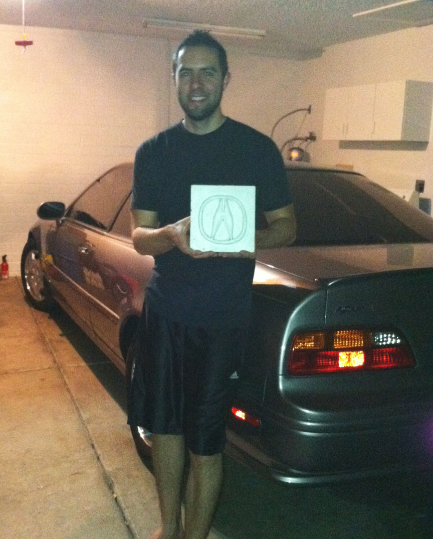
This was an extra nice gift: Jason presented me with a hand-made ceramic tile featuring a 3D “A” emblem. This is now proudly displayed in my home. I wish I had those kind of craft skills!
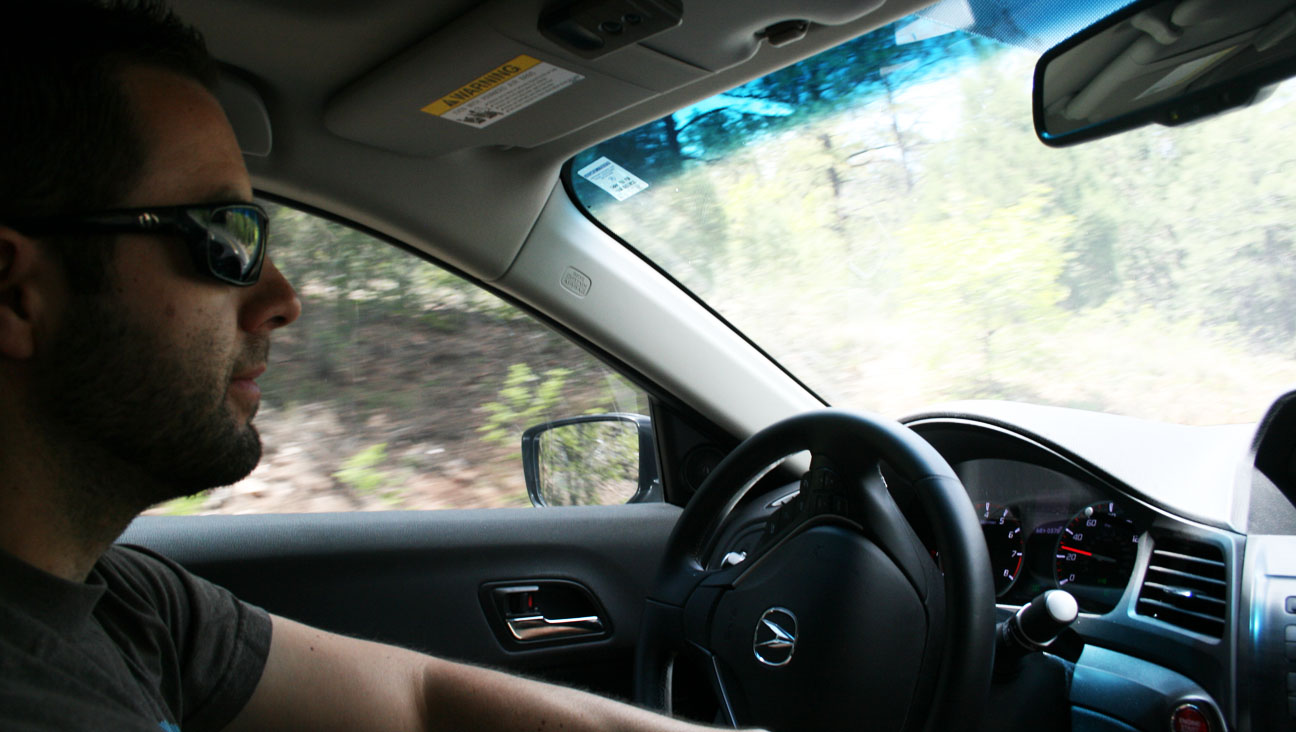
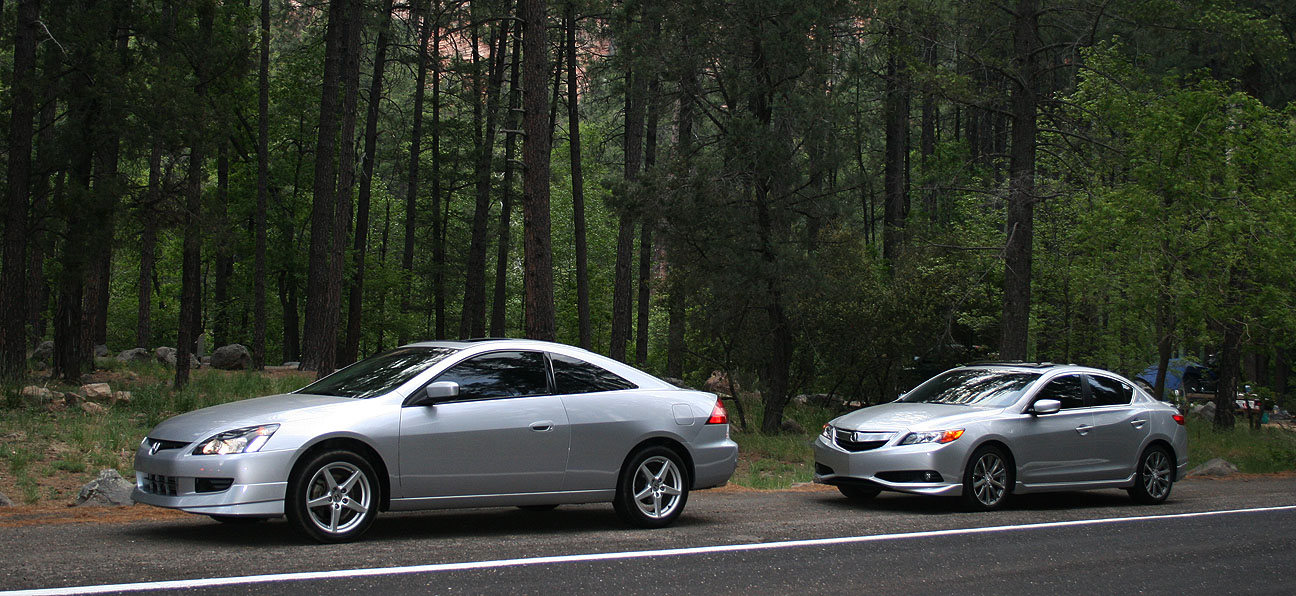
Saturday morning, bright and early, we revved up our Honda engines and set sail for the alluring cooler temperatures of northern Arizona. But first, I treated myself to a blueberry muffin from Starbucks. My friend Chris took the shotgun seat of the ILX for the duration of the drive and Jason followed us in his silver 2004 Honda Accord coupe 6-speed.
Coming from an Acura Legend with zero cupholders, I was pleased to note that all FOUR of the cupholders in the ILX were used that at morning. Our Starbucks beverages took the center console and we each had a water bottle in our door pocket. This car can transport almost as many beverages as a minivan!
Our cars filled up on some 91 octane fuel at the Circle K on Phoenix’s 7th Avenue & Loop 101 before we headed out from the Phoenix Valley.
Fewer than 50 miles up Interstate 17, we veered west on Highway 69, northbound toward Prescott, Arizona.
Here, we awaited the third member of this caravan.
Austin arrived shortly in his 1987 Acura Legend. It has over 280,000 miles on the body itself, but the engine and transmission are not original to the car. Lovingly referred to as “FrankenLegend” by its owner, the car’s engine is upgraded to a 2.7 liter (as opposed to a 2.5), and the transmission was swapped to a 5-speed from an automatic. The original 1986-1990 Legend sedan has a classic bodystyle and Austin’s is in nice shape!
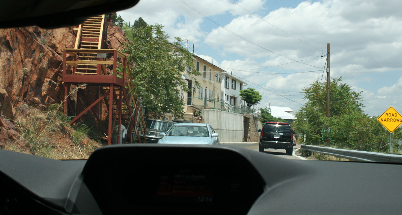
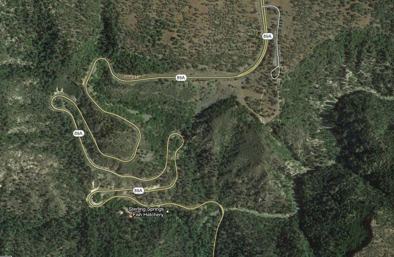
The next 19 miles of two-lane highway up Highway 89A would lead us through some very technical and fun curves leading to our lunch destination in Jerome, Arizona.
Chris zoned out for a bit from the passenger seat and when he started waking up, he commented, “I didn’t even realize you were driving a manual transmission, those shifts were so smooth.” That’s what I pride myself in! Perfection in rev-matching. While an automatic transmission may offer faster paddle-activated control, there is no substitute for a traditional three-pedal manual transmission for an engaging driving experience.
We climbed to over 5,000 feet in elevation and the temperatures dropped as we did so. Jerome’s high temperature for the day was in the high 70’s Fahrenheit — absolutely perfect weather for a moonroof-open cruise.
Jerome, like many of the other towns where I’ve taken my readers in recent months, got its start as a copper mining town in the 1800’s. Once having a population as high as 10,000 people, it’s now home to fewer than 500 people. The town is built precariously on the side of “Cleopatra Hill.” Roads are narrow (some are one-way) and steep.
Here’s a view of Jerome that I took from the Jerome Historical Society Museum. This town was named “Wickedest Town in the West” in 1903 by the New York Sun.
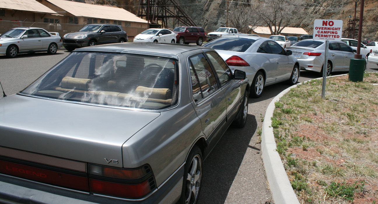
We were greeted by heavy traffic as there were special events taking place in town. Jerome is a very popular Saturday destination for bicyclists, motorcyclists, and car clubs.
We parked our trio of Hondas at a lot a few blocks from town and walked over to find a lunch destination.
Brandon, pictured at right in the black shirt, and his girlfriend Alishaba met up with us as well. More about Brandon’s Acura shortly.
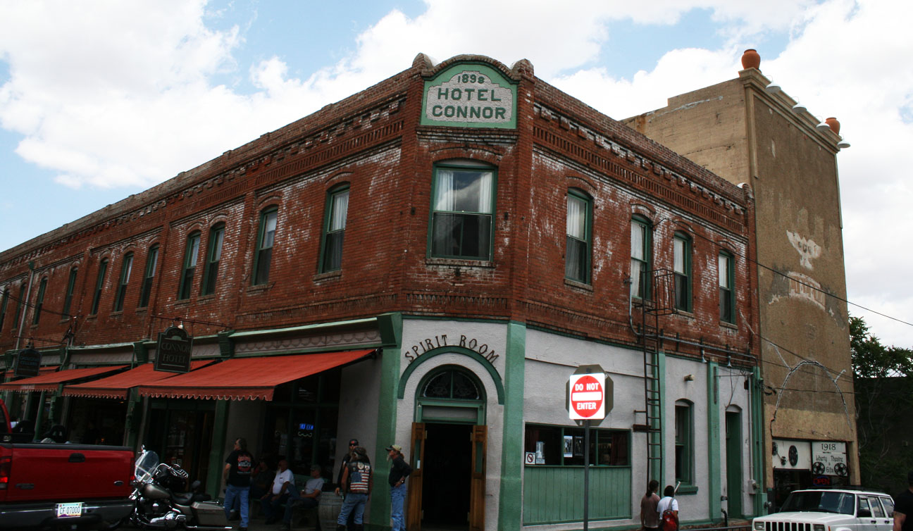
We walked past the Hotel Connor, built in 1898. It has 20 rooms on the second level that were first rented for $1 per night. From the hotel’s website:
After it reopened [after a fire] in August of 1899, it enjoyed a heyday of being one of the finest lodging establishments in the booming mining towns of the West. The hotel had its own bus for delivering guests to the train depot, and was full to capacity much of the time. It was one of the earliest buildings in Jerome to be fully wired for electricity, and each room had a call bell for service.
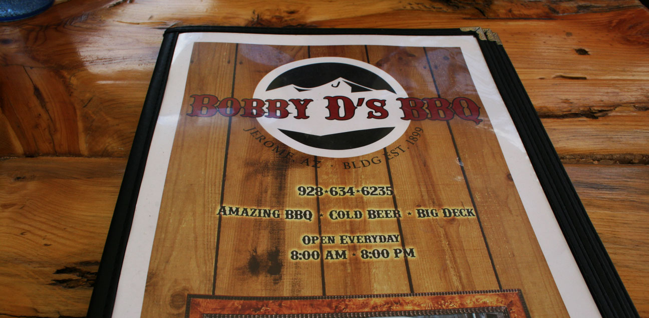
Just down the street, we were lured in by the smell of sweet barbeque sauce so we stepped inside Bobby D’s BBQ for a bite to eat.
The pulled pork definitely hit the spot! Bobby D’s is built on the site of an 1899 restaurant called the English Kitchen which was demolished after the last mine closed in 1953. The building has been rebuilt and boasts amazing food.
Left to right: Brandon, Alishaba, Austin, Tyson, Jason, Chris
Jerome’s curves mean business. This hairpin at the end of Main Street is one example.
Now we got to check out Brandon’s car. Brandon is as Legend-crazy as I am, and this 1995 Sherwood Green LS Coupe 6-speed is his 8th. It’s nicely equipped with the OEM cell phone, gold emblem package, and 16″ chrome GS wheels. Brandon has upgraded the engine to a 3.5 liter from the 1996+ Acura 3.5 RL, but the car retains its original 6-speed manual transmission.
The car looks great for having over 220,000 miles on it.
Time to say farewell to our Legend friends and continue the drive!
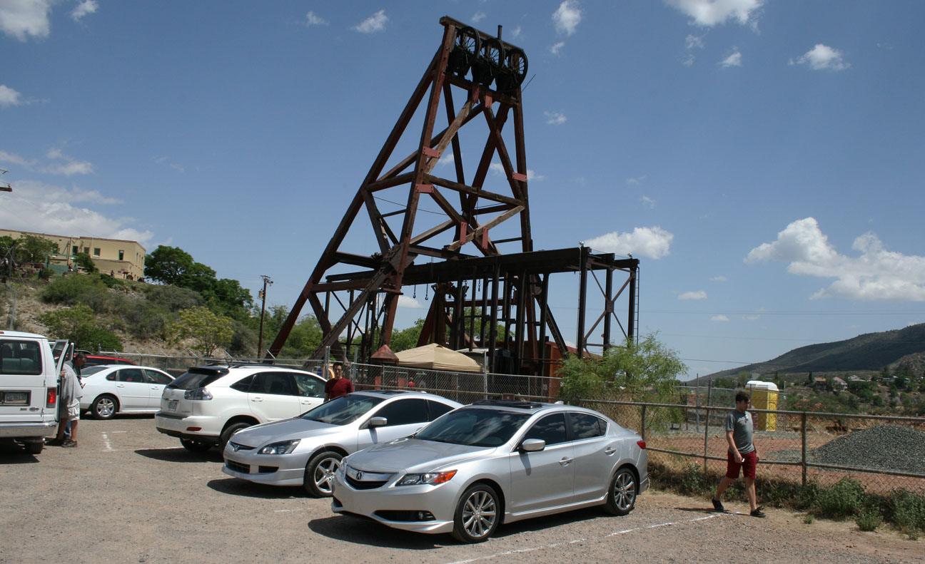
Just down the street, off Douglas Road, we weaved up to the Jerome Historical Museum’s “Audrey Headframe Park.”
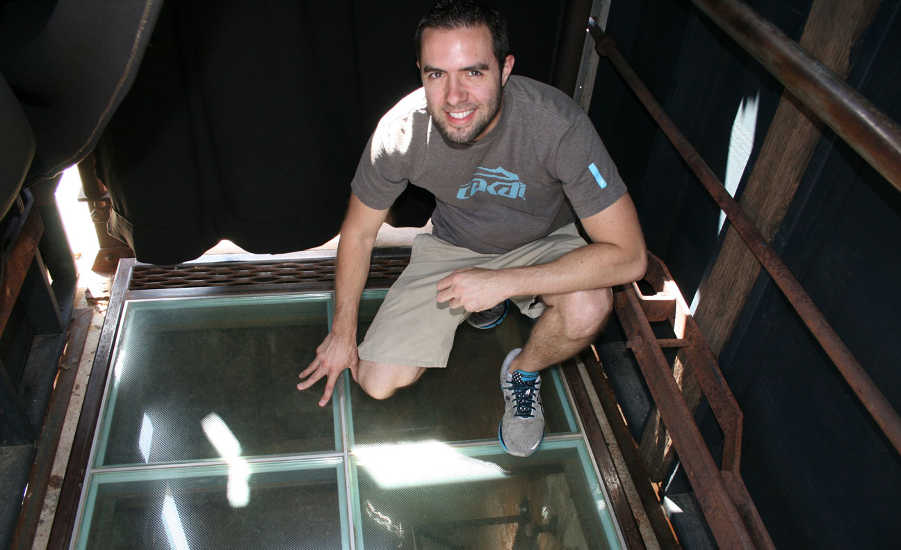
Named for the adopted daughter of the mine’s superintendent, this is the oldest piece of mining equipment in Arizona. Admission is free and the park is open daily from 8 to 5. The main attraction? This special glass floor.
In that picture, I am standing over a mine shaft that is 1,900 feet deep. To put that into perspective, look at how the depth of the shaft absolutely dwarfs the height of the Eiffel Tower and the Empire State Building!
Looking straight down. The shaft was built in 1918 and over $125 million worth of ore was harvested here. Though tough to tell from this picture, there are lights and mirrors going all the way down the shaft to help capture the sheer depth of it. It was a bit unnerving to stand there!
Though mining efforts in Jerome closed in 1953, over the 77 years that it was in operation, Jerome’s mining industry produced over 33 million tons of copper, gold, silver, lead, and zinc ore.
Time to head toward Sedona!
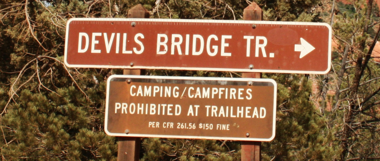
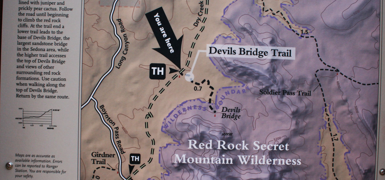
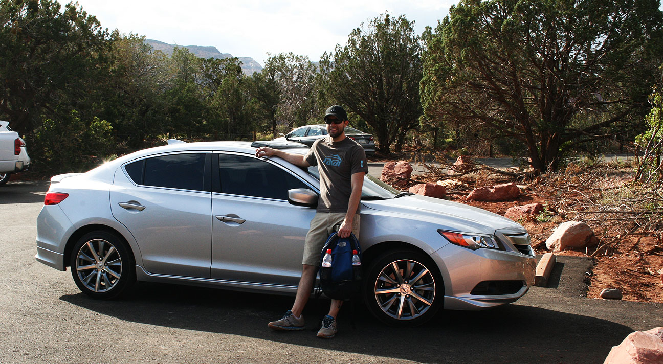
We wanted to stretch our legs a bit and enjoy the perfect weather, so we went to a trailhead of the Devil’s Bridge Hike off Dry Creek Road, just west of Sedona on Highway 89A. An even closer trailhead is accessible via 1.3 mile dirt road, but it’s only suitable for high-clearance vehicles. My ILX would have easily bottomed out if I’d attempted to drive it there. Here I’m giving a thumbs down to the fact that I can’t take my car on this dirt road.
After hiking those 1.3 miles down the road, Jason and Chris and I arrived at the “official” start to the trail.
From here, we were only about a mile from the bridge.
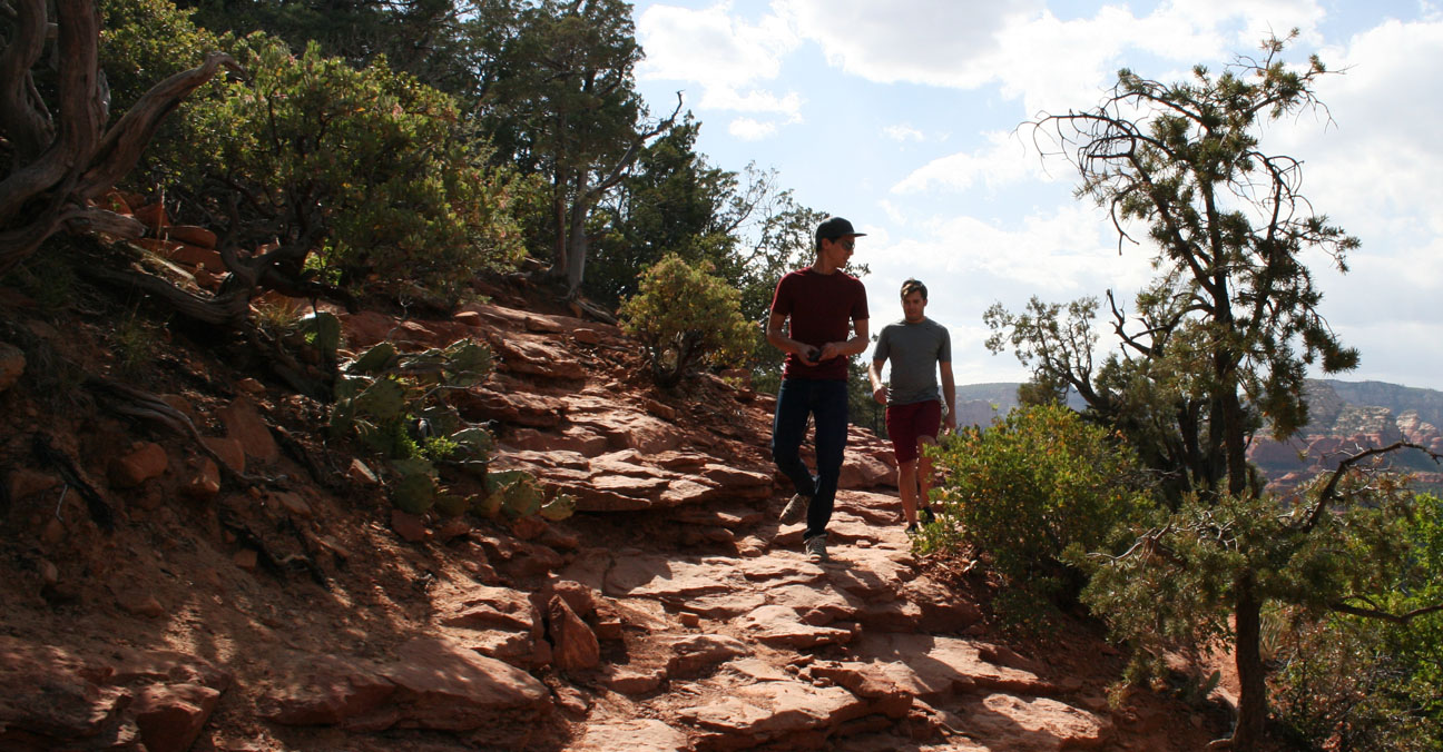
Jason led the way as we headed toward our destination. Few other people were out hiking; it was a special experience being out in the wilderness in such a beautiful landscape.
We climbed 400 feet in elevation on natural red sandstone rocks until finally laying our eyes on the prize.
Devil’s Bridge is the largest natural sandstone arch in the Sedona area. It’s 50 feet above ground. For this shot, we had another hiker take our picture after we carefully crept out to the narrowest section of the bridge. I enjoyed sitting for a few minutes to admire nature’s beauty before we started heading back out.
Time for the descent.
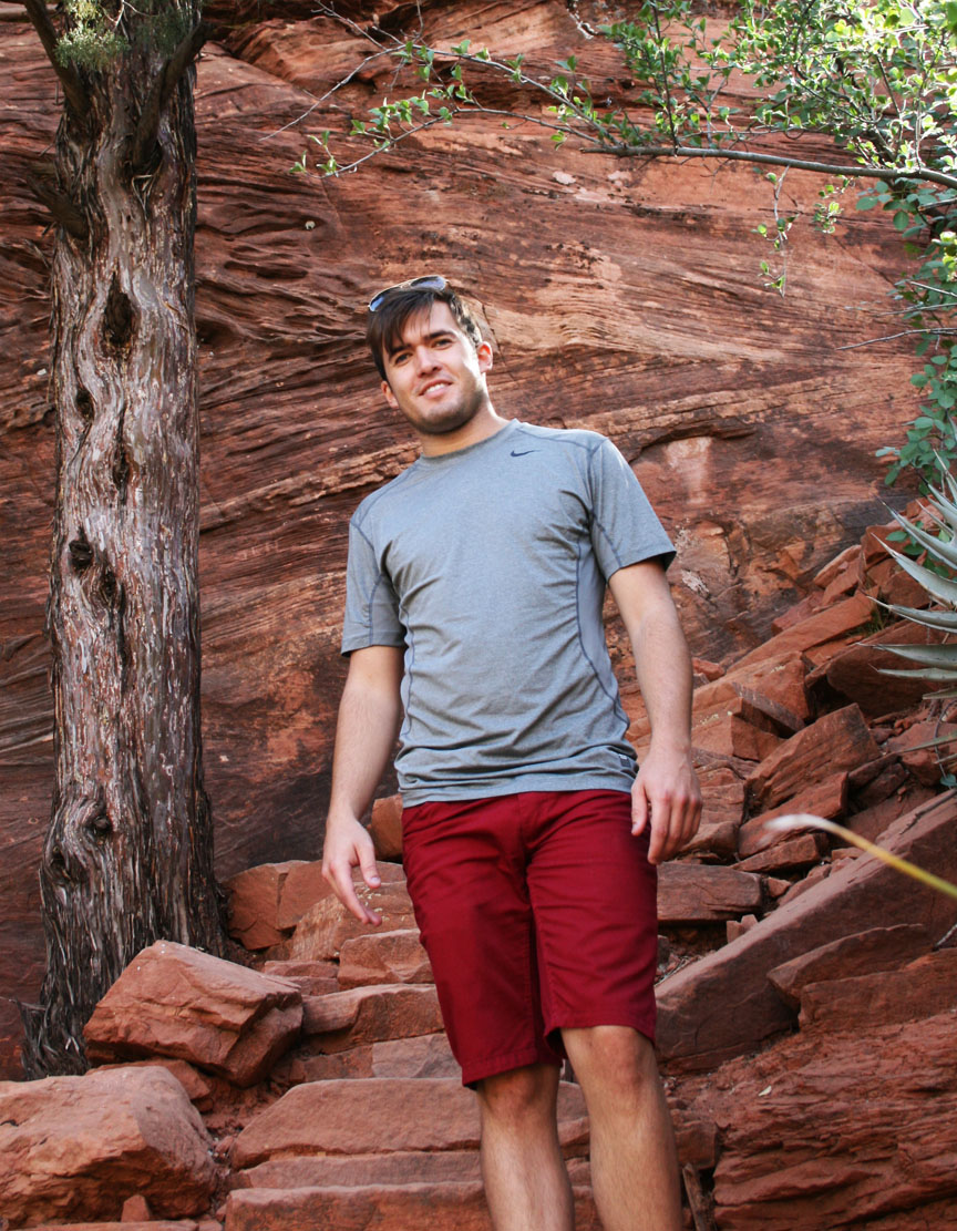
And relieved to get back to the driver’s seat after my shoes became full of red sand. It had taken us roughly 2.5 hours to complete the journey.
The first place I thought of for some much-needed refreshment was the Red Planet Diner, where I had eaten in January with other friends who joined for a Sedona day trip. I had to poke fun at Chris for a bit. Red Planet is famous for its burgers, yet he ordered a teriyaki bowl. Notice the employee in the background has a black T-shirt which reads, “Welcome Earthlings.”
I went for something a little more simple: grilled cheese and a root beer float.
This time, I let Jason take the lead and he took us up a road toward the Sedona airport. Picturesque views surrounded us there.
The last thing on our to-do list for this trip was to drive Highway 89A the remaining 30 or so miles to Flagstaff, Arizona. This stretch of road climbs in elevation to a heavily wooded forest called Oak Creek Canyon.
This is the type of road where Jason’s Accord and my ILX felt right at home. Both of our cars are equipped with manual transmissions for maximum control and have suspensions that are designed for handling the curves with balance. We were lucky that traffic was minimal, so when the hills begged for a little speed, we responded.
Chris did his best at video recording the above twisty section. Thanks to Enrique Iglesias for the soundtrack! I’ve got to invest in a GoPro camera for better stability one of these days.
At the end of the line, Highway 89A meets up with Interstate 17 which is where we parted ways with Jason and he headed to Flagstaff, while Chris and I returned to Phoenix.
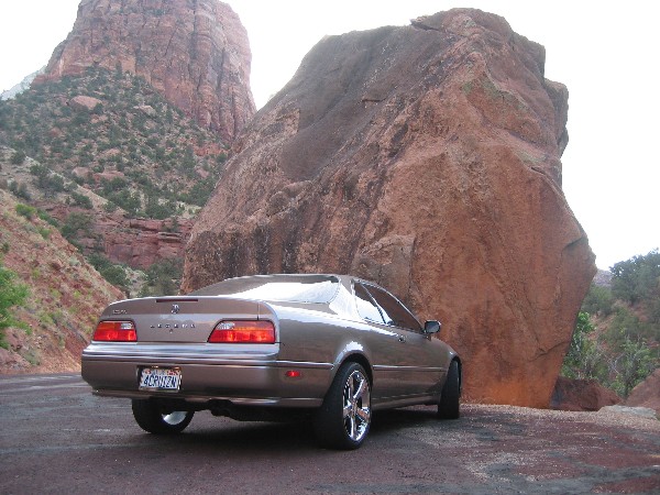
Red sandstone at dawn is one of my most favorite things ever. This April 2007 picture of my Legend at Snow Canyon State Park in southwest Utah captures some of the beauty that can be observed during that peaceful time of day.
Capitol Reef National Park, September 2006:
Utah Highway 12, approaching Bryce Canyon National Park on Highway 12. I had chrome 16″ OEM wheels on the Legend at the time.
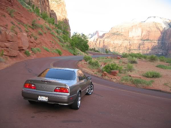
Just a 45 minute drive from my hometown in St. George, Utah lies the mouth of the stunning Zion National Park, established in 1909.
Massive sandstone cliff walls border a narrow canyon with the Virgin River at the base. This has always been one of my favorite road trip destinations. The first time I remember taking my Legend there was on June 13, 2004. This was back when it had 18″ Mille Miglia chrome wheels on it.
Following is a picture I took at the time, when my car had just 140,000 miles on it:
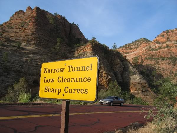
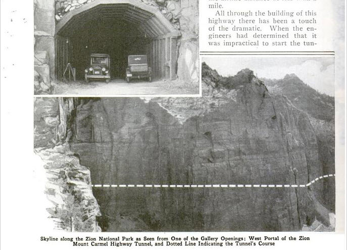
At the time it was completed in 1930, the Zion – Mt. Carmel Tunnel was the longest non-urban tunnel in the United States. It’s a 1.1 mile tunnel with 5 “window” openings that were carved at various intervals through the sandstone rock. This picture from a 1930 issue of Popular Mechanics shows the route taken by the tunnel, which took 3 years to complete.
Stopped at one of the windows / “galleries.” When the tunnel was originally built, cars were allowed to pull out at these openings and enjoy the view.
On June 27, 2005, I took a 1,000-mile “Utah Tour” trip when I rolled through the tunnel at about 3:45 in the morning. About halfway through the tunnel, I stopped the car, shut it off, and turned off my lights. I have never felt such complete and utter darkness and silence as I did at that moment in time. That memory has stuck with me as one of my fondest road trip memories.
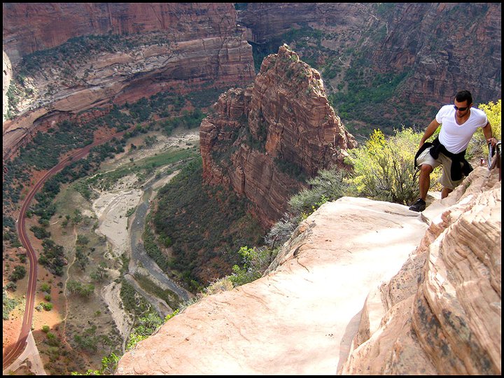
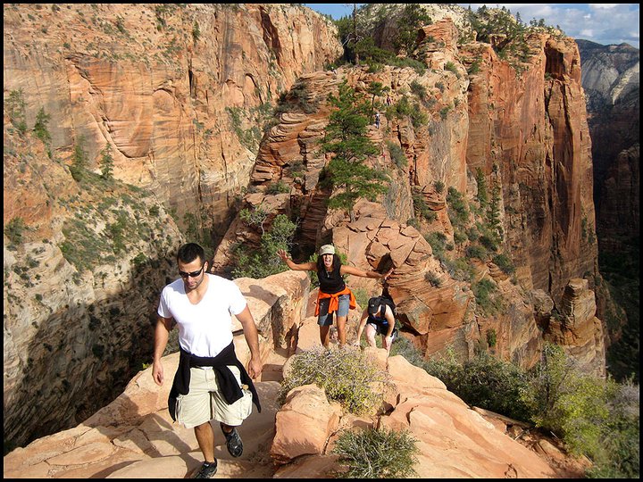
Angel’s Landing is not the best hike selection for those afraid of heights. At only 5 miles in distance round-trip, it’s not the distance that’s daunting – it’s the elevation gain of 1,500 feet and treacherous terrain.
During ascent, a series of 21 tight switchbacks are soon followed by a trail that requires chain hand-holds to maintain balance and direction. Huge, sheer drop-offs on either side can give a sense of dizziness. Reaching the final peak at 5,785 feet in elevation requires a great deal of bravery.
View from the top, June 2004. Look at that mop of hair I had (at left in the picture):
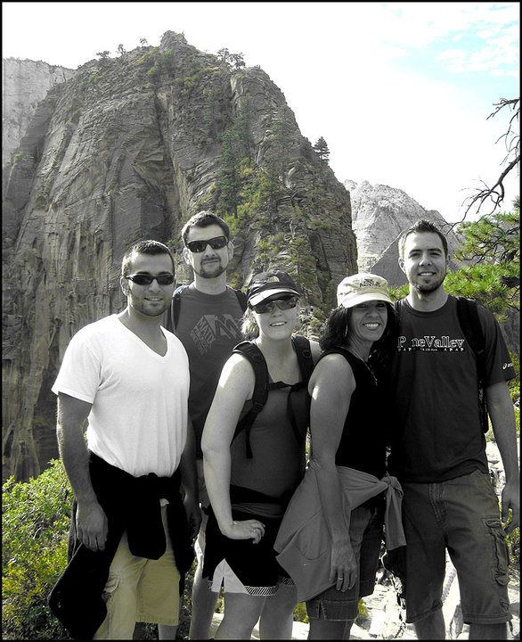
I’ve hiked Angel’s Landing three times and it’s felt like a different experience each time. These are pictures from one time I hiked it in October 2010.
The little red ribbon at left in the below picture is the two-lane road at the valley floor, thousands of feet below.
Here’s the last ascent before reaching the summit. No turning back now!
For any looking for an unbelievable national park experience, I highly recommend a trip to Zion!
This week I drove past Amy’s Baking Company in Scottsdale. This place was home to a bit of a social media disaster this week. If you recognize the name, you’ll know what I’m talking about!
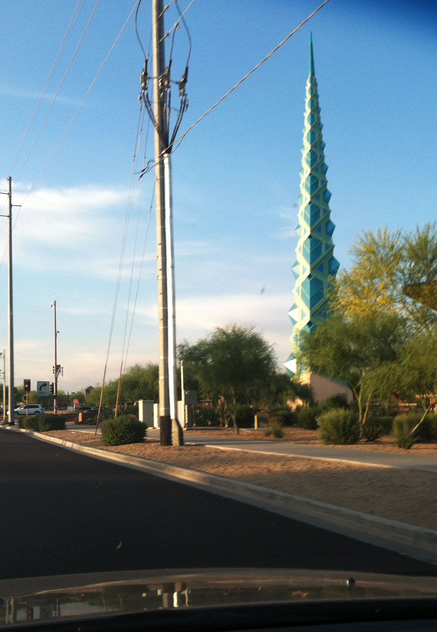
And I also saw the Frank Lloyd Wright spire. This was originally designed to be on the grounds at the Arizona state capitol, but it instead ended up being placed in a shopping center. The spire was designed by Wright in 1957 but wasn’t constructed until 2004. It’s made up of 1,700 individual pieces of steel and it weighs 75 tons!
The spire lights up blue at night so I’ll have to stop back by for another picture sometime soon.
Best part of my commute:
ILX Updates
The 2014 ILX is now on sale as of two days ago. The new model now comes with 8 additional standard features for the base model including the 17″ alloy wheels and an active noise cancellation system. Further refinements to the interior include upgraded leather seating surfaces, door panel trim, and other features. It’s hard to believe it’s already been almost a year since I got my ILX. I’m still loving it!
Some of you have already found me on Instagram. If not, look me up under @tysonhugie.
I’ve come a long way since this picture was taken in 1982. Many thanks to my great mom for always riding along on my Drive to Five travels, whether online or in person. Happy Mother’s Day!
Today I’m going to take you to 5 different destinations in the Tucson, Arizona area that I visited yesterday in my 2013 Acura ILX 2.4 6-speed. I headed out on Interstate 10 eastbound to make the ~120 mile drive from the Phoenix area with a few hot spots in mind. Here they are, in the order I saw them.
1. Sentinel Peak / “A” Mountain
The University of Arizona was the first university in the state. It was founded in 1885 and currently there are about 40,000 students participating in its programs. In March, 1916, a huge “A” was constructed on the side of Sentinel Peak just west of town. It’s a basalt rock formation that measures 160 feet tall by 70 feet wide. After the September 11, 2011 terrorist attacks, it was painted red, white, and blue (also the school’s colors) but it’s since been whitewashed.
This is the View of the “A” as seen from Interstate 10 just before exiting the freeway at Congress Road (slightly hidden behind that tree).
Nearing Sentinel Peak Road, I saw a sign that indicated I was getting close to the A. This marker could easily be mis-read as “a mountain,” instead of “A” Mountain. Either way, I continued my ascent up the 2,900-foot elevation gain to the summit.
Much like at Gates Pass where I traveled a few weeks ago, there were several forewarnings about the grade and width of the road as I approached the section with greatest elevation gain.
The road becomes one-lane and one-way as the top of the peak approaches. This was a fun little stretch of road in the 6-speed-equipped ILX as I downshifted to get maximum torque while looping around the top of the mountain.
Strangely, though, this road has no guardrails. It can get a little dicey trying to wind up the hill when bicyclists are trying to share the narrow roadway.
Finally at the top of the peak, I took a picture of my car with downtown Tucson in the background. Tucson is the headquarters of Pima County and is home to over 500,000 people. Since air conditions were favorable, I was able to clearly see downtown Tucson in the distance.
Facing south, the outskirts of town were visible.
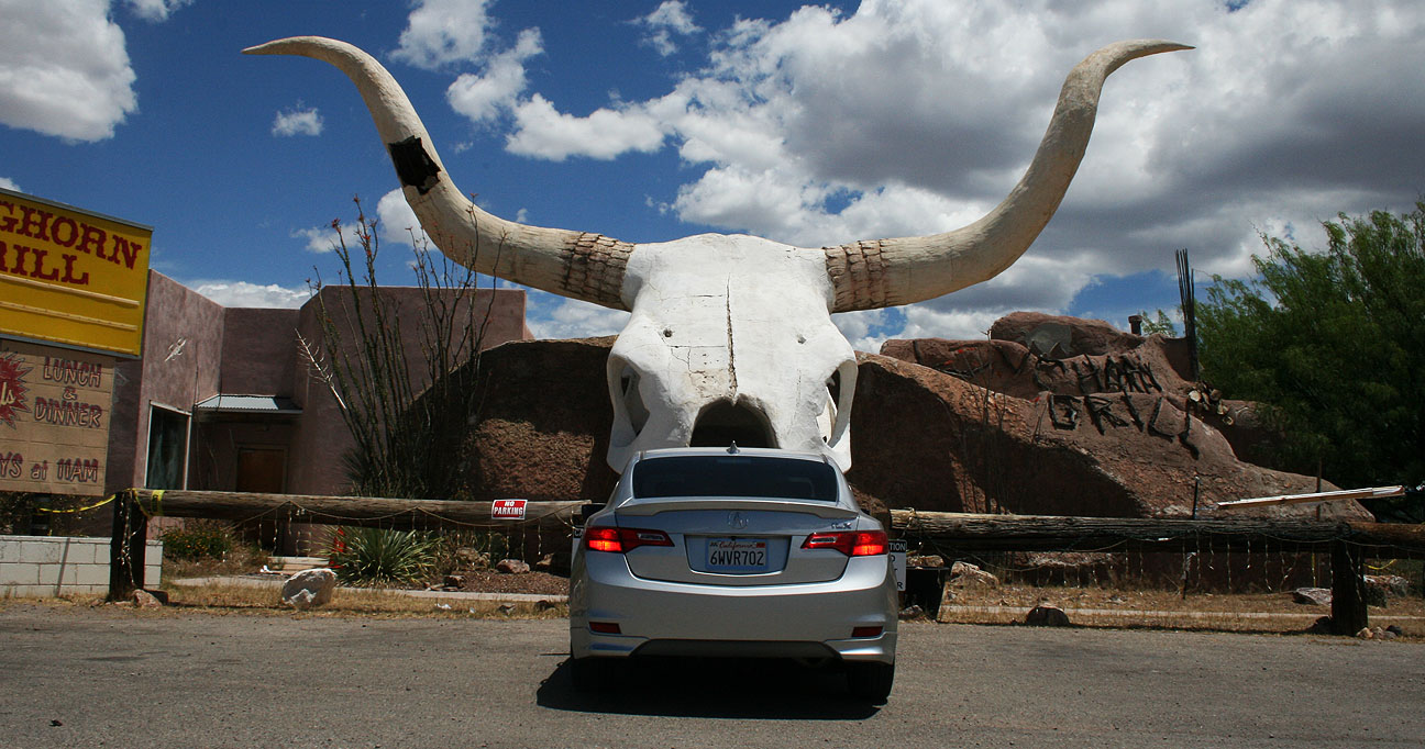
2. Longhorn Grill: Amado, Arizona
In my endless search for the most offbeat destinations I can find, I stumbled across this restaurant in southern Arizona shaped like a longhorn skull in Amado. My trip to the Longhorn Grill required a 33-mile southbound drive on Interstate 19 which I talked about in my post on Saguaro National Park. I-19 is unique in that it’s perhaps the only interstate in the country that’s signed with metric distances. Amado is a tiny teeny 295-person town, so the few businesses in operation there were easy to spot.
Before I checked out Longhorn, I first pit stopped across the street from it at Cow Palace.
Cocktails, steaks, sandwiches, and package liquor are found here. This is definitely a one-stop shop. Cow Palace has hosted movie stars and other notable personalities since the 1930’s. There’s a picture of John Wayne hanging in the entrance.
The restaurant is open daily from 7:00 a.m. to 8:00 p.m. I didn’t dine there, but I did take a look at the menu and there are some great sounding selections, including:
Bacon Wrapped Filet: Tender and lean 6 oz filet with roasted garlic butter. Served with baked potato, smashed red potatoes, palace beans, fries, or Spanish rice. Includes vegetables, fresh baked bread and your choice of soup or salad. $24.99
And for dessert:
Giant Sticky Bun: House made cinnamon roll baked in brown sugar, butter, and cream glaze. $4.99
This is a storage container sitting near the main lobby of the restaurant where meats are shown. Customers may purchase special cuts of steak that are aged for 7, 14, or 21 days.
At noon on a Saturday, this place was dead. I caught a few glances with the bartender who probably wondered why in the world I was taking pictures of his restaurant. It looked like it’d make a great place to host a party, though!
Next door to Cow Palace lies the “Mini Market Amado Market Market.” I wonder if they’ve sufficiently communicated the fact that this is a market?
My gaze quickly shifted to those 30-foot-tall horns mounted on the building looming behind me: the long-awaited Longhorn. This building was built in the 1970’s and has been home to a variety of different companies — most recently, a steakhouse. The restaurant has been closed since mid-2012, so I can’t help but wonder if perhaps the Cow Palace put this place out of business. Competition is fierce in this one-horse (one-cow?) town!
The temptation was just too great to overcome when I saw a small one-lane road leading off into the middle of nowhere, so I switched the ILX into 4×4 mode (not really, but there were unpaved stretches that did require higher clearance) and began exploring a little.
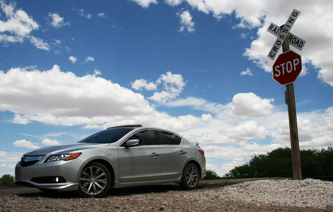
As it turns out, there wasn’t much at all to see out there, but as always, the drive afforded plenty of scenic photo-ops including this railroad crossing.
3. 25-ton Tiki Head
Exactly one week after pit-stopping to see Giganticus Headicus on Route 66 in the northern part of the state, I decided to find its sibling. I made my way back to Tucson via I-19 (again, notice the metric signage in the picture below). Speed limits are still posted in miles per hour instead of km/h.
I exited at 22nd Street on the same exit that goes to Silverlake Rd & Star Pass Blvd. Talk about a confusing interchange!
On my way to get lunch with my friend Josh, I drove past Chapman Acura, the Tucson area dealership, and saw that they had a nice Silver Moon ILX 2.0 automatic on the lot with aftermarket wheels.
Josh is a long-time Acura fan and currently owns two Integras. I featured his white Integra turbo in a blog post a few months ago, and his daily driver Integra is the red one shown here.
Here that tiki head. The story on this one starts around 1969 when entrepreneur Lee Koplin built a miniature golf course east of Interstate 10 on Speedway Boulevard. The golf course, called Magic Carpet Golf, survived until 2007 when it went out of business. The fate of the tiki head, along with many other stucco sculptures, was quite uncertain at the time.
Thankfully, the head found its new home at 305 North 4th Street, seven miles away from where the miniature golf course was located. It now sits atop a bar called The Hut. It reportedly cost $20,000 for the bar to procure and transport the head by sawing it off its base.
Interestingly enough, nobody wanted the sphinx statue from Magic Carpet which weighed in at several tons. It ended up getting bulldozed in 2011.
4. 30-foot-tall Neon Cactus
Just a little up the road from The Hut stands a huge tribute to neon signs of old. This illuminated cactus was constructed in 2010 on a road that was the first divided highway in the state of Arizona.
The south side of the cactus reads “Miracle Mile.” The name is in reference to a title given by Arizona Highways magazine after the road’s completion in 1937. Since the road had a median, it was considered the “miracle mile of safety.”
I found a picture of what the cactus looks like at night. I’ll have to go back and check it out soon.
5. Muffler Man
We don’t know much about this fiberglass statue on Stone Avenue except that he’s an artist’s rendition of Paul Bunyan and watches over an intersection while holding an ax. The first muffer man on record was constructed in 1963 and since then many more have followed. Most often, these statues are 18-25 feet tall and carry mufflers, tires, or other automotive parts in their hands. This guy looks like he’s got a fresh coat of paint.
Hope you enjoyed getting acquainted with a few of Tucson’s offbeat attractions! Driving around to find them in my Acura ILX felt a bit like a scavenger hunt. It sounds nerdy, but each time I found one I got a little more excited than I probably should have.
My last stop on Saturday night was the Scottsdale Pavilions car show. This is a parking lot near my place that fills up every single Saturday, year-round, with all sorts of vehicles. I happened to park next to a souped up Subaru.
Posted in Reader's Ride on May 8, 2013 by tysonhugie
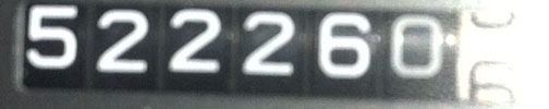
Odometer (Legend): 522,074
Odometer (ILX): 37,000
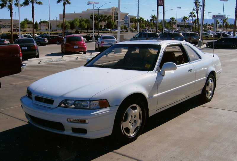
Now that it’s been over 18 years since the last Legend rolled off the production line, many have made their way to junkyards and many others aren’t far from that destination. Relatively few are still on the road and in good condition mechanically and cosmetically. Even fewer still are what one would consider “low” mileage. Here’s one that is.
Back in June 2004, I saw an ad posted for a 6-speed LS Legend coupe with only 6,500 miles on the odometer. Even back then, at 10 years old, the car had only averaged 650 miles per year. Though I already had my Legend, I made arrangements with my friend Louie who worked in Sales at the Las Vegas dealership where the car was located so that I could take a look at it. Louie pulled the car out so that I could get some pictures with this beauty.
Nose to nose: 6,533 miles meets 140,000 miles
This is a thread from the Legend forums where I talked about the experience. The car was listed for sale at the time for $28,990.
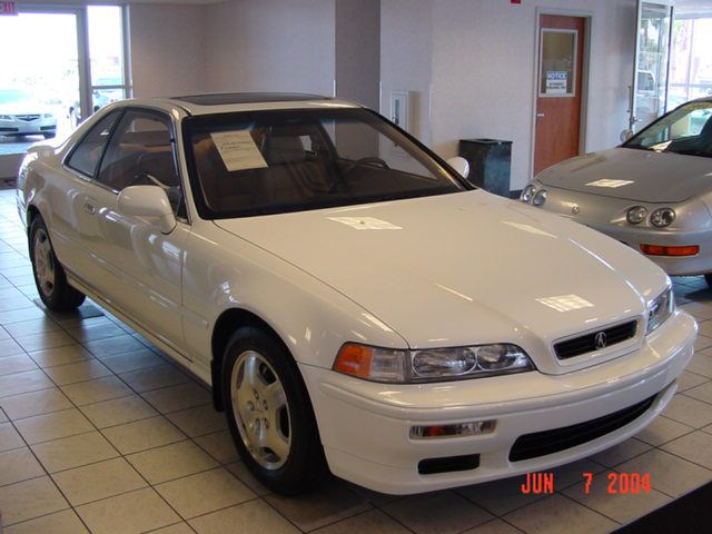
Here are a few pictures from when it sat in the showroom, courtesy of my friend Jeff who’s local to the Las Vegas area and is a long-time Acura enthusiast. At the time, Jeff drove a 1993 Legend LS coupe 6-speed in Canterbury Green.
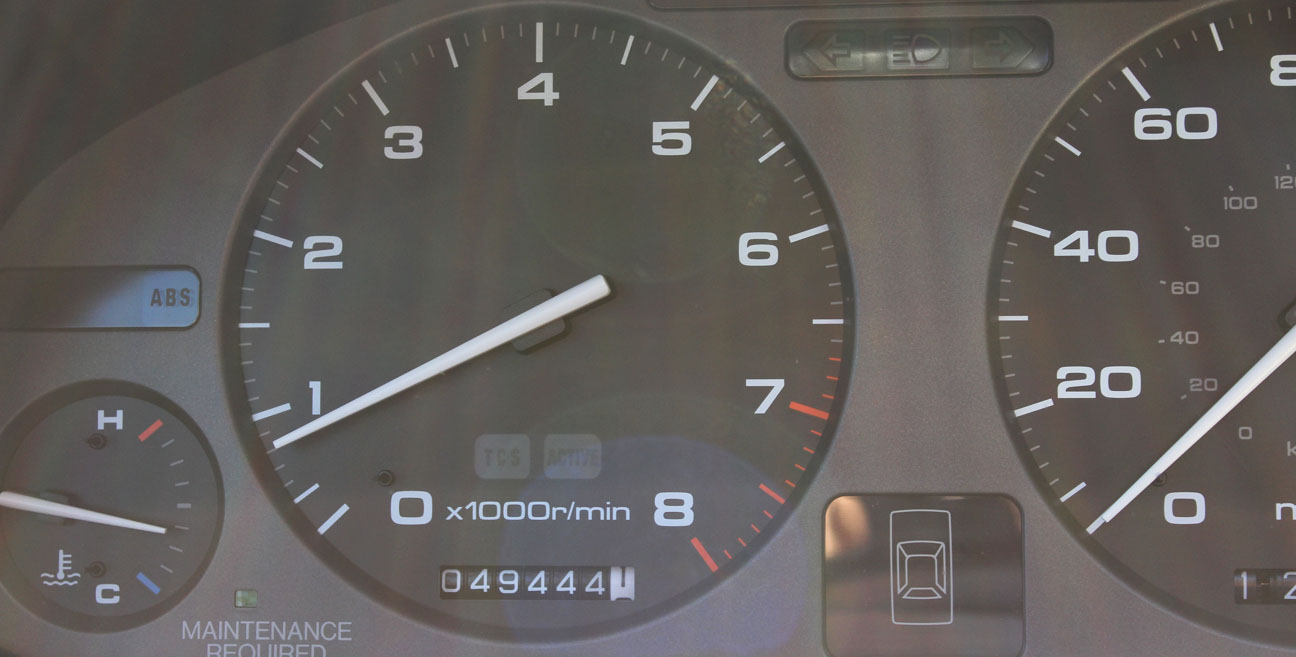
This pristine Legend was auctioned on Ebay and went first to California for a couple of years, then ended up in Indiana. The last I heard of it was when it was sold around October 2010 by my friend Mitch who’d sold it.
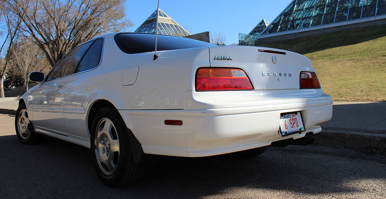
A couple of months ago, however, I received a private message on the Acura Legend forums asking me if I still had pictures of this car. As it turns out, this was the new owner, named Alaeldeen, contacting me! This Legend is now in Edmonton, Alberta, Canada. Ten years later, it now has 49,444 miles on it. I’m glad to hear that it’s in good hands; Alaeldeen has been an Acura enthusiast since he owned his first car, a black 1988 Legend LS sedan. He’s since gone on to own 4 Legends.
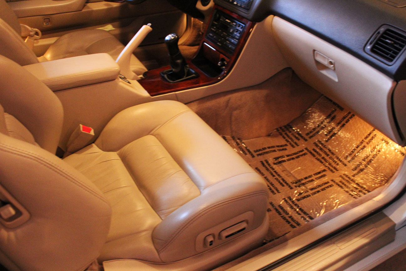
Look at the pictures he sent me of his Taffeta White beauty as it currentlysits.
The plastic on the floor mats has been in place since 2008.
Alaeldeen says that there are only about 4 months of good weather per year in Edmonton, so he’s hoping to take advantage of as many good days as he can to enjoy the car before putting it back into hibernation for the winter.
The car is completely stock.
Type II powerplant looks new to me.
Notice anything special about that license plate?
He’s sporting my same letter / number combination! Hopefully someday the Alberta & Arizona “6 SPD” Legend coupes will get together for a photoshoot.
Best of luck with your new ride, Alaeldeen! Thanks for reaching out.
Other low-mileage examples I’ve featured previously on the blog: Chuck’s 1993 LS with around 30,000 miles; Marc’s 1995 LS with 35,000 miles.
Brett’s 1995 Acura Legend LS Hits 250,000 Miles
At the other end of the mileage spectrum, we have cars like this next one. It’s just as much fun for me to watch others achieve high mileage with their Acura vehicles as it is to hit milestones in mine. This week, my friend Brett from Huntington Beach crossed the 1/4 million mile mark on his immaculately clean Canterbury Green Metallic Legend L sedan. I posted about Brett in May 2012 when I visited him in southern California.
The long awaited milestone happened May 4, 2013 at 10:10 p.m. in Newport Beach, California at Pomona Avenue and 16th Street. We are all about attention to detail around here!
Here’s a video Brett sent me of the rollover. If you’re overly anxious like me, the grand finale happens just a few seconds before the end of the clip, so skip there! Though, his soundtrack by The Cure is nice to listen to.
These are a few more pictures Brett sent. He’s as much of a neat freak as I am, and thus his Legend looks good even with that many miles on it.
The painted grille and 16″ wheels make the car look like a “GS” trim level, but Brett’s car is in fact an “L”.
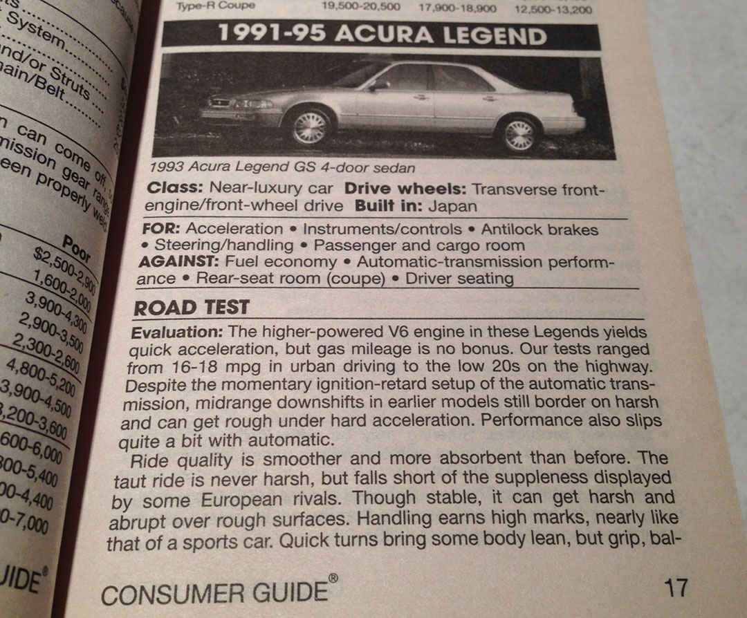
It’s fun to read write-ups about Acura’s flagship Legend. Following are some pictures from Consumer Guide that my friend Jason shared with me this week. This first one is from an issue of Consumer Guide discussing the new (at the time) 1995 cars. It states, “Legend handles and rides like a sports car.” Not sure if mine still handles like a sports car at 522,000 miles! The suspension is worn and floaty.
This second one is from a 2003 “Used Cars” version. It knocked the Legend’s fuel economy but gave it strong wins for acceleration and handling.
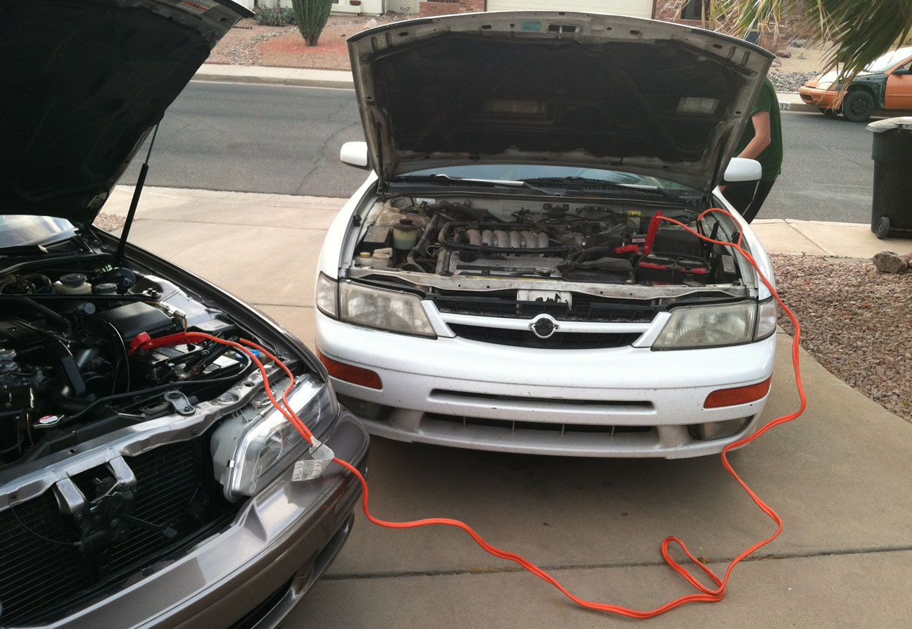
Here’s my one-day-a-week commuter, today on the drive home through the Salt River Indian Community.
My Legend got to help my roommate when I got home. He’d left the headlights on in his 1997 Nissan Maxima and the battery was drained, so we jumped him and he was on his way. The old Maxima is a 5-speed manual with about 210,000 miles on it.
2014 Acura RLX CNET Review
One of my favorite automotive review channels on YouTube is that of CNET, hosted by Brian Cooley. In the latest CNET review, Brian spends 8 minutes talking about Acura’s most technologically-advanced car ever: the 2014 RLX. I just saw the first “customer-owned” RLX on the road on Monday night near my home. The taillights were super sexy at night, not to mention the jewel eye headlights. Check out Brian’s comments on the car that can pretty much drive itself!
Acura ILX Long-Term Updates
My ILX is getting great fuel economy. When I took this picture earlier in the week, I’d been averaging exactly 33 mpg in the 1,777 miles since my last oil change when it was reset. It pays to drive conservatively!
Finally – happy travels to my friend Ryan who you may remember from our January trip to Sedona. Now that school’s out, he’s headed home to South Dakota for the summer (about a 1,400 mile drive). He sent this today when he met the Nebraska state line in his 2006 Acura TL.
I’m jealous that he got to spend the day on the open road and I sat inside an office!
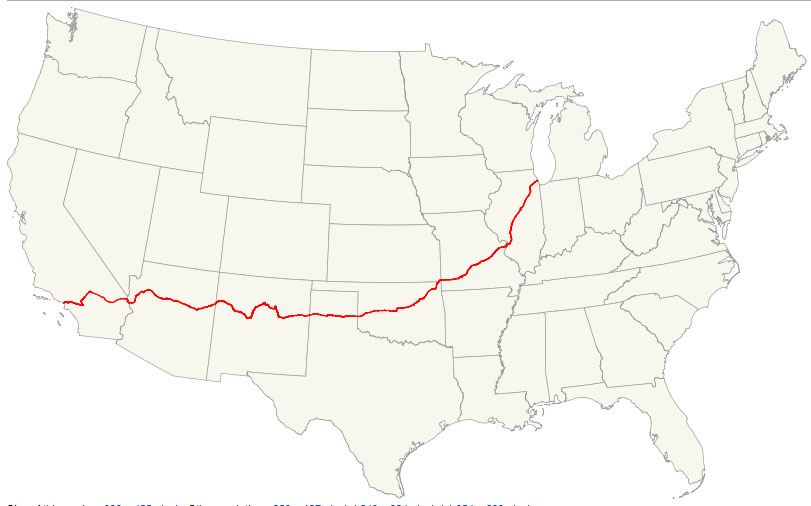
For this weekend’s ILXcapades, we find ourselves venturing back to the heyday of automobile travel as we know it. Route 66 – the “Mother Road” – has long been known as the most talked-about corridor in popular culture. Its entire length ran about 2,400 miles from Chicago to Los Angeles, but the road was decommissioned 28 years ago in the mid-1980s. This is a map of the original route.
Since then, it’s been bypassed, bulldozed, or otherwise forgotten except for in a few special sections where Route 66 heritage is embraced. I’ve driven a couple of those areas (Oatman in the Legend in 2007 and Flagstaff in the ILX last September). My friend Jack and I took my 2013 Acura ILX on a 9-hour adventure to explore some yet-unseen roads in northwestern Arizona. Our first stop was the Wikieup Trading Post off Highway 93.
Wikieup is known as the “rattler capital of the world” due to the number of rattlesnakes in the area.
And they aren’t kidding! This is one snake skin on display hanging on the wall above the door to the restrooms.
On the road again and playing one of my all-time favorite driving playlists: the Top Gun soundtrack. The ILX Premium Audio System definitely did the song “Danger Zone” justice when blasted at max volume of level 40.
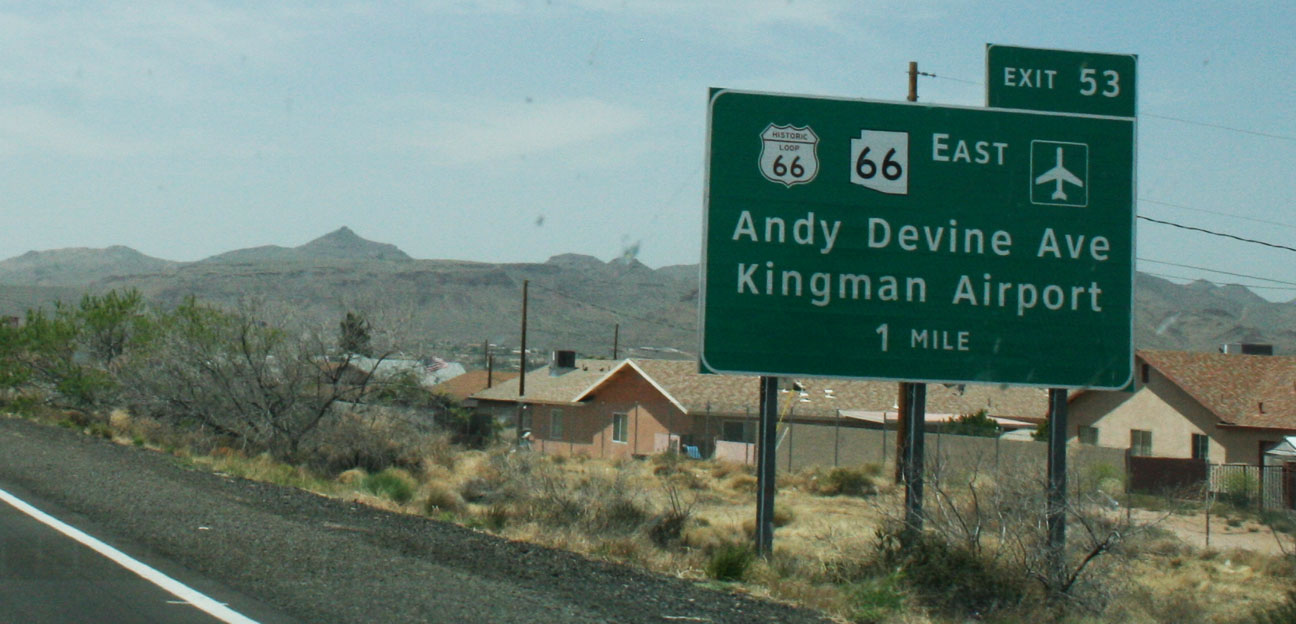
Once we approached Kingman, it was clear we’d entered Route 66 territory.
We went to the historic part of town where a yearly classic car “fun run” was taking place. Streets were closed off and there were vendors, entertainers, and classic cars all over the place.
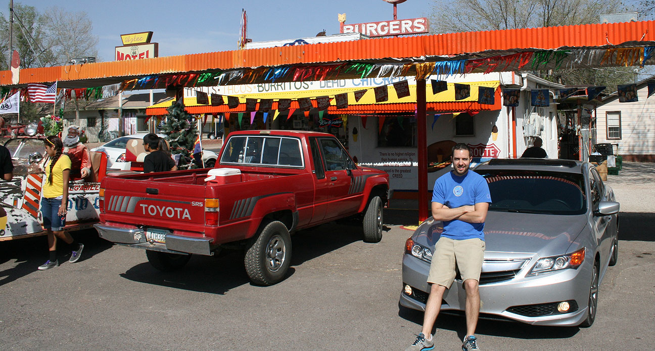
By now, we’d worked up an appetite and the sign for “Mr. D’z Route 66 Diner” was calling our names. Mr. D’z was once a small cafe & gas station in the 1950’s and 1960’s. It’s now the hub of several annual car shows.
I went with the “Route 66 Bacon Cheeseburger” and a frosty mug of homemade root beer. I do recommend it!
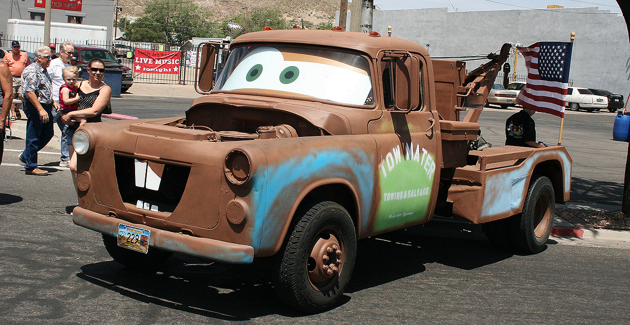
Out front, we saw a few eye catching rides, including this tow truck inspired by Tow Mater from the 2006 Disney / Pixar movie “Cars.” More about Cars later.
Let’s get this Route 66 party started!
Here I’m posing like Vanna White next to a destination marker showing where Jack and I would be headed in the ILX shortly.
Our friend Mike was in town as a judge for the classic car show so we met up with him briefly.
Then, Jack and I were on our way.
The 83-mile section of Route 66 between Kingman and Seligman is a well-preserved stretch of old 66 that’s stuck in a time warp, and that’s why I wanted to drive there so badly. Traveling the same point-to-point via the parallel Interstate 40 would shave off over 20 miles and probably 1/2 hour of drive time, but this drive wasn’t about speed, it was about taking time to experience the sights along the way.
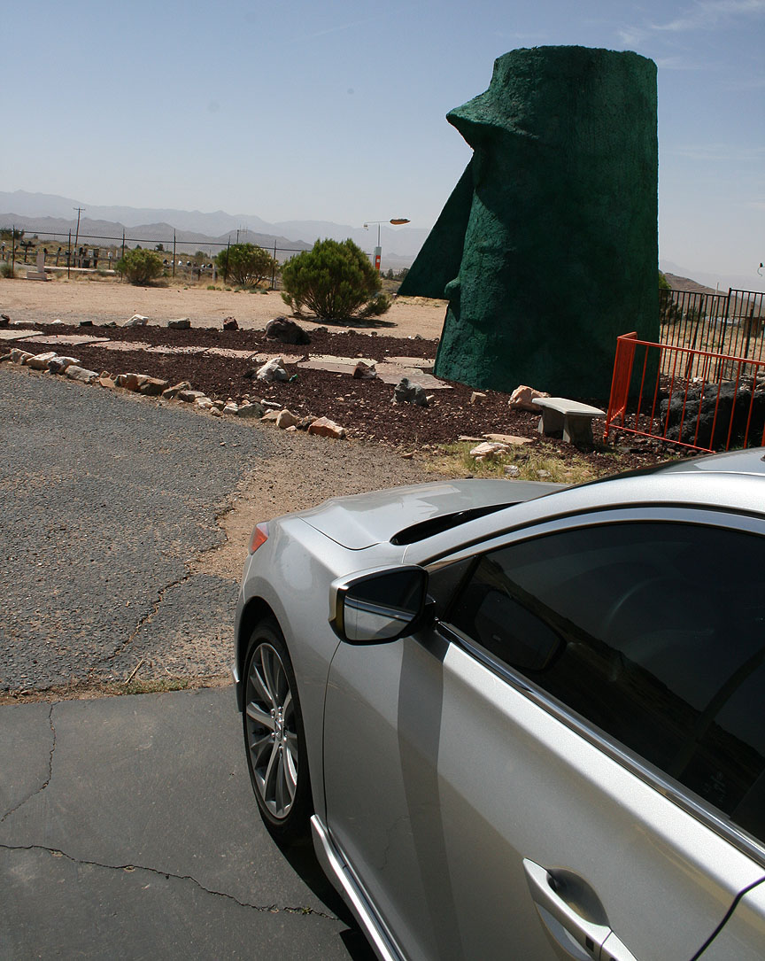
The road heads northwest from the Kingman area and quickly slims down to 2 lanes from 4. Not far up Route 66, we saw the (now abandoned) Kozy Corner Trailer Park. There are a couple special things about this particular trailer park.
First of all, the trash can warns everyone nearby that it’s full of baby rattlesnakes. I didn’t peek inside to confirm that.
And secondly, you might have noticed that giant green head sitting out front. That is called “Giganticus Headicus.” It’s 14 feet tall and was created in 2003 by someone named G. Arnold.
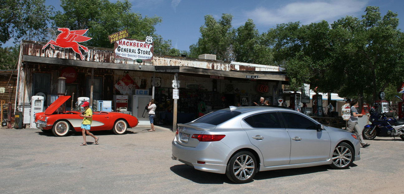
Continuing on, our next pit stop was the general store in Hackberry, Arizona. Here we found all sorts of collector “stuff.”
Antique collectors: plan to spend awhile here.
75 degrees and sunny for our drive – couldn’t have asked for better weather! Speed limits varied from 35-65 and the ILX 6-speed made a great cruiser.
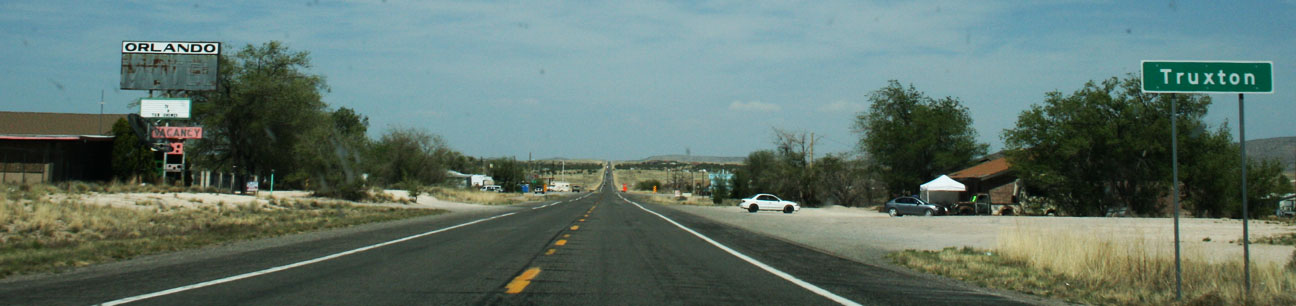
It only takes a blink to miss some of these small towns that we passed through. Truxton is one example. From the entrance of town limits to the exit took only a few seconds to drive.
But those few seconds were entertaining, nonetheless. I enjoyed seeing these old motels and there seemed to be a lot of classic cars parked alongside the road for sale in places like this.
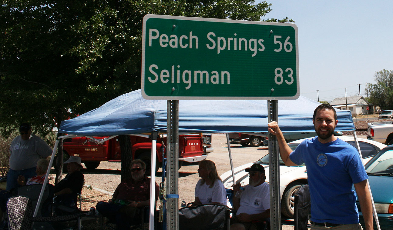
About halfway to our destination of Seligman, we passed through a town called Peach Springs. Traffic through Peach Springs died down sharply after Interstate 40 was opened about 20 miles south in 1978. According to Wikipedia, Peach Springs “survived as the administrative base of the Hualapai Indian tribe but suffered irreparable economic damage.”
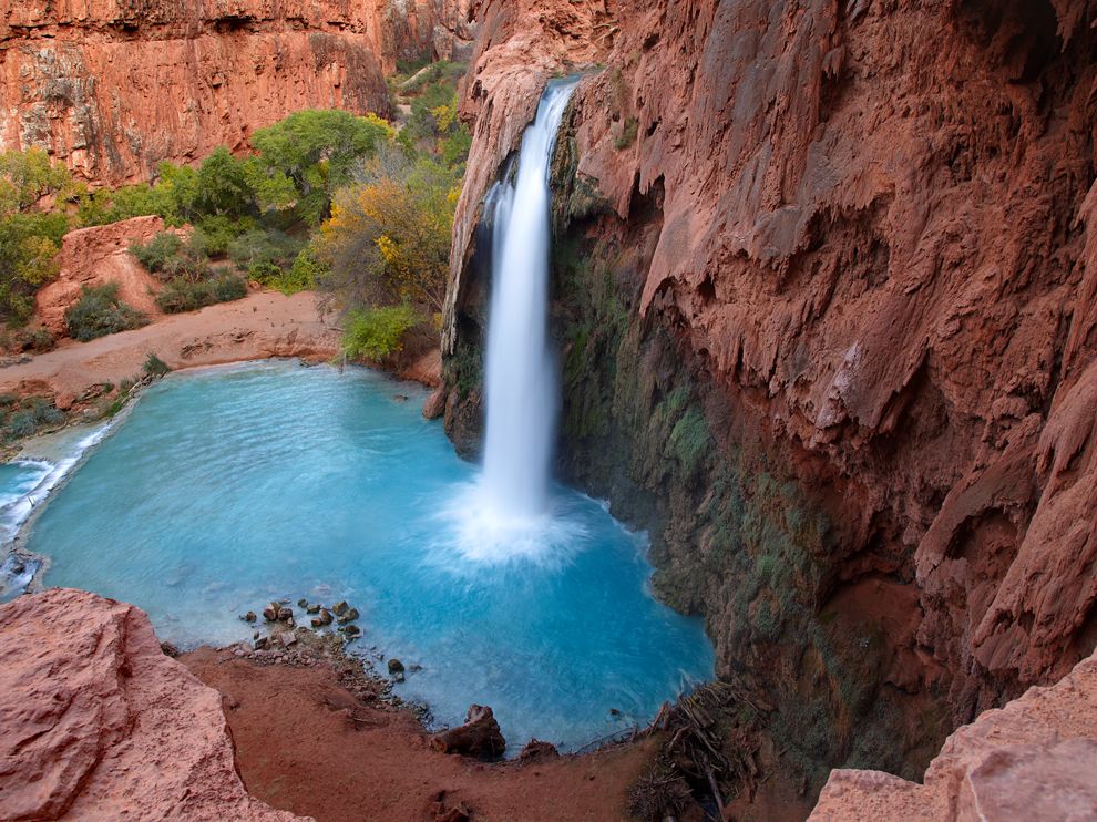
Just 55 miles northeast of Peach Springs, visitors will find the Hualapai Indian tribe town of Hualapai Hilltop. This place serves as the trailhead for an 8-mile hike that drops into the Grand Canyon and now-famous 120-foot-tall Havasu Falls, a place which has been on my to-see list for several years now.
The town itself is pretty run-down with the exception of the Indian-run visitor center.
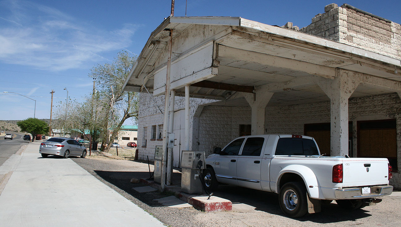
I did find this photo-op worthwhile, though. This is an old service station dating back to the 1920’s.
A nearby informational sign reads as follows:
Historic John Osterman Gas Station: This property was listed in the National Register of Historic Places on March 15, 2012. The John Osterman gas station was one of several privately owned and operated businesses in the town of Peach Springs during the 1920s through the 1950s. The building, constructed by Osterman in 1923, was a vernacular design of poured concrete block and built in the tradition of the “House with Bays” form. It featured an office resembling a small house and a series of attached garage bays. The design, in addition to allowing the sale of gasoline and other automotive products, is indicative of the large amount of repair work the station undertook over the years.
It looks like the pumps out front still read $2.99 / gallon which means it wasn’t closed that long ago.
For the next 37 miles, we dodged tumbleweeds and cruised alongside the train tracks as we continued eastbound. There were several “Burma Shave” roadside sign sequences that I enjoyed. These types of signs were a huge part of roadside America from 1925 until the 1960’s. They are small signs spaced at periodic distances alongside the road to advertise a brand of shaving cream. Here are a few of them that Jack and I took note of:
IF YOU DON’T KNOW
WHOSE SIGNS THESE ARE
YOU HAVEN’T DRIVEN
VERY FAR
Burma Shave
ANGELS WHO GUARD YOU
WHEN YOU DRIVE
USUALLY RETIRE
AT SIXTY-FIVE
Burma Shave
And finally, toward the end of the route:
JUST THIS ONCE
AND JUST FOR FUN
WE’LL LET YOU FINISH
WHAT WE’VE BEGUN
????
The last stop on this historic drive was in the small town of Seligman, home to fewer than 500 people. It’s the birthplace of Route 66 (at least they’d like to think so).
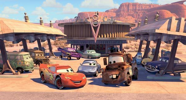
When Disney/Pixar was putting together the 2006 film “Cars,” director John Lasseter met with the business owners in Seligman to talk about the town’s history as a stopping point on the Mother Road. He ended up basing the fictional town of Radiator Springs loosely on Seligman. To jog your memory, here’s the cast of the film, including star Lightning McQueen.
The grammar Nazi in me wanted to step into this gift shop and tell them they’d spelled “memorabilia” wrong, but I guess a misspelled word here and there is what keeps a place like this even more interesting.
I’d heard of Roadkill Cafe but never knew it actually existed. Here Jack is standing with the ILX in front of such a place. The slogan here is “You Kill It, We Grill It.”
Some of Roadkill’s entrees are:
Splatter Platter
Swirl of Squirrel
Big Bagged Stag
Highway Hash
Main Street looks a lot like one would expect. It’s a tourist trap in every way, but I loved it.
For me, the most awaited point of interest had arrived: Snow Cap Drive-In, seen in the background here:
Delgadillo’s Snow Cap Drive-In has greeted motorists for 60 years. Its founder, Juan Delgadillo, died 9 years ago but the enterprise continues serving up great food AND a great cultural experience for those who make a stop there. Delgadillo’s son and daughter run the business today. A 1936 Chevrolet with a Christmas tree attached to the back of it is on permanent display out front (seen at left below).
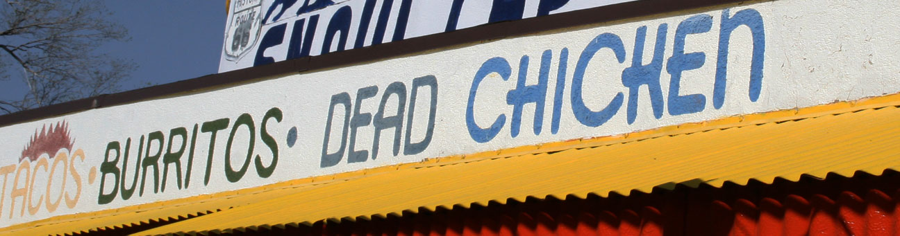
Where else can you find menu selections like “dead chicken”….
And “cheeseburgers with cheese”? Truly this place is worth checking out if you’re looking for something offbeat.
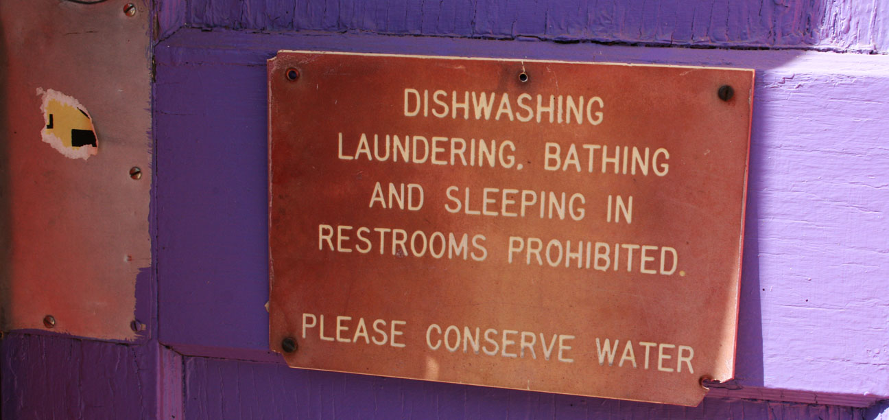
Don’t get too comfortable, though, because sleeping in the restroom out back is prohibited.
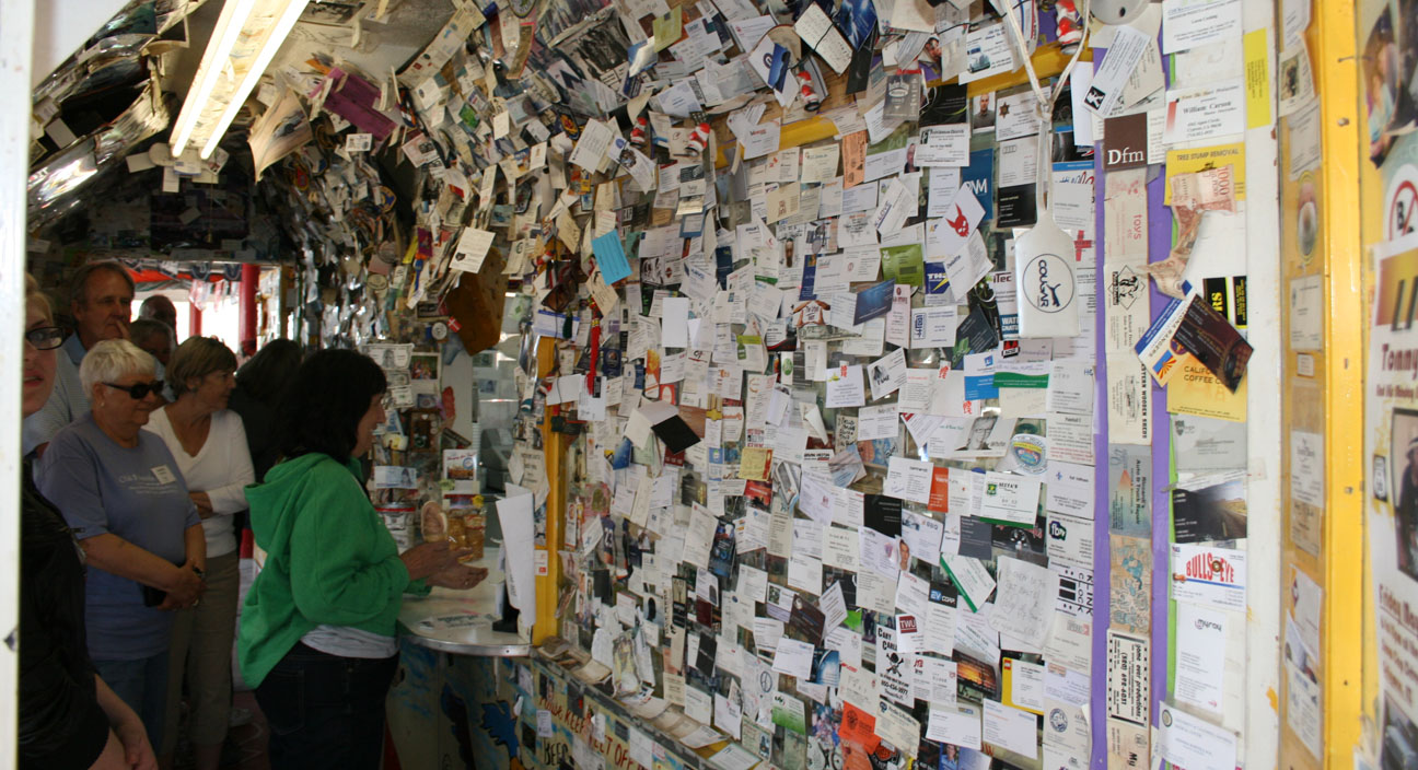
Inside the Snow Cap, the walls are lined ceiling-to-floor with pictures and business cards from guests who have visited since this place opened in 1953. I added my business card to the mix.
The line was fairly long but I was determined to sample something off the menu. Meanwhile, we became acquainted to some of the other visitors. Most were from other countries! Snow Cap had a lot of entertaining pictures and signs, including this one about the company’s credit manager, Helen Waite, that took me a few attempts to understand. Say it out loud a time or two:
These ladies were hilarious. They have a plastic mustard bottle that they “squirt” at customers and a piece of yellow string comes out the tip. I thought for sure I’d have mustard all over my shirt when I looked down. I asked if I could have a small ice cream cone and she brought me a miniature one. Then I asked for a lemonade and she said, “Would you like ice with that?” I said, “Yes please,” and this is what she came out with:
The jokes kept rolling when she asked if I wanted a “straw” and she handed me a piece of hay instead. When it was time to get my change back from a $20 bill, she started passing out my change to OTHER CUSTOMERS. Ha! We got all that cleared up and headed outside… via the door with two different handles. Did I say this place is offbeat?
Jack and I wandered around the backyard of Snow Cap while we enjoyed our vanilla ice cream cones.
That pretty much wrapped up our Route 66 adventures as we soon got on Interstate 40 and took it to Highway 89. After heading south on Highway 89, we passed through the tiny communities of Paulden and Chino Hills in the 55 miles until we reached Prescott, then we headed over to Interstate 17 via Hwy 89A and then Hwy 69. I enjoyed rowing the 6-speed ILX through its gears on these back roads.
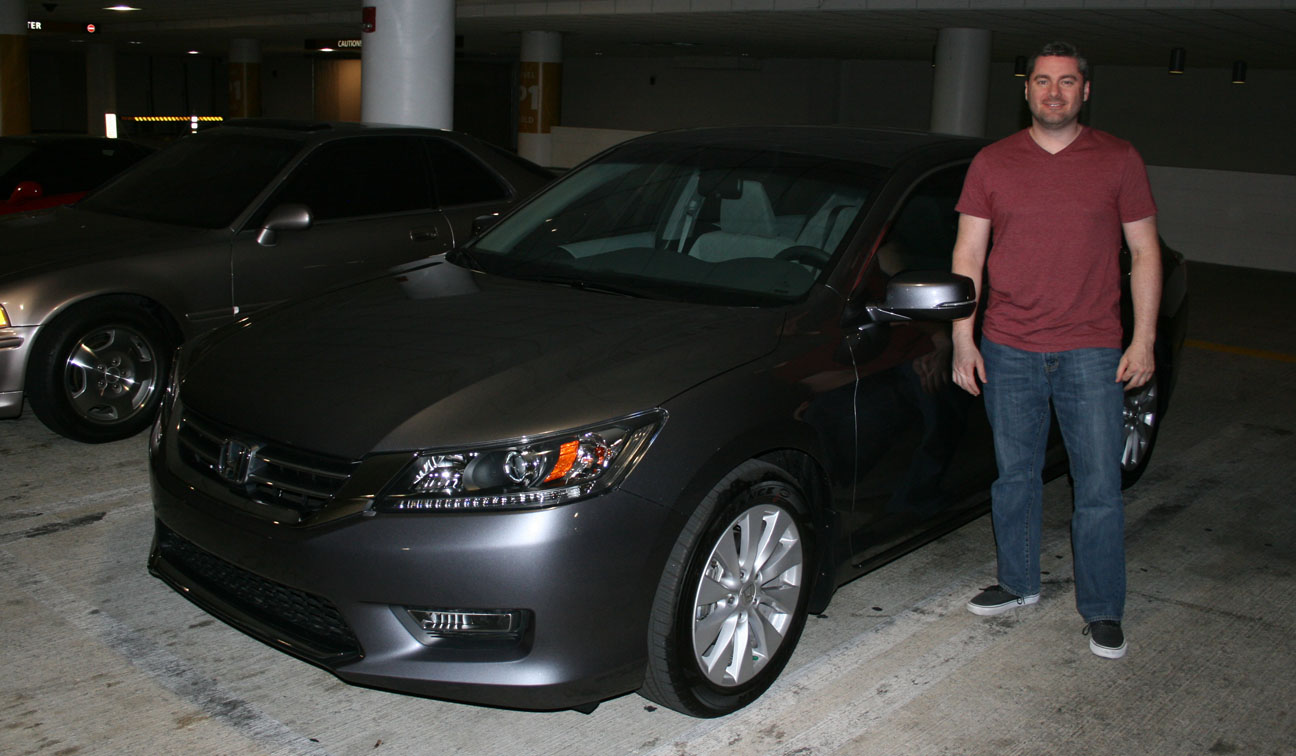
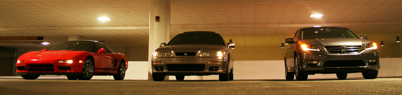
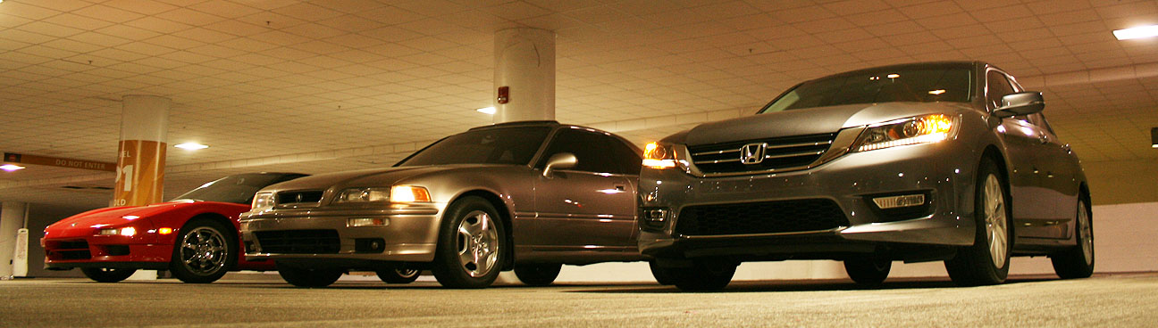
Later in the evening, I met up with my friends Kevin and Kelvin. Kevin is the proud new owner of Modern Steel Metallic 2013 Honda Accord EX. After having driven a Toyota Corolla for 12 years, I nudged Kevin into the Honda dealership and he was really impressed with what the Accord had to offer. He’s thrilled with his new ride!
We got a few pictures with Kelvin’s 1993 NSX, my 1994 Legend, and Kevin’s 2013 Accord at a parking garage in Scottsdale.


![IMG_4452[1]](https://drivetofive.com/wp-content/uploads/2013/05/img_44521.png)