Archive for the ILX Category

ILX Colorado Trip Day 2: Mount Evans

Posted in Colorado, ILX, Road Trip on July 23, 2013 by tysonhugie

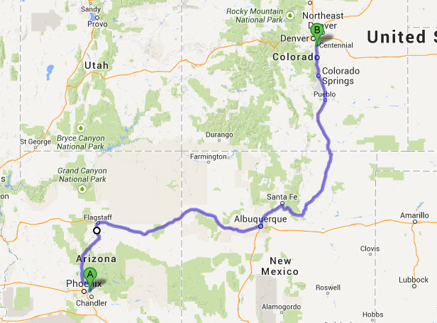
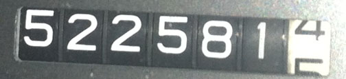
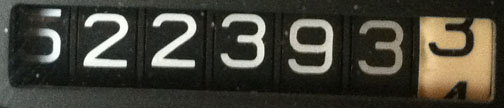
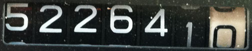
Odometer (Legend):  522,641

522641

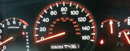
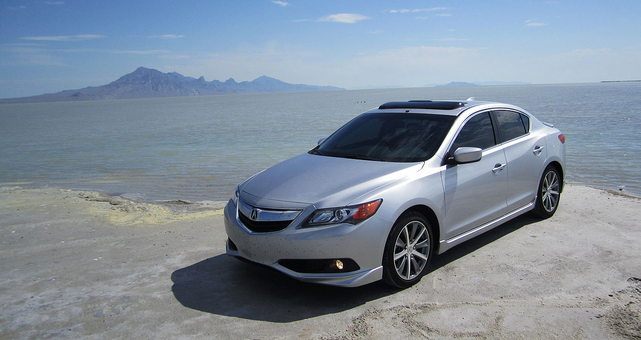
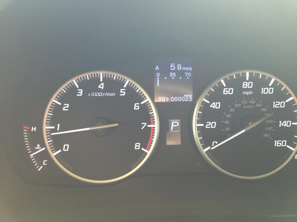
Odometer (ILX):  47,189

47189

Daily Distance:  ~250 Miles

mount_evans_drive

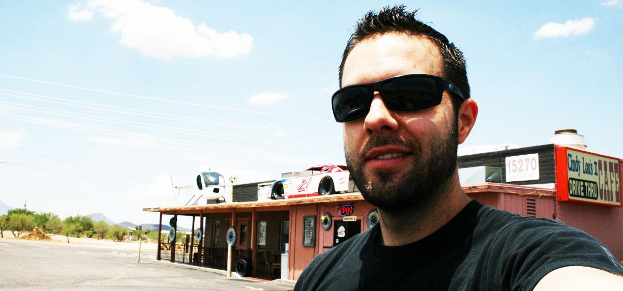
Welcome to Part 2 of my Colorado weekend adventure wrap-up.  How could I resist the temptation to drive my Acura ILX to a place that’s described like this?

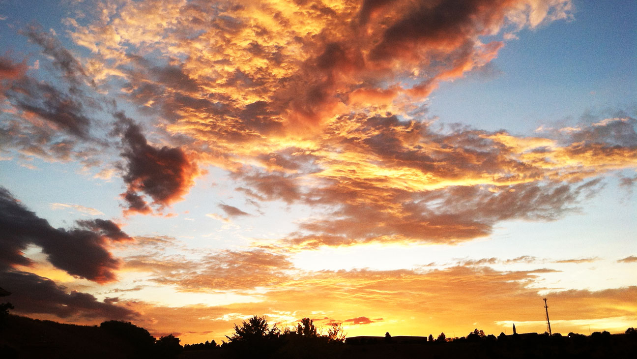
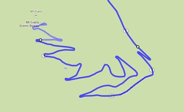
Mount Evans is the road into the sky. Drive from 8,700 feet at Idaho Spring where you turn off Interstate 70 to 14,240 feet to the summit, and you will pass through 3 life zones, passing ancient trees, lakes and forest to the land above timberline. It can be 90 degrees in Denver and 40 degrees at the top of Mount Evans.  Mountain Goats and Bighorn Sheep will greet you as you climb to the top of the world.

If you want to cut to the chase, here’s the video:

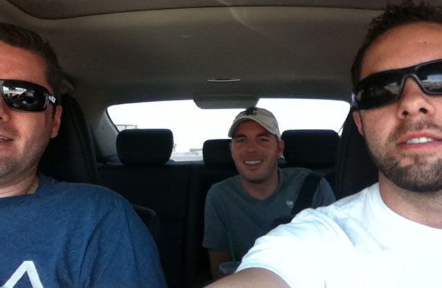
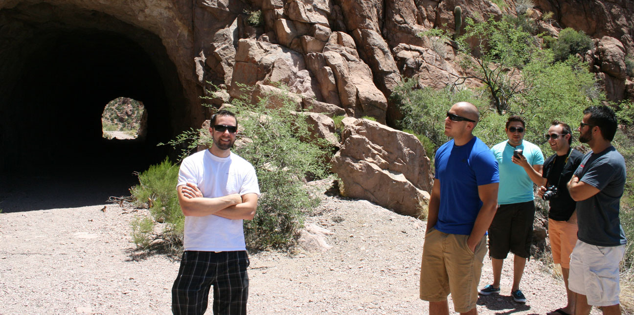
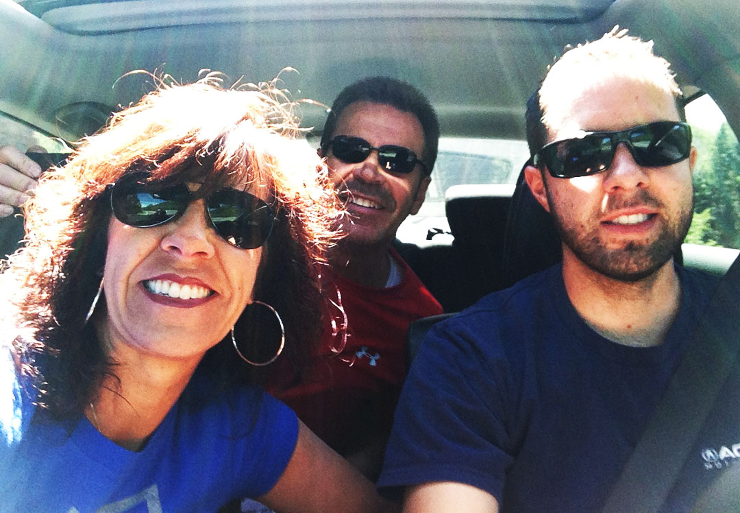
Jason, Jeremy, Johl and I set out on Saturday morning to see what Mount Evans was all about.  An LED sign above I-70 west of Denver soon crushed our plans:  The highway was to be closed until 2:00 p.m. for a bicycle race:

notice

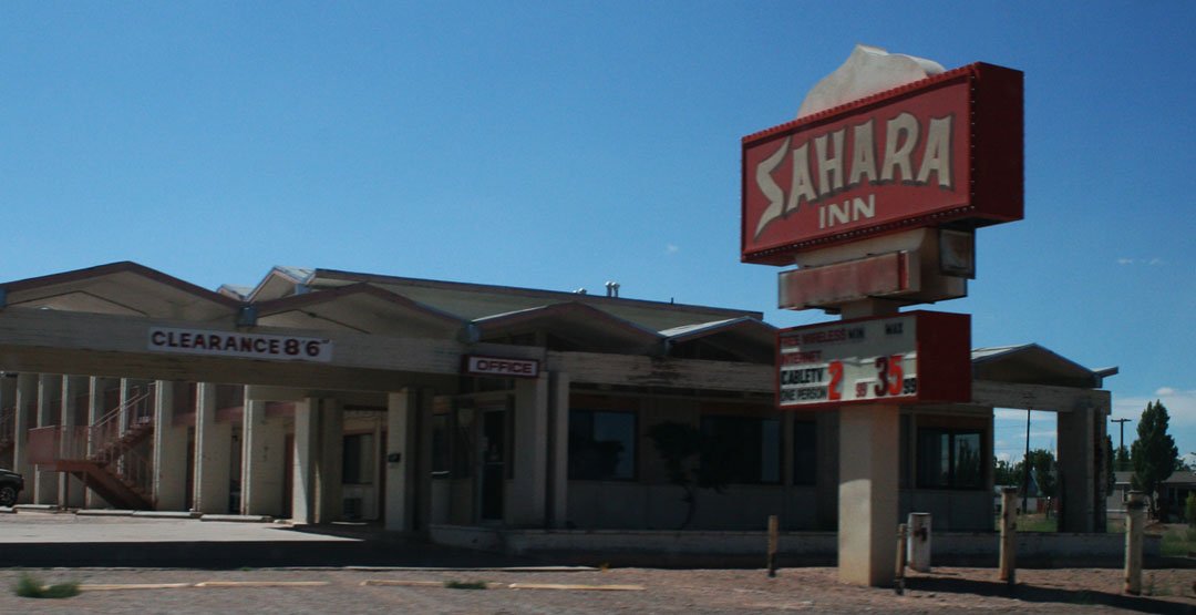
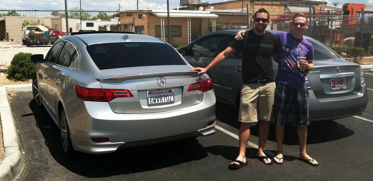
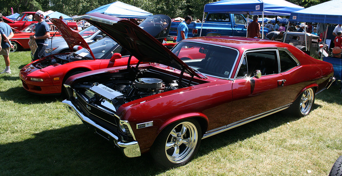
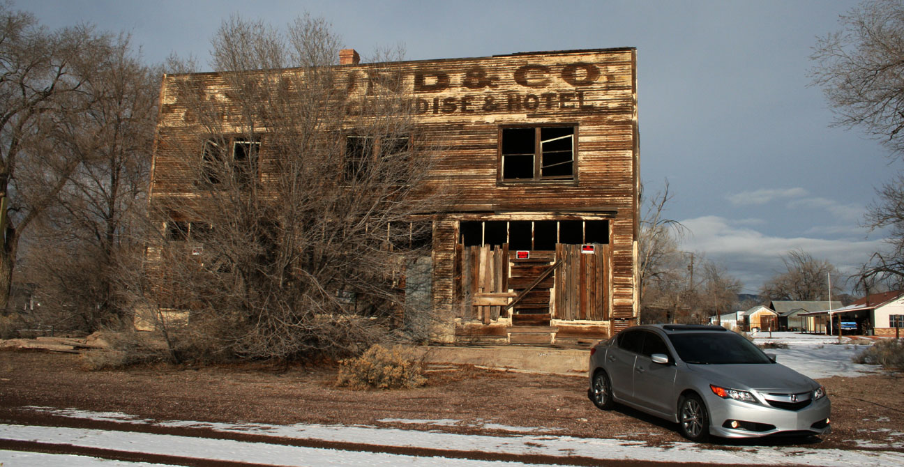
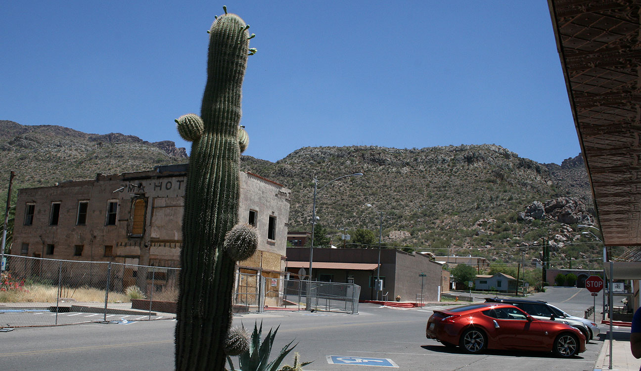
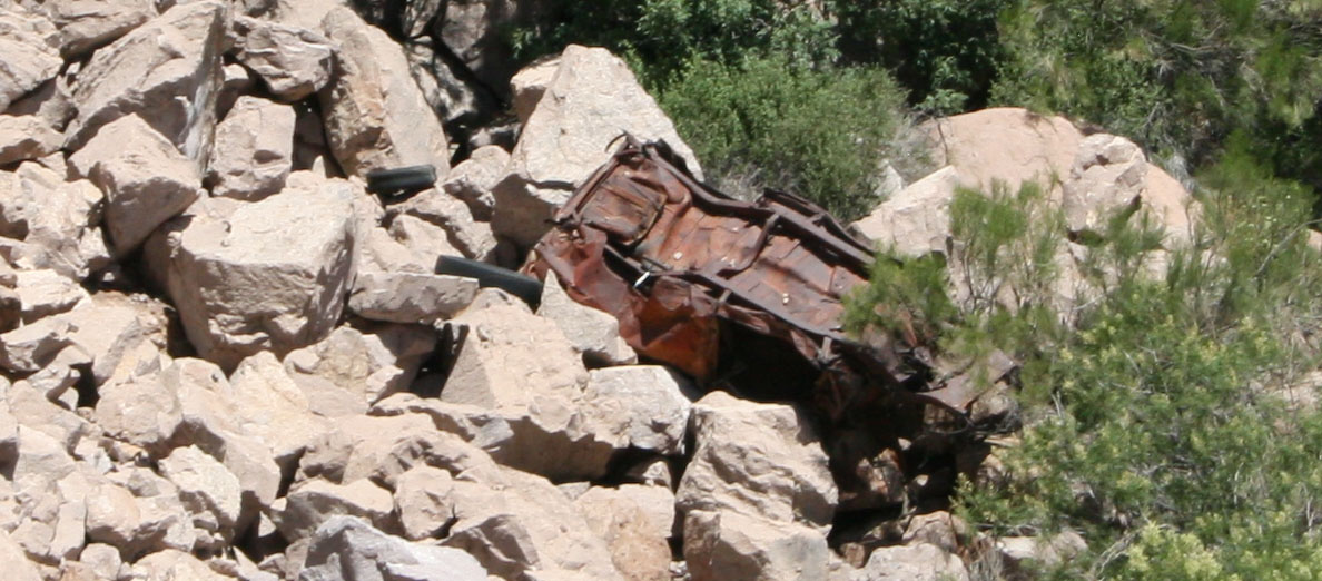
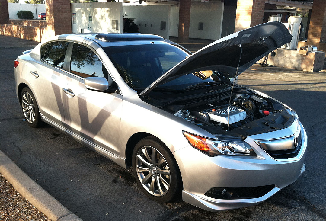
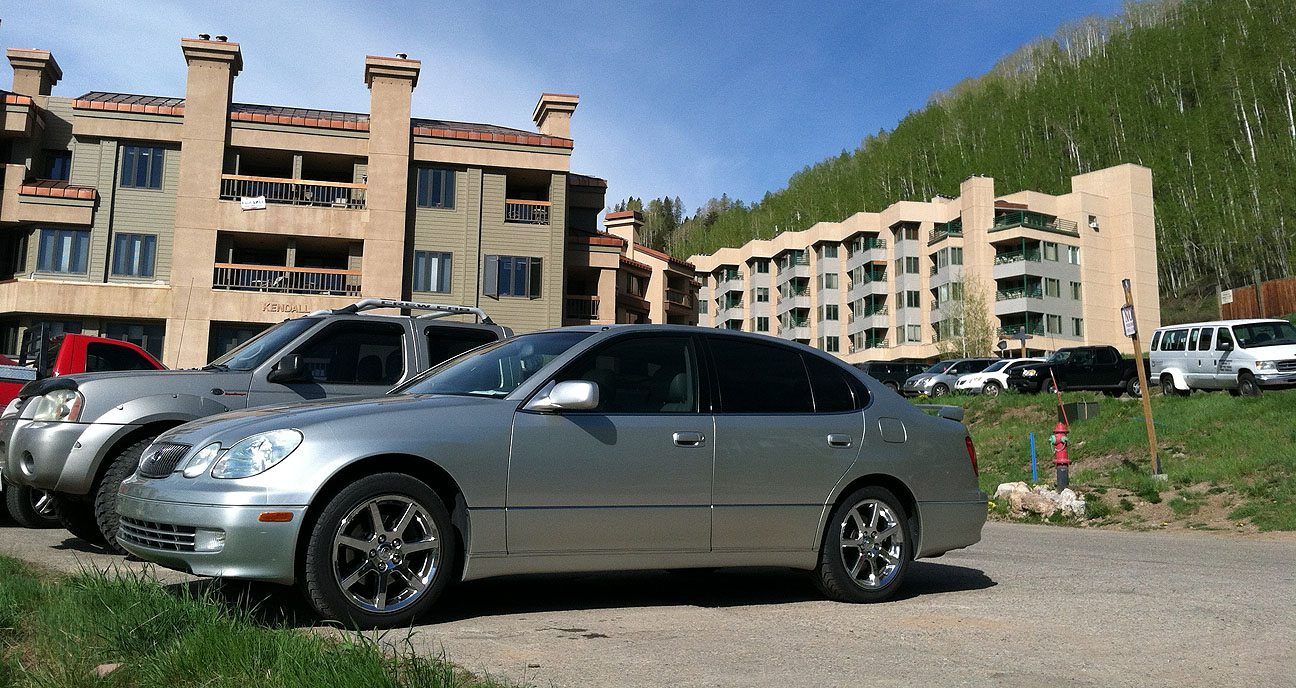
Determined to still climb the mountain that day, we delayed our plans and entertained ourselves in the meantime.  Jeremy and I went to see & drive this 1994 Acura Legend LS Coupe 6-Speed that’s currently for sale on Denver craigslist.  A friend asked me to give it a look since he’s a prospective buyer.

legend_craigslist_ad

legend_ls_coupe_in_denver

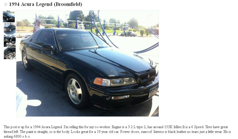
This car looks nice from a distance, but it’s a full repaint (and a poor one, at that) and it needs some mechanical help, too.  At 151,000 miles, it did drive fairly nice, but I didn’t feel the car was worth the $6,800 asking price.

legend_6speed_interior

Back up the mountain we go!

tyson_driving_acura_ilx

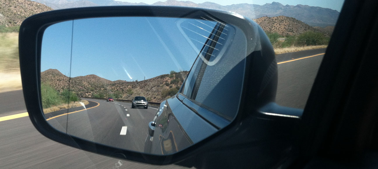
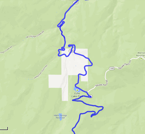
Jason and Jouhl followed us as we snaked our way on Squaw Pass Road toward the base of the Mount Evans.

jason_following

We weren’t discouraged when we had to cruise through a dusty construction zone.  We were determined.

dirt_road_squaw_peak_colorado

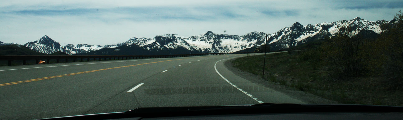
Even before we got to the official “Mount Evans Highway,” we were already beginning our ascent.  On a clear day, the views stretch a great distance.

squaw_peak_road_view_colorado

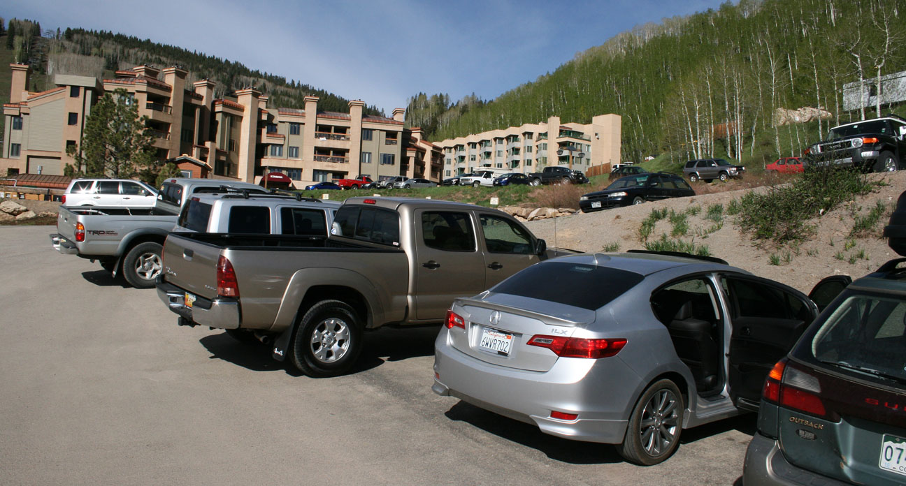
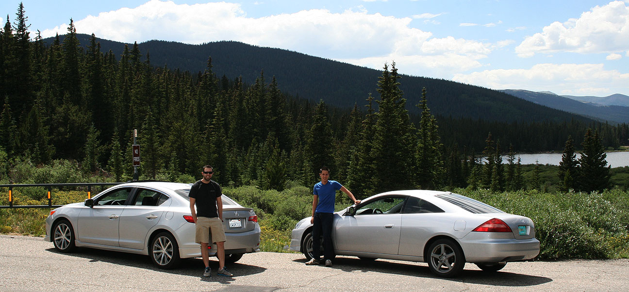
Echo Lake, at 10,600 feet, lies in the background in the below picture and marks the start of the 14-mile road that leads to the summit of Mount Evans.  The Accord and the ILX had driven a combined 1,800 miles to get to this point.  Even without a car wash, our silver paint jobs hid the bugs and dirt well.

tyson_jason_echo_lake

Jason, Jouhl, and myself at a wooden sign in front of the Echo Lake Lodge which doubles as a gift shop.

jason_jouhl_tyson_mount_evans

The ILX, rooftop GoPro video camera equipped, was ready to scamper up the mountain.

evans_sign_acura_ilx

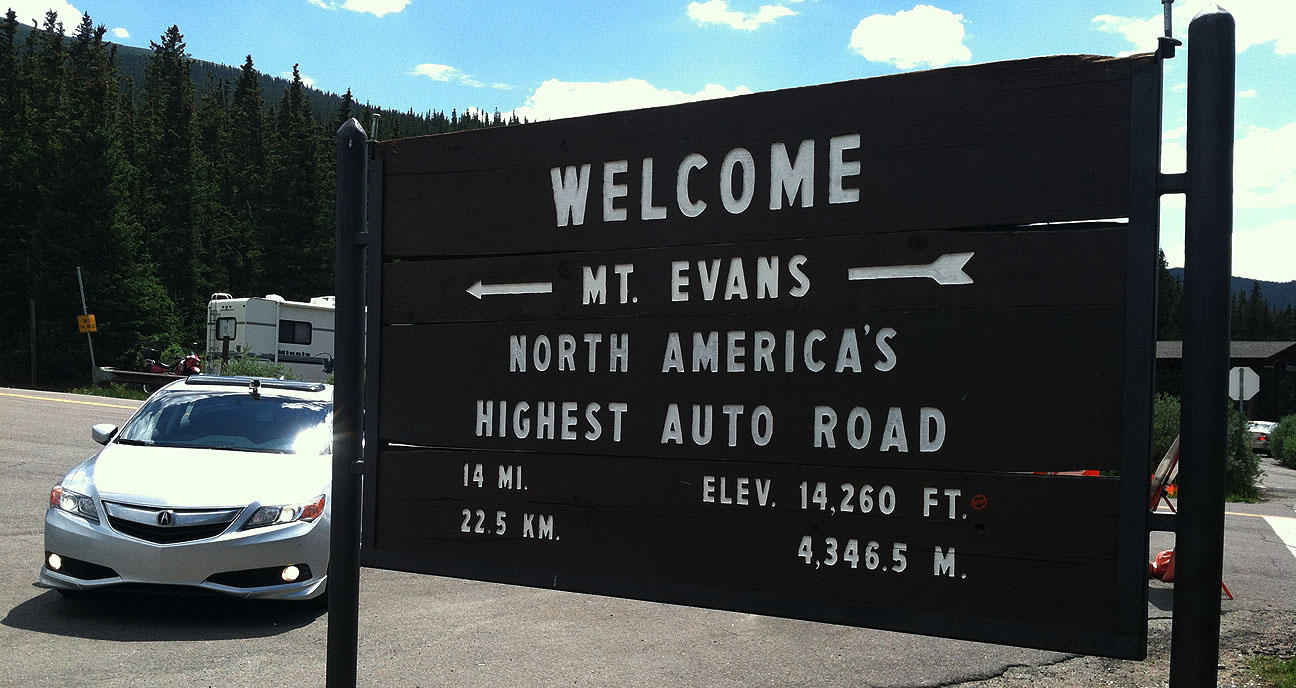
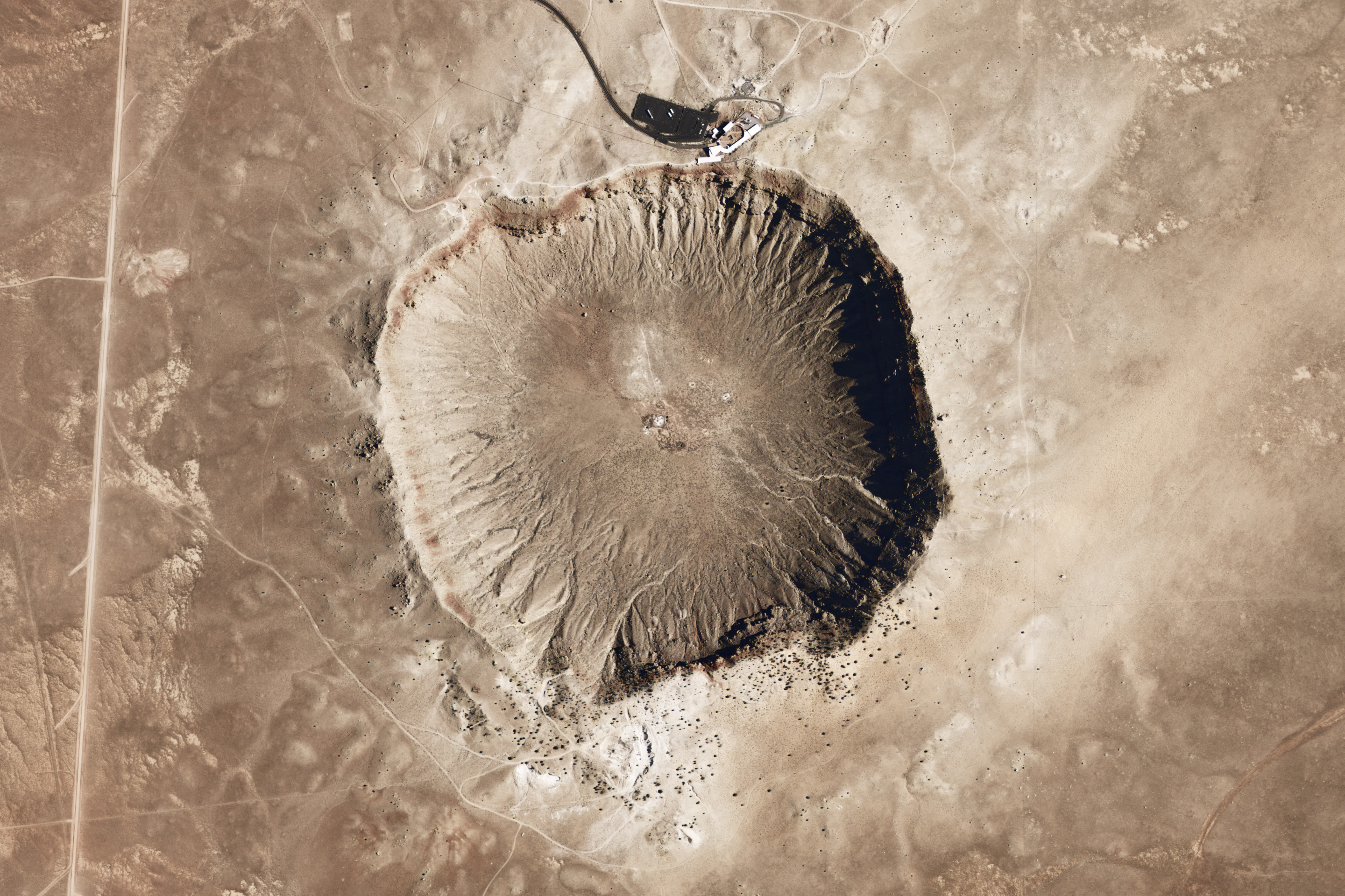
A tollbooth at the base of Mount Evans road collected $10 per vehicle, then we were on our way to climb our first “Fourteener.”  Denver people call a “fourteener” any of the area mountain peaks (which are several) which exceed 14,000 feet in elevation.

above_treeline

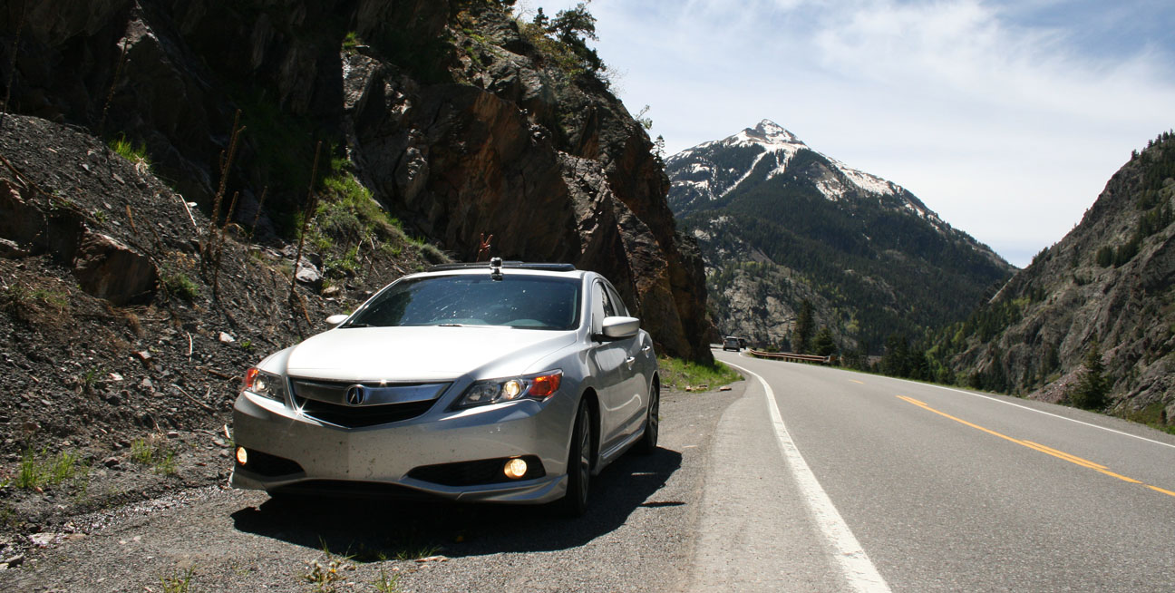
Quick pullout for a photo-op against a beautiful sky.

accord_jeremy_ilx_evans_rd

It’s impossible to convey the beauty of the panoramic views that surrounded us on 360 degrees.

evans_view_with_ilx

Let’s roll!  Windows were down because it was a pleasant 60 degrees or so.

accord_ilx_mount_evans_rd

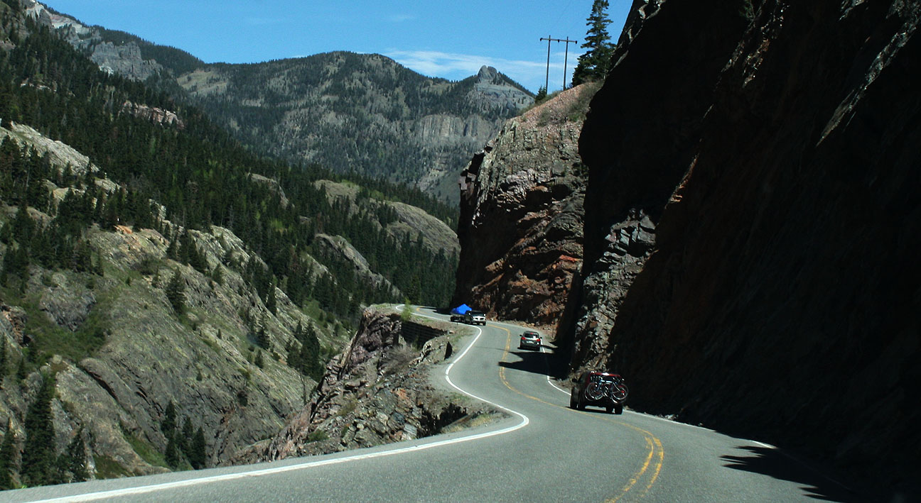
You can see here where the highway has been sliced into the mountainside.  In this particular area, notice that there are no trees.  That’s because the tree line in Colorado is 12,000 feet and we’d already gone above that.

mirror_shot_evans_rd

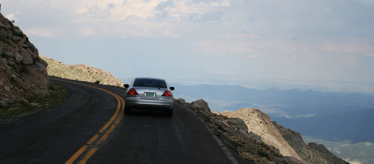
Z Z Z.  The ILX 6-speed makes for an amazing machine to aggressively tackle switchbacks like this, but I was a little less inclined to push my limits on this road given its danger.  No guard rails here!

evans_switchbacks

It seriously felt like we were endlessly climbing.  13,000 feet.  14,000 feet.

ilx_on_mount_evans_road

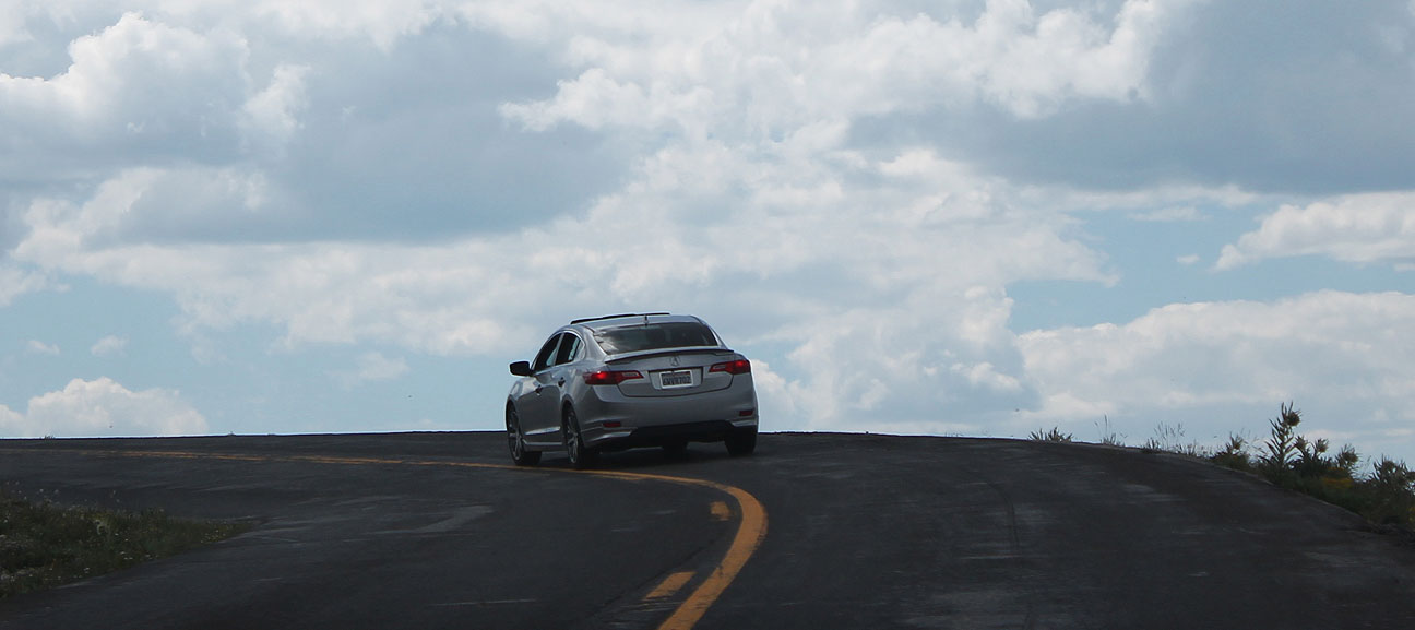
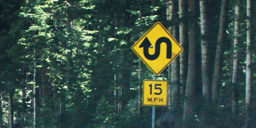
I don’t recall seeing a posted speed limit at all.  “Reasonable” is anywhere from 15-25 miles per hour on most of these blind corners and tight stretches.

ilx_back_mt_evans

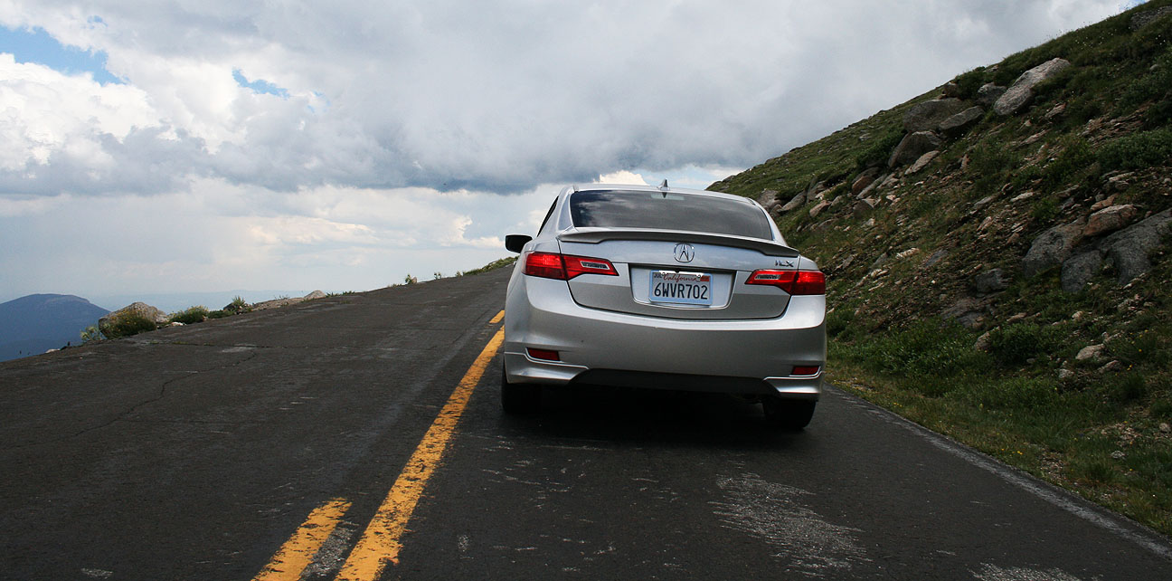
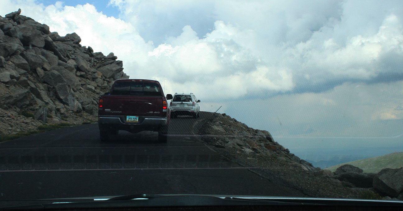
As we got even higher in elevation, the road continued to get skinnier and it no longer had pavement markings.  It required care to make way for vehicles coming the opposite direction.

evans_rd_1

Finally, we rounded the last corner and arrived at the lookout/observatory on top of the mountain.  The parking lot was pretty full but we found a place to parallel park the ILX.

acura_ilx_at_mount_evans

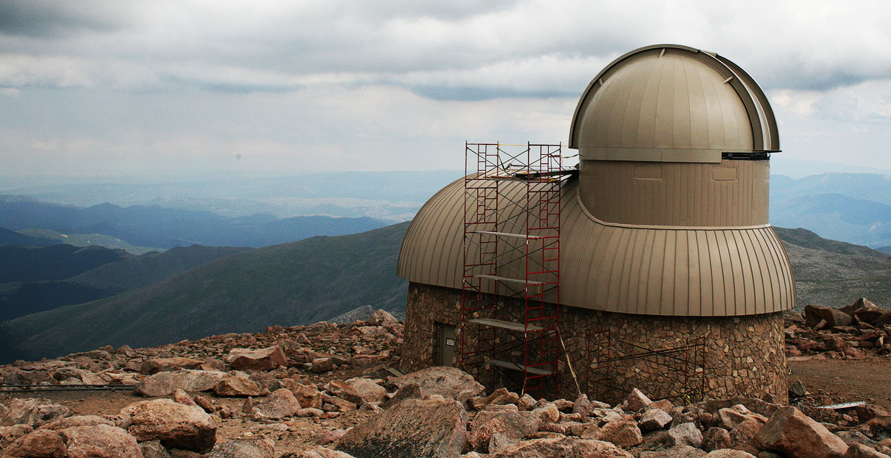
At one time there was a stone-built restaurant and gift shop located here, but after a propane explosion & fire in 1979, it was never rebuilt.  Instead, some of the original walls have been reinforced and the structure serves as an observation point.

tyson_at_mount_evans

Here’s an observatory visible from the visitor area.

mount_evans_observatory

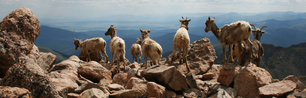
Evans is home to around 100 mountain goats.  They were extremely approachable and didn’t appear to have any fear or apprehension toward the many people visiting their home turf.

mount_evans_wildlife

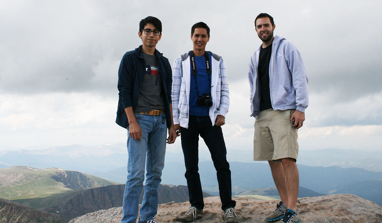
Photo credit for these great pictures goes to Jeremy who was borrowing my Canon at the time.

mountain_goats_mount_evans

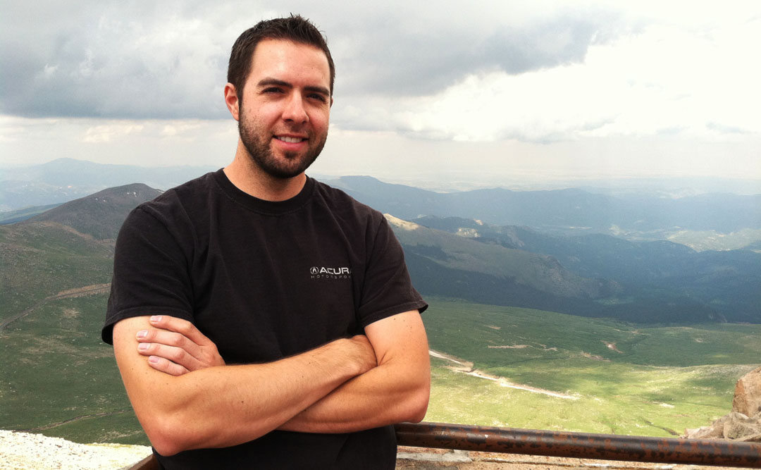
By this time I had put on my hooded sweatshirt.  I never thought I’d need a hoodie in late July!  In front of me was one of several elevation markers mounted in the rocks.

tyson_atop_mount_evans

This one said 14,258 feet.

marker_mount_evans

In the distance we could see Summit Lake below us.

summit_lake_mount_evans

Jouhl, Jason, Tyson.  Enjoying that crisp 14,000 foot air!  I did get slightly light-headed.

jouhl_jason_tyson_mount_evans

This guy didn’t, though.  Jeremy was off exploring.

jeremy_at_mount_evans

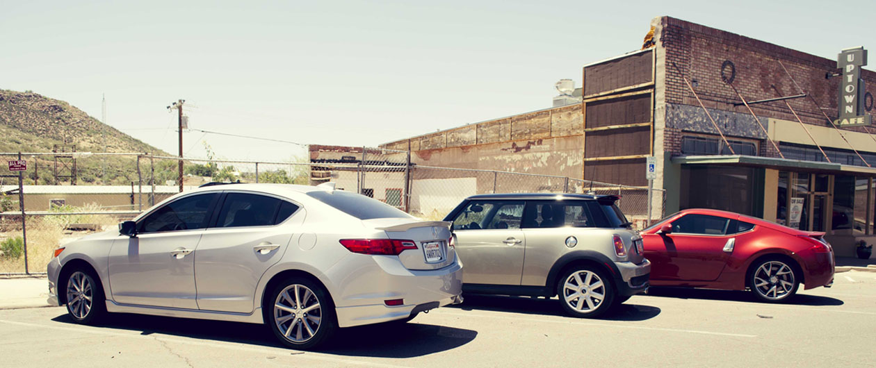
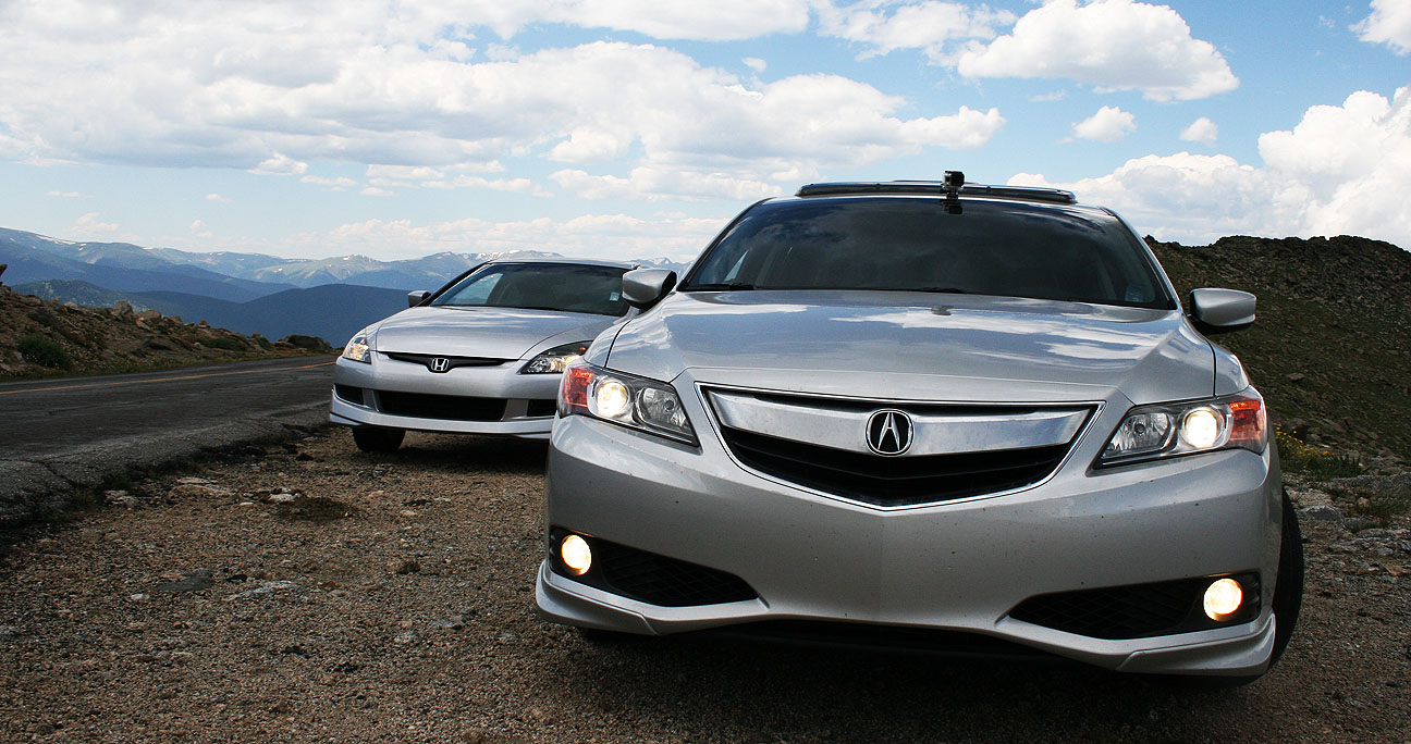
Preparing for departure, the silver Hondas line up for a beauty shot.

ilx_accord_mount_evans

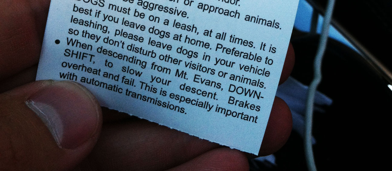
There’s a word of warning on the back of the tollway ticket instructing people to down-shift to avoid overheating their brakes on the way down the mountain.  This is where having a stick shift is truly an advantage.

evans_receipt_warning

Jason led the way.  He expertly handled the grades using his 6-speed transmission to his advantage, because he rarely had to hit the brakes.

jason_leaving_mount_evans

More fun awaited us as we made our way to Idaho Springs, Colorado after reaching the base of Mount Evans Road.

mount_evans_rd

Eastbound Interstate 70 has some steep down-grades as it heads into the Denver area.  Apparently this freeway has a history with being dangerous for truckers because there are signs like the below saying, “Don’t Be Fooled!”

truckers_fooled_i70_colorado

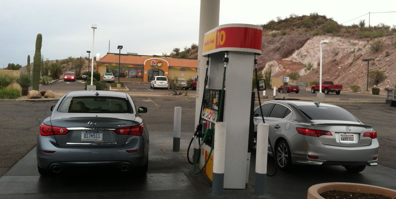
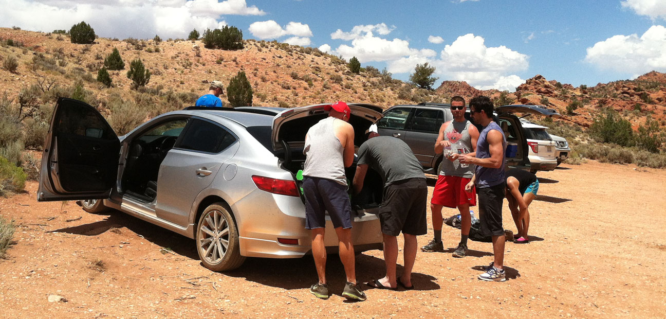
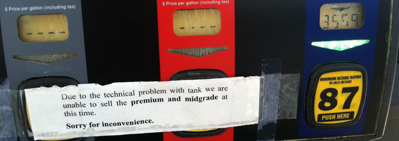
We made it back to civilization and treated ourselves – and our cars – to some fuel.  Interestingly enough, There’s 85 octane available in Colorado Springs.  I think the lowest we see in Arizona is 87.

gas_grades_colorado_springs

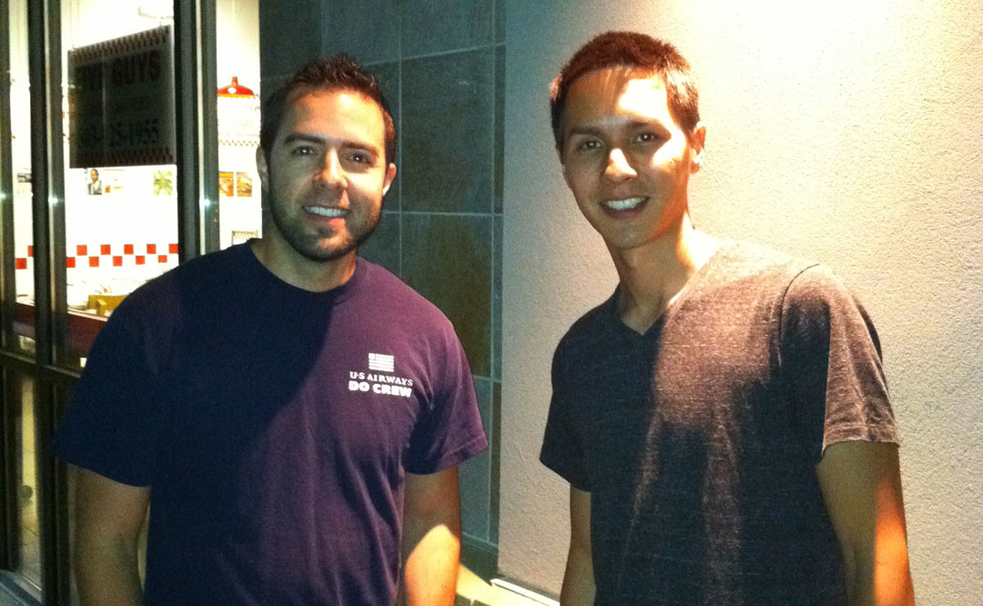
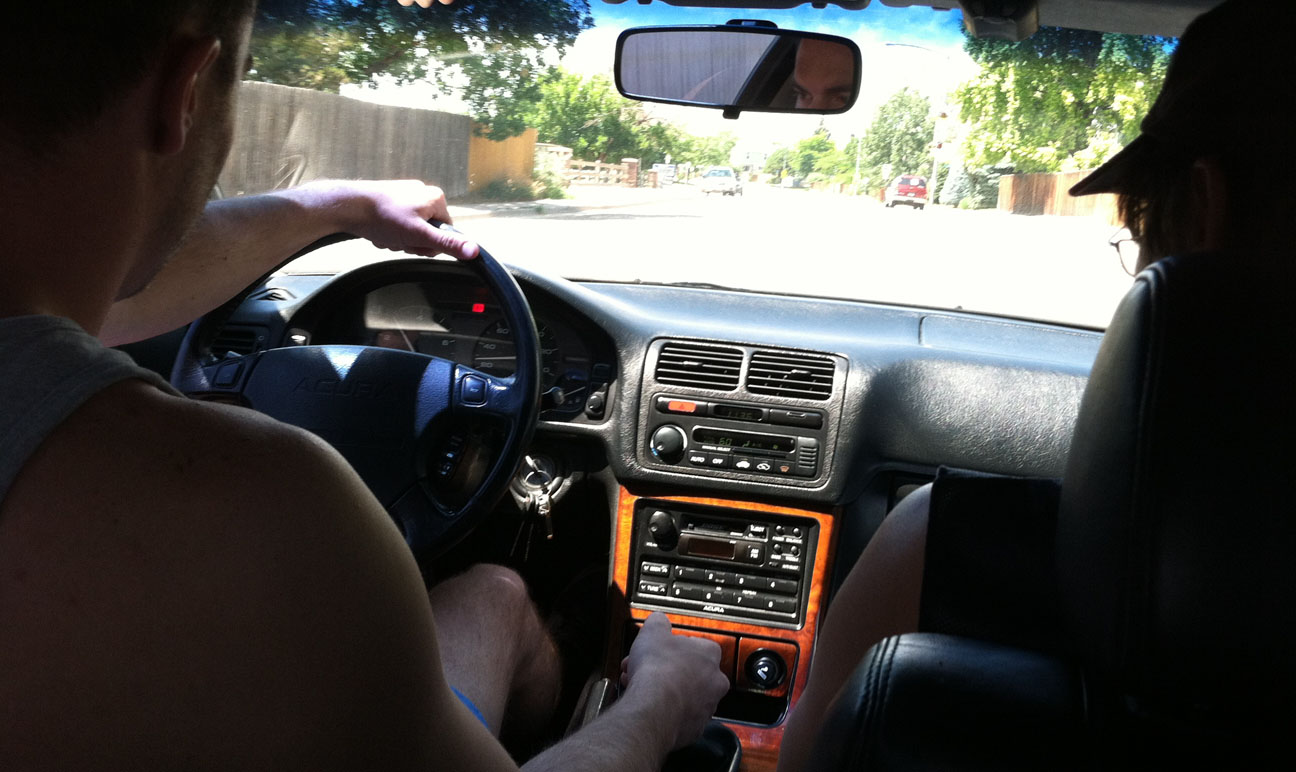
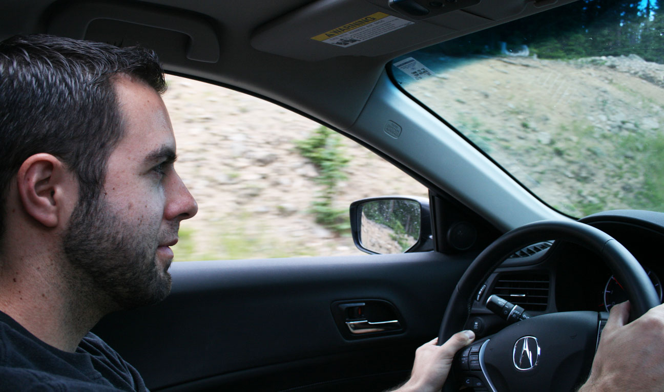
Jason took the wheel in the ILX when we went to dinner.  This photo is not one of my finer ones.

jason_jouhl_ilx_blurry

It was a great end to an adventurous day.  I was glad to spend time with friends doing something that I love!

Tune in tomorrow for the final stretch of the Colorado trip.

ILX Colorado Trip Day 1: Scottsdale to Denver

Posted in Colorado, ILX, Road Trip on July 22, 2013 by tysonhugie

Odometer (ILX):  47,142

47142

Total Trip Distance:  1,941 Miles

Daily Distance:  903 Miles

scottsdale_to_denver

Hold your breath.  I’m about to take you on a high-adventure ride to some elevations where oxygen is in short supply.  Last Friday, I took flight in my 2013 Acura ILX to head for the mile-high city of Denver, Colorado.  My goal was to push my car to extreme elevations and to experience the inspiring scenery of the Rockies.

I’ll share this trip write-up in a 3-part series.

acura_ilx_meteor_crater

Just 3 hours northeast of the Phoenix area lies a meteor crater that was formed an estimated 50,000 years ago.  If it weren’t for the multiple signs along Interstate 40 trying to lure drivers in, I probably wouldn’t have even known it existed.  I couldn’t resist the temptation to have a look at what the billboards stated was the “best preserved impact site on earth.”  A $16 entry fee later, I was standing at the rim of a 4,000-foot-wide hole in the ground.

tyson_at_meteor_crater

And here’s what that looks like from overhead (thanks Wikipedia):

Meteor_Crater_-_Arizona_overhead

Mining engineer and businessman Daniel Barringer spent decades in the early 1900’s trying to find the meteor that created this gigantic impact site, to no avail.  It was originally thought that the meteorite would be buried directly beneath the center of the crater.  Drilling projects were unsuccessful.  It is currently believed that the meteor vaporized upon impact.  Only small fragments remain.  As the sign at the entrance to the site indicates, the meteor was traveling an estimated 26,000 miles per hour.

acura_ilx_meteor_speed_limit

My next pit stop satisfied an intense craving for a Taco Bell crunch wrap supreme at 10:30 in the morning in Holbrook, Arizona (breakfast of champions!).  I had an interesting conversation with a guy named David in a blue Subaru WRX as I was fueling up.  “Is that the new Acura?” he asked.  I told him that yes, this was a new model.  “That looks really sharp!” he said.  After telling him a little more about my story with the car, “I’m sure glad you got the 6-speed.”  I am too.

While in Holbrook, I drove through town on what was formerly part of Route 66.  There are a number of establishments that carry on the Route 66 style.  I especially enjoyed “Empty Pockets” Saloon.

empty_pockets_saloon

Sahara Inn.  I thought for sure this place was long-since closed, but a look on Trip Advisor reveals that it’s still in business.  It’s rated #15 out of 18 hotels in Holbrook, though.  Be advised!

sahara_inn_holbrook_az

Holbrook is only about 70 miles from the New Mexico state line, and that was my next destination.  The Zuni Indian Reservation straddles the border and there are tourist traps advertising $7.99 “authentic Indian” blankets and $10 phone cards all over the place.  Does anyone still use phone cards?  The scenery can’t be beat, though.

i40_at_az_nm_border

I’ve stopped here a number of times already, but it just seems appropriate to commemorate my entrance to the “Land of Enchantment” every time I pass this sign on Interstate 40.

acura_ilx_new_mexico_state_line

Gallup, New Mexico shares that same Route 66 DNA with Holbrook, so again we see some run-down relics of what may have at one time been really nice motels.  Desert Skies has a rate of $25/night.  Bargain basement rates.

desert_skies_motel_holbrook

I didn’t linger long enough to learn what kind of things “Zuni Fetishes Direct” sells.

zuni_gallup

But just ahead, I pulled the ILX into the historic 1937 El Rancho Hotel.  El Rancho’s claim to fame is that over the years, it has hosted such famous guests as John Wayne, Ronald Reagan, and Katherine Hepburn.

el_rancho_sign

Though the Interstate 40 bypass of Route 66 cost El Rancho some business, a renovation effort has again made it an attractive place to stay.  A vintage postcard shows the hotel in its original glory.

el_rancho_historic_postcard

“The Charm of Yesterday; The Convenience of Tomorrow” is still the motto today.  Surprisingly little has changed from an appearance perspective in El Rancho’s 76 years of existence.

acura_ilx_el_rancho_hotel_gallup_new_mexico

Eastward Ho to Albuquerque we go, then north on Interstate 25 toward Santa Fe.  ABQ marked the halfway point for this drive.  I took the opportunity to stretch my legs, fuel up the ILX with some premium fuel, and take a bathroom break at the Flying J service station.

i25_northbound

The high desert pines of Santa Fe give way to some open grassland in northern New Mexico.  I breezed through Las Vegas without even deactivating my cruise control in 6th gear.  Unlike the Las Vegas in Nevada, this one doesn’t offer much to see.  Well, except for 27 “modern” gas stations and 34 restaurants, per the blue sign at the south entrance to town.  I’ve always been intrigued with how New Mexico provides these types of stats for each town.

las_vegas_nm_amenities

  • Cotton Eye Joe – Rednex
  • Tubthumping – Chumbawamba

Anyone remember such classics?  I listened to volumes 1 through 4 of JOCK JAMS to get me through northern New Mexico.  I’ve had these CDs for 15 years, but they still get the blood pumping every time.

jock_jams_cd

As I neared the NM / CO state line, storm clouds descended but I saw that Denver finally was a mere 250 miles away.

ilx_denver_distance_sign

Thanks to the random travelers who took my picture with the Colorado entrance sign.

tyson_at_colorado_entrance

I was driving the wrong car for this particular picture, but I still felt it worth a stop.

acura_ilx_highway_of_legends

Sunset on I-25 as I roll through Castle Rock, Colorado northbound.

colorado_sunset

And finally, reunited with my friend Jason as we’re about to embark on our 4th road trip together.  Jason and I have met up a number of times in the past, for trips to Bisbee, White Sands, and Sedona.  He made the trip from Las Cruces, New Mexico in his 2004 Honda Accord EX coupe 6-speed.

tyson_jason_at_five_guys

The next day was when we REALLY started having fun.  More on that soon!

By the way, did anyone else see the 401,000 mile 1988 Acura Legend sedan that ran on Ebay last week?  Not too shabby!

401k_sedan

Acura ILX Trip: Why, Arizona

Posted in Arizona, ILX, Road Trip on July 14, 2013 by tysonhugie

Odometer (Legend):  522,599

522599

Odometer (ILX):  44,920

44920

Trip Distance:  370 Miles

why_map

An instant message conversation with a colleague at work went something like this on Friday.

IM_with_ed

Apparently my coworkers know me too well.  I can’t sit still for long.

It’s times like these during the peak of Phoenix summer heat when the 4 million of us who live in the Phoenix metropolitan area ask ourselves, “Why?”  Why do we live in this oven of a city?  The answer shows up in the fall when Mother Nature unplugs the heater and we bask in perfect winter weather from October through May.

The word “Why” took on a whole new meaning this weekend.  “Why” is a place in southern Arizona.  It’s a place so small and insignificant that even my Garmin Nuvi GPS unit didn’t know what it was.

why_on_gps

You’re telling me there’s no other town named Why for at least 2,800 miles from here?  This place must be special.  I was determined to see what this little speck on the map had to offer.  As it turns out, the drive was most rewarding.  On a cool summer morning (that’s 96 degrees at 8:16 in the morning for us Phoenicians), I set out westbound on Interstate 10 in my 2013 Acura ILX 6-speed.

departure

At Arizona Highway 85, I headed south for 35 miles to Gila Bend.

buckeye_distance_sign

This blog entry brought to you in part by Fertizona:  Arizona’s largest agricultural fertilizer and crop protection retailer.  (Not really, but I thought the name was clever).

fertizona

Gila Bend:  Home of 1700 friendly people and 5 old crabs.  The 5 crabs’ names, by the way, are written out on the smaller sign below.  Seriously!

gila_bend_entrance_sign_acura_ilx

After passing through town, which didn’t take longer than a minute or two, I headed even deeper south.  Next stop:  Mexico.

mexico_sign

Without a passport, I wasn’t going to get too far, but there were plenty of shops willing to sell me a Mexican insurance policy.  Here’s one such example where they actually sell Mexican insurance at a DRIVE-THRU.  Can I get a chimichanga with that policy?

mexican_insurance_drive_thru

Just a bit down the road in Ajo, Arizona (Ajo is Spanish for “garlic”), I found the ultimate one-stop shop.  Cactus, jelly, copper, onyx, jewelry, T-shirts, blankets, pottery, rugs, and… swords?!  Good to know!

southwestern_souvenirs_acura_ilx

Ahh, here we go.  Getting closer – the sign told me I was just 10 miles from Why.  Rocky Point, at 103 miles from this sign, resides in Mexico.  It’s a popular summertime destination for Arizonans seeking beach-time.  It is, in fact, the closest beach to Arizona.  Remember that country song, “Oceanfront Property In Arizona”?  Well, that ocean’s in another country.

why_distance_sign

We now learn why Why is called Why.  The map below from my GPS illustrates it best.  When the unincorporated town was formed, it lied at the intersection of Highways 85 and 86.  They roads came together at a “Y.”  Since the law at the time required a town’s name to be at least 3 letters long, it was spelled out W-H-Y.  Safety concerns later on prompted the creation of a traditional “T” style intersection instead of the original Y.

gps_in_why_arizona

At last.  I made it.  Surprisingly, there’s enough customer traffic for a few businesses to stay afloat out there.

why_entrance_sign_acura_ilx

Here’s that piece of road that’s now curved where it used to go straight down.

entering_why_arizona

No trip to Why would be complete without a stop at the Why Not Travel Store.

why_not_travel_store_acura_ilx

Because you can get Free Why-Fi.  Love it.

why_fi

I made a bathroom break out back and continued on my way.  I’d seen all that Why had to offer.

why_rest_room

At only about 25 miles from the Mexican border, it was ironic that Madonna’s “Borderline” chose to play from my iPod on the ILX’s 7-speaker Premium Audio System at this time.  I rocked it out with plenty of volume.

borderline_song

Eastbound on Highway 86, I had the road to myself.  Except when I passed this guy.  He didn’t even flinch when I laid on the horn.

horse_in_the_raod

The next place of any significance on my drive was Sells, Arizona.  Sells was pretty quiet except for the marketplace.  It’s on Indian land and is the capital of the “Tohono O’odham” Nation.  A service station by the name of Sells Gas sits on the main drag through town.  I bet they… sell gas.

sells_gas_sign

Over the course of my 6 or so hours behind the wheel today, I encountered dozens of border patrol vehicles.  The Ajo-Why-Sells-Tucson area is a hotbed of immigrant activity.  For this reason, it’s heavily policed.  I was stopped briefly by officers here, just east of Sells on Highway 86.

border_checkpoint

For a brief moment while I neared Tucson, I thought I’d driven my ILX into Dr. Seuss’ Whoville.  Wasn’t there a Who named Cindy Lou Who?  Apparently Cindy Lou Who opened up a restaurant out here called Cindy Lou’s Cafe.  Tacos are only $1.25!

cindy_lous

Now we’re cookin’.

tyson_random

Last stop on the journey was a meet-up with my friends Nick & Kurt in Tucson for a bite of Mexican grub.

tyson_nick_in_tucson

Hope you enjoyed the trip to Why!  Now, if I could only find out if there are towns named Who, What, and Where.

In high-mileage news:  My friend Jason linked me to a website about a 2005 Honda Accord Coupe EX V6 that’s gone the distance.  Here’s the thread on the 7th Generation section of the DriveAccord.net forums.

500k_accord_odo

The odometer reads just over 506,000 miles.  The car was owned since new by a territory salesman in Minnesota and every service record is accounted for.  The timing belt was changed every 100,000 miles.  Reportedly, the only items which have failed are the starter, the power steering, and the battery.

500k_accord

The new owner paid $6,000 for the car.  He plans on modifying it with visual & suspension upgrades.  I’d leave it alone!

Over and out.

Independence Day Trip to Utah

Posted in ILX, Road Trip, Utah on July 8, 2013 by tysonhugie

Odometer (Legend):  522,581

522581

Odometer (ILX):  44,274

44274

Trip Distance:  1,727 Miles

independence_day_trip

Happy Independence Day!  Lured by cooler temperatures up north, I saddled up in the Acura ILX last Wednesday and set out on a long-distance journey to the motherland of Utah.  Highway 93 northbound from Phoenix was surprisingly quiet for a holiday.

acura_ilx_instrument_panel

I wasn’t alone, though.  Along for the drive was my friend Matt who works for Nissan / Infiniti at the company’s proving ground just south of Phoenix.  Matt brought a pre-production model 2014 Q50 Sport Hybrid.  The Q50 goes on sale August 5th, but Matt was given special access to this test car for evaluation purposes.

q50_ilx_fueling

The numbers grew yet again when another friend, Jeremy, hopped in the caravan in St. George, Utah the following morning.

q50_is

At that point, we had 3 Japanese luxury brands represented.

IMG_6012

Jeremy, Matt, and I showed our patriotism on July 4th with colors that were as close to Red, White, and Blue as we could muster:

  • 2006 Lexus IS350 in Matador Red Metallic
  • 2013 Acura ILX 2.4 in Silver Moon Metallic
  • 2014 Infiniti Q50-S Hybrid in Hagane Blue Metallic

three_cars_2

These cars, while each one distinct in its approach, all compete against one another in a sport luxury sedan category.  For 200 miles from St. George, Utah to Nephi, Utah, we paced each other on Interstate 15.  Jeremy’s Lexus is powered by a 306-horsepower, 3.5 liter V6 gasoline engine.  It puts power to the wheels via a 6-speed automatic transmission.  Paddle shifters on the steering wheel offer the driver control over which gear is selected.

infiniti_acura_lexus

The Infiniti is the most powerful of the 3 vehicles.  The Q50’s powertrain is referred to as a “Performance Hybrid” system.  Power is delivered to the rear wheels via a 3.5 liter gasoline engine coupled with an electric motor.  Together, those two systems work either in unison or independently to maximize efficiency and power.  Net horsepower is 354 — over 150 more horses than I had at my command while piloting the ILX.

q50

To be fair, the ILX was the only 4-cylinder vehicle in our escapade, and it beats out the other two from a pricing perspective by quite a bit.

  • The Q50 starting price is $36,700 and equipped as a Hybrid with Sport package, comes in closer to $50k
  • Jeremy’s IS350 priced out at $35,440 when it was new
  • The ILX starts out at below $27,000.  My 2.4 liter 6-Speed Premium is $29,200 according to Acura.com.

Specs aside, no doubt we had our fun cruising in tandem along I-15.

tyson_jeremy

Soon, we approached Utah Valley and the unmistakable Rocky Mountain peaks referred to as the start of the Wasatch Front.  These mountains are notorious for Utah’s “greatest snow on earth” during ski season.

utah_county_peaks

My friend Branson borrowed the ILX and he visited some noteworthy landmarks in northern Utah that I thought I’d share:

The “Metaphor” statue along Interstate 80 in deserted western Utah has long perplexed motorists who drive past it.  Created in 1986 by Swedish artist Karl Momen, it stands 87 feet tall and is made of concrete.  It’s also sometimes referred to as the “Tree of Life.”  We simply don’t know much else about its meaning, but if it’s offbeat, you know it gets me excited.

acura_ilx_metaphor

Just 25 miles further west, nearing the Nevada state line, lie the expansive Bonneville Salt Flats.  The flats cover 44,000 acres of public land and are the remnant of an ancient Lake Bonneville which has since evaporated, depositing salt in the area.  Due to the salt flats’ incredibly flat surface, they became a popular place to race vehicles & motorcycles.

acura_ilx_salt_flats

The first carriage race was held here in 1911.  According to the information sign on-site, by the 1960’s, jet and rocket powered cars had broken the 600 mph barrier.  The Bonneville Speedway itself is 10 miles long and is home every year to various racing events such as “Speed Week.”

acura_ilx_salt_flats_2

When Branson visited the flats on Sunday morning, they were under water.  During rainy seasons, the area is flooded.

acura_ilx_bonneville_salt_flats

The salt flats are a beautiful place to admire the vast nothingness that exists in remote western Utah.  Unfortunately, due to salt being harvested from the flats, they’re shrinking in size.

acura_ilx_bonneville_salt_flats_2

Here is a link to some pictures from when I took my Legend there in June 2007.  Eighty miles north of Salt Lake lies my birthplace – Logan, Utah.  It was refreshing to experience temperatures like these, having come from the Arizona fireplace.

IMG_6064

I met up with some Honda-fanatic friends.  Ryan is the proud owner of a black Honda S2000.  He took my mom for a drive and she was all grins.

tia_ryan_s2000

I joined Matt, Ryan, and Tyler for a drive up the Logan Canyon Scenic Byway, US Highway 89.

tyson_matt_ryan_tyle

Tyler’s 1990 Prelude Si 4WS 5-speed is in amazing shape and I’ve blogged about it before.

tyler_prelude

One of the stops while going up the canyon was “Ricks Spring.”  Once thought to be producing water from a deep aquifer, a series of dye tests later revealed that this water outflow from a cave in Logan Canyon actually comes from the Logan River.  The water is extremely clear and chilly.

tyson_at_rick_springs

On Saturday, I attended the Cache Valley Cruise-In car show, a 4th of July tradition for my family.  My brother Bentley’s 1968 Chevy II Nova Super Sport looked phenomenal.  The car is sitting on a fully adjustable coilover suspension and American Racing wheels.  Bentley recently had the brakes upgraded to Wilwood components with cross-drilled and slotted rotors.

nova_ss_car_show

This is one mean machine.  It’s powered by a small block 350 cubic inch motor which has been bored to 388 cubic inches.  The registration form for car show entry asked for owners to fill in horsepower ratings.  Bentley wrote in: “Enough.”

nova_ss_back

The Nova has a 5-speed manual transmission and factory A/C.  I still haven’t driven this thing!

68_nova_interior

Baby Beckam enjoyed the show as much as the rest of us did.

beckam3

While I haven’t driven the Nova, I did have a special driving experience while in Logan.  My step-dad Todd owns a 1951 Plymouth Cranbrook sedan.  This baby blue 4-door has a 6 cylinder under the hood.

plymouth_dash

More importantly for me, it’s equipped with a 3-speed manual, column-shifted transmission.  This was the first time I had the opportunity to drive a “3 on the tree”!  It was quite intuitive once I got the hang of it.  The biggest challenge was remembering that the clutch engagement point was really high, and the brake engagement point was really low.  Fancy footwork is required!

tyson_riding_in_plymouth

Just when I mastered the art of 3-speed shifting, the car’s gas pedal stuck to the floor and we had to shut the car off and coast into a service station.  Oops!  Thankfully, we got the Plymouth back up and running the following morning.

tyson_with_plymouth

A phenomenal Cache Valley sunset closed out Saturday night.

logan_sunset

On Sunday morning, we were off for more sightseeing.  Golden Spike National Historic Site is a very important landmark among railroad enthusiasts.  It’s located 32 miles west of Interstate 15, near Brigham City, Utah.

tyson_at_golden_spike_sign

Golden Spike is the famous location where, on May 10, 1969, the Union Pacific and Central Pacific railroads came together, completing the very first coast-to-coast, transcontinental railroad.  Golden Spike gets its name from the fact that a spike made of 17.6 carat gold was the last spike to be driven. The actual golden spike is on display in Palo Alto, California.  It was donated to Stanford University in 1892 by its owner, David Hewes.

tyson_at_golden_spike

There’s some fascinating information about the golden spike here.  When the individual teams of railroad workers started getting closer to one another in 1869, they worked feverishly to reach a meeting point.  The Central Pacific team was so productive that they they laid a record-setting 10 miles of track in a single day.

ten_miles_of_track_sign

Today, reproduction locomotives are on display at the site.  There are daily 1:00 p.m. demonstrations.

golden_spike

Matt and I set out on our return trip to Arizona and we were met with some adverse weather near Cedar City, Utah.  The Q50 and the ILX were surefooted enough to get us to St. George safely for the evening.

rainy_q50

By Monday morning when we completed the final stretch, the sun had peeked out yet again.  I took a couple of “retro” pictures in Fredonia, Arizona at an abandoned service station.  I wish I could have the opportunity to see inside this one.

acura_ilx_fredonia_2

I doubt this service station ever stocked the 0W20 oil that would be appropriate for my Acura ILX.

acura_ilx_fredonia_service_station

Hey, check out that gas mileage!  In the 399.2 miles driven since my last fuel-up in Hurricane, Utah, my ILX has averaged 35.8 miles per gallon.  I bet my friends in the Lexus and Infiniti are jealous now.

35mpg

Thanks for joining for the trip!

I really like this tribute to Honda engineering that was released a few days ago.  Enjoy!

ILX Sunday Drive on the Apache Trail in Arizona

Posted in Arizona, ILX, Road Trip on June 23, 2013 by tysonhugie

Odometer (Legend):  522,443

522443

Odometer (ILX):  42,221

42221

Trip Distance:  179 Miles

apache_route

Time for a little 4×4 action in my luxury car… again.

In March 2008, I took my Acura Legend where (maybe) no Acura had gone before:  a dirt road that was once the main way to get from Roosevelt, Arizona to Apache Junction, Arizona.  The total drive distance when going this route is 45 miles.  To avoid the dirt road and go around it on paved streets, the distance is significantly longer at 79 miles.  The “Apache Trail,” as it became named, is also known as Arizona Highway 88 and to this day is one of my favorite roads to drive.

ohv-apache-trail-map

Here’s the video for those who’d rather watch than read:

My friend Matt and I decided to do a little Sunday drive and some sightseeing in the Superstition Mountains east of the Phoenix valley, so we set out in two vehicles:  My 2013 Acura ILX, and his work-issued 2013 Nissan Pathfinder.  Highway 88 is lined with rivers and lakes, including Canyon Lake pictured below.

canyon_lake_acura_ilx

For the most part, it’s a fun, twisty two-laner with very few passing lanes.  There are two one-lane bridges to cross.

bridge_az88

We made our way toward Tortilla Flat which was once a common stopping point when the Apache Trail was more heavily traveled.

tortilla_distances

Quick pit stop in Tortilla Flat for a bathroom break.  We parked next to a nice 370Z 6-speed.

pathfinder_370z_ilx

The misspelling about the “dinning” room entrance at the Tortilla Flat restaurant is almost too far fetched to be true.  I think they’ve left it there intentionally to add to the quirkiness of this place.  The walls are absolutely covered with $1 bills.  I would have added my own, but I needed to save my $1 bills for a car wash later in the day.  You’ll see why.

tortilla_flat_dinning_room

Though once home to a motel, Tortilla Flat is now just a place to grab food and supplies.

tortilla_flat_sign

The road continues paved for several miles beyond Tortilla Flat, but then:

pavement_ends

For the next 22 miles, we curved around rocks & rivers as we made our way toward Roosevelt Lake on the graded dirt road.

acura_ilx_on_apache_trail

There were several one-lane bridges to cross.  This one crossed over Fish Creek.

bridge_az88_acura_ilx

The ILX handled the adverse terrain with poise.  I did have to disable the traction control system to get maximum grip – on some of the washboard ruts, the system would disable power to one of the front tires and keep me from maintaining momentum.

fish_creek_bridge_acura_ilx

I got a picture with our two transport vehicles.  The 2013 Nissan Pathfinder was featured back in March on a trip to Bagdad, Arizona.  It’s a Middle Eastern-spec vehicle with speed in kilometers per hour on the gauge cluster.

tyson_with_pathfinder_and_ilx

Saddle up – we’re off again.

ilx_pathfinder_with_matt

Matt and I traded off taking the lead on the drive.  I ate his dust for a good part of it.  I think my ILX will probably be due for an engine air filter change at its next service.  The suspension did a great job of absorbing the uneven road.  There were a few sights to see along the way, including the Apache Lake Marina.

apache_lake_marina_sign

Soon we were just 12 miles from the junction with Highway 188.

roosevelt12

A few more bridges, and we were home free.

az88_bridge

The road descended in elevation until we again met up with the Salt River.  From there, we followed it upstream toward the Roosevelt Dam.

az88_acura_ilx

Some of you may recognize this place from a drive a few weeks ago when I went with several friends to check out the Roosevelt Dam and its impressive accompanying bypass bridge.

dam_entrance_acura_ilx

It was a great trip and one that I’d highly recommend!

I’ve got a few other random news bits before signing off for this weekend’s entry:

1)  In November 2012, I drove the ILX back to Phoenix from southern Utah, and I took a picture at the historic Marble Canyon Lodge on Highway 89A in northern Arizona.  Phoenix news station 3TV ended up using my picture in an article this week after the lodge burned down.  Check out slide 6 of 6 with the ILX parked out front!  Screen capture below.

3tv_article_marble_canyon_lodge_fire

Pretty sad to see the 1920’s lodge end up like this.

061913_marble-canyon-resized

2)  Anybody hear about Irv Gordon’s latest in his 1966 Volvo?  He’s only 30,000 miles away from hitting 3 million miles!

irv

Here’s the video.  This guy’s an inspiration.  I’ve tried contacting him to introduce myself but haven’t had any luck yet.

3)  I scanned some old Legend promotional materials this week.  I’ve got a huge collection of magazine articles and brochures related to all things Acura, but specifically about the Legend.  Here’s a reprint from Road & Track magazine.

road_track_reprint

It’s kind of fun to read the specifications for the Legend Coupe & Sedan from a “Preferred Pre-Owned” brochure.

pre_owned_page_4

4)  It’s 4,052 miles from Scottsdale, Arizona to Prudhoe Bay, Alaska on the Arctic Circle.  This would be the road trip of all road trips.  My friend Ben told me he’s interested in doing the drive someday, and the more I look into it, the more obsessed I get with it.  Would anyone like to come along?

prudhoe

5)  Congrats to my friend Chase from Austin, Texas who just picked up a 2013 Fathom Blue Pearl Acura ILX 2.0 on Friday!

chase_ilx_1

Just 23 miles on the odometer when he took delivery!

chase_ilx_2

6)  Speaking of ultra-low mileage, ever heard of a 50+ year-old vehicle with fewer than 10 miles on the odometer?  It’s really possible.  A friend today told me about a classic car gold mine of sorts in Pierce, Nebraska:  a Chevy dealership that’s been closed for decades and which houses dozens of “new” cars that have never been sold.  A 1958 Cameo pickup truck with 1 mile on the odometer seems like a pretty unreal find, but it does exist.  The truck, and nearly 400 other vehicles, will go up for auction this September as the owners of the now-closed dealership (now in their late 90’s) liquidate everything.

LambrechtChevrolet_02_1500

Video here:

Have a great week!

ILX Trip to Utah: Buckskin Gulch Hike

Posted in Hikes, ILX, Road Trip, Utah on June 17, 2013 by tysonhugie

Odometer (Legend):  522,393

522393

Odometer (ILX):  41,757

41757

Trip Distance:  1,101 Miles

route_map_buckskin

Lace up your hiking boots for this one!

Here’s a 4-minute video of the action.  Watch for the dancing by my friend Rustin toward the middle of the sequence.

Kid’s got rhythm!  😉

From the hustle and bustle of the Las Vegas Strip to one of the most remote, rugged canyons in the southwestern United States, the Acura ILX saw it all this past weekend.  Since it’s just a 5-hour drive for me from the Phoenix area, Las Vegas is a frequent destination.  My friend Kevin and I headed out last Thursday afternoon and set our sights on Sin City.

vegas_arrival

The Las Vegas Strip is a 4.2 mile stretch of Las Vegas Boulevard.  A little known fact is this stretch of road is not in fact located within the City of Las Vegas, but rather in the unincorporated towns of Paradise and Winchester.  The allure of the city brings in nearly 40 million visitors per year, and it’s home to over 20,000 conferences per year.  Since all of those visitors need places to stay, 15 of the world’s 25 largest hotels are located in Las Vegas.

excalibur

Kevin and I stayed at the castle-themed Excalibur Hotel that’s been around since 1990.

Gambling is big business here!  The gambling revenue of the Las Vegas Strip is $6.2 billion per year.  This city never sleeps.  I’ve been on the Strip at all hours of the night – there are perhaps even more pedestrians out at 3:00 in the morning than there are at 3:00 in the afternoon due to the brutal desert heat!

vegas

We met up with a couple of other friends who were visiting from Calgary, Alberta. Kevin and I are in the front seats; Jeff and Jason in the back.  The ILX was quite accommodating for the 4 of us and all of our gear.

crew_in_ilx

Jason had never tried In-N-Out Burger before, so that was a must-see before we headed to Utah to do some hiking.  All these great dining opportunities in Las Vegas, yet our Canadian friends wanted to have burgers!

in_n_out_burger

100 miles north of Vegas on Interstate 15, we arrived in my hometown of St. George, Utah and got settled in.

arriving_st_george

I showed my friends a few sights around town, including a great sunset viewpoint on the “Red Hill.”

acura_ilx_at_red_hill

St. George a community in the far southwest corner of Utah.  It’s home to 74,000 people.

view_of_st_george

My sister-in-law recommended a stop at a place on St. George Boulevard called Swig.  This place specializes in custom-flavored sodas.  The top-selling beverage is called a “Dirty Dr. Pepper,” which includes coconut syrup.

acura_ilx_at_swig

Saturday morning was hike day, starting bright and early at 6:30 a.m.  Another friend, Rob (back seat, red hat) joined the party and we headed out on the 2.5 hour drive from St. George to the hike trailhead of Buckskin Gulch.

car_full_of_people

My mom and step-dad, Todd, followed in the 2003 Lexus GS430 as we paralleled the Utah-Arizona state line on Highway 389 eastbound.

ilx

After a pit stop in Kanab, we continued 38 miles east on Highway 89 until we found a dirt road called House Rock Valley Road.  It was time to get the ILX dirty.  Aside from washboard ruts, the road conditions were pretty friendly for a passenger vehicle.  This type of road would definitely be impassible for a two-wheel-drive vehicle in inclement weather, though.

house_rock_road_acura_ilx

In just over 8 miles, we arrived at the trailhead for the Wire Pass hike and the Buckskin Gulch.

buckskin_sign

This same trailhead is used to access a geologic formation called “The Wave.”  However, hiking to The Wave requires a special permit, of which only 20 are issued per day.  We weren’t selected for that hike but decided to explore that same area in a different direction.

the_wave-arizona

We parked our dirty cars and started gearing up for the hike ahead.  With temperatures over 100 degrees Fahrenheit, we knew we had to pack plenty of water.

dusty_trunk

Pit toilets are available but there are no other amenities at the trailhead.

ilx_at_buckskin_trailhead_2

Blue skies and warm temperatures made it a perfect day to explore the great outdoors.

ilx_at_buckskin_trailhead

From an informative sign at the Wire Pass trailhead:

You’ll find no designated trails, developed campsites, signs, or facilities inside the wilderness boundary.  The terrain is rugged and hiking conditions can change with the weather.  Hikers should be in good physical condition and know how to navigate in a primitive backcountry setting.

trailhead_unpacking

The following sign warns hikers about the importance of being prepared.

flash_flood_warning_sign

For the first 20 minutes or so of the hike, we walked along this dried up riverbed.

rustin_rob_hiking

For the next 2.5 hours, we hiked deep into the wilderness through this awe-inspiring canyon.  Buckskin Gulch was dry on the day that we hiked it, but during rainy season carries a high volume of water.  It’s a tributary of the Paria River, which itself is a tributary of the Colorado River.  Below, Jeff and Kevin are first arriving at the area where the passageway starts to narrow.

jeff_kevin_hiking

The canyon’s length is 13 miles and there’s only one place where hikers can exit mid-way through (called, appropriately, Middle Trail).  That means once you’re in the slot canyon, there’s no way out for at least several miles.  Here, Cathy and Rustin are leading the way through one of the very narrow sections.  Can you imagine a wall of water coming at you if a flash flood happened here?

buckskin_rustin_cathy

The width of the canyon varied anywhere from 2 feet to 40 feet, and the terrain of the canyon floor was diverse, too.  Sometimes we were trudging through very fine sand and other times we had to step across river rocks.

hiking_jeff_Jason

It’s impossible to capture the perspective of just how massive some of these rock formations towered over our heads.  Around each corner, there was a new surprise.

dwellings

Hieroglyphics from native Indian tribes were found on some of the rock formations.  Natural arches are found in various places along the hike.

archway

It’s incredible to see how nature has formed these sandstone passageways over hundreds of years.  Here I’m pictured with Kevin and Jeff.

kevin_tyson_jeff_buckskin

There was only one area where we encountered water, and it was easily passed via some logs and rocks which we could hop across.

crossing_water

One account that I read online said that during rainy seasons, the water level in places could require swimming.

tyson_in_buckskin

Enjoy the rest of these pictures that were captured on the hike, either by my camera or by others in our group.

todd_hiking

group_at_arch

tyson_hiking

Tyson, Jason, Rustin, Jeff, Cathy

tyson_with_group_hiking

group_hiking_buckskin

hiking

Jeff, Rustin, Cathy, Jason, Kevin

group_hiking

rob_rustin_jeff_hiking

This is the location where we stopped to have lunch and empty the sand from our shoes.  Most of us had packed peanut butter & jelly sandwiches.

lunch_bunch

Photo-op with my mom at our picnic spot.

tia_tyson_hiking

The return to trailhead seemed to go a lot more quickly than our descent.  In all, we were hiking for nearly 7 hours and we only experienced a small section of what Buckskin Gulch has to offer.  It was a relief to get back to the cars and rest our legs.

after_hike_group

Get me some water!

after_hike

Heading back out on House Rock Road, the ILX kicked up a cloud of dust for the 8-mile drive until meeting up with Highway 89 again.

acura_ilx_house_rock_road

As a testament to Acura comfort, even on a road with conditions like these:

house_rock_road

These two tired hikers in the backseat were STILL able to fall sound asleep.

jason_rob_asleep

Here, we were reunited with Highway 89 which would take us back to Kanab, then St. George for the evening.  It was good to be back on a smooth road.  As I got up to 65 mph, I left a cloud of dust behind me as the wind blew off the car.

highway_89

That was our hike experience!  Glad I was able to spend some time with friends.  We loaded up the car at the close of the weekend and reminisced about the good times we had shared.  One day I hope to go back and hike Buckskin in its 13-mile entirety.

loading_ilx_trunk

I had to top off with some 87 octane instead of Premium this trip, but didn’t notice any adverse performance.

fuel_in_st_george

Thanks for coming along!

The only use the Legend has had in the last few days was a drive last night to dinner, when ironically I was passed by a Bellanova White Pearl ILX Hybrid!

white_hybrid_ilx

In closing, enjoy this ILX “A-Spec” rendering that was sent to me courtesy of digital artist (and Acura fanatic) “Hondatalover.”  I need those wheels!  Thanks, Dillon, for sending.

hondatalover_a_spec_ILX

One Year Anniversary with the Acura ILX

Posted in ILX on June 12, 2013 by tysonhugie

Odometer (ILX):  40,530

40530

Exactly one year ago, I drove away from Acura of Tempe, Arizona driving a 2013 Acura ILX 2.4 with just 16 miles on the odometer.  Today, I can say with conviction that I have enjoyed each of the 40,514 miles that I’ve driven it since.

lund_hotel

Here’s how the year breaks down.  Fast facts:

  • 1,213 gallons of premium fuel used
  • 106 blog posts including this one
  • 33.4 average miles per gallon
  • 14 states visited; 4 ghost towns; 2 national parks; 2 national monuments
  • 8 oil changes with 0W20
  • 1 recall
  • 0 speeding tickets
  • 0 unscheduled maintenance
  • Longest single road trip:  Phoenix, Arizona to Milwaukee, Wisconsin (3,700 miles round trip) – July 2012

Memorable Milestones & Locations

  • 10,000 Miles:  August 10, 2012 in Banning, California on Interstate 10 westbound.  Post here.

10000

  • 20,000 Miles:  November 5, 2012 in Gap, Arizona on Highway 89 southbound.  Post here.

20000

  • 30,000 Miles:  March 1, 2013 on Loop 101 in Scottsdale, Arizona.  Post here.

30000

  • 40,000 Miles:  June 2, 2013 in Globe, Arizona on Highway 60 westbound.  Post here.

40000_miles

Complete maintenance history:

ilx_maintenance

I celebrated today’s anniversary by going to a Piano Guys concert with a friend tonight.  These talented artists are from my hometown in St. George, Utah but I went to their show tonight in Mesa, Arizona.  Here’s one cover song they did a great job on:

Here’s to many more miles ahead!  Thanks for coming along on the journey!

ILX 40,000 Milestone: Group Drive to Roosevelt Lake, Arizona

Posted in Arizona, ILX, Milestones, Road Trip on June 2, 2013 by tysonhugie

Odometer (Legend):  522,260

522260

Odometer (ILX):  40,126

40126

Trip Distance:  206 Miles

roosevelt_lake_drive

Would you believe I made it all the way to Miami and back for a day trip?  Sure did!  Miami, Arizona that is.  The small copper boomtown about 80 miles east of Phoenix was just one of the many destinations that I visited in my 2013 Acura ILX with a few friends today.  Here’s a 4-minute recap in country music form.

Eastward ho on US-60 we went, in search of tunnels, lakes, and bridges.

hwy_60_interchange

These two lucky chaps shared the ILX with me while a few of our other friends drove separately.  Kevin got shotgun and Brian had the back seat to himself.  There was plenty of room for all.

kevin_brian_tyson_in_ilx

In the rearview you’ll see the participants in today’s road rally.  Brock brought his 2007 Mini Cooper S 6-speed and Matt brought his 2013 Nissan 370Z Sport 6-speed.  I took the lead and we headed for the hills.

ilx_mirror_mini_cooper

First stop was Superior, Arizona, which from the looks of things is far from “superior” in any way.  Buildings here on Main Street have been vacant for decades.  Superior’s history starts in 1875 when the Queen Creek Mine started producing copper that brought thousands of prospectors to the area.  Mine operations have largely been shut down, but a few hearty residents (3,000, to be exact) continue to call this place home.

abandoned_building_superior_arizona

Our stop here was merely for a photo-op with of the ghost-towned buildings that lined this once-busy thoroughfare through town.  The cars in today’s drive were all 6-speed manuals, but that’s about all they had in common.

car_lineup_superior_arizona

Thanks to Brock for this great shot!

ilx_cooper_z

Not a single business was open for customers along this stretch.  We peeked inside a few of these.  One was a diner that looked 100% complete inside.  It was almost as if the owners and patrons had simply vanished from existence and left everything in place.

main_street_superior_2

It’s an eery feeling to walk around in a community that showed so few forms of “life.”  We saw only a few other people out and about early on Sunday afternoon.

main_street_superior_arizona

We saw it fitting to take a picture of Matt’s 370Z in front of the historic Hotel Magma, constructed in 1923.  Matt’s Z’s official color is “Magma Red.”

magma_hotel_magma_370z

A lonely cactus watches us as we bring more excitement to town than it’s probably seen for a few days.

cactus_in_superior

Just a ways up the road, the drive took us through the 1952 Queen Creek Tunnel.  Originally striped as two lanes in each direction, it now has just two lanes uphill and one downhill due to wider lanes than the standard when it was constructed.  It’s roughly 1/4 mile long.  Matt got on the gas of his 370Z inside so we could all listen to his exhaust note.

ilx_entering_queen_creek_tunnel

Just at the north end of the tunnel, we pulled out into a gravel area and admired the scenery.

ilx_z_mini_queen_creek

This picture shows the current (yellow line) highway where the Queen Creek Tunnel cuts directly through the mountain.  The curvy road toward the bottom of the frame is the pre-1952 highway alignment.  It also included a short tunnel, called the Claypool tunnel.  This was a critical piece of infrastructure for travelers going from Superior to the next town.

us60_queen_creek_tunnel

Claypool tunnel is now completely closed to automobile traffic but it can be reached in a short 15 minute hike from the current road.  We crossed through this gate and went to check it out.

old_hwy_60

Temperatures over 100 degrees Fahrenheit didn’t melt our appetite for adventure.

hiking_queen_creek

Peering over the edge of the road, we saw the remains of some auto wreckage in the ravine below.

car_in_ravine

Jack admires the scenery.  Though it’s been over 60 years since this stretch of road was in service, we could still see plenty of areas where the blacktop and even painted road lines are still clearly visible.

jack_taking_picture_queen_creek

Soon, we could see the Claypool tunnel.

tunnel_entrance

Aside from the sound of our shoes crunching along in the dirt, we heard unmistakable squeaking sounds coming from the ceiling.  Connor pulled out his cell phone to see if this tunnel would allow him to “check in” on his FourSquare app, and indeed our suspicions were confirmed when he saw what it was called there:  “Bat Cave.”

Jack captured this picture of me walking along.  It looks like something from a sci-fi film!

tyson_in_queen_creek_tunnel

It’s amazing how crudely built this tunnel was.  There is graffiti on the walls but it’s litter-free and relatively undisturbed.

brock_connor_in_tunnel

Coming out the other end, it’s difficult to tell that this was even at one time a road.

old_road

Here I am playing tour guide and telling the others about the history of the tunnel that I’d learned online.  They just roll their eyes at me when I start spouting off random facts and trivia.  I love geeking out on stuff like this!

tyson_hiking

Time to make our way back to the cars and continue the journey.

brian_kevin_hiking

These guys definitely have the right level of enthusiasm.

brock_connor_hiking

Here we are, entering Miami.  Not to be confused with the Miami, Florida that’s 2,361 miles away from my house — this one is a lot closer.

370z_entering_miami

A few miles down the road, we’d seen all that Miami had to offer (which wasn’t much), and we entered the next town of Globe.  Lunch was at Jerry’s Restaurant – one of the “safest” looking places in town.  As much as I love hole-in-the-wall type food joints, I respect the health of my travel companions so I wanted something that seemed clean and had decent reviews.

jerrys_sign

Just don’t try and come here too late in the day.  Looks like they leave their closing time up in the air (Noted by “?”).

jerrys_hours

Inside, our party of 7 overtook the place.  It was a quiet Sunday afternoon in Globe.

jerrys_interior

Fueled up and ready to journey onward.

jerrys_paying

My ILX crossed the 40,000 mile mark less than a mile after leaving Jerry’s.

40000_miles

Thirty miles, later up Highway 188, we saw this bridge looming ahead of us.  This was the famous Roosevelt Lake Bridge.

approaching_roosevelt_bridge

This junction is where Highway 88 leads back to the Phoenix area via a 20+ mile dirt road and.  We opted not to do any off-roading this trip, but I’ve driven that stretch before in the Legend.

tortilla_flat_sign

We drove as far as where the pavement ended before looping back to get a glimpse of the Roosevelt Dam.

z_profile

A picture truly does not give a sense of the massive size of this dam.  Built between 1905 and 1911 and named for then-president Theodore Roosevelt, the dam currently stands 357 feet high.  I say currently because the dam when originally built was 280 feet high, but in the 1990’s it underwent some reconstruction that made it much larger. There were 41 workers who died during construction of the original engineering masterpiece.

roosevelt_dam_3

Still, in 1911 the Roosevelt Lake that the original dam created was the world’s largest artificial reservoir.  The lake today contains over 1 million acre-feet of water.  It also put the original town of Roosevelt under water!

roosevelt_dam_2

Here’s some information I learned from the Bureau of Reclamation about the dam and its newer bypass bridge.

Prior to completion of the bridge in October 1990, traffic drove over the top of the dam. The bridge itself earned rare distinction when the bridge was named one of the top 12 bridges in the nation in November 1995. The American Consulting Engineers Council cited the bridge for overall design, size, eye-appeal and design challenge. Other bridges cited were the Golden Gate Bridge and Brooklyn Bridge.

The $21.3 million bridge was built to take traffic off the top of Roosevelt Dam. Roosevelt Lake Bridge is the longest two-lane, single-span, steel-arch bridge in North America. The bridge, spans 1,080 feet across Roosevelt Lake providing two-way traffic. The original dam-top roadway was designed to allow two Model-T Fords to pass abreast, but today’s recreational vehicles and full-size automobiles are too wide to permit two-way traffic.

roosevelt_bridge_from_ilx

Here, we parked our vehicles in the overlook and viewed the bridge from a distance.

roosevelt_bridge_overlook

The bridge was painted blue so that it would blend in with the sky.  I’d say they matched the color quite perfectly.

brock_ilx_z_mini

Check out the interior of Brock’s Mini Cooper with just 50,000 miles on it.

brock_mini_interior

This is the view from the other side of the dam.

roosevelt_dam

Notice that the road on the bridge has a slight upward curvature.  This is because if the bridge was level, drivers would have the perception that the roadway was sagging — not a good sensation when you’re driving 150 feet above the water!

roosevelt_lake_bridge

One more shot of the rides, anxious for the last leg of our journey.

mini_z_ilx

Group shot:  Brian, Tyson, Jack, Matt, Kevin, Connor, Brock

group_at_roosevelt_bridge

We cruised back to Highway 188 and headed northbound.

arizona_188

Here’s what it looked like to cross that 1,080-foot bridge.

crossing_bridge

Our last stop was for some refreshing drinks (remember, it was a 100-degree Arizona day!) at the Butcher Hook restaurant, store, and saloon in Tonto Basin.

butcher_hook_tonto_basin

Highway 87 took us home.

z_mini_in_mirror

Thanks to my friends for coming along – whether in person, or vicariously through the blog post.

brock_mini_front

Million Dollar Highway Day 3: Chinle to Scottsdale

Posted in Colorado, ILX, Road Trip on May 29, 2013 by tysonhugie

Daily Distance:  287 Miles

day3

Almost home!  Welcome to Part III of my trip write-up about my Memorial Day 2013 travels to southwestern Colorado in the Acura ILX, totaling nearly 1,300 miles over the 3-day weekend.

Monday morning, I took my time getting up and about at my hotel in Chinle, Arizona (pronounced chin-lee).  The name itself is derived from a Navajo term that means “flowing out,” since this location is where the water comes out of the adjacent canyon. One point of notable historical significance is that Chinle was the location of the 1864 peace conference between the Navajo people and Kit Carson that ended the war between the Navajo tribe and the United States.

These old phone booths are an indication of just how behind the times this community is.  It all appeared pretty run-down during my brief drive through.

chinle_phone_booths

Just a little bit out of town on Highway 191, I saw a small one-lane dirt road leading off to the east.  As I got closer, I noticed that the sign said this road would lead to the town’s cemetery.  Since it was Memorial Day, I saw it fitting that I should go.

Notice, the south side of the sign said “Cemetery.”

chinle_cemetery_sign

And the north side of the sign spelled it “Cemetary.”  This sign was clearly confused.

chinle_cemetery_entrance

Here’s what the road looked like.  It seemed to lead off into the middle of nowhere.  I was careful not to take things too quickly in my ILX and road conditions were pretty good considering it was a dirt path.

dirt_road_to_cemetery

Probably 2 miles down the road, I got to the location of the cemetery.  There is a dirt mound for each gravesite, but at this point I’m not clear on whether that means the bodies are buried above ground or below.

acura_ilx_at_chinle_cemetery_2

I took a few minutes to pay my respects.

chinle_cemetery

I can see why the Navajo nation has selected this place for its graveyard.  It is very remote, secluded, and quiet.  There was a very peaceful feeling about it.

acura_ilx_at_chinle_cemetery

Back on my way I go.

acura_ilx_chinle_cemetery_road_2

Loved this picture which captures the lines of the ILX in front of a picturesque background.

acura_ilx_chinle_cemetery_road

The only other picture I took on the way home was at a (closed / abandoned) trading post called Bita Hochee.

bita_hochee

In the 730 miles since I reset the car on Sunday morning, the ILX achieved 38.6 miles per gallon.

38mpg

Here’s a 5-minute, 40-second video which captures the entire 25-mile drive from Silverton to Ouray, Colorado in a speed that’ll give you motion sickness if you watch the screen too closely.  Watch at your own risk!

ANDDD, after all of that, I’d say it was time for a car wash.

before

I decided an at-home wash job was not going to suffice, so I spent $2 at the local coin-op car high-pressure station.

washing3

Bugs-be-gone!

washing2

washing

Squeaky clean.

after_wash

I took a few moments to wipe down the interior and all-weather floor mats, too.

interior

It cleans up pretty nicely for having about 40,000 miles on it already.  This week I also made an upgrade to the license plate lighting.  At left is the new LED bulb; on the right is the stock bulb.  The car definitely now has a more upscale look to it at night.

led_license_plate_lighting

Thought I’d share this messy page from my day planner.  This started out as my list of “to-see” driving destinations for 2013.  Notice how many of them I’ve already crossed off.  And the list continues to grow.

to_do_list

Thanks for coming along!

Million Dollar Highway Day 2: Durango to Chinle

Posted in Colorado, ILX, Road Trip on May 28, 2013 by tysonhugie

Daily Distance:  443 Miles

day2

Welcome back!  This is Part 2 of 3 in my write-up about this past weekend’s Memorial Day trip to Colorado in the ILX.  Part 1 is here.

Sunday morning, I woke up to crisp temperatures in the mid 30’s Fahrenheit and bright blue skies in Durango, Colorado.  It was a perfect day to enjoy the great outdoors on some of the most famous “driving roads” in the country with my mom and my step-dad.

departing_durango_mtn_resort

We left behind my mom’s 2003 Lexus GS430 in favor of my 2013 Acura ILX.

lexus_gs430

Fueled up and ready to rock & roll, we headed northbound on U.S. Highway 550.

tyson_with_ilx

I took the opportunity just a few miles up the road to attach my GoPro Hero3 video camera to the roof of the car.  You’ll see the video footage from this at a later date – I’m thrilled with how it turned out.

ilx_door_open

Our first stop was just about 20 miles up the road.  Silverton is a beautiful community at a striking 9,300 foot elevation.  I could really start to feel the effect of the thin air as I powered my way up the mountains to get there.  Winters are so harsh here that many of the business are only open for 6 months of the year:  from the first part of May until the end of October.

silverton_welcome_sign

Total land area of the town itself is only .8 square miles.

entering_silverton

A Jeep excursion company offers summertime recreation to visitors who come to this area.

silverton_main

We parked the ILX and took some time to walk around and enjoy the cool weather and unique shopping opportunities.

todd_pointing_in_silverton

There are about 600 brave residents who call this place home year-round.

acura_ilx_in_silverton_bw

A trip to Silverton wouldn’t be complete without a little bit of shopping for silver.  We stepped into this store to have a look at the selection.  The sign on the black door of the safe behind the employee in this picture says:  “Yes, this was a bank from 1882 to 1939.  No, it was never robbed.”

silverton_jewelry_store

Colorfully-painted buildings line the main road, called Greene Street.

silverton_main_street

The below “Railroad Art” store is for sale for $85,000 if any of my readers are entrepreneurs who’d like to invest!  Silverton is one of the hubs to the Durango-Silverton Narrow Gauge Railroad so the railroad industry is one of the most important sources of income for this small community.

railroad_store_silverton_colorado

Don’t get too comfortable on that park bench, mom; we’ve got places to go!

tia_silverton_colorado

Your eyes don’t deceive you; that’s a 4×4, lifted red Checker taxi cab parked outside Ortega’s Old Town Indian Store.

todd_tia_silverton

Let’s get this show on the road, I say!

tyson_with_ilx_in_silverton_colorado

The Million Dollar Highway officially starts in Silverton and goes 25 miles north to Ouray.  It’s part of the San Juan Skyway Scenic Byway.  From Wiki:

Though the entire stretch has been called the Million Dollar Highway, it is really the twelve miles (19 km) south of Ouray through the Uncompahgre Gorge to the summit of Red Mountain Pass which gains the highway its name. This stretch through the gorge is challenging and potentially hazardous to drive; it is characterized by steep cliffs, narrow lanes, and a lack of guardrails; the ascent of Red Mountain Pass is marked with a number of hairpin curves used to gain elevation, and again, narrow lanes for traffic—many cut directly into the sides of mountains.

My eyes were open wide for the amazing scenery that we’d soon be experiencing.

hwy_550_northbound

The twisties were endless.  I’m afraid to think of what the road conditions would be like in any kind of inclement weather.  The sport-tuned suspension on the Acura ILX made light work of the hairpins.

curvy_hwy_550

And we all enjoyed the Colorado sunshine streaming through the moonroof.

driving_group_in_car

The Million Dollar Highway as we see it today was completed in 1924, but it dates back to 1883 when it was constructed as a toll road.  The origin of the road’s name is not known for sure, though two one idea is that it cost $1 million per mile in the early 1920’s to build the road, and another idea is that the fill dirt that was used during construction contains $1 million in gold ore.

Hang on!

15_mph_sign

At one area on the road, a concrete “overpass” of sorts has been built to keep avalanches from wiping out the highway.  We drove underneath it and continued on our way.

hwy_550_avalanche_overpass

Here’s where the road really started to show its character.

hwy_550

This is an honest-to-goodness white knuckler.  No guard rail, narrow lanes, and a steep drop-off on one side.

million_dollar_highway

In one of the rare places where there was a shoulder wide enough to pull off the road, I shot a picture of the car.

acura_ilx_on_million_dollar_highway_2

Look for mom’s “peace sign” hand gesture out the moonroof.

acura_ilx_on_million_dollar_highway

The only tunnel along the MDH is this short one.

hwy_550_tunnel

Another small mining town awaited us a few miles north.  Here we’re entering Ouray, Colorado:  Elevation 7,706 feet.

entering_ouray

I love the architecture of these old towns.  It feels like taking a step back in time to pass through them.  Prospectors first arrived here in 1875.  The town was named after a chief of the Ute Indian tribe that was native to the area.

ouray_colorado_main

This type of scenery is unlike anything else in the country.  Ouray’s economy is based on tourism as the town is referred to as the “Switzerland of America.”  It’s boxed in on 3.5 sides by steep mountains.  I also learned that this place is the winter ice-climbing capital of the United States.

ouray_colorado

Candid shot by mom.  Get that camera out of my face!

tyson_driving

Panoramic vistas surrounded us as we made our way westbound on Highway 62 in Ridgway, Colorado.

peaks

23 miles later, we hooked up with Highway 145 and headed toward our next stop:  Telluride.

telluride_sign

Found it!

acura_ilx_entering_telluride

Telluride, like many of the other small towns in southwestern Colorado, got its start as a mining boom town.  Today it’s a recreation hub for skiers, hikers, and ATVers year-round.  It’s home to just over 2,500 people.  The first ski lift wasn’t installed until 1972.

Traffic was tough to come by along the main road (Colorado Avenue) but we snagged a space and walked around.

telluride_new_sheridan

In the background of the below picture, a waterfall is clearly visible that cascades from the mountaintop to the valley below.

tia_todd_telluride

The layout here looks a lot like Silverton and Ouray, but Telluride boasts a festival of some sort almost every single weekend of the summer.  While we were there, the “Mountainfilm” festival was going on.

acura_ilx_in_telluride

Check out those gnarly mountain bike tires!

mountain_bikes

Lunch was at a place called Maggie’s.  The mushroom & Swiss burger hit the spot!

mushroom_swiss_burger_from_maggies

A sign along Colorado Avenue tells us that the tunnels in the mountains surrounding Telluride would reach from San Francisco to Los Angeles.

telluride_info

One of the main reasons I’d wanted to see Telluride this trip was to check out a place called Bridal Veil Falls.  I learned that a trailhead started at the east end of town, so we headed there on Colorado Avenue. The pavement ended and we continued a bit further.  Soon, though, it became clear that this road would require a high-clearance vehicle, so I parked the car and we hiked.

ilx_offroading_in_telluride

Spy shot by mom.  Sneaky, sneaky.

tyson_in_telluride

Here’s a glimpse at the ILX parking space; the waterfall can also be seen the very far top left edge of the picture.

ilx_parked_at_bridal_veil

Quick photo-ops for Todd & Tia.

todd_tia_hiking_telluride

And one for Tyson.

tyson_hiking_telluride

Just a little ways up the road, a stream crosses the roadway.  I was tempted to dip my feet in but I held back!

tyson_tia_waterfall

Bridal Veil Falls are the tallest free-falling falls in Colorado.  They reach over 360 feet in height. A power plant and a private home sit at the top of the falls.  The power plant was built in 1907 to supply power to a local mine, but it only operated until 1953.  The view must be incredible from up there!

bridal_veil_falls_telluride_colorado

Even from our vantage point probably a mile away, we could still hear the gushing water as the sound echoed off the canyon walls.  We didn’t end up hiking the rest of the steep trail but continued back to the car.

acura_ilx_with_bridal_veil_falls_tia_todd

The rest of our return trip to Durango on Highway 145 took us to summits of over 10,000 feet in elevation.

hwy_550_north_of_durango

Back at the Durango Mountain Resort, I dropped off my mom and Todd.  I had a bit further to travel to my nightly destination.

durango_mtn_resort

Back down the canyon I went.

hwy_145

Back through Durango, Cortez, and descending to the desert, I once again abandoned the green forest and became familiar with the barren landscape of the desert.

hwy_160

At 331.8 miles driven since the start of the day, I noticed that somehow I’d achieved a miraculous 40 miles per gallon.  That’s even better than the ILX hybrid is supposed to get!  It helps that most of the day’s travels were at conservative 35-60 mph in 5th & 6th gear.  But still, I was very impressed!

acura_ilx_40_mpg

At the intersection of Highway 160 and Highway 504, I stayed on Highway 160 and headed toward Kayenta.

kayenta_sign

And as dusk descended, I took Highway 191 south.

ilx_hwy_191_front

This time of day is my absolute favorite time to drive in the desert because of the way the sunset ignites the red sandstone colors.

sunset_on_hwy_191

I pulled over for just a few pictures before I ran out of daylight.

ilx_hwy_191_3

sunset

And about 60 miles later, I’d arrived at my hotel in Chinle, Arizona on the Navajo reservation.

Tune in next time for the last day of travels for this Memorial Day escapade!