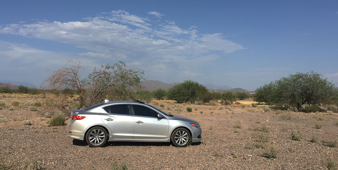
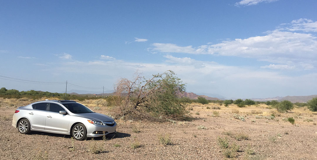
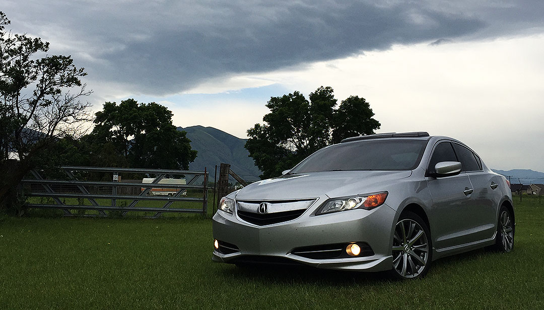
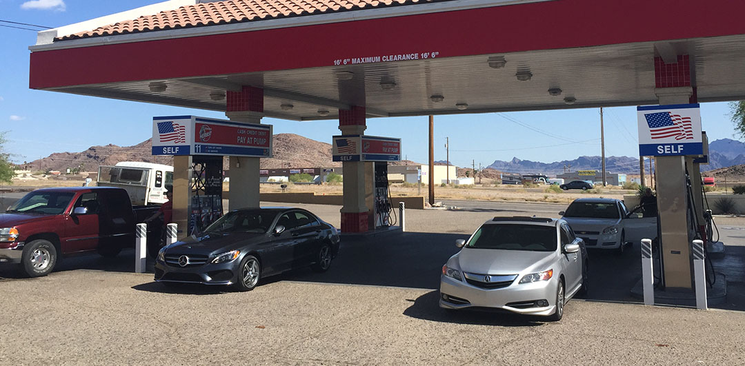
Posted in Arizona, ILX on July 2, 2015 by tysonhugie
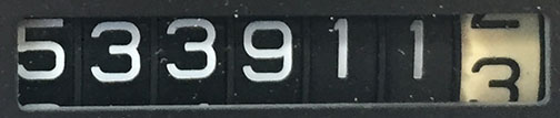
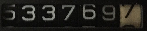
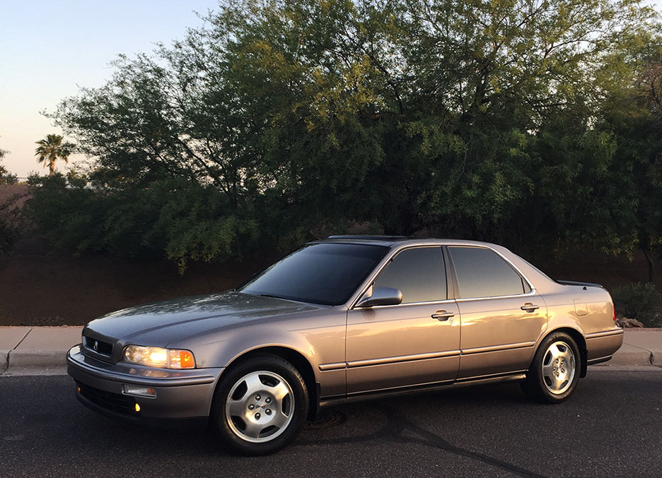
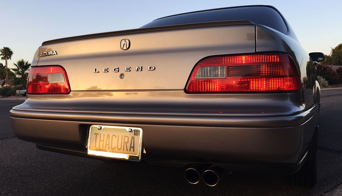
Odometer (Legend): 533,911
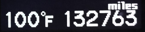
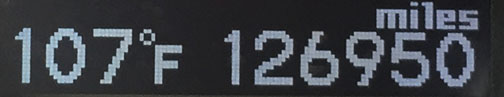
Odometer (ILX): 132,763
Thanks, mom, for always digging up the best pictures to post on Facebook. This gem from about 1995 was shared today. I’m at far right, breaking every fashion rule imaginable in those socks & sandles. And didn’t I look thrilled to be waiting for the parade?
Happy 4th of July weekend, and I hope you’re all as festive as my family was.
Someone named Damon in Ohio is giving me a run for my mileage. He posted on Wednesday to Acura’s Facebook page after hitting 500,000 miles in his 2002 Acura TL. That comes out to a little over 38,000 miles per year. Impressive. Apparently he drives 200 miles round-trip to his job. Keep the miles coming, Damon.
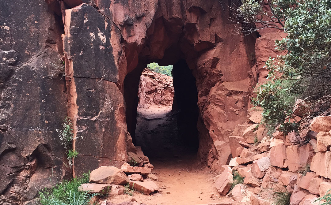
Just a quick post for today. Urban Exploration:
Urban exploration (often shortened as urbex or UE) is the exploration of man-made structures, usually abandoned ruins or not usually seen components of the man-made environment. Photography and historical interest/documentation are heavily featured in the hobby and, although it may sometimes involve trespassing onto private property, this is not always the case.
It was a little over a year ago (May 2014) when I let my curiosity get the best of me and finally went wandering around inside an abandoned automotive racetrack called Beeline Dragway that had been unused since about the late 1970’s. The dragstrip’s run in operation was short lived, at only a little over a decade.
There wasn’t much left to see when I stopped by 15 months ago except for a graffiti-ridden, concrete, 3-story tower which once housed the announcer and equipment. The quarter-mile asphalt lanes had long since been dug up:
Since I drive past that same location every weekday on my commute home via Highway 87, it dawned on me the other day that I couldn’t see the tower any longer.
“That’s odd,” I thought. Why would they decide to finally tear a building down that had already been abandoned for 4 decades? Was there some trouble going on in there perhaps? So, I pulled off the highway and started cruising around in search of any remains for the building. I found this particular concrete slab, but the location just didn’t feel right. I clearly remembered being further east than this.
Taking a step back. “Nope, this still doesn’t seem like where it was.”
So I went driving around on the dirt paths out there.
And a little more.
And, then I had an idea. Google Maps. If I pulled up the satellite view, it would probably have an older image that would still show where the concrete tower & staircase used to stand. BINGO. I zoomed in and saw the rectangular shape, and I drove my ILX over to park directly in front of where that building used to stand. I was the blue dot here.
These are the photos I took in that spot, where the building would have been in the background.
Nothing now remains aside from a few chunks of blacktop.
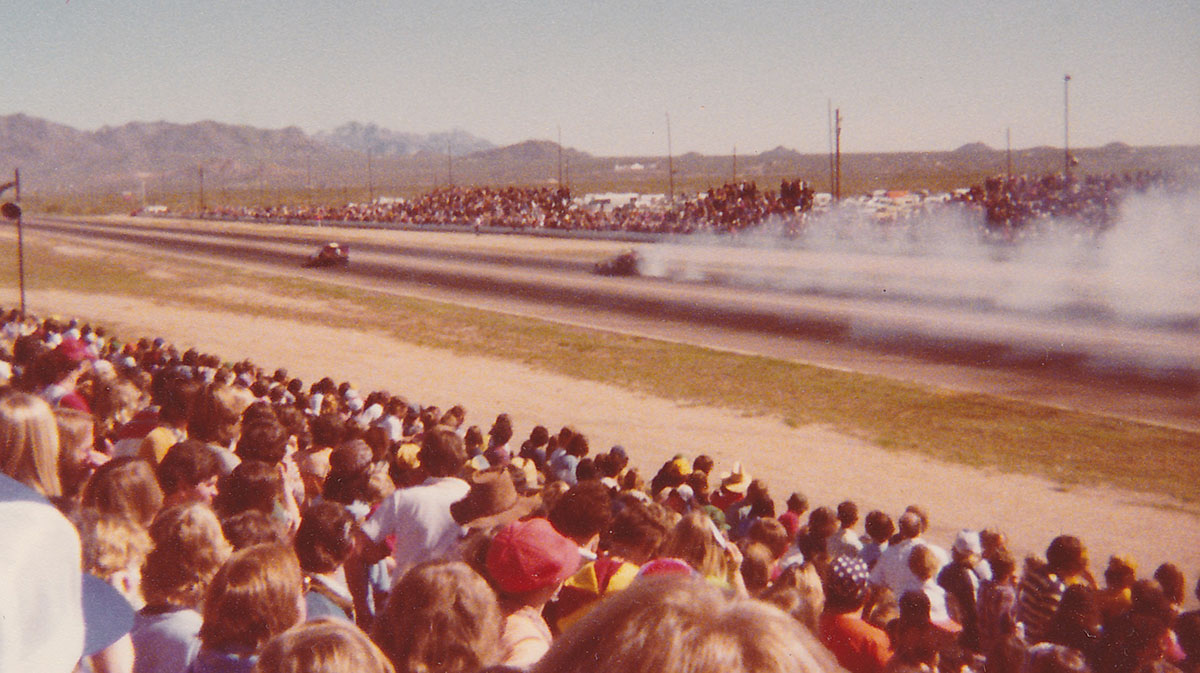
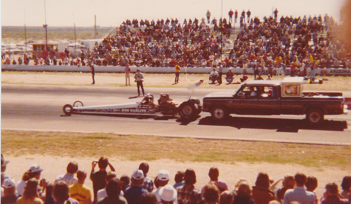
EDIT: Thanks to loyal reader and local Phoenix resident Hy, I’ve been granted permission to post a few exclusive pics from the Beeline Dragway dating back to 1978. Hy attended the “Winter Nationals” event in February of that year and snapped these shots:
Special guest for the occasion was Billy Carter, brother of then-president Jimmy Carter. Here he is riding atop a 1978 Corvette.
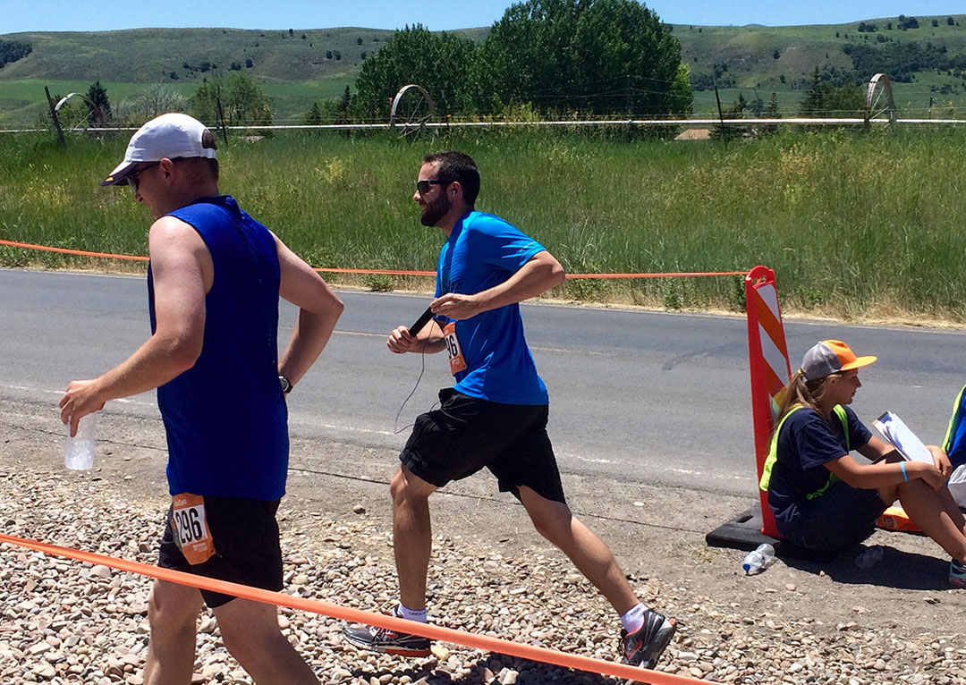
You’ve got to be kidding me – 200 miles? Who would be crazy enough to run that? Not me. Well, unless I had the help of 11 other people to slice up the distance into smaller pieces.
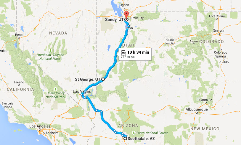
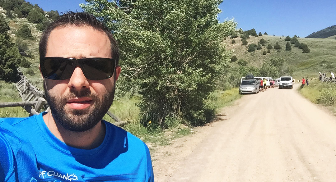
That’s the concept behind the Ragnar Relay Series. First launched in 2003, the Ragnar races have expanded to include 15 different events in various locations across the country. This past weekend, I joined forces with some friends and family members to compete at the 13th annual “Wasatch Back” Ragnar Relay which started on Friday morning in Logan, Utah, and ended Saturday afternoon in Midway, Utah near Park City. The race’s name comes from the fact that the course runs along the back (east) side of the Wasatch Mountain Range, a section of the Rockies that borders the Salt Lake City area.
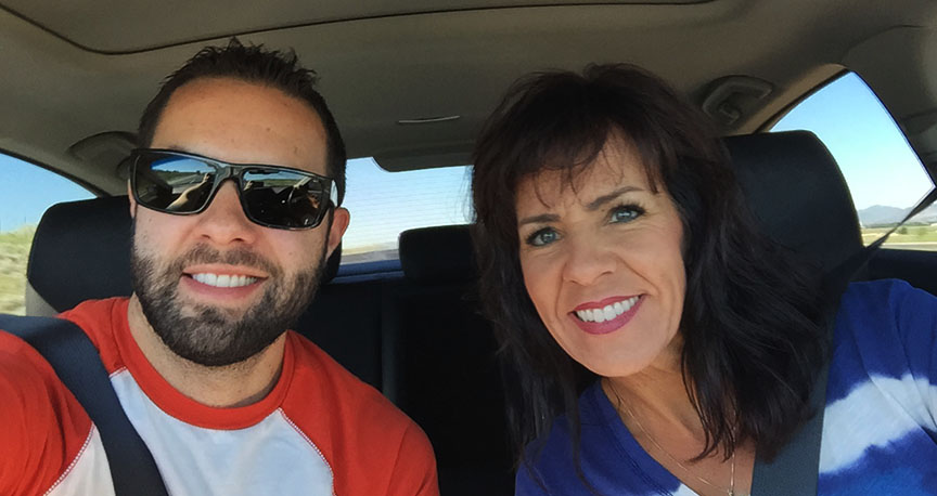
I took yet another jaunt to the Beehive State aboard the ILX for this occasion. In the 10 years I’ve lived in Arizona, I’d guess I’ve taken the drive to Utah at least 7 times per year. So, this is a well-known route for me. I left the car at my friend Jeremy’s place in Sandy, Utah and carpooled with my mom & stepdad the rest of the way to the race’s starting location in Logan, a couple of hours north.
My mom and aunt Jodi acted as team captains for us. Our team was code-named “Athens 2 Sparta” in a tribute to the first marathon – undertaken by a guy named Phidippides in 490 B.C. during the Persian/Greek War. He was sent as a messenger due to his running speed and endurance, often completing distances of 140 miles or more. He eventually died from exhaustion after one particularly taxing route! We hoped for a dissimilar fate.
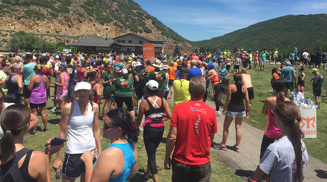
There were 946 teams registered. At 12 people each, that’s 11,352 people. Plus two drivers per group, so that’s another 1,892 people. We are talking about over 12,000 people engaged in this craziness. Although, I guess I should mention – not all teams chose to go out with 12 participants. Any team considered “ultra” had 6 or fewer people on it. In other words, the people in those groups were running twice as frequently (and therefore, twice as far) as “normal” participants. I can’t imagine what would compel anyone to do such a thing!
Race Time
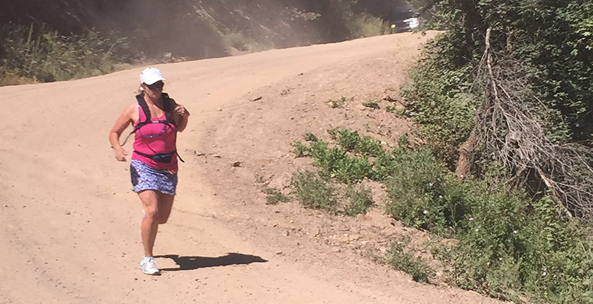
Due to the volume of people involved in this event, start times were staggered in waves. We reported at 9:30 a.m. as instructed on Friday, June 19th, checked in, showed the race administrators that we had appropriate safety gear, and watched a short instructional video. My mom was our first runner for our 10:30 a.m. start. We had to send our all-star out first to get us off on the right foot! It was perfect weather for a run and she took off in a flash.
My three assigned legs were as follows:
Leg #4: 4.3 Miles, Net Elevation Gain 127 Feet, est 2:00 p.m. Friday
Leg #16: 5.9 Miles, Net Elevation Loss 922 Feet, est 3:00 a.m. Saturday
Leg #28: 2.7 Miles, Net Elevation Gain 320 Feet, est 1:00 p.m. Saturday
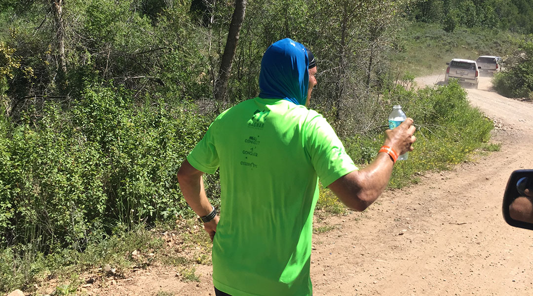
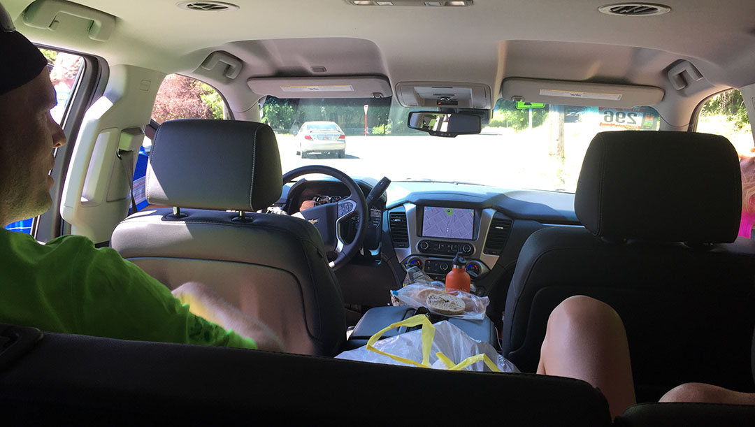
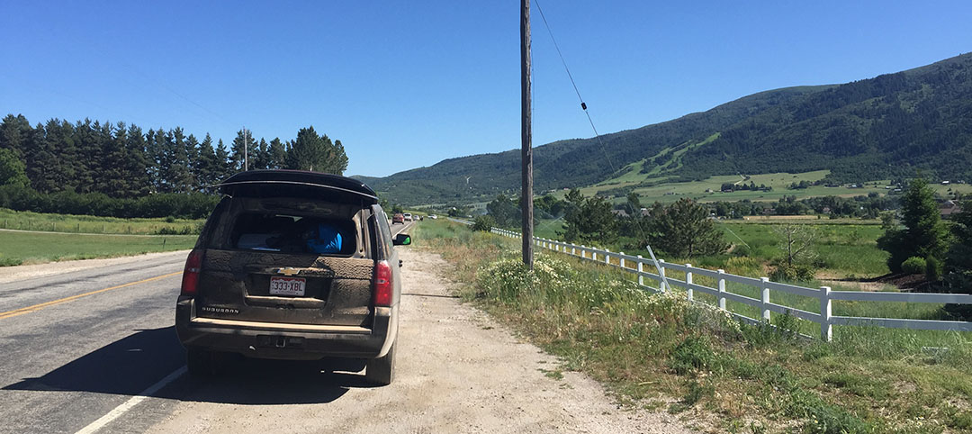
When the rest of us we weren’t running, six of us (5 runners + our driver, Mark) rode along in a rented black 2015 Chevy Suburban (“Van 1”) and provided “support” to our team member who was on deck. I spent most of my time in the back seat trying to avoid motion sickness as we frequently did U-turns and re-routed to find our way around. A second Suburban (“Van 2”) carried the other six members of our team and started after Van 1 members had each completed their first leg. Logistics confusing enough yet? As a first-timer to this event, I was amazed at how seamlessly it worked.
Despite only being 4 miles long, the fact that Leg #4 was a slight uphill and took place in the hottest point of the day made it a doozy for me. I was relieved when I finally saw my team members at the next exchange and I happily chugged a chocolate milk after passing the baton (which was in fact just a 1980’s-esque bright orange slap bracelet) to Damon who picked up the next segment after mine. Poor Damon ended up running 8.8 miles on an uphill, dirt road, while eating the dust of vans passing by! Torture.
We got up over Avon Pass and back to pavement in the tiny town of Liberty, and then we made our first “big” exchange when Van 2 took over. Meanwhile, Van 1 had about 6 hours to spare. We traveled to our next starting point in Morgan, Utah and sprawled out on a grassy field near the high school while having our lunches. I rolled out my sleeping bag and did my best to rest my eyes but it didn’t do much good. Mom tried the same.
It was a little after midnight when mom took Leg #13 and started our van off again. I was already exhausted when Jeffrey passed me the torch a little before 3:00 in the morning. I had been standing at the summit of State Highway 65 near East Canyon Reservoir and trying to jog in place to keep the blood flowing and to keep from getting cold. Once I finally got rolling, I’d forgotten all about the temperature. I had a momentary emergency when my “taillight” clipped to my reflective vest fell off and lost its battery, but my van quickly came to my rescue when they drove past. This was my attempt at a picture.
The next 6 miles were bliss: Steady downhill grade, perfectly clear night with the brightest stars I’ve ever seen, good music, and refreshing temperatures. A remix of the Cranberries’ hit “Zombie” was just what I needed for motivation at 3:05 in the morning when I took this screen shot. Good song!
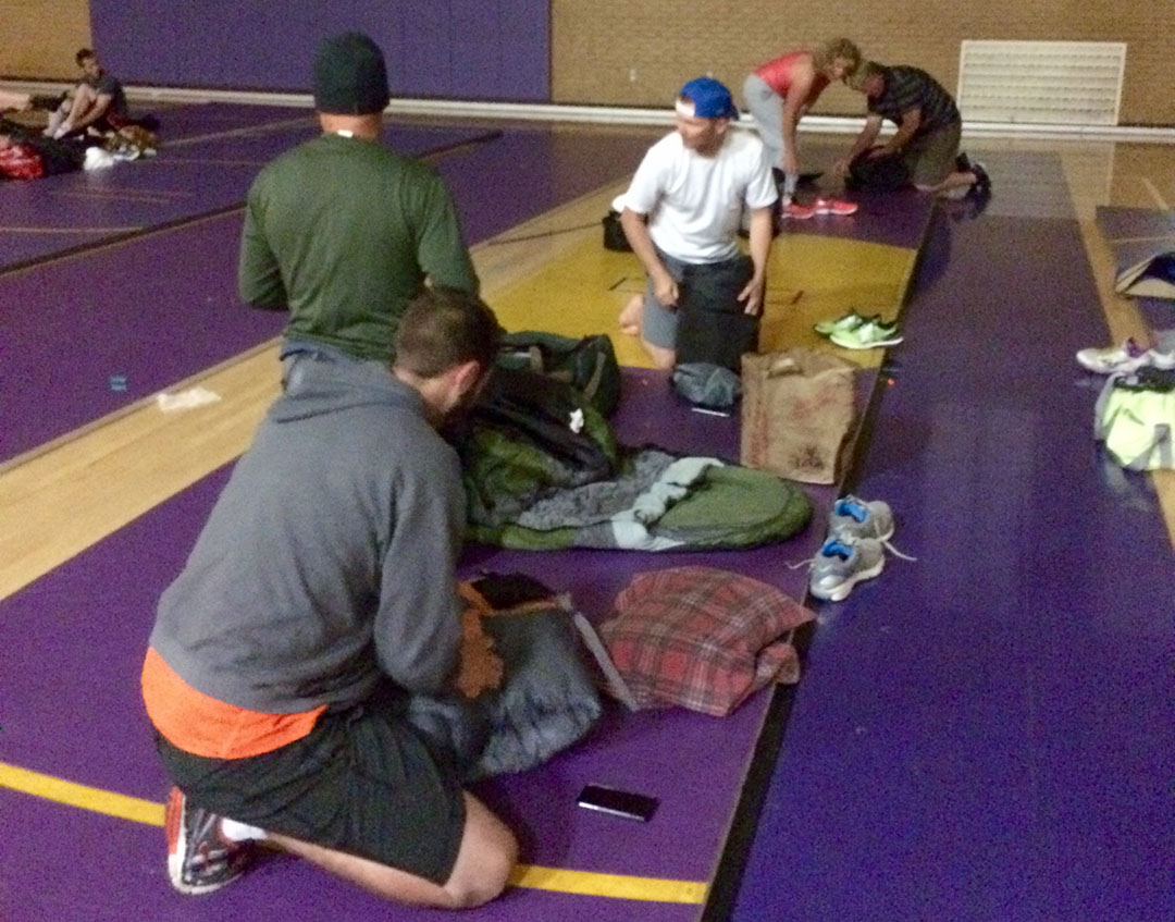
That was a refreshing way to spend the morning and it definitely helped wake me up. Once again we filed through our segments and tried in vain to catch shuteye when we weren’t the ones pounding the pavement. Soon, the sun started peeking over the horizon and Day 2 had begun. We arrived in Coalville, Utah at North Summit High School for our next group break. They were selling hot showers for $2 and pancake breakfasts for $4. I gladly paid up! After that, we rolled our sleeping bags out onto the floor of the gymnasium and shut our eyes for a little while.
My last leg was along Highway 248 where I awaited my turn to take the bracelet and run with it. I was standing in parking lot at beautiful Jordanelle Reservoir and should have been enjoying the view, but instead my eyes were transfixed on a massive hill ahead of me — one that very soon I’d be attempting to run up. It seemed like an eternity before Jeffrey came down to pass me the reins, but he finally did and I took off as briskly as my legs allowed me to.
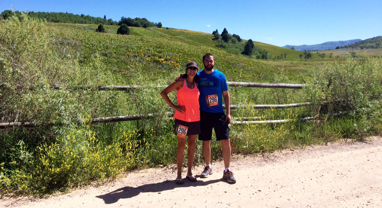
Water bottle sloshing in hand, I did my best to keep a consistent pace up the grade, but I had to slow it down to a power-walk a couple of times to keep from overheating. My van waited for me at the top of the hill and my mom threw a water-soaked cloth around my neck. That gave me enough motivation to press onward. It was an amazing feeling to finally crest the summit and be able to see the next exchange location within view. I gladly passed Damon the bracelet and felt a huge sense of relief, having completed my last part of the relay race.
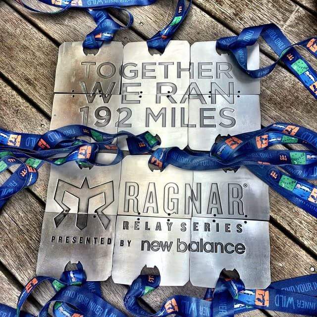
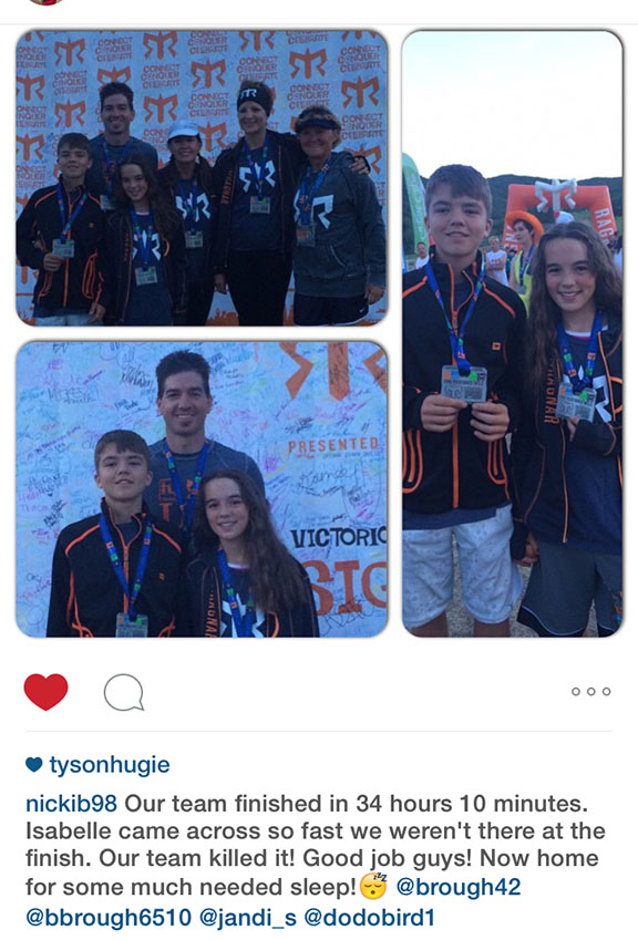
It was several more hours before our “Van 2” team members finished their parts, and I wasn’t able to stick around to see them at the finish line at dusk, but they shared the good news that our team, Athens 2 Sparta, had completed the 194 miles in 34 hours, 10 minutes. That put us in 278th place out of 719 co-ed teams. Top third placement – not too shabby!
This was one of the most challenging physical things I’ve ever done, probably second only to the 26-mile Grand Canyon hike I did a few weeks ago. But the neat thing about the Ragnar concept is that you’re a member of a team, and each person contributes something to the overall outcome. It’s a lesson in working together to achieve a common goal, and feeling great about it when you’re done. Huge thanks to Mark, Nicki, Jodi, Tia, Ben, Jarrett, Isabelle, Roxie, LaReen, Damon, Jeffrey, Muriel, and Jandi from my team for playing a part in this!
I enjoyed my 10 hours of reflection on that topic while driving home to Phoenix. Now, if only I could’ve taken a team approach to the 256 unread email messages that were waiting for me at the office on Monday morning. Sigh.
Here’s a short video with just a few scenes from the race. Thanks for coming along for the run!
Rolling northbound with mom on I-15 in central Utah on Thursday morning
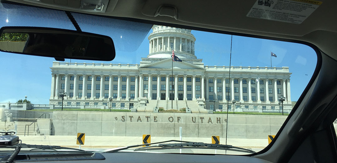
Drive-by at the Utah State Capitol while in the truck with mom & Todd
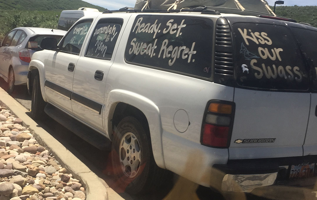
Decorating our rental Suburban with writing on the windows and our “Athens 2 Sparta” team name
Checking in on Friday morning at the Utah State University stadium in Logan
Watching a safety briefing video
Saddled up in the Suburban while one of our runners takes a turn
A friend sent me this screen shot shortly after we got underway. This race is serious business.
My first leg, a 4-miler on pavement from Paradise to Avon, Utah
The exchange where I handed off the reins to Damon who was runner #5
Waiting for Damon to finish his leg on Avon Pass
LaReen taking her turn on the dirt road now
Back on solid ground, arriving Liberty, Utah
Photo-op with mom
Passing Pineview Reservoir while driving to our next exchange point
“Mormon Muffins”? What would that be?
Here they are. With honey butter!
My view upward while lying on the grass in Morgan, Utah and resting
“M” on the hill stands for Morgan
Daybreak the next morning in Coalville, Utah at North Summit High School
Pancakes never tasted so good
Next exchange, sitting next to Aunt Jodi
Isabelle, Jandi, Jodi, Jarrett – from our “Van 2”
Dying!
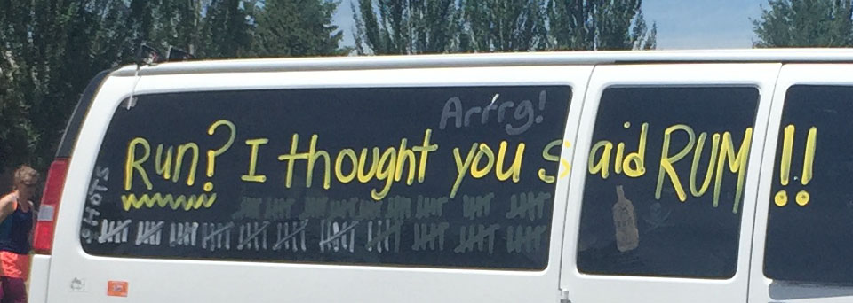
I loved the clever names that some people came up with for their vans.
“Ready, Set, Sweat, Regret.” “Kiss our swass.”
“Shitter’s Full.” (name that movie)
“Run? I thought you said rum!” (and notice the tally marks below where they were marking their “kills” – all the people their runners passed along the way)
“Cropdusters.”
Near Park City, Utah, at the final exchange to Van 2
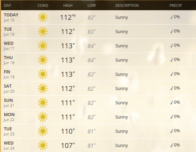
Annnnnd the Phoenix oven is now fully pre-heated! Just looking at the 10-day forecast makes me break a sweat.
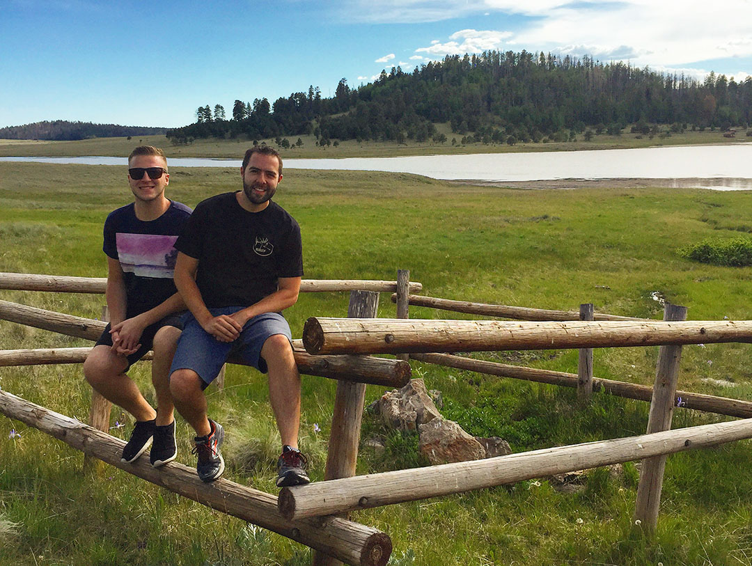
There’s only one logical solution: Get out of town. And that’s exactly what I did this past weekend, along with 3 other friends. The destination of choice this time was the White Mountains, a range in eastern Arizona near the border with New Mexico. While Phoenix sits at a little over 1,000 feet in elevation, the town to which we’d be heading, Eagar, has an elevation of nearly 7,000 feet. And along with that added height comes a 10-day forecast that’s a lot less intimidating (think: High temps in the 80’s).
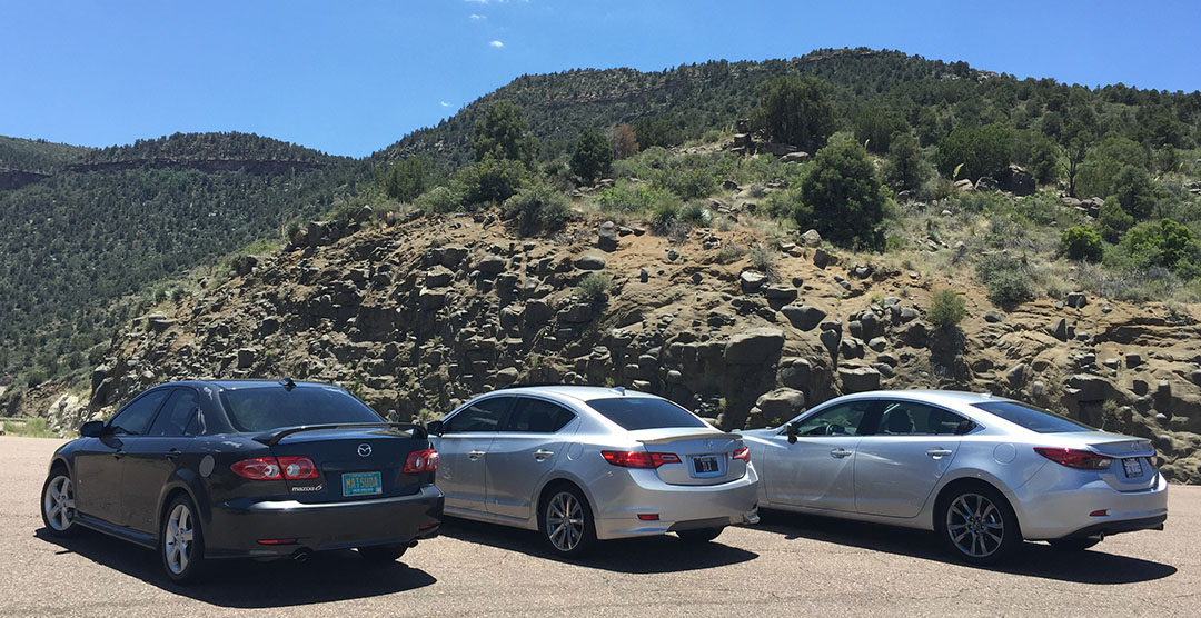
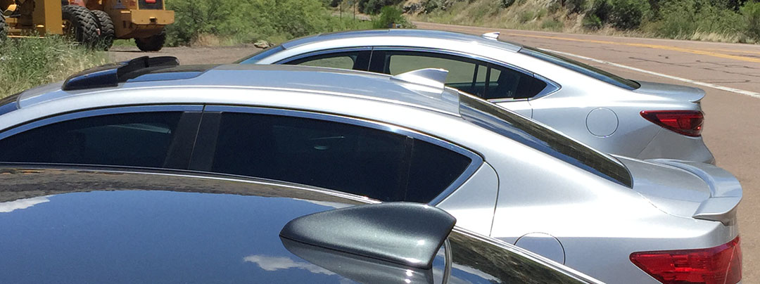
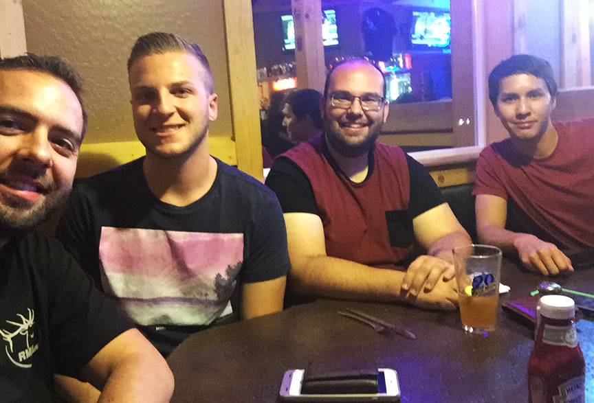
From my place on Saturday morning, three of us including James from Six Speed Blog headed out on US Highway 60 through the “East Valley” part of the Phoenix area. We made a fuel stop at the Chevron on Idaho Road and then continued eastward to the small mining town of Superior where we met up with Jason of Driven for Drives who had come out from Las Cruces, New Mexico to join for the drive. At this point, our caravan of 3 cars now consisted of the following:
After grabbing a Red Bull and Moon Pie at the Chevron gas station in Globe, we played musical cars and I got to pilot Jason’s 2004 Mazda 6 for the next stretch. For being 11 years old and having 164,000 miles on the clock, the 5-speed Mazda was a solid ride. Jason recently upgraded to an all-leather interior. Bradley and I couldn’t figure out how to pair his audio system to our iPhones, but it didn’t matter because Jason had Linkin Park in the 6-disc changer to keep us company.
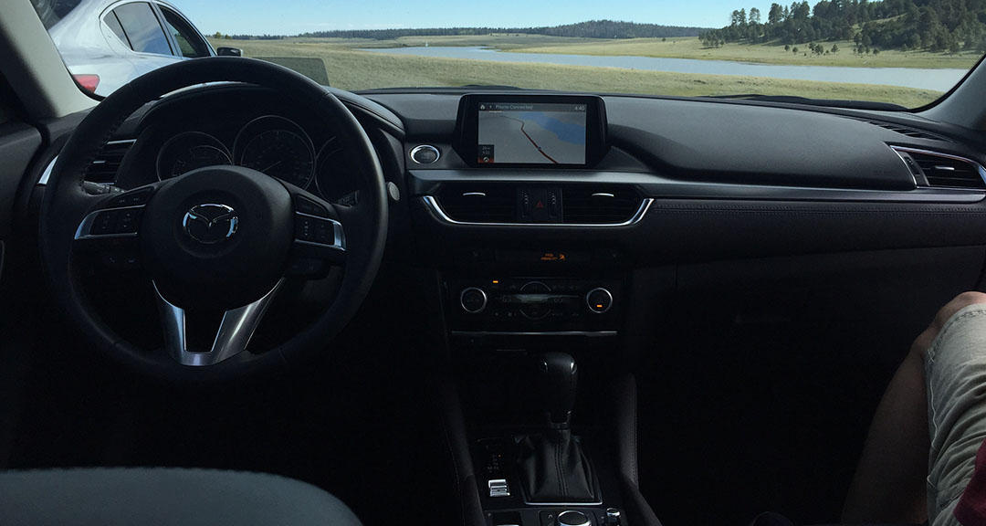
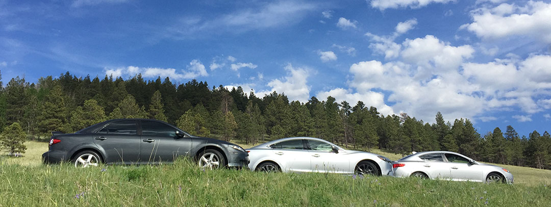
We pit stopped at the base of the Salt River Canyon which I’ve blogged about a number of times before. (Acura TLX Review, Christmas Day trip to name a couple). From the river level, there are two massive bridges passing overhead. We climbed back up to the parking lot (got my cardio in for the day) and did another car swap. This time, I got to take control of the Mazda 6. Ringing in at a pricetag in the low $30’s, I must say the new 6 offers great bang for the buck.
The styling is attractive from any angle. Projector headlamps and foglamps offer supreme nighttime visibility. The leather stitched pieces on the dashboard exude a premium feel. And the car comes up with a head-up display – all of which are class-leading amenities for a vehicle in this segment. From a performance perspective, the 2.5 liter needed to be coaxed a bit on the grades, and the transmission seemed slow to shift when prompted, even with the paddle shifters. Even so, the car scoots – and even with a 36-horsepower deficit compared to its older sibling, we found out that acceleration time is pretty on par: Mazda is delivering V6 power with 4-cylinder fuel economy.
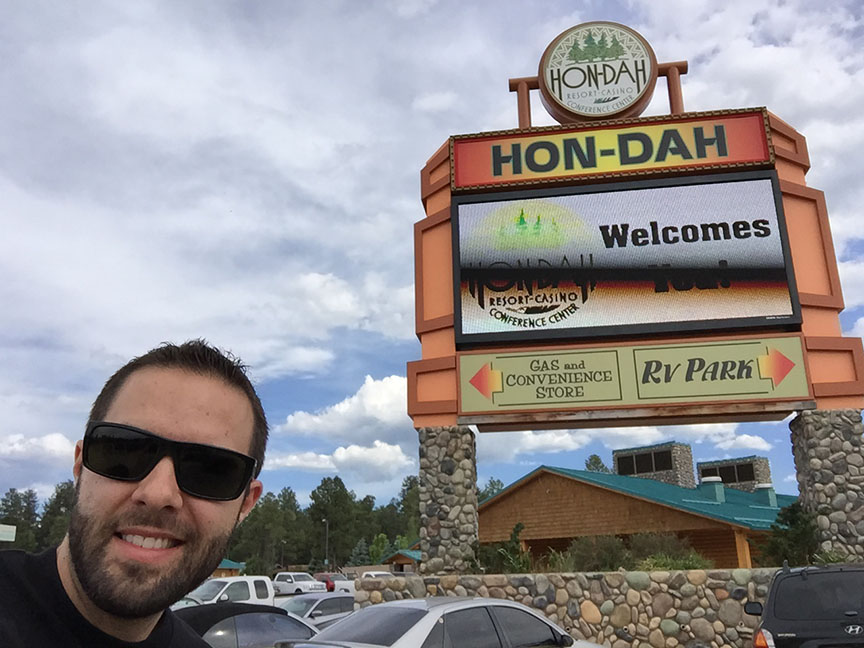
We had lunch in Show Low at Licano’s and then headed out toward the small towns of Pinetop & Lakeside. There’s a special place I needed to see at the intersection of Highways 260 & 73: Hon-Dah casino. Oh yes – of course we stopped in to check the place out. Jason tried his had at the 25 cent slot machines and scored a $15 gain after James had lost $20 in a matter if minutes. Ha! I don’t know why it’s called the Hon-Dah casino but maybe the folks on the White Mountain Indian Reservation are Honda fans.
A jog southward on Highway 273 took us past the Sunrise Ski Resort (which had closed for the day just minutes prior, or we probably would have taken a chair lift ride to the summit) and then through some scenic, rolling, grassy hills. It took about 20 minutes until we met the intersection with Highway 261 near Crescent Lake. There was so little traffic out there. I made the comment at one point, “If I worked in car advertising and ever needed to shut down a road for filming, this would be the one.” Highway 261 was full of all the right curves in all the right places. I captured 9 minutes of GoPro footage where you can see just how isolated, yet fun, this road can be.
Want to drive that 9-minute distance with me in only 34 seconds? Here you go.
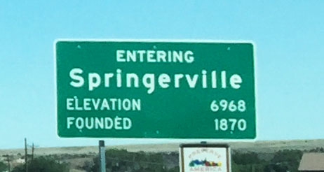
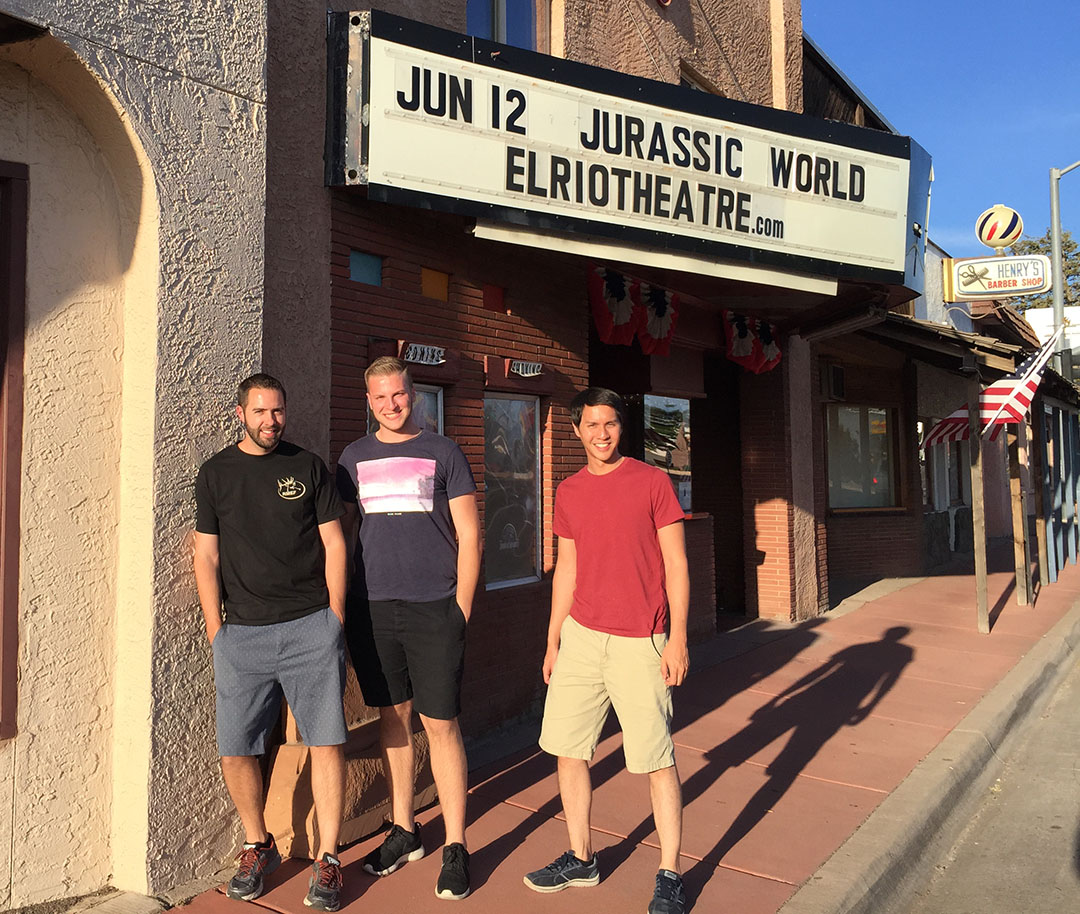
Eagar and its neighboring town, Springerville, comprise what the locals refer to as “Round Valley.” The population of the two cities combined is fewer than 7,000 people and there are only two stoplights. It’s a neat town and the people are friendly. When we told the front desk agent at Best Western that we wanted to go see a movie, she said, “Make sure you see Gloria. She’s the owner and she’ll take good care of you.” Now that’s hometown hospitality!
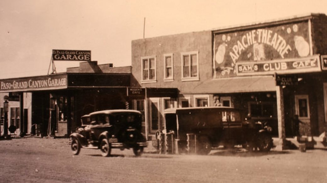
We did decide to catch a new release at an old theater. The El Rio theater, formerly known as the Apache theater, opened in 1915. Even after 100 years, the place was well-kept and had a great vibe to it! Last year, the theater was converted from 35mm film to digital projection after the community raised enough money to keep the theater in business. Movie tickets were $6 concessions were dirt cheap too! $5 for a soda and a large popcorn. I could get used to prices like that. Oh, and the movie? Jurassic World. Highly recommended.
I had a great time enjoying a drive in the hills with a few friends and hope you did too. Here are a few pics.
Fueling up in Globe with the two Sixes and the ILX
Entering Salt River Canyon on eastbound US 60
View of the Salt River from underneath the US 60 bridges
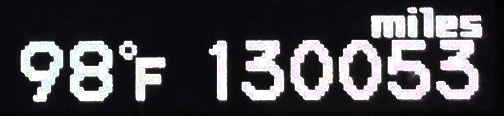
Posted in ILX, Road Trip on June 13, 2015 by tysonhugie
Odometer (Legend): 533,727
Odometer (ILX): 130,053
Leg Distance: 1,252 Miles
The third and final chapter of last weekend’s 2,600-mile highway jaunt!
I peeled open the drapes of room 410 to a stunning blue-sky Montana day last Sunday morning. I now know with a certainty why the state gets its name for being “Big Sky Country.” Dad and I enjoyed a hearty breakfast of blueberry waffles in the lobby of the Comfort Inn in Missoula before firing up the ILX for another mile-filled day. My dad’s been a long-time member of the Rocky Mountain Elk Foundation (RMEF) so we decided we needed to check out the world headquarters just north of town. They had a lot of taxidermied (I’m making up that word) animals on display as well as a small theater and a gift shop where we had to spend a few bucks on T-shirt souvenirs.
Leaving Missoula eastbound on I-90, I saw a couple of billboards announcing the “Testicle Festival.” What a name for an event! Apparently this annual tradition in Clinton, Montana draws thousands of people and involves the consumption of animal testicles. I’m serious. Check out testyfesty.com for more information, and book your trip to Clinton for July 29 – August 2 if you want to experience it firsthand!
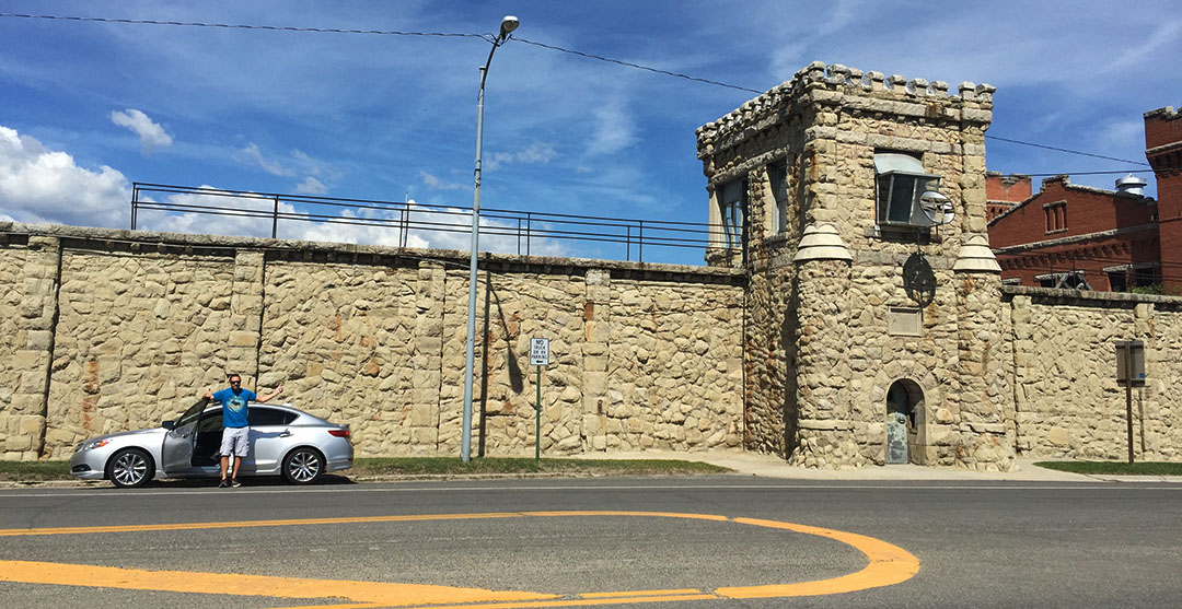
It seems a little odd that we’d want to tour a creepy old prison, but I get a kick out of urban exploration so our next stop was the Montana State Prison in Deer Lodge, right off Interstate 90. This facility dates way back to 1871 when it was a territorial prison and it served as the primary prison facility for the state of Montana until 1979. It started out very small but was added onto in the decades that followed.
Even so, there were constant problems with overcrowding despite the additional cellblocks being added. There were 3 riots in the 1950s and a warden was shot in 1959 in an inmate escape attempt. For two more decades after that, the facility struggled with substandard conditions. Finally in 1979, a new prison was built a few miles away and the inmates were moved over. Here is a picture from the early days of the prison.
The first thing dad and I did was visit the “Hobby Shop” across the street where merchandise that has been created by inmates is sold. There were a lot of leather goods, some paintings, and other arts & crafts. Each item had a tag tied to it with the handwritten name of the inmate who made it. We didn’t make any purchases. Next, we walked across the street to a 100+ classic car exhibit in a building next to the prison. Finally, we entered the prison itself for our self-guided tour of the grounds.
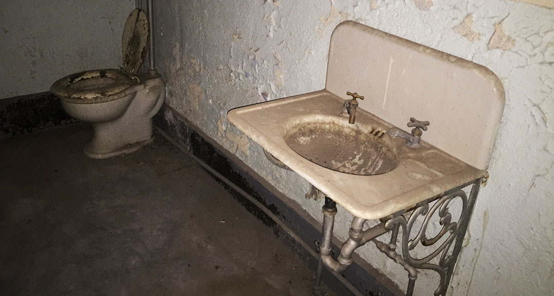
There were 20-someodd points of interest in the small leaflet the cashier had given us, and we saw most of them. Most of the cement cells were depressing to look through – tiny showers, dirty toilet facilities, huge metal doors that took a lot of effort to open & close. The coolest part was walking up through several flights of stairs that were pitch black until I turned on the flashlight on my iPhone to guide me. It felt like a horror movie in the making. Plaster was coming off the walls and ceiling and there was an echo with each step I took.
The last stop on our prison tour was a peek inside the Clark Theater, completed in 1920. In its day, it could seat 1,000 people. It was the first of its kind – no other prison in the country had a theater. Severe fire damage in 1975 left it almost to ruin. Today, there is a gallows standing in the center of the room where the seats were once lined up. That gallows was used in the execution of 7 men from 1920 to 1939. Notice that there were 13 steps leading up to the platform with a trap door – symbolic of the “unluckiness” of those who climbed them.
Look in the right hand side of the below picture at Exit 201 for Anaconda, Montana. You’ll see a vertical tower in the far background. That tower is actually a massive, 585-foot-tall smoke stack that was part of the Anaconda Company and built in 1919. It is taller than the Washington Monument, and remains today as the world’s largest free-standing masonry structure. The surrounding buildings were demolished in 1981 after the plant closed, and now the area is a state park.
Just before getting to Butte, we veered southbound on Interstate 15 from eastbound Interstate 90 and headed toward Idaho. Once again it was time for some highway grub by the time we got to Dillon, Montana about an hour later. We decided to wing it on the restaurant choice and took Business loop through downtown Dillon toward what looked like a historic/commercial area. A few options jumped out at us and we went with a place called Papa T’s that was packed with a bustling lunchtime crowd.
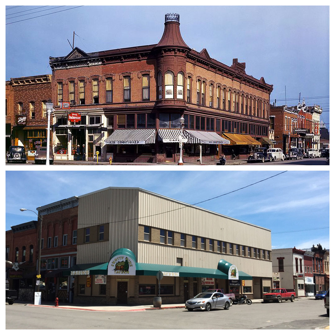
I happened to look up the Wikipedia page for Dillon, Montana while we were waiting for our burgers and the article had a historic 1942 picture of the intersection of Bannack Street & Montana Street. “Neat pic,” I thought. “I wonder if I could duplicate it?” So we had a mission after to dinner to find out exactly from which angle it had been taken. The good news: We found the correct location. The bad news: The neat 1940’s architecture from the historic photo has been replaced by boring siding, and most of the decorative rooftop woodwork has been removed. Even so, we got the picture we were after and I’ll post it here for your viewing pleasure.
Same intersection, but 73 years’ time difference:
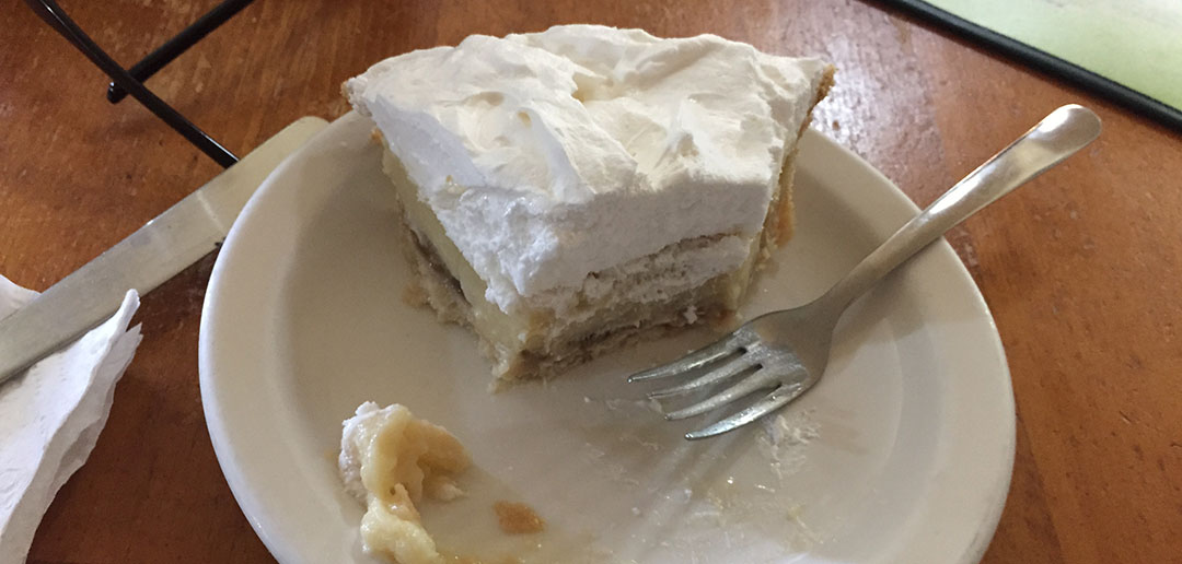
Even thought we were still absolutely stuffed from lunch, my dad insisted we stop at one more place for food a little ways down the road: Dell, Montana. Dell is really nothing more than a few buildings and a set of train tracks. But the one special landmark that’s been there since 1978 is the “Calf-A” restaurant. Calf-A occupies the building that was originally constructed in 1903 as a schoolhouse. The most popular items on the menu are the pies, and for good reason. I sampled the banana cream and it was amazing.
I had dad take the wheel from there on out. We crossed back into Idaho at Monida Pass (6,811) feet and continued on down I-15 for about the next 200 miles all the way through Idaho, stopping only once for fuel in Pocatello. My step-mom Tanya met up with us a little beyond the Utah state line and I said bye to my dad since he had to work the next morning. Meanwhile, I took the driver’s seat and continued southbound because I still had a ways yet to go before my trip would be over.
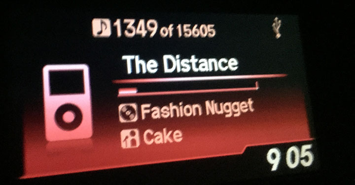
I ended up plugging through all the way until St. George at the opposite end of Utah, where I spent the night at my brother’s. It seemed fitting when the Cake song “Going the Distance” came on my iPod a little after 9:00 p.m. (so, 10:00 p.m. Utah time) when I still had about an hour to go and I’d already been in the car for nearly 800 miles that day. I gladly called it a night at my brother’s place.
Monday morning, I knew I had just one final stretch left. But before getting out of town, I paid a few visits including to my mother, my sister-in-law (where I met my 3-day-old nephew Locke), my grandpa, and my brothers. It was an incredible trip and I’m glad I was able to spend it with my dad and see some other family members along the way. Thanks for being a part of it!
Video with some driving scenes and a short slideshow at the end:
Montana State Prison in Deer Lodge from the outside
Antique car collection in a building near the prison
Entering the prison grounds
Locked up!
Bathroom facilities are top notch
Concrete stairways outside are crumbling
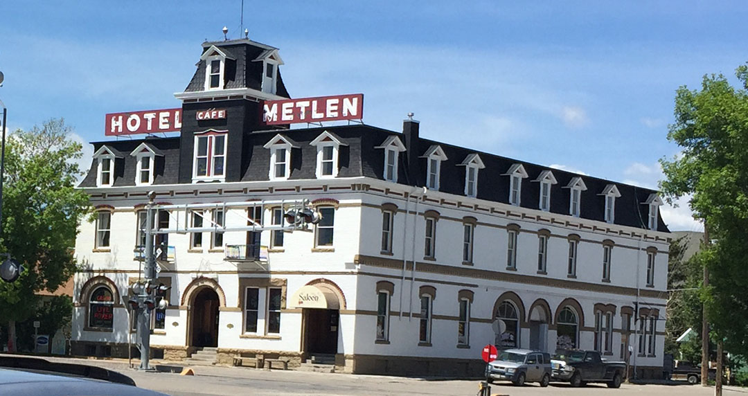
Historic 1897 Hotel Metlen in Dillon, Montana. It’s for sale!
Inside Calf-A restaurant in Dell, Montana
Having dad drive for a bit along southbound I-15
Grandpa’s two Avalons: 2006 and 2000
Acura party at my brother’s place – his mother-in-law’s TL, his new MDX, and my ILX
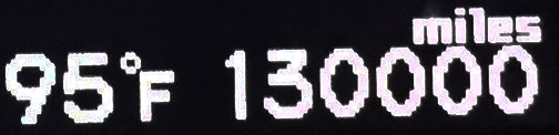
Posted in ILX, Road Trip on June 11, 2015 by tysonhugie
Odometer (Legend): 533,697
Odometer (ILX): 130,000
Leg Distance: 318 Miles
Welcome back for Part 2 of this past weekend’s road trip! Part 1 is here.
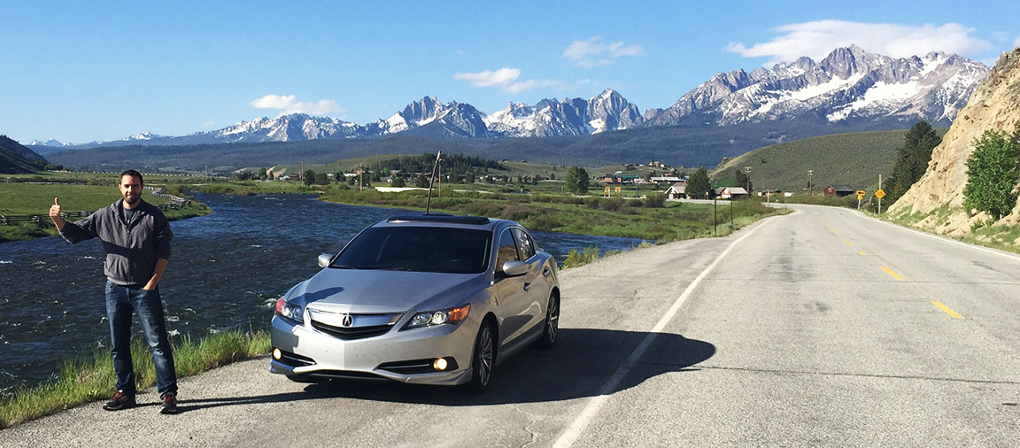
It was a picture-perfect morning in Ketchum, Idaho on Saturday morning: cloudless and sunny with just enough of a nip in the air to require a light jacket. After a quick walk down the block to a log cabin Starbucks from the Tamarack Lodge for a light breakfast, we hit Highway 75 in the ILX and headed out of town. The two laner was completely ours for the taking – it seemed we had beat the peak RV season and we were out early enough that there was little to no traffic. It became apparent when my ears popped that we were quickly going upward in elevation.
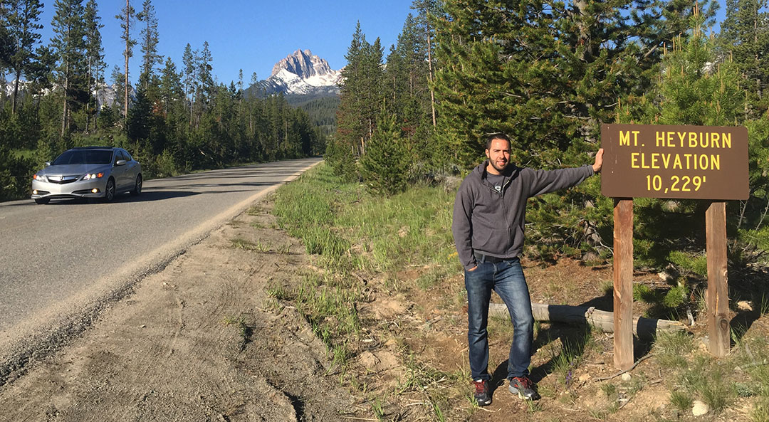
At 8,701 feet, we crossed over the Galena Summit and a whole new view opened up to us as we started our way back down the backside in the Sawtooth Wilderness. The next several miles, we looped back and forth across the switchbacks as dad eyeballed a few dozen antelope out on the mountainside. The highway straightened out a bit when we got to lower elevations and I was able to set the cruise just momentarily at 65 or so. We came up on a sign announcing the exit for Redfish Lake and I’d been highly recommended by my grandpa that we stop there, so I hit the brakes and headed left toward some campsites along the lakeside. Looming ahead of us was snow-capped Mount Heyburn at 10,229 feet.
Following some hand-written notes from my grandpa, I knew we had just a bit longer to go until we’d be seeing a place called Sunbeam Dam along the roadside. I came around a corner at one point and saw smoke rising from the hillside ahead. “Whoa, looks like a fire,” I said. Dad quickly corrected me – I was looking at rising steam from a geothermal ‘hot spot’ rather than smoke from flames. That was enough reason to kill the ignition of the ILX for a few minutes and get a few pictures.
Sunbeam Dam ended up being just a couple of miles further. Originally poured in 1910, Sunbeam Dam caused the Salmon River to become a small lake in that area. A hydroelectric power plant on-site provided power to a gold mine 13 miles up Yankee Fork Canyon. However, only 11 months later, that mining venture had gone bottom-up and the power plant was sold off at Sheriff’s Auction. In 1934, the dam was partially blown up, allowing water to begin flowing freely along one side of it. Today, there’s still half the dam standing.
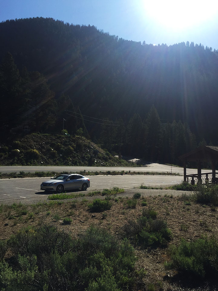
It was here where we found the starting line to our next adventure. The Yankee Fork Road that took off to the north looked a little bit unimproved but we were determined to head up there and get an up-close look at a historic gold dredge. For the first few miles, pavement was good but the road was narrow and there was no center line. Puddles in shaded areas told us that it had rained a fair amount overnight. In a few miles we met the inevitable “PAVEMENT ENDS” yellow sign and I put the ILX into 4-wheel-drive (just kidding). We continued to sail along at 35 or so miles per hour because the gravel road was well-graded and not all that more uncomfortable than the paved one. Alongside our car we started seeing huge piles of gravel and boulders, heaped up in mounds that were often many times taller than my car.
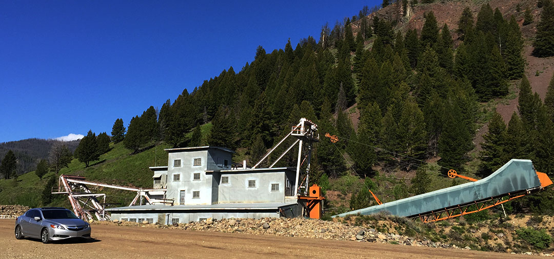
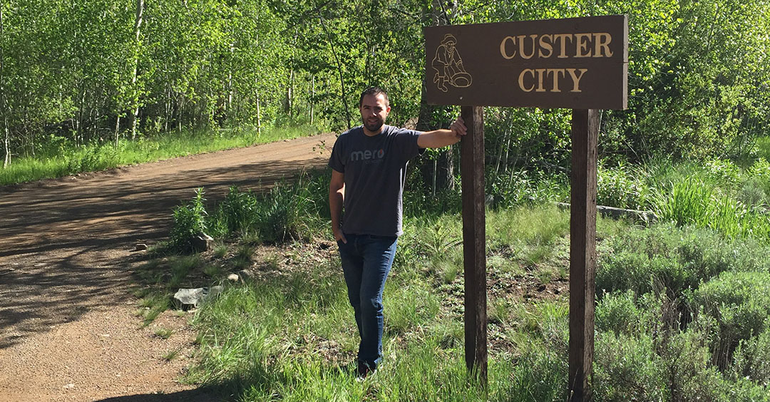
There was no question when we had arrived at the Yankee Fork Gold Dredge. It’s a metal monstrosity, 4 stories tall, 112 feet long and weighing in at a whopping 988 tons. Since self-guided tours wouldn’t be starting until 10:00 a.m., we had a bit of time to kill, but that was perfect. We looked at our clock and it was around 9:30 in the morning. That meant we had just enough time to go 1 mile further up the road to see a ghost town called Custer.
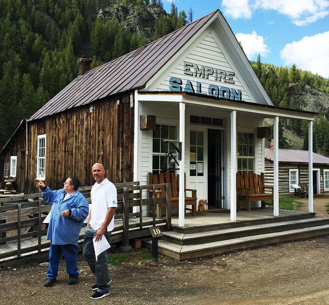
I didn’t know it was possible to make a speed bump out of a dirt road, but somehow they did. It was actually not so much a bump as it was a huge rut in the road. Luckily I’d seen the sign that said the speed limit was 10 miles per hour so I had time to prepare for it. Custer, once home to a couple dozen structures, had succumbed to the same fate that so many other wild west towns have – it was founded as a mining establishment and at one time was home to 600 hearty people at its peak in 1896.
Only seven years later, the mining business had started to fade out, and by 1910 Custer was already considered a ghost town. Dad and I parked next to the Empire Saloon and went inside to take a look. There was a Forest Service representative there who was very friendly. She pointed to a log-constructed section of the bar down at the end of the room. “That’s an original piece of the actual bar. It’s over 110 years old.”
Today, seven of Custer’s buildings qualify to be on the National Register of Historic Places. We went inside a couple of them, including the schoolhouse which is now a museum and which houses some neat artifacts like the original 1901 dentist’s chair, some desks from the original school, and a tiny scale model in a plexiglass case that shows what the layout of the town used to be like before so many of its buildings were burned down, destroyed, or fell to ruin.
By now it was time to head back to the Yankee Fork Gold Dredge. This engineering marvel was in operation for only 12 years, from 1940 until 1952. When it was put in operation, there was an estimated 11 million dollars’ worth of gold in the 5-mile claim of the Yankee Fork River in which it operated. The dredge was a huge mobile machine that could move (slowly) upstream and use its 71 (8-cubic-foot-each) buckets to dig up land. Then the diggings would go through a number of steps including settlement in “sluice boxes” where the heavier gold would settle to the bottom. The evidence of the dredge’s work remains even 63 years after it last ran – huge hills of gravel and boulders line the entire length of the Yankee Fork Road all the way down to its intersection with Highway 75.
My dad and I took a walking tour of the entire machine and I was amazed at the work that went into it. During its operation, the dredge was manned by only 3 people: one inside the 4th floor control room, and two who were dedicated only to keeping things oiled and lubricated. The dredge was so loud when in operation that the workers had to use a sort of morse code to communicate messages to one another, and it was rumored that the dredge could be clearly heard running from over 10 miles away. By the time the company had dredged its entire claim, it had recovered $1.2 million worth of gold. That’s nowhere near the estimated $11 million that was thought to be available, but still a good chunk of money in 1952 dollars.
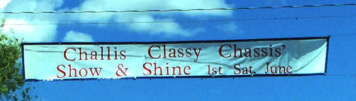
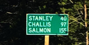
We’d started getting a bit of an appetite, so we were glad to get back to paved road and continue our trip along the Sawtooth Mountain Range. The next city of note would be Challis. Gleaming chrome bumpers in the sunlight were visible from many blocks away when we started approaching town. Little did we know – the first weekend of June is when the “Challis Classy Chassis” event takes place, drawing dozens of hot rods and muscle cars for a show on the grassy lawns lining the highway through town.
First order of business was finding a bite to eat so we stepped into one saloon that looked like it might have potential. We quickly decided against that one and ended up going down the road to a place called the Village Inn. But it’s not the Village Inn you’re thinking of. This one was definitely a hometown operation. We had the entire wait staff at our attention. I grabbed a root beer and a bacon burger, along with a side of “famous” Idaho fries that were huge. Idaho is so proud of its agriculture that its license plates say “Famous for Potatoes.” Upon learning I was from Arizona, the waitress asked, “So you guys don’t have fry sauce down there?” I of course know what fry sauce is but I answered her that no, we don’t get a whole lot of that in Phoenix.
We continued on up the road with our sights set on Salmon, Idaho. The main road through town looked a bit like other historic Rocky Mountain towns I’ve seen – brick storefronts and a saloon on just about every street corner. Dad was driving at this point and he knew of a place to pull off and hike into a grassy park along the Salmon River. We wandered across a foot bridge that spanned the mighty Salmon and sat down on the grass on the other side. I couldn’t resist the temptation to take off my shoes and socks for a few minutes and dip my feet in the water to test out its temperature.
I got a little thirsty by the time we got to North Fork, about 20 miles north of Salmon, so we stopped at the all-in-one post office / gas station / convenience store and snagged a couple of Hubert’s bottled blackberry lemonades to take back on the road. “Chains Advised” said a sign along the road, so we knew we’d again be heading upward in elevation as we approached the Montana state line. Sure enough we ascended to a little over 7,000 feet yet again and it was prime time to throw the sunroof open for a little top-down cruising on the twisties after we got a picture at the Montana entrance sign. I took the opportunity to capture a little bit of Go-Pro footage at that point.
Some of the Montana towns we visited felt like they were frozen in time. A store in Darby had a huge sign out front “VCR and Video Rentals.” What? When was the last time you ever needed to rent a VCR, or even saw one in real life? We couldn’t resist the temptation to step into a thrift shop that was just chock-full of a hodge-podge of wares. The woman at the front counter greeted us with a cheery face as she looked up just briefly from her solitaire game. Not computer solitaire, of course. The real kind, with actual cards.
“I could handle living in this town,” dad said of Hamilton, Montana. It seems like just the right size of town: a few stoplights, a Pizza Hut, and a hardware store. What more do you need? Oh yeah – there are mountains galore in the periphery. Snow-capped peaks to the west, green pine-covered mountains to the west, and likely countless herds of wildlife thriving in the wilderness. THAT, I think, was the biggest selling point to my outdoorsman dad. We parked the ILX on Main Street and wandered around for a few blocks. Interestingly enough, most of the shops closed down at 5 or 6 p.m. on Saturdays. I guess most people prefer to spend the weekend nights at home – not a bad strategy. It’s just a huge change coming from the urban Phoenix metropolis where even the dry cleaners are open 24/7.
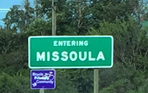
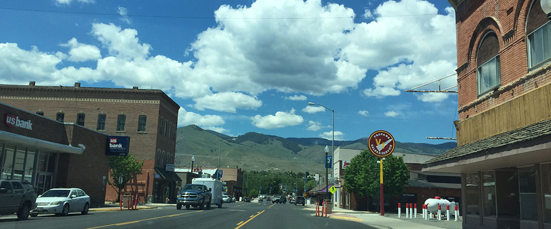
Dad plugged in our Comfort Inn to his iPhone and let the pleasant voice navigate us all the way into Missoula about 40 miles north. We took off on Reserve Street and headed on toward downtown where our hotel was on Broadway. The view from our 4th floor room was unbelievable – a perfect vantage point overlooking the Clark Fork river flowing westbound. It felt great to rest for a few minutes before venturing back out.
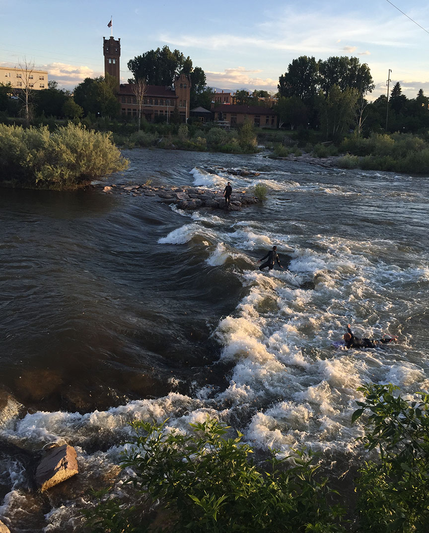
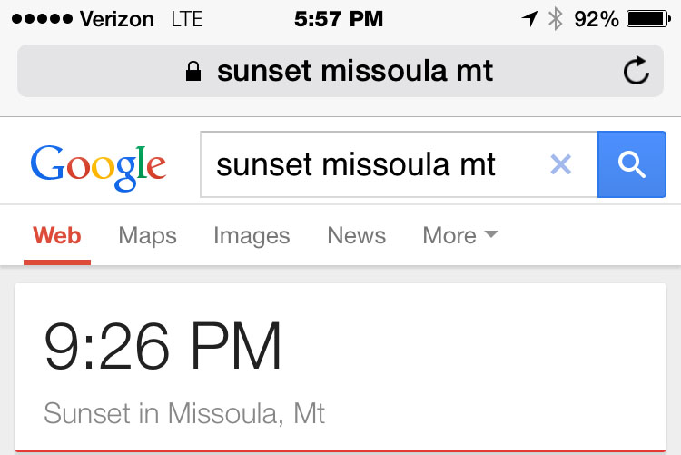
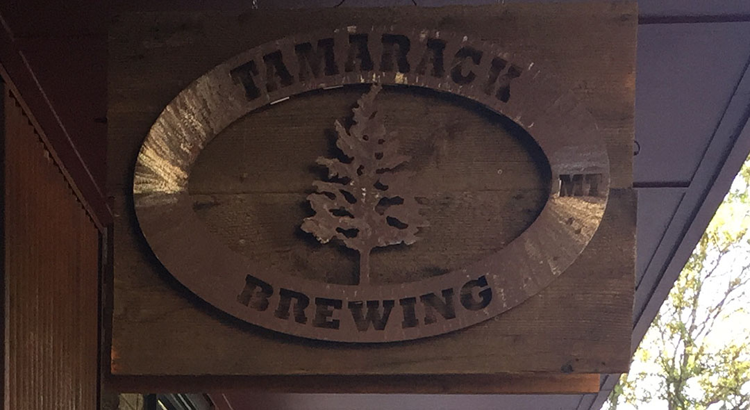
Dad had gotten a dining recommendation from the attendant at the front desk for the best place in town to eat. It was just 1.2 miles away in the downtown area, just a block away from the river. Tamarack Brewery was the name of the joint, and they gave me a Cobb Salad that could have easily fed 3 or 4 people. The Clark Fork was a popular place for surfing. There were several people in kayaks and with surfboards taking advantage of a huge curling wave along the river. We were able to watch from a wooden deck at the river’s edge for several minutes as the sun began to set.
Speaking of sunset, I couldn’t get over how late it stays light outside up north! It wasn’t sundown until about 9:30 p.m. By that time, we were sitting on log chairs around a fire pit outside our Comfort Inn talking with a nice couple who were road tripping through the area from Calgary, Alberta.
8-minute video from our dredge tour
Morning in Ketchum
Starbucks in Ketchum with log cabin atmosphere & construction
Off we go!
Taken looking east near Galena Summit on Highway 75
Most scenic gas station ever – Stanley, Idaho. Notice “Premium” is 90 octane, and it’s Ethanol-free.
Photo-op along the Salmon River
And a comparison with Josh’s photo that we were matching
Geothermal location between Stanley and Sunbeam Dam on Highway 75
ILX at Sunbeam Dam parking lot
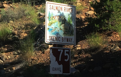
Salmon River Scenic Byway sign
Heading up Yankee Fork Road
Abandoned cabin on Yankee Fork Road
Sign for tours of the Yankee Fork Gold Dredge
Arriving in the ghost town of Custer, Idaho
Dad inside the Empire Saloon in Custer
Signing in to the register. Notice only a few people sign in per day.
Original 1901 dentist chair in Custer museum
Gold dredge informational marker
The dredge sits in this small pond. It hasn’t moved since 1953.
View from the north.
Control room of the dredge on the 4th floor
One of two huge Ingersoll-Rand 7-cylinder diesel engines that powered the dredge
We stuck pretty close to the Salmon all day long
Welcome to Clayton, Idaho. With a thriving population of…
Seven!
Intersection of Highways 75 and 93, where we headed north toward Challis & Salmon
Challis “Classy Chassis” car show
Northbound Highway 93
Getting closer to our nightly stop in Missoula
45th Parallel!
Close-up of the sign. This location on Highway 93 is halfway between the Equator and the North Pole.
Arrival in Salmon, Idaho
Owl Club has a big owl on front – and if you zoom in, you can see that people have shot arrows at it!
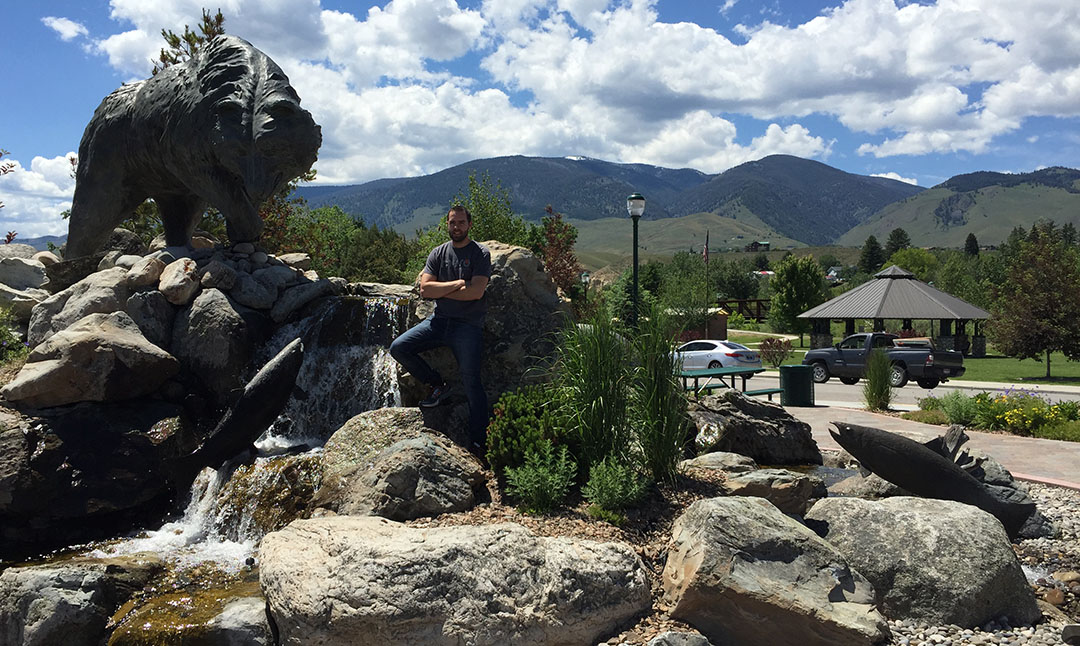
Bear statue & fountain in Salmon, Idaho
Shortly after crossing into Montana on Highway 93
Wandering around the shops in Darby, Montana
Candy store in Darby
Restaurant in Hamilton, Montana
It’s light so late!
Arrival in Missoula. Our hotel was near the University of Montana campus.
Dinner spot at Tamarack Brewing.
Did you know there was such a thing as a Ford Tempo All-Wheel-Drive?
Evening view overlooking the Clark Fork River
Evening sunset from our hotel
Come back for the final chapter of our trip next time!
Posted in ILX, Road Trip on June 9, 2015 by tysonhugie
Odometer (Legend): 533,695
Odometer (ILX): 129,937
Leg Distance: 1,053 Miles
How many states did I drive in this past weekend?
Arizona
Idaho
Montana
Nevada
Utah
Only five. But I covered some serious ground (roughly 2,600 miles) and I had an avid road tripper, my dad, along for most of the ride. Each year, he and I pick a scenic Rocky Mountain destination and set aside a long summer weekend to hit the open road. This time, we decided to check out a few neat little towns along the Sawtooth Mountain Range in Idaho & Montana that came highly recommended (and for good reason, we learned).
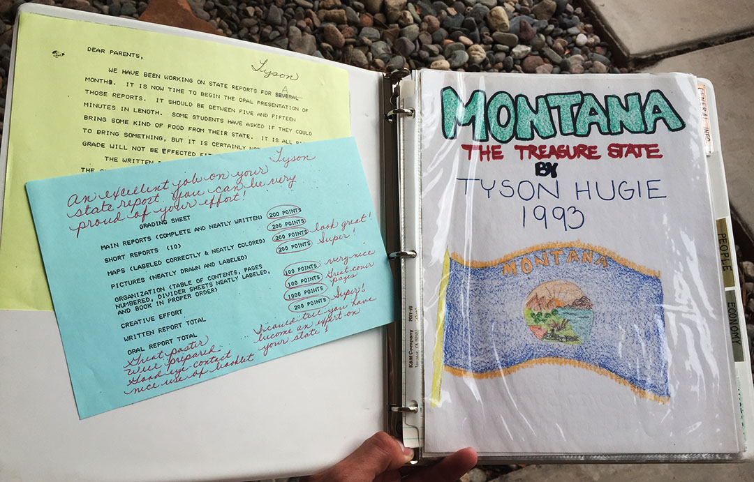
I’ve had a fascination with Montana since my elementary school years. Check out this 3-ring-bound, multi-section report I did on Montana when I was in 5th grade in 1993. Notice my teacher’s comments on the blue grading form: “You can be very proud of your effort! I can tell you have become an expert on your state.” Ha! I guess I have had a thing for geography for awhile now.
And can we just have a moment to appreciate my perfect cursive handwriting? Thanks.
This year’s father-son trip started out last Thursday after work when I hit the highway and headed to southern Utah, putting in about 400 miles that night by the time I arrived in St. George. The combination of a late arrival, early wake-up, AND an hour “loss” due to time zone differences (did you know that Arizona doesn’t change clocks to observe Daylight Saving Time?) meant I was red-eyed on Friday morning when I hit Interstate 15 northbound by about 5:30 in the morning, Utah time.
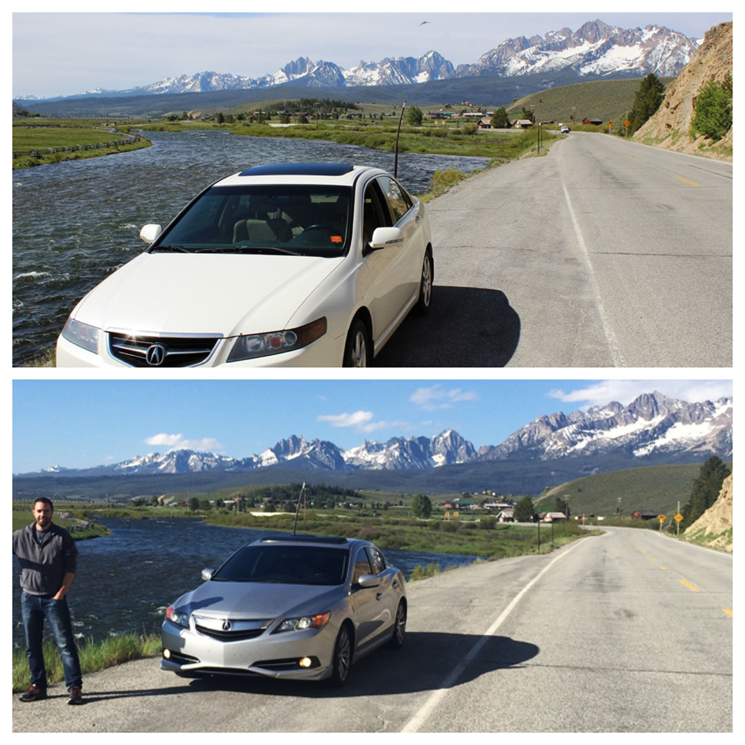
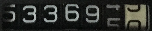
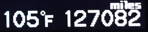
Most of I-15 is pretty mindless and thus the state has seen fit to post speed limits at 80 miles per hour. My only stop was in Cedar City to top off my tank and pick up a banana and some chocolate milk for the road. I did share one special occasion with my friend Chris who follows this blog, when my 2013 ILX surpassed his 2006 Toyota Sequoia in mileage at 127,784 miles. He put together this image to commemorate my/our achievement.
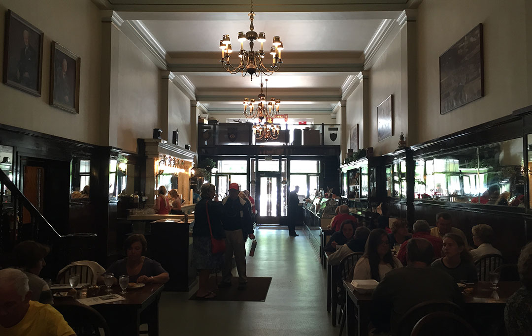
By about 11 a.m., I had traveled the nearly 400-mile south-to-north distance of the state of Utah and arrived in Logan, where my dad and other family members live. We dined for lunch at the historic Bluebird Cafe on Main Street to celebrate my grandpa Russell’s birthday. Then, it was time to head out.
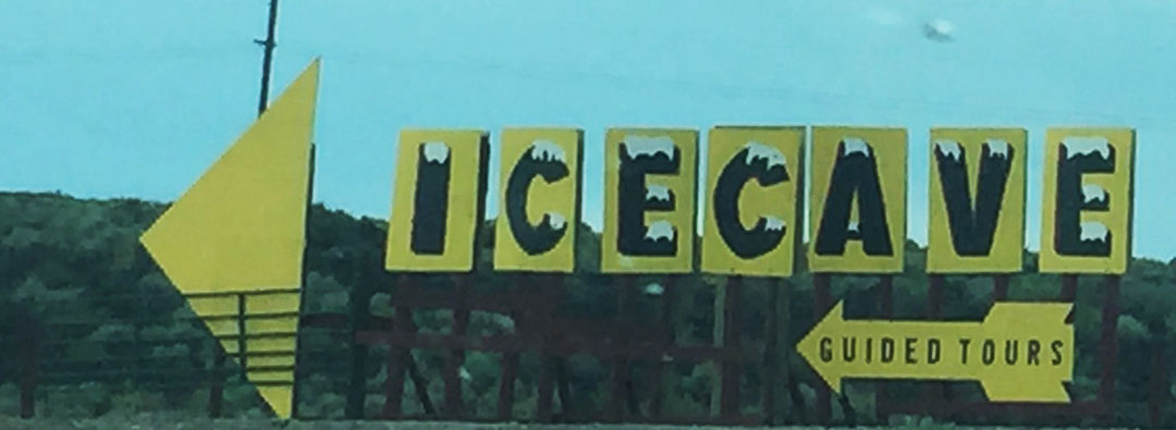
Our drive took us back to I-15 where it meets with I-84 near Tremonton, Utah. I-84 from there to the Idaho state line is pretty barren. You’re lucky to eek out 1 bar of cell phone signal in the 40 or so miles until you get into the Gem State. From there, we made our way westward to the Twin Falls area. I’ve blogged before about that area – specifically when Josh from TSXTravels.com and I met up at Shoshone Falls a little over a year ago. Once we got off the interstate, we headed directly north on Highway 75 and through some rinky-dink little towns like Shoshone and Hailey. It looked like the entire town of Hailey was attending a carnival.
Finally, we rolled into Ketchum (as seen above with a sign that’s tough to read). Along with its neighboring town, Sun Valley, Ketchum is a base camp for skiers, fishermen, bicyclists, and anyone who enjoys the outdoors. It’s apparent that tourist money has helped the community bloom. I picked up a postcard inside the lobby of our motel for the night, the Tamarack Lodge, that listed several dozen annual events that take place in the Ketchum area. Basically every weekend from May through October is booked with some festival or another.
The Pioneer Saloon was absolutely packed on a Friday evening. Luckily, it was only about a 20-minute wait for a teeny table for two in a back room that was quieter than the bar area out front. Our waittress assured us that they were known for their steaks, so I went with a sirloin and it was one of the best I’ve ever had. It was lights-out pretty early because dad and I knew we had a busy day to come.
Come back next time to see where we went the following day!
Photo-op in grandma’s backyard – Logan, Utah
Bluebird Restaurant in Logan, established 1914
Turnoff for the Shoshone Ice Caves north of Twin Falls, Idaho
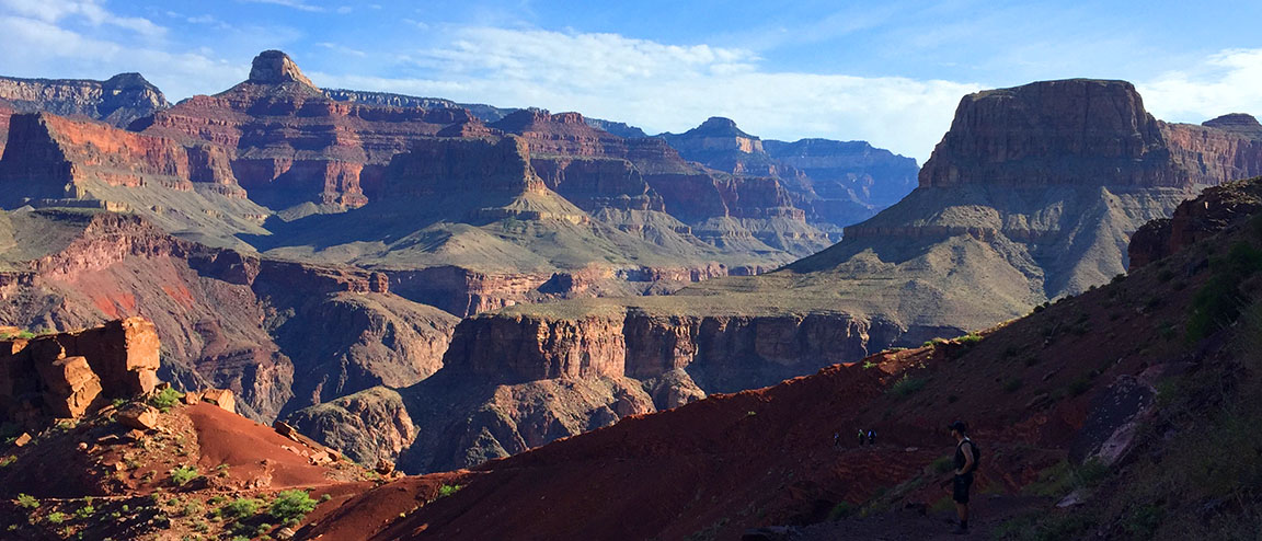
Last week, I was reviewing a GMC Canyon. This week, I’m reviewing another Canyon. The Grand Canyon.
While most of the canyon’s 5 million visitors per year are content to stand at the edge and admire its grandeur from afar, others are not happy until they get down and dirty while trudging across 20+ miles of it. My mom is one of those people, and I let her talk me (and a few friends) into joining her for this crazy adventure inside one of the “7 natural wonders of the world” last Friday. And 4 days later, my legs still scream at me for putting them through it.
I last blogged about the Grand Canyon in April 2014 when my friend Brad and I road-tripped to the Skywalk, a glass platform suspended from the canyon walls at the West Rim on the Hualapai Indian Reservation. But the 1,900-squre-mile national park is vastly different to look at from any of the many different angles, and there are several different hiking paths that lead down into it for those who dare.
Painfully Awesome
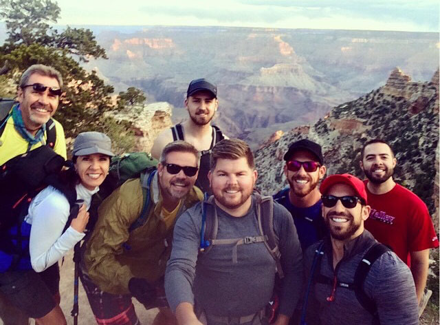
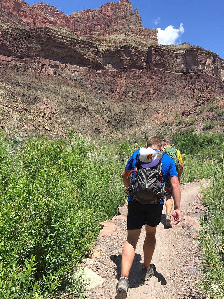
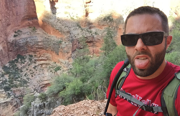
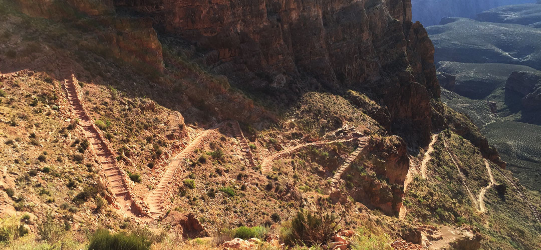
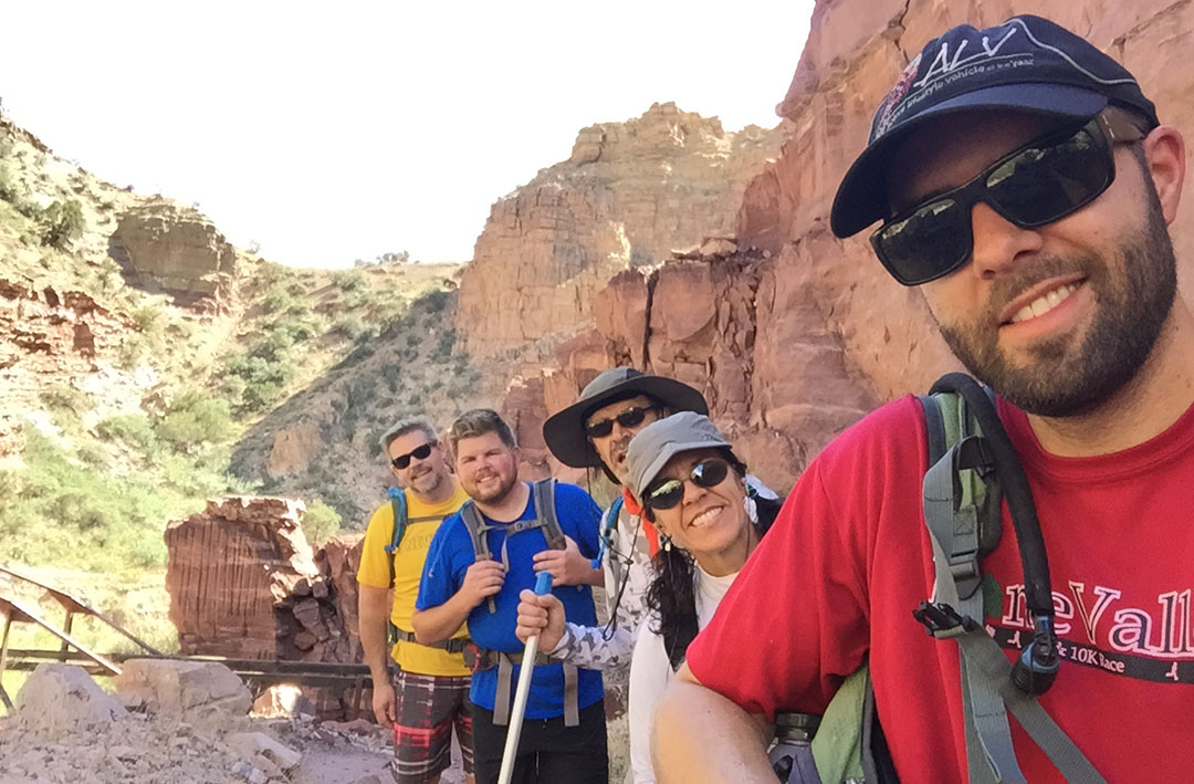
My friend Dave was telling me the other day about a bike ride he’d taken that had been especially difficult. He called it “painfully awesome.” That sums up in two words exactly how I’d describe Friday’s 14-hour hike. It was the most physically challenging thing I have ever done. Joined by 5 ambitious friends as well as my mom & stepdad, we set our sights on a “rim-to-rim” excursion. In other words, we would start on the south side of the canyon, hike down into into its depths at the Colorado River, then eventually make our way up the north side. For many months we prepared ourselves physically and mentally for the task, but the actual experience was exponentially more than I was ready for.
On Thursday afternoon, I picked up Kyle, Bryce, and Justin in the ILX for our departure from the Phoenix area. It took us about four hours to arrive at the Maswick Lodge along the South Rim. Highway 64 is a very quiet place at night. It’s a two-laner that climbs through the pine forests west of Flagstaff with little traffic, and no significant services or amenities aside from an occasional lonely gas station. By about 10:00 p.m. we met up with my mom, stepdad, and two other friends and settled in for a somewhat sleepless night.
It’s Go Time
In the blink of an eye it was time for a 4:00 a.m. wake-up call. Right off the bat, anxiety ran high because we were rushed to get to the train station for a 5:00 a.m. shuttle bus. We had to make last-minute decisions on what to throw into our packs, how much water to take, and what to wear. (Some of our gear would be staying in my car rather than making the trip across the canyon on our backs.) The bus took us to the South Kaibab trailhead (elevation 7,260 feet) about 15 minutes away and we hopped out. The sight of the canyon at daybreak is something unreal. Temperatures were cool but not uncomfortable. And then began our short-lived tradition of taking a group “selfie” at one-mile intervals throughout the course of the hike. I say short-lived, because by about halfway through the day we cared very little about group pics; we were focused instead on sheer survival.
With energy in abundance we made our way down the rocky but well-marked trail toward the base of the canyon. “We’re going down there?” I thought to myself as I looked in the distance at the vast expanse of rugged terrain. The trail required a good deal of focus for proper footing, but every once in awhile we had to look up from the ground below and admire the scenery around us. “OOOH AHH POINT,” one of the first signed viewpoints we came across, was aptly named. We zig-zagged our way down thousands of feet in elevation. Right away I discovered an issue with my Camelbak backpack when it started soaking my back and shorts. Somehow I hadn’t sealed it tightly enough and it was leaking like crazy. Eventually I dumped the water out of it and resorted to just using 3 refillable bottles.
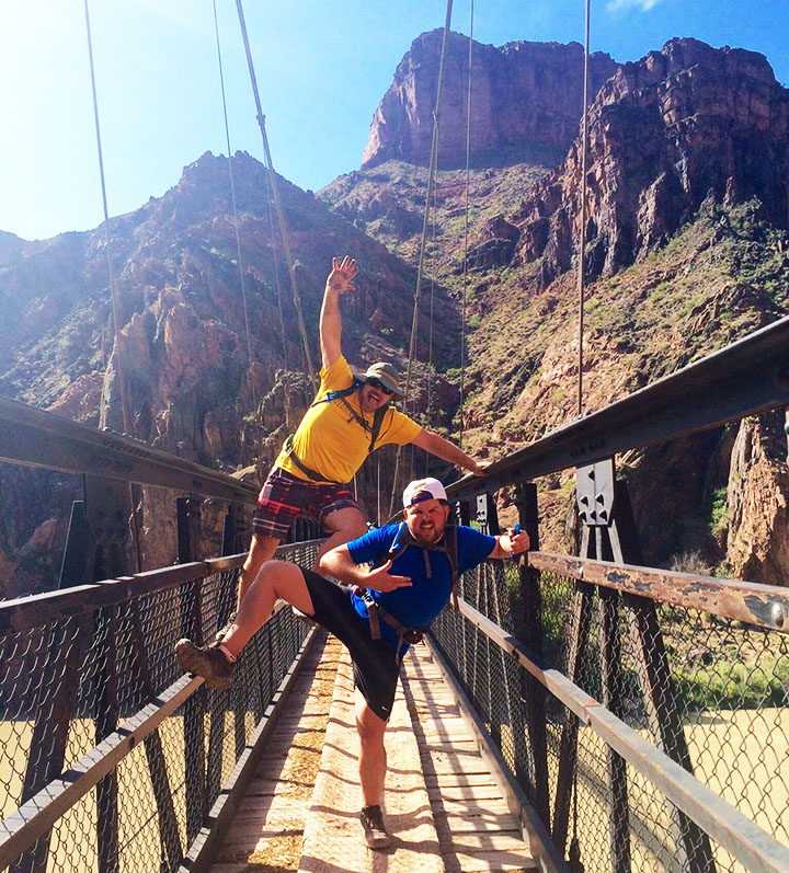
Besides having plenty of water, we were adequately prepared with other forms of nutrition. Rustin and Wade had packed what appeared to be an entire deli counter. Sliced lunch meats, prosciutto cheese, fresh strawberries and other delicacies were offered up when we made our first rest stop. Thanks to the downhill grade, our pace was quick at a little over 2 miles per hour. A short tunnel and pedestrian bridge across the Colorado River (which had a milky green look to it at the time) awaited us when we finally got to the bottom of the canyon.
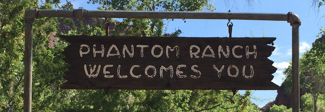
Phantom Pit Stop
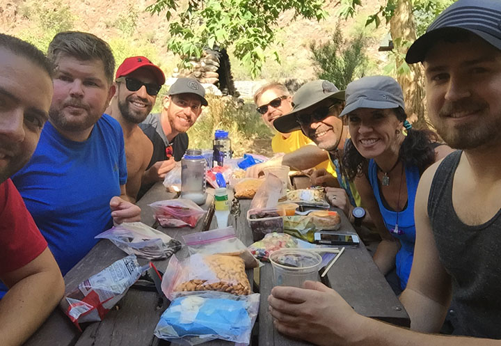
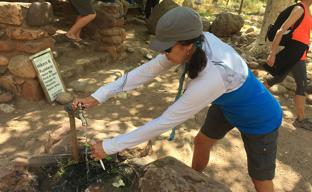
By now we were starting to wonder when we’d make it to Phantom Ranch at 2,460 feet. Notably the most “developed” of any place we’d be seeing throughout the course of the day, the lodge there has been a waypoint for Grand Canyon travelers since it was constructed in 1922. It was about 7.4 miles into our hike, and as we got closer, I could only think about one thing: LEMONADE. Inside the lodge, they sell cups of ice cold lemonade for $3.00 each. I chugged one so quickly it gave me a headache. Outside, there was a fresh water spigot for refilling water packs. The 8 of us sat around a picnic table under a shade tree and laid out some food items to refill our stomachs. Rustin pulled out a travel size bottle of Hidden Valley Ranch dressing and we all gave him a look of: “You packed that down here?”
The sound of Bright Angel Creek running nearby was therapeutic in itself. Todd took the opportunity to soak his legs in the chilly water. The rest of us just enjoyed the chance to rest at the picnic area. After so much downhill, for some reason when standing still, my legs felt wobbly. I knew already that for every one step downhill we’d taken, we’d be taking closer to two uphill. And that I dreaded.
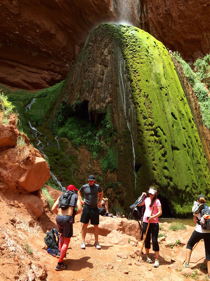
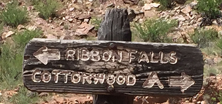
Ribbon Falls
The trail ran parallel to the river for many more miles. It was about this time – probably 10:30 or 11 in the morning – when the heat started cranking up. Even though I’d lathered up in SPF50 and I was wearing a baseball cap and sunglasses, I could feel the sun cooking the back of my neck. At times we had to walk single file and at other times we stood two abreast and held conversations. Several times there were bridge crossings where the trail changed sides in relation to the river. The steady uphill grade started getting the best of me and I now started drinking more water than ever before. I could now see why on average 250 people per year are rescued from the canyon. Dehydration is a very real concern.
My mom had learned of a detour that was an absolute must-see called Ribbon Falls. I don’t think any of us were too keen on adding distance to our already-long hike, but multiple sources had recommended we make time for it. So, when we saw a crudely-carved wooden sign pointing us in its direction, we rallied our energy as best we could and headed toward Ribbon to check it out. We had to cross a stream and hike up some boulders to get there, but in about 20 minutes we came upon the most beautiful oasis I’ve ever seen. Misty water came down upon us from dozens of feet above where it spilled through an opening in the red sandstone. Justin quickly scampered up as high as he could go on the waterfall itself, but all I could think about was ripping my shoes and socks off to dip my feet in the water.
I could have sat at Ribbon Falls for the rest of the day, but sadly we knew we had another 12 or 13 (all uphill) miles to hike before dusk.
Cottonwood Campground
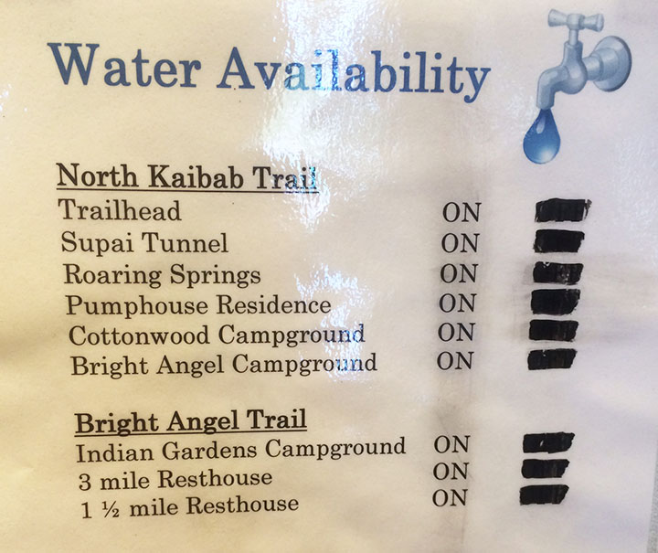
Todd had a great idea for a way to beat the heat when we got a couple of miles into our hike again. We took our shirts off and soaked them in the creek. The feeling of putting on a soaking wet T-shirt or tank top is unbelievably refreshing when you’re sweaty and gross – especially if there’s a slight wind to exaggerate the temporary chill factor. There are, occasionally, water spigots available every few miles on the trail from Phantom Ranch to the North Rim. Hikers have to be careful and plan ahead, though, because it’s possible sometimes for the water to be out of service. We lucked out and everything was in operation during our hike.
The next stop had probably a dozen or so campsites in it. We again took refuge in a spot of shade and refueled our bodies with food & drink. I took the opportunity to dump a grape flavored 5 Hour Energy shot into my water bottle in hopes that the caffeine would give me a kick for the next little while. My legs, feet, and back were screaming at me. By now, our tradition of taking a group photo at every mile marker had long been thrown out the window. Sometimes there was a lot of space between each of us, as each hiker settled into his or her own pace.
The Ascent
It was upon leaving Cottonwood that I really started questioning my ability to go the rest of the way. I knew from reviewing my mom’s pre-printed trail notes that our location at Cottonwood was still 6.8 miles from the finish line on the North Kaibab Trail. But it wasn’t that distance that scared me. It was this:
Cottonwood Campground: 4,080 feet
North Kaibab Trailhead: 8,241 feet
Okay. So, I’m no rocket scientist but that’s 4,161 feet. Vertically. In other words, after having already hiked about 18 miles, we still had almost 7 to go and we would essentially be climbing 78% of a vertical mile. Straight up in the air. My life flashed before my eyes. Would I send everyone onward without me and potentially stay the night in the canyon? Was I going to be one of “those people” who had to get helicopter air lifted out of the canyon on the news? I couldn’t let myself think about failure. I just had to keep taking it one step at a time.
And that’s where I found myself setting my own pace. Kyle, Bryce, and Justin had gone on ahead. I was kind of in the middle of the pack. I set my iPhone (in airplane mode all day to conserve battery since cell service is non-existent of course) on shuffle and let it play music from inside my pocket. That helped steer my mind clear from the task at hand. I passed a couple who was walking the opposite direction. They could tell that I was “spent” physically by the way that I braced myself with a tree while standing to catch my breath. “There’s a water stop about a mile and a half up, right after a tunnel,” the man told me. I thanked him. But I’m pretty sure he lied to me.
That was probably the longest mile and a half of my life. I kept looking for a tunnel that never came. Endless log stairs, rocks to climb over, and switchbacks. I’d round a corner and they just kept coming. “Really?!” was the thought that kept crossing my mind. I’d walk for a couple minutes, then have to catch my breath and keep my heart from coming out of my chest. When I finally saw that tunnel after an eternity of hiking, it almost seemed like a mirage. I went through, plopped down on a rock, and just sat there without moving a muscle for at least a few minutes. The sun had started its descent into the horizon already so I knew daylight was on the way out.
The fat chipmunks at that small rest area kept me company (and ate some of the peanuts in my trail mix) for about 15 minutes until my mom and Todd arrived, and then Rustin and Wade were just a few minutes behind them. We talked for a bit and then decided it was best to press on as daylight would soon be closing out.
Final Stretch
The last 1.7 miles of the hike happened at a snail’s pace. Every so often I would look behind/below me at the huge canyon and get a little dizzy thinking I had just come up from there. At one point I got insanely hungry and dug into a Nature’s Valley granola bar. I didn’t care that it had become nothing more than a packet full of crumbs at that point. I inhaled it, and I downed two more bottles of water that I’d filled up at the rest stop. Keep in mind, I hadn’t used the bathroom since Cottonwood. All that water was flowing right through me as sweat.
I knew I was getting close when I started hearing the sound of automobile traffic overhead. The trail conditions got notably better, and I passed a man sitting along the side of the trail who was waiting for some family members. “You’ve only got 100 yards to go,” he told me. Music to my ears. I made it. And it was the biggest rush of relief that I had ever felt.
Aftermath
It’s miraculous that the 8 of us everyday people made it through such a physically taxing event. We took one last group photo from the bed of Todd’s pickup truck which was parked there at the North Rim. After showering up, we made it to our 9:00 p.m. dinner reservation at the historic North Rim Lodge. I glanced around the table and the look of exhaustion was pretty common. We slept like rocks at our rented log cabin.
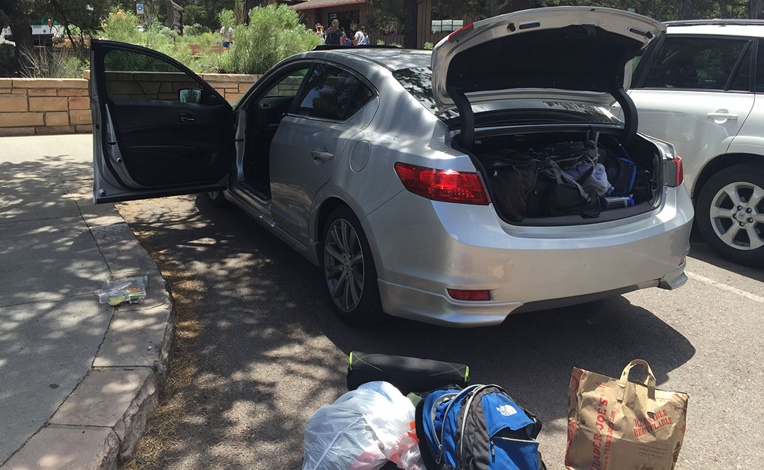
On Saturday morning, Justin, Bryce, Kyle, and I got on a 7:00 shuttle van that drove us 4.5 hours back to where my ILX was parked at the South Rim. Each time we stumbled out of the packed van at a rest area, my legs reminded me that they weren’t happy with what I’d put them through the day prior. It was great to get back to the car and settle in for the rest of the trip home. Here’s a picture from when we exited the park on Saturday morning.
We dined at a neat little Italian restaurant in historic Williams off Interstate 40 before heading back to the Phoenix area.
Thanks for being a part of this memorable adventure! The rest of the pictures and a short video follow:
Rest stop near Camp Verde, Arizona on I-17 headed north toward the Grand Canyon
Setting out on our hike
Still wearing a smile, just a few miles into the hike.
One of the group pictures we took for the first 1/2 of the hike
Switchbacks leading down to the floor of the canyon
Another group pic
Rustin and Wade taking a snack break
A few of the scenic views that surrounded us
Wade and Rustin had a lot of energy still at about 6 miles into the hike.
Group shot whilst crossing the bridge
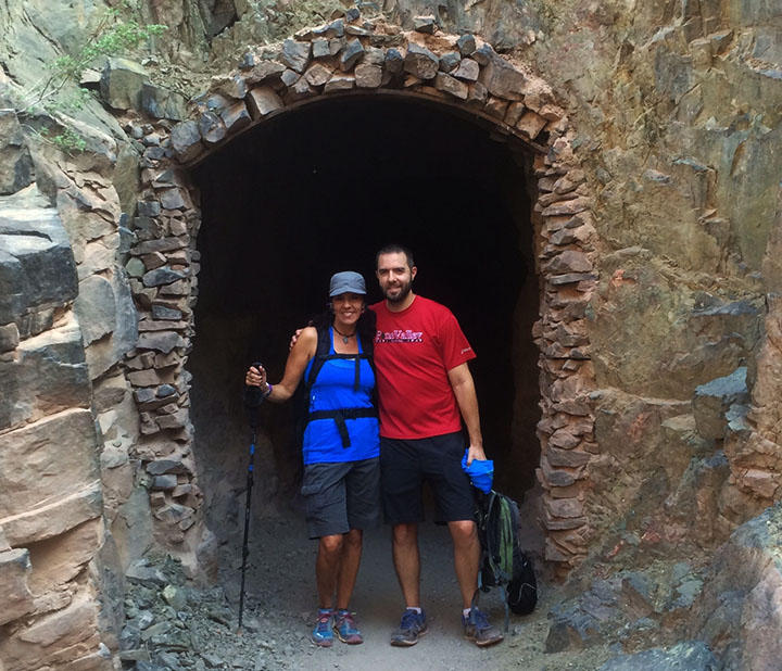
Tunnel crossing – Todd pictured here
View of the bridge
Back on the trail we went
Refreshing lemonade at Phantom Ranch
Speaking of Ranch, here’s the man who packed a bottle of it!
Luckily for us, the pipes were working.
Mama Tia filling up on water before heading out again
Taking a break in the shade along the trail (Bryce, Tia, Kyle)
One of many river crossings
Arrival at Ribbon Falls
Rustin savoring every drop of his Diet Dr. Pepper which he’d lugged into the canyon
On the trail again, just can’t wait to get on the trail again.
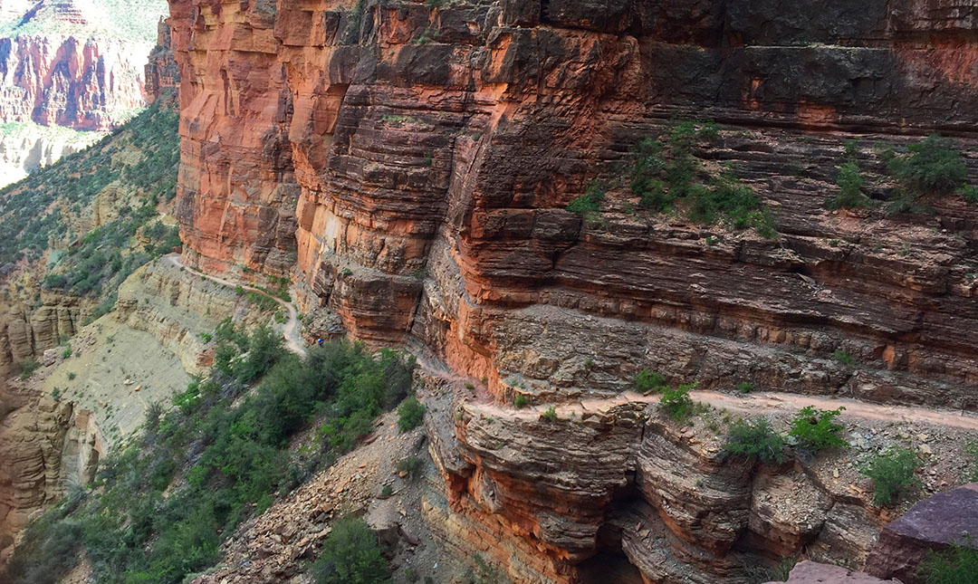
A few pictures from the upward climb. You can see the trail about halfway up the hillside.
And another shot of the trail looking back down.
North Rim Lodge as seen on Saturday morning, the day after our hike
Our shuttle van for the 4.5-hour trip from North Rim to South Rim
Arrival back at the ILX which had been parked at Maswick Lodge
Lunch spot in historic Williams, Arizona
Finally, a shout-out to one of my most loyal readers, Conor, who sent me a Hot Wheels NSX to match the real deal!
Greetings! How’d everyone spend last weekend’s holiday?
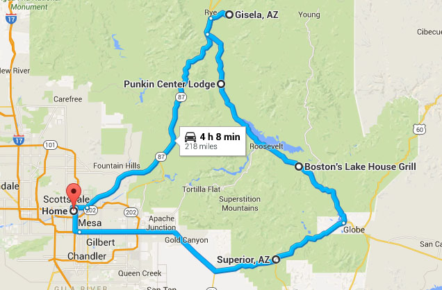
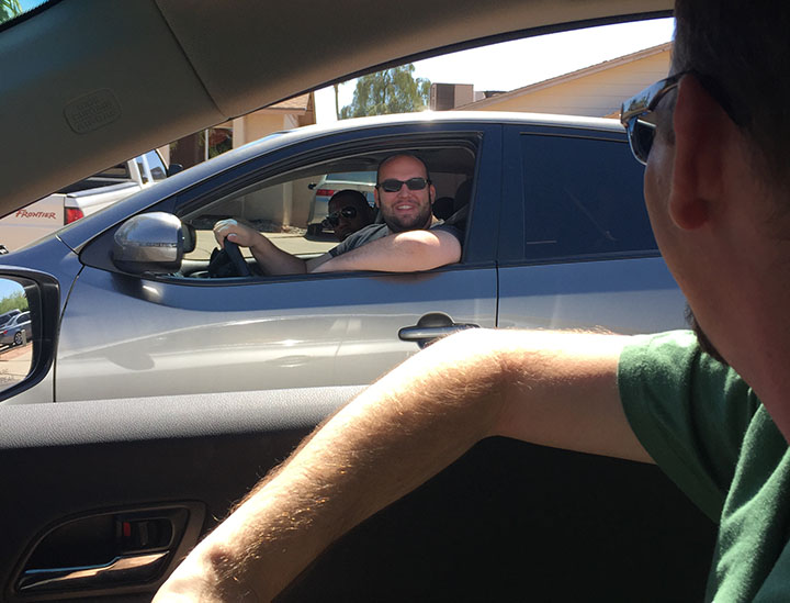
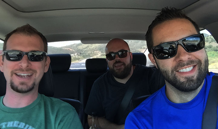
My buddy Lance visited from Dallas for a few days and it seemed only fitting that I treat him to a good old-fashioned Arizona road trip. I rounded up a few other guys and we hit the highway at 10:00 a.m. on Monday morning in my 2013 Acura ILX and in James’ 2011 Kia Forte 5-door SX. After a quick fuel stop at Chevron on Highway 87, we continued northbound to the exit for a teeny town called Gisela. I’d visited the area two years ago but wanted to introduce my 4 friends to the sweet 5-mile road leading there.
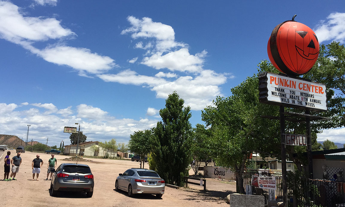
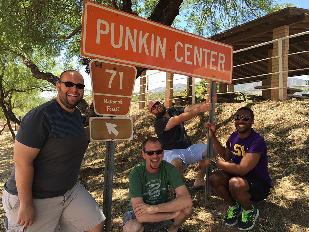
The other place I’d wanted to check out was a town off Highway 188 on the way to Roosevelt Lake called “Punkin Center.” Now, there’s absolutely nothing to see or do in Punkin Center. Well, I guess there’s a thrift shop, a little bar & grill, a quaint lodge, and a few locals who looked at us like the foreigners we were when we rolled into town. After staging the Forte & the ILX for a picture in front of the signature Punkin Center sign, a couple of rough looking guys rolling by in a Dodge pickup truck rolled down their window. “You guys gonna drag race?” the driver asked James. James told him that we were. Ha!
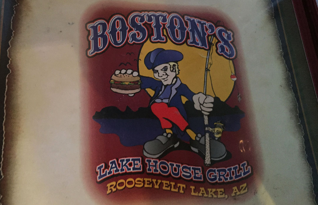
The lodge at Punkin dates back to 1912 and is available for $235 for a one-week stay. I might have to plan a longer trip out. From there it was time to head out and grab a bite to eat. I’d found a decent looking place about 30 miles down Highway 188 called Boston’s Lake House Grill. We dined on a cheese crisp with green chile and then some greasy hamburgers. Even better than the food was the audio soundtrack. When Paula Abdul’s 1988 classic “Straight Up” came on the surround sound, our entire table lit up in karaoke unison. The forest service guy with the big mustache in the corner booth may have given us a dirty look at around that time.
After din, we did a car & driver switcheroo – I took the Kia this time – and we completed our loop via US Highway 60 on through Miami, Superior, and into Apache Junction at the east end of the Phoenix metro area. I found the Forte to be quite the impressive little ride. James’ car has only 49,000 miles on it and looks/smells new. The seats were my favorite feature. I haven’t had a car with cloth seats since my 1989 Prelude when I was 17! I forgot how comfortable they are!
Thanks to the guys for joining us, and to the rest of you for tuning in electronically.
Ready for roll-out!
Kevin, Peter, Tyson in the ILX
Taking a break in Gisela
James and Lance discovered they had matching fluorescent yellow shoelaces
Next stop: Punkin Center
Few pics in Punkin Center. It’s like Halloween every day!
Even on a holiday weekend, not much happening here!
Couldn’t resist a couple pictures at the (orange) entrance sign to town
Having way too much fun
View of Roosevelt Lake from Highway 188
Lunch menu at Boston’s Lake House Grill
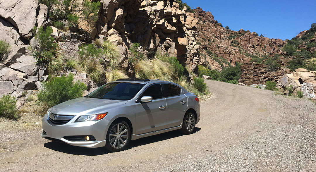
ILX looking all photogenic on Highway 60 just east of Superio
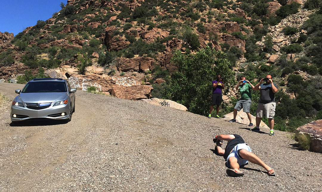
Peter taking a picture. And people taking a picture of me, taking a picture of Peter, taking a picture.
Goofy kids.
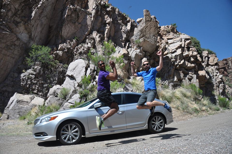
Jump! In the style of those old Toyota commercials (“I love what you do for me!”).
In-car karaoke, courtesy of Lance, Peter, and Tyson.
Next up: Ever wanted an inside look at the Grand Canyon? I’m about to take you from the South Rim, deep down to its base at the Colorado River, and up the north side… via 26-mile hike. My legs are burning from yesterday’s trek but the story was worth it.
Before we get started with today’s drive, I need to get a nursery rhyme stuck in your head:
London Bridge is falling down,
Falling down, falling down.
London Bridge is falling down,
My fair lady.
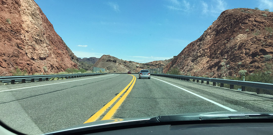
There now. Let’s get in the car and check out a fun Saturday road trip destination about 3.5 hours west of Phoenix.
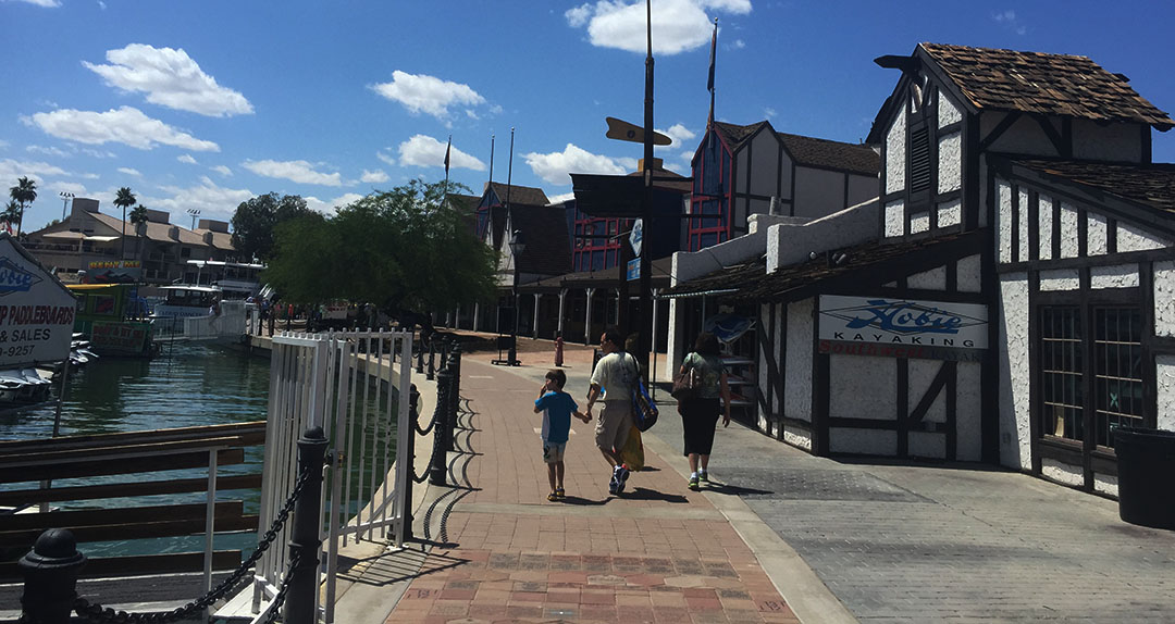
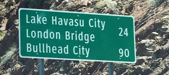
In 1958, there was not much to see in the Mojave Desert at the Arizona-California state line. From a barren wasteland, a man named Robert P. McCulloch had a vision: He wanted to build a city. He purchased 3,300 acres of land on the east side of Lake Havasu on the Colorado River and planned it out for 4 years. Later, he picked up another 13,000 acres. Lake Havasu City was established in 1963, incorporated in 1978, and continued to develop in the ensuing decades. Today, LHC is home to about 52,000 people. It’s a popular destination for spring breakers, water recreationalists (I just made that word up), and snowbirds who escape the winters up north and park their fifth-wheel trailers for a few months in Arizona every year.
One of the city’s biggest attractions is a 930-foot-long stone & concrete bridge that was once a critical piece of infrastructure way across the Atlantic, in England. From 1831 until 1967, this bridge spanned the River Thames in London. But Robert McCulloch wanted so badly to bring a “centerpiece” to his newly-founded community that he purchased the entire bridge from the city of London and had it transported, piece by piece (they were numbered to keep them in order), to western Arizona. It took three years to re-build the bridge in its new location, and it opened for traffic in 1971. It connects a small island in the Colorado River with the rest of Lake Havasu City. The area surrounding the bridge is understandably themed as that of an English village.
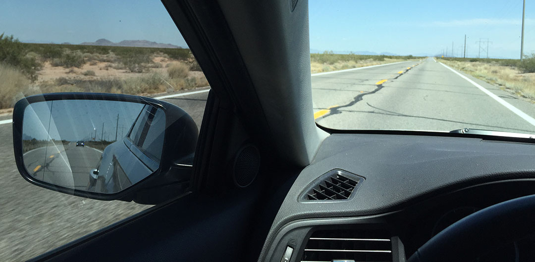
James from Six Speed Blog and I headed out in our luxo-rides around 9:30 in the morning. This week, his test car was a 2015 Mercedes-Benz C400 sedan. I took my tried & true 2013 Acura ILX. Most of our drive was on hum-drum Interstate 10 which is always plagued with way too many 18-wheelers clogging up the fast lane, but a couple hours into it, we entered the back roads and things got a lot more interesting.
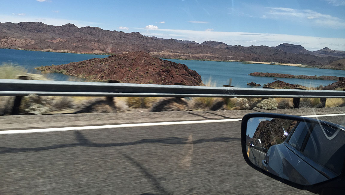
For about the next 90 minutes, Highway 95 ran parallel to the bright turquoise Colorado River. There were homes lining the river for most of the way, and we spotted a few boaters out enjoying the beautiful Saturday weather. It wasn’t long until we closed in on Lake Havasu City.
The name of the road which passes over London Bridge is (not surprisingly) McCulloch Drive, named for the man who purchased & reconstructed the bridge back in the 1960s. The first thing James and I wanted to do when we arrived in town was get some lunch, so I picked a top-rated (well, 4.3 out of 5-star) spot for us to check out, called Barley Bros. From our booth, we had a sweet view of the bridge outside. I went with a chicken club sandwich and James went for a “lobster burger,” but the thing we both raved the most about was the garlic cheese bread we got as an appetizer. The bread was so soft it almost melted in your mouth!
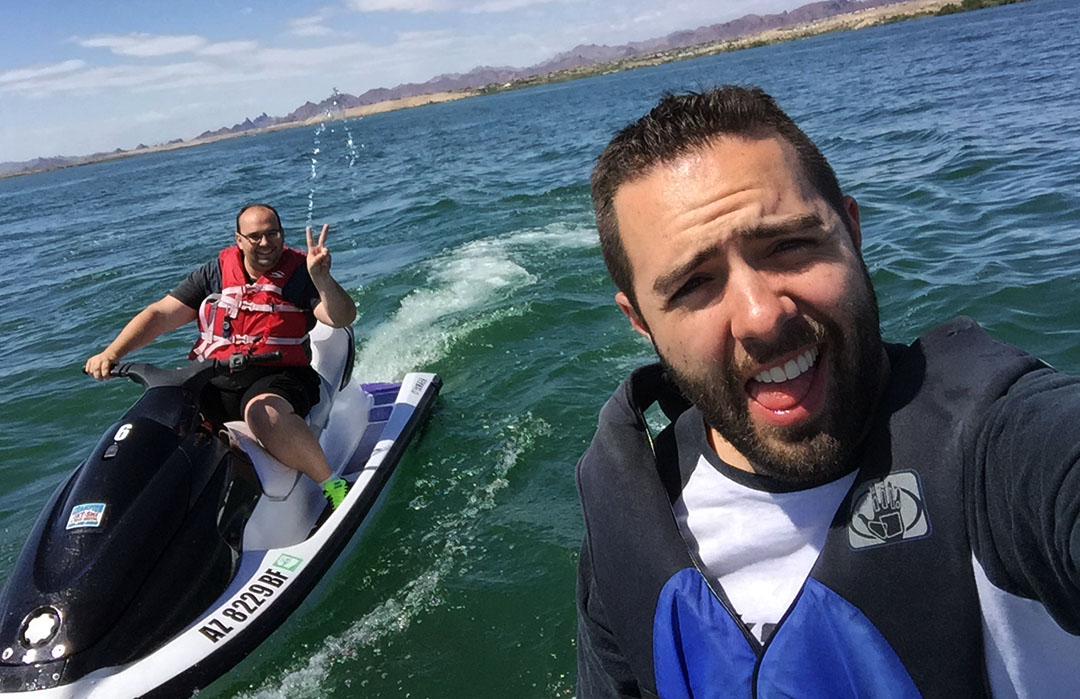
There are shops, food trucks, and other vendors along the water underneath the bridge, so we hiked down a couple flights of stairs and wandered around a little to check out the area. James spotted a jet ski rental place so we decided to try something spontaneous and check out the pricing. Champion Rentals offered pontoon boots and watercraft for rental by the hour. Jet skiing is something I hadn’t done for probably a decade and a half, but back in the day, my family spent a ton of time at the lake. Here’s a picture of me in summer 1997 at Lake Powell in southeastern Utah.
And another shot of me (left) and my dad (right) following the boat.
James had a little experience with personal watercraft too, and we both kind of wanted to have some fun. For $75 each, we plunked down our credit cards and booked ourselves on a couple of black & white Yamaha WaveRunners. I was surprised at how “little” training the owner gave – basically a few instructions on operation of the machines and a how-to on buckling the life vests, and we were off!
It took us 10 minutes to idle our way out of the “No Wake Zone” in Thompson Bay but immediately afterward we hit the throttles and had a drag race. My WaveRunner somehow was a good deal quicker than James’ so I left him in my dust. Or, in my wake, rather. We had a lot of fun tooling around and got plenty wet in our everyday apparel – including shoes & socks which ended up being squishy and wet.
After our hour of fun, we turned our watercraft back in and went back to the cars. We fueled up at a station called “Terrible’s” (not sure why anyone would name a business such a thing) and started our return drive to the Phoenix area. This time, I took the extremely posh Benz. Coming from a high-revving 4 cylinder to the Mercedes 3.0 V6, I was immediately blown away at just how refined the car felt at 70 miles per hour. It effortlessly floated along with zero wind noise.
At one point I needed to pass two slow-moving semi trucks on Highway 95 and I discovered just how quickly the car can scoot! Its 329 horses are readily available to gallop. The head-up display made a handy way to tell current speed and direction at all times without taking eyes off the road. I had to chuckle when James pulled up behind me at a stop light and his iPhone bluetooth paired with the Mercedes’ radio and started playing his music. As soon as I pulled away at the green light, the music cut back out again.
For the return trip, we opted for a little different routing. Instead of taking Highway 95 down through Quartzsite and getting on Interstate 10 from there, we headed southeast on Highway 72 through some rinky-dink towns like Hope and Salome. There really wasn’t much to see, but the seclusion and feeling of remoteness made it fun and the road had a bunch of whoop-de-doos. One 30-mile stretch between Salome and I-10 had at least 40 or 50 warnings painted on the pavement in giant block letters: “WATCH FOR CATTLE.” Since it’s open range out there, I’m guessing they have a high incidence rate of car-to-cow contact. I didn’t see a single cow in the whole stretch, however. We did make a quick stop at a teeny chapel. This one was just a tad larger than the one I saw in Yuma back in September.
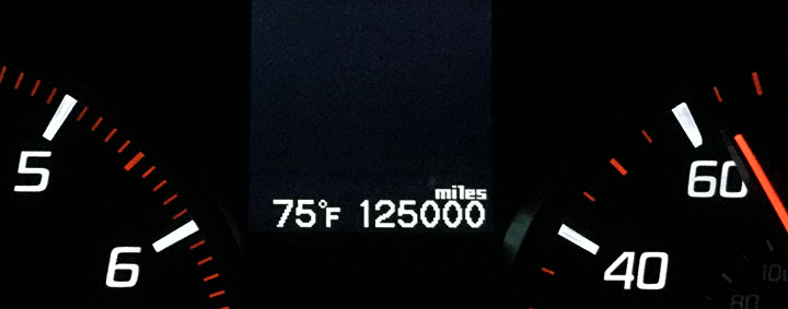
The day concluded with a memorable 125,000-mile milestone in the ILX. Next month, on June 12, I’ll celebrate my 3-year anniversary with that car. Hard to believe how quickly the years (and miles) have flown. Thanks for being a part of today’s drive and I look forward to having you along for many more in the future. Below are the rest of the pictures and a short video.
Exiting Interstate 10 and heading north on Highway 95
Hey! I think I found out where I need to build a home!
Arrow-straight Highway 95 heading north toward Parker, Arizona from Quartzsite
In Parker, a junction with Highway 62 which leads toward California
Onward toward LHC
Getting closer!
Welcome to Lake Havasu City! “Play Like You Mean It.” Ha! It’s no wonder Havasu is such a hot-spot for spring-breakers.
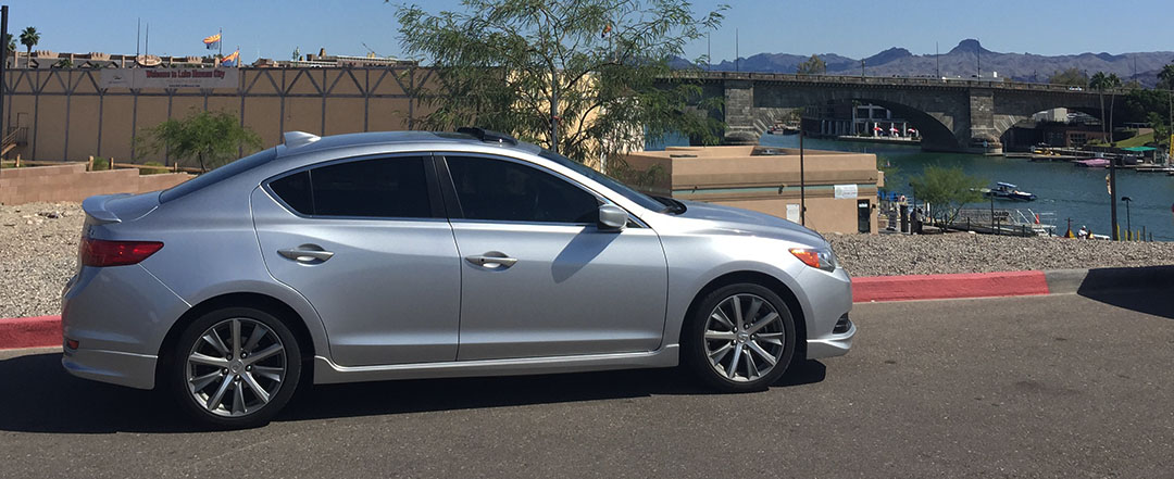
The ILX with the London Bridge in the background
Driving across the London Bridge. I wonder if even those light fixtures are original?
Peeking out toward the mighty Colorado River.
Lake Havasu City is a true oasis. It’s nothing but barren Mojave Desert in every direction.
A good look at the bridge from the south side.
We saw this guy doing acrobatic tricks on some crazy looking “water jet shoes” of some sort.
James cruising along on his WaveRunner
Getting a little wet in the middle of the lake
Pre-departure fuel stop.
“Suds your Duds” Laundromat near Bouse, Arizona.
Couple hours from home.
Picture from inside the tiny chapel on Salome Road
Some people buy a vehicle as a disposable appliance – a sheer means of transportation to get from A to B. Others hold their vehicles so near and dear that they’ll rebuild them – twice – after catastrophic collisions. Where do you fall within that range of car owners?
One of my favorite things to do on rare weekends when I stay in town is to visit the local Ecology “pick & pull” auto junkyard, plunk down $2 for my entry fee, and simply wander around through the aisles of parted-out cars. I like to eyeball the interiors and look specifically at the gauge clusters to see just how many miles each one traveled before being put to rest in the graveyard. Occasionally I’ll come across something with fewer than 100,000 miles on it. Most of the time the odometers are between 200,000 and 300,000. And every once in awhile, I’ve seen them beyond that – but never anything in the 400’s or 500’s.
The thing that I wonder about, though, is what kind of story each car would tell if it could talk. How many of those vehicles have ever had “Just Married” painted on them? How many were driven by a zealous 16-year-old as his or her first car? How many ever took a cross-country trip from one coast to the other? How many of them were ever stolen? Or, a more somber thought, how many of them became witness to their driver’s death in a collision?
Many people today buy a car without ever having thought of its prior ownership history. For me, such history is a hugely important part of how “good” a used car is. I go crazy for a clean car for sale by its original owner, with a stack of detailed maintenance paperwork, a clean title, and some original floor mats. Mmmm. It’s scary to think of buying something without any kind of record. There are, however, ways to at least know something about where any car’s been.
Carfax and Autocheck are companies in business to provide that kind of reporting. Carfax has been around since 1986. The company has access to 10 billion records from 86,000 sources (motor vehicle departments, auctions, insurance companies, repair facilities, etc). With just a VIN or a license plate (and a credit card), regular consumers can pull vehicle history reports from those billions of records. Carfax is certainly not a complete record, and it should only be considered for a used car purchase in combination with other research.
As I’ve been casually in the market for a 1992-94 Acura Vigor, I grabbed a $45 Carfax account and started running reports on a few prospective cars, including the above pictured beauty (sarcasm). My account gives me access to UNLIMITED reports by license plate / state, or 5 reports by 17-digit Vehicle Identification Number (VIN). I had some fun with this.
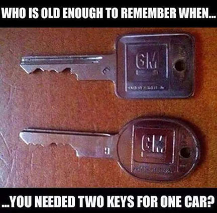
One Vigor showed record of a whopping 13 owners in its lifetime. I ran some of my friends’ cars for the heck of it, too. I also checked out some of my “old” cars to see where they ended up. I was intrigued by the report on my first car: the 1986 Chevy Celebrity that was my pride and joy from 1997-98. I laughed the other day when I saw this picture on Instagram because the keys shown there are exactly what the keys to my Celeb looked like (square for the ignition, round for the door & trunk locks – I think).
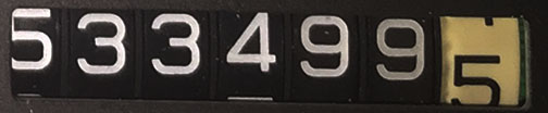
I know my parents bought the car new in 1986 from Axtell Chevrolet in Logan, Utah. But the first record on Carfax wasn’t until March 1994 with an odometer reading of 555 miles. Say what? Yes. The odometer on that Celebrity only had 5 digits. So, by the time the car was only 8 years old, it had already turned over to 00,000 and made any future readings erroneous. Utah noted that fact on the Celebrity’s report. The car’s title was branded with “Exceeds Mechanical Limits.” Can you imagine if my ILX only had a 5-digit odometer? It would have rolled over once already and it’s a 2-year-old car.
By the time I got the Celebrity, it had around 194,000 miles on it. But of course, the odometer read only 94,000.
That Celebrity dropped off Carfax reporting a decade ago, since the last record was a purchase reported in March 2005. I’m sure the car has long since been crushed and turned into scrap metal.
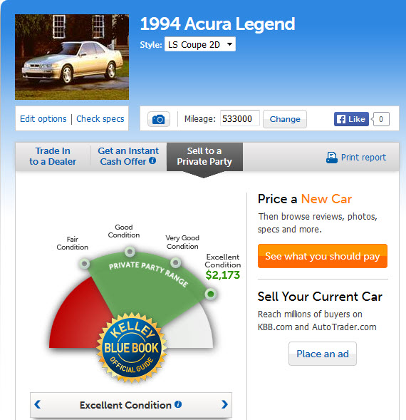
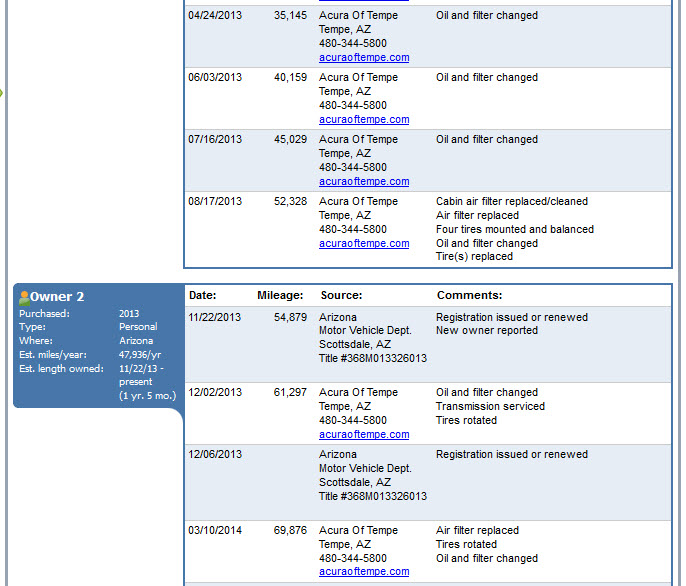
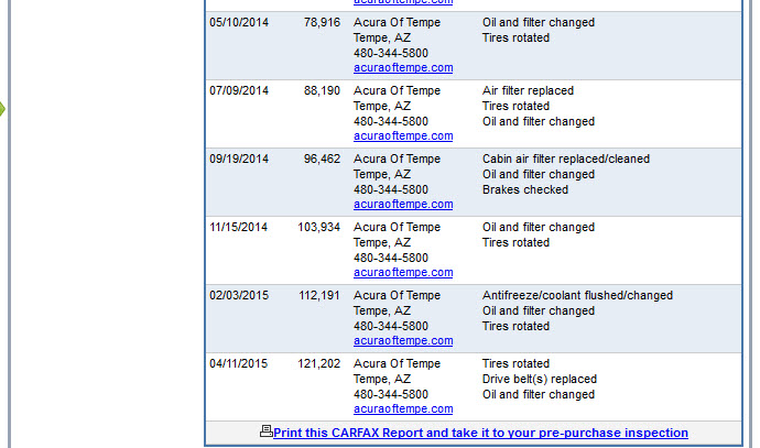
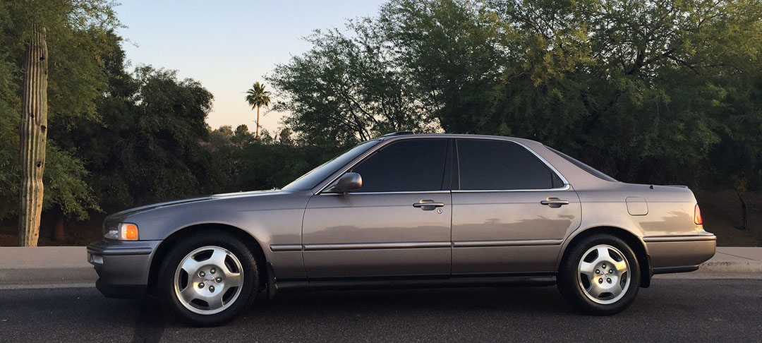
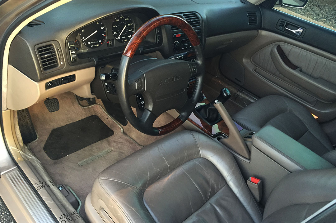
I thought it would be interesting to go ahead and share the detailed Carfax reports for my Legend and for my ILX. The Legend’s history is tainted so it’s a little unnerving to post it here, but it’s all in the interest of a good history lesson. Some of you may know that I hit two deer with the Legend in summer 2007.
It took almost six years — until early 2013 — before that insurance claim started showing up on the Carfax report! My car’s title today is clear. There are a whopping 77 service records, and oddly enough, Carfax thinks my Legend is actually worth about $2,600 MORE than retail book value! That means I could price it at about $4,700 since “excellent” condition value is $2,173.
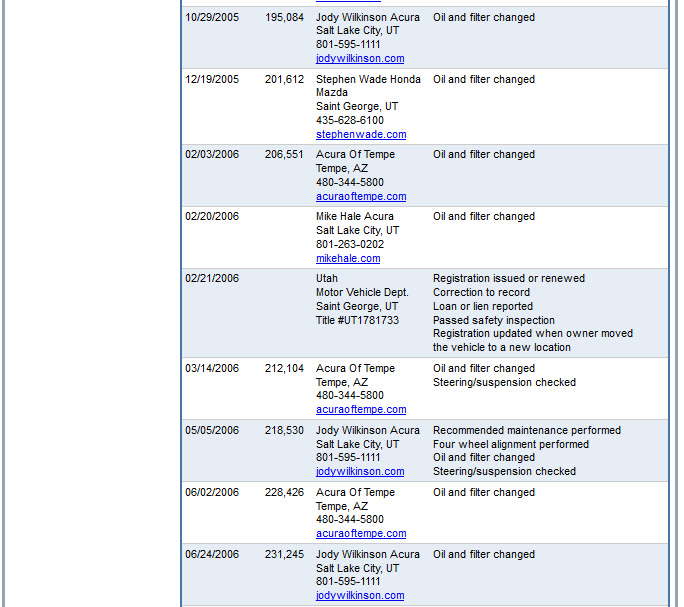
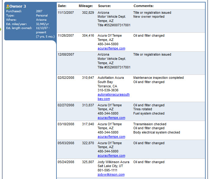
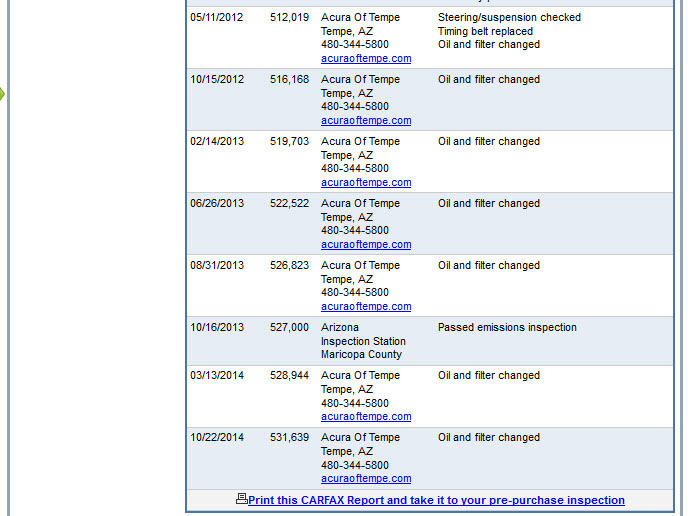
It took me 11 screen captures to get the full Legend Carfax report. Here you go!
Page 1
Page 2
Page 3
Page 4
Page 5
Page 6
Page 7
Page 8
Page 9
Page 10
Page 11
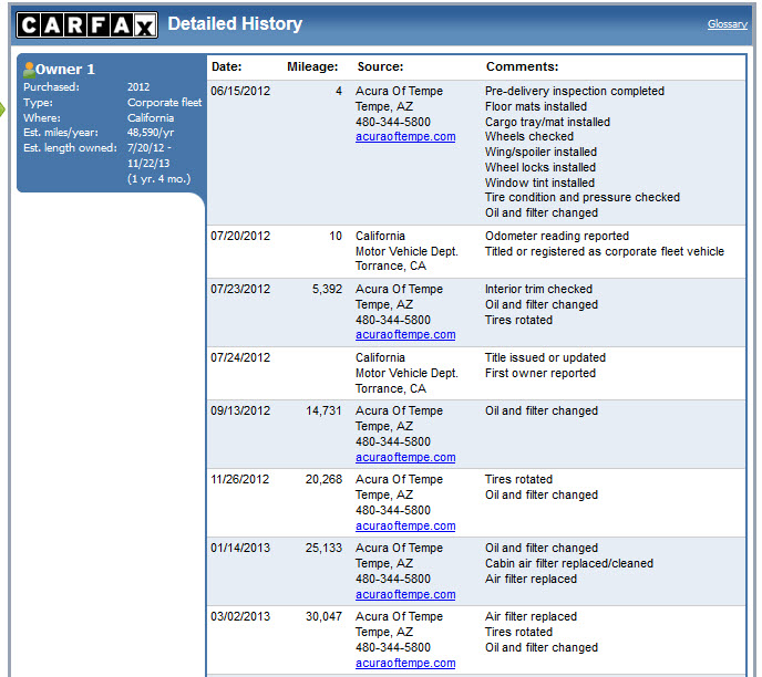
Then there’s the ILX. Clockwork maintenance from Acura of Tempe, and not much else.
Page 1
Page 2
Page 3
There’s one more Legend record that’ll be showing up soon. I got a $41.23 oil change on Wednesday with 5W30 synthetic blend oil at Acura of Tempe. It had been over 6 months since my last service, but only 1,703 miles. I really hadn’t driven the car much since last fall! Here’s the latest snapshot from my Excel maintenance record showing service and repair costs since about 512,000 miles.
The technician did note a number of leaks, including the differential, transmission, driver side inner CV boot, and rear main seal. This all does come as a bit of a surprise though since my garage floor is squeaky clean and I’ve never noticed a drop in any fluid levels.
Today during lunch, I took my Legend GS sedan for its emissions (“smog”) testing. The test is required once every two years and it evaluates the levels of pollutants in the exhaust output. The wait was only about 20 minutes.
Here are the numbers:
Hydrocarbons in grams/mile: .49 (applicable standard = .80)
Carbon monoxide in grams/mile: 7.65 (applicable standard = 12)
Oxides of nitrogen in grams/mile: .66 (applicable standard = 2)
It passed, I was issued my certificate for a $20 fee, and I went on my way. My 2-year renewal registration with the State of Arizona was only $95, and $50 of that was because I have a personalized tag. It really is a cheap car to hang onto. I gave the car a bath before putting it back into storage.