Archive for June, 2015

Reader’s Ride: Wayne’s 1994 Legend GS 6-Speed

Posted in Legend, Reader's Ride on June 29, 2015 by tysonhugie

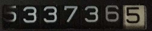
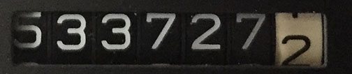
Odometer (Legend):  533,874

533874

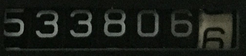
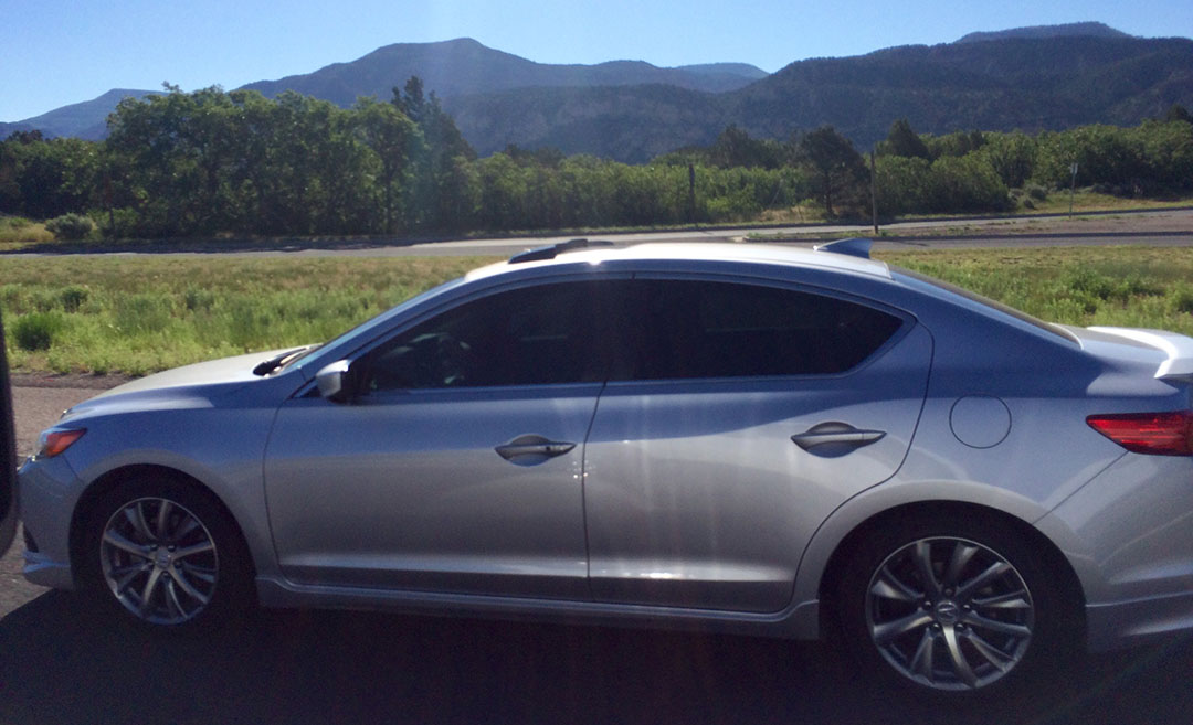
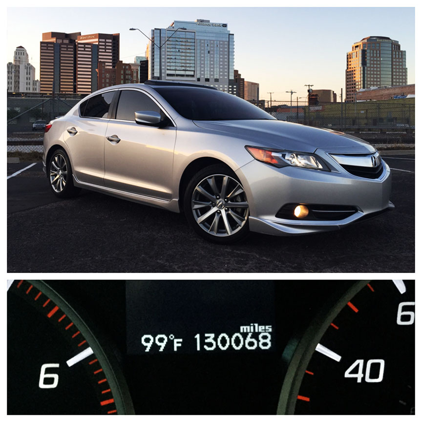
Odometer (ILX):  132,548

132548

Odometer (NSX):  100,769

100769

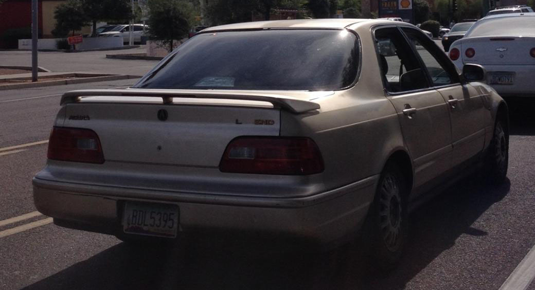
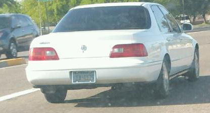
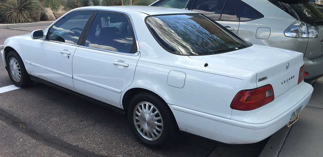
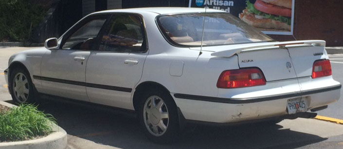
It was January 2007.  I had just finished up graduate school of Thunderbird School of Global Management and I wanted to reward myself with something special.  Posted on craigslist, I found a cream puff of a car in southern California that fit the bill perfectly:  a Sirius White Pearl 1994 Acura Legend GS sedan 6-speed.  Having owned my Legend coupe for about 4 years, I felt ready to expand the fleet a little.  Now, I’d already owned a couple of other Legends in the past but this one was special because of its ownership history & condition.

The below pictures from the online listing stole my heart.  The seller, Simon, had even installed the car’s original “Hoehn Acura” license plates for the pictures.  He informed me that his mother Lorraine, the original owner, had named the car Bodecia.  She had traveled frequently between Carlsbad, California and her cabin in Oregon and thus the car had over 200,000 miles on it at the time of listing but didn’t look even a year old.

IMG_6925edit

IMG_6929edit

IMG_6931edit

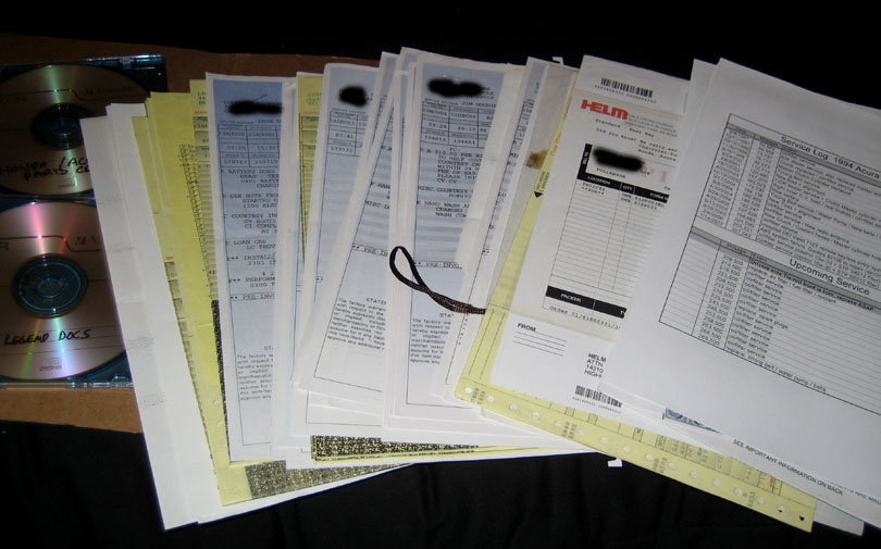
On January 15th, I flew from Phoenix to Orange County airport and took delivery of the Legend at 207,100 miles from Simon.  He gave me every single stitch of paperwork on the car – one of the most complete records I’ve ever seen.

simon1

Notice he’d even given me a CD with the maintenance records digitized.  This guy was over the top, and I loved it.

receipt

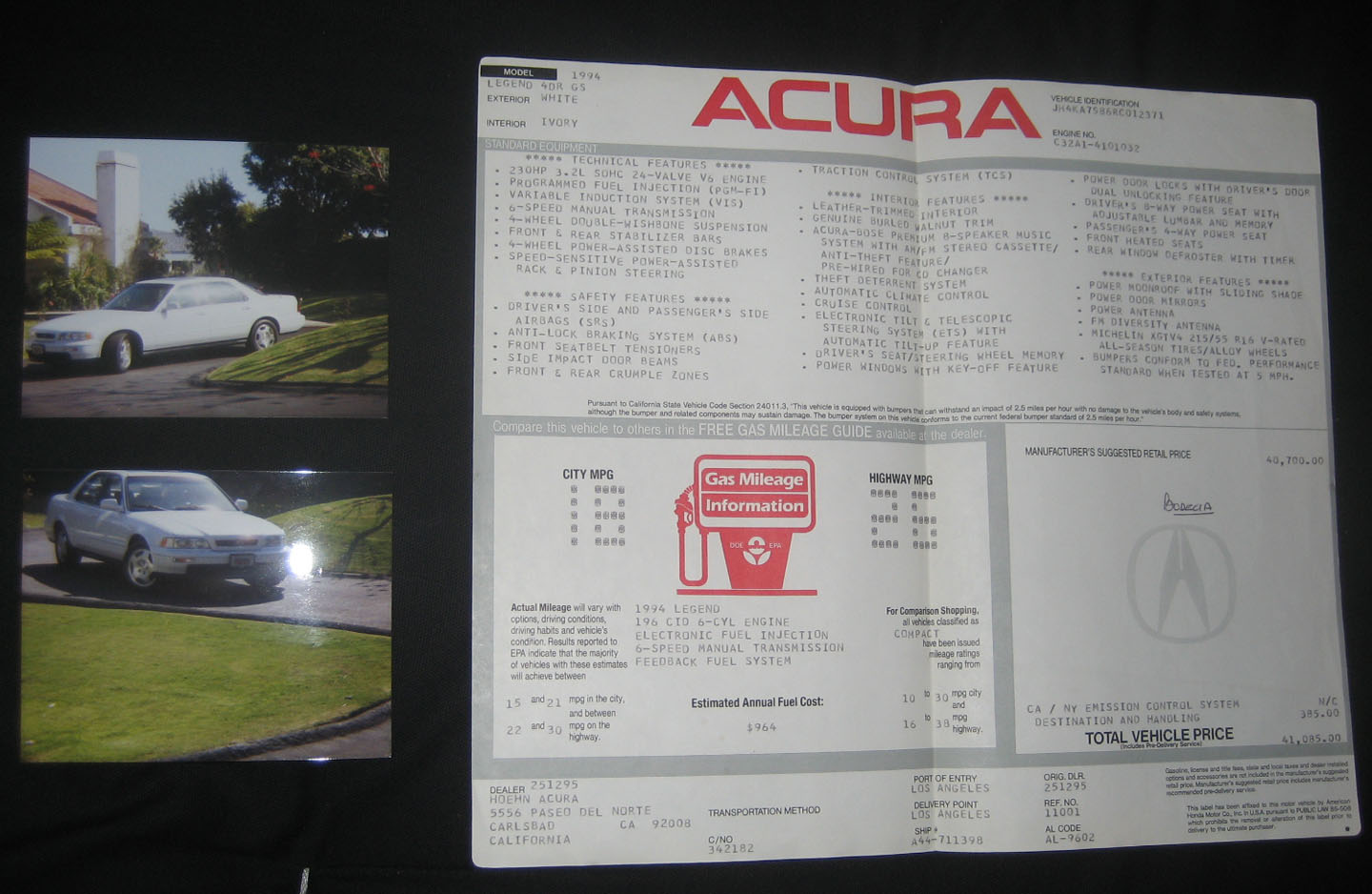
Icing on the cake was getting ahold of the original window sticker AND a couple of pictures from when the car was brand new.

gspics

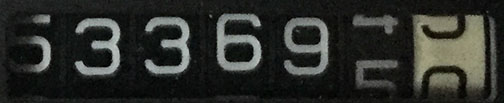
Starting odometer reading when I took delivery.

mileage

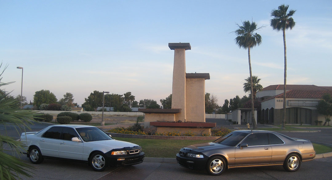
Back in Phoenix and meeting its coupe sibling for the first time.

school1

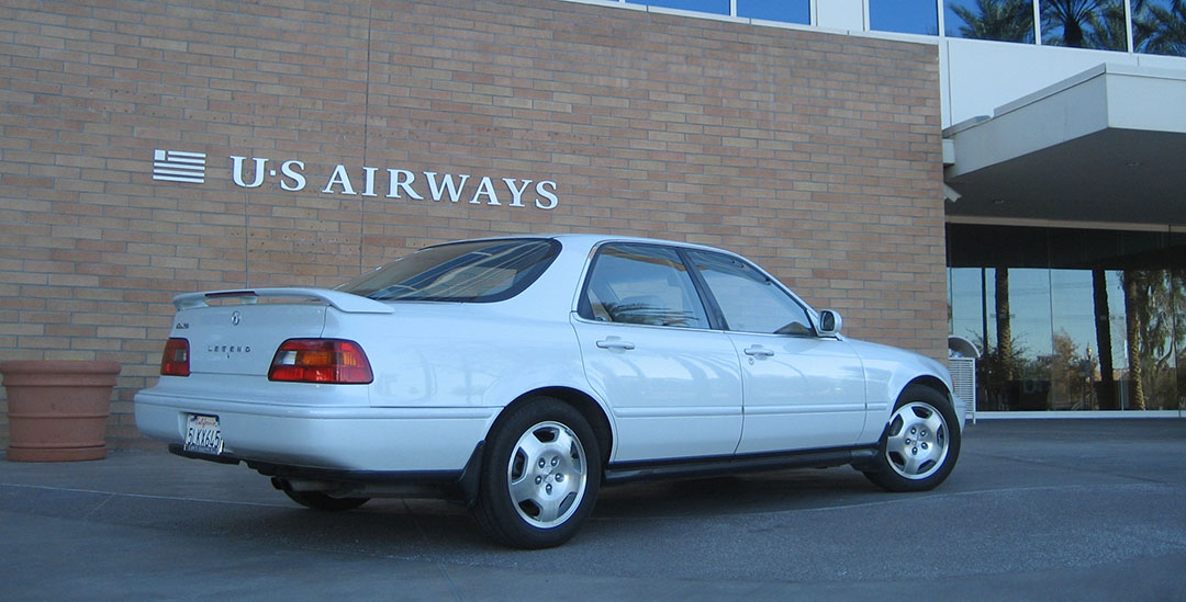
It was at this same time that I got my first “real” job.  I was working at the US Airways main office in Tempe, Arizona on the Domestic Pricing team.  I was the guy who you either loved or hated when you got online to check airfares.

us_air

I exchanged several emails around that time with the original owner Lorraine.  She was a sweet lady.  Here’s her message dated May 14, 2007.

Tyson,

It makes me want to cry to see how beautiful Bodecia looks. Thank you for the pictures.  Here’s the story how I chose her.  I had, at that time, a white 1980 Mazda RX 7.  She had a Weber carburetor, air horns, a straight through exhaust and a D-bar and a racing clutch because I blew the original clutch.  You could hear her half a block away.  I loved that car.  Skip Gorman, Simon’s mentor, had worked on my car with all the add-ons and as Simon grew older, Simon put them on for me.

So, one day, an old Legend gave me a run for my money on the on/off ramp from 52 on to 805. I was intrigued  and followed this car till I found out what it was. I needed a sedan as my Nissan Maxima of 10 years was past its prime. So, I test drove the 1994 Legend. I loved it. Loved the 6 forward gears, I was trained to use gears to slow down not the brakes. I wanted white and they had to search for her.  Bodecia was one of 5 white models in the USA at that time. She was loaded on a semi and shipped down to Carlsbad from Los Angeles, especially for me.   So, she may be the only white pearl GS left of the 1994 GS models in USA.  This was the first car I had paid for and chose for myself after my divorce and she meant the world to me.  Simon called her OJC (old Japanese car) and that hurt and it hurt to see her at his house.  I still think I love her better than my new car which is an automatic for when I really am a little old lady.

Bodecia just has an air about her.  She was a Legend so I picked the name Bodecia who was a British legend.  She fought the Romans after her husband was killed in battle. Rallied her people  but unfortunately they lost.  You may see her on some of the old English coins, chariot, spear shield.  So, you can imagine how happy I am to see Bodecia is getting the care she deserves.  Congratulations on your Masters Degree. Quite a feat. Well done.  I would love to meet you next time you are in California. Let me know.  I am retired but babysit for my daughter in Yorba Linda and am a Senior Patrol Volunteer for the Encinitas Sheriff Department. I will definitely make time for you.  Will mail off the window sticker tomorrow.  Yes, I spell funny. I was born in Australia.

Lorraine

I owned the white Legend GS for fewer than 10 months, but in that one short span of ownership, I had so much fun with the car, some of which I’ve already shared on the blog.

Here are a few other pictures of memorable occasions.

February 2007 – Sirius White Pearl block party at Chuck’s house, with his 1993 LS coupe and 1993 LS sedan.

chuck

Neighbors were rolling their eyes I’m sure!

chuck2

May 2007 – Legend 6-speed photoshoot near the home I was renting in Tempe, Arizona.

two

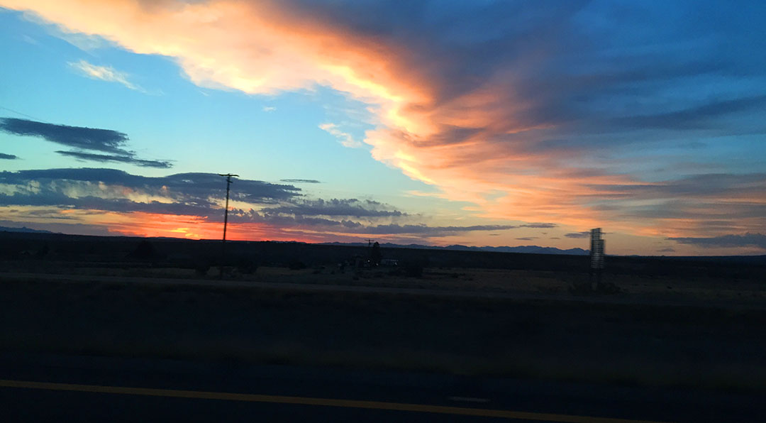
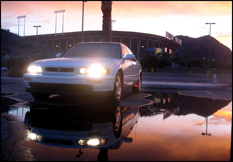
August 2007 – The sedan had become my daily driver while the coupe was being repaired from a couple of deer collisions.  I took advantage of an amazing sunset one evening in the parking lot of the Arizona State University football stadium in Tempe.

rightrear

front3

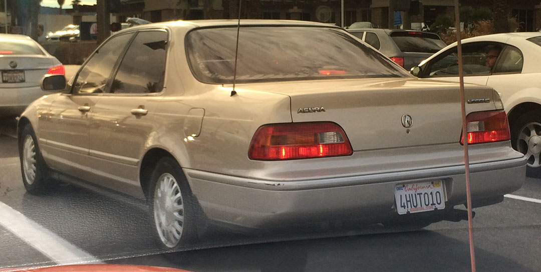
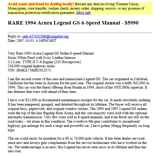
On October 1, I was ready to sell the car.  The coupe was coming back from the body shop, I had picked up a 3rd car (1991 Honda Prelude 4WS) that was sucking a lot of my attention away — plus I had limited parking space at my rental home.  So, with great hesitance I posted the ad for the car with 216,000 miles for $5,990 on craigslist.  My advertisement was several pages long and had at least a dozen detailed pictures.

gs_ad

I also included a screen shot of the maintenance records Excel file.

maintenance

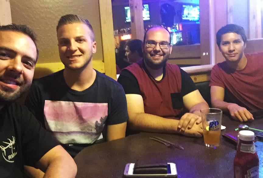
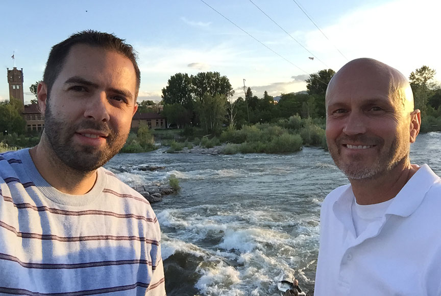
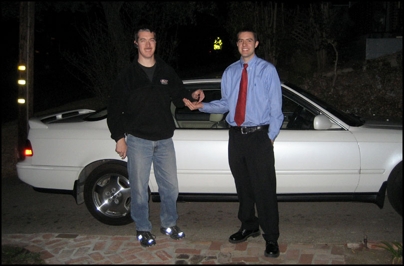
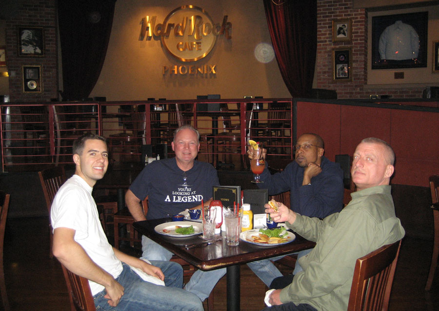
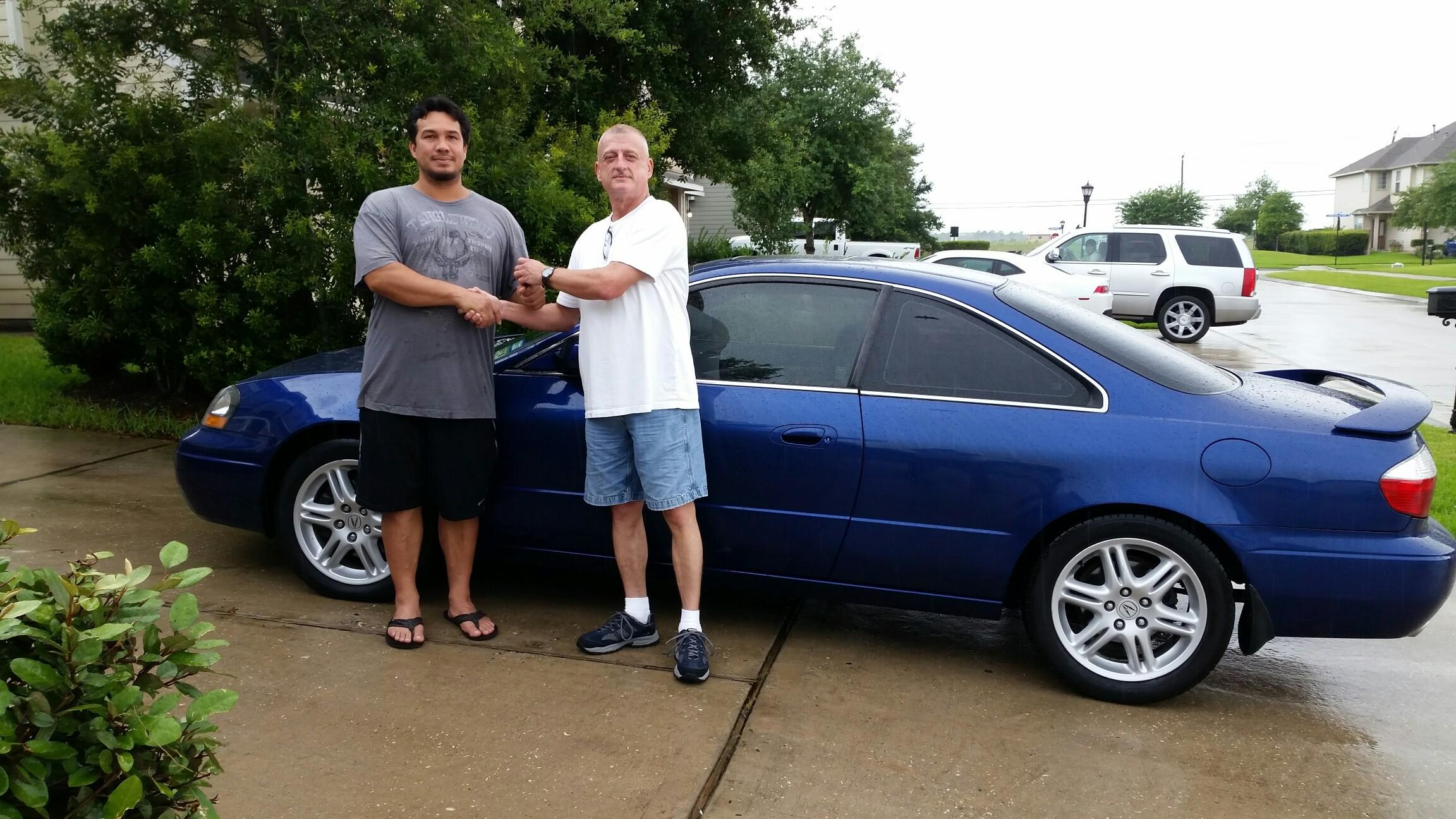
On October 26th, long-time friend of mine Wayne flew from Houston to take delivery of the car.  We took the opportunity to rally another Legend lover, Chuck, for dinner in central Phoenix at Hard Rock Cafe when Wayne and his friend Terrell were in town.

garage

Group photo at the restaurant

hardrock

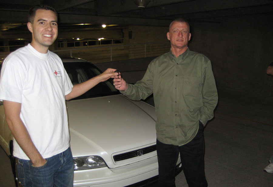
Key handoff to Wayne

keys2

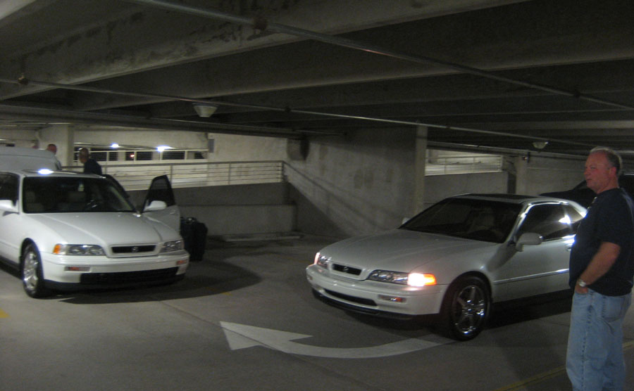
Tyson, Wayne, Chuck, in the parking garage before heading out.

keys

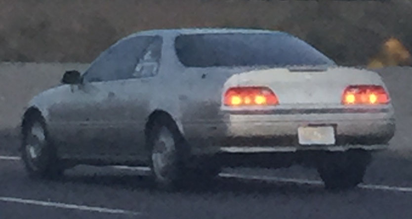
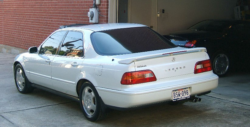
Wayne and Terrell made the 1,176-mile drive home to Houston the following morning.  Not long afterward, Wayne sent me this picture of the car wearing its newly-issued Texas license plates.

bodeciatx1

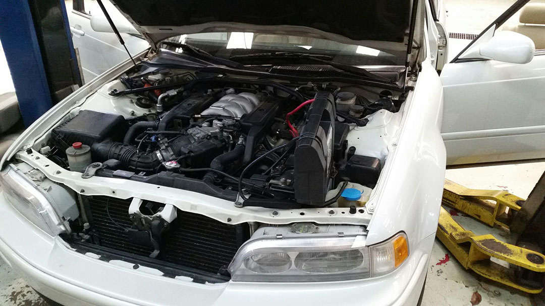
For many years (nearly 8, in fact) Wayne lovingly cared for the Legend with regular maintenance.  Then tragedy struck in May 2015.  The Houston area was pummeled with rain and most of the city went underwater, including the garage where Wayne had his Legend stored.  Despite efforts to bring it back to life, the car was pronounced a total loss as the water had become too deep.  Sterling McCall Acura technicians delivered the somber news.

gs_in_shop

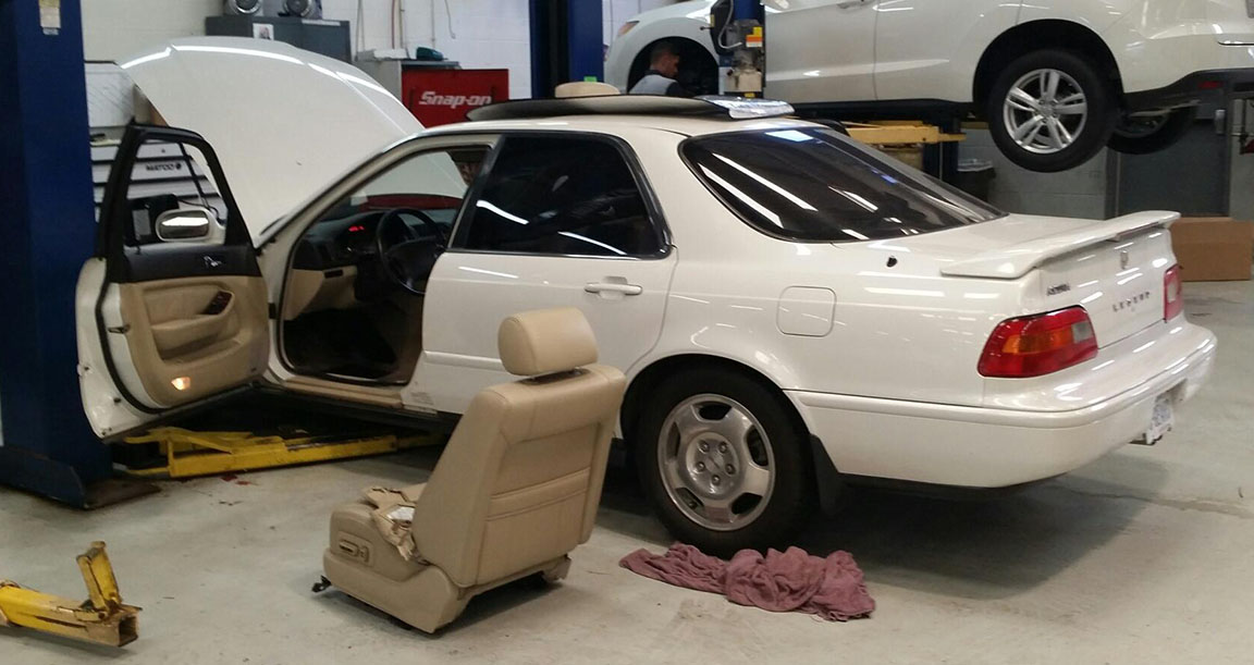
These are photos from the car as it sat while drying out in the service bay.

gs_engine

And this was the news I received from Wayne regarding the insurance company’s decision.

wayne_text

At 220,439 miles, this Legend was merely broken in and still had a lot of life to live.  Post your condolences for Wayne in the comments box, and let’s hope he can find another replacement car soon.  Thanks, Wayne, for letting me share your story!

EDIT:  July 2, 2015

Wayne has already found a worthy replacement for his Legend.  He is the proud owner of a 2003 Acura CL Type-S 6-Speed manual. As most of you Acura fans will know, the CL 6MT is an extremely rare find.  His is an Aegean Blue Pearl model, one of only 230 ever produced.  2003 was the only model year to offer a stick shift in the 2nd gen Acura CL.

Congratulations, Wayne!

IMG_8473

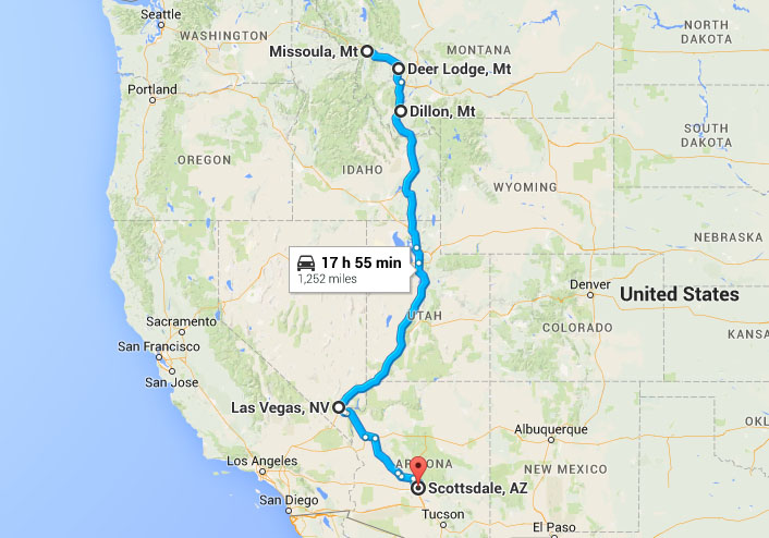
I have just 4 quick pics from this past weekend:

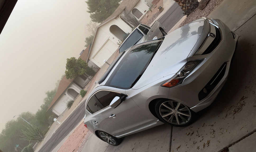
The ILX enduring a desert sandstorm just moments after I’d finished washing it.

ilx_sandstorm

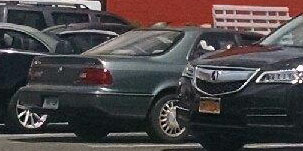
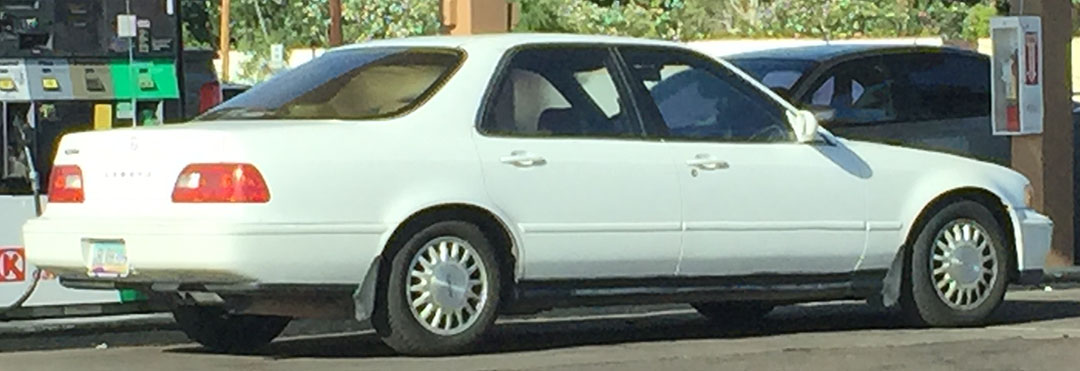
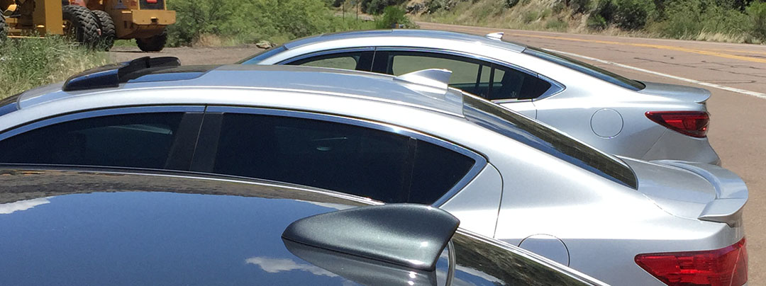
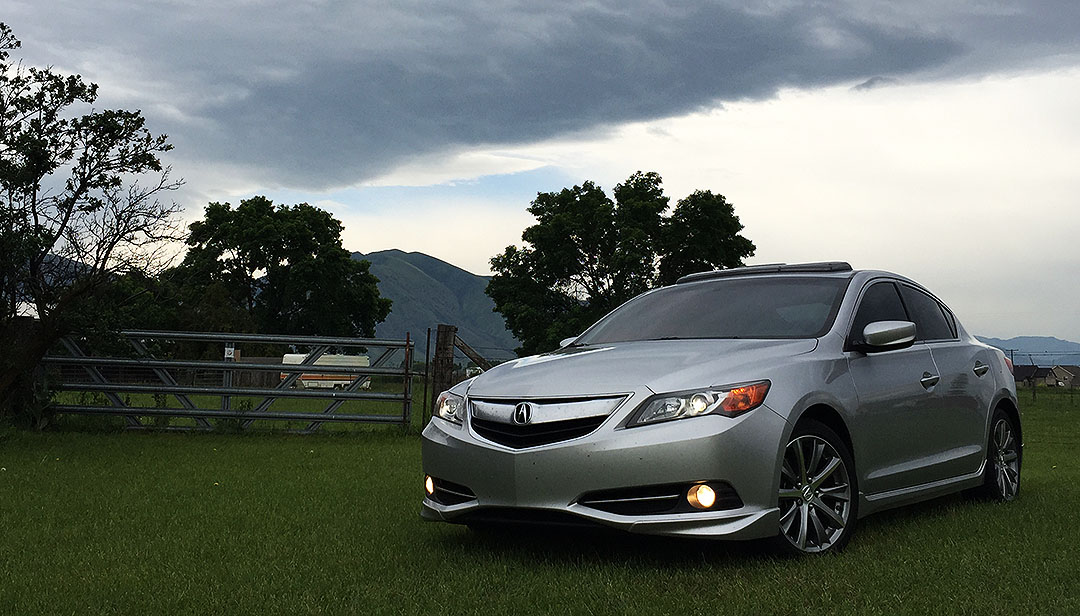
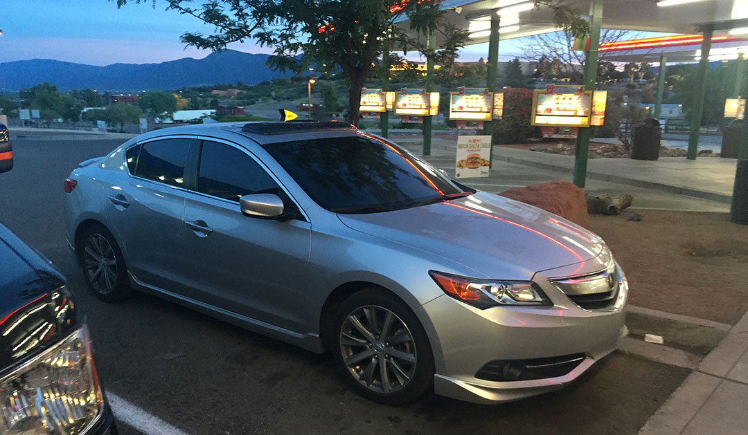
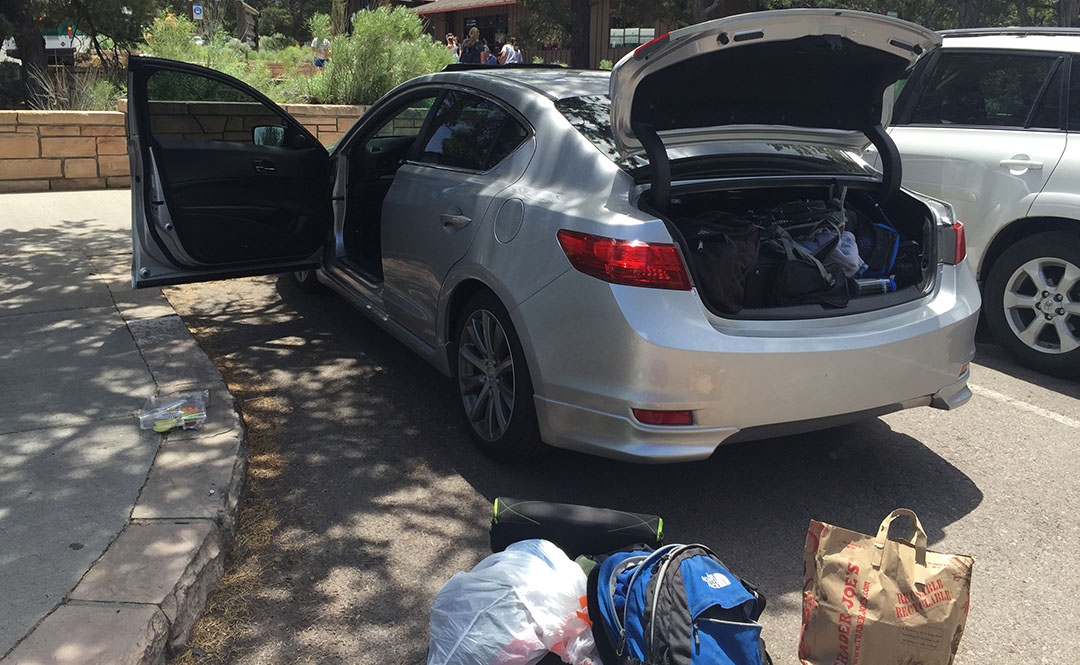
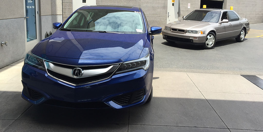
The Legend sedan getting an oil change on Saturday and parked next to a 2016 ILX.

ilx_legend

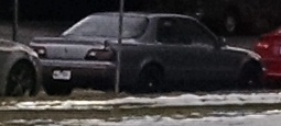
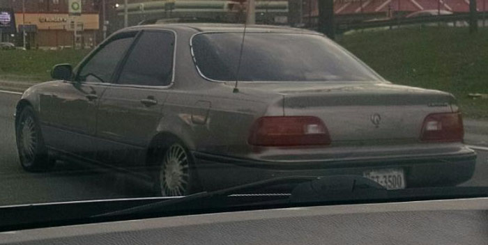
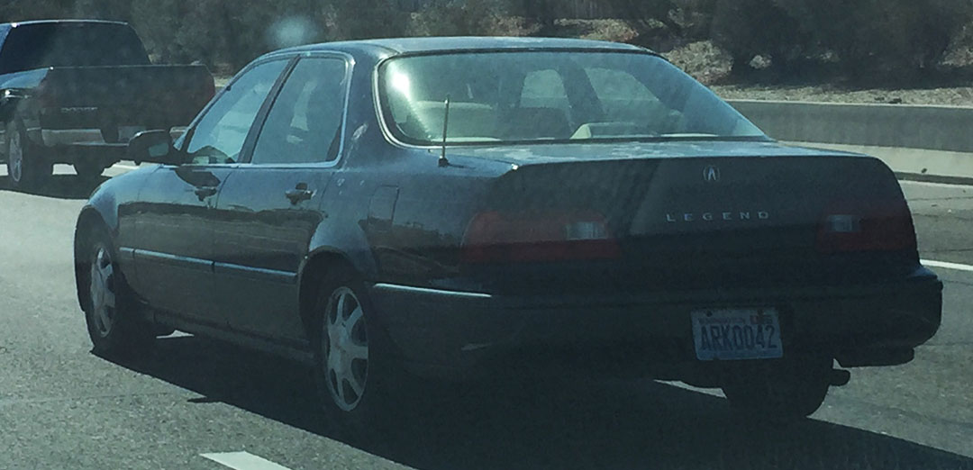
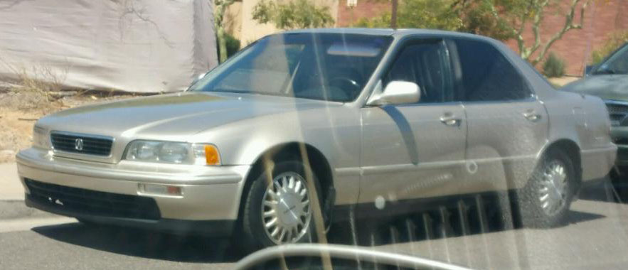
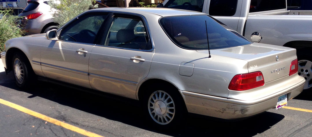
A congrats to my friend Jimmy on picking up a Legend.  He got this 1994 GS 6-Speed with 166,048 miles on it recently.  I took a test drive.

gs_ls

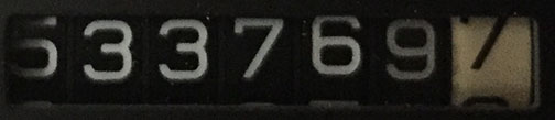
And a shot from a Sunday drive in the NSX.  Even at 8:00 a.m. the heat was unbearable.  I need to get the A/C fixed in that car.

tyson_nsx_6-28

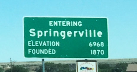
Oh, and that’s the 62-foot-long “America’s Largest Sundial” in Carefree, AZ that I’ve blogged about before.

Have a great week!

Final Visit: Pinnacle Peak Patio Steakhouse in Scottsdale, Arizona

Posted in Arizona, Restaurants on June 26, 2015 by tysonhugie

Odometer (Legend Coupe):  533,806

533806

Odometer (Legend Sedan):  146,900

146900

Odometer (ILX):  132,419

132419

Trip Distance:  42 Miles

ppp_trip

I got my necktie chopped off last night at dinner.  Ever heard of a restaurant that does such a thing?

patio_logo

I’m on a roll here with visiting the “endangered species” of local restaurants.  Just a few weeks ago, my friends Kevin, James, Devan, and I visited historic Bill Johnson’s Big Apple in Phoenix the day before it closed for good after being in business for 59 years.  This time, Kevin and James and I wanted to check out another long-lived Phoenix landmark on the brink of extinction:  Pinnacle Peak Patio.

pp_headline

PPP opened in 1957 in what was then a very remote part of town far north of Scottsdale, Arizona.  Back in those days, it was a rest stop and general store, mostly visited by people headed to the nearby lakes.  Oddly enough, there are cows perched on roof, just like Bill Johnson’s had.  The restaurant’s last day open will be this Sunday.

pinnacle_peak_outside

Even today, the location of the restaurant feels way out there.  It’s a solid 20 miles from “downtown” Scottsdale and I can only imagine how much further it must have felt 58 years ago, before urban development encroached upon it.  The homes in the surrounding area are high-dollar estates with names like DC Ranch and Troon, a luxurious master-planned golf community.  That’s why Pinnacle Peak Patio is so refreshing — in a sea of hoity-toity high-class homes, it’s a place that embraces a kick-back attitude.  Which is why, as you’ll understand, neckties are outlawed.

tyson_with_tie_sign

From the company’s website:

The “no necktie” tradition was started one night when a Phoenix executive came in for dinner. The original owner, wanting to keep the atmosphere in his restaurant casual, told the executive, “Either you take that tie off, or I’ll cut it off.” The executive did not take heed and was appalled when the owner pulled out a butcher knife and promptly cut off the offending cravat.

We headed out around 7:00 p.m. in the ILX and took Loop 101, then Pima Rd, and then eastward on Happy Valley Road (had to put a smile on our faces as we rounded the corner).  It’s pretty easy to spot the location of Pinnacle Peak Patio at the intersection of Thompson Peak Rd & Alma School:  It feels like you’re back in the wild west.  Even the parking lot remains unpaved after all these years.

ilx_tyson_pinnacle_peak

Right at the entrance to the swinging wooden doors, a hand-painted sign gives a warning:  BEWARE:  WEAR TIES AT YOUR OWN RISK.  I wasn’t (that) afraid.  We were seated right away by the hostess in a back room and started admiring some of the artifacts on the walls:  Rodeo trophies from years gone by, sheriff badge collections in display cases, wall after wall covered with license plates, and oh — the severed ties:  hundreds and hundreds of neckties of every size and color were stapled to the wooden rafters above us.  Most of them had small yellow tags on them indicating the wearer and the date it was collected.

plates

Our server, Tanner, recommended the “Wrangler” 10 oz. Top Sirloin for $17.95 and that’s the selection I went with.  It was absolutely one of the juiciest steaks I’ve ever eaten.  It came with homemade wheat bread, a side salad, and a baked potato which I paid a little extra for.  Meal quality = top tier.  Our meal was accompanied by a live musician in the other room, playing twangy honky-tonk country which was especially fitting for a venue of this type.

wrangler

meal

It wasn’t until we were almost ready to get our checks that I realized the waitstaff hadn’t seemed to take note that I was wearing a tie.  Tanner came over to see how things were going and I replied, taking a tug at my collar and loosening the tie a notch, “It’s a little warm in here, to be honest.”  “Ohhh!” he exclaimed, and he scampered off to get his pair of scissors.  “I didn’t even realize you had that on!”  So, in a ceremonial ritual as I’m sure has taken place thousands of times before, Tanner took the clippers to my silk blue tie and sliced it in two.

tie_cutting

It’s too bad that places like PPP are a dying breed these days.  I really enjoyed the vibe of eating at a non-chain place that teleports you away from the hustle and bustle of 2015 and feels more like 1985.  The last thing you see as you depart the restaurant is the phrase “Y’all come back now, ya hear?” painted on the backside of courtyard entrance sign.  Well, Pinnacle Peak Patio, unfortunately I won’t be going back.  You won’t be there.

exit_sign

Thanks for joining on this Thursday night adventure!

And thanks to Kevin and James for being good sports and giving this place a whirl with me.

kevin_james_tyson

Happy Valley Road eastbound

happy_valley_rd

Entering the restaurant courtyard from the parking lot

kevin_tyson_james

Checking in at the front desk.  There’s a gift shop area and a mechanical riding horse for kids.

james_kevin

If you’re local to Phoenix and you get this message in the next 48 hours before it shuts down permanently, go check this place out!

200-Mile Run in Utah: “Wasatch Back” Ragnar Relay Race

Posted in ILX, Road Trip, Running, Utah on June 22, 2015 by tysonhugie

Odometer (Legend):  533,769

533769

Odometer (ILX):  132,222

132222

Trip Distance (Drive):  1,434 Miles

scottsdale_to_sandy

Trip Distance (Run):  194 Miles

You’ve got to be kidding me – 200 miles?  Who would be crazy enough to run that?  Not me.  Well, unless I had the help of 11 other people to slice up the distance into smaller pieces.

ragnar_logo

That’s the concept behind the Ragnar Relay Series.  First launched in 2003, the Ragnar races have expanded to include 15 different events in various locations across the country.  This past weekend, I joined forces with some friends and family members to compete at the 13th annual “Wasatch Back” Ragnar Relay which started on Friday morning in Logan, Utah, and ended Saturday afternoon in Midway, Utah near Park City.  The race’s name comes from the fact that the course runs along the back (east) side of the Wasatch Mountain Range, a section of the Rockies that borders the Salt Lake City area.

wasatch_back_overall

I took yet another jaunt to the Beehive State aboard the ILX for this occasion.  In the 10 years I’ve lived in Arizona, I’d guess I’ve taken the drive to Utah at least 7 times per year.  So, this is a well-known route for me.  I left the car at my friend Jeremy’s place in Sandy, Utah and carpooled with my mom & stepdad the rest of the way to the race’s starting location in Logan, a couple of hours north.

ilx_action_shot

My mom and aunt Jodi acted as team captains for us.  Our team was code-named “Athens 2 Sparta” in a tribute to the first marathon – undertaken by a guy named Phidippides in 490 B.C. during the Persian/Greek War.  He was sent as a messenger due to his running speed and endurance, often completing distances of 140 miles or more.  He eventually died from exhaustion after one particularly taxing route!  We hoped for a dissimilar fate.

providence_mountains

There were 946 teams registered.  At 12 people each, that’s 11,352 people.  Plus two drivers per group, so that’s another 1,892 people.  We are talking about over 12,000 people engaged in this craziness.  Although, I guess I should mention – not all teams chose to go out with 12 participants.  Any team considered “ultra” had 6 or fewer people on it.  In other words, the people in those groups were running twice as frequently (and therefore, twice as far) as “normal” participants.  I can’t imagine what would compel anyone to do such a thing!

Race Time

Due to the volume of people involved in this event, start times were staggered in waves.  We reported at 9:30 a.m. as instructed on Friday, June 19th, checked in, showed the race administrators that we had appropriate safety gear, and watched a short instructional video.  My mom was our first runner for our 10:30 a.m. start.  We had to send our all-star out first to get us off on the right foot!  It was perfect weather for a run and she took off in a flash.

tyson_tia

My three assigned legs were as follows:

  • Leg #4:  4.3 Miles, Net Elevation Gain 127 Feet, est 2:00 p.m. Friday
  • Leg #16:  5.9 Miles, Net Elevation Loss 922 Feet, est 3:00 a.m. Saturday
  • Leg #28:  2.7 Miles, Net Elevation Gain 320 Feet, est 1:00 p.m. Saturday

When the rest of us we weren’t running, six of us (5 runners + our driver, Mark) rode along in a rented black 2015 Chevy Suburban (“Van 1”) and provided “support” to our team member who was on deck.  I spent most of my time in the back seat trying to avoid motion sickness as we frequently did U-turns and re-routed to find our way around.  A second Suburban (“Van 2”) carried the other six members of our team and started after Van 1 members had each completed their first leg.  Logistics confusing enough yet?  As a first-timer to this event, I was amazed at how seamlessly it worked.

jeffrey_tyson

Despite only being 4 miles long, the fact that Leg #4 was a slight uphill and took place in the hottest point of the day made it a doozy for me.  I was relieved when I finally saw my team members at the next exchange and I happily chugged a chocolate milk after passing the baton (which was in fact just a 1980’s-esque bright orange slap bracelet) to Damon who picked up the next segment after mine.  Poor Damon ended up running 8.8 miles on an uphill, dirt road, while eating the dust of vans passing by!  Torture.

damon_running

We got up over Avon Pass and back to pavement in the tiny town of Liberty, and then we made our first “big” exchange when Van 2 took over.  Meanwhile, Van 1 had about 6 hours to spare.  We traveled to our next starting point in Morgan, Utah and sprawled out on a grassy field near the high school while having our lunches.  I rolled out my sleeping bag and did my best to rest my eyes but it didn’t do much good.  Mom tried the same.

mom_sleeping_bag

It was a little after midnight when mom took Leg #13 and started our van off again.  I was already exhausted when Jeffrey passed me the torch a little before 3:00 in the morning.  I had been standing at the summit of State Highway 65 near East Canyon Reservoir and trying to jog in place to keep the blood flowing and to keep from getting cold.  Once I finally got rolling, I’d forgotten all about the temperature.  I had a momentary emergency when my “taillight” clipped to my reflective vest fell off and lost its battery, but my van quickly came to my rescue when they drove past.  This was my attempt at a picture.

my_run

The next 6 miles were bliss:  Steady downhill grade, perfectly clear night with the brightest stars I’ve ever seen, good music, and refreshing temperatures.  A remix of the Cranberries’ hit “Zombie” was just what I needed for motivation at 3:05 in the morning when I took this screen shot.  Good song!

screen_shot

That was a refreshing way to spend the morning and it definitely helped wake me up.  Once again we filed through our segments and tried in vain to catch shuteye when we weren’t the ones pounding the pavement.  Soon, the sun started peeking over the horizon and Day 2 had begun.  We arrived in Coalville, Utah at North Summit High School for our next group break.  They were selling hot showers for $2 and pancake breakfasts for $4.  I gladly paid up!  After that, we rolled our sleeping bags out onto the floor of the gymnasium and shut our eyes for a little while.

gym

My last leg was along Highway 248 where I awaited my turn to take the bracelet and run with it.  I was standing in parking lot at beautiful Jordanelle Reservoir and should have been enjoying the view, but instead my eyes were transfixed on a massive hill ahead of me — one that very soon I’d be attempting to run up.  It seemed like an eternity before Jeffrey came down to pass me the reins, but he finally did and I took off as briskly as my legs allowed me to.

tyson_hill

Water bottle sloshing in hand, I did my best to keep a consistent pace up the grade, but I had to slow it down to a power-walk a couple of times to keep from overheating.  My van waited for me at the top of the hill and my mom threw a water-soaked cloth around my neck.  That gave me enough motivation to press onward.  It was an amazing feeling to finally crest the summit and be able to see the next exchange location within view.  I gladly passed Damon the bracelet and felt a huge sense of relief, having completed my last part of the relay race.

finished

It was several more hours before our “Van 2” team members finished their parts, and I wasn’t able to stick around to see them at the finish line at dusk, but they shared the good news that our team, Athens 2 Sparta, had completed the 194 miles in 34 hours, 10 minutes. That put us in 278th place out of 719 co-ed teams.  Top third placement – not too shabby!

This was one of the most challenging physical things I’ve ever done, probably second only to the 26-mile Grand Canyon hike I did a few weeks ago.  But the neat thing about the Ragnar concept is that you’re a member of a team, and each person contributes something to the overall outcome.  It’s a lesson in working together to achieve a common goal, and feeling great about it when you’re done.  Huge thanks to Mark, Nicki, Jodi, Tia, Ben, Jarrett, Isabelle, Roxie, LaReen, Damon, Jeffrey, Muriel, and Jandi from my team for playing a part in this!

medal

I enjoyed my 10 hours of reflection on that topic while driving home to Phoenix.  Now, if only I could’ve taken a team approach to the 256 unread email messages that were waiting for me at the office on Monday morning.  Sigh.

sunset_st_g

Here’s a short video with just a few scenes from the race.  Thanks for coming along for the run!

Rolling northbound with mom on I-15 in central Utah on Thursday morning

tyson_tia_in_car

Drive-by at the Utah State Capitol while in the truck with mom & Todd

utah_capitol

Decorating our rental Suburban with writing on the windows and our “Athens 2 Sparta” team name

suburban_prep

Checking in on Friday morning at the Utah State University stadium in Logan

checking_in

Watching a safety briefing video

pre_race

Saddled up in the Suburban while one of our runners takes a turn

suburban_riding

A friend sent me this screen shot shortly after we got underway.  This race is serious business.

article

My first leg, a 4-miler on pavement from Paradise to Avon, Utah

my_rn

The exchange where I handed off the reins to Damon who was runner #5

avon_exchange

Waiting for Damon to finish his leg on Avon Pass

tyson_avon_pass

LaReen taking her turn on the dirt road now

lareen_running

Back on solid ground, arriving Liberty, Utah

liberty_roadside

Photo-op with mom

tia_tyson

Passing Pineview Reservoir while driving to our next exchange point

reservoir

“Mormon Muffins”?  What would that be?

mormon_muffins_sign

Here they are.  With honey butter!

mormon_muffins

My view upward while lying on the grass in Morgan, Utah and resting

tree_view

“M” on the hill stands for Morgan

morgan_mountain

Daybreak the next morning in Coalville, Utah at North Summit High School

coalville_high_school

Pancakes never tasted so good

pancakes

Next exchange, sitting next to Aunt Jodi

tyson_jodi

Isabelle, Jandi, Jodi, Jarrett – from our “Van 2”

isabelle_jandi_jodi_jarrett

Dying!

tyson_running

I loved the clever names that some people came up with for their vans.

“Ready, Set, Sweat, Regret.”  “Kiss our swass.”

swass

“Shitter’s Full.”  (name that movie)

cv_reference

“Run?  I thought you said rum!”  (and notice the tally marks below where they were marking their “kills” – all the people their runners passed along the way)

kills

“Cropdusters.”

crop_dusters

Near Park City, Utah, at the final exchange to Van 2

exchange_group

Finish line pics courtesy of my cousin Nicki

nicki_post

Legend Spy Shot Roundup #5

Posted in Legend, Spy Shots on June 17, 2015 by tysonhugie

Odometer (Legend):  533,736

533736

Odometer (ILX):  131,174

131174

I know the mileage-mania has gone too far when even my mom is posting things like this on Facebook:

mon_contest

She’s recently picked up a hot little red 2010 Volkswagen EOS convertible and she’s already racking up the miles AND offering gift card prizes to her friends who most closely guess the date & location of her 50,000-mile rollover.  Did you notice the 44 mile per hour speed to align with the 44,444 odometer?  Now, if only she’d hit that at 4:44 p.m. and with 44.4 on the trip meter.  Keep trying, mom!

(Her car is at right, and the other one is its twin – owned & driven by my aunt Connie)

eoses

Now for today’s feature:

Bring out those spy cams.  My readers have been at it again.  I present to you, in alphabetical order by submitter, the latest in Acura Legend spy pics from around the country.  It’s only been 3 months since the last Spy Shot Roundup, but there were FIFTY (5-0!) pictures submitted since then so I figured it was time to go ahead and post the latest ones for you all to see.

Beau in Arizona (6 submissions – Legend Spotter Extraordinaire Award Recipient)

beau1

beau3

beau4

beau5

beau6

beau

Chris M in Maryland

chris1

Chris G in California

chrisg1

Conor in New York

conor1

conor2

conor3

conor9

Check that rearview!

conor

Daniel in Arizona

daniel1

Dillon in North Carolina

dillon1

dillon2

Grant in Utah

grant1

Ian in Arizona – spotted my friend Joe!

ian

Ira in Washington

ira1

Jack in Arizona

jack1

jack2

chrisg1

jack9

James in Arizona

james1

james2

james

Jim in Arizona

jim1

jim2

jim3

jim

Clever shot here!

jim2

Joe in Arizona

joe1

joe2

joe3

joe4

Kyle in Arizona

kyle1

Nice attempt at a rearview mirror shot here, Kyle!

kyle2

kyle3

Matt in South Carolina

matt_G

Yours truly!  Came up behind this guy on Cave Creek Rd in Phoenix a few weeks ago.  Nicely kept Milano Red 1995 L coupe.

me

Nate in Idaho

nate1

Paul in Georgia

paul1

paul2

Ruben in Arizona

ruben

Ryan in Arizona

ryan1

ryan2

Scott in California

scott1

scott2

Sunny in Utah

sunny

WINNER!  Toby in New York

toby1

Special features!  Jason in New Mexico captured a 1987 Chevy Celebrity Classic, much like my first car.  It even had the same vinyl roof.  Bonus points, Jason!

celeb

We have a few Vigor features this time, too.

Chris C in Florida – blurry, but we can tell what it is!

chrisc1

Chris G in California

chrisg2

Kurt in Arizona

kurt1

Thanks again everyone for playing!

Weekend Cruise: Round Valley, Arizona in the White Mountains

Posted in Arizona, ILX, Road Trip on June 15, 2015 by tysonhugie

Odometer (Legend):  533,734

533734

Odometer (ILX):  130,675

130675

Trip Distance:  462 Miles

drive

Annnnnd the Phoenix oven is now fully pre-heated!  Just looking at the 10-day forecast makes me break a sweat.

phx_weather

There’s only one logical solution:  Get out of town.  And that’s exactly what I did this past weekend, along with 3 other friends.   The destination of choice this time was the White Mountains, a range in eastern Arizona near the border with New Mexico.  While Phoenix sits at a little over 1,000 feet in elevation, the town to which we’d be heading, Eagar, has an elevation of nearly 7,000 feet.  And along with that added height comes a 10-day forecast that’s a lot less intimidating (think:  High temps in the 80’s).

salt_river_canyon

From my place on Saturday morning, three of us including James from Six Speed Blog headed out on US Highway 60 through the “East Valley” part of the Phoenix area.  We made a fuel stop at the Chevron on Idaho Road and then continued eastward to the small mining town of Superior where we met up with Jason of Driven for Drives who had come out from Las Cruces, New Mexico to join for the drive.  At this point, our caravan of 3 cars now consisted of the following:

  • 2016 Mazda 6 Grand Touring:  2.5 liter 4-cylinder, 184 horsepower; 6-speed automatic
  • 2004 Mazda 6:  3.0 liter V6, 220 horsepower; 5-speed manual
  • 2013 Acura ILX:  2.4 liter 4-cylinder, 201 horsepower; 6-speed manual

mazda_ilx_mazda

After grabbing a Red Bull and Moon Pie at the Chevron gas station in Globe, we played musical cars and I got to pilot Jason’s 2004 Mazda 6 for the next stretch.  For being 11 years old and having 164,000 miles on the clock, the 5-speed Mazda was a solid ride.  Jason recently upgraded to an all-leather interior.  Bradley and I couldn’t figure out how to pair his audio system to our iPhones, but it didn’t matter because Jason had Linkin Park in the 6-disc changer to keep us company.

salt_river_group

We pit stopped at the base of the Salt River Canyon which I’ve blogged about a number of times before.  (Acura TLX Review, Christmas Day trip to name a couple).  From the river level, there are two massive bridges passing overhead.  We climbed back up to the parking lot (got my cardio in for the day) and did another car swap.  This time, I got to take control of the Mazda 6.  Ringing in at a pricetag in the low $30’s, I must say the new 6 offers great bang for the buck.

6

The styling is attractive from any angle.  Projector headlamps and foglamps offer supreme nighttime visibility. The leather stitched pieces on the dashboard exude a premium feel.  And the car comes up with a head-up display – all of which are class-leading amenities for a vehicle in this segment.  From a performance perspective, the 2.5 liter needed to be coaxed a bit on the grades, and the transmission seemed slow to shift when prompted, even with the paddle shifters.  Even so, the car scoots – and even with a 36-horsepower deficit compared to its older sibling, we found out that acceleration time is pretty on par:  Mazda is delivering V6 power with 4-cylinder fuel economy.

6_interior

We had lunch in Show Low at Licano’s and then headed out toward the small towns of Pinetop & Lakeside.  There’s a special place I needed to see at the intersection of Highways 260 & 73:  Hon-Dah casino.  Oh yes – of course we stopped in to check the place out.  Jason tried his had at the 25 cent slot machines and scored a $15 gain after James had lost $20 in a matter if minutes.  Ha!  I don’t know why it’s called the Hon-Dah casino but maybe the folks on the White Mountain Indian Reservation are Honda fans.

hondah_casino

A jog southward on Highway 273 took us past the Sunrise Ski Resort (which had closed for the day just minutes prior, or we probably would have taken a chair lift ride to the summit) and then through some scenic, rolling, grassy hills.  It took about 20 minutes until we met the intersection with Highway 261 near Crescent Lake.  There was so little traffic out there.  I made the comment at one point, “If I worked in car advertising and ever needed to shut down a road for filming, this would be the one.”  Highway 261 was full of all the right curves in all the right places.  I captured 9 minutes of GoPro footage where you can see just how isolated, yet fun, this road can be.

Want to drive that 9-minute distance with me in only 34 seconds?  Here you go.

white_mountains_scenic_dirve

springerville

Eagar and its neighboring town, Springerville, comprise what the locals refer to as “Round Valley.”  The population of the two cities combined is fewer than 7,000 people and there are only two stoplights.  It’s a neat town and the people are friendly.  When we told the front desk agent at Best Western that we wanted to go see a movie, she said, “Make sure you see Gloria.  She’s the owner and she’ll take good care of you.”  Now that’s hometown hospitality!

el_rio_group

We did decide to catch a new release at an old theater.  The El Rio theater, formerly known as the Apache theater, opened in 1915.  Even after 100 years, the place was well-kept and had a great vibe to it!  Last year, the theater was converted from 35mm film to digital projection after the community raised enough money to keep the theater in business.  Movie tickets were $6 concessions were dirt cheap too!  $5 for a soda and a large popcorn.  I could get used to prices like that.  Oh, and the movie?  Jurassic World.  Highly recommended.

I had a great time enjoying a drive in the hills with a few friends and hope you did too.  Here are a few pics.

Fueling up in Globe with the two Sixes and the ILX

giant_globe

Entering Salt River Canyon on eastbound US 60

canyon_entry

View of the Salt River from underneath the US 60 bridges

salt_river_2

Quick group shot – Bradley, Tyson, Jason, James

group

Shark fins.  Watch out.  (Jaws Theme)

shark_fins

Highway 260 leading eastward

pinetop_lakeside

Anybody want some “Hon-Dah” brand fuel?  Just $3.05 for premium!

hondah_gas

Photo spot at intersections of Highways 273 and 261 near Crescent Lake

three_cars_2

Picture perfect day

three_cars

Just for kicks, a senior portrait on this log fence with Bradley

brad_tyson

Informational stone in front of the historic El Rio theater in Eagar

el_rio_sign

Old picture of the El Rio theater, then called the Apache theater

apache_theater

Seating inside the theater

el_rio_interior

Dinner after the flick

dinner_group

Oddly enough, we saw a 1985 Ford Tempo in the parking lot of our hotel with a Deer Lodge, Montana sticker on it.  I was just in Deer Lodge a week ago!

1985_tempo

Sunday morning:  Checking out an abandoned 4-bay car wash facility.

phone

“I wonder how many swirls this thing has caused” – Jason

carwash2

Vacuum cleaners probably haven’t been turned on since 2010, which was the most recent inspection date on a sticker I found.

vacuum

Lined up in the wash bays.

carwash

The Mazdas going head to head for a picture.

mazdas

Side note:

Last Friday, June 12th was the 3-year anniversary of my ILX ownership.  The car had 16 miles on it when I took delivery in June 2012.

3_years

I caught a few pictures in central Phoenix last week just for fun.

ilx

It’s been a fun ride!  Time has surely flown by.

ilx2

Have a great week!

Roadtrip with Dad Part 3: Missoula, MT to Scottsdale, AZ

Posted in ILX, Road Trip on June 13, 2015 by tysonhugie

Odometer (Legend):  533,727

533727

Odometer (ILX):  130,053

130053

Leg Distance:  1,252 Miles

missoula_to_scottsdale

The third and final chapter of last weekend’s 2,600-mile highway jaunt!

I peeled open the drapes of room 410 to a stunning blue-sky Montana day last Sunday morning. I now know with a certainty why the state gets its name for being “Big Sky Country.” Dad and I enjoyed a hearty breakfast of blueberry waffles in the lobby of the Comfort Inn in Missoula before firing up the ILX for another mile-filled day. My dad’s been a long-time member of the Rocky Mountain Elk Foundation (RMEF) so we decided we needed to check out the world headquarters just north of town. They had a lot of taxidermied (I’m making up that word) animals on display as well as a small theater and a gift shop where we had to spend a few bucks on T-shirt souvenirs.

rocky_mtn_elk_foundation

Leaving Missoula eastbound on I-90, I saw a couple of billboards announcing the “Testicle Festival.” What a name for an event! Apparently this annual tradition in Clinton, Montana draws thousands of people and involves the consumption of animal testicles.  I’m serious.  Check out testyfesty.com for more information, and book your trip to Clinton for July 29 – August 2 if you want to experience it firsthand!

tyson_at_jail

It seems a little odd that we’d want to tour a creepy old prison, but I get a kick out of urban exploration so our next stop was the Montana State Prison in Deer Lodge, right off Interstate 90.  This facility dates way back to 1871 when it was a territorial prison and it served as the primary prison facility for the state of Montana until 1979.  It started out very small but was added onto in the decades that followed.

Even so, there were constant problems with overcrowding despite the additional cellblocks being added.  There were 3 riots in the 1950s and a warden was shot in 1959 in an inmate escape attempt.  For two more decades after that, the facility struggled with substandard conditions.  Finally in 1979, a new prison was built a few miles away and the inmates were moved over.  Here is a picture from the early days of the prison.

jail_old

The first thing dad and I did was visit the “Hobby Shop” across the street where merchandise that has been created by inmates is sold.  There were a lot of leather goods, some paintings, and other arts & crafts.  Each item had a tag tied to it with the handwritten name of the inmate who made it.  We didn’t make any purchases.  Next, we walked across the street to a 100+ classic car exhibit in a building next to the prison.  Finally, we entered the prison itself for our self-guided tour of the grounds.

inmate_merchandise

There were 20-someodd points of interest in the small leaflet the cashier had given us, and we saw most of them.  Most of the cement cells were depressing to look through – tiny showers, dirty toilet facilities, huge metal doors that took a lot of effort to open & close.  The coolest part was walking up through several flights of stairs that were pitch black until I turned on the flashlight on my iPhone to guide me.  It felt like a horror movie in the making.  Plaster was coming off the walls and ceiling and there was an echo with each step I took.

jail_walls

stairs

The last stop on our prison tour was a peek inside the Clark Theater, completed in 1920.  In its day, it could seat 1,000 people.  It was the first of its kind – no other prison in the country had a theater.  Severe fire damage in 1975 left it almost to ruin.  Today, there is a gallows standing in the center of the room where the seats were once lined up.  That gallows was used in the execution of 7 men from 1920 to 1939.  Notice that there were 13 steps leading up to the platform with a trap door – symbolic of the “unluckiness” of those who climbed them.

theater

Look in the right hand side of the below picture at Exit 201 for Anaconda, Montana.  You’ll see a vertical tower in the far background.  That tower is actually a massive, 585-foot-tall smoke stack that was part of the Anaconda Company and built in 1919.  It is taller than the Washington Monument, and remains today as the world’s largest free-standing masonry structure.  The surrounding buildings were demolished in 1981 after the plant closed, and now the area is a state park.

anaconda_exit

Just before getting to Butte, we veered southbound on Interstate 15 from eastbound Interstate 90 and headed toward Idaho.   Once again it was time for some highway grub by the time we got to Dillon, Montana about an hour later. We decided to wing it on the restaurant choice and took Business loop through downtown Dillon toward what looked like a historic/commercial area. A few options jumped out at us and we went with a place called Papa T’s that was packed with a bustling lunchtime crowd.

I happened to look up the Wikipedia page for Dillon, Montana while we were waiting for our burgers and the article had a historic 1942 picture of the intersection of Bannack Street & Montana Street.  “Neat pic,” I thought.  “I wonder if I could duplicate it?”  So we had a mission after to dinner to find out exactly from which angle it had been taken.   The good news:  We found the correct location.  The bad news:  The neat 1940’s architecture from the historic photo has been replaced by boring siding, and most of the decorative rooftop woodwork has been removed.  Even so, we got the picture we were after and I’ll post it here for your viewing pleasure.

Same intersection, but 73 years’ time difference:

1942_2015

Even thought we were still absolutely stuffed from lunch, my dad insisted we stop at one more place for food a little ways down the road:  Dell, Montana.  Dell is really nothing more than a few buildings and a set of train tracks.  But the one special landmark that’s been there since 1978 is the “Calf-A” restaurant.  Calf-A occupies the building that was originally constructed in 1903 as a schoolhouse.  The most popular items on the menu are the pies, and for good reason.  I sampled the banana cream and it was amazing.

calf_a_restaurant

banana_cream

I had dad take the wheel from there on out.  We crossed back into Idaho at Monida Pass (6,811) feet and continued on down I-15 for about the next 200 miles all the way through Idaho, stopping only once for fuel in Pocatello.  My step-mom Tanya met up with us a little beyond the Utah state line and I said bye to my dad since he had to work the next morning.  Meanwhile, I took the driver’s seat and continued southbound because I still had a ways yet to go before my trip would be over.

i15

I ended up plugging through all the way until St. George at the opposite end of Utah, where I spent the night at my brother’s.  It seemed fitting when the Cake song “Going the Distance” came on my iPod a little after 9:00 p.m. (so, 10:00 p.m. Utah time) when I still had about an hour to go and I’d already been in the car for nearly 800 miles that day.  I gladly called it a night at my brother’s place.

sunset3

cake

Monday morning, I knew I had just one final stretch left.  But before getting out of town, I paid a few visits including to my mother, my sister-in-law (where I met my 3-day-old nephew Locke), my grandpa, and my brothers.  It was an incredible trip and I’m glad I was able to spend it with my dad and see some other family members along the way.  Thanks for being a part of it!

Video with some driving scenes and a short slideshow at the end:

Montana State Prison in Deer Lodge from the outside

jail_turret

Antique car collection in a building near the prison

museum

Entering the prison grounds

inside_jail

Locked up!

tyson_in_jail

Bathroom facilities are top notch

bathroom

Concrete stairways outside are crumbling

steps

Historic 1897 Hotel Metlen in Dillon, Montana.  It’s for sale!

hotel_metlen

Inside Calf-A restaurant in Dell, Montana

inside_calf_a

Having dad drive for a bit along southbound I-15

devil_creek

Grandpa’s two Avalons:  2006 and 2000

gpa_avalons

Acura party at my brother’s place – his mother-in-law’s TL, his new MDX, and my ILX

payton_house

New nephew, “Locke”

tyson_with_locke

Bugs galore!

bugs

Until next time!

Roadtrip with Dad Part 2: Ketchum, ID to Missoula, MT

Posted in ILX, Road Trip on June 11, 2015 by tysonhugie

Odometer (Legend):  533,697

533697

Odometer (ILX):  130,000

130000

Leg Distance:  318 Miles

ketchum_to_missoula

Welcome back for Part 2 of this past weekend’s road trip!  Part 1 is here.

It was a picture-perfect morning in Ketchum, Idaho on Saturday morning: cloudless and sunny with just enough of a nip in the air to require a light jacket. After a quick walk down the block to a log cabin Starbucks from the Tamarack Lodge for a light breakfast, we hit Highway 75 in the ILX and headed out of town. The two laner was completely ours for the taking – it seemed we had beat the peak RV season and we were out early enough that there was little to no traffic. It became apparent when my ears popped that we were quickly going upward in elevation.

departing_ketchum

At 8,701 feet, we crossed over the Galena Summit and a whole new view opened up to us as we started our way back down the backside in the Sawtooth Wilderness. The next several miles, we looped back and forth across the switchbacks as dad eyeballed a few dozen antelope out on the mountainside. The highway straightened out a bit when we got to lower elevations and I was able to set the cruise just momentarily at 65 or so. We came up on a sign announcing the exit for Redfish Lake and I’d been highly recommended by my grandpa that we stop there, so I hit the brakes and headed left toward some campsites along the lakeside. Looming ahead of us was snow-capped Mount Heyburn at 10,229 feet.

tyson_mt_heyburn

Following some hand-written notes from my grandpa, I knew we had just a bit longer to go until we’d be seeing a place called Sunbeam Dam along the roadside. I came around a corner at one point and saw smoke rising from the hillside ahead. “Whoa, looks like a fire,” I said. Dad quickly corrected me – I was looking at rising steam from a geothermal ‘hot spot’ rather than smoke from flames. That was enough reason to kill the ignition of the ILX for a few minutes and get a few pictures.

Sunbeam Dam ended up being just a couple of miles further. Originally poured in 1910, Sunbeam Dam caused the Salmon River to become a small lake in that area.  A hydroelectric power plant on-site provided power to a gold mine 13 miles up Yankee Fork Canyon.  However, only 11 months later, that mining venture had gone bottom-up and the power plant was sold off at Sheriff’s Auction.  In 1934, the dam was partially blown up, allowing water to begin flowing freely along one side of it.  Today, there’s still half the dam standing.

sunbeam_dam

It was here where we found the starting line to our next adventure.  The Yankee Fork Road that took off to the north looked a little bit unimproved but we were determined to head up there and get an up-close look at a historic gold dredge. For the first few miles, pavement was good but the road was narrow and there was no center line. Puddles in shaded areas told us that it had rained a fair amount overnight. In a few miles we met the inevitable “PAVEMENT ENDS” yellow sign and I put the ILX into 4-wheel-drive (just kidding). We continued to sail along at 35 or so miles per hour because the gravel road was well-graded and not all that more uncomfortable than the paved one. Alongside our car we started seeing huge piles of gravel and boulders, heaped up in mounds that were often many times taller than my car.

ilx_with_dredge

There was no question when we had arrived at the Yankee Fork Gold Dredge.  It’s a metal monstrosity, 4 stories tall, 112 feet long and weighing in at a whopping 988 tons.  Since self-guided tours wouldn’t be starting until 10:00 a.m., we had a bit of time to kill, but that was perfect. We looked at our clock and it was around 9:30 in the morning. That meant we had just enough time to go 1 mile further up the road to see a ghost town called Custer.

tyson_custer_sign

I didn’t know it was possible to make a speed bump out of a dirt road, but somehow they did. It was actually not so much a bump as it was a huge rut in the road. Luckily I’d seen the sign that said the speed limit was 10 miles per hour so I had time to prepare for it. Custer, once home to a couple dozen structures, had succumbed to the same fate that so many other wild west towns have – it was founded as a mining establishment and at one time was home to 600 hearty people at its peak in 1896.

dad_empire_saloon

Only seven years later, the mining business had started to fade out, and by 1910 Custer was already considered a ghost town.  Dad and I parked next to the Empire Saloon and went inside to take a look.  There was a Forest Service representative there who was very friendly.  She pointed to a log-constructed section of the bar down at the end of the room.  “That’s an original piece of the actual bar.  It’s over 110 years old.”

original_bar

Today, seven of Custer’s buildings qualify to be on the National Register of Historic Places.  We went inside a couple of them, including the schoolhouse which is now a museum and which houses some neat artifacts like the original 1901 dentist’s chair, some desks from the original school, and a tiny scale model in a plexiglass case that shows what the layout of the town used to be like before so many of its buildings were burned down, destroyed, or fell to ruin.

By now it was time to head back to the Yankee Fork Gold Dredge.  This engineering marvel was in operation for only 12 years, from 1940 until 1952.  When it was put in operation, there was an estimated 11 million dollars’ worth of gold in the 5-mile claim of the Yankee Fork River in which it operated.  The dredge was a huge mobile machine that could move (slowly) upstream and use its 71 (8-cubic-foot-each) buckets to dig up land.  Then the diggings would go through a number of steps including settlement in “sluice boxes” where the heavier gold would settle to the bottom.  The evidence of the dredge’s work remains even 63 years after it last ran – huge hills of gravel and boulders line the entire length of the Yankee Fork Road all the way down to its intersection with Highway 75.

tyson_with_dredge

dredge_bull_gear

My dad and I took a walking tour of the entire machine and I was amazed at the work that went into it.  During its operation, the dredge was manned by only 3 people:  one inside the 4th floor control room, and two who were dedicated only to keeping things oiled and lubricated.  The dredge was so loud when in operation that the workers had to use a sort of morse code to communicate messages to one another, and it was rumored that the dredge could be clearly heard running from over 10 miles away.  By the time the company had dredged its entire claim, it had recovered $1.2 million worth of gold.  That’s nowhere near the estimated $11 million that was thought to be available, but still a good chunk of money in 1952 dollars.

bayhorse_bridge

We’d started getting a bit of an appetite, so we were glad to get back to paved road and continue our trip along the Sawtooth Mountain Range. The next city of note would be Challis. Gleaming chrome bumpers in the sunlight were visible from many blocks away when we started approaching town. Little did we know – the first weekend of June is when the “Challis Classy Chassis” event takes place, drawing dozens of hot rods and muscle cars for a show on the grassy lawns lining the highway through town.

classy_chassis

First order of business was finding a bite to eat so we stepped into one saloon that looked like it might have potential. We quickly decided against that one and ended up going down the road to a place called the Village Inn. But it’s not the Village Inn you’re thinking of. This one was definitely a hometown operation. We had the entire wait staff at our attention. I grabbed a root beer and a bacon burger, along with a side of “famous” Idaho fries that were huge. Idaho is so proud of its agriculture that its license plates say “Famous for Potatoes.” Upon learning I was from Arizona, the waitress asked, “So you guys don’t have fry sauce down there?” I of course know what fry sauce is but I answered her that no, we don’t get a whole lot of that in Phoenix.

fries

We continued on up the road with our sights set on Salmon, Idaho. The main road through town looked a bit like other historic Rocky Mountain towns I’ve seen – brick storefronts and a saloon on just about every street corner. Dad was driving at this point and he knew of a place to pull off and hike into a grassy park along the Salmon River. We wandered across a foot bridge that spanned the mighty Salmon and sat down on the grass on the other side. I couldn’t resist the temptation to take off my shoes and socks for a few minutes and dip my feet in the water to test out its temperature.

salmon_river

I got a little thirsty by the time we got to North Fork, about 20 miles north of Salmon, so we stopped at the all-in-one post office / gas station / convenience store and snagged a couple of Hubert’s bottled blackberry lemonades to take back on the road. “Chains Advised” said a sign along the road, so we knew we’d again be heading upward in elevation as we approached the Montana state line. Sure enough we ascended to a little over 7,000 feet yet again and it was prime time to throw the sunroof open for a little top-down cruising on the twisties after we got a picture at the Montana entrance sign. I took the opportunity to capture a little bit of Go-Pro footage at that point.

montana_state_line

Some of the Montana towns we visited felt like they were frozen in time. A store in Darby had a huge sign out front “VCR and Video Rentals.” What? When was the last time you ever needed to rent a VCR, or even saw one in real life? We couldn’t resist the temptation to step into a thrift shop that was just chock-full of a hodge-podge of wares. The woman at the front counter greeted us with a cheery face as she looked up just briefly from her solitaire game. Not computer solitaire, of course. The real kind, with actual cards.

tyson_in_hamilton

“I could handle living in this town,” dad said of Hamilton, Montana. It seems like just the right size of town: a few stoplights, a Pizza Hut, and a hardware store. What more do you need?   Oh yeah – there are mountains galore in the periphery. Snow-capped peaks to the west, green pine-covered mountains to the west, and likely countless herds of wildlife thriving in the wilderness. THAT, I think, was the biggest selling point to my outdoorsman dad. We parked the ILX on Main Street and wandered around for a few blocks. Interestingly enough, most of the shops closed down at 5 or 6 p.m. on Saturdays. I guess most people prefer to spend the weekend nights at home – not a bad strategy. It’s just a huge change coming from the urban Phoenix metropolis where even the dry cleaners are open 24/7.

missoula

Dad plugged in our Comfort Inn to his iPhone and let the pleasant voice navigate us all the way into Missoula about 40 miles north. We took off on Reserve Street and headed on toward downtown where our hotel was on Broadway. The view from our 4th floor room was unbelievable – a perfect vantage point overlooking the Clark Fork river flowing westbound. It felt great to rest for a few minutes before venturing back out.

Dad had gotten a dining recommendation from the attendant at the front desk for the best place in town to eat. It was just 1.2 miles away in the downtown area, just a block away from the river. Tamarack Brewery was the name of the joint, and they gave me a Cobb Salad that could have easily fed 3 or 4 people. The Clark Fork was a popular place for surfing. There were several people in kayaks and with surfboards taking advantage of a huge curling wave along the river. We were able to watch from a wooden deck at the river’s edge for several minutes as the sun began to set.

clark_fork_river

Speaking of sunset, I couldn’t get over how late it stays light outside up north! It wasn’t sundown until about 9:30 p.m. By that time, we were sitting on log chairs around a fire pit outside our Comfort Inn talking with a nice couple who were road tripping through the area from Calgary, Alberta.

bonfire

8-minute video from our dredge tour

Morning in Ketchum

ketchum_morning

Starbucks in Ketchum with log cabin atmosphere & construction

log_starbucks

Off we go!

mileages

Taken looking east near Galena Summit on Highway 75

tyson_galena_summit

Most scenic gas station ever – Stanley, Idaho.  Notice “Premium” is 90 octane, and it’s Ethanol-free.

stanley_pump

Photo-op along the Salmon River

stanley_tyson_ilx

And a comparison with Josh’s photo that we were matching

josh_comparo_pic

Geothermal location between Stanley and Sunbeam Dam on Highway 75

tyson_hot_spots

ILX at Sunbeam Dam parking lot

sunbeam_ilx

Salmon River Scenic Byway sign

salmon_river_scenic_byway

Heading up Yankee Fork Road

yankee_fork_road

Abandoned cabin on Yankee Fork Road

cabin_yankee_fork

Sign for tours of the Yankee Fork Gold Dredge

dredge_tours

Arriving in the ghost town of Custer, Idaho

custer_road

Dad inside the Empire Saloon in Custer

dad_inside_saloon

Signing in to the register.  Notice only a few people sign in per day.

custer_visitor_register

Original 1901 dentist chair in Custer museum

dentist_chair

Gold dredge informational marker

dredge_sign

The dredge sits in this small pond.  It hasn’t moved since 1953.

dredge_pond

View from the north.

dredge1

Control room of the dredge on the 4th floor

dredge_control_room

One of two huge Ingersoll-Rand 7-cylinder diesel engines that powered the dredge

tyson_dredge_engine

We stuck pretty close to the Salmon all day long

salmon_river_sign

Welcome to Clayton, Idaho.  With a thriving population of…

clayton_museum

Seven!

clayton_population

Intersection of Highways 75 and 93, where we headed north toward Challis & Salmon

salmon_sign

Challis “Classy Chassis” car show

challis_car_show

Northbound Highway 93

highway_93

Getting closer to our nightly stop in Missoula

distance

45th Parallel!

ilx_at_45th_paralle

Close-up of the sign.  This location on Highway 93 is halfway between the Equator and the North Pole.

45th_parallel

Arrival in Salmon, Idaho

salmon_main

Owl Club has a big owl on front – and if you zoom in, you can see that people have shot arrows at it!

owl_club_salmon

Bear statue & fountain in Salmon, Idaho

tyson_in_salmon

Shortly after crossing into Montana on Highway 93

curves

Wandering around the shops in Darby, Montana

darby

Candy store in Darby

darby_candy

Restaurant in Hamilton, Montana

hamilton_restaurant

It’s light so late!

missoula_sunset

Arrival in Missoula.  Our hotel was near the University of Montana campus.

arrival_missoula

Dinner spot at Tamarack Brewing.

tamarack_brewing

Did you know there was such a thing as a Ford Tempo All-Wheel-Drive?

awd_ford

Evening view overlooking the Clark Fork River

tyson_craig

Evening sunset from our hotel

sunset2

Come back for the final chapter of our trip next time!

Roadtrip with Dad Part 1: Scottsdale, AZ to Ketchum, ID

Posted in ILX, Road Trip on June 9, 2015 by tysonhugie

Odometer (Legend):  533,695

533695

Odometer (ILX):  129,937

129937

Leg Distance:  1,053 Miles

scottsdale_to_ketchum

How many states did I drive in this past weekend?

  • Arizona
  • Idaho
  • Montana
  • Nevada
  • Utah

Only five.  But I covered some serious ground (roughly 2,600 miles) and I had an avid road tripper, my dad, along for most of the ride.  Each year, he and I pick a scenic Rocky Mountain destination and set aside a long summer weekend to hit the open road.  This time, we decided to check out a few neat little towns along the Sawtooth Mountain Range in Idaho & Montana that came highly recommended (and for good reason, we learned).

I’ve had a fascination with Montana since my elementary school years.  Check out this 3-ring-bound, multi-section report I did on Montana when I was in 5th grade in 1993.  Notice my teacher’s comments on the blue grading form:  “You can be very proud of your effort!  I can tell you have become an expert on your state.”  Ha!  I guess I have had a thing for geography for awhile now.

montana_report

And can we just have a moment to appreciate my perfect cursive handwriting?  Thanks.

contents

This year’s father-son trip started out last Thursday after work when I hit the highway and headed to southern Utah, putting in about 400 miles that night by the time I arrived in St. George.  The combination of a late arrival, early wake-up, AND an hour “loss” due to time zone differences (did you know that Arizona doesn’t change clocks to observe Daylight Saving Time?) meant I was red-eyed on Friday morning when I hit Interstate 15 northbound by about 5:30 in the morning, Utah time.

sunset

Most of I-15 is pretty mindless and thus the state has seen fit to post speed limits at 80 miles per hour.  My only stop was in Cedar City to top off my tank and pick up a banana and some chocolate milk for the road. I did share one special occasion with my friend Chris who follows this blog, when my 2013 ILX surpassed his 2006 Toyota Sequoia in mileage at 127,784 miles.  He put together this image to commemorate my/our achievement.

odometers_tyson_chris

By about 11 a.m., I had traveled the nearly 400-mile south-to-north distance of the state of Utah and arrived in Logan, where my dad and other family members live.  We dined for lunch at the historic Bluebird Cafe on Main Street to celebrate my grandpa Russell’s birthday.  Then, it was time to head out.

gma_russell

Our drive took us back to I-15 where it meets with I-84 near Tremonton, Utah.  I-84 from there to the Idaho state line is pretty barren.  You’re lucky to eek out 1 bar of cell phone signal in the 40 or so miles until you get into the Gem State.  From there, we made our way westward to the Twin Falls area.  I’ve blogged before about that area – specifically when Josh from TSXTravels.com and I met up at Shoshone Falls a little over a year ago.  Once we got off the interstate, we headed directly north on Highway 75 and through some rinky-dink little towns like Shoshone and Hailey.  It looked like the entire town of Hailey was attending a carnival.

tyson_ketchum_sign

Finally, we rolled into Ketchum (as seen above with a sign that’s tough to read).  Along with its neighboring town, Sun Valley, Ketchum is a base camp for skiers, fishermen, bicyclists, and anyone who enjoys the outdoors.  It’s apparent that tourist money has helped the community bloom.  I picked up a postcard inside the lobby of our motel for the night, the Tamarack Lodge, that listed several dozen annual events that take place in the Ketchum area.  Basically every weekend from May through October is booked with some festival or another.

tyson_pioneer_saloon

The Pioneer Saloon was absolutely packed on a Friday evening.  Luckily, it was only about a 20-minute wait for a teeny table for two in a back room that was quieter than the bar area out front.  Our waittress assured us that they were known for their steaks, so I went with a sirloin and it was one of the best I’ve ever had.  It was lights-out pretty early because dad and I knew we had a busy day to come.

Come back next time to see where we went the following day!

Photo-op in grandma’s backyard – Logan, Utah

ilx_in_logan

Bluebird Restaurant in Logan, established 1914

bluebird_interior

Turnoff for the Shoshone Ice Caves north of Twin Falls, Idaho

ice_cave_sign

Check out those boots, pardner!

tyson_craig_ketchum

Much, much more to come.  See you soon.

Grand Canyon 26-Mile Hike: South Rim to North Rim in One Day

Posted in Arizona, Hikes, ILX, National Parks, Road Trip on June 2, 2015 by tysonhugie

Odometer (Legend):  533,657

533657

Odometer (ILX):  127,082

127082

Trip Distance (Car):  476 Miles

scottsdale_to_south_rim

Trip Distance (Hike):  26 Miles

downward

Last week, I was reviewing a GMC Canyon.  This week, I’m reviewing another Canyon.  The Grand Canyon.

While most of the canyon’s 5 million visitors per year are content to stand at the edge and admire its grandeur from afar, others are not happy until they get down and dirty while trudging across 20+ miles of it.  My mom is one of those people, and I let her talk me (and a few friends) into joining her for this crazy adventure inside one of the “7 natural wonders of the world” last Friday.  And 4 days later, my legs still scream at me for putting them through it.

I last blogged about the Grand Canyon in April 2014 when my friend Brad and I road-tripped to the Skywalk, a glass platform suspended from the canyon walls at the West Rim on the Hualapai Indian Reservation.  But the 1,900-squre-mile national park is vastly different to look at from any of the many different angles, and there are several different hiking paths that lead down into it for those who dare.

Painfully Awesome

My friend Dave was telling me the other day about a bike ride he’d taken that had been especially difficult.  He called it “painfully awesome.”  That sums up in two words exactly how I’d describe Friday’s 14-hour hike.  It was the most physically challenging thing I have ever done.  Joined by 5 ambitious friends as well as my mom & stepdad, we set our sights on a “rim-to-rim” excursion.  In other words, we would start on the south side of the canyon, hike down into into its depths at the Colorado River, then eventually make our way up the north side.  For many months we prepared ourselves physically and mentally for the task, but the actual experience was exponentially more than I was ready for.

tyson_hiking

On Thursday afternoon, I picked up Kyle, Bryce, and Justin in the ILX for our departure from the Phoenix area.  It took us about four hours to arrive at the Maswick Lodge along the South Rim.  Highway 64 is a very quiet place at night.  It’s a two-laner that climbs through the pine forests west of Flagstaff with little traffic, and no significant services or amenities aside from an occasional lonely gas station.  By about 10:00 p.m. we met up with my mom, stepdad, and two other friends and settled in for a somewhat sleepless night.

It’s Go Time

In the blink of an eye it was time for a 4:00 a.m. wake-up call.  Right off the bat, anxiety ran high because we were rushed to get to the train station for a 5:00 a.m. shuttle bus.  We had to make last-minute decisions on what to throw into our packs, how much water to take, and what to wear.  (Some of our gear would be staying in my car rather than making the trip across the canyon on our backs.)  The bus took us to the South Kaibab trailhead (elevation 7,260 feet) about 15 minutes away and we hopped out.  The sight of the canyon at daybreak is something unreal.  Temperatures were cool but not uncomfortable.  And then began our short-lived tradition of taking a group “selfie” at one-mile intervals throughout the course of the hike.  I say short-lived, because by about halfway through the day we cared very little about group pics; we were focused instead on sheer survival.

dawn

group_start

With energy in abundance we made our way down the rocky but well-marked trail toward the base of the canyon.  “We’re going down there?” I thought to myself as I looked in the distance at the vast expanse of rugged terrain.  The trail required a good deal of focus for proper footing, but every once in awhile we had to look up from the ground below and admire the scenery around us.  “OOOH AHH POINT,” one of the first signed viewpoints we came across, was aptly named.  We zig-zagged our way down thousands of feet in elevation.  Right away I discovered an issue with my Camelbak backpack when it started soaking my back and shorts.  Somehow I hadn’t sealed it tightly enough and it was leaking like crazy.  Eventually I dumped the water out of it and resorted to just using 3 refillable bottles.

ooh_aah

Besides having plenty of water, we were adequately prepared with other forms of nutrition.  Rustin and Wade had packed what appeared to be an entire deli counter.  Sliced lunch meats, prosciutto cheese, fresh strawberries and other delicacies were offered up when we made our first rest stop.  Thanks to the downhill grade, our pace was quick at a little over 2 miles per hour.  A short tunnel and pedestrian bridge across the Colorado River (which had a milky green look to it at the time) awaited us when we finally got to the bottom of the canyon.

tia_tyson_tunnel

Phantom Pit Stop

phantom_sign

By now we were starting to wonder when we’d make it to Phantom Ranch at 2,460 feet.  Notably the most “developed” of any place we’d be seeing throughout the course of the day, the lodge there has been a waypoint for Grand Canyon travelers since it was constructed in 1922.  It was about 7.4 miles into our hike, and as we got closer, I could only think about one thing:  LEMONADE.  Inside the lodge, they sell cups of ice cold lemonade for $3.00 each.  I chugged one so quickly it gave me a headache.  Outside, there was a fresh water spigot for refilling water packs.  The 8 of us sat around a picnic table under a shade tree and laid out some food items to refill our stomachs.  Rustin pulled out a travel size bottle of Hidden Valley Ranch dressing and we all gave him a look of:  “You packed that down here?”

lunch_group

The sound of Bright Angel Creek running nearby was therapeutic in itself.  Todd took the opportunity to soak his legs in the chilly water.  The rest of us just enjoyed the chance to rest at the picnic area.  After so much downhill, for some reason when standing still, my legs felt wobbly.  I knew already that for every one step downhill we’d taken, we’d be taking closer to two uphill.  And that I dreaded.

Ribbon Falls

The trail ran parallel to the river for many more miles.  It was about this time – probably 10:30 or 11 in the morning – when the heat started cranking up.  Even though I’d lathered up in SPF50 and I was wearing a baseball cap and sunglasses, I could feel the sun cooking the back of my neck.  At times we had to walk single file and at other times we stood two abreast and held conversations.  Several times there were bridge crossings where the trail changed sides in relation to the river.  The steady uphill grade started getting the best of me and I now started drinking more water than ever before.  I could now see why on average 250 people per year are rescued from the canyon.  Dehydration is a very real concern.

following_rustin

My mom had learned of a detour that was an absolute must-see called Ribbon Falls.  I don’t think any of us were too keen on adding distance to our already-long hike, but multiple sources had recommended we make time for it.  So, when we saw a crudely-carved wooden sign pointing us in its direction, we rallied our energy as best we could and headed toward Ribbon to check it out.  We had to cross a stream and hike up some boulders to get there, but in about 20 minutes we came upon the most beautiful oasis I’ve ever seen.  Misty water came down upon us from dozens of feet above where it spilled through an opening in the red sandstone.  Justin quickly scampered up as high as he could go on the waterfall itself, but all I could think about was ripping my shoes and socks off to dip my feet in the water.

ribbon

tyson_ribbon_falls

I could have sat at Ribbon Falls for the rest of the day, but sadly we knew we had another 12 or 13 (all uphill) miles to hike before dusk.

Cottonwood Campground

Todd had a great idea for a way to beat the heat when we got a couple of miles into our hike again.  We took our shirts off and soaked them in the creek.  The feeling of putting on a soaking wet T-shirt or tank top is unbelievably refreshing when you’re sweaty and gross – especially if there’s a slight wind to exaggerate the temporary chill factor.  There are, occasionally, water spigots available every few miles on the trail from Phantom Ranch to the North Rim.  Hikers have to be careful and plan ahead, though, because it’s possible sometimes for the water to be out of service.  We lucked out and everything was in operation during our hike.

ribbon_falls_sign

The next stop had probably a dozen or so campsites in it.  We again took refuge in a spot of shade and refueled our bodies with food & drink.  I took the opportunity to dump a grape flavored 5 Hour Energy shot into my water bottle in hopes that the caffeine would give me a kick for the next little while.  My legs, feet, and back were screaming at me.  By now, our tradition of taking a group photo at every mile marker had long been thrown out the window.  Sometimes there was a lot of space between each of us, as each hiker settled into his or her own pace.

trail3

The Ascent

It was upon leaving Cottonwood that I really started questioning my ability to go the rest of the way.  I knew from reviewing my mom’s pre-printed trail notes that our location at Cottonwood was still 6.8 miles from the finish line on the North Kaibab Trail.  But it wasn’t that distance that scared me.  It was this:

  • Cottonwood Campground:  4,080 feet
  • North Kaibab Trailhead:  8,241 feet

Okay.  So, I’m no rocket scientist but that’s 4,161 feet.  Vertically.  In other words, after having already hiked about 18 miles, we still had almost 7 to go and we would essentially be climbing 78% of a vertical mile.  Straight up in the air.  My life flashed before my eyes.  Would I send everyone onward without me and potentially stay the night in the canyon?  Was I going to be one of “those people” who had to get helicopter air lifted out of the canyon on the news?  I couldn’t let myself think about failure.  I just had to keep taking it one step at a time.

tired_tyson

And that’s where I found myself setting my own pace.  Kyle, Bryce, and Justin had gone on ahead.  I was kind of in the middle of the pack.  I set my iPhone (in airplane mode all day to conserve battery since cell service is non-existent of course) on shuffle and let it play music from inside my pocket.  That helped steer my mind clear from the task at hand.  I passed a couple who was walking the opposite direction. They could tell that I was “spent” physically by the way that I braced myself with a tree while standing to catch my breath.  “There’s a water stop about a mile and a half up, right after a tunnel,” the man told me.  I thanked him.  But I’m pretty sure he lied to me.

tunnel2

That was probably the longest mile and a half of my life.  I kept looking for a tunnel that never came.  Endless log stairs, rocks to climb over, and switchbacks.  I’d round a corner and they just kept coming.  “Really?!” was the thought that kept crossing my mind.  I’d walk for a couple minutes, then have to catch my breath and keep my heart from coming out of my chest.  When I finally saw that tunnel after an eternity of hiking, it almost seemed like a mirage.  I went through, plopped down on a rock, and just sat there without moving a muscle for at least a few minutes.  The sun had started its descent into the horizon already so I knew daylight was on the way out.

roaring_springs

The fat chipmunks at that small rest area kept me company (and ate some of the peanuts in my trail mix) for about 15 minutes until my mom and Todd arrived, and then Rustin and Wade were just a few minutes behind them.  We talked for a bit and then decided it was best to press on as daylight would soon be closing out.

Final Stretch

The last 1.7 miles of the hike happened at a snail’s pace.  Every so often I would look behind/below me at the huge canyon and get a little dizzy thinking I had just come up from there.  At one point I got insanely hungry and dug into a Nature’s Valley granola bar.  I didn’t care that it had become nothing more than a packet full of crumbs at that point.  I inhaled it, and I downed two more bottles of water that I’d filled up at the rest stop.  Keep in mind, I hadn’t used the bathroom since Cottonwood.  All that water was flowing right through me as sweat.

tia_tyson

I knew I was getting close when I started hearing the sound of automobile traffic overhead.  The trail conditions got notably better, and I passed a man sitting along the side of the trail who was waiting for some family members.  “You’ve only got 100 yards to go,” he told me.  Music to my ears.  I made it.  And it was the biggest rush of relief that I had ever felt.

group_finish

Aftermath

It’s miraculous that the 8 of us everyday people made it through such a physically taxing event.  We took one last group photo from the bed of Todd’s pickup truck which was parked there at the North Rim.  After showering up, we made it to our 9:00 p.m. dinner reservation at the historic North Rim Lodge.  I glanced around the table and the look of exhaustion was pretty common.  We slept like rocks at our rented log cabin.

cabin

On Saturday morning, Justin, Bryce, Kyle, and I got on a 7:00 shuttle van that drove us 4.5 hours back to where my ILX was parked at the South Rim.  Each time we stumbled out of the packed van at a rest area, my legs reminded me that they weren’t happy with what I’d put them through the day prior.  It was great to get back to the car and settle in for the rest of the trip home. Here’s a picture from when we exited the park on Saturday morning.

grand_canyon_entrance

We dined at a neat little Italian restaurant in historic Williams off Interstate 40 before heading back to the Phoenix area.

Thanks for being a part of this memorable adventure!  The rest of the pictures and a short video follow:

Rest stop near Camp Verde, Arizona on I-17 headed north toward the Grand Canyon

ilx

Setting out on our hike

pre_hike

Still wearing a smile, just a few miles into the hike.

tyson

One of the group pictures we took for the first 1/2 of the hike

group1

Switchbacks leading down to the floor of the canyon

zig_zag_trail

Another group pic

group5

Rustin and Wade taking a snack break

rustin_wade

A few of the scenic views that surrounded us

canyon2

canyon

Wade and Rustin had a lot of energy still at about 6 miles into the hike.

wade_rustin

Group shot whilst crossing the bridge

group8

Tunnel crossing – Todd pictured here

tunnel

View of the bridge

bridge

Back on the trail we went

just_hiking

Refreshing lemonade at Phantom Ranch

phantom_lemonade

Speaking of Ranch, here’s the man who packed a bottle of it!

rustin_ranch

Luckily for us, the pipes were working.

water_avail

Mama Tia filling up on water before heading out again

water_refill

Taking a break in the shade along the trail (Bryce, Tia, Kyle)

break

One of many river crossings

bridge2

Arrival at Ribbon Falls

tyson_ribbon_falls-2

Rustin savoring every drop of his Diet Dr. Pepper which he’d lugged into the canyon

rustin_dr_pepper

On the trail again, just can’t wait to get on the trail again.

group

A few pictures from the upward climb.  You can see the trail about halfway up the hillside.

trail4

And another shot of the trail looking back down.

trail2

North Rim Lodge as seen on Saturday morning, the day after our hike

morning_north_rim_lodge

Our shuttle van for the 4.5-hour trip from North Rim to South Rim

van_ride

Arrival back at the ILX which had been parked at Maswick Lodge

loading_up

Lunch spot in historic Williams, Arizona

lunch_williams

Finally, a shout-out to one of my most loyal readers, Conor, who sent me a Hot Wheels NSX to match the real deal!

NSX_WITH_NSX

Thanks buddy!