Archive for the ILX Category

Motor City Masters: Hollywood, CA TV Show Finale in the ILX

Posted in California, ILX, Road Trip on August 28, 2014 by tysonhugie

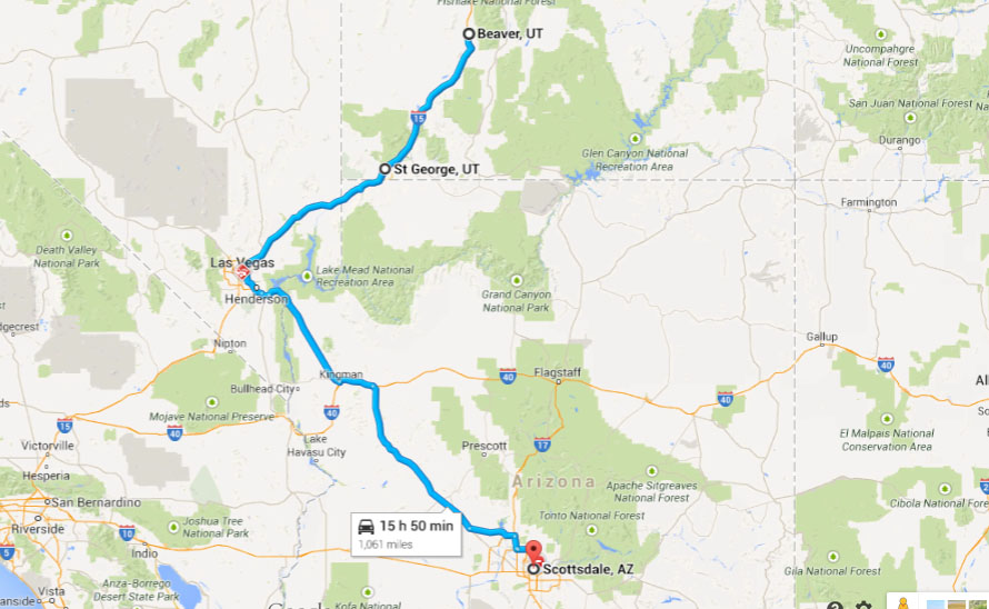
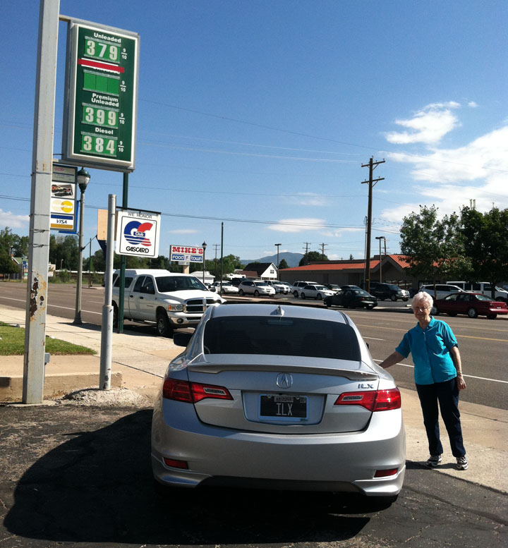
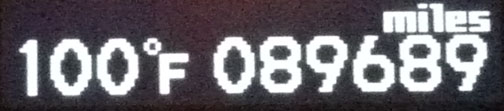
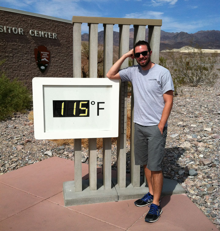
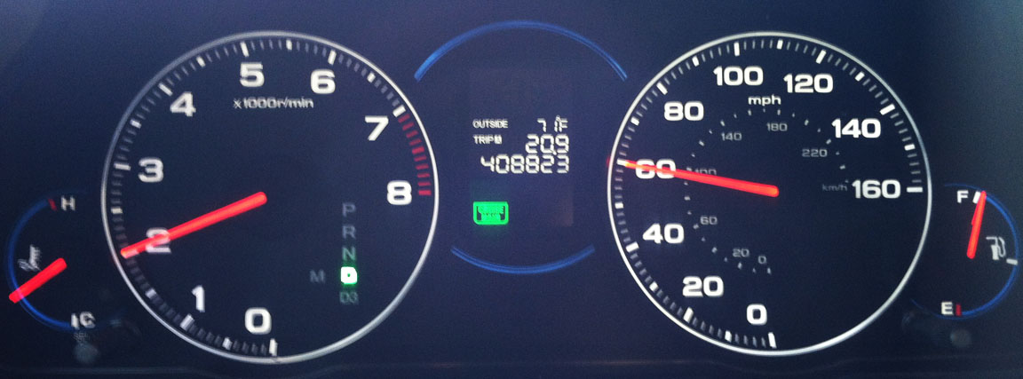
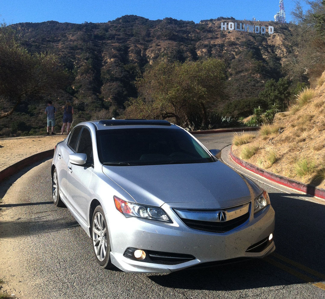
Odometer (ILX):  94,087

94087

Trip Distance: 780 Miles

scottsdale_to_hollywood

What started as the location of a single adobe hut in 1853 has grown to become one of most recognized and prominent places in the world because of its ties to the motion picture industry.  Its name was coined by a man named H.J. Whitley who bought a 500-acre range there in February 1887 and filed the deed with the Los Angeles County Recorder’s Office with the name specified.  Hollywood merged with the City of Los Angeles in 1910 and has since grown to become one of the most densely populated neighborhoods in LA.  As of the 2008 census, it was home to over 22,000 people per square mile!  Let’s go there.

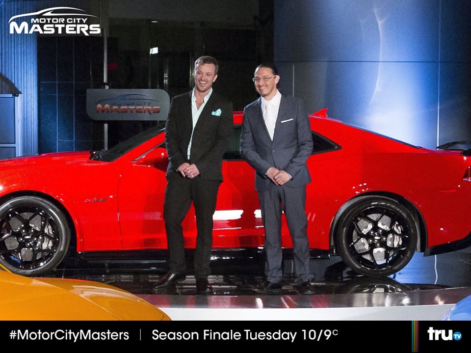
Motor City Masters is a Hollywood-based reality TV show centered around automotive design.  Automotive spy photographer Brenda Priddy invited me to accompany her to an exclusive Hollywood party in connection with a viewing of the show’s final episode.  The concept of MCM is pretty simple:  What started as a group of 10 automotive designers was whittled down via elimination in various design events to just two finalists:  Bryan Thompson and Camilo Pardo, pictured below.  The winner at the end of the series would receive $100,000 cash and a 2014 Chevy Camaro Z28.

bryan_camilo

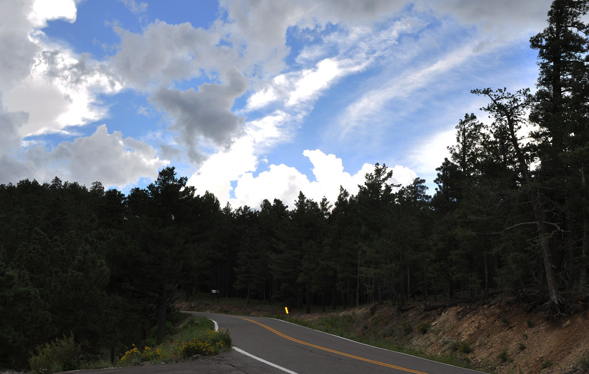
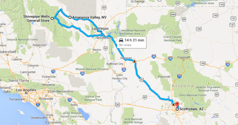
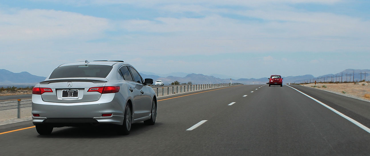
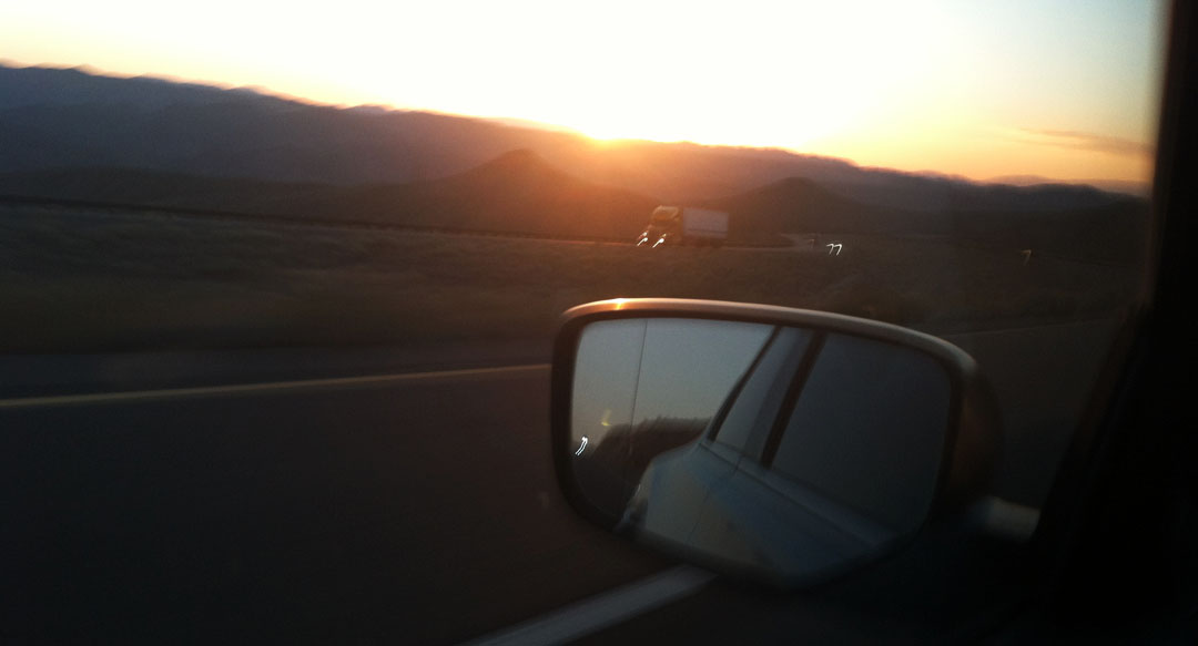
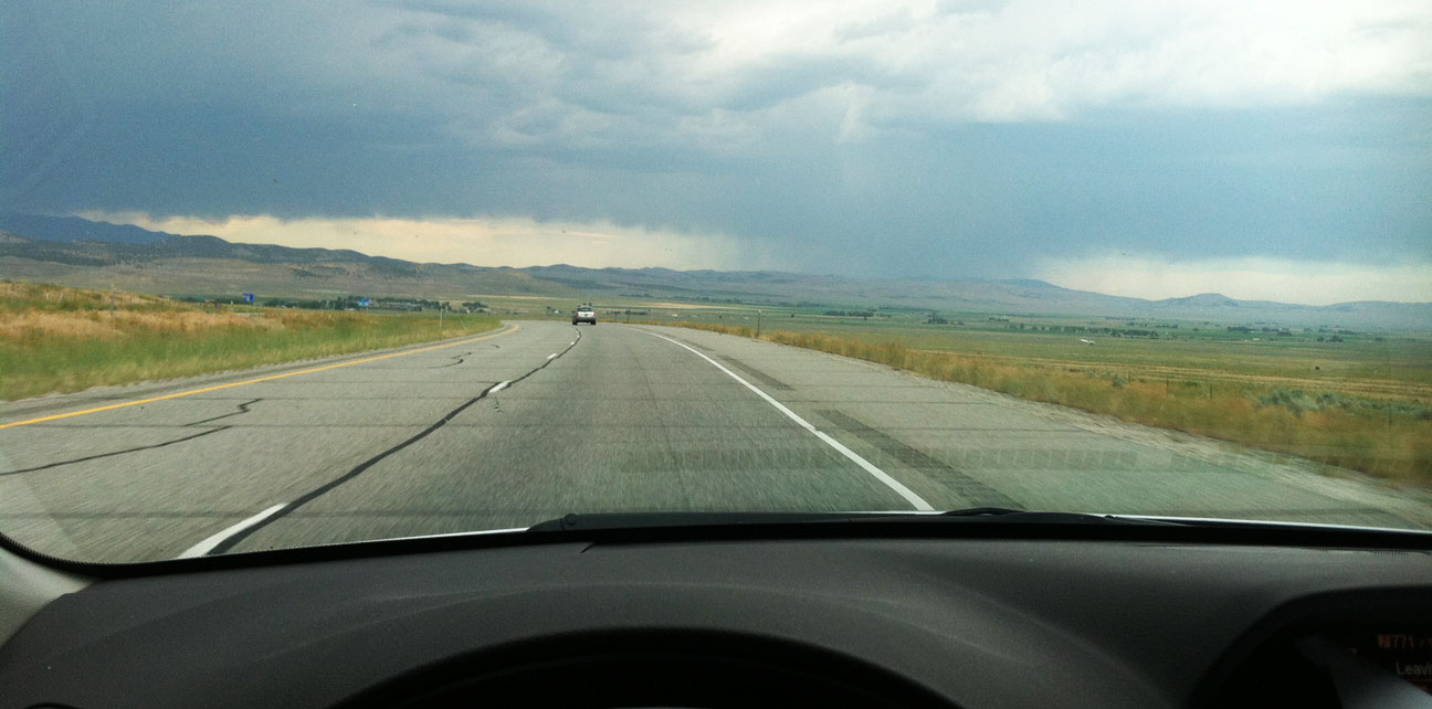
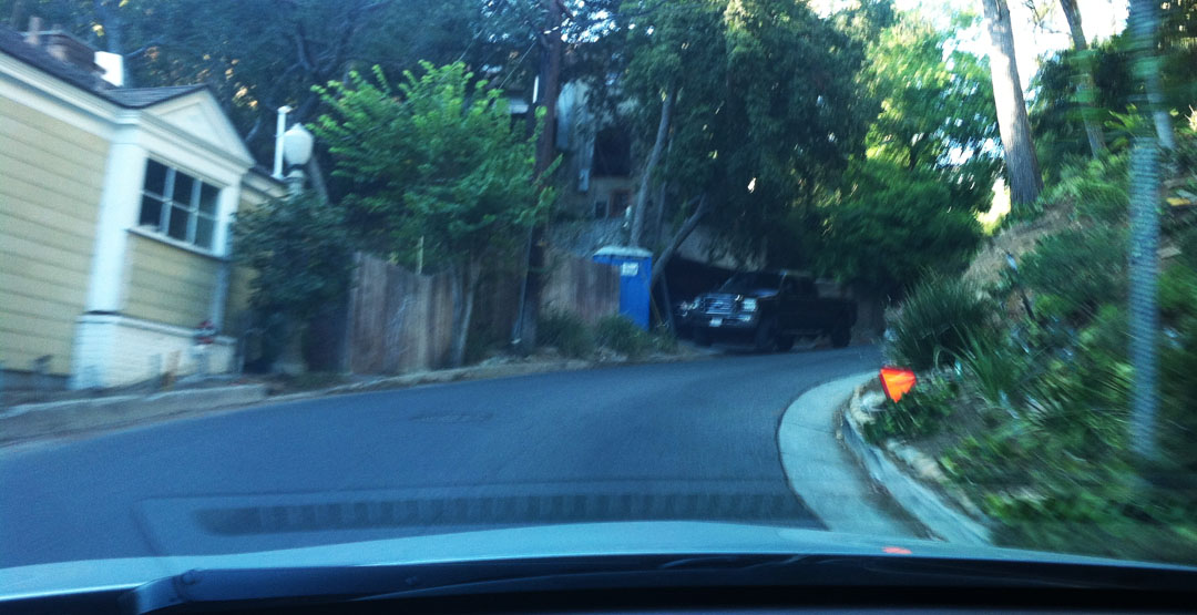
I took a half day off work on Tuesday so that I’d be able to cruise out to southern California for the occasion.  The drive from the Phoenix area to Hollywood takes about 6 hours and is spent almost entirely on Interstate 10.  Miraculously, I hit zero traffic delays until just 4 miles before my scheduled exit on Highway 101.  Making my way northbound on Gower Street, the white HOLLYWOOD sign that I’ve seen so many times before on movies and in TV was there ahead of me in the distance, plain as day.   The challenge was getting anywhere near it!  Look at these loop-de-loop residential roads!

hollywood_roads

Talk about a maze.  Plus, what the map there doesn’t convey is that the roads in most cases are barely wide enough to fit a single car through, and the turns are tight with blind corners.  Topping that off, the grades are steep.  My Garmin Nuvi GPS unit had to recalculate a couple of times before I found the party house location.

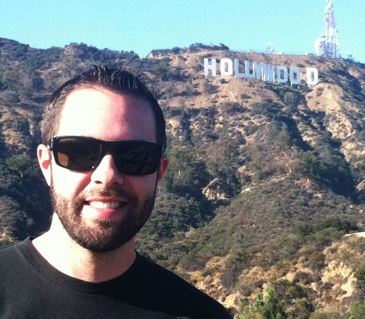
Along the way, though, I did happen to cross right through Lake Hollywood Park which had a perfect viewpoint of the Hollywood sign.  Did you know that the letters in the Hollywood sign are each 45 feet tall?  That’s four stories!  The sign was originally constructed in 1923 and it said “HOLLYWOODLAND” to advertise a new housing development.  In 1949, the “Land” part was dropped, and by 1970 the sign had deteriorated badly.  It was restored in 1979 to its current condition.

ilx_with_hollywood_sign

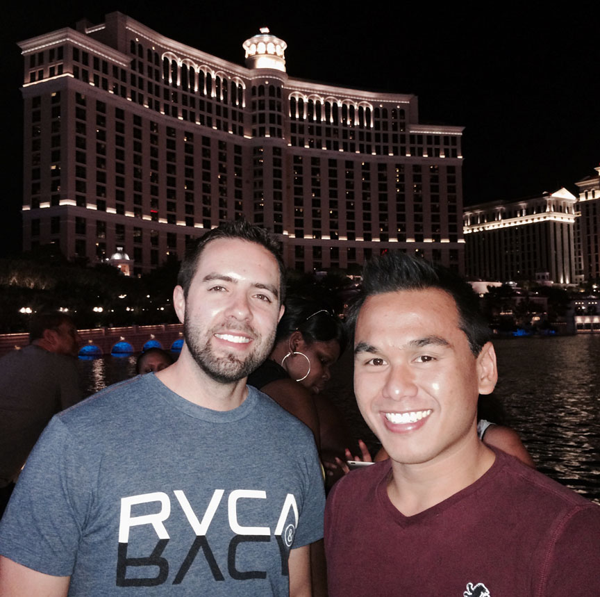
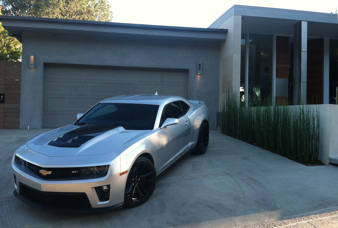
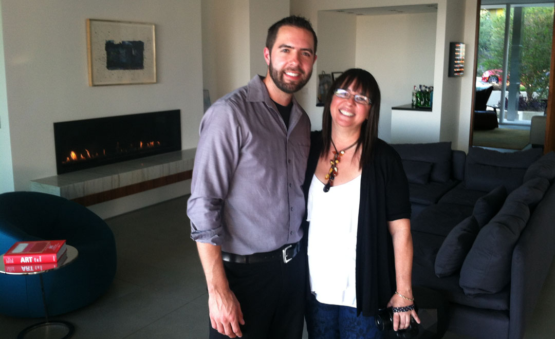
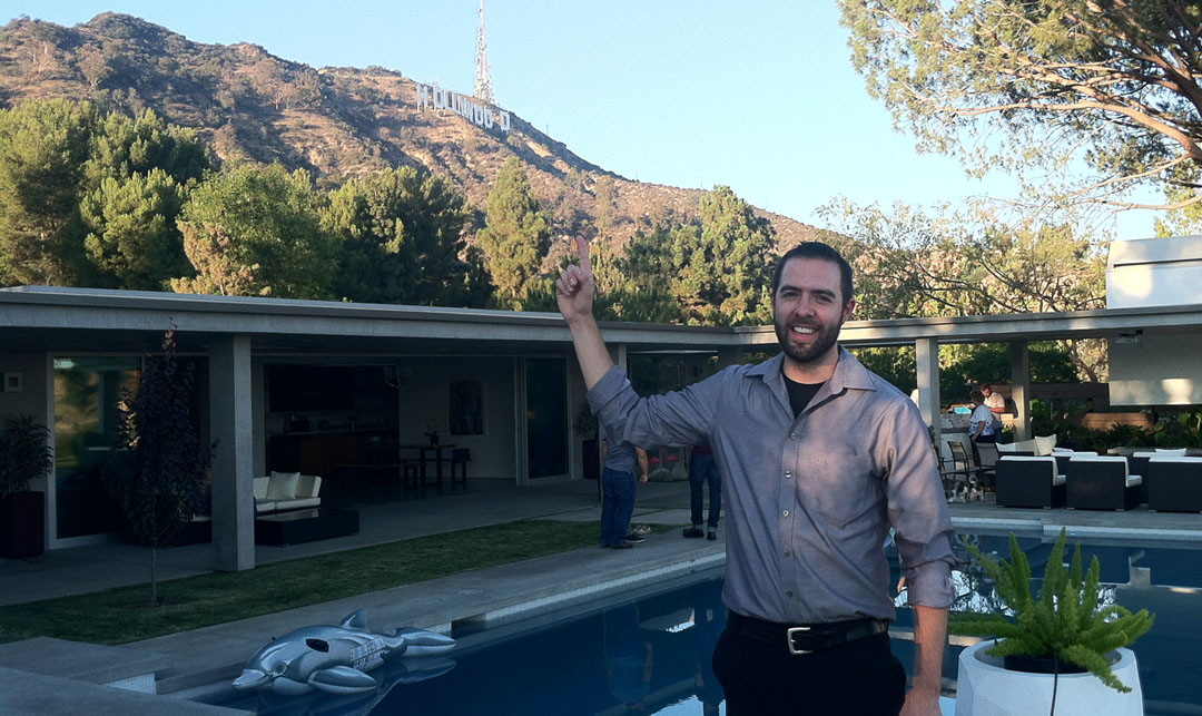
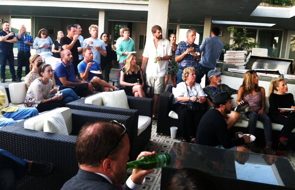
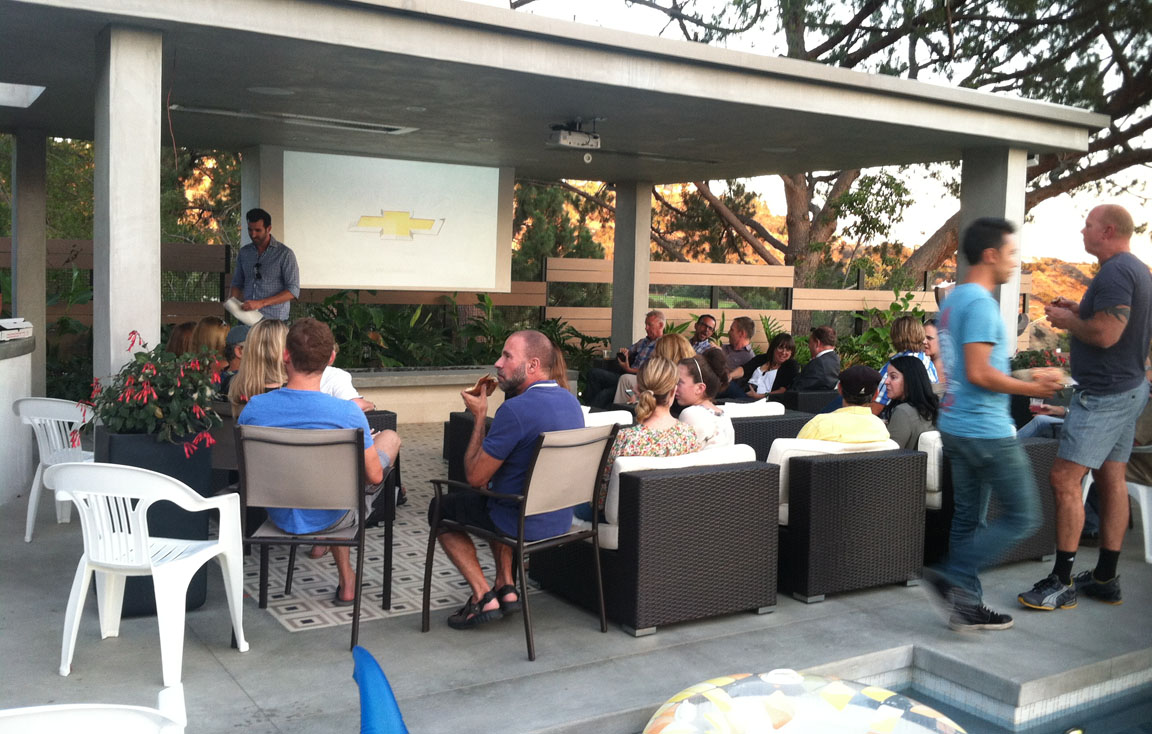
The party I attended was hosted by a man named Axel who has a beautiful glass-walled, modern home overlooking the city with a pool in the backyard.  Weather was perfect and the amenities were top notch.  Best of all, I got to meet a couple of the show’s cast members.  We watched the final Motor City Masters episode, but were disappointed to learn that “our” pick – Bryan – ended up in 2nd place.  In the end, though, he still came out ahead.  Bryan had struck a dealer with Camilo earlier in the show:  Whoever won first place would get the cash, while the second place winner would get the car.  Bryan plans on selling the Camaro and allocating the funds to a scholarship fund for design students.  Pretty cool of him!

pool

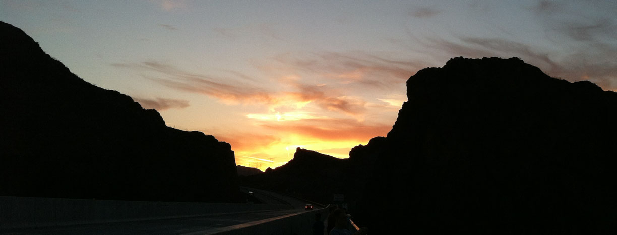
I eventually broke away from the party in anticipation of a long night’s drive ahead.  Once I got past the Palm Springs area, I felt like I was all alone with the truckers out on I-10 in the desert.  I passed dozens of them.  The interstate was smooth sailing, though.  Even though it’s taxing at times, I like to drive at night just because it’s cooler out and there’s less traffic to deal with. Of the 15,605 songs on my 80-gig iPod Classic, this one randomly came on at 1:53 in the morning.  Fitting.

system_of_a_down

Give it a listen.  I rolled into my driveway around 2:45 in the morning, tired from a long day but feeling like it was all worth it!  Here are the rest of my pics.  Enjoy, and thanks for coming along!

Approaching the Hollywood sign

gower_2

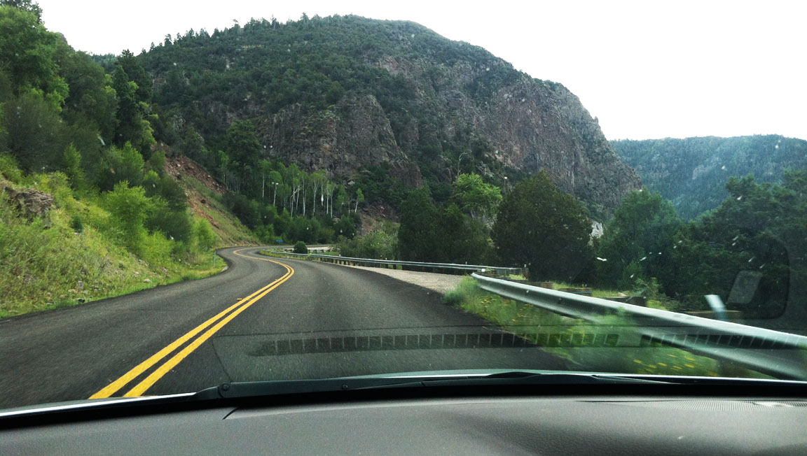
Making my way up the steep, curvy neighborhood roads

gower

Hollywood Lake Park

tyson_hollywood_sign_2

More views from the park

hollywood_park_view

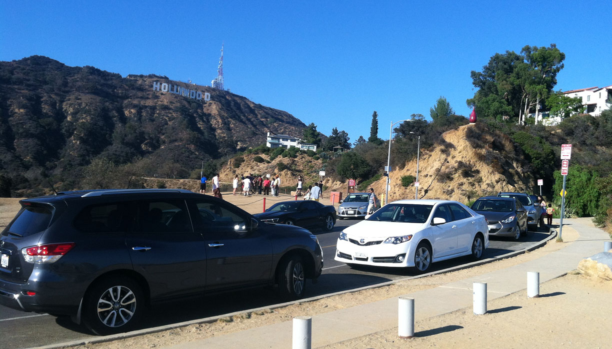
Heavy tourist activity around here

hollywood_park_2

Looking to the southeast

hollywood_park

Arriving at Axel’s place for the party

camaro

Brenda, who’d invited me to the party

tyson_brenda

You can see the Hollywood sign from the house

tyson_hollywood_sign

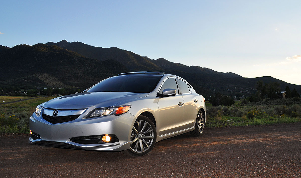
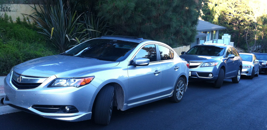
Acura-only parking!  My friend Scott parked behind me in his RDX, and my friend Chris parked behind him in a TSX.

ilx_rdx_tsx

Watching the show.

group

Another angle

screen

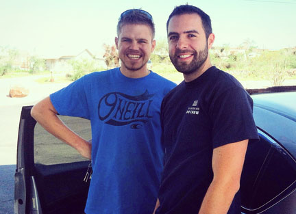
Kevin and Bryan, both cast members from the show (goofing off!)

tyson_kevin_bryan


Utah State Highway 153: Beaver Canyon Scenic Byway in the ILX

Posted in ILX, Road Trip, Utah on August 25, 2014 by tysonhugie

Odometer (Legend):  531,490

531490

Odometer (ILX):  93,204

93204

Trip Distance:  1,061 Miles

map

pinevalley1

Welcome aboard for an AZ-NV-UT-NV-AZ weekend!  The route between Phoenix, Arizona and St. George, Utah is a long-time favorite of mine.  An old friend of mine got hitched on Saturday evening, so I made the trek to my old stomping grounds to participate in the festivities and to reconnect with a few family members.

hwy_74

While waiting for a gas pump to continue filling my 13-gallon tank with 91 octane, I was rooting around in the center console for my key so I could lock the car and go inside the convenience store for a drink.  A voice from behind me said, “Excuse me sir…” I was a little startled and looked up to see it was a friend from my hometown, Danny! Here I was, 200 miles from home, and he was also 200 miles from home – randomly meeting up at a Mobil gas station in small town Kingman, Arizona. It’s a really small world indeed.

danny_tyson

Saturday evening’s wedding was held in Pine Valley Utah.  I’d been there before around Christmas 2012.  The drive from St. George to Pine Valley on State Route 18 took about 40 minutes. The elevation gain lends itself to a change in landscape, as the vivid red sandstone rock formations transition to pine trees and greener surroundings. Pine Valley’s afternoon weather was absolutely perfect for the wedding festivities, so it was appropriate that the ceremony was held outside on the lawn of the bright white, historic 1868 chapel of the Church of Jesus Christ of Latter-day Saints.

pine_valley_chapel

I paid a quick visit to my brother Payton who’s knee-deep in a car “build” that’s been underway for over a year now. He’s converting his blue Lexus IS300 to a stick shift and performing all sorts of drivetrain upgrades in the process.

On Sunday morning, I picked up a special copilot for the day’s drive, Grandma McGregor.  She’d already packed us up a couple coolers full of picnic lunch supplies and food, so we threw those in the back seat and headed out northbound on Interstate 15 toward Beaver.  The 100-mile drive went quickly thanks to the posted 80 mph speed limits that took effect a couple of years ago.  Upon arrival in Beaver, we met up with my mom, stepdad, sister-in-law, niece, and nephew who’d arrived in a separate vehicle (mom’s 2003 Lexus GS430).

grandma_tyson

Beaver’s State Route 153 dates back to 1945.   It’s 40 miles long, but the 13 easternmost miles to the city of Junction, Utah are unpaved.  The 27 miles that are paved are a glorious place to take a nice-handling sports sedan like the ILX.  Grandma and I started our drive from Beaver and headed for the hills.

hwy_153_route

Making our way  eastbound, Highway 153 enters the Fishlake National Forest as it climbs into the Tushar Mountains.   The road first winds along the Beaver River at the base of the canyon, then begins a sharp ascent to its 9,200 foot elevation at its highest point on the paved portion.  The grades reach up to 9-10% and it’s very common for vehicles to overheat going uphill or to lose braking control going downhill.  Extreme drop-offs have taken many victims over the years – including some accidents that we’ve witnessed firsthand.

153

We made it to our destination at the top of the hill, near Eagle Point ski area.  My brother has a cabin under construction there that we took a look at.  Afterward, we traversed a one-lane dirt road deep into the woods and paid our respects to the location where the cremated remains of some of our dear family members were buried.  The ILX got a little muddy, but it was worth it.

picnic

The descent on Highway 153 went quickly.  Knowing that I had a full day’s drive still ahead of me (8 more hours) in getting back to the Phoenix area, I turned over the reins to my stepdad, Todd, who drove the ILX the 100 miles from Beaver to St. George.

By 9:30 p.m. that night, I’d arrived at home in Scottsdale — tired, but feeling very fulfilled about a great weekend.  This was my favorite song from the drive home.  I listened 3 times in a row, at full (level 40) volume.

Thanks for coming along on the trip!  Here are a few more pictures.

Entering Utah from Arizona on the outskirts of St. George

utah_welcome

My brother’s pool.  Anybody want to come take a dip?

bentley_pool

Photo-op with the ILX on the south end of town.

ilx_old_airport_road

This was the same place where I took my mom’s 1993 Legend L sedan back in June 1997.  The surrounding landscape has changed a great deal over the last 17 years, but the rocks remain exactly the same.  I found out, by the way, that the old Sherwood Green Legend is long gone.  As of August 2011, it received a “junk” title in Boise, Idaho and there has been no record of it on Carfax since.  RIP, Legend!

legend1997

Arrival in Pine Valley, Utah

pine_valley_arrival

Premium parking at the wedding

wedding_parking

Reunited with my friend Kati at the wedding

kati_tyson

My grandma is a whiz!  How many 81-year-olds do you know who text message?

doce_text

Arrival in Beaver, UT with grandma and making a fuel-up at Sinclair for $3.84.

sinclair_gas_station

Mom captured this pic of me passing them on Hwy 153 heading up Beaver Canyon

ilx_hwy_153

High elevation cruising!

hwy_153

Brother’s cabin construction underway

b_cabin

Quick photo-op with one of the best road trip companions I’ve ever had!

tyson_grandma_ilx

Arriving at our picnic site

ilx_doce

Lexus and Acura off-road vehicles

ilx_gs

Niece Vivienne was the star of the show.

picnic2

Group photo:  Kali (with Vivienne), Grandma, Tia, Tyson (with Rex)

group

Todd at the wheel of the ILX for part of the return trip

todd_driving_ilx

Group Drive: Mount Graham, Arizona

Posted in Arizona, ILX, Road Trip on August 17, 2014 by tysonhugie

Odometer (Legend):  531,438

531438

Odometer (ILX):  91,696

91696

Trip Distance:  390 Miles

graham_map

Just a half hour after eating the biggest plate of chicken enchiladas of my life, I was already regretting it.  The road I was carving up in my 2013 Acura ILX was so curvy, it was making me nauseous.  After 8 or 9 miles of zig-zagging up the side of one of Arizona’s tallest mountains, I got stuck behind a slow-moving pickup truck.  Joe, from the passenger seat, said, “Good, maybe my lunch will go back to my stomach now.”  Ha!  I guess I hadn’t been the only one holding my breath and hanging on for dear life!  At least it wasn’t like that time when I was 8 years old and lost my lunch in the backseat of my aunt Jodi’s SUV.

highway366

10mph

Arizona Highway 366, also known as the “Swift Trail,” climbs southern Arizona’s Mount Graham in the Pinaleño Mountains at 10,717 feet in elevation.  It’s open from May through November and was designated a state scenic parkway in 1993.  There are some great resources online about this road but due to its remote nature, I’ve never been able to make it over there and check it out until yesterday.  Here’s one very detailed write-up, with the following excerpt:

The Swift Trail, with twenty-nine paved miles and the remainder gravel, begins seven miles south of Safford on U.S. 191. Turn southwest on Arizona Highway 366 and ascend a gently sloping bajada studded with creosote, mesquite, and acacia trees toward the looming Pinaleño Mountains.

ilx_graham_view

The temperature can (and did, for us) vary by up to 30 degrees from the base of the road to the summit!  “It’s like driving from Mexico to Canada in an hour and a half,” said one author.  Joe and I watched as we passed 4,000; 5,000; 6,000 foot signs.  This road maxed out at over 9,000 feet!  The landscape changed dramatically, too.  The desert floor gave way to taller trees and every curve offered a new viewpoint of the valley below.  Guardrails?  Non-existent.  This was a two-hands-on-the-wheel driving experience.  With exception for shifting gears, of course, because in my case there were plenty of high-RPM shifts through 2nd, 3rd, and 4th gears to power up the steep grade and keep the momentum.

Just check out this road!

graham_road

For this experience, I was joined by a few friends.  I present to you, the contenders:

Tyson’s 2013 Acura ILX 2.4:  201 horsepower

ilx_badge

Paul’s 2013 Acura TL SH-AWD:  305 horsepower

tl_badge

Matt’s 2014 Infiniti Q50S:  328 horsepower

q50_badge

Our day started out in the Phoenix area with a quick breakfast stop at the Krispy Kreme store on Superstition Springs Road in Mesa off US 60.  No road trip is complete without appropriate fuel, right?  Or in this case, a sugar rush.  From there, we made our way eastward through the mining towns of Superior, Miami, and Globe.  Miami, Arizona is the “Copper Center of the World”  (or at least that’s what their entrance sign below said).

ilx_in_miami

About 80 miles from Globe, we arrived in the small town of Safford.  The best Mexican place in town, Casa Mañana, was bustling with hungry midday lunch traffic, but we enjoyed the menu and hospitality before heading southbound on Highway 191 toward Swift Trail Junction.  There, we’d be taking Highway 366 all the way to the summit of Mount Graham, some 29 miles later.

swift_junction

Matt and Alan took the lead in the Q50, Paul and Peter followed suit in the TL, and Joe and I brought up the rear in the ILX.  I knew I’d be making some photo and video stops along the way and didn’t want to hold the other guys up.  Besides, did I think I was going to be able to set the pace with a full 100 horsepower fewer than either of them had under the hood?  No thanks!

tl_in_motion

Still, I gave the ILX tires and suspension a pretty good beating.  The rev-happy 2.4 liter spent most of its time in the 3,000 to 5,000 RPM range as we made our ascent.  After our short delay behind the slow pickup truck (and after our stomachs had the chance to settle just slightly), Joe and I zoomed back to an exhilarating pace and made our way up the switchbacks.  Finally, we made it to the end of the paved road where the other guys had already started taking a few pictures.  Despite the fact that the temperature at the base of Graham was 100 degrees, we were now in 67 degrees and enjoying it immensely.

matt_paul_tyson

I couldn’t resist exploring a bit down the dirt road ahead, so we followed that for a couple of miles which led us to a campground.  The downhill return to Safford went quickly – so quickly, in fact, that I could smell burning tires and brakes.  My sweet tooth got the best of me and I succumbed to a pit stop at “Taylor Freeze” for a root beer freeze in the town of Pima.  A phenomenal Arizona sunset closed out the day as we returned to the Phoenix area.  In all, the drive took us about 9 hours round-trip including the breaks and the lunch stop.  Another adventure in the books for me — and for all of us.

sunset

Thanks for being a part of it!  Here are the rest of the photos and a short video.

Peter and Joe up front in the ILX

peter_driving_ilx

Lunchtime!

casa_manana_sign

Those “creamy enchiladas.”  I think there was an entire tub of sour cream on this plate.

enchiladas

It’s almost as if my ILX and Paul’s TL were having a fight and didn’t want to park next to one another.

acuras

Starting the ascent up Highway 366

ilx_graham

Made it to the top!  Or, at least where the pavement ends.

tyson_on_road

Three Japanese luxury sport sedans

car_backs

Venetian Ruby is a great color on that Q50

q50_tl_ilx

Quick stop at the campground after doing a little off-roading (sorry, Matt & Paul!)

ilx_q50_tl

Back to the highway we go

curves

Photo op at scenic viewpoint

q50_parking

Just can’t get enough of these Arizona skies

graham

Cars were looking good!

lineup

Fuel stop in Thatcher, Arizona at Shell

gas_station_group

Taylor Freeze.  Stop there sometime for a shake or malt!

taylor_freeze

Playing in Phoenix’s Papago Park

Posted in Arizona, Hikes, ILX on August 10, 2014 by tysonhugie

Odometer (Legend):  531,389

531389

Odometer (ILX):  91,003

91003

It’s been a relaxing last couple of weekends in town since the whole NALM adventure in Los Angeles.  I’ve lived in the Phoenix area for 8 years and it wasn’t until yesterday that I took the time to hike Papago Park.  There’s a sandstone rock formation there called “Hole In the Rock.”  Many years of wind erosion (6 million+ years worth) have left an opening in this gigantic rock.  It’s believed that ancient Hohokam Indian tribes used the openings and sunlight to track the solstices.

ilx_at_papago

If you look very closely (and excuse the poor quality of my iPhone photography) you’ll see miniature people standing inside the opening in the above picture.  To access that area, the very short trail goes around the back side of the rock and up a series of steps.  I was walking at a good pace and it took me only about 8 minutes to get up to the viewpoint.

hike_steps

On approach, the view is something like this.

hole_view

And here’s the view while sitting in the opening.

papago_park

Made it!

tyson_at_hole_in_rock

Stay tuned to RNR Auto Blog for a review coming up of the Legend coupe & sedan.  My friend Ruben and I got together for some pictures and test drives of the Desert Mist Metallic twins this afternoon.

1994_legends

In other news:  Y’all remember that guy from Idaho with the 410,000-mile TSX who joined me for a drive over the 4th of July?  Well, unfortunately he had a little run-in with a pickup truck a few weeks ago and his car has been under reconstruction.

josh_tsx

The great news is that the car is already repaired.  In a short matter of time, Josh is now back to pounding the pavement in his tried and trusty workhorse.  Follow his detailed account of his TSX rebuild on TSX Travels.

Have a great week!

Drive to the Wild West: Tombstone and Fairbank, Arizona in the ILX

Posted in Arizona, ILX, Road Trip on July 31, 2014 by tysonhugie

Odometer (Legend):  531,295

531295

Odometer (ILX):  90,167

90167

Trip Distance:  372 Miles

tombstone_map

When my friend Chris from Maryland was planning his visit to Arizona, he said, “I want to see a saloon.  Take me to an Old West town.”  I knew exactly which destination would fulfill those wishes:  Tombstone.

tombstone_sign

Just a day after arriving from our trip to Los Angeles for the National Acura Legend Meet, Chris and I again hit the highway in search of a new adventure.  And this time, we traveled back in time 135 years to a town that they say is “Too Tough to Die.”  It’s a town of legends (get it?) and history that fills volumes.

ilx_at_old_tombstone

Compare to the May 2011 picture, when I took the Legend there.

wyatt_earp

Our first stop was the Boothill Graveyard.  We took a self-guided tour and noticed that most of the headstones were marked “UNKNOWN.”  The ones that did have names on them were mostly dated from the late 1800’s.  Here’s one example of an inscription we found on a headstone:

Here Lies George Johnson, 1882

He Was Right, We Was Wrong

But We Strung Him Up, and Now He’s Gone

ilx_at_boothill

chris_at_boothill

We parked the ILX and proceeded to walk around in the muggy afternoon weather.  Tombstone’s history dates back to 1879 when it became a boomtown thanks to the nearby silver mine.  During those years, a guide educated us, the town’s population soared to around 10,000 residents, which was even greater than the population of Los Angeles at the time.  A series of destructive fires in 1882 wiped out over 100 businesses.  Additional fires in the mines themselves, depletion of ore, and the falling price of silver led to the decline of Tombstone.  Today, it’s home to only about 1,300 people and the town survives primarily on the tourism industry.

tombstone_street

On October 26, 1881, a historical gunfight took place in an empty lot behind the O.K. Corral.  Lawman Doc Holliday and 3 other officers fought it out against 4 cowboys who were suspected of murder.  Thirty shots were fired, resulting in injury or death for everyone involved except for Wyatt Earp.  Earp lived on until 1929 when he died at the age of 80.  Chris and I watched a gunfight reenactment and got our photo afterward with some of the actors.

chris_tyson_with_actors

The main road through town, Allen Street, is closed to car traffic.  However, carriage rides are available and the town is very pedestrian-friendly.  Chris and I went to the Crystal Palace Saloon for lunch.  The “shroom and Swiss” hamburger was phenomenal, but my favorite item on the menu was the fried ice cream for dessert.

tyson_chris_stagecoach

This courthouse cost $45,000 to build in 1882 and still stands today with a visitor center in the lobby.

courthouse

Heading north from Tombstone, I decided to change up the trip a little bit and do a little ghost towning.  My friend Leif had once told me about a townsite called Fairbank off Highway 82 in southern Arizona, and I happened to notice how close we were to it thanks to my Garmin Nuvi GPS unit as we were departing from Tombstone.

Just before a border patrol checkpoint, Chris and I veered west into the San Pedro Valley and about 8 miles later we arrived at what was once a bustling railroad town in the late 1800’s.  In 1890 and 1894 the area flooded.  An earthquake in 1897 altered the course of the San Pedro River, knocked railroad tracks out of place, and devastated some of the structures in the town.  It’s almost as if Fairbank was destined to be a ghost town from the very beginning.  Fairbank has been abandoned since the 1970’s and today amounts to just a few decrepit structures and a 1920 schoolhouse that was restored in 2007.

fairbank_sign

Heading on in via a very short, perhaps 1/4 mile, one-lane dirt road.

ilx_at_fairbank

Parked at the gate to the townsite.

parked_at_fairbank

Chris heads on in.

fairbank_entry

This building was once a post office and mercantile.

fairbank

The signs posted on these buildings say that they are condemned due to being unsafe.

chris_with_fairbank_building

We didn’t take the time to hike all 1/2 mile to the San Pedro riverbed, but I enjoyed the green vegetation and it was a nice change of scenery from the rest of the surrounding desert.

chris_hiking_san_pedro

Continuing on Highway 82, I had my first experience with geocaching when Chris and I started heading north on Highway 90.  Geocaching is defined as a recreational activity in which participants use a global positioning system (GPS) to hide and seek containers (“caches”).  Chris downloaded a geocache app to his iPhone and started guiding me on where to make some turns so that we could find it.  I took this picture of the ILX just before Chris (in the background) hit the jackpot.

ilx_at_geocache

Hidden within the chain link fence’s post in this residential neighborhood was a small container attached to the lid.  Once we unscrewed the lid, we found inside a small plastic bag with a folded piece of paper and a pencil where we would fill in the date and our names.  It’s like a treasure hunt!  I had a blast.

tyson_with_geocache

Nice view of Newman Peak just east of I-10 near Picacho on the way back to the Phoenix area.

mountains

We turned over 90,000 miles right around there!

90000

Thanks for joining on the trip!

Just a couple more parting shots today – first, Chris had free reign of the NSX on Tuesday while I was at work, and he found a great road called South Mountain where he took this picture overlooking the Phoenix downtown area.

nsx_at_south_mountain

Later that day, he drove himself to the airport in the Legend coupe.  Having owned a 400,000 mile 3rd generation Prelude Si, he has an appreciation for cars with higher mileage.

chris_driving_legend

And finally, a well deserved shout-out to my friend Alex.  Despite the fact that his Acura Legend did not even have an engine or transmission installed in it just a couple of weeks ago, he got his car together in time to drive it all the way across the country:  from Warm Mineral Springs, Florida, to Los Angeles, California, for this year’s NALM.  Not only that, but he’s now on his return trip (5,000 miles into it, currently in Chicago) and a couple of days ago passed through my hometown in southern Utah and sent me this photo at the state line.  Keep on trucking, Alex!

alex_coupe_in_utah


Acura ILX + TL Drive to Death Valley National Park, California

Posted in California, ILX, National Parks, Nevada, Road Trip on July 20, 2014 by tysonhugie

Odometer (ILX):  89,689

89689

Odometer (Legend):  530,150

530150

Trip Distance:  901 Miles

dv_map

“This could be scary,” Sofyan mumbled as we rolled our suitcases up the front walkway to Longstreet Inn & Casino in Amargosa Valley, Nevada. The hotel, visible for miles on Highway 373 in the barren desert, had loomed like an oasis on the horizon while we approached it (photo below). The sound of country music and horribly off-key karaoke filled the air while I and my 3 traveling colleagues checked into our rooms for the night’s stay. We were weary from a full day of adventure in Death Valley National Park, one of the country’s most oft-overlooked and yet most scenic landscapes. And the evening’s agenda was just what we needed to unwind: A dip in the pool, a home-cooked meal topped off by apple pie, and the clearest nighttime sky I’ve seen in a long time – with stars so visible it was as if we’d pulled them closer to earth.

arrival_longstreet

“Death Valley” sounds like such an enticing place to visit in the middle of the summer, doesn’t it?

On July 10, 1913, a record 134 °F (56.7 °C) was measured at the Weather Bureau’s observation station at Greenland Ranch (now the site for the Furnace Creek Inn), the highest temperature ever recorded in the world.  Daily summer temperatures of 120 °F (49 °C) or greater are common, as well as below freezing nightly temperatures in the winter. July is the hottest month, with an average high of 115 °F (46 °C) and an average low of 88 °F (31C (reference).

The area was named a national monument in 1933 and became a national park in 1994.  It receives nearly a million visitors annually.  Death Valley got its name from prospectors who passed through the area in 1849 when the California gold rush took place, though reportedly only one death took place.  My first and only experience with the area was in August 2011 in the Legend coupe when I paid a visit to a close friend and automotive spy photographer Brenda Priddy who spends her summers there.

ilx_driving

Joining me for this trip were a few friends.  Sofyan, host of the 2theRedline YouTube auto review channel, had flown in from Washington, D.C. for the occasion, and my local friend Peter also came along.

Our day started out in Las Vegas, a city that never sleeps. Glassy-eyed and a bit tired from a night out on the town, we made our way to Johnny Rockets for delicious Belgian waffles with strawberries & whipped cream. That sugar rush was enough to bring me to my senses. Jason Pawela from Driven for Drives arrived and we set out with his 2010 Acura TL and my 2013 Acura ILX in search of some adventures. Highway 160 – “Blue Diamond” took us westward toward Pahrump, Nevada. A slow-moving 65 mph limit felt like it should have been 85 mph: The arrow-straight highway made its way through the desert and Sofyan, who’s visiting from Washington, D.C., commented on the landscape. “So what IS a tumbleweed?” he asked. Oh, you city folks!

last_gas

A little beyond Pahrump, we took a left on Highway 190 toward Death Valley National Park. A few brave travelers – most from other countries, it seemed – joined us at the entrance sign for pictures. Our first stop was at Furnace Creek. It’s a place with $5.56 premium Chevron gas and a breeze that feels like a blow dryer in your face. We were able to find a saloon/restaurant – “49er” — serving up lunch so we were grateful for the opportunity to refill our bellies. All four of us ordered the exact same meal: Turkey club w/o red onion. It hit the spot. A stop at the national park visitor center was in order, so we could pay our $20/car entry fee and legalize our visit. A sign inside the gift shop announced: Heat-Related Deaths Since April 2014: 2. That’s a sobering thought.

group_at_death_valley_entrance

Peter, Sofyan, Tyson, Jason

Jason and I swapped car keys and headed out toward Badwater Basin, some 17 miles away. Badwater is the lowest elevation point in North America, at 282 feet below sea level. I enjoyed seat-time in the 305-horsepower TL with its 3.7 liter V6. Torque for days! The sound system and level of refinement were clearly superior to the ILX, but I did briefly miss the more nimble feel of my smaller sedan. Regading Badwater: Legend has it that a traveler once got to this point and was severely dehydrated. He could not even get his horse to drink from the shallow pool because the water was so salty. Thus the place was named “bad water” and it stuck. Receiving fewer than 2 inches of rain per year, Badwater is one of the driest places in the world. We hiked out a little and Jason filled a Ziploc bag with sand, then we gratefully sought refuge from the oven inside our nicely air conditioned Acura sedans.

peter_tyson_at_badwater

Just 85 miles from Badwater stands the tallest mountain in the contiguous 48 U.S. states, called Mount Whitney (14,505 feet).  You may recall a trip from last summer when Jason and I drove the highest elevation paved road in North America:  Mount Evans in Colorado, at 14,265 feet.   I would have loved to visit Mount Whitney if time permitted.

We wanted to make sure and take home some Death Valley dust on our cars, and I knew just the place to find it. “20 Mule Team Road,” just a few miles from Furnace Creek, is an amazing one-lane, one-way dirt track that winds for 2.7 miles along some terrain that looks like another planet. Jason and I weren’t afraid of doing a little off-roading. In fact, after our first lap of Mule Team, we switched drivers. Sofyan drove the ILX and Peter drove the TL – and we did it all over again. Kicking up dust in style.

20_mule

The last place I wanted to check out was Stovepipe Wells, a small settlement about 23 miles north of Furnace Creek. It’s nestled in between expansive sand dunes. As we approached, it was evident that the wind activity was high because of the wisps of sand sweeping across the roadway. Because of Death Valley’s notoriety as one of the hottest climates in the world, it is an optimal place for automakers to test out the durability of prototype / pre-production vehicles. Sure enough, as Sofyan pulled my ILX into the parking lot at Stovepipe Wells, we spotted 3 white 2016 model year GMC Canyon Diesels out for evaluation. I picked up 2 Gatorades for $3 – best purchase of the day by far. I was parched.

We made our way out of the park on Highway 127 just as the sun dipped down in the western sky. We got a few photos at the California/Nevada state line and then made our entrance into the Longstreet for the night. A great day with great friends.

nevada_entry

Enjoy this video and the rest of these pictures from our trip!

Peter at the wheel of the ILX; Sofyan in the backseat

in_car

Backseat vantage point:  something I’m not used to seeing!

driving

Sunset over the Hoover Dam bypass bridge at the AZ/NV state line

sunset

View from our hotel in Las Vegas:  Excalibur

view

Catching the water show at Bellagio

tyson_sofyah

Saturday morning:  A destination in mind

dv

Ruins in an abandoned Nevada town

tl_ilx_garage

Next stop:  Furnace Creek

furnace_creek_sign

Thanks to Jason for some awesome “rolling shots” of the ILX

ilx_going_to_pahrump

We made it

tyson_jason_dv_entrance

Sign reads:  CAUTION!  EXTREME HEAT DANGER

heat_dange

Elevation:  Sea level as we made our way toward Furnace Creek

junction_death_valley

How’s $5.59/gallon for Premium sound?

gas_prices

Lunch spot

general_store

A brisk 115 degrees Fahrenheit at the National Park Visitor Center

115_degrees

Although, the ILX only showed 113 degrees at the time

113

Shot of the ILX in the TL sideview mirror

ilx_in_mirror

Warning at Badwater Basin.  “Walking after 10 a.m. not recommended.”

stop_sign

Checking out the sights, 282 feet below sea level.

badwater_group

ilx_back

Pit stop along the “20 Mule Team Canyon” trail.

mule

Hitchhiking due to broken down Acuras.  Not.

acuras_broken_down

Stovepipe Wells

stovepipe_wells

GMC Canyon Diesel prototype that was out for hot-weather testing near Stovepipe

gmc_prototype

Crossing back into Nevada from California for the night

california_welcome

Sunday morning’s return drive to Phoenix:  Gigantic cow

cow

And the world’s largest firecracker!

firecracker

Thanks for coming along!

4th of July Weekend Part 3: McCall, Idaho to Scottsdale, Arizona

Posted in ILX, Maintenance, Road Trip on July 9, 2014 by tysonhugie

Odometer (ILX):  88,204

88204

Leg Distance:  1,177 Miles

mccall_to_scottsdale

The return trip from this vacation went by quickly thanks to good music and good company.  About 5 hours into the 17-hour journey, I picked up a copilot in Salt Lake City and we spent the rest of the drive trading off shifts at the wheel.  It sure was tough to leave behind the beauty of the mountains and especially the comfort of cooler temperatures.  My 3-mile run on Saturday morning along the lake in McCall was surrounded by scenes like this.

lake

We spent the day lounging on the deck and doing a little antique shopping in McCall.  That evening, we celebrated my niece’s birthday at a restaurant called Lardo’s.  If you can get past the name, the place really does have quite a bit to offer!  I headed south on Highway 55 after dinner and spent the next 105 miles winding through the Boise National Forest next to the beautiful Payette River.

idaho_highway_55

From Salt Lake City, my friend Jeremy hopped aboard and we continued the rest of the journey together.  Having originally intended to spend the night in St. George, Utah, we decided to press onward.  Black storm clouds on the horizon had other plans for us:  Within 5 miles of entering the Virgin River Gorge on Interstate 15, traffic came to a standstill due to construction delays, and the clouds began to unleash.  The construction and adverse weather conditions were further complicated by much-heavier-than-normal holiday traffic.  The delay in the Gorge cost us about 30 minutes, and then the slow-moving traffic elsewhere on I-15 in torrential downpours cost us even more.

By the time we arrived in Las Vegas, we were exhausted and ready to call it a night, so we did so.  I pulled the rain-soaked ILX into the Hilton Garden Inn in Henderson for a late night check-in, anxious for a fluffy pillow and a good night’s sleep.

vegas_arrival

On Monday morning, conditions were much more suitable for road tripping.  We made time for a pit stop at the Mike O’Callaghan – Pat Tillman Memorial Bridge.  The bridge, completed in 2010, is better known as the Hoover Dam Bypass Bridge.  Before its construction (which cost $240 million), traffic was formerly routed OVER Hoover Dam.  To walk across the bridge is a bit unnerving if heights are of concern.  The span covers some 1,900 feet and looms 880 feet above the surface of the Colorado River far below.  But the view of the dam from there is, dare I say it, “dam” good.

hoover_dam_sign

hoover_dam

The rest of our drive was an easy one with a quick fuel stop in Kingman, Arizona and then a few hours of desert two-laners on Highway 93 on into the Phoenix area.  The closer we got to Phoenix, the higher the temperature climbed — right up until the 110-degree mark.  I sure wished I was still sitting on the cabin deck in McCall, Idaho.

Thanks for coming along on the trip!  Here are the rest of the pictures.

Dinner at Lardo’s with Ali and Beckam.  Poor lighting for the pic, but phenomenal food.

lardos

Another neat dining establishment I wish I’d had time to check out:  “Dollar Bill’s Casual Fine Red Neck Dining,” in Cascade, Idaho.  What a name!

dollar_bills

Arrival in Salt Lake City, Utah on Interstate 15 southbound.

salt_lake_city

Picking up Jeremy and giving him some time at the the wheel.

tyson_jeremy

Taken near the Hoover Dam at the Arizona/Nevada state line.

nevada_welcome

Total trip time & distance:  41 hours, 39 minutes and 2,521 miles since I departed last Wednesday.

elapsed_time

And that’s a wrap to the trip!

MAINTENANCE UPDATES

Now, it’s time to get down to business and get some updates on how these cars are staying on the road.

Here’s a photo while driving the Legend to get some maintenance done, and following Jeremy in my ILX.

legend_following_ilx

The Legend coupe is currently getting a new power steering rack, fresh spark plugs, and a CV axle boot. I’ll pick it up tomorrow.  These maintenance items are in preparation for the road trip to NALM later this month in Los Angeles.

The ILX went in today for a “B1” service including an oil change with 0W20 oil, new engine air filter, and a tire rotation.  It set me back $118.69.  The technician’s inspection noted that my rear brakes are down to 3MM.  Also, I’m coming up on a 90k service interval which calls for replacement of the serpentine belt and a coolant flush.  What surprised me was how far the car allowed me to drive on that same oil change.  Since my last appointment on May 14th, I drove 9,274 miles on one oil change, and the car’s Maintenance Minder still told me the oil had 15% life remaining.

The dealership is undergoing some renovations inside & out.  Think they have enough flat-screen TVs in the Customer Lounge?

dealership_tvs

Inspection notes.

ilx_inspection

And back on my way!

ilx_at_dealership

Later!

4th of July Weekend Part 2: Boise to McCall, Idaho

Posted in ILX, Road Trip on July 7, 2014 by tysonhugie

Odometer (Legend):  530,040

530040

Odometer (ILX):  88,114

88114

Leg Distance:  173 Miles

boise_to_mccall

jims_grocery

Every day that I’m behind the wheel is an independence day. Drive time means freedom from the stresses of the workplace, freedom from chores, from worries, and from problems. It’s a time when the most pressing concern on my mind is keeping my vehicle between the white lines while making sure I don’t miss out on any amazing roadside attractions. For this year’s July 4th holiday, I swapped car keys with my friend Josh Clymer  of TSX Travels and spent a hundred miles at the helm of his 2005 Acura TSX. Our route took us from the Boise, Idaho metropolitan area through forested, curvy highways escalating to 7,000 feet in elevation in the mountains northeast of town.

From our meeting/departure point near the Boise airport, Josh ensured that I made myself comfortable by helping me get the seat, mirrors, and steering wheel just where I wanted them. “The nav is already programmed,” he said, “You’re going to lead the way.” And with that, we were off to explore the open road by about 9:00 in the morning. Our first attraction was Lucky Peak State Park shortly after we got on Highway 21 and started heading north. The two-lane highway progressively got more technical and it required full attention most of the time, but I couldn’t help but steal a few glances at my own ILX in the rearview mirror periodically.

rearview

My two-way radios were nothing but a static-fest, but that’s okay because I was glad to shut mine off. The only sounds I wanted to hear were the harmonious growl of the TSX’s finely tuned 2.4 liter and the buffeting of mountain winds throughout the windows-down cabin. Every so often, the smell of fresh pine trees would be overtaken by the scent of campfire and it brought back memories of so many nights I spent in the great outdoors as a kid.

idaho_city

About 40 miles into our drive, we entered the town of Idaho City and pulled into the General Store. A young man was sweeping the front porch. I asked him to take a photo of us, and then inquired, “So what’s there to do in Idaho City today?” To my surprise, he laid out the entire weekend’s schedule for us, including the plans for a parade which was to begin at noon. He wondered where we were from. When I asked him if he knew where Phoenix was, he said, “I’ve heard of it.” Josh piped up immediately with, “It’s like a frying pan with sand.” I nodded in approval at that description.

Now armed with my GoPro video camera mounted up, we started our next leg: Idaho City to Lowman. Here’s where the road started dishing out some real surprises. Josh had told me to go ahead and ‘open up’ the TSX if I felt so inclined. My better judgment told me I probably didn’t want to ask too much of a car that had 408,800 miles on the odometer. But the car begged for a little torture, so I obliged. Sweeping banked curves of Highway 21 provided the optimal place to test out the suspension tuning. I remember coming into a 25 mile per hour (“recommended”) curve at probably double that. “Whoa, Nelly,” I thought. But aside from a howl from the TSX’s tires, the switchback was easily managed and Josh stayed right on my tail in the ILX, rowing through its 6-speed gearbox. I found the manual mode in the TSX seamless and handy, especially on the downgrades where I wanted to take it easy on the brakes.

tsx_ilx_pit_stop

ilx_tsx

I found it miraculous that on a holiday we had the road almost entirely to ourselves. By the time we arrived in Lowman, my stomach was ready for fuel and Josh had just the right place in mind: Sourdough Lodge. A place he discovered by chance when stopping during a traffic back-up, I dare say the Sourdough Lodge now ranks as one of my favorite restaurants to get an omelet. Midway through our breakfast conversation, Josh said, “Oh, wait a sec – I have to show you something,” and he headed for the door. He brought back a white envelope and threw it on the table. I opened it up and saw that it was the original purchase contract for his TSX, dated December 29, 2004 when the car had 5 miles on it. Josh knows that I go crazy for documentation, so this was a real find.

ilx_arriving_sourdough_lodge

payphone

I got a kick out of the phone booth in front of Sourdough Lodge: A sign taped above it said, “Will eat your hard earned money. Courtesy phone inside.” Full and happy, Josh and I headed out to take a cutoff road that would get us to Highway 55. Along the way, we stopped and admired the sights and gushing sounds of the South Fork of the Payette River. It was time to swap cars again, and I thanked Josh for allowing me some seat-time in his TSX. The next 70 miles took me through more heavily wooded forests. Parade traffic in the town of Cascade cost me a 20-minute delay, but I didn’t mind one bit. How could I complain? I had my windows down and moonroof open, and it was July. Try doing that in Arizona without getting cooked.

It was a great evening in McCall, Idaho with my family at my brother’s cabin. As I drafted this blog entry from a lounge chair on the back deck whilst admiring a glass-smooth lake, I can think of very few places I’d rather be spending the holiday weekend. Ice cream and a phenomenal fireworks show over Payette Lake capped off an amazing Independence Day.

mccall_sunset

Here are the rest of the photos and a video from this piece of my weekend journey.

First, Josh taking the wheel of the ILX.

josh_at_chevron

Odometer of the TSX.  I forgot to get one before we departed, but I have this in-motion shot from once we got going on I-84 at the beginning of the day.  Yep, that says 408,823 miles.

408k_tsx

Idaho City, Idaho.

josh_tyson

Highway 21 northbound in all its wooded glory.

scenery

Scenic turnout.

scenic_view

Pull-out near Lowman so we could re-group.

ilx_in_lowman

Most of the day, there was little to no cellular service.  Having a reliable car is critical.

no_service

Like an oasis in the desert, the Sourdough Lodge shone like a beacon along the road.  We were hungry.

arrival_sourdough_lodge

I got a kick out of Josh’s mileage log.  Daily he records his business miles for the road-warrior TSX.

logbook

Sourdough Lodge omelet.  Two thumbs way up.

omelet

Following Josh back toward a cutoff that would take us to Highway 55.

garden_valley_turnoff

Unmatched scenery as the road winds along the South Fork of the Payette River.

ilx_tsx_scenic

Water levels are high due to spring runoff.  The sound of water rapids is something I could listen to all day long.

payette_river_2

Looking west along the river.

payette_river

Goofy ol’ me.

tyson_with_cars

Here’s where Josh and I parted ways.  I headed north to McCall; he headed south to Boise.

boise_mccall

I took this for my friend Chris who shares a last name with the name of this (very small!) town.

donnelly_welcome

Finally, I arrived in McCall.

mccall_welcome

This is how I spent much of the afternoon, sprawled out in a lounge chair at my brother’s cabin.

lounging

Later that night, ice cream with my niece Addy.

tyson_addy

And fireworks over the lake.  Couldn’t have asked for a nicer evening!

fireworks

Come back next time for the wrap-up of my Idaho driving adventure.

4th of July Weekend Part 1: Scottsdale, Arizona to Boise, Idaho

Posted in ILX, Road Trip on July 3, 2014 by tysonhugie

Odometer (Legend):  530,029

530029

Odometer (ILX):  86,638

86638

Leg Distance:  1,071 Miles

scottsdale_to_boise

Brigham City, Utah.  I had a few minutes to kill while waiting for my friend Nick to meet me for some hometown food, so I sprawled out on my back on the grassy lawn in front of Peach City Drive-In and enjoyed the incredible summertime weather.  As I looked above me, the whispy clouds drifted across the sky and the sun peeked through the leaves with a glisten in the light breeze.  Coming from a place where A) It’s 110 degrees, and B) Hardly anyone landscapes with grass, this was quite a rich experience.  I was in my element.

tree_overhead

That is, until I heard the sputter of a sprinkler head a few feet away from my face.  Within seconds, the oscillating nozzle made its way with gushing water right toward me.  I thought quickly enough to shield my iPhone from the water as I darted across the grass to safety, but my shirt and sunglasses got soaked.  Nick pulled up a minute or so later and I had to explain, “No, this isn’t sweat.  I just got attacked by the sprinklers and I think everyone inside the restaurant is laughing at me right now.”

It’s a 5-day holiday weekend for me and I’m making the most of it by exploring some new turf up north.  Tonight, I’m in stationed in the capitol of the Gem State of Idaho, in Boise.  Tomorrow, I’m meeting up with none other than Josh of TSXTravels.com for a scenic tour of the surrounding area en route to my brother’s cabin in the town of McCall.  It’s already been a memorable 1,071-mile trip so far.  Enjoy a few of the photos from this first piece of my journey.

The was just dipping below the horizon around quarter to eight last night as I neared Hoover Dam in Nevada.

sunset

I made some time to meet up with my friend Jessie and Devon in Boulder City for some Panda Express dinner.

jessie_tyson_devon

In St. George, Utah, I dropped off a transmission at my brother’s place.  That unit is going into a Lexus IS300 that my brother is building.  Sure was fun to hoist that into / out of my trunk by myself (Payton wasn’t home at the time of drop-off).

is300_ilx

Saturday morning meet-up with mom before heading northbound on I-15 from St. George

tyson_tia

Mom knows me best.  She took a couple of “spy shots” while I was driving ahead of her on Bluff Street.

ilx_bluff_street

Bonus points to her for also getting the rear quarter panel of a 2nd generation Acura TL!

ilx_bluff_st_2

Peace!

tyson_st_george

In Salt Lake City, I made a couple of friend visits but soon continued onward.

slc

Brigham City (population 18,000) is the proud home of the World’s Greatest Wild Bird Refuge, according to a sign that spans its main street.  The Bear River Migratory Bird Refuge covers some 74,000 acres and was established in 1928.

brigham_welcome

I couldn’t help but stop at “Chim-Chiminey” Fireplace and Stove Shop on Main Street.

chim_chiminey

The sign immediately made me think of this Mary Poppins Song.

Soon, I arrived at Peach City Drive-In at 300 North Main Street.

300north

Peach City has been a landmark in Brigham City since 1937 but its current location dates back to 1957.

peach_city_with_ilx

Here’s that darn sprinkler that blasted me.

sprinkler

Nick arrived in his gorgeous 2006 BMW 325xi and we prepared to dine.

nick_wagon

nick_tyson

Grilled cheese, waffle fries, and… fry sauce.  This might be a Utah thing, but “fry sauce” is the best.  It’s basically a combination of ketchup and mayonnaise.  And it’s incredibly delicious.

grilled_cheese

Heading out again on I-15 to I-84 westbound.

freeway_split

Storms loomed ahead and at one point the torrential rains forced me to put the windshield wipers into high gear.

i84

It was during these thunderstorms that the temperature cooled to a refreshing 65 degrees outside.

boise

By the way, I’m having a tough time adjusting to these daylight hours!  Back home, sunset was at 7:40 p.m.  Here in Boise, it was 9:25 p.m.!  Anyway, here I am, relaxing for the night with many more adventures yet to come.

Thanks for joining!

530k Milestone & Flagstaff Quick Drive

Posted in Arizona, ILX, Legend, Milestones, Road Trip, Spy Shots on June 29, 2014 by tysonhugie

Odometer (Legend):  530,024

530024

Odometer (ILX):  85,452

85452

Took me long enough to get to 530k!

530k

Friday, I drove the Legend to work and achieved a milestone on the way home from the office.  I took a few cell phone shots of the car just shortly after the roll-over.  They aren’t the best quality but you get the idea.

I have a few maintenance items to address before driving it to Los Angeles next month for NALM.  I might go ahead and have the spark plugs changed (last replaced at 434,000).  There’s also a leaking inner CV boot on the passenger side, and I’ve been told the A/C lines at the compressor are leaking, though the system still somehow blows ice cold air.

coupe_front

These were taken just east of Phoenix on the Beeline Highway near the Saguaro Lake turnoff.

coupe_front_right

trunk

Yesterday, I escaped the Phoenix heat for a few hours and met up with some friends in Flagstaff, Arizona.  It’s only about a 150-mile drive each way via I-17 so I was easily able to get up and back comfortably over the course of the day.  It sure was great to spend some time in “only” 90 degree temperatures as opposed to the 110 degrees at my house.

scottsdale_to_flag

The only photos I grabbed were at Exit 317:  Fox Ranch Road.

fox_ranch

Perfect day for a drive.

flag_sign

Think anyone will mind if I park the car there?  I was a rebel for a few seconds.

no_parking

I thought it would be fun to share a few “spy shots” that friends have sent me over the last couple of weeks since I recently started saving them.  My friends know how Legend-crazy I am, so I frequently get text messages of random sightings from the road.

From Tim

spy1

From Terrance

spy2

Another from Terrance

spy3

From Paul

spy4

From Mike

spy5

From Jim

spy6

Another from Jim

spy7

From Beau

spy8

Haha, to those who have my phone number or email:  Keep the pics coming!