Posted in Reader's Ride on August 10, 2013 by tysonhugie
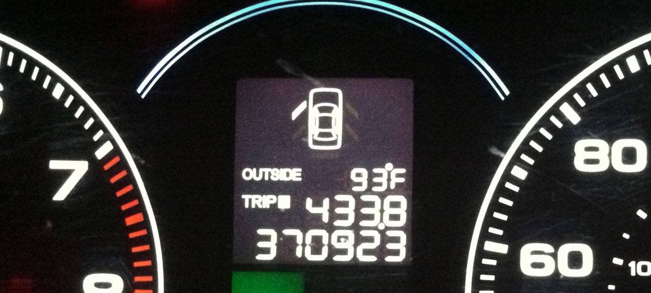
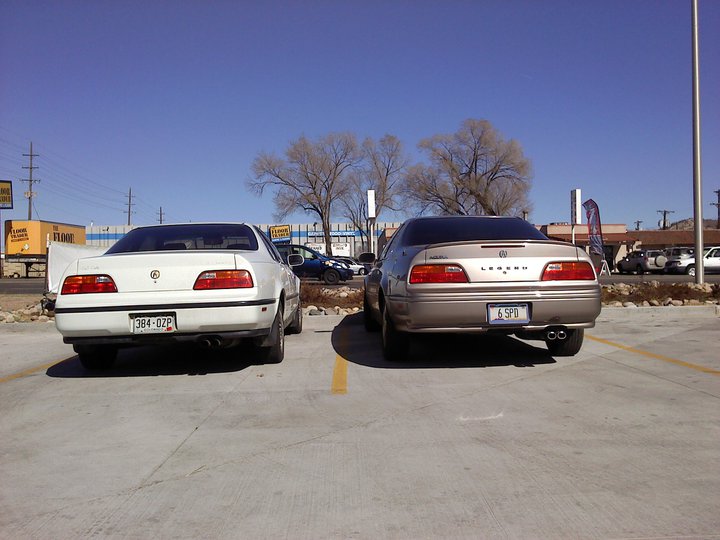
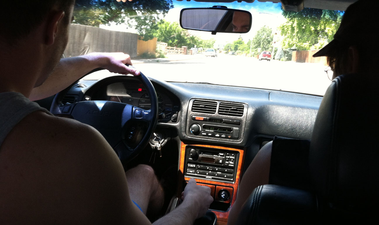
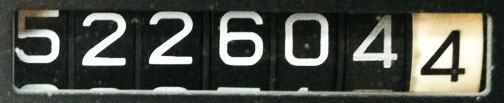
I found a car that’s well on its way to million mile status. Check out the odometer on this 2005 Acura TSX that’s driven an average of over 46,000 miles per year. That’s right: 370,923 miles!
Several months ago, I’d seen a fellow Acura fan post on Facebook about his high-mileage TSX. We ended up sharing stories about our experiences in “life beyond 100,000 miles” in an Acura.
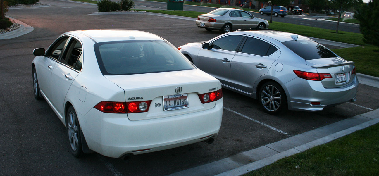
These two Acuras share the same 2.4 liter 4 cylinder motor.
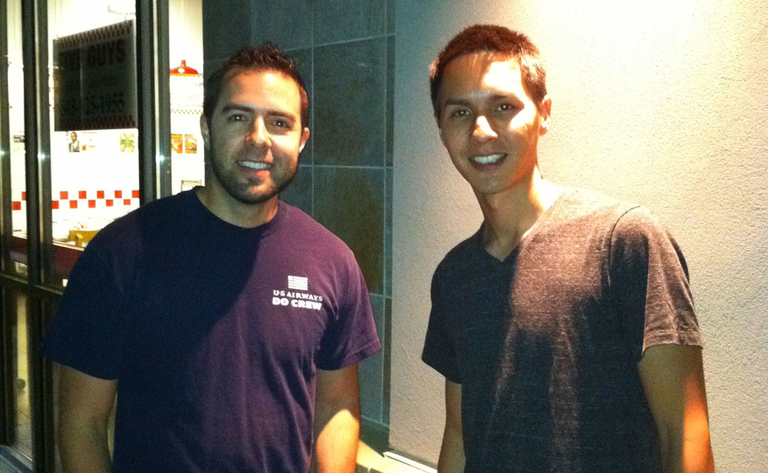
Josh and I finally had a chance to meet last night when he brought his White Diamond Pearl beauty over to a hotel where I was staying on the west side of Boise, Idaho.
Josh bought this TSX brand new. He is in the insurance business and currently drives around 5,000 miles per month. Josh says that his car is 100% dealer maintained and the service team at Lyle Pearson Acura knows him personally. In fact, when they call him for an after-service follow-up, “Smooth and silky, as always, Josh?” is their greeting.
This car is equipped with all the bells & whistles that were available in 2005, including the navigation.
Check out that bug collection!
Josh and I took the TSX for a spin around the block and I must say – even with the original suspension, the car rides great!
My favorite part: He’s even still left the blue plastic covering over the aluminum door sills since the car was new 8 years ago.
Thanks, Josh, for meeting up! Drive to Five! I’ll be keeping tabs on your progress.
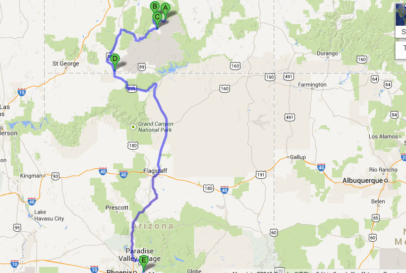
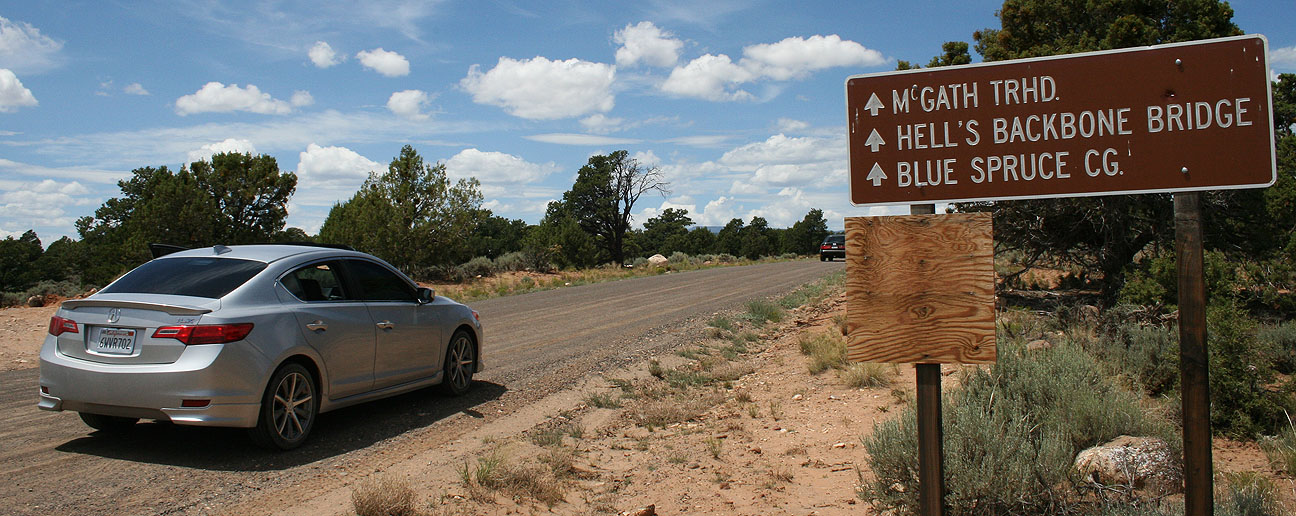
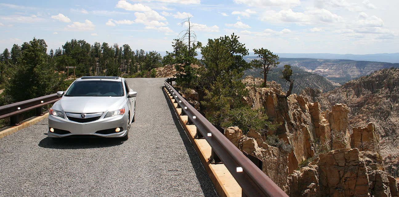
Welcome to the third and final chapter of last weekend’s wild ride in Utah with 2013 Acura ILX. Fueled up by my tasty Trout Quesadilla after lunch in Boulder Utah on Saturday, I had a renewed vigor for travel. My friend Ryan and I were determined to conquer one last road before we called it a day: Hell’s Backbone.
Seen along the ridge in the above picture, Hell’s Backbone (Forest Road 153) was built in the mid-1930s as an alternate route between the towns of Escalante and Boulder, Utah. It was constructed by the Civilian Conservation Corps and created a means for the first automobiles to reach Boulder.
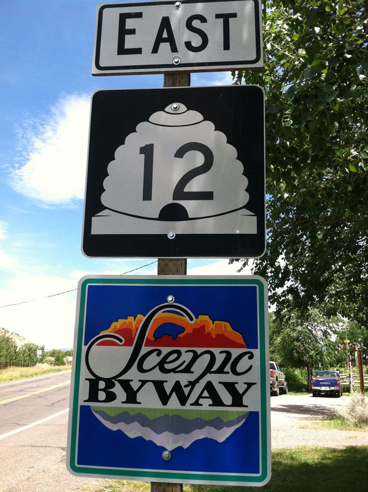
Highway 12 is notoriously one of the most beautiful in Utah. Someday I plan on driving it in its entirety.
Just a few miles south of Boulder on Highway 12, we veered right and entered Hell’s Backbone Road. Again, Ryan led the way in his 230,000 mile Audi A6 while I followed in the 48,000 mile Acura ILX.
We were lucky to not encounter adverse weather conditions during our drive, as muddy roads would have made this route impassible for passenger cars. Notice I had my GoPro video camera mounted on the car’s rear quarter panel for part of the drive.
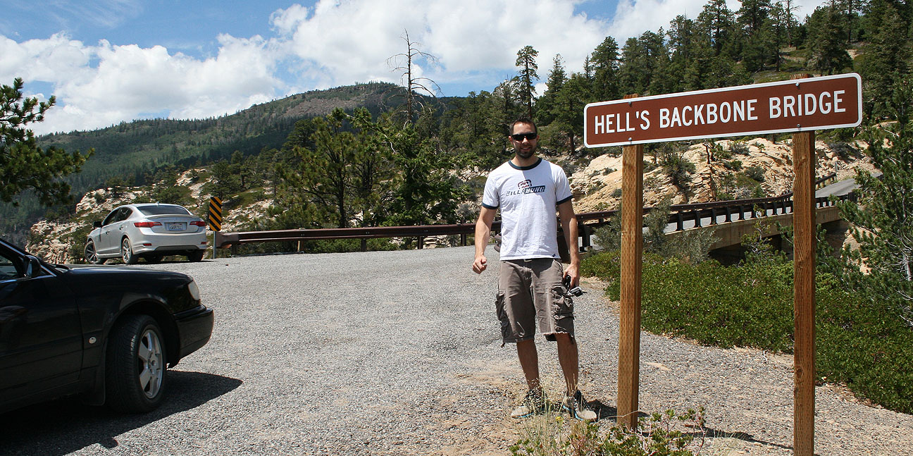
The dirt road reaches an elevation of 9,000 feet and skirts the edge of Box-Death Hollow Wilderness. Midway through the 38-mile stretch of gravel road lies the the one-lane Hell’s Backbone Bridge (originally constructed in 1933).
From an informative sign on-site:
The original bridge was in use until the early 1960’s, when its decaying timbers started to groan and squeak ominously as vehicles crossed over it. The faithful old wooden bridge was replaced by a steel and concrete reinforced structure. That bridge was replaced in 2005 by the present bridge which is wider and stronger than the two previous bridges.
This thing still looks pretty skinny to me! I wonder what it would’ve looked like in 1933.
Ryan and I took a breather from driving and spent awhile hiking around the area. It was perfect weather.
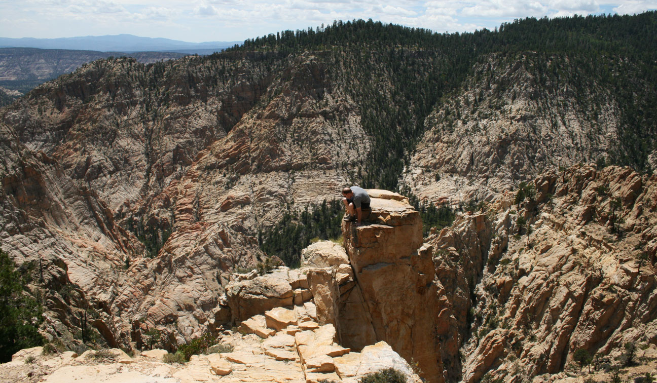
Here, Ryan (carefully!) climbed on top of one of the sandstone spires. A fall would have been fatal at that height.
Pictures do not do justice to the depth of the canyon and the many layers of it.
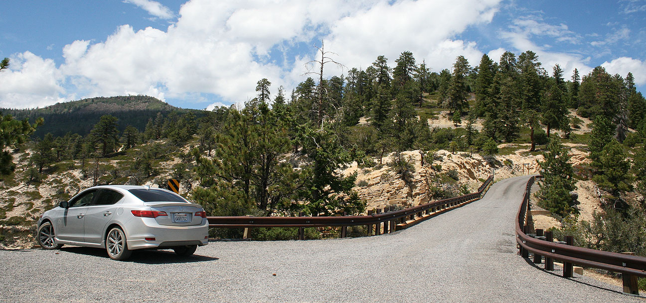
All aboard! Here is the ILX crossing the bridge.
I was met by a truck coming the opposite direction and had to back up to let it pass.
Hell’s Backbone Road went on to join with Pine Creek Road, which is what we followed to the town of Escalante, Utah. In all, we traveled around 38 miles on the dirt backroads.
Here, I took the chance to go ahead and top off my fuel tank with some $4.09 premium fuel at the only gas station in town.
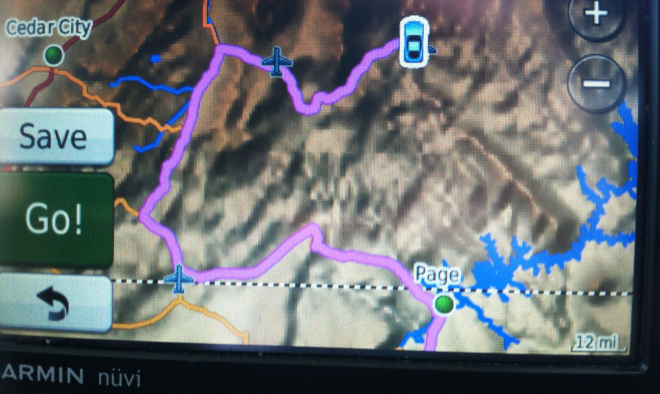
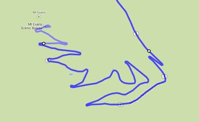
And from there, since Ryan and I had completed our mission, I started contemplating the drive home. Unfortunately, as the GPS screen capture illustrates below, there was no direct way to get where I was going.
Through the towns of Henrieville, Cannonville, and Tropic, we headed westward on Highway 12. I love old homes like this one, and I’d especially like to take a peek inside if the opportunity presented itself. Looks like this one’s even for sale!
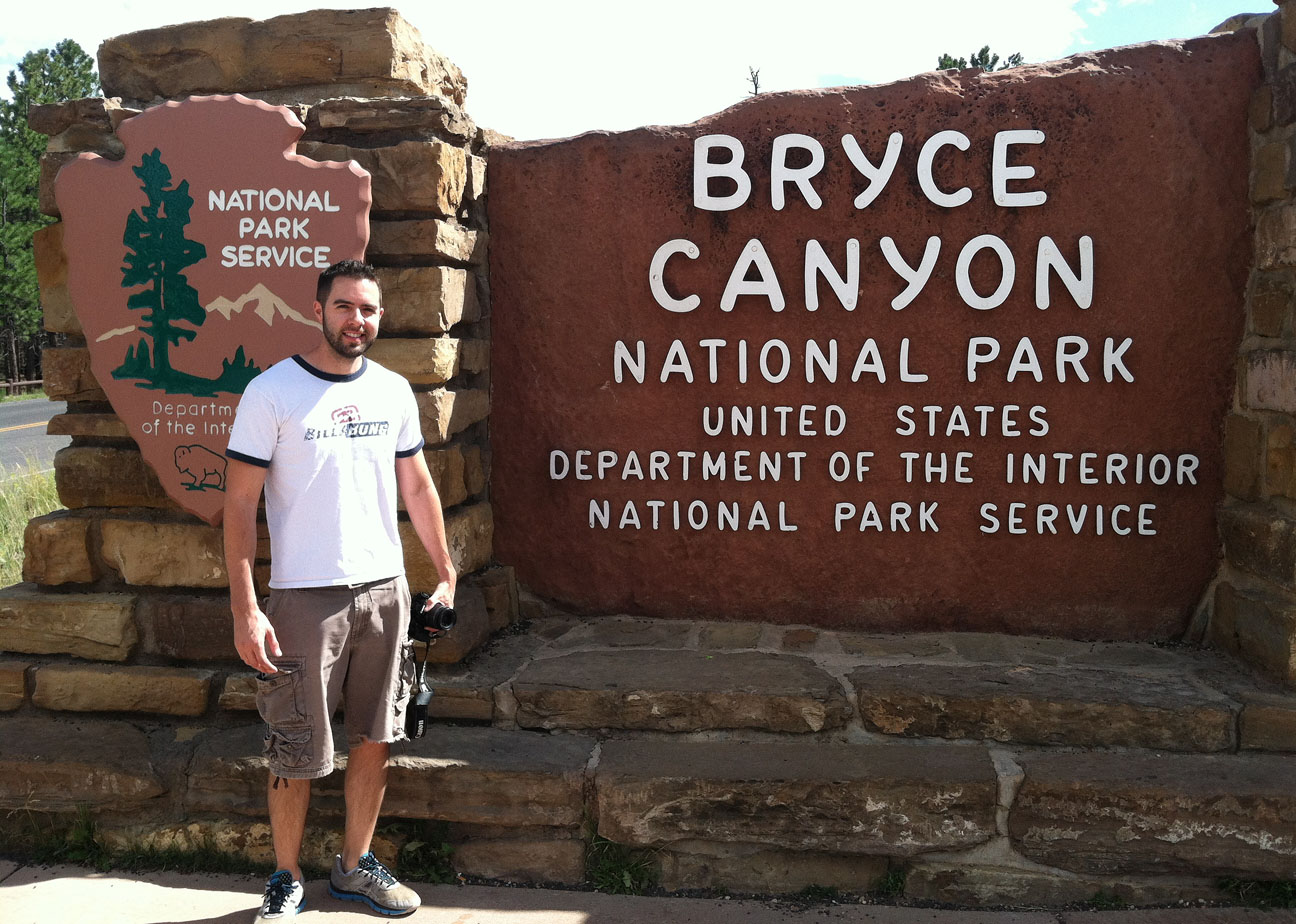
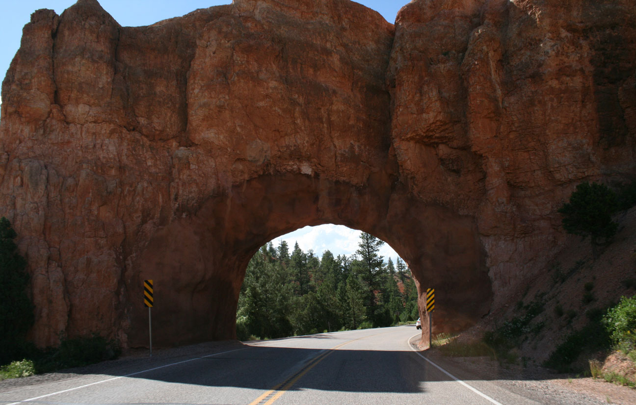
Bryce Canyon, just up the road, is one of 5 national parks in Utah. I started seeing some impressive rock formations and knew that we were getting close.
Sure enough, we rolled up to the entrance. Given the long day that Ryan and I had already experienced, we opted out of entering the park.
However, we still enjoyed plenty of the surrounding area’s scenery, including this tunnel on the highway.
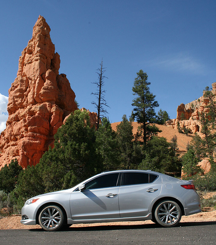
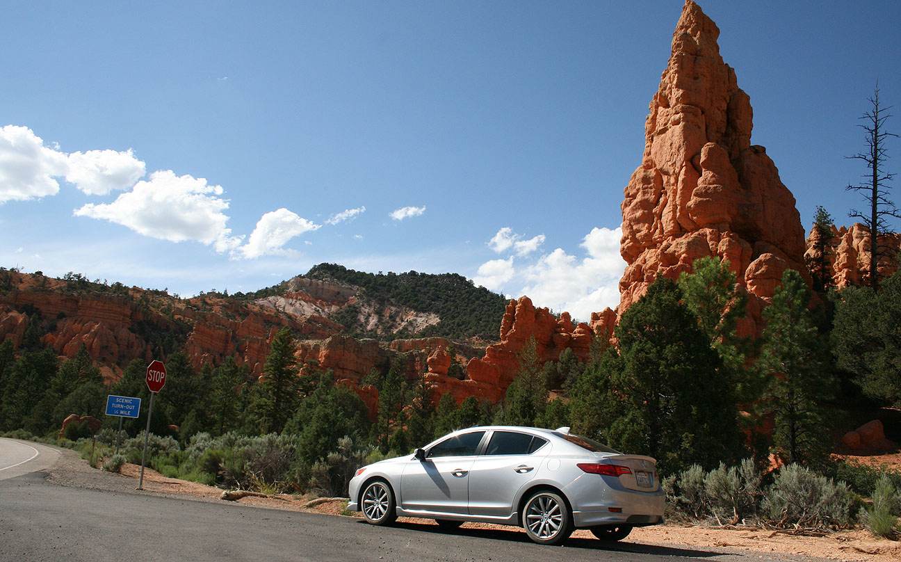
And these scenic pull-outs where I couldn’t resist stopping for a picture.
This place specifically is called “Red Canyon.”
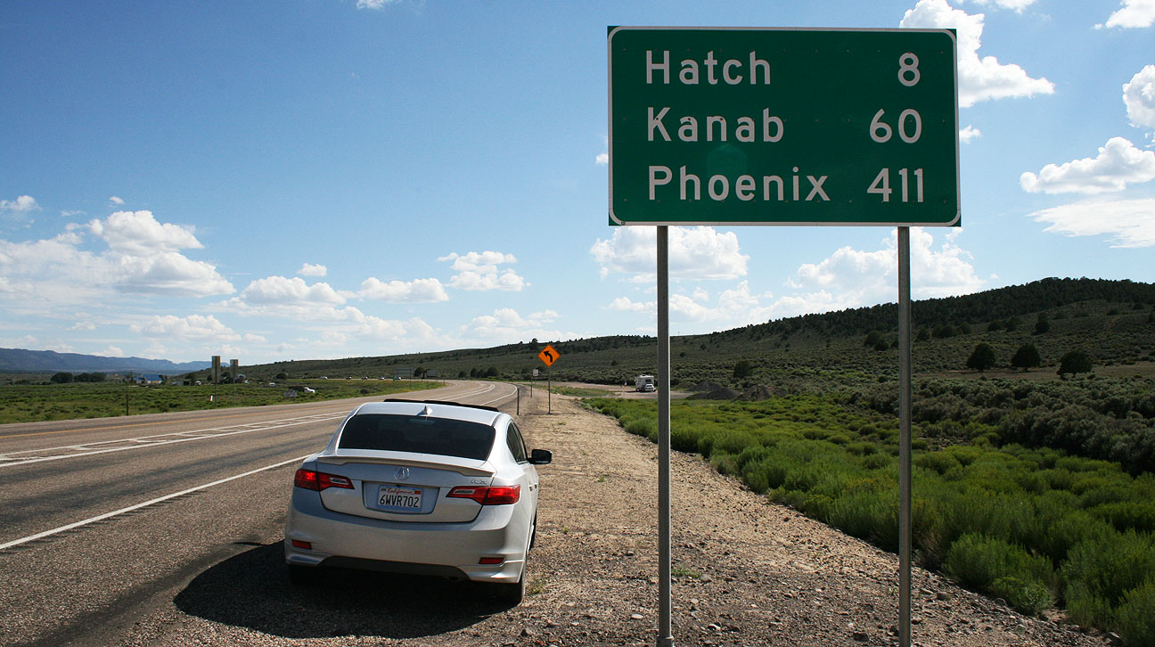
Finally, we’d reached our separation point. From the junction at Highway 89, Ryan would be heading north and I’d be heading south.
That Phoenix destination marker must’ve been identified with me in mind. I can’t imagine many travelers in that part of Utah are driving to Phoenix.
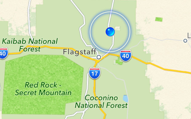
It felt really good to finally be honing in on my target destinations as I got close to Flagstaff, which is only 2 hours from Phoenix.
My ILX performed like a hybrid from an MPG perspective! From the time I reset my trip meter when entering Hell’s Backbone until the time I arrived at home, 515 miles later, I averaged 38 miles per gallon.
That concluded Saturday’s travels! Here’s a video wrap-up of the entire weekend:
Fresh off the Hall’s Crossing ferry boat on the north side of Lake Powell at Bullfrog Marina last Saturday, Ryan and I already had a pretty good idea where we’d be heading next in our vehicles. We wanted to scope out a route called the Burr Trail, one of the most remote yet scenic roads in Utah. This route is primitive in sections as it winds through the backcountry. Here is a little info on Burr Trail, courtesy of the National Park Service:
John Atlantic Burr was born in 1846 aboard the SS Brooklyn somewhere in the Atlantic Ocean. He and his family lived in Salt Lake City, then later moved south and established the town of Burrville, Utah, in 1876. John Burr soon developed a trail to move cattle back and forth between winter and summer ranges and to market. This cattle trail through the rough, nearly impassible country around the Waterpocket Fold, Burr Canyon, and Muley Twist Canyon came to be known as the Burr Trail.
I lived in Utah for over 20 years and had never even heard of Burrville, but I looked it up on Google Maps and realized why: It’s teeny. Here’s the whole town today.
After heading north from the marina on State Route 276 for about 4-5 miles, we turned west on Burr Trail. There were no signs or markings aside from this lonely one.
The National Park Service has posted written instructions online on what to expect for each mile of the drive. These were most helpful as Ryan and I made our way through what was new, unfamiliar territory for both of us.
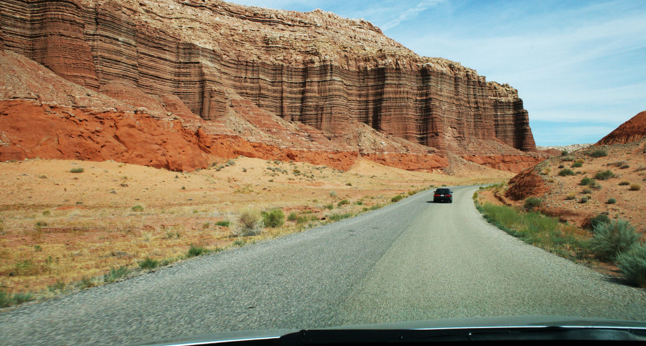
Our eyes were wide open to appreciate the chiseled mountains that surrounded us in various shades of red.
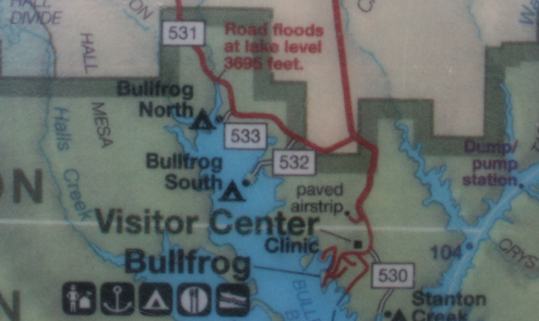
Just a little ways into the drive, our plans were nearly foiled. There’s a part of the Burr trail that floods when the lake level exceeds a certain measurement (3,695 feet, to be exact). See the note here in red on a map:
The lake’s level appears to currently be at or near that level, because Ryan and I saw a wash ahead of us with muddy ruts that I was almost positive my car wouldn’t be able to get through. I had Ryan go first in his Audi, and then I had him video record me crossing – just in case anything funny happened, of course.
Thank goodness for those 6 inches of ground clearance! I used them all.
With that out of the way, we continued onward on Burr Trail. For a time, the road straddled a ridge with canyons on both sides. Then we left the pavement for what ended up being 15 miles of off-roading.
The printouts that I’d taken with me had a lot of warnings regarding the dangers of driving this road in inclement weather.
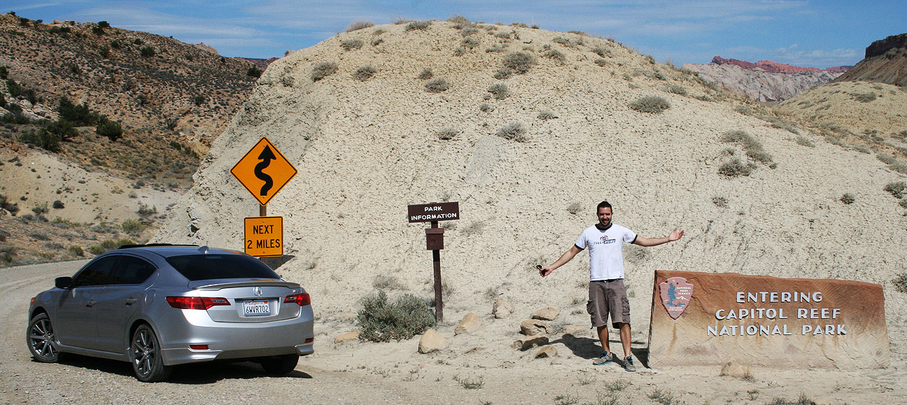
A bit further up the road, Ryan and I entered the park boundary for Capitol Reef National Park. Unlike most other national park entrances, though, this one has no entry fee. It’s so remote that it isn’t even staffed. There’s a small signpost which reads “PARK INFORMATION” and holds a wooden box containing brochures.
Even though summer travels are in full swing, Ryan and I only saw a couple of vehicles in the 2 hours that we were on the Burr Trail. This road is truly under-appreciated, and I’m okay with that. It’s something amazing to be able to stop your vehicle, shut off the motor, and hear absolute silence. That’s what we experienced.
A sign at the fork in the road ahead ensured us that we were on the right track, but still 42 miles from our next destination in Boulder, Utah.
I had Ryan take the lead in his Audi and gave him plenty of space so that I didn’t have to eat his dust the whole time. Not long after he got out of my line of sight, he came on our 2-way radio and said, “Dude, this just got real.” I knew the sights ahead were going to be awesome. And they were.
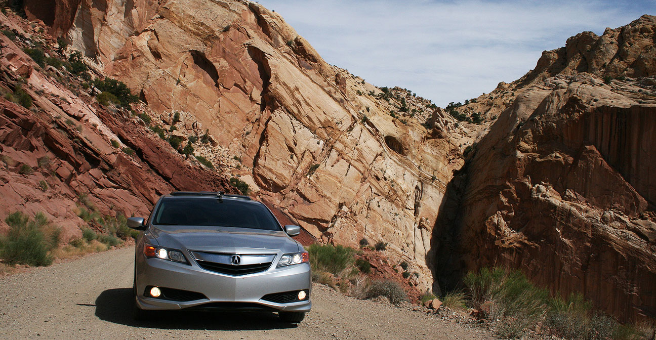
Massive stone canyon walls loomed above us on 3 sides as we started up a series of very tight switchbacks. Road conditions were poor in some spots. There were washboard ruts that gave my car’s Traction Control System a workout as my Michelin tires tried to get a grip in the loose gravel.
We made it up the steep grades and pulled over to take a look at what we’d just driven up.
The winding dirt road in this picture was the road behind us. To truly appreciate the picture, click it to enlarge, and follow the line all the way from the background to the twisty foreground. This is my kind of road!
It’s worth noting here that for a long chunk of our day, including this stretch, Ryan and I had zero cell phone service. If we’d had any issues we would have been a long hike away from any civilization.
At the top of the switchbacks, we saw Peek-A-Boo arch to the right. This is said to resemble an unblinking eye in the horned head of a giant lizard.
Finally we were back on pavement as we entered the Grand Staircase-Escalante National Monument. It was established in 1996 and protects over 1.8 million acres of land.
Still the road was narrow in many places and had no markings whatsoever.
Ryan and I commented to one another via our walkie-talkies how surprised we were at how quickly the landscape can change in just a matter of miles. We went from red rocks to white rocks as we got closer to Boulder, Utah.
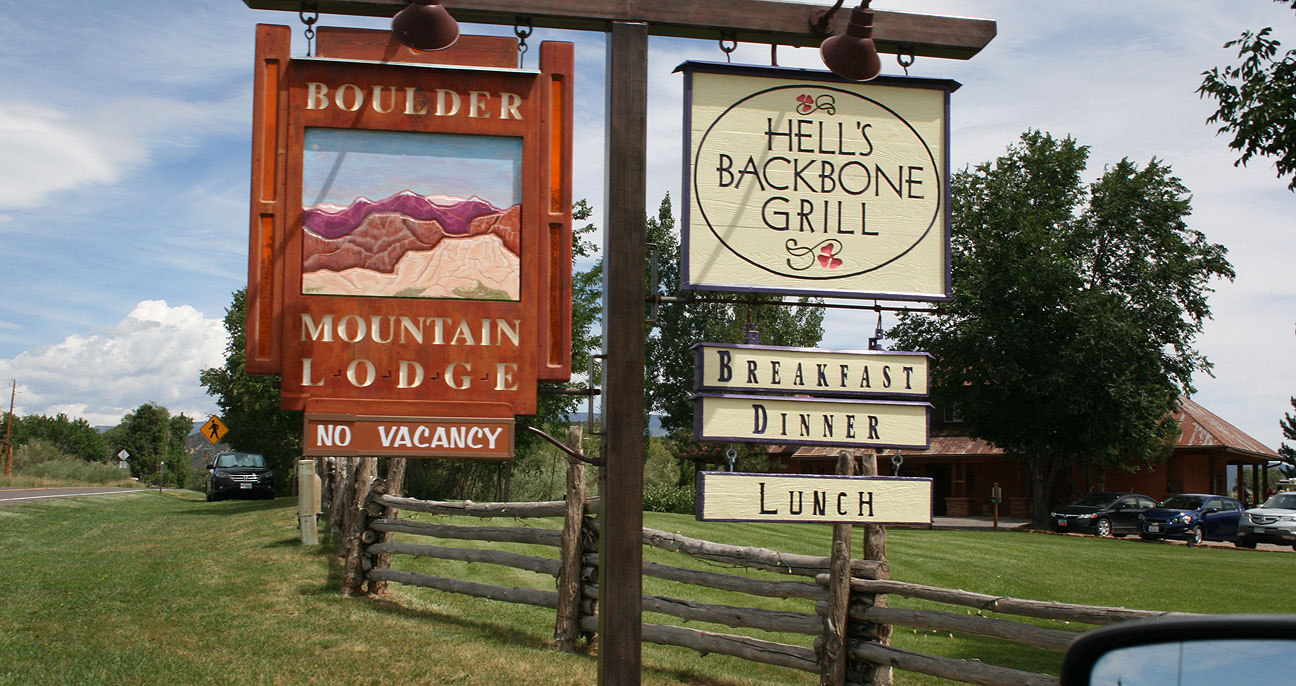
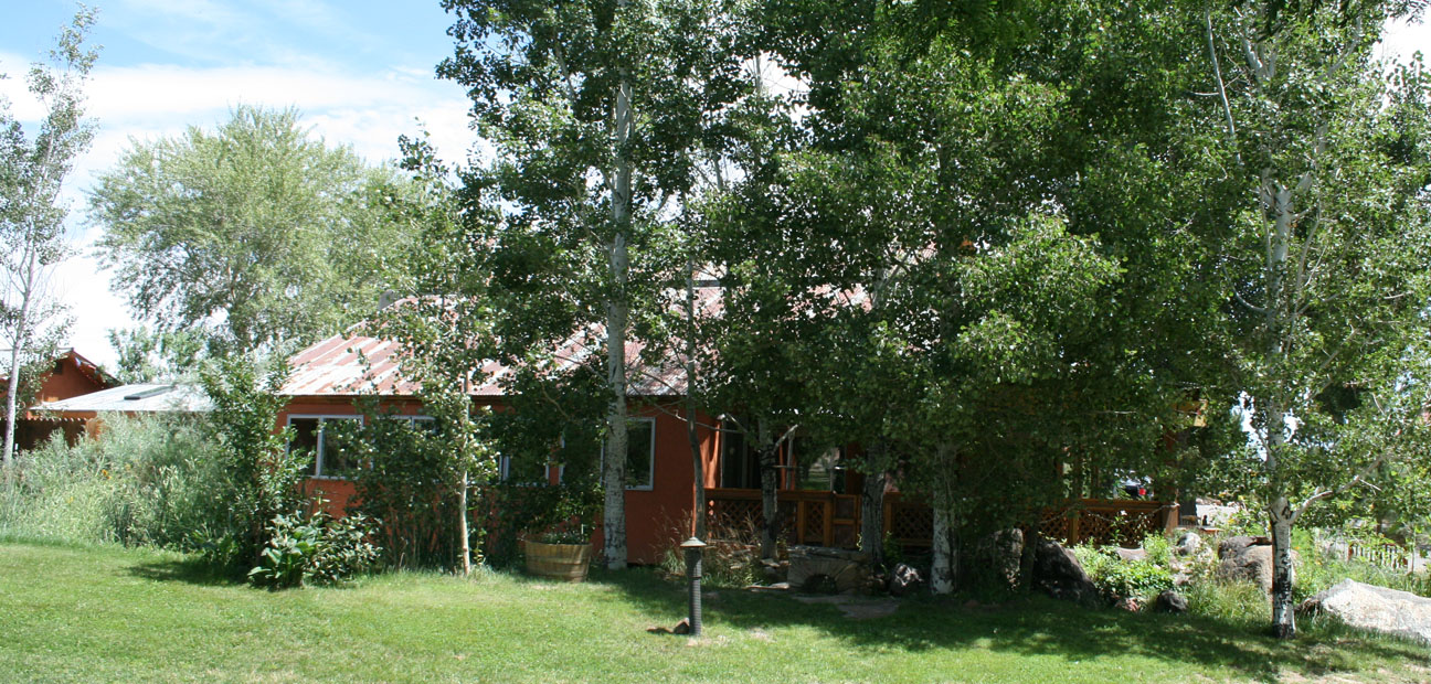
The restaurant, which had a rustic lodge feel to it, was hidden in these trees.
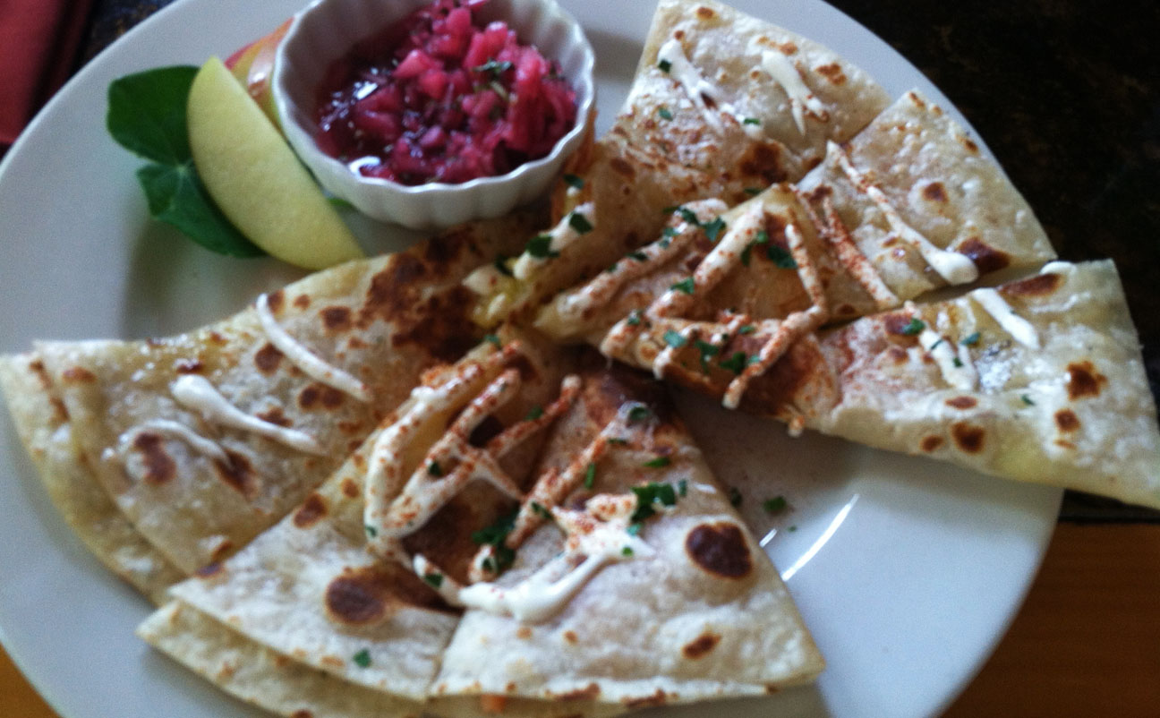
Ryan and I were the only ones there for lunch! Well, except for a cat named Jezabel who sat on a chair in the patio. I tried something new to me: Smoked Trout Quesadilla.
“Where the food is heavenly” is a fitting slogan; this really did hit the spot.
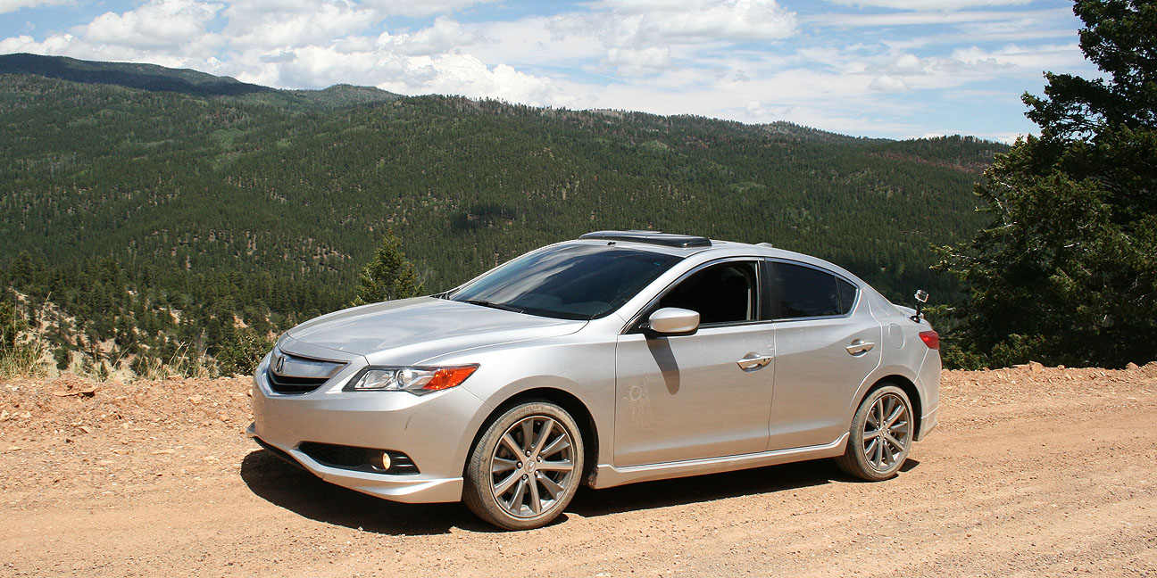
The ILX took a few deep breaths outside after climbing Burr Trail.
Ryan and I topped off our stomachs with dessert. My hot fudge sundae even had an orange flower stuck in it.
The “Country Corner” service station pictured below is long-since closed, but we grabbed some beverages and headed out for the next chapter of our trip: Hell’s Backbone Scenic Byway. Would the road live up to its ominous sounding name? Find out next time.
Coming to a blog near you: A 3-part series about this weekend’s trip to Southern Utah’s red rock backcountry. The Acura ILX 6-speed hit the highway again for a 1,083-mile on- and off-road adventure that I’m looking forward to sharing with you.
The intent of this trip was to meet up with my friend Ryan who had joined me on the Arches National Park trip back in February. We were determined to check out some of the most scenic roads that Utah has to offer.
Friday afternoon’s departure from the Phoenix, Arizona area left me soggy as I hit monsoon rainstorms about two hours into my trip, in Flagstaff.
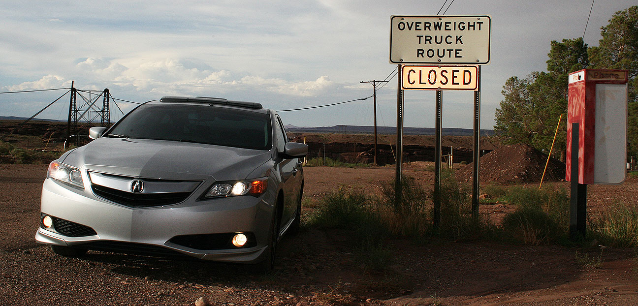
About 50 miles north of Flagstaff on the Navajo Indian Reservation, there’s a bridge crossing the Little Colorado River near the town of Cameron. An old suspension bridge seen in the background here was built in 1911 and spans 680 feet. It was damaged by an overload of sheep in 1937! However, it was repaired and continued to carry automobile traffic until 1959 when it was replaced by a newer bridge just to the east.
Because of the weight restrictions imposed on the bridge, there was a secondary route that truckers were required to follow, called the Overweight Truck Route. Signs for that bridge are still in place but the route is now closed.
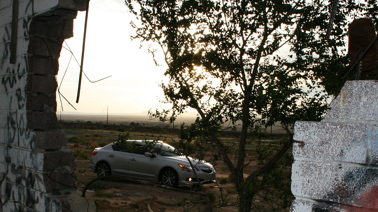
I still took the ILX to explore a little about what’s left of that old alternate route.
There’s a lot of neat road history in this area. An old stretch of Highway 89 parallels the current highway. I saw this section where it had buckled in various places over a wash crossing, forming a zig-zag of concrete.
I branched off to the northeast on Highway 160 and headed in the direction of Four Corners, stopping along the way to get a picture at the remains of a service station. Standard Oil, dating back to 1870, was once the largest oil refiner in the world.
This particular station looked like it hadn’t seen any customers for at least half a century, though.
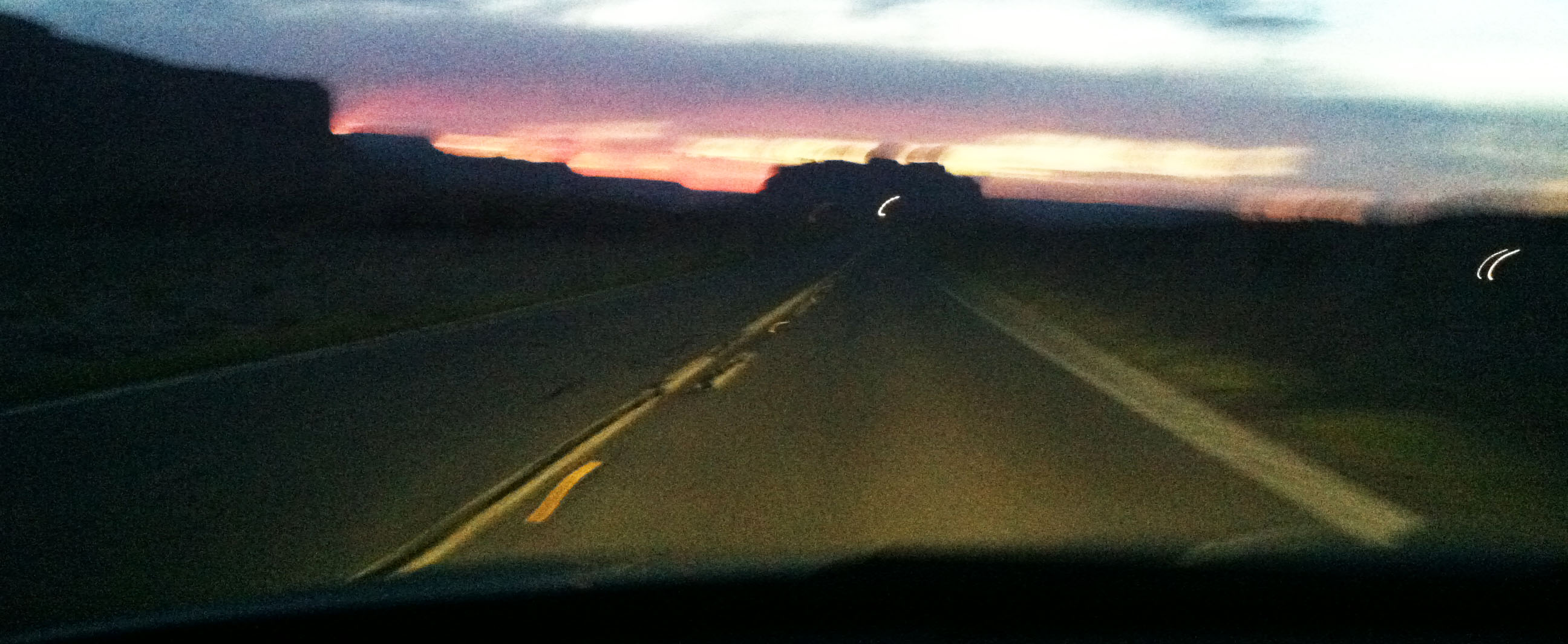
As dusk fell, I was rolling northward on Highway 163 through Monument Valley. Traffic was light and this was a great chance to enjoy the open road and the amazing scenery that surrounded me.
The employee at the front desk of the Super 8 Motel in Blanding, Utah, told me after I’d checked in for the night, “You’ve got a really nice car.” I glanced outside to where it was parked. It did look rather photogenic in that light.
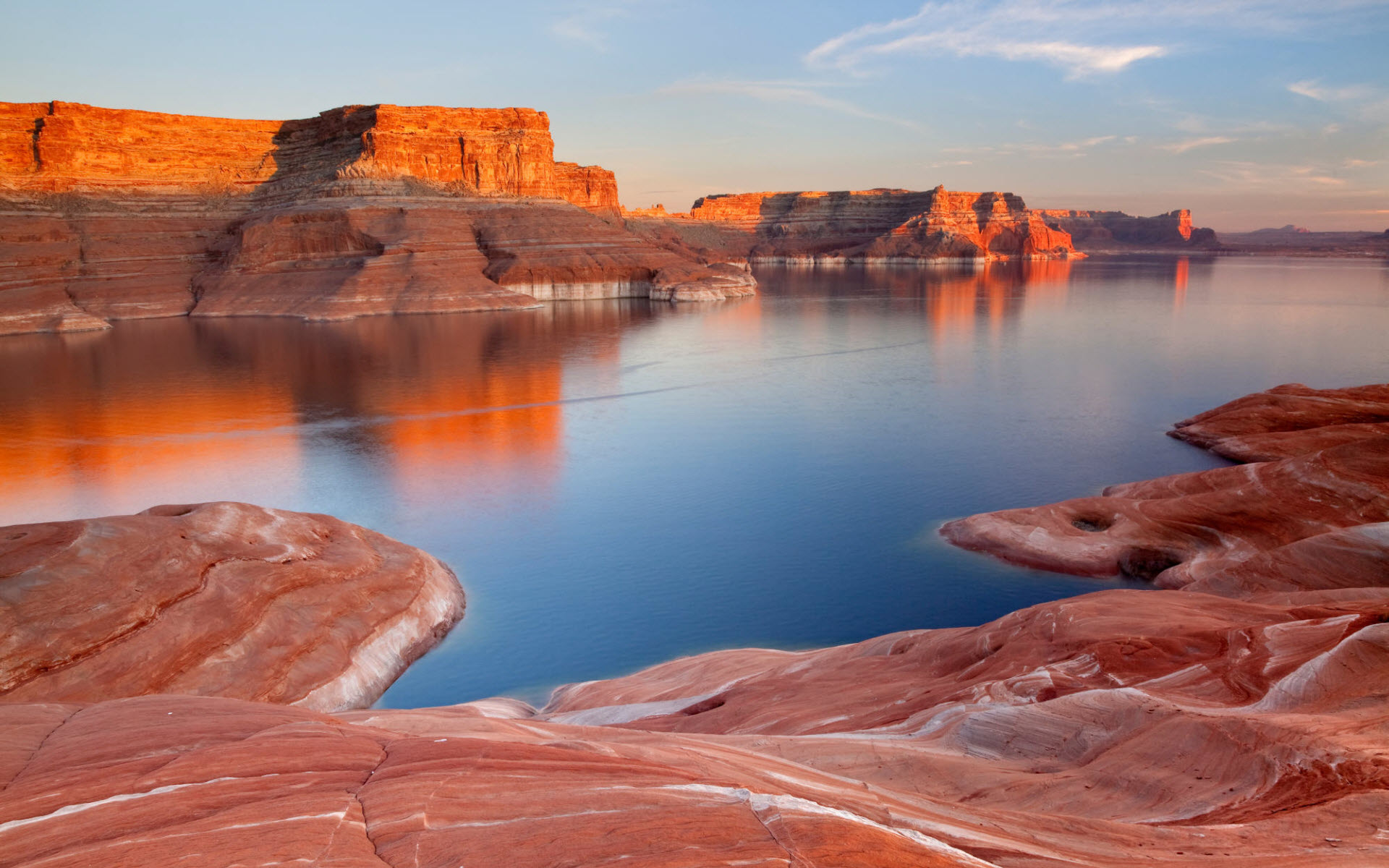
Ryan arrived at about this same time in his black 1996 Audi A6 Quattro. We called it a night fairly early, because we wanted to be rested up for the next day, when we’d be seeing this. (Photo Credit for this pic)
Lake Powell is a body of water on the Colorado River that covers over 250 square miles. That makes it the second largest man-made reservoir in the United States. Creation of this lake was made possible by construction of the Glen Canyon Dam which was completed in 1963.
It took 11 years for the water to fill up to the high water mark!
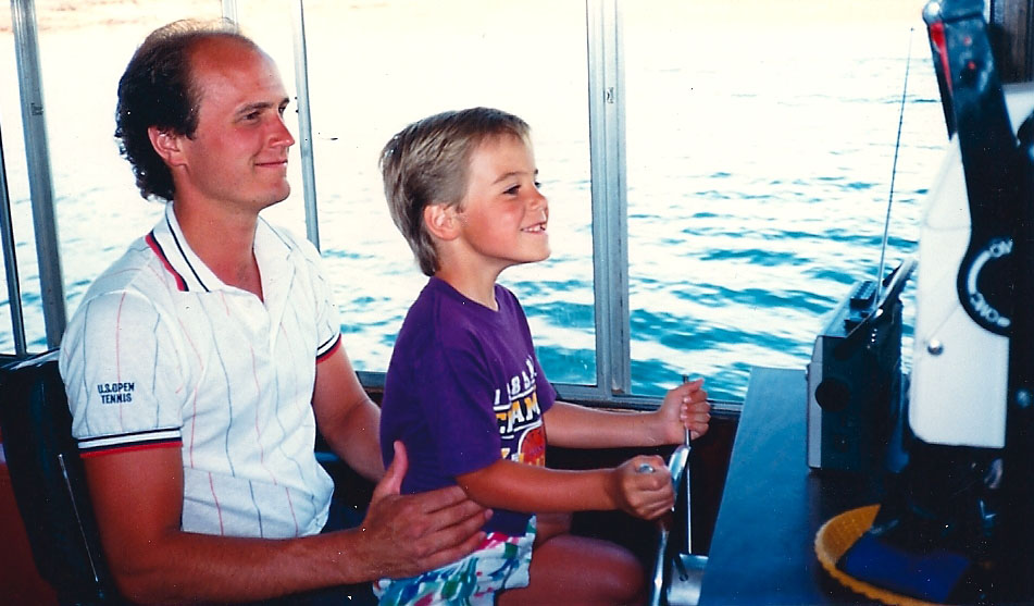
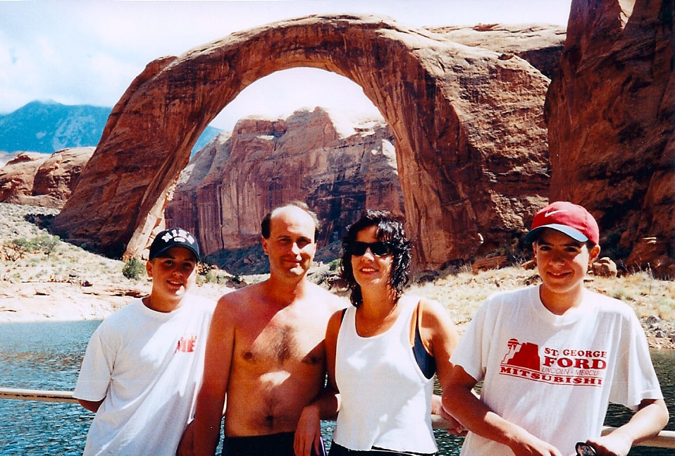
The above picture of me with my dad was taken in July 1987. Lake Powell was a favorite boating destination for my family when I was growing up. Here’s another classic from a few years later (I’m on the right).
The arch seen in the background there has a story of its own. Lake Powell is home to Rainbow Bridge National Monument, a 290-foot-tall sandstone natural bridge that had been seen only by the Native Americans until 1909.
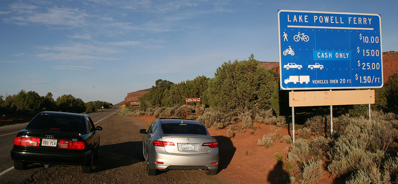
Ryan and I decided to transport our vehicles across Lake Powell via a ferry that’s been in operation since 1985 called Hall’s Crossing. The drive from Blanding to Hall’s Crossing was 88 miles via scenic byways 95 and 276 . As seen here, the rate for vehicles is $25 so we were prepared with cash to pay our fares.
This curvy two-laner was prime environment for the 6-speed ILX. I found I rarely needed to downshift to get up the grades. Interestingly enough, we only saw one other vehicle on this road, and it ended up being a ferry employee who blew past us. She must’ve been late for work!
Soon we could see a sliver of blue water in the distance. We’d arrived at Hall’s Crossing. The road to this crossing was completed in 1969.
The park ranger let us in the marina without paying the $15 per vehicle fee, since we were just going to catch the ferry rather than spend time boating. Her instructions were, “Don’t recreate.” As in, recreation, not re-creation. Still sounded funny to use that word in such a context.
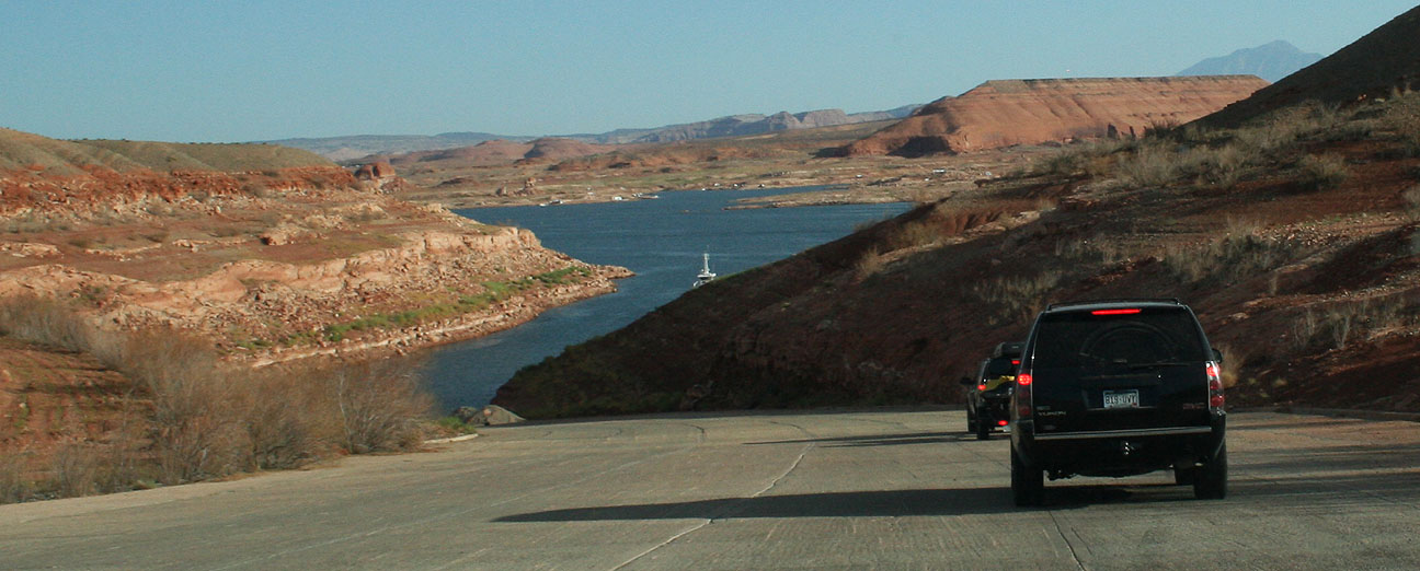
As we got closer to the ferry dock, it became apparent that the water level looked pretty low.
I’ve since learned that Lake Powell’s water level fluctuates greatly depending on rainfall and other factors; it is now at its lowest point in 5 years.
After a 30-minute wait for our 9:00 a.m. departure, the ferry attendant waved us onward and the ILX climbed the ramp to get on the boat.
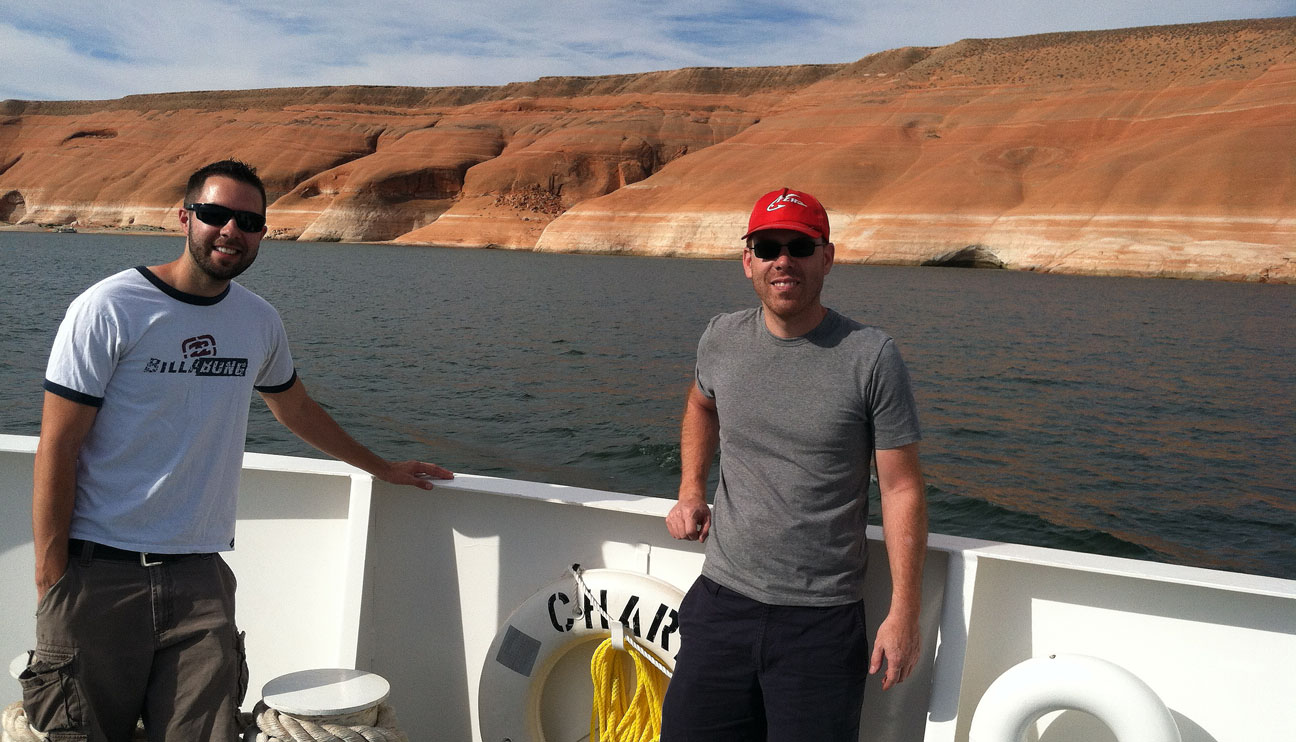
The ferry is 3 lanes wide. I would estimate it could accommodate 15 or so vehicles. Ryan and I were in our element! A ferry operator came on an intercom and instructed everyone that we could exit our cars and wander around.
Here was the ILX’s parking space for the 30-minute ride from Hall’s Crossing to Bullfrog Marina.
And we’re off!
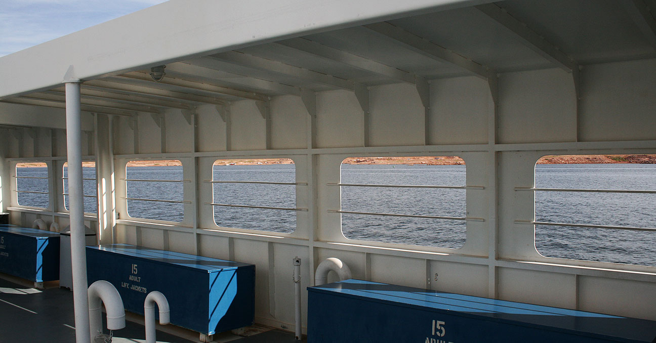
Notice the water line evident behind us as we made our way across the lake.
Because of the way Lake Powell is laid out and how it extends into so many different canyons, there are nearly 2,000 miles of shoreline – more than the west coast of the United States!
I was able to stand at the back of the ferry and watch the waves which we were creating.
Views surrounded us on all sides as we motored past houseboats, ski boats, and jet skis. When people see the ferry coming, they get out of the way!
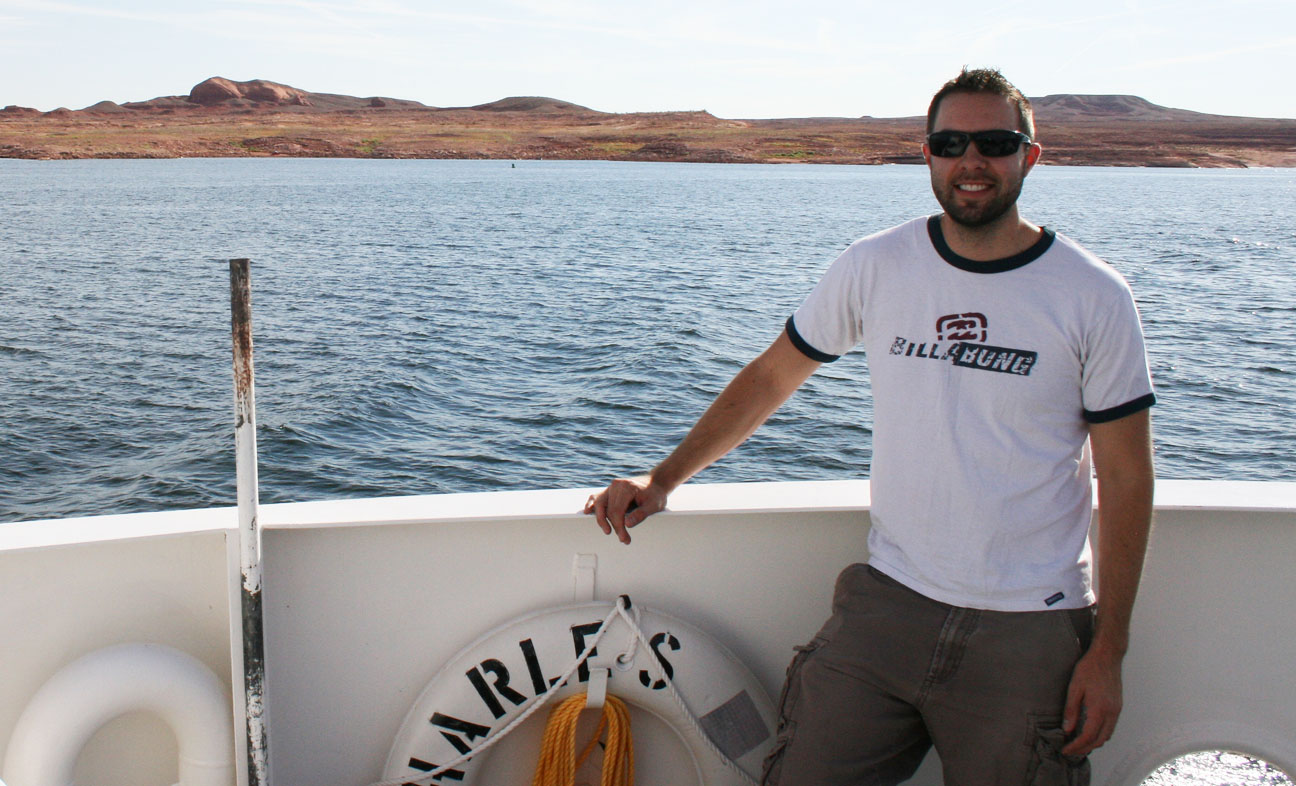
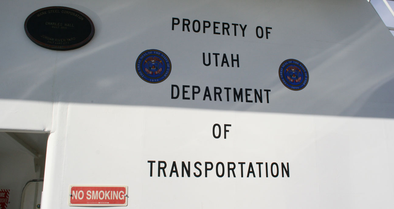
Captain Tyson at your service.
The ferry itself was only built about 13 years ago but to me it looked much older.
All too soon, our joyride was over but another one was yet to begin. After we exited the lake, Ryan and I plotted out our game plan for where we’d take our cars next. I think you’ll enjoy the next piece of the story. Stay tuned.
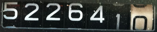
Posted in Arizona, Legend on July 31, 2013 by tysonhugie
Odometer (Legend): 522,664
Odometer (ILX): 47,508
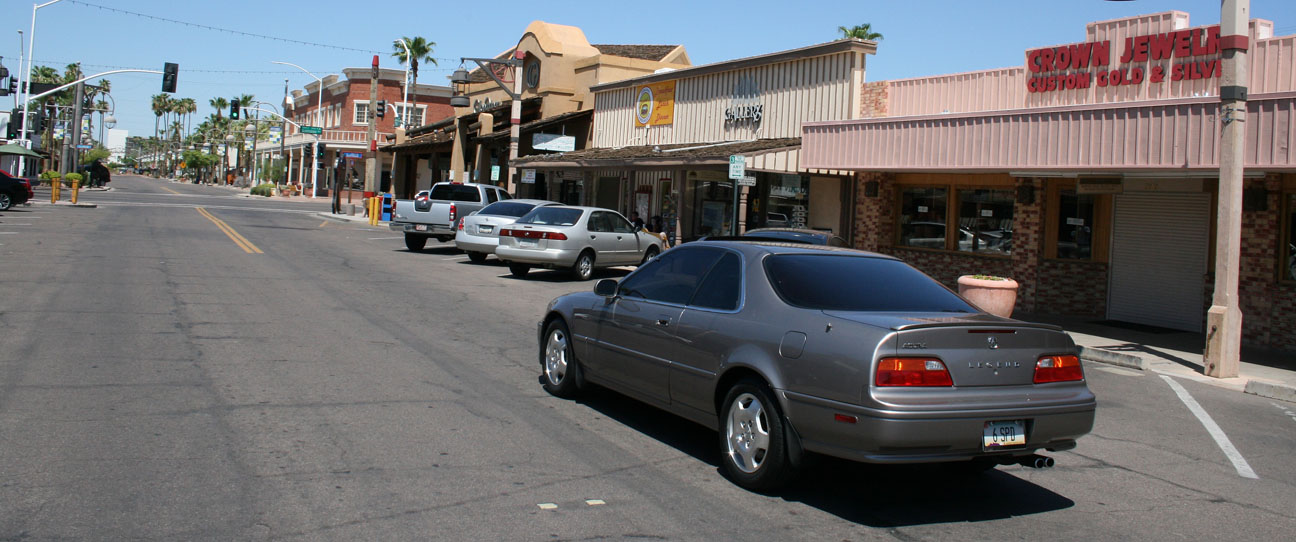
I’m one of 221,789 people who call Scottsdale, Arizona home. The city is located in the Phoenix metropolitan area and was incorporated in July 1951. It probably seems to many of my readers that I must not like where I live, since on any given weekend I’m usually on an Acura trip far from home. Truth is, though, that I love it here.
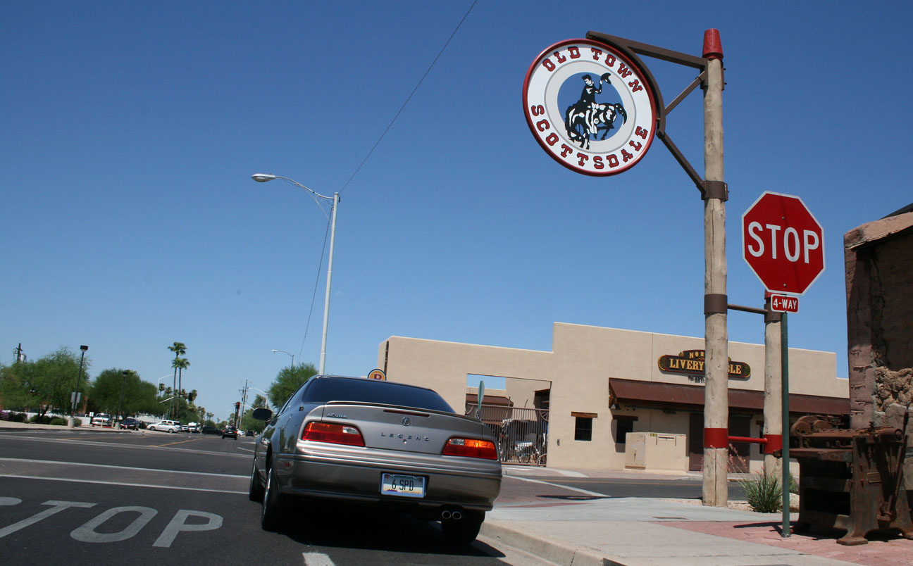
On Sunday, I took a morning cruise in the Legend to downtown Scottsdale which is only about 10 minutes from my home. “Old Town,” as it’s called, refers to an area at the intersections of Scottsdale Rd & Indian School Rd that is the hub of area night life, commerce, and culture. I had brunch with my friend Kati at RnR Restaurant & Bar.
Fueled by a delicious omelet & a tall glass of orange juice, I took the Legend around to see a couple of the sights.
The city’s seal is a mounted cowboy, and there are signs of him standing on various corners in the Old Town area.
Some fun facts about Scottsdale, thanks to Wikipedia:
Scottsdale in 1993 was named the “Most Livable City”, in the United States by the United States Conference of Mayors. This title is notoriously lampooned across the state because of the high cost of living in Scottsdale. It is continually ranked as one of the premier golf and resort destinations in the world, with a sizable portion of tax revenue being derived from tourism. It is also home to the Phoenix Open Golf Tournament and the Barrett Jackson car auction held at WestWorld.
At 4005 North Scottsdale Road lies Sugar Bowl – the best place in town for foods, ice cream, pastries, and candy. It’s been around since 1958.
On May 29th, I had dessert there with my friend Kevin and I confirm that the hot fudge sundae cannot be beat.
Sugar Bowl’s claim to fame is that it has been featured in many of the “Family Circus” cartoons by artist Bil Keane. Bil lived in Paradise Valley, Arizona and was one of Sugar Bowl’s famous customers.
Bil even wrote a note to the owner of the restaurant on this cartoon that’s hanging at the entrance. Bil passed away in November 2011 but his son Jeff continues to draw the Family Circus cartoons.
Old Town is a fun place to walk around and check out the mom & pop shops.
Just a few blocks away lies the Scottsdale Fashion Square Mall, one of the 20 largest shopping malls in the country.
The “Old West Meets the New West.” Below, the Adobe Mission lies at the intersection of Main Street & Brown Avenue. It was built from 1931-33 and restored in 2000.
Thanks for coming along on the tour of my hometown!
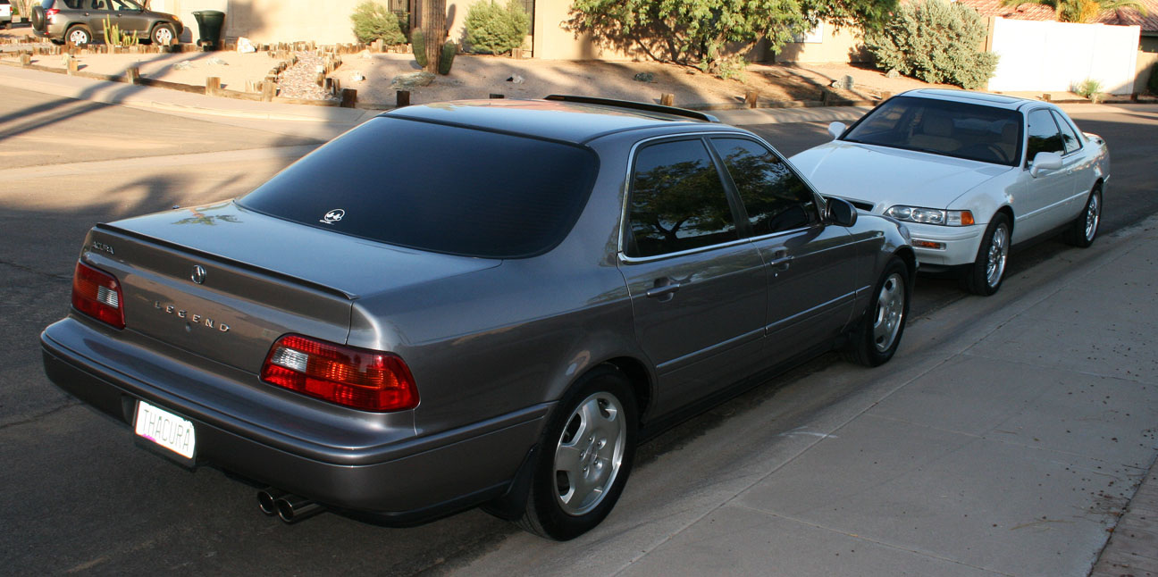
When I moved to Arizona nearly 8 years ago, the Acura Legend enthusiast network was one of my means for meeting new friends in the area. Chuck was one of those first people who I connected with.
In February 2007, I owned a 207,000 mile white Acura Legend GS 6-speed manual. At the time, Chuck had two beautiful Sirius White Pearl 1993 Legends. We decided to have a “Pearl White Block Party” and I shared a few pictures on the Legend forums at the time.
Chuck’s sedan had 61,000 miles on it. His 6-speed coupe had 17,000 miles on it.
Today, Chuck’s sedan is gone but the coupe lives on, now with just under 31,000 miles on the odometer.
Purchased in December 2004 with 16,000 miles on it, this car sees the road only when it’s time to head to the golf course (once a week or so).
The license plate “AZLEGND” is synonymous with Chuck’s username on the Acura Legend forums.
The wheels on the coupe are 16″ aftermarket wheels that were once on Chuck’s sedan.
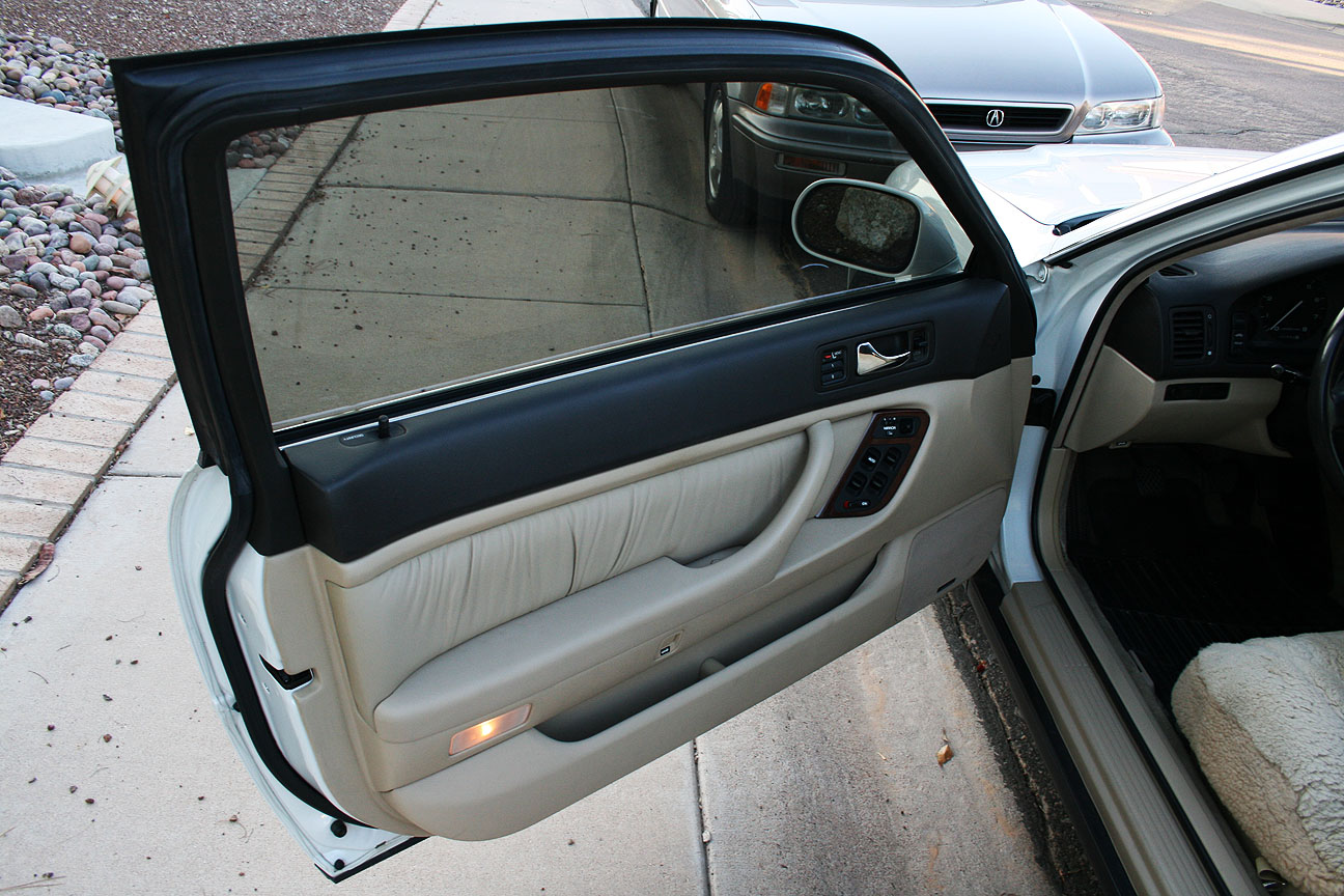
Underneath those sheepskin seat covers, the condition of the leather is near-new. In fact, the whole car smells fresh.
All-weather mats protect the perfect carpet.
Even the door panels are immaculate.
Here’s a start-up and very short drive video of this amazingly well-kept Legend.
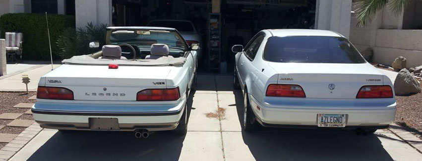
Readers with a keen eye may have noticed a first generation Legend in Chuck’s garage. There’s a story behind that one.
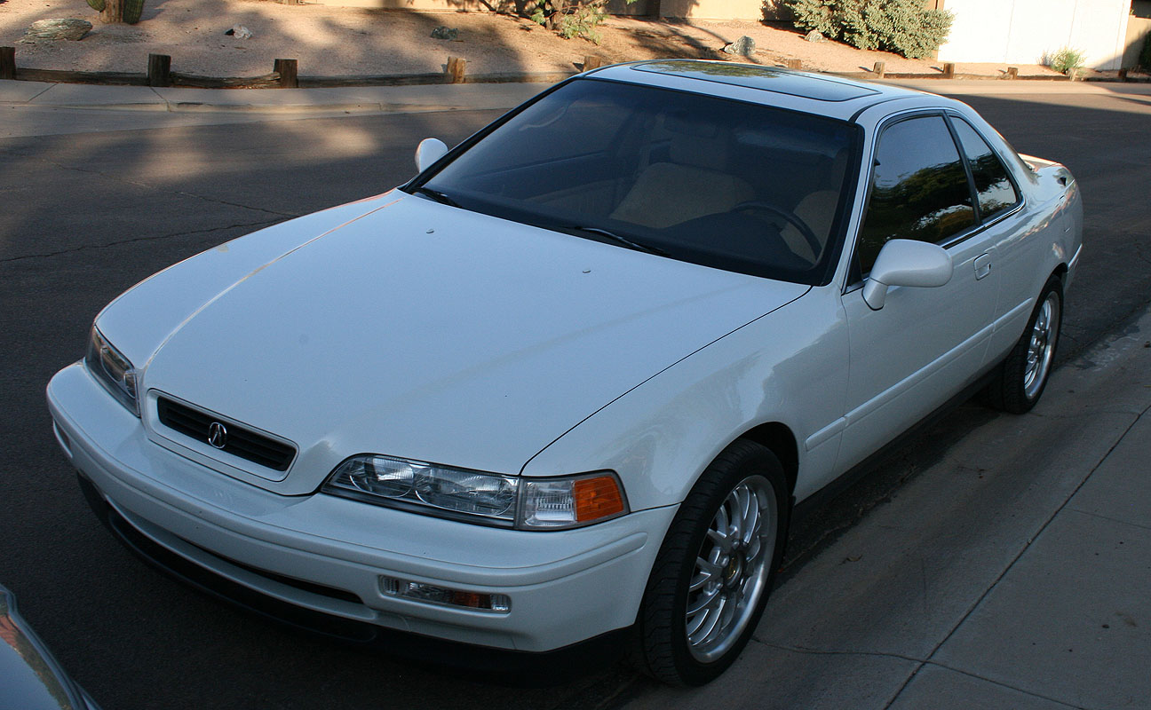
In March 2010, I went to take a look at a rare custom Legend convertible about 75 miles from my home. I posted a pretty detailed write-up to the forums at the time, but I didn’t end up pulling the trigger on it for myself. The car was a 1988 L model automatic. It had 87,000 miles on its 2.7 liter engine at the time I took it for a spin.
Over 3 years later, the car popped back up on Phoenix craigslist a couple of weeks ago, and Chuck had the honor of scooping this beauty up. It became the 5th Acura Legend that he’s owned. Now at 111,000 miles, the car is in worthy Legend enthusiast hands and I’m excited to see what he’ll do with it. I can’t think of a better ride for enjoying the perfect Phoenix winters with the top down.
Supposedly this convertible was one of only 12 conversions completed at the time. It’s nicely put together.
Can’t wait to take this one for a spin! Thanks, Chuck, for your friendship and for letting me borrow some tools from time to time!
I happened to be driving my Legend GS sedan when I stopped by on Tuesday evening.
This old girl is sitting at about 144,200 miles currently. It resides in storage but comes out to play about once every 2-3 weeks.
That Legend odometer seems stuck at 522,000 these days. The car is resting up for its big trip to Asheville, North Carolina next month. Meanwhile, I drove the wheels off my ILX (attempted to, anyway) in Colorado this weekend.
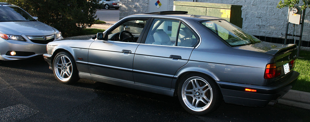
Rested up from a day of mountain-climbing, my third day of the Mount Evans trip this past weekend was entirely dedicated to my return trip to Arizona. Many years ago, I rolled through Colorado Springs in my 1994 Legend coupe and I met up with my friend Adam who’s local to the area. He owned a 1991 Legend coupe 5-speed at the time.
Now, Adam’s moved on to other automotive interests and he’s currently driving a 1995 BMW 540i. Adam stopped by my hotel on Sunday morning for a reunion.
This car’s in amazing shape for having 210,000 miles on it. Best of all, it’s a 6-speed manual. Adam says it’s one of only 100 cars that were produced in its color / transmission configuration for the year.
I gave Adam the opportunity to take the ILX for a short cruise.
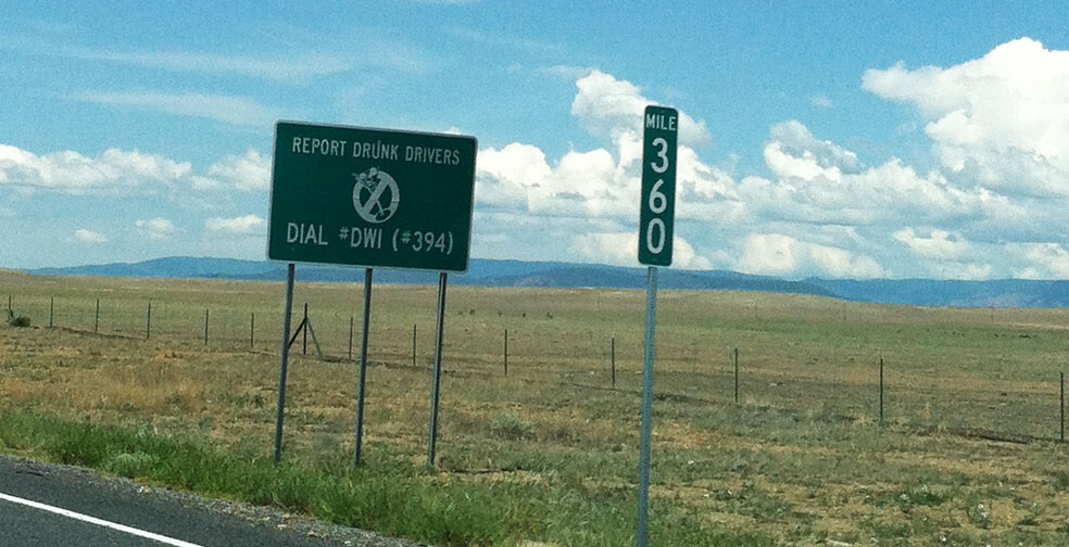
After that, I hit the highway and headed southbound toward home. This was a sign along I-25 in northern New Mexico when I made my return trip:
It reads:
Report Drunk Drivers
Dial #DWI (#394)
I know I’ve been on Instagram too long because when I blew past the sign, I read it as “Hashtag DWI” instead of “Pound DWI.” Why in the world would they want me to report a drunk driver by hashtagging?
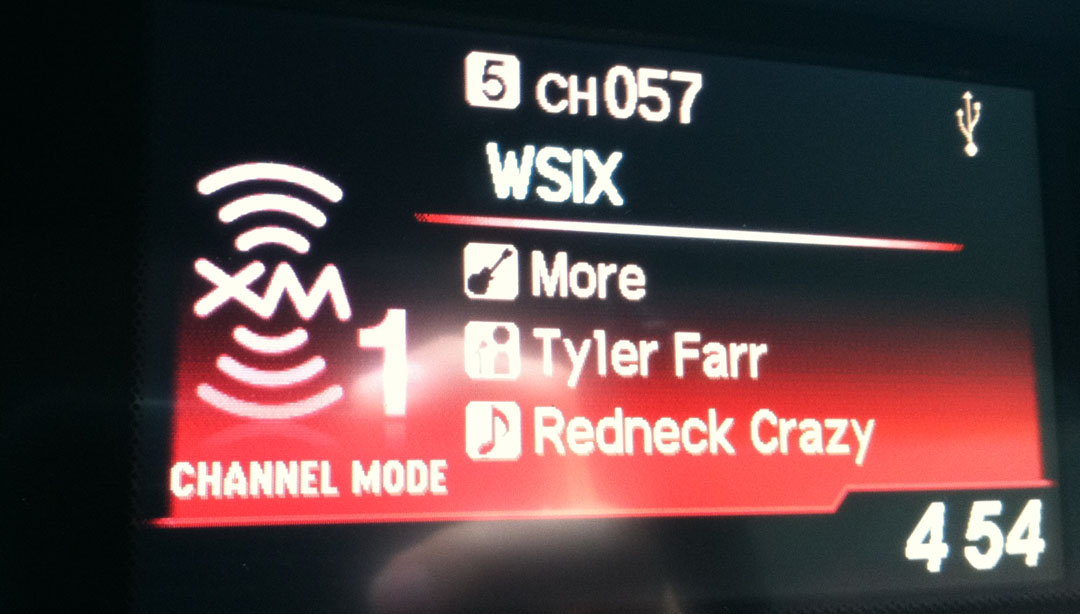
I was on the road long enough (roughly 12 hours, with only short stops for fuel & bathroom breaks) to learn that XM radio stations DO repeat the same songs. Frequently. I spent most of the day on a country station, WSIX Channel 57. I heard this song 4 times. And I couldn’t bring myself to change the station each time. It’s too dang catchy!
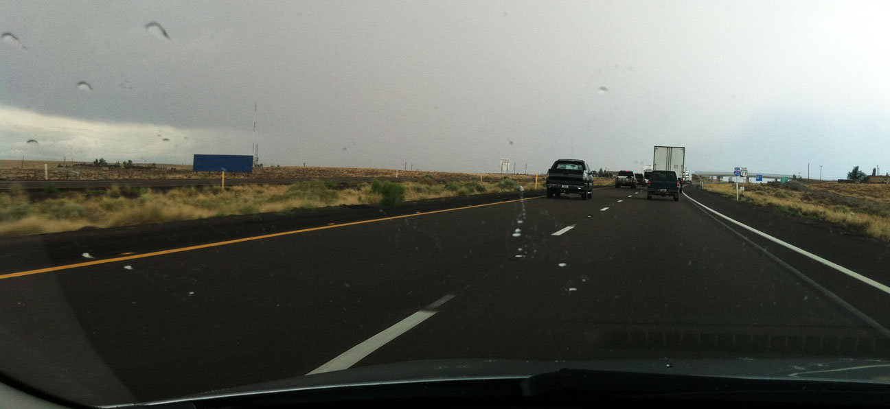
Storm clouds loomed in the distance as I neared Holbrook, Arizona.
Sure enough, the summer “monsoon” storms were in full force and I got very wet. The ILX, even with 47,000 miles on the current Michelin Pilot tires, gets excellent grip and I was able to make it through the weather with confidence.
That concluded the 3-day Colorado adventure to the highest paved road in America. I loved the drive and I’m glad you could all be a part of it!
Random Fun Mileage News:
The other day, I came across a “Trade In Quality Index” website that is a database of about 160,000 traded-in vehicles. It illustrates the percentage of vehicles with over 180,000 miles on them on this chart. Acura had 20%. Geo was the highest at 27%. I’m not sure how current this data is, but it’s fun to consider. I have colleagues at work who get antsy to sell or trade their vehicles as soon as they close in on 100,000. That’s barely past break-in.
Here’s a 1987 Chevy Celebrity with over 375,000 miles, found on Copart.com. Impressive for an old tank! The Celebrity model will also have a special place in my heart since it was my first car.
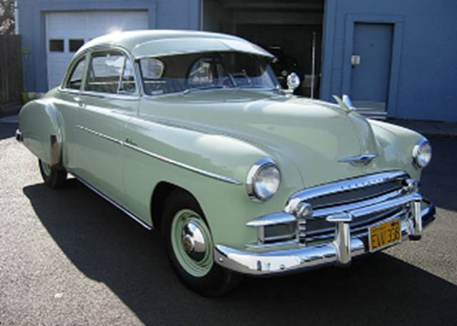
And here’s another Chevy with super LOW miles. This is a 1950 model year with just 437 miles on it. More on that here.
All original – of course!
Just look at that interior.
Lastly –
If you haven’t already watched it, check out this Acura “Advance” Commercial linked here. Thanks Ryan for finding it!
Welcome to Part 2 of my Colorado weekend adventure wrap-up. How could I resist the temptation to drive my Acura ILX to a place that’s described like this?
Mount Evans is the road into the sky. Drive from 8,700 feet at Idaho Spring where you turn off Interstate 70 to 14,240 feet to the summit, and you will pass through 3 life zones, passing ancient trees, lakes and forest to the land above timberline. It can be 90 degrees in Denver and 40 degrees at the top of Mount Evans. Mountain Goats and Bighorn Sheep will greet you as you climb to the top of the world.
If you want to cut to the chase, here’s the video:
Jason, Jeremy, Johl and I set out on Saturday morning to see what Mount Evans was all about. An LED sign above I-70 west of Denver soon crushed our plans: The highway was to be closed until 2:00 p.m. for a bicycle race:
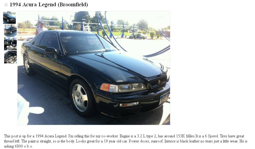
Determined to still climb the mountain that day, we delayed our plans and entertained ourselves in the meantime. Jeremy and I went to see & drive this 1994 Acura Legend LS Coupe 6-Speed that’s currently for sale on Denver craigslist. A friend asked me to give it a look since he’s a prospective buyer.
This car looks nice from a distance, but it’s a full repaint (and a poor one, at that) and it needs some mechanical help, too. At 151,000 miles, it did drive fairly nice, but I didn’t feel the car was worth the $6,800 asking price.
Back up the mountain we go!
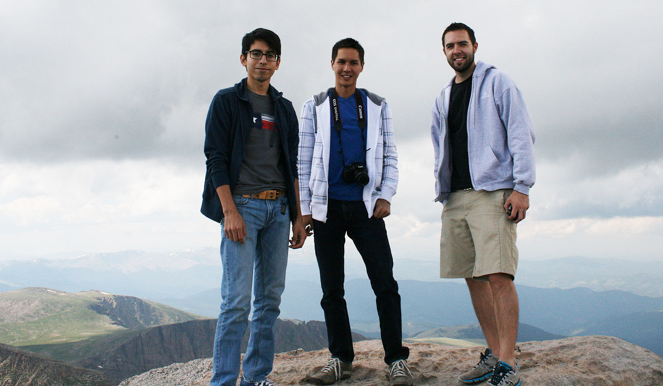
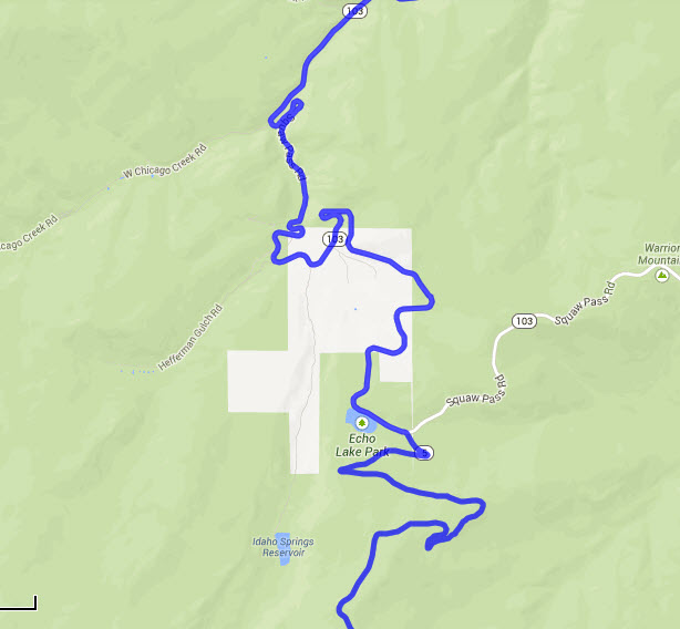
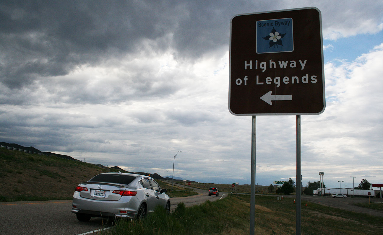
Jason and Jouhl followed us as we snaked our way on Squaw Pass Road toward the base of the Mount Evans.
We weren’t discouraged when we had to cruise through a dusty construction zone. We were determined.
Even before we got to the official “Mount Evans Highway,” we were already beginning our ascent. On a clear day, the views stretch a great distance.
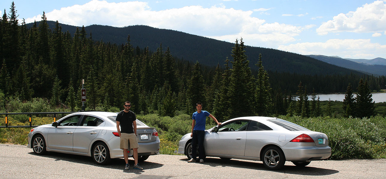
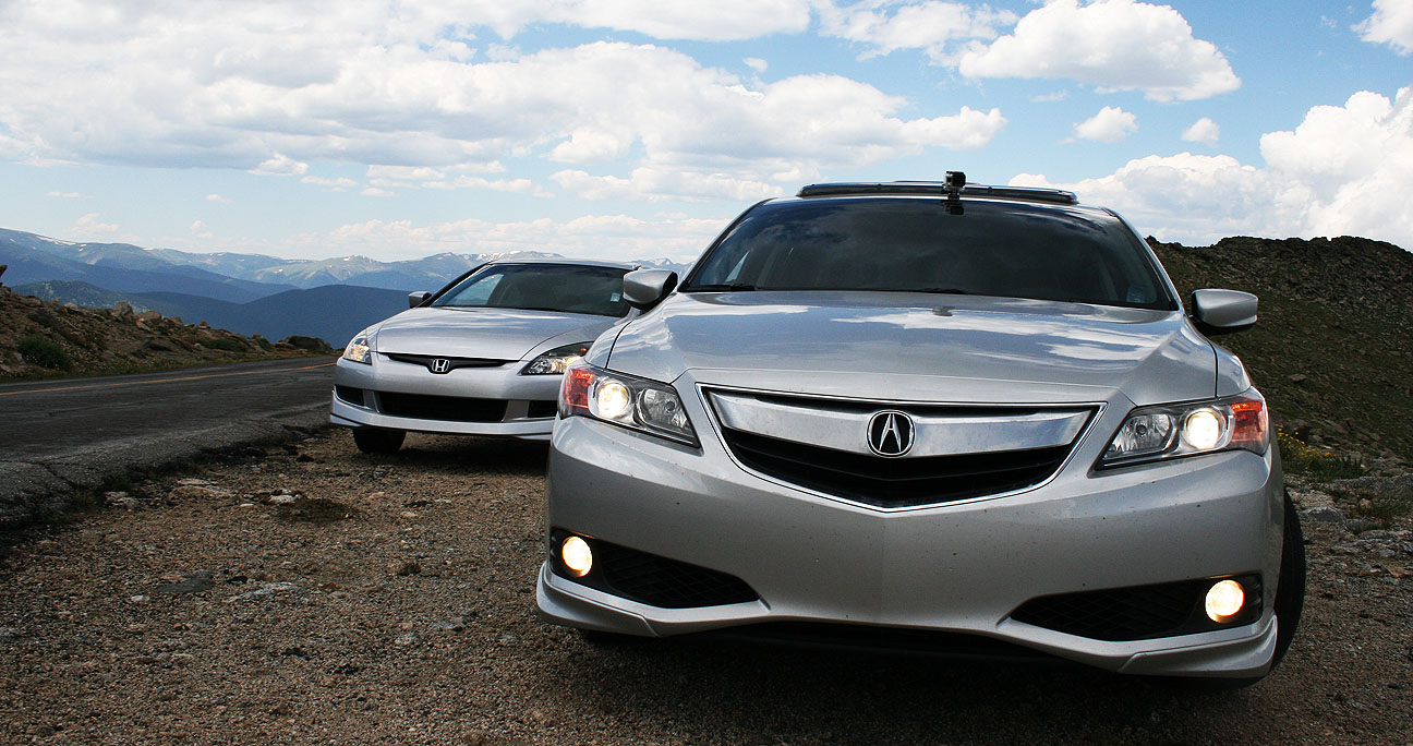
Echo Lake, at 10,600 feet, lies in the background in the below picture and marks the start of the 14-mile road that leads to the summit of Mount Evans. The Accord and the ILX had driven a combined 1,800 miles to get to this point. Even without a car wash, our silver paint jobs hid the bugs and dirt well.
Jason, Jouhl, and myself at a wooden sign in front of the Echo Lake Lodge which doubles as a gift shop.
The ILX, rooftop GoPro video camera equipped, was ready to scamper up the mountain.
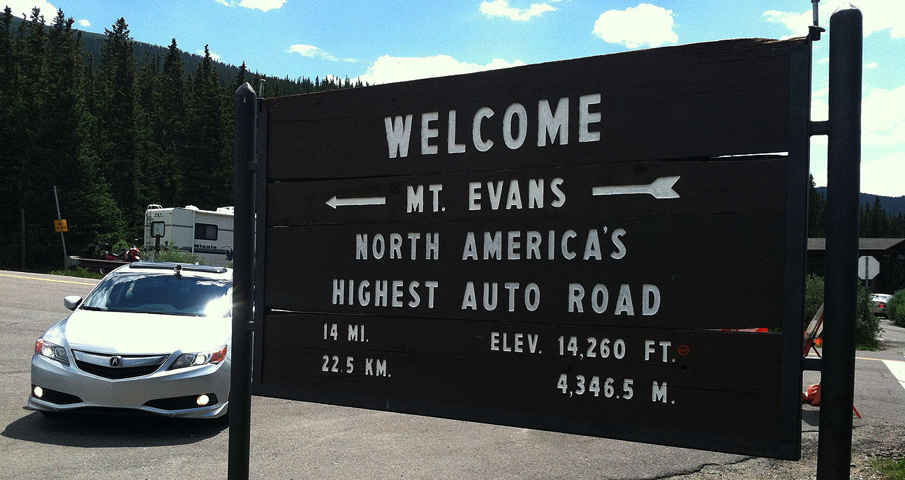
A tollbooth at the base of Mount Evans road collected $10 per vehicle, then we were on our way to climb our first “Fourteener.” Denver people call a “fourteener” any of the area mountain peaks (which are several) which exceed 14,000 feet in elevation.
Quick pullout for a photo-op against a beautiful sky.
It’s impossible to convey the beauty of the panoramic views that surrounded us on 360 degrees.
Let’s roll! Windows were down because it was a pleasant 60 degrees or so.
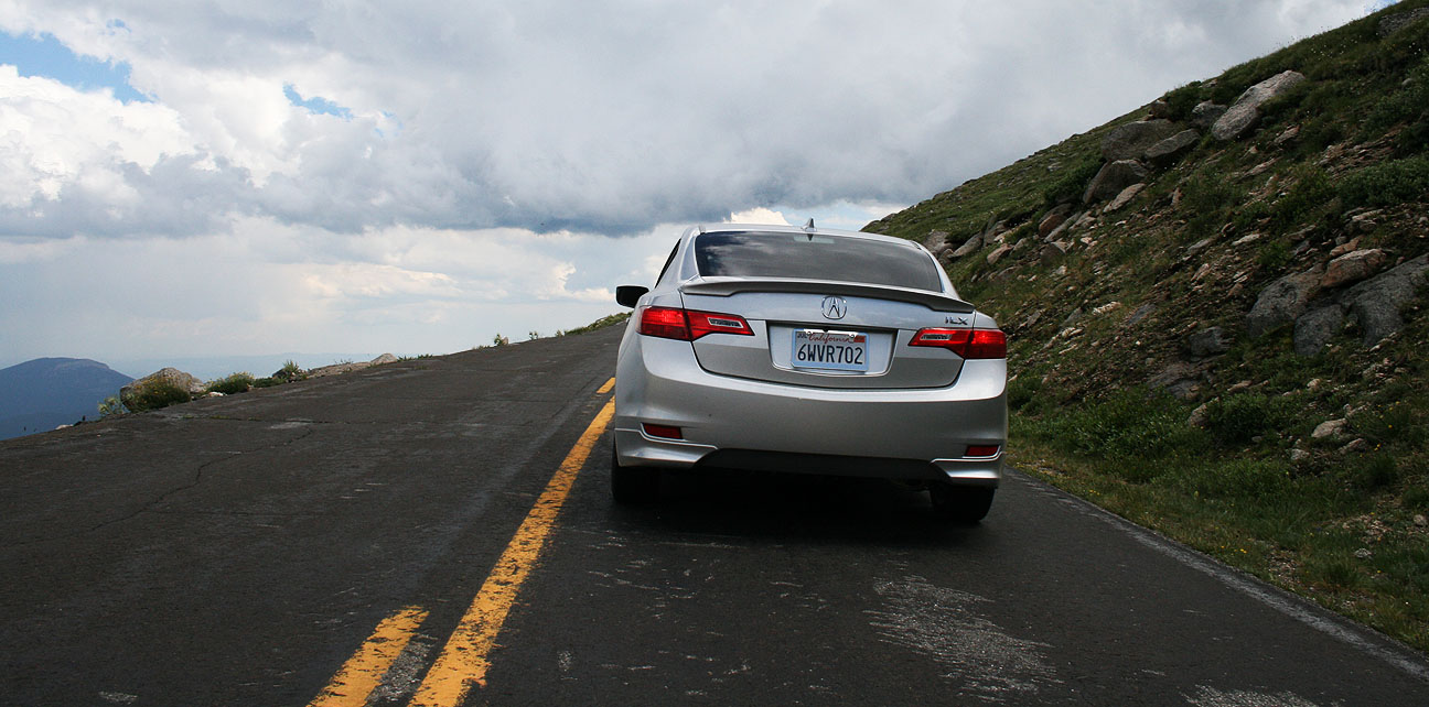
You can see here where the highway has been sliced into the mountainside. In this particular area, notice that there are no trees. That’s because the tree line in Colorado is 12,000 feet and we’d already gone above that.
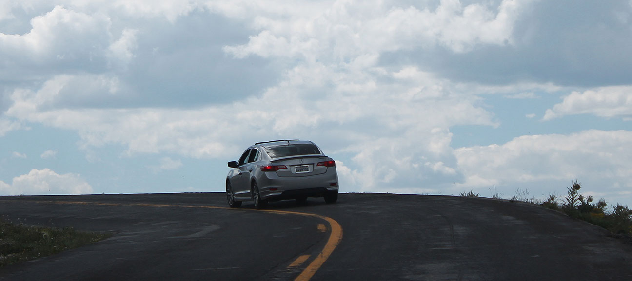
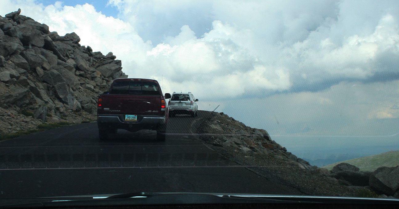
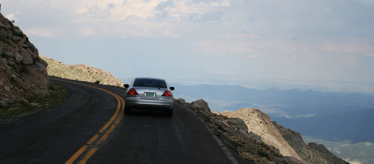
Z Z Z. The ILX 6-speed makes for an amazing machine to aggressively tackle switchbacks like this, but I was a little less inclined to push my limits on this road given its danger. No guard rails here!
It seriously felt like we were endlessly climbing. 13,000 feet. 14,000 feet.
I don’t recall seeing a posted speed limit at all. “Reasonable” is anywhere from 15-25 miles per hour on most of these blind corners and tight stretches.
As we got even higher in elevation, the road continued to get skinnier and it no longer had pavement markings. It required care to make way for vehicles coming the opposite direction.
Finally, we rounded the last corner and arrived at the lookout/observatory on top of the mountain. The parking lot was pretty full but we found a place to parallel park the ILX.
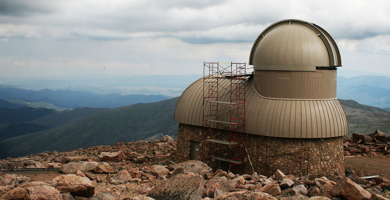
At one time there was a stone-built restaurant and gift shop located here, but after a propane explosion & fire in 1979, it was never rebuilt. Instead, some of the original walls have been reinforced and the structure serves as an observation point.
Here’s an observatory visible from the visitor area.
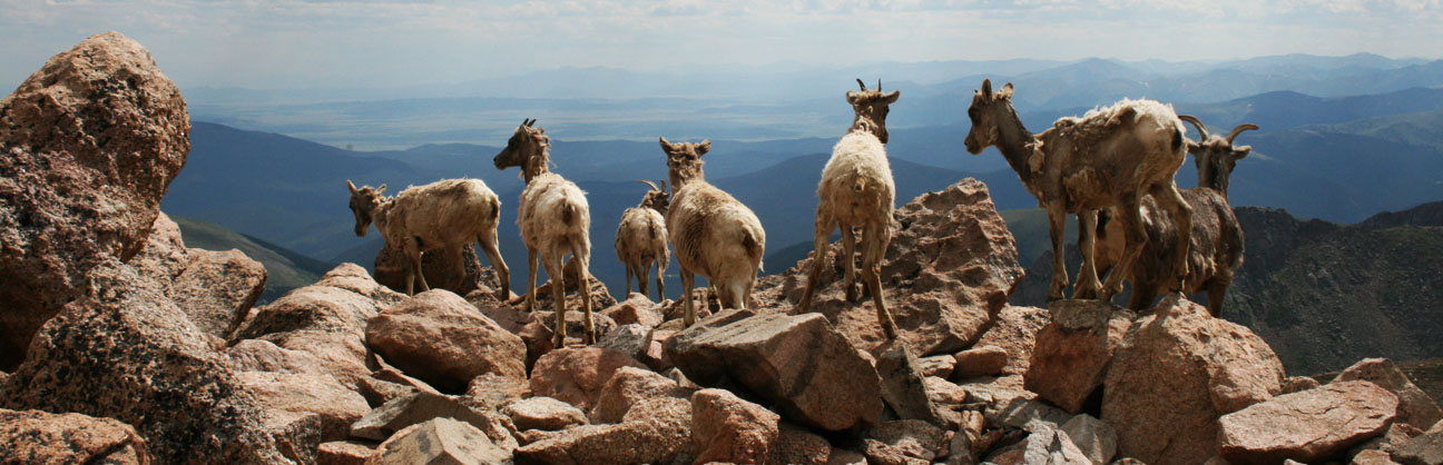
Evans is home to around 100 mountain goats. They were extremely approachable and didn’t appear to have any fear or apprehension toward the many people visiting their home turf.
Photo credit for these great pictures goes to Jeremy who was borrowing my Canon at the time.
By this time I had put on my hooded sweatshirt. I never thought I’d need a hoodie in late July! In front of me was one of several elevation markers mounted in the rocks.
This one said 14,258 feet.
In the distance we could see Summit Lake below us.
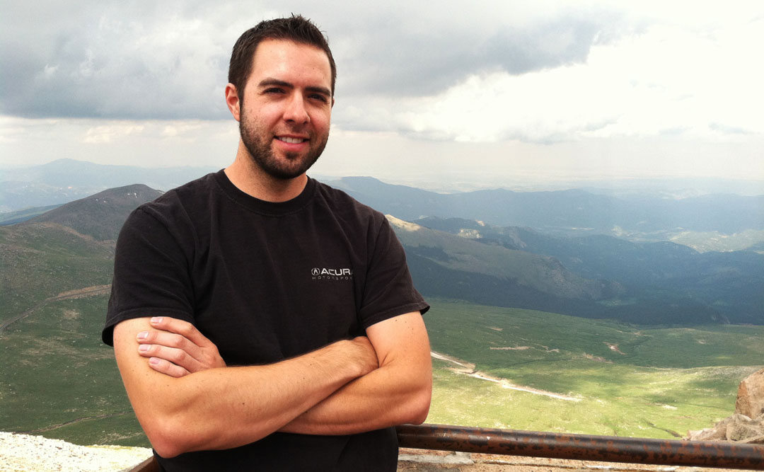
Jouhl, Jason, Tyson. Enjoying that crisp 14,000 foot air! I did get slightly light-headed.
This guy didn’t, though. Jeremy was off exploring.
Preparing for departure, the silver Hondas line up for a beauty shot.
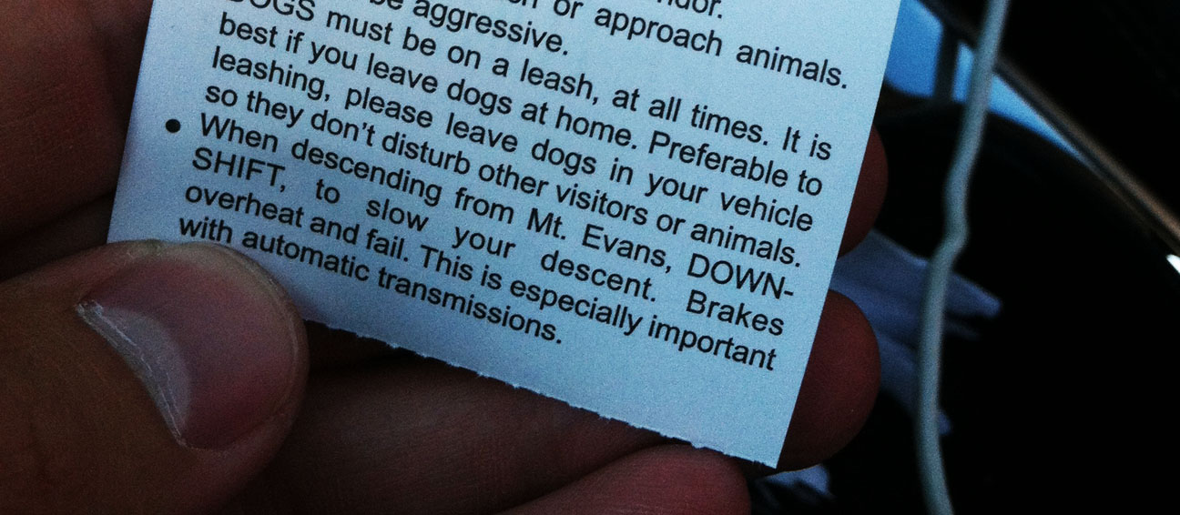
There’s a word of warning on the back of the tollway ticket instructing people to down-shift to avoid overheating their brakes on the way down the mountain. This is where having a stick shift is truly an advantage.
Jason led the way. He expertly handled the grades using his 6-speed transmission to his advantage, because he rarely had to hit the brakes.
More fun awaited us as we made our way to Idaho Springs, Colorado after reaching the base of Mount Evans Road.
Eastbound Interstate 70 has some steep down-grades as it heads into the Denver area. Apparently this freeway has a history with being dangerous for truckers because there are signs like the below saying, “Don’t Be Fooled!”
We made it back to civilization and treated ourselves – and our cars – to some fuel. Interestingly enough, There’s 85 octane available in Colorado Springs. I think the lowest we see in Arizona is 87.
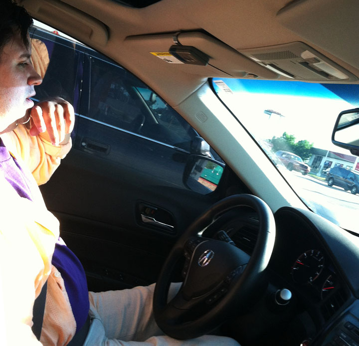
Jason took the wheel in the ILX when we went to dinner. This photo is not one of my finer ones.
It was a great end to an adventurous day. I was glad to spend time with friends doing something that I love!
Tune in tomorrow for the final stretch of the Colorado trip.
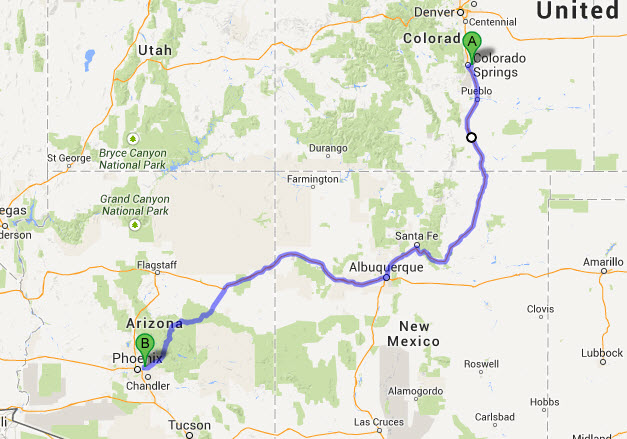
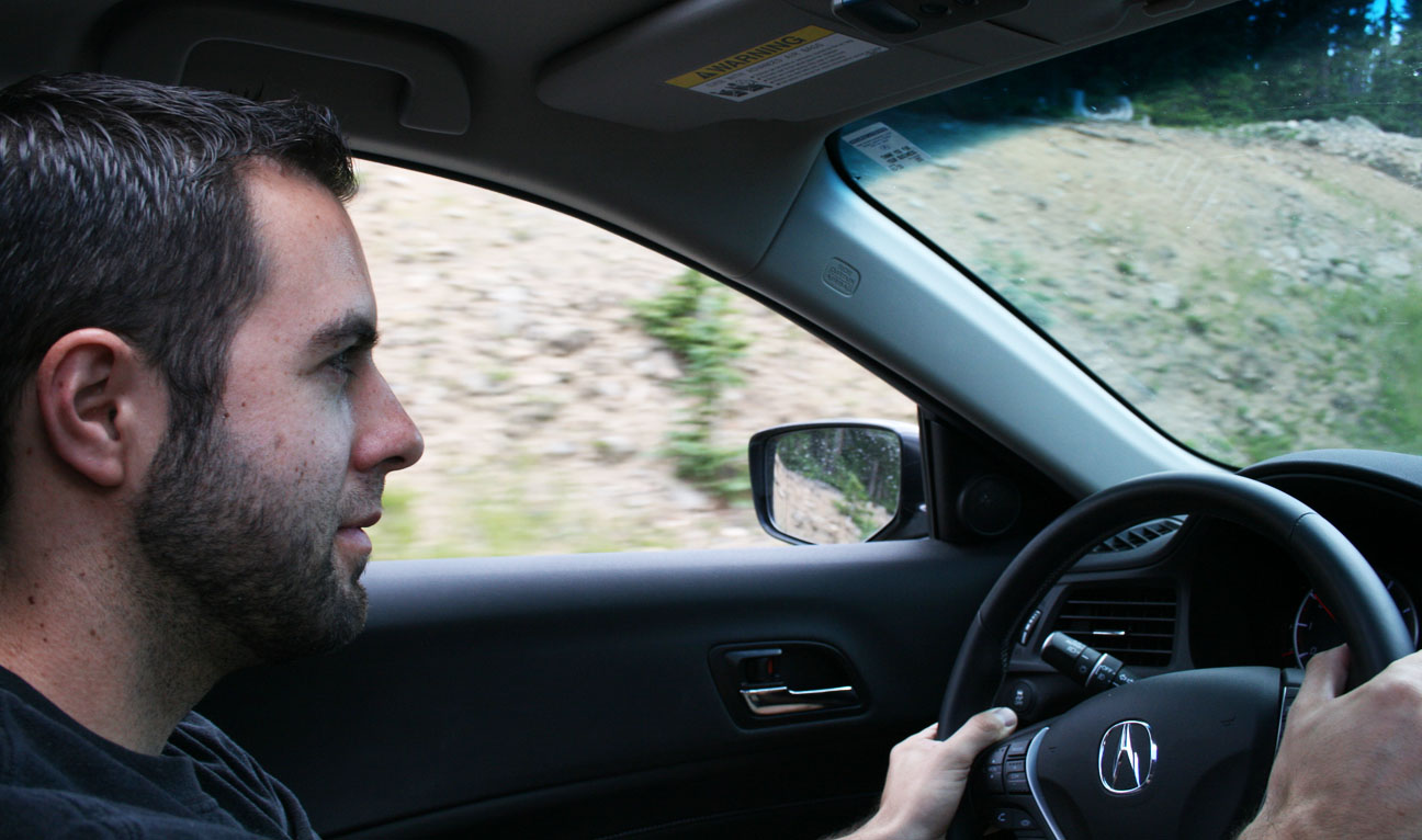
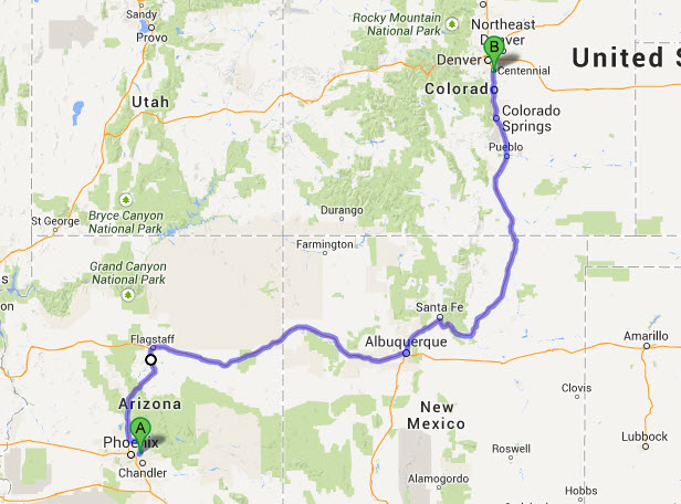
Hold your breath. I’m about to take you on a high-adventure ride to some elevations where oxygen is in short supply. Last Friday, I took flight in my 2013 Acura ILX to head for the mile-high city of Denver, Colorado. My goal was to push my car to extreme elevations and to experience the inspiring scenery of the Rockies.
I’ll share this trip write-up in a 3-part series.
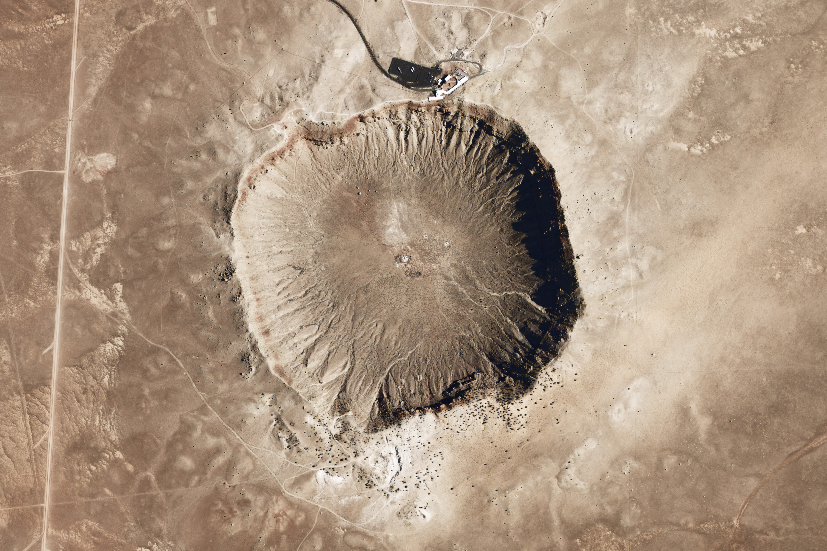
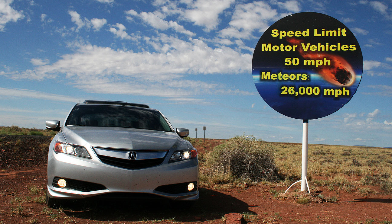
Just 3 hours northeast of the Phoenix area lies a meteor crater that was formed an estimated 50,000 years ago. If it weren’t for the multiple signs along Interstate 40 trying to lure drivers in, I probably wouldn’t have even known it existed. I couldn’t resist the temptation to have a look at what the billboards stated was the “best preserved impact site on earth.” A $16 entry fee later, I was standing at the rim of a 4,000-foot-wide hole in the ground.
And here’s what that looks like from overhead (thanks Wikipedia):
Mining engineer and businessman Daniel Barringer spent decades in the early 1900’s trying to find the meteor that created this gigantic impact site, to no avail. It was originally thought that the meteorite would be buried directly beneath the center of the crater. Drilling projects were unsuccessful. It is currently believed that the meteor vaporized upon impact. Only small fragments remain. As the sign at the entrance to the site indicates, the meteor was traveling an estimated 26,000 miles per hour.
My next pit stop satisfied an intense craving for a Taco Bell crunch wrap supreme at 10:30 in the morning in Holbrook, Arizona (breakfast of champions!). I had an interesting conversation with a guy named David in a blue Subaru WRX as I was fueling up. “Is that the new Acura?” he asked. I told him that yes, this was a new model. “That looks really sharp!” he said. After telling him a little more about my story with the car, “I’m sure glad you got the 6-speed.” I am too.
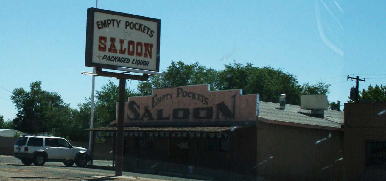
While in Holbrook, I drove through town on what was formerly part of Route 66. There are a number of establishments that carry on the Route 66 style. I especially enjoyed “Empty Pockets” Saloon.
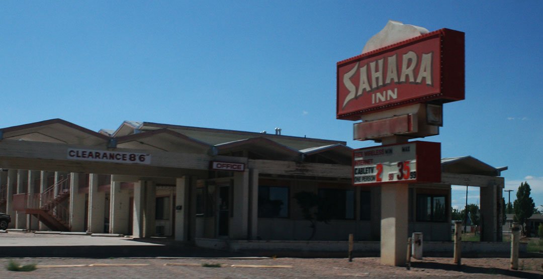
Sahara Inn. I thought for sure this place was long-since closed, but a look on Trip Advisor reveals that it’s still in business. It’s rated #15 out of 18 hotels in Holbrook, though. Be advised!
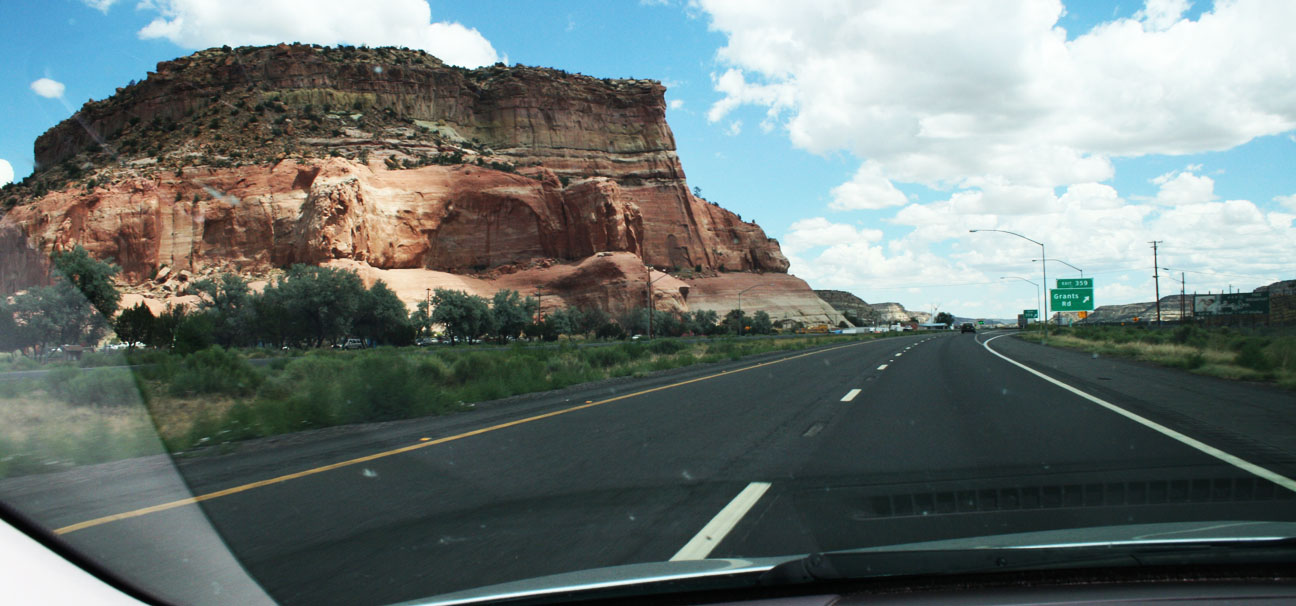
Holbrook is only about 70 miles from the New Mexico state line, and that was my next destination. The Zuni Indian Reservation straddles the border and there are tourist traps advertising $7.99 “authentic Indian” blankets and $10 phone cards all over the place. Does anyone still use phone cards? The scenery can’t be beat, though.
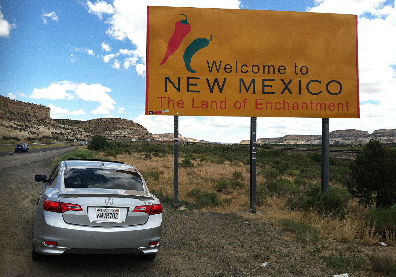
I’ve stopped here a number of times already, but it just seems appropriate to commemorate my entrance to the “Land of Enchantment” every time I pass this sign on Interstate 40.
Gallup, New Mexico shares that same Route 66 DNA with Holbrook, so again we see some run-down relics of what may have at one time been really nice motels. Desert Skies has a rate of $25/night. Bargain basement rates.
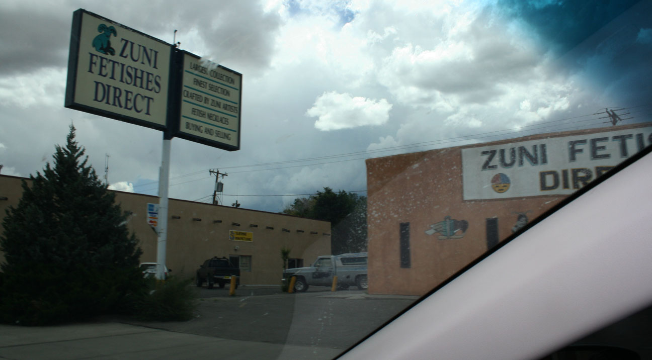
I didn’t linger long enough to learn what kind of things “Zuni Fetishes Direct” sells.
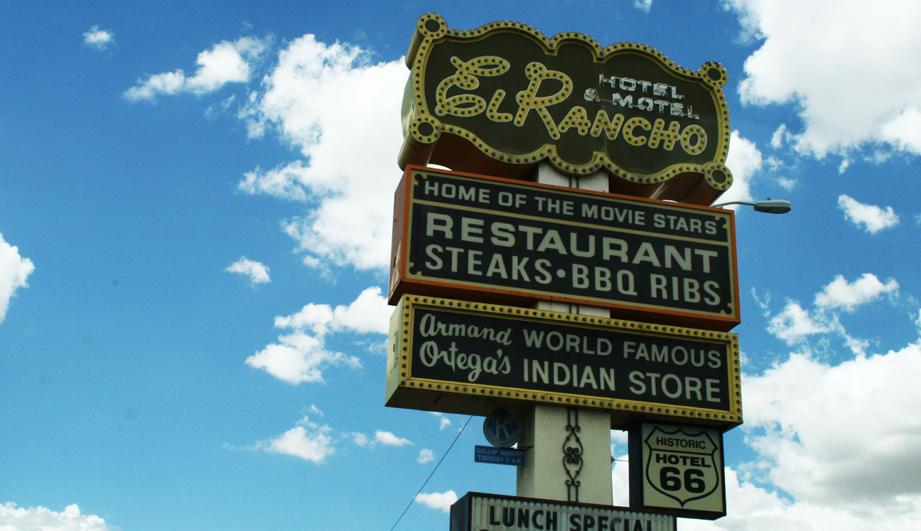
But just ahead, I pulled the ILX into the historic 1937 El Rancho Hotel. El Rancho’s claim to fame is that over the years, it has hosted such famous guests as John Wayne, Ronald Reagan, and Katherine Hepburn.
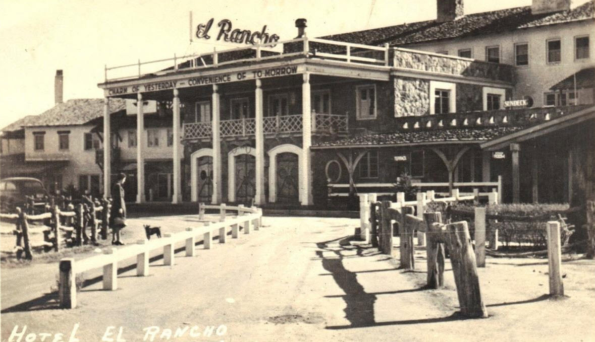
Though the Interstate 40 bypass of Route 66 cost El Rancho some business, a renovation effort has again made it an attractive place to stay. A vintage postcard shows the hotel in its original glory.
“The Charm of Yesterday; The Convenience of Tomorrow” is still the motto today. Surprisingly little has changed from an appearance perspective in El Rancho’s 76 years of existence.
Eastward Ho to Albuquerque we go, then north on Interstate 25 toward Santa Fe. ABQ marked the halfway point for this drive. I took the opportunity to stretch my legs, fuel up the ILX with some premium fuel, and take a bathroom break at the Flying J service station.
The high desert pines of Santa Fe give way to some open grassland in northern New Mexico. I breezed through Las Vegas without even deactivating my cruise control in 6th gear. Unlike the Las Vegas in Nevada, this one doesn’t offer much to see. Well, except for 27 “modern” gas stations and 34 restaurants, per the blue sign at the south entrance to town. I’ve always been intrigued with how New Mexico provides these types of stats for each town.
Cotton Eye Joe – Rednex
Tubthumping – Chumbawamba
Anyone remember such classics? I listened to volumes 1 through 4 of JOCK JAMS to get me through northern New Mexico. I’ve had these CDs for 15 years, but they still get the blood pumping every time.
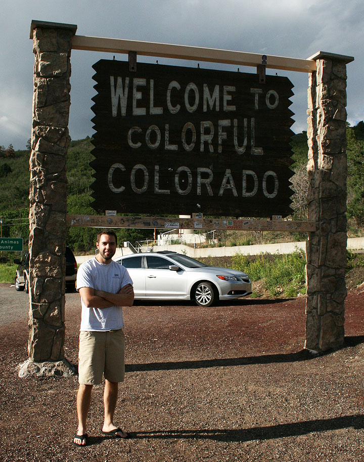
As I neared the NM / CO state line, storm clouds descended but I saw that Denver finally was a mere 250 miles away.
Thanks to the random travelers who took my picture with the Colorado entrance sign.
I was driving the wrong car for this particular picture, but I still felt it worth a stop.
Sunset on I-25 as I roll through Castle Rock, Colorado northbound.
And finally, reunited with my friend Jason as we’re about to embark on our 4th road trip together. Jason and I have met up a number of times in the past, for trips to Bisbee, White Sands, and Sedona. He made the trip from Las Cruces, New Mexico in his 2004 Honda Accord EX coupe 6-speed.
The next day was when we REALLY started having fun. More on that soon!
By the way, did anyone else see the 401,000 mile 1988 Acura Legend sedan that ran on Ebay last week? Not too shabby!
Posted in Detailing on July 17, 2013 by tysonhugie
Odometer (Legend): 522,604
Odometer (ILX): 45,120
From the time I was old enough to pick up a sponge, I was helping my dad uphold our family’s reputation for having the cleanest cars on the block. In fact, he used to pull the cars out onto the front lawn from time to time and take pictures of them. I remember a neighbor coming over to ask one time, “When’s the car show?”
(That’s me on the right)
When I got a little older, I’d detail cars for neighbors and friends. My pride and joy was this chrome-tastic 1989 Honda Prelude Si.
This was one car that I loved working on: A Geneva Green Pearl 1991 Acura Legend LS Coupe. It had the Ivory interior and an automatic transmission.
This car belonged to a couple named McKay and Joan who used to visit the copy shop where I worked at the time. From the moment I sat inside this Legend and drove it to my house, I knew I’d someday own one. These pictures were taken in 1999 when I was 17.
It wasn’t until 4 years later that I ended up buying a Legend of my own. McKay and Joan sold this Legend to someone else but I’ll never forget the thrill of calling it my own, even if just for an hour.
In fact, that Legend coupe even inspired me at one point to start making a small clay model of a Legend. I didn’t get very far with it.
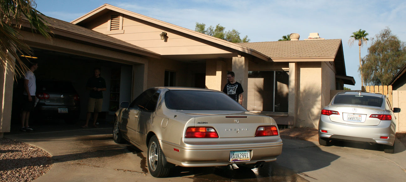
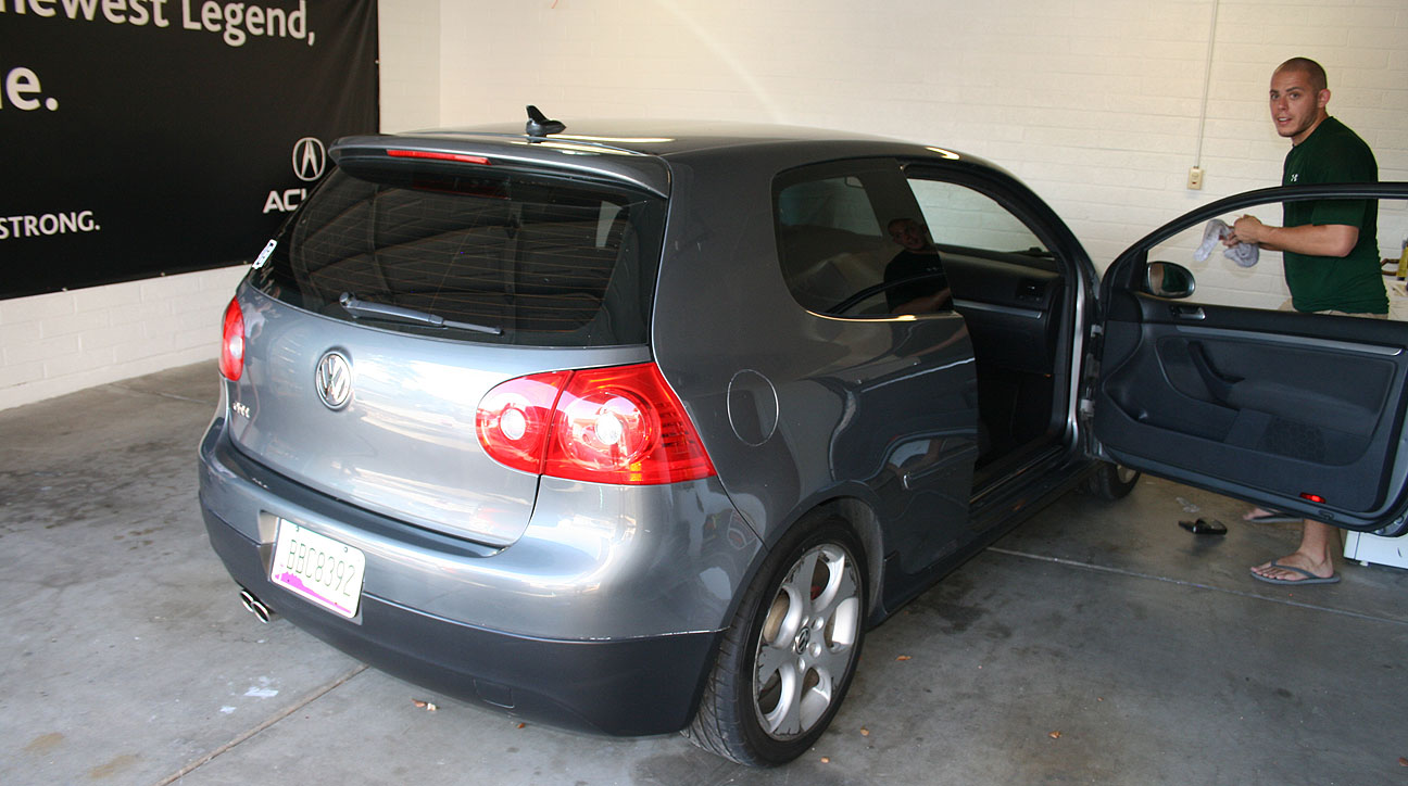
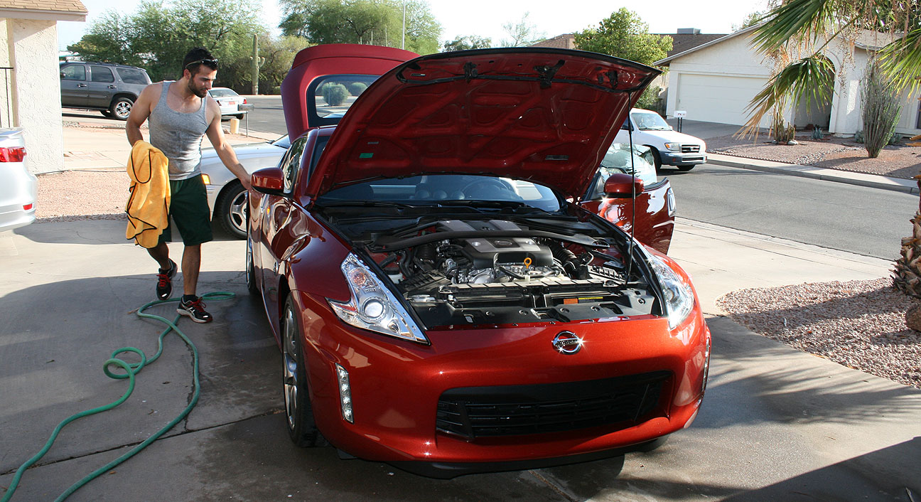
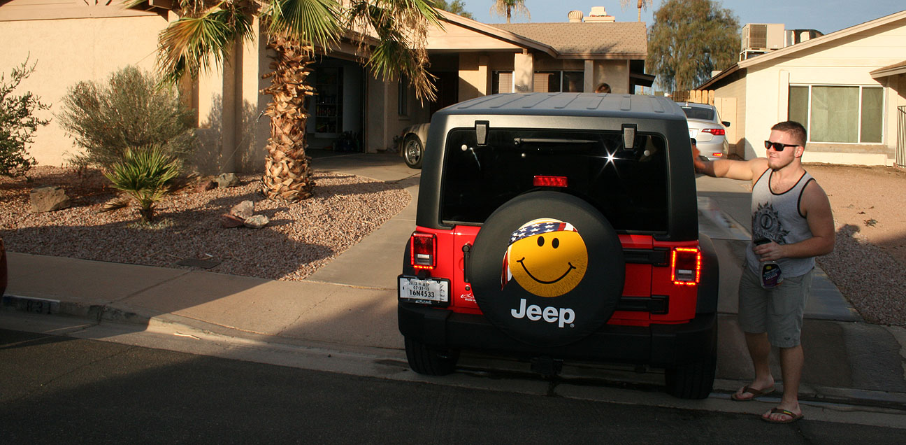
Last Saturday, I hosted a car wash party of sorts at my house. My friends showed up with a hodge-podge of vehicles, including the following:
Joe’s 1995 Acura Legend LS Coupe Automatic
Jack’s 2008 Volkswagen GTI 6-Speed
Matt’s 2013 Nissan 370Z 6-speed
Jacob’s 2013 Jeep Wrangler 4-door 6-speed
Joe’s Legend is pretty special. It’s production #1234 from the last model year of the Legend, 1995. He’s had it for just a few months but already done quite a bit of maintenance to it.
At 155,000 miles on the odometer, it’s got a ways left to go.
Joe recently ditched the aftermarket wheels that were on the car previously and replaced them with the correct 16″ Legend “GS” wheels.
Another friend who came to the party was Paul in his 2013 Acura TL SH-AWD.
Paul’s TL is the definition of “fully loaded.” This car is equipped with the Advance package and Acura’s signature “Super Handling All-Wheel-Drive” (SH-AWD).
It’s a good thing I was wearing sunglasses, because that Bellanova White Pearl is blinding in the Arizona afternoon sunlight. The darkly tinted glass on Paul’s TL gives a nice contrast.
Here’s the immaculate interior. It still smells brand new – and, at only 5,000 miles on the odometer, it should! Those seats are ventilated. A great feature to have here in the desert!
My favorite upgrade to Paul’s TL is a Grumpy Cat sticker on the right rear window. Grumpy Cat, also known by her official name of Tardar Sauce, lives not far from me in Morristown, Arizona.
Who would win this race? Battle of the brands.
2013 Nissan 370Z Sport:
332 horsepower, 3.7 liter V6 engine
6-speed manual transmission with Synchro-Rev match system
2013 Acura TL SH-All Wheel Drive:
305 horsepower, 3.7 liter V6 engine
6-speed automatic transmission with sport-shift paddles
It’d be a fun match to watch.
Current events:
My ILX went in for an oil change yesterday at 45,028 miles. The technician recommended replacement of the cabin & engine air filters, and fresh manual transmission fluid, due to mileage. Otherwise, just a few quarts of fresh 0W20 oil and I was on my way.
Here’s the latest ILX rendering by Hondatalover.
In his own words, here are the makings of this amazing looking custom ILX.
Things you can see:
Tinted windows
Tinted Headlights (lightly, just going for a darker housing look)
Clear strip for Reverse and turn signal’s on the taillights.
18″ European Honda Accord Type-S wheels.
A slight drop. Probably 1/2 an inch,
‘A-Spec’ front, side and rear bumpers with wing spoiler. (One piece, not a lip kit) –I have a non-wing spoiler version. Since not everyone likes wings, I’ll send and let you pick.
Things you cannot:
Dual, quad exit exhaust (can’t see, but it’s implied)
Dark metal trim w/ fake Carbon fiber accenting.
Full LED interior lighting and accenting.
LED puddle lights in the L and R mirrors, behind the door handles, bottom of the door (when open) to shine onto the ground, and license plate.
Sound deadening material through out.
Mechanics:
HFP/ A-Spec suspension (1/2″ drop)
High performance summer tires.
RV6 Bellmouth down pipe w/ Si mufflers.
Limited-slip differential.
Cold Air Intake.
Beefier stabilizer bars.
Beefier front and rear tower struts.
Hondata reflash optional.
Sounds like a dream ILX to me! Sign me up for those enhancements.